Suspension Bridges of Montana
This is a list of all 18 bridges from the suspension bridge inventory for Montana in USA. Wherever you see a Bridgemeister ID number click it to isolate the bridge on its own page.
Related Lists:
1951: Marias River
Chester vicinity, Montana, USA - Marias River
| Bridgemeister ID: | 6486 (added 2021-08-15) |
| Year Completed: | 1951 |
| Name: | Marias River |
| Also Known As: | Pugsley |
| Location: | Chester vicinity, Montana, USA |
| Crossing: | Marias River |
| Coordinates: | 48.291043 N 111.046520 W |
| Maps: | Acme, GeoHack, Google, OpenStreetMap |
| Use: | Vehicular |
| Status: | In use (last checked: 2021) |
| Main Cables: | Wire (steel) |
| Suspended Spans: | 1 |
| Main Span: | 1 x 88.4 meters (290 feet) |
| Characteristics: | Hinged cables |
Notes:
- Unconventional hinged suspension system with asymmetric cables.
- Similar to 1889 Fiorentini (Ferro, Soldo, Soldino) - Rome, Italy.
- Similar to 1936 Ininskiy (Ининский) - Inya (Иня), Altai Republic, Russia.
- Similar to 1936 Kindee - Kindee, Ellenborough vicinity, New South Wales, Australia.
- Similar to (footbridge) - Sarov (Саров), Nizhny Novgorod Oblast, Russia.
- Similar to Allan - Segenhoe, Scone vicinity, New South Wales, Australia.
- Similar to Reku Vel' - Solginskiy (Солгинский), Arkhangelsk Oblast, Russia.
External Links:
1964: Gates Park Pack
Augusta vicinity, Montana, USA - North Fork of the Sun River
| Bridgemeister ID: | 6349 (added 2021-07-25) |
| Year Completed: | 1964 |
| Name: | Gates Park Pack |
| Location: | Augusta vicinity, Montana, USA |
| Crossing: | North Fork of the Sun River |
| At or Near Feature: | Bob Marshall Wilderness |
| Coordinates: | 47.553636 N 112.944389 W |
| Maps: | Acme, GeoHack, Google, OpenStreetMap |
| Use: | Pack and Footbridge |
| Status: | Replaced, 2011 |
| Main Cables: | Wire (steel) |
| Suspended Spans: | 1 |
| Main Span: | 1 x 39 meters (128 feet) |
Notes:
- May have replaced another suspension bridge dating to 1948.
- Replaced by 2011 Gates Park Pack - Augusta vicinity, Montana, USA.
- All past and present bridges at this location.
External Links:
1964: Medicine Springs Pack
Augusta vicinity, Montana, USA - North Fork Sun River
| Bridgemeister ID: | 6347 (added 2021-07-25) |
| Year Completed: | 1964 |
| Name: | Medicine Springs Pack |
| Location: | Augusta vicinity, Montana, USA |
| Crossing: | North Fork Sun River |
| At or Near Feature: | Bob Marshall Wilderness |
| Coordinates: | 47.632222 N 112.857444 W |
| Maps: | Acme, GeoHack, Google, OpenStreetMap |
| Use: | Pack and Footbridge |
| Status: | Replaced, 2016 |
| Main Cables: | Wire (steel) |
| Suspended Spans: | 1 |
| Main Span: | 1 x 35.1 meters (115 feet) estimated |
Notes:
- May have replaced another suspension bridge.
- Replaced by 2016 Medicine Springs Pack - Augusta vicinity, Montana, USA.
- All past and present bridges at this location.
External Links:
- Remote pack bridge near Bob gets a face-lift; materials flown in. "A 52-year-old pack bridge leading into the Bob Marshall Wilderness is being replaced, with tons of material needed in the replacement flown in by helicopter."
2004: (footbridge)
Conner vicinity and Darby vicinity, Montana, USA - Bitterroot River
| Bridgemeister ID: | 1516 (added 2004-10-10) |
| Year Completed: | 2004 |
| Name: | (footbridge) |
| Location: | Conner vicinity and Darby vicinity, Montana, USA |
| Crossing: | Bitterroot River |
| Coordinates: | 45.95001 N 114.13475 W |
| Maps: | Acme, GeoHack, Google, OpenStreetMap |
| Principals: | Sahale, LLC |
| Use: | Footbridge |
| Status: | In use (last checked: 2007) |
| Main Cables: | Wire (steel) |
| Suspended Spans: | 1 |
| Main Span: | 1 x 61 meters (200 feet) |
| Deck width: | 5 feet |
2006: Rattlesnake Creek
Missoula, Montana, USA - Rattlesnake Creek
| Bridgemeister ID: | 2030 (added 2006-04-22) |
| Year Completed: | 2006 |
| Name: | Rattlesnake Creek |
| Location: | Missoula, Montana, USA |
| Crossing: | Rattlesnake Creek |
| Coordinates: | 46.90980 N 113.96633 W |
| Maps: | Acme, GeoHack, Google, OpenStreetMap |
| Principals: | HDR Inc. |
| Use: | Footbridge and Pack |
| Status: | In use (last checked: 2006) |
| Main Cables: | Wire (steel) |
| Suspended Spans: | 1 |
| Main Span: | 1 x 27.4 meters (90 feet) |
External Links:
Image Sets:

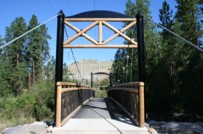
2011: Gates Park Pack
Augusta vicinity, Montana, USA - North Fork of the Sun River
| Bridgemeister ID: | 6350 (added 2021-07-25) |
| Year Completed: | 2011 |
| Name: | Gates Park Pack |
| Location: | Augusta vicinity, Montana, USA |
| Crossing: | North Fork of the Sun River |
| At or Near Feature: | Continental Divide Trail, Bob Marshall Wilderness |
| Coordinates: | 47.553624 N 112.944214 W |
| Maps: | Acme, GeoHack, Google, OpenStreetMap |
| Use: | Pack and Footbridge |
| Status: | In use (last checked: 2011) |
| Main Cables: | Wire (steel) |
| Suspended Spans: | 1 |
| Main Span: | 1 x 39 meters (128 feet) |
Notes:
2016: Medicine Springs Pack
Augusta vicinity, Montana, USA - North Fork Sun River
| Bridgemeister ID: | 6348 (added 2021-07-25) |
| Year Completed: | 2016 |
| Name: | Medicine Springs Pack |
| Location: | Augusta vicinity, Montana, USA |
| Crossing: | North Fork Sun River |
| At or Near Feature: | Bob Marshall Wilderness |
| Coordinates: | 47.632292 N 112.857250 W |
| Maps: | Acme, GeoHack, Google, OpenStreetMap |
| Use: | Pack and Footbridge |
| Status: | In use (last checked: 2016) |
| Main Cables: | Wire (steel) |
| Suspended Spans: | 1 |
| Main Span: | 1 x 35.1 meters (115 feet) estimated |
Notes:
- Replaced 1964 Medicine Springs Pack - Augusta vicinity, Montana, USA.
- All past and present bridges at this location.
External Links:
- Remote pack bridge near Bob gets a face-lift; materials flown in. "A 52-year-old pack bridge leading into the Bob Marshall Wilderness is being replaced, with tons of material needed in the replacement flown in by helicopter."
(footbridge)
Gardiner vicinity, Montana, USA - Yellowstone River
| Bridgemeister ID: | 2000 (added 2005-12-25) |
| Name: | (footbridge) |
| Location: | Gardiner vicinity, Montana, USA |
| Crossing: | Yellowstone River |
| At or Near Feature: | Blacktail Deer Creek Trail, Yellowstone National Park |
| Coordinates: | 44.996583 N 110.578867 W |
| Maps: | Acme, GeoHack, Google, OpenStreetMap |
| Use: | Footbridge |
| Status: | In use (last checked: 2006) |
| Main Cables: | Wire (steel) |
| Suspended Spans: | 1 |
| Main Span: | 1 x 67.1 meters (220 feet) estimated |
Notes:
- Near the confluence of Blacktail Deer Creek and Yellowstone River, just south of Crevice Lake.
- Near Tower (Hellroaring, Yellowstone River) - Mammoth Hot Springs vicinity, Wyoming, USA. The bridges are similar in appearance.
External Links:
Image Sets:
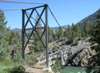
(footbridge)
Great Falls vicinity, Montana, USA - Missouri River
| Bridgemeister ID: | 2111 (added 2006-09-03) |
| Name: | (footbridge) |
| Location: | Great Falls vicinity, Montana, USA |
| Crossing: | Missouri River |
| At or Near Feature: | Ryan Island Day Use Area |
| Coordinates: | 47.568717 N 111.119083 W |
| Maps: | Acme, GeoHack, Google, OpenStreetMap |
| Use: | Footbridge |
| Status: | In use (last checked: 2006) |
| Main Cables: | Wire (steel) |
Notes:
- Located just below Ryan Dam.
External Links:
Image Sets:
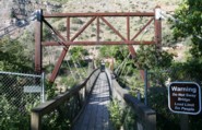
(footbridge)
Moorehead, Montana, USA - Powder River
| Bridgemeister ID: | 1789 (added 2005-05-17) |
| Name: | (footbridge) |
| Location: | Moorehead, Montana, USA |
| Crossing: | Powder River |
| Coordinates: | 45.055883 N 105.87705 W |
| Maps: | Acme, GeoHack, Google, OpenStreetMap |
| Use: | Footbridge |
| Status: | Derelict (last checked: 2005) |
(pipeline bridge)
Plains vicinity and Thompson Falls vicinity, Montana, USA - Clark Fork River
| Bridgemeister ID: | 2124 (added 2006-10-21) |
| Name: | (pipeline bridge) |
| Location: | Plains vicinity and Thompson Falls vicinity, Montana, USA |
| Crossing: | Clark Fork River |
| Coordinates: | 47.52982 N 115.05720 W |
| Maps: | Acme, GeoHack, Google, OpenStreetMap |
| Use: | Pipeline |
| Status: | Extant (last checked: 2006) |
| Main Cables: | Wire (steel) |
| Suspended Spans: | 1 |
| Main Span: | 1 x 274.3 meters (900 feet) |
Notes:
- Near (pipeline bridge) - Thompson Falls vicinity, Montana, USA.
- Near (pipeline bridge) - Thompson Falls vicinity, Montana, USA.
- Near (pipeline bridge) - Thompson Falls vicinity, Montana, USA.
- Near (pipeline bridge) - Thompson Falls, Montana, USA.
Image Sets:
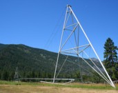
(pipeline bridge)
Thompson Falls vicinity, Montana, USA - Clark Fork River
| Bridgemeister ID: | 2125 (added 2006-10-21) |
| Name: | (pipeline bridge) |
| Location: | Thompson Falls vicinity, Montana, USA |
| Crossing: | Clark Fork River |
| Coordinates: | 47.57957 N 115.20910 W |
| Maps: | Acme, GeoHack, Google, OpenStreetMap |
| Use: | Pipeline |
| Status: | Extant (last checked: 2006) |
| Main Cables: | Wire (steel) |
| Main Span: | 1 x 274.3 meters (900 feet) estimated |
Notes:
(pipeline bridge)
Thompson Falls vicinity, Montana, USA - Clark Fork River
| Bridgemeister ID: | 2126 (added 2006-10-21) |
| Name: | (pipeline bridge) |
| Location: | Thompson Falls vicinity, Montana, USA |
| Crossing: | Clark Fork River |
| Coordinates: | 47.57604 N 115.19292 W |
| Maps: | Acme, GeoHack, Google, OpenStreetMap |
| Use: | Pipeline |
| Status: | Extant (last checked: 2006) |
| Main Cables: | Wire (steel) |
| Main Span: | 1 x 176.8 meters (580 feet) estimated |
Notes:
(pipeline bridge)
Thompson Falls vicinity, Montana, USA - Clark Fork River
| Bridgemeister ID: | 2127 (added 2006-10-21) |
| Name: | (pipeline bridge) |
| Location: | Thompson Falls vicinity, Montana, USA |
| Crossing: | Clark Fork River |
| Coordinates: | 47.56988 N 115.17832 W |
| Maps: | Acme, GeoHack, Google, OpenStreetMap |
| Use: | Pipeline |
| Status: | Extant (last checked: 2006) |
| Main Cables: | Wire (steel) |
| Main Span: | 1 x 189 meters (620 feet) estimated |
Notes:
(pipeline bridge)
Thompson Falls, Montana, USA - Clark Fork River
| Bridgemeister ID: | 2128 (added 2006-10-21) |
| Name: | (pipeline bridge) |
| Location: | Thompson Falls, Montana, USA |
| Crossing: | Clark Fork River |
| Coordinates: | 47.58064 N 115.32105 W |
| Maps: | Acme, GeoHack, Google, OpenStreetMap |
| Use: | Pipeline |
| Status: | Extant (last checked: 2006) |
| Main Cables: | Wire (steel) |
| Suspended Spans: | 1 |
| Main Span: | 1 x 304.8 meters (1,000 feet) estimated |
Notes:
Benchmark Pack
Augusta vicinity, Montana, USA - South Fork Sun River
| Bridgemeister ID: | 6351 (added 2021-07-25) |
| Name: | Benchmark Pack |
| Location: | Augusta vicinity, Montana, USA |
| Crossing: | South Fork Sun River |
| At or Near Feature: | Continental Divide Trail, Bob Marshall Wilderness |
| Coordinates: | 47.506399 N 112.890707 W |
| Maps: | Acme, GeoHack, Google, OpenStreetMap |
| Use: | Pack and Footbridge |
| Status: | In use (last checked: 2018) |
| Main Cables: | Wire (steel) |
| Suspended Spans: | 1 |
| Main Span: | 1 x 27.4 meters (90 feet) estimated |
Black Bear Pack
Flathead National Forest, Montana, USA - South Fork Flathead River
| Bridgemeister ID: | 9111 (added 2025-03-29) |
| Name: | Black Bear Pack |
| Location: | Flathead National Forest, Montana, USA |
| Crossing: | South Fork Flathead River |
| At or Near Feature: | Black Bear Bridge Ford Trail |
| Coordinates: | 47.715222 N 113.372889 W |
| Maps: | Acme, GeoHack, Google, OpenStreetMap |
| Use: | Footbridge and Pack |
| Status: | In use (last checked: 2024) |
| Main Cables: | Wire (steel) |
| Suspended Spans: | 1 |
| Main Span: | 1 x 64 meters (210 feet) estimated |
External Links:
- Facebook - Bob Marshall Wilderness Foundation. Image of the bridge. Posted January 12, 2018.
- Flickr - Black Bear Pack Bridge. Image of the bridge. Taken July 2, 2015.
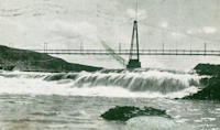
Black Eagle Falls
Great Falls and Black Eagle, Montana, USA - Missouri River
| Bridgemeister ID: | 6358 (added 2021-07-26) |
| Name: | Black Eagle Falls |
| Location: | Great Falls and Black Eagle, Montana, USA |
| Crossing: | Missouri River |
| At or Near Feature: | Eagle Falls, Black Eagle Dam |
| Coordinates: | 47.519905 N 111.262229 W |
| Maps: | Acme, GeoHack, Google, OpenStreetMap |
| Use: | Footbridge |
| Status: | Destroyed, June 6, 1908 |
| Main Cables: | Wire (steel) |
| Main Span: | 1 |
| Side Span: | 1 |
Notes:
- Completed early 1890s.
- 1908, June: Destroyed by flood.
External Links:
- Black Eagle Dam - Wikipedia. From the article (retrieved 2021): "A 200-foot-long (61 m), 10-foot-wide (3.0 m) pedestrian suspension bridge ran from the bluffs above each powerhouse over the river." However, historic images of the bridge show it wa significantly longer with main and side spans of roughly 400 and 200 feet respectively.
Image Sets:
Do you have any information or photos for these bridges that you would like to share? Please email david.denenberg@bridgemeister.com.
Mail | Facebook | X (Twitter) | Bluesky