Suspension Bridges of Canada (101-155 of 155)
This is a list of bridges 101 through 155 (of 155 total) from the suspension bridge inventory for the country Canada. Wherever you see a Bridgemeister ID number click it to isolate the bridge on its own page.
Related Lists:
(footbridge)
Port-Daniel, Quebec, Canada - Petite Rivière Port-Daniel
| Bridgemeister ID: | 1407 (added 2004-07-04) |
| Name: | (footbridge) |
| Location: | Port-Daniel, Quebec, Canada |
| Crossing: | Petite Rivière Port-Daniel |
| Coordinates: | 48.177817 N 64.971483 W |
| Maps: | Acme, GeoHack, Google, OpenStreetMap |
| Use: | Footbridge |
| Status: | In use (last checked: 2004) |
| Main Cables: | Wire (steel) |
| Suspended Spans: | 1 |
(footbridge)
Prince Albert, Saskatchewan, Canada - Little Red River
| Bridgemeister ID: | 4847 (added 2020-07-11) |
| Name: | (footbridge) |
| Location: | Prince Albert, Saskatchewan, Canada |
| Crossing: | Little Red River |
| At or Near Feature: | Little Red River Park |
| Coordinates: | 53.223489 N 105.721042 W |
| Maps: | Acme, GeoHack, Google, OpenStreetMap |
| Use: | Footbridge |
| Status: | In use (last checked: 2020) |
| Main Cables: | Wire (steel) |
(footbridge)
Ryan vicinity, British Columbia, Canada - Moyie River
| Bridgemeister ID: | 1868 (added 2005-08-06) |
| Name: | (footbridge) |
| Location: | Ryan vicinity, British Columbia, Canada |
| Crossing: | Moyie River |
| Coordinates: | 49.121617 N 116.043633 W |
| Maps: | Acme, GeoHack, Google, OpenStreetMap |
| Use: | Footbridge |
| Status: | In use (last checked: 2005) |
| Main Cables: | Wire |
| Suspended Spans: | 1 |
(footbridge)
Saint-Juste-du-Lac, Quebec, Canada - Touladi River
| Bridgemeister ID: | 2589 (added 2014-04-14) |
| Name: | (footbridge) |
| Location: | Saint-Juste-du-Lac, Quebec, Canada |
| Crossing: | Touladi River |
| Coordinates: | 47.675142 N 68.795619 W |
| Maps: | Acme, GeoHack, Google, OpenStreetMap |
| Use: | Footbridge |
| Status: | In use (last checked: 2019) |
| Main Cables: | Wire (steel) |
| Suspended Spans: | 1 |
| Main Span: | 1 x 48.8 meters (160 feet) estimated |
| Bridgemeister ID: | 1712 (added 2005-04-03) |
| Name: | (footbridge) |
| Location: | St-Norbert-de-Mont-Brun vicinity, Quebec, Canada |
| At or Near Feature: | Parc d'Aiguebelle |
| Coordinates: | 48.463686 N 78.702162 W |
| Maps: | Acme, GeoHack, Google, OpenStreetMap |
| Use: | Footbridge |
| Status: | In use (last checked: 2013) |
| Main Cables: | Wire (steel) |
| Suspended Spans: | 1 |
(footbridge)
Stuckless Pond vicinity, Newfoundland and Labrador, Canada - Lomond River
| Bridgemeister ID: | 1195 (added 2004-01-27) |
| Name: | (footbridge) |
| Location: | Stuckless Pond vicinity, Newfoundland and Labrador, Canada |
| Crossing: | Lomond River |
| At or Near Feature: | Gros Morne National Park |
| Use: | Footbridge |
(footbridge)
Toronto, Ontario, Canada - West Don River
| Bridgemeister ID: | 1474 (added 2004-09-02) |
| Name: | (footbridge) |
| Location: | Toronto, Ontario, Canada |
| Crossing: | West Don River |
| At or Near Feature: | Serena Gundy Park |
| Coordinates: | 43.71918 N 79.35383 W |
| Maps: | Acme, GeoHack, Google, OpenStreetMap |
| Use: | Footbridge |
| Status: | In use (last checked: 2004) |
| Main Cables: | Wire (steel) |
(footbridge)
West Creston vicinity, British Columbia, Canada - Summit Creek
| Bridgemeister ID: | 903 (added 2003-10-11) |
| Name: | (footbridge) |
| Location: | West Creston vicinity, British Columbia, Canada |
| Crossing: | Summit Creek |
| At or Near Feature: | Dewdney Trail |
| Coordinates: | 49.14233 N 116.6446 W |
| Maps: | Acme, GeoHack, Google, OpenStreetMap |
| Use: | Footbridge |
| Main Span: | 1 x 36.6 meters (120 feet) estimated |
(footbridge)
Whistler, British Columbia, Canada - Cheakamus River
| Bridgemeister ID: | 5358 (added 2020-11-22) |
| Name: | (footbridge) |
| Location: | Whistler, British Columbia, Canada |
| Crossing: | Cheakamus River |
| Coordinates: | 50.067139 N 123.032569 W |
| Maps: | Acme, GeoHack, Google, OpenStreetMap |
| Use: | Footbridge |
| Status: | In use (last checked: 2020) |
| Main Cables: | Wire (steel) |
(footbridge)
Whitehorse, Yukon, Canada - Yukon River
| Bridgemeister ID: | 1053 (added 2003-12-12) |
| Name: | (footbridge) |
| Location: | Whitehorse, Yukon, Canada |
| Crossing: | Yukon River |
| At or Near Feature: | Kishwoot Island Park |
| Coordinates: | 60.72929 N 135.05673 W |
| Maps: | Acme, GeoHack, Google, OpenStreetMap |
| Use: | Footbridge |
| Status: | In use |
| Main Cables: | Wire |
| Suspended Spans: | 1 |
| Main Span: | 1 x 57.9 meters (190 feet) estimated |
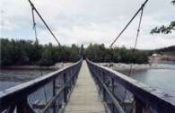
(pipeline bridge)
Burstall vicinity, Alberta, Canada - South Saskatchewan River
| Bridgemeister ID: | 2048 (added 2006-05-13) |
| Name: | (pipeline bridge) |
| Location: | Burstall vicinity, Alberta, Canada |
| Crossing: | South Saskatchewan River |
| Use: | Pipeline |
| Status: | Extant |
| Main Cables: | Wire (steel) |
Notes:
- Burstall is in Saskatchewan, but the bridge appears to be located west of Burstall in Alberta.
(pipeline bridge)
North Cowichan, Chemainus vicinity, British Columbia, Canada
| Bridgemeister ID: | 5173 (added 2020-10-03) |
| Name: | (pipeline bridge) |
| Location: | North Cowichan, Chemainus vicinity, British Columbia, Canada |
| Coordinates: | 48.904068 N 123.757119 W |
| Maps: | Acme, GeoHack, Google, OpenStreetMap |
| Use: | Pipeline |
| Status: | Extant (last checked: 2020) |
| Main Cables: | Wire (steel) |
External Links:
(pipeline bridge)
Savona, British Columbia, Canada - Thompson River
| Bridgemeister ID: | 1511 (added 2004-10-09) |
| Name: | (pipeline bridge) |
| Location: | Savona, British Columbia, Canada |
| Crossing: | Thompson River |
| Use: | Pipeline |
| Status: | Extant (last checked: 2004) |
| Main Cables: | Wire (steel) |
| Suspended Spans: | 1 |
| Main Span: | 1 x 182.9 meters (600 feet) |
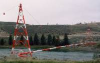
(pipeline bridge)
Taylor, British Columbia, Canada - Peace River
| Bridgemeister ID: | 919 (added 2003-10-18) |
| Name: | (pipeline bridge) |
| Location: | Taylor, British Columbia, Canada |
| Crossing: | Peace River |
| Coordinates: | 56.13737 N 120.66919 W |
| Maps: | Acme, GeoHack, Google, OpenStreetMap |
| Use: | Pipeline |
| Status: | In use |
| Suspended Spans: | 1 |
Notes:
- Near former location of 1943 Peace River - Taylor, British Columbia, Canada.
External Links:
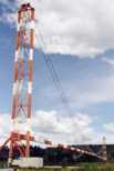
(snowmobile bridge)
Causapscal, Quebec, Canada - Causapscal River
| Bridgemeister ID: | 2592 (added 2014-04-14) |
| Name: | (snowmobile bridge) |
| Location: | Causapscal, Quebec, Canada |
| Crossing: | Causapscal River |
| Use: | Snowmobile |
| Status: | In use (last checked: 2011) |
| Main Cables: | Wire (steel) |
| Suspended Spans: | 1 |
| Main Span: | 1 x 51.8 meters (170 feet) estimated |
(suspension bridge)
Belleville, Ontario, Canada - Moira River
| Bridgemeister ID: | 275 (added before 2003) |
| Name: | (suspension bridge) |
| Location: | Belleville, Ontario, Canada |
| Crossing: | Moira River |
| Coordinates: | 44.165340 N 77.386448 W |
| Maps: | Acme, GeoHack, Google, OpenStreetMap |
| Status: | Removed |
| Main Cables: | Wire |
| Suspended Spans: | 1 |
Notes:
- Was located near (or exactly) the present-day footbridge at the foot of Catharine Street.
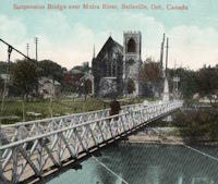
(suspension bridge)
Dawson, Yukon, Canada - Klondike River
| Bridgemeister ID: | 2449 (added 2008-04-24) |
| Name: | (suspension bridge) |
| Location: | Dawson, Yukon, Canada |
| Crossing: | Klondike River |
| Main Cables: | Wire |
| Suspended Spans: | 1 |
Notes:
- Was in existence in 1901.
(suspension bridge)
Saint-Alexis-des-Monts vicinity, Quebec, Canada - Loup River
| Bridgemeister ID: | 1788 (added 2005-05-17) |
| Name: | (suspension bridge) |
| Location: | Saint-Alexis-des-Monts vicinity, Quebec, Canada |
| Crossing: | Loup River |
| Coordinates: | 46.56165 N 73.144883 W |
| Maps: | Acme, GeoHack, Google, OpenStreetMap |
Art Wilson Memorial
Minnedosa, Manitoba, Canada - Little Saskatchewan River
| Bridgemeister ID: | 2614 (added 2014-04-16) |
| Name: | Art Wilson Memorial |
| Location: | Minnedosa, Manitoba, Canada |
| Crossing: | Little Saskatchewan River |
| Coordinates: | 50.25261 N 99.82839 W |
| Maps: | Acme, GeoHack, Google, OpenStreetMap |
| Use: | Footbridge |
| Status: | In use (last checked: 2013) |
| Main Cables: | Wire |
Beauharnois
Melocheville, Quebec, Canada - St. Lawrence River
| Bridgemeister ID: | 1146 (added 2004-01-17) |
| Name: | Beauharnois |
| Location: | Melocheville, Quebec, Canada |
| Crossing: | St. Lawrence River |
| Coordinates: | 45.316050 N 73.908033 W |
| Maps: | Acme, GeoHack, Google, OpenStreetMap |
| Use: | Vehicular (two-lane, heavy vehicles), with walkway |
| Status: | In use (last checked: 2018) |
| Main Cables: | Wire (steel) |
| Suspended Spans: | 1 |
Notes:
- Carries route 132 across a small arm of the St. Lawrence by the Canal de Beauharnois dam.
- Major rehabilitation efforts completed in 2011 and 2012 including replacement of 56 vertical suspenders.
External Links:
Big Salmon River
Saint Martins, New Brunswick, Canada - Big Salmon River
| Bridgemeister ID: | 3558 (added 2019-12-26) |
| Name: | Big Salmon River |
| Location: | Saint Martins, New Brunswick, Canada |
| Crossing: | Big Salmon River |
| Coordinates: | 45.422665 N 65.409299 W |
| Maps: | Acme, GeoHack, Google, OpenStreetMap |
| Use: | Footbridge |
| Status: | In use (last checked: 2019) |
| Main Cables: | Wire (steel) |
Bunzten Lake
Anmore, British Columbia, Canada - Buntzen Lake
| Bridgemeister ID: | 5174 (added 2020-10-03) |
| Name: | Bunzten Lake |
| Location: | Anmore, British Columbia, Canada |
| Crossing: | Buntzen Lake |
| Coordinates: | 49.365787 N 122.858608 W |
| Maps: | Acme, GeoHack, Google, OpenStreetMap |
| Use: | Footbridge |
| Status: | In use (last checked: 2020) |
| Main Cables: | Wire (steel) |
Notes:
- 2022, September: Bridge is scheduled to be replaced by November 2022.
Cal Cheak
Cal Cheak, Whistler, British Columbia, Canada
| Bridgemeister ID: | 5360 (added 2020-11-22) |
| Name: | Cal Cheak |
| Location: | Cal Cheak, Whistler, British Columbia, Canada |
| Coordinates: | 50.059813 N 123.101920 W |
| Maps: | Acme, GeoHack, Google, OpenStreetMap |
| Use: | Footbridge |
| Status: | In use (last checked: 2020) |
| Main Cables: | Wire (steel) |
Castor
Clark Hill Islands, Ontario, Canada - Niagara River
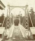
| Bridgemeister ID: | 319 (added before 2003) |
| Name: | Castor |
| Also Known As: | Burning Springs |
| Location: | Clark Hill Islands, Ontario, Canada |
| Crossing: | Niagara River |
| Status: | Removed |
| Main Cables: | Wire |
| Suspended Spans: | 1 |
Notes:
Chaudière River
Charny, Quebec, Canada - Chaudière River
| Bridgemeister ID: | 247 (added before 2003) |
| Name: | Chaudière River |
| Location: | Charny, Quebec, Canada |
| Crossing: | Chaudière River |
| Coordinates: | 46.717350 N 71.285937 W |
| Maps: | Acme, GeoHack, Google, OpenStreetMap |
| Use: | Footbridge |
| Status: | In use (last checked: 2019) |
| Main Cables: | Wire (steel) |
Notes:
- Long footbridge.
- Near 1970 Pierre Laporte - Quebec City and Levis, Quebec, Canada. The Pierre Laporte and Quebec Cantilever bridges are visible in the distance from this footbridge.
Club Les Chevaliers De La Motoneige
New Richmond, Quebec, Canada - Little Cascapedia River
| Bridgemeister ID: | 2595 (added 2014-04-14) |
| Name: | Club Les Chevaliers De La Motoneige |
| Location: | New Richmond, Quebec, Canada |
| Crossing: | Little Cascapedia River |
| Use: | Snowmobile |
| Status: | In use (last checked: 2011) |
| Main Cables: | Wire (steel) |
| Suspended Spans: | 1 |
| Main Span: | 1 x 79.9 meters (262 feet) estimated |
Des Chutes Du Ruisseau Creux
Saint-Alphonse-de-Caplan, Quebec, Canada - Bonaventure River
| Bridgemeister ID: | 2596 (added 2014-04-14) |
| Name: | Des Chutes Du Ruisseau Creux |
| Location: | Saint-Alphonse-de-Caplan, Quebec, Canada |
| Crossing: | Bonaventure River |
| Coordinates: | 48.192363 N 65.563592 W |
| Maps: | Acme, GeoHack, Google, OpenStreetMap |
| Use: | Snowmobile and Footbridge |
| Status: | In use (last checked: 2018) |
| Main Cables: | Wire (steel) |
| Suspended Spans: | 1 |
| Main Span: | 1 x 79.2 meters (260 feet) estimated |
Forêt Ouareau
Notre-Dame-de-la-Merci, Quebec, Canada - Ouareau River
| Bridgemeister ID: | 2423 (added 2008-03-02) |
| Name: | Forêt Ouareau |
| Location: | Notre-Dame-de-la-Merci, Quebec, Canada |
| Crossing: | Ouareau River |
| At or Near Feature: | Ouareau Forest |
| Coordinates: | 46.252520 N 73.974730 W |
| Maps: | Acme, GeoHack, Google, OpenStreetMap |
| Use: | Snowmobile |
| Status: | In use (last checked: 2020) |
| Main Cables: | Wire (steel) |
Galatea Trail
Kananaskis Village vicinity, Alberta, Canada - Kananaskis River
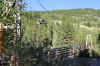
| Bridgemeister ID: | 815 (added 2003-05-30) |
| Name: | Galatea Trail |
| Location: | Kananaskis Village vicinity, Alberta, Canada |
| Crossing: | Kananaskis River |
| At or Near Feature: | Galatea Trailhead |
| Coordinates: | 50.8634 N 115.178917 W |
| Maps: | Acme, GeoHack, Google, OpenStreetMap |
| Use: | Footbridge |
| Status: | In use (last checked: 2022) |
| Main Cables: | Wire (steel) |
| Suspended Spans: | 1 |
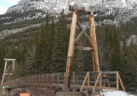
| Bridgemeister ID: | 2705 (added 2019-06-15) |
| Name: | George C. King |
| Location: | Calgary, Alberta, Canada |
| Crossing: | Bow River |
| Coordinates: | 51.048159 N 114.047009 W |
| Maps: | Acme, GeoHack, Google, OpenStreetMap |
| Use: | Footbridge |
| Status: | Demolished, 2013 |
| Main Cables: | Wire (steel) |
Notes:
- Demolished late 2012 or early 2013, since replaced with a new George C. King bridge completed 2014.
Gervais Lacasse
Causapscal vicinity, Quebec, Canada - Assemetquagan River
| Bridgemeister ID: | 2591 (added 2014-04-14) |
| Name: | Gervais Lacasse |
| Location: | Causapscal vicinity, Quebec, Canada |
| Crossing: | Assemetquagan River |
| Use: | ATV and Footbridge |
| Status: | In use (last checked: 2011) |
| Main Cables: | Wire (steel) |
| Suspended Spans: | 1 |
| Main Span: | 1 x 36.6 meters (120 feet) estimated |
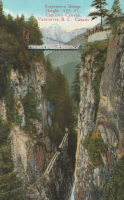
Grand Canyon
Capilano, British Columbia, Canada
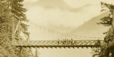
| Bridgemeister ID: | 1006 (added 2003-11-21) |
| Name: | Grand Canyon |
| Also Known As: | Second Canyon |
| Location: | Capilano, British Columbia, Canada |
| Use: | Footbridge |
Notes:
- Level footbridge with large timber towers, not the famous Capilano swinging bridge.
Great Woods Park
Beausejour vicinity, Manitoba, Canada - Brokenhead River
| Bridgemeister ID: | 1502 (added 2004-10-08) |
| Name: | Great Woods Park |
| Location: | Beausejour vicinity, Manitoba, Canada |
| Crossing: | Brokenhead River |
| Coordinates: | 50.078129 N 96.468661 W |
| Maps: | Acme, GeoHack, Google, OpenStreetMap |
| Use: | Footbridge |
| Status: | In use (last checked: 2021) |
| Main Cables: | Wire (steel) |
| Suspended Spans: | 1 |
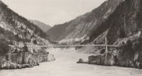
Hell's Gate
Boston Bar, British Columbia, Canada - Fraser River
| Bridgemeister ID: | 1244 (added 2004-02-16) |
| Name: | Hell's Gate |
| Location: | Boston Bar, British Columbia, Canada |
| Crossing: | Fraser River |
| At or Near Feature: | Hell's Gate |
| Coordinates: | 49.780421 N 121.449785 W |
| Maps: | Acme, GeoHack, Google, OpenStreetMap |
| Use: | Footbridge |
| Status: | In use (last checked: 2020) |
| Main Cables: | Wire (steel) |
| Suspended Spans: | 1 |
| Main Span: | 1 x 82.3 meters (270 feet) estimated |
Notes:
- Appears to be wide enough to have once carried vehicles, but is now restricted to pedestrians.

Hopewell Heritage
Hopewell, Nova Scotia, Canada - East River
| Bridgemeister ID: | 5101 (added 2020-09-05) |
| Name: | Hopewell Heritage |
| Location: | Hopewell, Nova Scotia, Canada |
| Crossing: | East River |
| Coordinates: | 45.477334 N 62.697679 W |
| Maps: | Acme, GeoHack, Google, OpenStreetMap |
| Use: | Footbridge |
| Status: | In use (last checked: 2020) |
| Main Cables: | Wire (steel) |
Jean-Luc Sylvain
Quebec City, Quebec, Canada - Montmorency River
| Bridgemeister ID: | 2727 (added 2019-06-22) |
| Name: | Jean-Luc Sylvain |
| Location: | Quebec City, Quebec, Canada |
| Crossing: | Montmorency River |
| Coordinates: | 46.927142 N 71.193853 W |
| Maps: | Acme, GeoHack, Google, OpenStreetMap |
| Use: | Snowmobile and ATV |
| Status: | In use (last checked: 2019) |
| Main Cables: | Wire (steel) |
Koksilah River
Cowichan Station, British Columbia, Canada - Koksilah River
| Bridgemeister ID: | 566 (added 2002-12-30) |
| Name: | Koksilah River |
| Location: | Cowichan Station, British Columbia, Canada |
| Crossing: | Koksilah River |
| At or Near Feature: | Bright Angel Provincial Park |
| Coordinates: | 48.73651 N 123.67823 W |
| Maps: | Acme, GeoHack, Google, OpenStreetMap |
| Use: | Footbridge |
| Status: | In use (last checked: 2007) |
| Main Cables: | Wire (steel) |
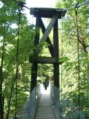
La Tuque
La Tuque, Quebec, Canada - St. Maurice River
| Bridgemeister ID: | 1628 (added 2005-03-11) |
| Name: | La Tuque |
| Location: | La Tuque, Quebec, Canada |
| Crossing: | St. Maurice River |
| Coordinates: | 47.449433 N 72.797383 W |
| Maps: | Acme, GeoHack, Google, OpenStreetMap |
| Use: | Vehicular (one-lane) |
| Status: | In use (last checked: 2022) |
| Main Cables: | Wire (steel) |
| Suspended Spans: | 1 |
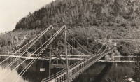
| Bridgemeister ID: | 2553 (added 2012-01-01) |
| Name: | Louis-Marie Gagnon |
| Location: | Grand-Fonds vicinity, Quebec, Canada |
| Coordinates: | 49.04213 N 66.69042 W |
| Maps: | Acme, GeoHack, Google, OpenStreetMap |
| Use: | Snowmobile |
| Status: | In use (last checked: 2010) |
| Main Cables: | Wire (steel) |
| Suspended Spans: | 1 |
Notes:
- Sign at bridge says "Passerelle - Louis-Marie Gagnon - Cap-Chat 2000"
Menzies Creek
Bloedel vicinity, British Columbia, Canada - Menzies Creek
| Bridgemeister ID: | 2427 (added 2008-04-12) |
| Name: | Menzies Creek |
| Location: | Bloedel vicinity, British Columbia, Canada |
| Crossing: | Menzies Creek |
| Coordinates: | 50.11210 N 125.37409 W |
| Maps: | Acme, GeoHack, Google, OpenStreetMap |
| Use: | Footbridge |
| Status: | In use (last checked: 2008) |
| Main Cables: | Wire (steel) |
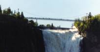
Montmorency Falls
Quebec City vicinity, Quebec, Canada - Montmorency Falls
| Bridgemeister ID: | 1418 (added 2004-07-17) |
| Name: | Montmorency Falls |
| Location: | Quebec City vicinity, Quebec, Canada |
| Crossing: | Montmorency Falls |
| Coordinates: | 46.890964 N 71.147429 W |
| Maps: | Acme, GeoHack, Google, OpenStreetMap |
| Use: | Footbridge |
| Status: | In use (last checked: 2021) |
| Main Cables: | Wire (steel) |
| Suspended Spans: | 1 |
Notes:
- This bridge allows tourists to walk above Montmorency Falls. The current towers are built to resemble the Isle Of Orleans bridge which is clearly visible from the falls. Stone towers from the previous suspension bridge are still present next to the current towers.
- At former location of Montmorency Falls - Quebec City vicinity, Quebec, Canada.
- Near 1935 l'Île d'Orléans (Isle of Orleans, Orleans Island, Taschereau) - Quebec City, Quebec, Canada.
External Links:
Montmorency Falls
Quebec City vicinity, Quebec, Canada - Montmorency Falls
| Bridgemeister ID: | 1526 (added 2004-10-24) |
| Name: | Montmorency Falls |
| Location: | Quebec City vicinity, Quebec, Canada |
| Crossing: | Montmorency Falls |
| Coordinates: | 46.890706 N 71.147952 W |
| Maps: | Acme, GeoHack, Google, OpenStreetMap |
| References: | AAJ, HBE |
| Use: | Vehicular |
| Status: | Failed, April 30, 1856 |
| Main Cables: | Wire (iron) |
| Suspended Spans: | 1 |
Notes:
- Towers from this bridge are still visible next to the towers of the current suspension footbridge. HBE, in 1911, notes that it "collapsed some years ago carrying a wagon and its driver into the cataract."
- Jakkula (AAJ) cites an article tracing back to the Quebec Gazette stating the bridge failed on April 30, 1856 resulting in the loss of "several" lives and recounting the troubled history of the bridge: "There had been statements made before to the effect that the bridge was not to be trusted. People crossed it with terror. On the northern bank, 5 of the 7 strands of one of the wire cables had previously given way, and the cable had been repaired."
- Later at same location Montmorency Falls - Quebec City vicinity, Quebec, Canada.
Oldenburg
Whitemouth, Manitoba, Canada - Whitemouth River
| Bridgemeister ID: | 5176 (added 2020-10-03) |
| Name: | Oldenburg |
| Location: | Whitemouth, Manitoba, Canada |
| Crossing: | Whitemouth River |
| Coordinates: | 50.018106 N 96.030656 W |
| Maps: | Acme, GeoHack, Google, OpenStreetMap |
| Use: | Footbridge |
| Status: | Derelict (last checked: 2013) |
| Main Cables: | Wire |
External Links:
Panorama Mountain Resort
Panorama, British Columbia, Canada - Toby Creek
| Bridgemeister ID: | 2676 (added 2019-03-30) |
| Name: | Panorama Mountain Resort |
| Location: | Panorama, British Columbia, Canada |
| Crossing: | Toby Creek |
| Coordinates: | 50.458872 N 116.240551 W |
| Maps: | Acme, GeoHack, Google, OpenStreetMap |
| Use: | Footbridge |
| Status: | In use (last checked: 2015) |
| Main Cables: | Wire (steel) |
Passerelle 132
Amqui, Quebec, Canada - Matapédia River
| Bridgemeister ID: | 2590 (added 2014-04-14) |
| Name: | Passerelle 132 |
| Location: | Amqui, Quebec, Canada |
| Crossing: | Matapédia River |
| Use: | Snowmobile and Footbridge |
| Status: | In use (last checked: 2011) |
| Main Cables: | Wire |
| Suspended Spans: | 1 |
| Main Span: | 1 x 50.9 meters (167 feet) estimated |
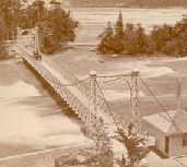
Pollux
Clark Hill Islands, Ontario, Canada - Niagara River
| Bridgemeister ID: | 848 (added before 2003) |
| Name: | Pollux |
| Also Known As: | Burning Springs |
| Location: | Clark Hill Islands, Ontario, Canada |
| Crossing: | Niagara River |
| Status: | Removed |
| Main Cables: | Wire |
Notes:
Sheep Creek
Williams Lake vicinity, British Columbia, Canada - Fraser River
| Bridgemeister ID: | 1641 (added 2005-03-14) |
| Name: | Sheep Creek |
| Location: | Williams Lake vicinity, British Columbia, Canada |
| Crossing: | Fraser River |
| Coordinates: | 51.982898 N 122.275076 W |
| Maps: | Acme, GeoHack, Google, OpenStreetMap |
| Use: | Vehicular (one-lane) |
| Status: | Removed |
| Main Cables: | Wire |
Notes:
- Crossed the Fraser southwest of Williams Lake next to the present route 20 crossing. Some of the stone piers are still visible next to the present arch bridge. For some time, the two bridges were standing side-by-side (perhaps 100 yards apart).
- Built prior to 1908. Removed after 1959.
Swinging
Tidnish vicinity, Nova Scotia, Canada - Tidnish River
| Bridgemeister ID: | 1751 (added 2005-04-20) |
| Name: | Swinging |
| Location: | Tidnish vicinity, Nova Scotia, Canada |
| Crossing: | Tidnish River |
| Coordinates: | 45.97675 N 64.042783 W |
| Maps: | Acme, GeoHack, Google, OpenStreetMap |
| Use: | Footbridge |
| Status: | Closed, January 2 015 (last checked: 2015) |
| Main Cables: | Wire (steel) |
| Suspended Spans: | 1 |
| Main Span: | 1 x 66 meters (216.5 feet) |
Notes:
- A visitor sent the following information: "[The bridge is] located on a hiking trail on the bed of an abandoned late 19th century railway track, which is raised several meters above a low, marshy area. The bridge itself spans a gap where the Tidnish River flows through the embankment. When driving along the Sunrise Trail, you get a brief glimpse of the bridge, although you must take a small back road to get to it... The bridge is very sturdy, and does not 'swing' although a 70 kg (150 lb.) person can easily create a visible ripple that passes back and forth along the deck by stomping on it. The anchors for the main cables appear to be nothing more than two I-beams sticking out of the ground on a 45 degree angle to which the cables are bolted. The diagonal I-beams are most likely bolted or welded to a horizontal, buried I-beam. The suspender 'cables' are steel rods that are kept from sliding by resting behind a clamp. The bridge looks small and assymetrical when viewed from a distance because the towers and a large portion of the span aren't visible through the trees on each end. The path also passes over an old keystone bridge which was constructed when the railway was built in the late 19th century, you do not realize this when you are actually on the path because there is 2-3 m (7-10 ft.) of soil on top of the bridge, so you can only see the large stones when you are standing ON them."
- Patrick S. O'Donnell sent more information about 19th-century arch bridge at this location. It was part of an ambitious project known as the "Chignecto Marine Transport Railway" intended to transport large ships across the Isthmus of Chignetco.
- Closed indefinitely in early 2015 after approach span wood supports were found to have deteriorated.
External Links:
Topham
Clearwater County, Alberta, Canada - North Saskatchewan River
| Bridgemeister ID: | 2706 (added 2019-06-16) |
| Name: | Topham |
| Also Known As: | Siffleur Falls |
| Location: | Clearwater County, Alberta, Canada |
| Crossing: | North Saskatchewan River |
| At or Near Feature: | Siffleur Falls Trailhead |
| Coordinates: | 52.048079 N 116.406621 W |
| Maps: | Acme, GeoHack, Google, OpenStreetMap |
| Use: | Footbridge |
| Status: | In use (last checked: 2020) |
| Main Cables: | Wire (steel) |
Valley River
Dauphin, Manitoba, Canada - Valley River
| Bridgemeister ID: | 5175 (added 2020-10-03) |
| Name: | Valley River |
| Location: | Dauphin, Manitoba, Canada |
| Crossing: | Valley River |
| Coordinates: | 51.242700 N 100.098440 W |
| Maps: | Acme, GeoHack, Google, OpenStreetMap |
| Use: | Footbridge |
| Status: | Removed, 2017 |
| Main Cables: | Wire (steel) |
External Links:
Walcott
Walcott, British Columbia, Canada - Bulkley River
| Bridgemeister ID: | 5920 (added 2021-06-10) |
| Name: | Walcott |
| Location: | Walcott, British Columbia, Canada |
| Crossing: | Bulkley River |
| Coordinates: | 54.517482 N 126.838512 W |
| Maps: | Acme, GeoHack, Google, OpenStreetMap |
| Use: | Footbridge |
| Status: | Replaced |
| Main Cables: | Wire (steel) |
| Main Span: | 1 |
Notes:
- Likely built in 1931 or 1932.
- Replaced by Walcott - Walcott, British Columbia, Canada.
- See 1912 Hagwilget (Bulkley Canyon) - Hagwilget, British Columbia, Canada.
External Links:
- Walcott Suspension Bridge on Bulkley River - Northern BC Archives. Image taken in 1932 stating the bridge was "moved from its original location in the Hagwilget Canyon" implying this is the relocated 1912 Bulkely/Hagwilget Canyon suspension bridge that was replaced in 1931. The two bridges, however, don't appear to resemble each other and the Walcott bridge's main span appears to have been about 50 feet shorter than the 1912 Bulkely Canyon bridge . Perhaps only the cables were reused.
Walcott
Walcott, British Columbia, Canada - Bulkley River
| Bridgemeister ID: | 5921 (added 2021-06-10) |
| Name: | Walcott |
| Location: | Walcott, British Columbia, Canada |
| Crossing: | Bulkley River |
| Coordinates: | 54.517548 N 126.839274 W |
| Maps: | Acme, GeoHack, Google, OpenStreetMap |
| Use: | Footbridge |
| Status: | In use (last checked: 2020) |
| Main Cables: | Wire (steel) |
| Main Span: | 1 |
Notes:
- Replaced Walcott - Walcott, British Columbia, Canada. Several components appear to have been retained from the prior bridge, but the towers and deck were replaced at some point giving the appearance of a different suspension bridge.
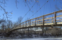
| Bridgemeister ID: | 1465 (added 2004-08-28) |
| Name: | Zoo |
| Also Known As: | St. George's |
| Location: | Calgary, Alberta, Canada |
| Crossing: | Bow River |
| At or Near Feature: | Calgary Zoo, St. George's Island |
| Coordinates: | 51.04615 N 114.030983 W |
| Maps: | Acme, GeoHack, Google, OpenStreetMap |
| Use: | Footbridge |
| Status: | Replaced |
| Main Cables: | Wire (steel) |
Notes:
- 2013: Damaged by flood. Closed and ultimately replaced.
- Replaced by 2018 Calgary Zoo - Calgary, Alberta, Canada.
Do you have any information or photos for these bridges that you would like to share? Please email david.denenberg@bridgemeister.com.