Suspension Bridges of Peru (201-229 of 229)
This is a list of bridges 201 through 229 (of 229 total) from the suspension bridge inventory for the country Peru . Wherever you see a Bridgemeister ID number click it to isolate the bridge on its own page.
Related Lists:
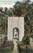
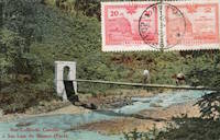
The bridge pictured here was presumably located in the village of Puente Capelo at the indicated coordinates, but this has not been confirmed. Bridgemeister ID: 5930 (added 2021-06-27)Name: Centenario Also Known As: Centennial Location: San Jerónimo de Tunán, Huancayo, Peru Crossing: Mantaro River Coordinates: 11.955931 S 75.296669 W Maps: Acme , GeoHack , Google , OpenStreetMap Use: Vehicular (one-lane) Status: In use (last checked: 2020) Main Cables: Wire (steel) Suspended Spans: 1 Main Span: 1
Bridgemeister ID: 6394 (added 2021-07-27)Name: Chongos Location: Chongos Bajo District and Viques District, Peru Crossing: Mantaro River Coordinates: 12.154210 S 75.244333 W Maps: Acme , GeoHack , Google , OpenStreetMap Use: Vehicular (one-lane) Status: Removed Main Cables: Wire Suspended Spans: 1
2014: Towers remain with no deck or cables. Demolished by 2020. Bridgemeister ID: 7495 (added 2022-12-30)Name: Cuyca Location: Cuyca, Colasay, Peru Crossing: Rio Chamaya Coordinates: 6.009487 S 78.860944 W Maps: Acme , GeoHack , Google , OpenStreetMap Use: Footbridge Status: Derelict, since March 2022 Main Cables: Wire (steel) Suspended Spans: 1 Main Span: 1 x 75 meters (246.1 feet) estimated
2022, March: Heavily damaged by flood. Bridgemeister ID: 6178 (added 2021-07-08)Name: Gramazú Location: Gramazú, Peru Coordinates: 10.512456 S 75.449030 W Maps: Acme , GeoHack , Google , OpenStreetMap Status: In use (last checked: 2021) Main Cables: Wire (steel) Suspended Spans: 1 Main Span: 1 x 98 meters (321.5 feet)
Bridgemeister ID: 7819 (added 2023-09-02)Name: Ivochote Location: Ivochote, Echarate, Peru Crossing: Urubamba River Coordinates: 12.460944 S 72.966333 W Maps: Acme , GeoHack , Google , OpenStreetMap Status: In use (last checked: 2022) Main Cables: Wire (steel) Main Span: 1 x 95 meters (311.7 feet) estimated Side Span: 1
Bridgemeister ID: 6022 (added 2021-07-02)Name: La Auvernia Location: Auvernia and La Victoria, Peru Crossing: Rio Tarma Coordinates: 11.107733 S 75.384482 W Maps: Acme , GeoHack , Google , OpenStreetMap Use: Vehicular (one-lane) Status: In use (last checked: 2020) Main Cables: Wire (steel) Suspended Spans: 1 Main Span: 1 x 42 meters (137.8 feet) estimated
Bridgemeister ID: 7833 (added 2023-09-02)Name: Mantoreal Location: Manto Real, Echarate, Peru Crossing: Urubamba River Coordinates: 12.649711 S 72.569289 W Maps: Acme , GeoHack , Google , OpenStreetMap Status: Extant (last checked: 2022) Main Cables: Wire (steel) Main Span: 1 x 98 meters (321.5 feet)
Bridgemeister ID: 7763 (added 2023-08-05)Name: Mayoc Location: Mayoc, Peru Crossing: Mantaro River Coordinates: 12.813517 S 74.385397 W Maps: Acme , GeoHack , Google , OpenStreetMap Use: Vehicular Status: Only towers remain, since April 25, 1974 (last checked: 2022) Suspended Spans: 1 Main Span: 1 x 83 meters (272.3 feet) estimated
1974, April 25: Destroyed by floodwaters. At this point the suspension bridge had already been bypassed by a concrete arch bridge. Later at same location 1975 Mayoc - Mayoc, Peru . Bridgemeister ID: 7765 (added 2023-08-15)Name: Mejorada Location: Huamancaca vicinity and Huancayo, Peru Crossing: Mantaro River Coordinates: 12.052207 S 75.240174 W Maps: Acme , GeoHack , Google , OpenStreetMap Use: Vehicular Status: Removed Main Cables: Wire Suspended Spans: 1
Facebook . 1970s image of Puente Breña (a truss bridge) with the suspension bridge visible in the background.Facebook . Translated: "Beautiful photograph of the old suspension bridge La Mejorada (c. 1920), seen from east to west, you can see an entrance door and the person in charge of charging for the use of this. Currently this space is occupied by the La Breña bridge, which allows access to the city of Huancayo from the right bank."Facebook . Another old photo of the bridge.Facebook . More old photos of the bridge.Bridgemeister ID: 2491 (added 2008-12-23)Name: Mirador Location: Moquequa, Peru Coordinates: 17.19889 S 70.93096 W Maps: Acme , GeoHack , Google , OpenStreetMap Use: Footbridge Status: In use (last checked: 2007) Main Cables: Wire (steel) Suspended Spans: 1
Bridgemeister ID: 5931 (added 2021-06-27)Name: Pamay Location: Mariposa, Satipo, Peru Coordinates: 11.448739 S 74.781266 W Maps: Acme , GeoHack , Google , OpenStreetMap Use: Vehicular Status: In use (last checked: 2014) Main Cables: Wire (steel) Main Span: 1
Bridgemeister ID: 7647 (added 2023-06-03)Name: Paroccan Location: Urcos, Peru Crossing: Urubamba River Coordinates: 13.665270 S 71.634868 W Maps: Acme , GeoHack , Google , OpenStreetMap Use: Vehicular (one-lane) Status: In use (last checked: 2022) Main Cables: Wire (steel) Suspended Spans: 1 Main Span: 1 x 48 meters (157.5 feet) estimated
Facebook . Several images of the bridge from what appears to be a ceremony commencing construction of a replacement bridge. October 25, 2022.Bridgemeister ID: 5953 (added 2021-06-30)Name: Peatonal Carapongo Also Known As: Foncodes Location: Lurigancho-Chosica and Ate, Peru Coordinates: 12.006744 S 76.864700 W Maps: Acme , GeoHack , Google , OpenStreetMap Use: Footbridge Status: In use (last checked: 2013) Main Cables: Wire (steel) Suspended Spans: 1 Main Span: 1 x 90 meters (295.3 feet) estimated
Bridgemeister ID: 3444 (added 2019-12-22)Name: Peatonal Paucarbamba Location: Pachar, Peru Crossing: Urubamba River Coordinates: 13.282869 S 72.200724 W Maps: Acme , GeoHack , Google , OpenStreetMap Status: In use (last checked: 2013) Main Cables: Wire (steel) Suspended Spans: 1
Bridgemeister ID: 7636 (added 2023-05-28)Name: Pillpinto Location: Acos and Pillpinto, Peru Crossing: Apurimac River Coordinates: 13.953790 S 71.754456 W Maps: Acme , GeoHack , Google , OpenStreetMap Use: Vehicular Status: Only towers remain Main Cables: Wire (steel) Suspended Spans: 1 Main Span: 1 x 50 meters (164 feet) estimated
Bridgemeister ID: 6190 (added 2021-07-14)Name: Playa Rosalinas Location: Caserio Santa Rosa and Kiuñalla vicinity, Peru Crossing: Apurimac River Coordinates: 13.421389 S 72.852945 W Maps: Acme , GeoHack , Google , OpenStreetMap Use: Footbridge Status: Derelict, since c. 2008-2017 Main Cables: Wire Suspended Spans: 1
Bridgemeister ID: 6191 (added 2021-07-14)Name: Playa Rosalinas Location: Caserio Santa Rosa and Kiuñalla vicinity, Peru Crossing: Apurimac River Coordinates: 13.421666 S 72.852563 W Maps: Acme , GeoHack , Google , OpenStreetMap Use: Footbridge Status: In use (last checked: 2021) Main Cables: Wire (steel) Suspended Spans: 1
Bridgemeister ID: 5976 (added 2021-07-01)Name: Pongora Location: Ayacucho, Peru Coordinates: 13.086515 S 74.224344 W Maps: Acme , GeoHack , Google , OpenStreetMap Use: Footbridge Status: In use (last checked: 2014) Main Cables: Wire (steel) Main Span: 1
Bridgemeister ID: 5967 (added 2021-06-30)Name: Promisora Location: La Promisora and Garibaldi, Peru Crossing: Rio Ulcamayo Coordinates: 11.054407 S 75.409569 W Maps: Acme , GeoHack , Google , OpenStreetMap Use: Vehicular (one-lane) Status: In use (last checked: 2021) Main Cables: Wire (steel) Suspended Spans: 1
Bridgemeister ID: 7470 (added 2022-12-25)Name: San Francisco Location: Uchiza, Peru Coordinates: 8.486166 S 76.463191 W Maps: Acme , GeoHack , Google , OpenStreetMap Use: Vehicular (one-lane) Status: In use Main Cables: Wire (steel) Suspended Spans: 1 Main Span: 1 x 145 meters (475.7 feet) estimated
Bridgemeister ID: 8224 (added 2024-02-06)Name: San Luis de Shuaro Location: San Luis de Shuaro, Peru Use: Footbridge
Bridgemeister ID: 7242 (added 2022-07-16)Name: Santo Cristo Location: Quiches, Ancash and La Libertad, Peru Crossing: Marañón River Coordinates: 8.372299 S 77.449082 W Maps: Acme , GeoHack , Google , OpenStreetMap Status: Extant (last checked: 2020) Main Span: 1 x 72 meters (236.2 feet) estimated
Appears to be in derelict condition since the late 2010s. Bridgemeister ID: 5949 (added 2021-06-29)Name: Shirany Also Known As: Chirani Location: Bajo Aldea, Peru Crossing: Río Perené Coordinates: 10.861878 S 75.006248 W Maps: Acme , GeoHack , Google , OpenStreetMap Use: Vehicular (one-lane) Status: In use (last checked: 2014) Main Cables: Wire (steel) Suspended Spans: 1
Bridgemeister ID: 3300 (added 2019-11-27)Name: Yanahuanca Location: Yanahuanca, Pozuzo, Peru Coordinates: 10.038418 S 75.569681 W Maps: Acme , GeoHack , Google , OpenStreetMap Use: Vehicular (one-lane) Status: In use (last checked: 2019) Main Cables: Wire (steel)
Bridgemeister ID: 5992 (added 2021-07-02)Name: Yanango Location: Yanango, Peru Crossing: Rio Yanango Coordinates: 11.209251 S 75.486013 W Maps: Acme , GeoHack , Google , OpenStreetMap Use: Vehicular (one-lane) Status: Dismantled, 2022 Main Cables: Wire (steel) Suspended Spans: 1 Main Span: 1 x 10⁷ meters (351 feet)
Provisional bridge replacing a cable-stayed bridge that collapsed in 2005. Dismanted in 2022 to be relocated to Satipo where it collapsed in early 2023 before it was opened to the public. Moved to 2023 (suspension bridge) - Satipo, Peru . Facebook . Images of the bridge being dismantled for relocation to Satipo. Posted January 12, 2022.Facebook . Images of the cable-stayed bridge that collapsed in 2005 and construction of the suspension bridge. Posted March 19, 2021.Facebook . Images of the bridge being dismantled for relocation to Satipo. Posted January 25, 2022.Do you have any information or photos for these bridges that you would like to share? Please email david.denenberg@bridgemeister.com .
Mail | Facebook | Twitter


