Suspension Bridges of USA (1,301-1,400 of 1,437)
This is a list of bridges 1,301 through 1,400 (of 1,437 total) from the suspension bridge inventory for the country USA . Wherever you see a Bridgemeister ID number click it to isolate the bridge on its own page.
Related Lists:
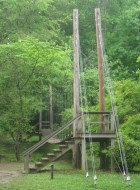
Bridgemeister ID: 2883 (added 2019-09-13)Name: Holden Arboretum Location: Kirtland, Ohio , USA At or Near Feature: Judith and Maynard H. Murch IV Canopy Walk Use: Footbridge Status: In use (last checked: 2019) Main Cables: Wire (steel)
Bridgemeister ID: 1715 (added 2005-04-04)Name: Horse Location: Tassajara Hot Springs vicinity, California , USA Crossing: Arroyo Seco At or Near Feature: Los Padres National Forest Coordinates: 36.218867 N 121.502183 W Maps: Acme , GeoHack , Google , OpenStreetMap Use: Footbridge Status: Destroyed, January 9, 2023 Main Cables: Wire (steel) Suspended Spans: 1 Main Span: 1 x 29.6 meters (97 feet) estimated
Located near confluence of Willow Creek and Arroyo Seco. 2023, January 9: Destroyed by flood. Bridgemeister ID: 1959 (added 2005-11-05)Name: Horseshoe Dam Location: Horseshoe Dam, Arizona , USA References: HAERAZ10 Status: Removed, 1944 Suspended Spans: 1
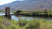
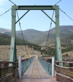
The vehicular suspension bridge at Hyampom, not to be confused with the locally famous Hyampom Mule Bridge, was likely located at the coordinates provided here and likely destroyed by the Christmas flood of 1964. Likely completed in the 1930s. 1964, December: Destroyed by flood. Coordinates provided are for approximate location of the bridge crossing the Nashua River from the railroad tracks north of Temple St., to Jackson Mill building number 2. Bridge was in existence in 1875 when it was photographed for a popular stereoview image. Bridgemeister ID: 822 (added 2003-05-31)Name: James Craig Bair Sheep Ranch Location: Dotsero vicinity, Colorado , USA Crossing: Colorado River At or Near Feature: Glenwood Canyon vicinity Coordinates: 39.64485 N 107.07813 W Maps: Acme , GeoHack , Google , OpenStreetMap Use: Footbridge and Stock Status: Extant (last checked: 2020) Main Cables: Wire (steel) Suspended Spans: 2 Main Span: 1 x 64 meters (210 feet) estimated Side Span: 1 x 16.5 meters (54 feet) estimated
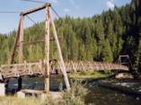
Bridgemeister ID: 1322 (added 2004-04-25)Name: Junction Mountain Trail Location: Clearwater National Forest, Idaho , USA Crossing: Kelly Creek Coordinates: 46.71925 N 115.23276 W Maps: Acme , GeoHack , Google , OpenStreetMap Use: Pack and Footbridge Status: In use (last checked: 2003) Main Cables: Wire (steel) Suspended Spans: 1 Main Span: 1 x 45.7 meters (150 feet) estimated
Bridgemeister ID: 834 (added 2003-06-01)Name: Kankakee River Trail Location: Altorf vicinity, Illinois , USA Crossing: Rock Creek At or Near Feature: Kankakee River State Park Coordinates: 41.205533 N 87.984933 W Maps: Acme , GeoHack , Google , OpenStreetMap Use: Footbridge Status: In use (last checked: 2020) Main Cables: Wire (steel) Suspended Spans: 1
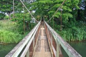
Bridgemeister ID: 2471 (added 2008-12-20)Name: Kapaa Location: Kapaa, Hawaii , USA Crossing: Kapaa Stream Coordinates: 22.10394 N 159.32420 W Maps: Acme , GeoHack , Google , OpenStreetMap Use: Footbridge Status: In use (last checked: 2008) Main Cables: Wire (steel) Suspended Spans: 1 Main Span: 1 x 45.7 meters (150 feet)
Collapsed, July, 1962 while a car was crossing. Three adults were killed, one child was injured, but survived. From a UPI wire news article appearing in July 1962 Kentucky newspapers: "The swinging bridge fell when a cable snapped afler being weakened by rubbing against a concrele abutment, [Commisioner of Highways Henry Ward] said." Likely built 1949-1953. Huge derelict industrial conveyor suspension bridge, mostly demolished by 2011. Patrick S. O'Donnell estimated the main span at approximately 750 feet. Mostly demolished as of late 2011. Bridgemeister ID: 5583 (added 2020-12-21)Name: Lava Creek Location: Mammoth, Wyoming , USA Crossing: Lava Creek At or Near Feature: Lava Creek Trail, Yellowstone National Park Coordinates: 44.973740 N 110.683292 W Maps: Acme , GeoHack , Google , OpenStreetMap Use: Footbridge Status: In use (last checked: 2020) Main Cables: Wire (steel) Suspended Spans: 1
Bridgemeister ID: 2182 (added 2007-01-14)Name: Lightning Creek Location: Ross Lake National Recreation Area, Washington , USA Crossing: Lightning Creek At or Near Feature: North Cascades National Park Coordinates: 48.87465 N 121.01784 W Maps: Acme , GeoHack , Google , OpenStreetMap Use: Footbridge Status: In use (last checked: 2006) Main Cables: Wire (steel) Suspended Spans: 1 Main Span: 1 x 59.6 meters (195.5 feet)
Bridgemeister ID: 1332 (added 2004-05-01)Name: Lindsay Lane Location: Criglersville, Virginia , USA Crossing: Robinson River Coordinates: 38.4574 N 78.301833 W Maps: Acme , GeoHack , Google , OpenStreetMap Principals: VDOT Use: Footbridge Status: Closed, October, 2020 (last checked: 2022) Main Cables: Wire (steel) Suspended Spans: 1 Main Span: 1 x 45.7 meters (150 feet) estimated
There are two suspension footbridges across the Robinson River at Criglersville. This one is located where Lindsay Lane fords Robinson River. 2020, October: Closed after failing safety inspection. 2021, February: VDOT (Virginia Department of Transportation) proposals to either rehabilitate or replace the bridge are being considered. Near 1987 (footbridge) - Criglersville, Virginia, USA . Bridgemeister ID: 1316 (added 2004-04-18)Name: Little Mac Location: Marilla vicinity, Michigan , USA Crossing: Manistee River Coordinates: 44.3654 N 85.826467 W Maps: Acme , GeoHack , Google , OpenStreetMap Use: Footbridge Status: In use (last checked: 2007) Main Cables: Wire (steel) Suspended Spans: 1 Main Span: 1 x 50.9 meters (167 feet)
This is the third Michigan suspension footbridge I've found nicknamed "Little Mac". Stephen Quintana writes: "One of my first projects was to be the inspector on the construction of this bridge. This was somewhere between 1994 and 1996. I remember the contractor's only experience with any Forest Service projects was installing some toilets for us. He had never done anything like this before. I wasn't on the job site the day he pulled the cables across the river, so I asked him how he did it. He said he used a fishing pole with a small weight and cast it across the river. Then he used that to pull a larger rope, then a much larger rope, then finally the cables. I thought they did a pretty good job on this bridge. I remember the cost was somewhere around $100,000 for this project." Bridgemeister ID: 1055 (added 2003-12-13)Name: Little Mac Location: Reed City, Michigan , USA Crossing: Hersey River Coordinates: 43.88466 N 85.51286 W Maps: Acme , GeoHack , Google , OpenStreetMap Use: Footbridge Status: In use (last checked: 2007) Main Cables: Wire (steel) Suspended Spans: 1 Main Span: 1 x 45.7 meters (150 feet)
Bridgemeister ID: 2113 (added 2006-09-03)Name: Long Bottom Location: Hinton, West Virginia , USA Crossing: New River Status: Removed Main Cables: Wire (steel)
From a sign at the New River Gorge visitors center: "Built in the 1920's, this suspension bridge connected the New River Lumber Company sawmill with the Long bottom train station on the other side of the New River. Rail cars pulled by a steel cable carried lumber to the railroad station." Bridgemeister ID: 2061 (added 2006-06-03)Name: Long Creek Location: Melvern, Kansas , USA At or Near Feature: Melvern Dam vicinity Coordinates: 38.513867 N 95.704033 W Maps: Acme , GeoHack , Google , OpenStreetMap Use: Footbridge Status: In use (last checked: 2006)
Sign at bridge reads: "Long Creek Suspension Bridge. This is a replica of the bridge that once spanned Long Creek at Francis Crossing approximately 2 miles southwest of Melvern. It was the only known bridge of this design in Kansas. The bridge was originally constructed between 1885 and 1890 by the Wilden Bridge Company. The original bridge was 100 feet long and 13 feet wide. It was designed for horse drawn hay wagons..." See 1882 Long Creek - Melvern vicinity, Kansas, USA . Bridgemeister ID: 2380 (added 2007-11-03)Name: Mackay Bar Location: Mackay Bar, Idaho , USA Crossing: Salmon River At or Near Feature: Frank Church-River of No Return Wilderness Coordinates: 45.38511 N 115.49917 W Maps: Acme , GeoHack , Google , OpenStreetMap Use: Pack and Footbridge Status: In use Main Cables: Wire (steel)
Bridgemeister ID: 2422 (added 2008-02-23)Name: Mariposa Equestrian Also Known As: Horse Location: Burbank, California , USA Crossing: Los Angeles River Coordinates: 34.15550 N 118.31265 W Maps: Acme , GeoHack , Google , OpenStreetMap Use: Equestrian and Footbridge Status: In use (last checked: 2021) Main Cables: Wire (steel) Suspended Spans: 1 Main Span: 1 x 41.1 meters (135 feet)
Bridgemeister ID: 1046 (added 2003-12-06)Name: Martins Ferry Location: Martins Ferry, Weitchpec vicinity, California , USA Crossing: Klamath River Use: Vehicular (one-lane) Status: Removed Main Cables: Wire
Bridgemeister ID: 1658 (added 2005-03-19)Name: Martins Ferry Location: Martins Ferry, Weitchpec vicinity, California , USA Crossing: Klamath River Status: Destroyed, Jan. 1890 Main Cables: Wire
Bird's eye view of Martins Ferry Bridge and buildings beyond . Undated high-resolution image of a Martins Ferry suspension bridge with open-frame timber towers. Unclear if this photo was taken before 1890, the purported destruction date of this early Martins Ferry suspension bridge. Despite the resolution, there is not much to see in the image to help date it. Twisted strand main cables are evident, but such cables were manufactured as early as the mid-1850s.Bridgemeister ID: 344 (added before 2003)Name: Mocus Point Pack Location: Clearwater National Forest, Idaho , USA Crossing: Lochsa River Coordinates: 46.46130 N 115.01868 W Maps: Acme , GeoHack , Google , OpenStreetMap References: PQU Use: Pack Status: In use (last checked: 2003) Main Cables: Wire (steel) Suspended Spans: 1 Main Span: 1 x 61 meters (200 feet) estimated
Bridgemeister ID: 345 (added before 2003)Name: Mongaup Location: Mongaup, New York , USA Crossing: Mongaup River References: WDH Status: Removed Main Cables: Wire Suspended Spans: 1
Bridgemeister ID: 2429 (added 2008-04-12)Name: Needleton Location: Needleton vicinity, Colorado , USA Crossing: Animas River At or Near Feature: Chicago Basin Trail Coordinates: 37.633477 N 107.692765 W Maps: Acme , GeoHack , Google , OpenStreetMap Use: Footbridge Status: Replaced, 2008 Main Cables: Wire Suspended Spans: 1
Bridgemeister ID: 2568 (added 2012-02-05)Name: Nome River Location: Nome vicinity, Alaska , USA Crossing: Nome River Use: Vehicular (one-lane) Main Cables: Wire
Likely removed. See Alaska digital archives identifiers ASL-P61-141-003, UAF-1980-68-295, and UAF-1980-68-296 which are photos of the bridge from the time period 1913-1939. One photo is captioned "Mile 3 - Nome River Susp. Br. - Rt. 8". Bridgemeister ID: 5673 (added 2021-01-31)Name: Northville-Placid Trail Location: Whitehouse, Lake Pleasant, New York , USA Crossing: West Branch Sacandaga River At or Near Feature: Northville-Placid Trail, Silver Lake Wilderness Coordinates: 43.372984 N 74.435520 W Maps: Acme , GeoHack , Google , OpenStreetMap Use: Footbridge Status: In use (last checked: 2020) Main Cables: Wire (steel) Main Spans: 2
Bridgemeister ID: 4948 (added 2020-08-08)Name: Oneida Baptist Institute Also Known As: OBI Location: Oneida, Kentucky , USA Crossing: Goose Creek Coordinates: 37.265185 N 83.648314 W Maps: Acme , GeoHack , Google , OpenStreetMap Use: Footbridge Status: Extant (last checked: 2020) Main Cables: Wire (steel)
Bridgemeister ID: 348 (added before 2003)Name: Orange County Golf Club Location: Middletown, New York , USA Crossing: Wallkill River Coordinates: 41.432753 N 74.374064 W Maps: Acme , GeoHack , Google , OpenStreetMap Principals: John A. Roebling Sons, Co. Use: Golf cart Status: In use (last checked: 2016) Main Cables: Wire (steel) Suspended Spans: 1 Main Span: 1 x 61 meters (200 feet)
Completed in 1926 or 1928. Now known as Orange Country Club. 2012: "Orange County Golf Club" renamed to "West Hills Country Club". Bridgemeister ID: 2724 (added 2019-06-22)Name: Oregon Zoo Location: Portland, Oregon , USA At or Near Feature: Cascade Canyon Trail, Black Bear Ridge Coordinates: 45.510517 N 122.715200 W Maps: Acme , GeoHack , Google , OpenStreetMap Use: Footbridge Status: In use (last checked: 2019) Main Cables: Wire (steel) Suspended Spans: 1
Bridgemeister ID: 1404 (added 2004-07-04)Name: Paradise Ranch Location: Lowell vicinity, Idaho , USA Crossing: Clearwater River Coordinates: 46.14862 N 115.73054 W Maps: Acme , GeoHack , Google , OpenStreetMap Use: Vehicular Status: In use (last checked: 2003) Main Cables: Wire (steel) Suspended Spans: 3 Main Span: 1 x 78 meters (256 feet) estimated Side Spans: 2 x 29.3 meters (96 feet) estimated
Private vehicular bridge. Bridgemeister ID: 6562 (added 2021-09-02)Name: Pedestrian Swinging Location: Belvidere, Illinois , USA Crossing: Kishwaukee River Coordinates: 42.255262 N 88.855792 W Maps: Acme , GeoHack , Google , OpenStreetMap Use: Footbridge Status: In use (last checked: 2021) Main Cables: Wire (steel) Main Span: 1 x 54 meters (177.2 feet) estimated
Bridgemeister ID: 2029 (added 2006-04-09)Name: Pedlar Location: Oronoco vicinity, Virginia , USA Crossing: Pedlar River At or Near Feature: George Washington National Forest Coordinates: 37.6669 N 79.2849 W Maps: Acme , GeoHack , Google , OpenStreetMap Use: Footbridge Status: In use (last checked: 2006) Main Cables: Wire (steel) Suspended Spans: 1 Main Span: 1 x 35.1 meters (115 feet)
In 2005, the Appalachian Trail was rerouted over this bridge. Bridgemeister ID: 1358 (added 2004-05-16)Name: Peggy Sue Location: Los Alamos, New Mexico , USA Crossing: Acid Canyon Use: Pipeline and Footbridge Status: Removed, February 1997 Main Cables: Wire (steel) Main Span: 1 x 167.6 meters (550 feet) Deck width: 3 feet
Bridgemeister ID: 349 (added before 2003)Name: Penn Public Service Co. Location: Rockwood, Pennsylvania , USA Crossing: Casselman River References: SJR Main Cables: Wire (steel) Suspended Spans: 1
Bridgemeister ID: 2634 (added 2019-02-26)Name: Pilgrim Park Location: Princeton, Illinois , USA Crossing: Brush Creek At or Near Feature: Pilgrim Park Use: Footbridge Status: In use (last checked: 2011) Main Cables: Wire (steel) Suspended Spans: 1
Spring, 2011: Largely destroyed by flood. October, 2011: Rebuilt. Bridgemeister ID: 1359 (added 2004-05-16)Name: Pueblo Canyon Location: Los Alamos, New Mexico , USA Crossing: Pueblo Canyon Use: Pipeline Status: In use (last checked: 2004) Main Cables: Wire (steel) Suspended Spans: 1 Main Span: 1 x 91.4 meters (300 feet)
Bridgemeister ID: 2388 (added 2007-11-19)Name: Raven Cliff Falls Location: Caesars Head State Park, South Carolina , USA Crossing: Matthew's Creek At or Near Feature: Raven Cliff Falls Coordinates: 35.104862 N 82.661154 W Maps: Acme , GeoHack , Google , OpenStreetMap Use: Footbridge Status: In use (last checked: 2020) Main Cables: Wire (steel) Suspended Spans: 1
Bridgemeister ID: 1347 (added 2004-05-08)Name: Riggins Hot Springs Lodge Location: Riggins vicinity, Idaho , USA Crossing: Salmon River Coordinates: 45.41820 N 116.17263 W Maps: Acme , GeoHack , Google , OpenStreetMap Use: Vehicular (one-lane) Status: In use (last checked: 2003) Main Cables: Wire (steel) Suspended Spans: 1 Main Span: 1 x 106.7 meters (350 feet) estimated
Bridgemeister ID: 1086 (added 2004-01-01)Name: Riverfront Also Known As: Swinging Location: Kingsport, Tennessee , USA Crossing: Holston River At or Near Feature: Riverfront Park, Heritage Park Coordinates: 36.550017 N 82.586383 W Maps: Acme , GeoHack , Google , OpenStreetMap Use: Footbridge Status: In use (last checked: 2022) Main Cables: Wire (steel) Suspended Spans: 1 Main Span: 1 x 73.2 meters (240 feet) estimated
2007, October: Closed due to structural issues. 2009-2010: Repaired late 2009 or 2010 and reopened. 2021, May: Closed due to "hazardous conditions" pending repairs. Work expected to start in July. 2021, July: Bridge remains closed indefinitely. City of Kingsport soliciting more bids for repair work. 2022, April: Repairs in progress. 2022, June: Repairs completed, bridge reopened. Bridgemeister ID: 793 (added 2003-03-28)Name: Rockbridge Baths Location: Rockbridge Baths, Virginia , USA Crossing: Maury River Coordinates: 37.90029 N 79.40998 W Maps: Acme , GeoHack , Google , OpenStreetMap Principals: VDOT Use: Footbridge Status: In use (last checked: 2021) Main Cables: Wire (steel) Suspended Spans: 1 Main Span: 1 x 56.7 meters (186 feet) estimated
Bridgemeister ID: 567 (added 2002-12-30)Name: Rockdale Location: Conyers vicinity, Georgia , USA At or Near Feature: South Rockdale Community Park Coordinates: 33.61648 N 84.11723 W Maps: Acme , GeoHack , Google , OpenStreetMap Use: Footbridge Status: In use Main Cables: Wire (steel) Suspended Spans: 1
Bridgemeister ID: 1497 (added 2004-09-26)Name: Roop's Mill Location: Roop's Mill, Westminster vicinity, Maryland , USA Crossing: Meadow Branch Creek Coordinates: 39.590281 N 77.032552 W Maps: Acme , GeoHack , Google , OpenStreetMap Use: Footbridge Status: Derelict (last checked: 2004) Main Cables: Wire Suspended Spans: 4 Main Spans: 2 Side Spans: 2
Sign at bridge states: "Destroyed August 1976, Rebuilt 1977" Coordinates are approximate location of this bridge, believed to be where present day (2020) Fleming-Sector Road would have continued to intersect the river. Location was also known as Glebe Station. Bridgemeister ID: 4544 (added 2020-05-23)Name: Sheep Location: Stanton Crossing vicinity, Idaho , USA Crossing: Big Wood River Coordinates: 43.329264 N 114.359692 W Maps: Acme , GeoHack , Google , OpenStreetMap Use: Stock and Footbridge Status: In use (last checked: 2019) Main Cables: Wire Suspended Spans: 1
Bridgemeister ID: 1182 (added 2004-01-24)Name: Sheltowee Also Known As: Swinging Location: Red River Gorge Geologic Area, Kentucky , USA Crossing: Red River At or Near Feature: Sheltowee Trace Trail Coordinates: 37.82781 N 83.62427 W Maps: Acme , GeoHack , Google , OpenStreetMap Use: Footbridge Status: Destroyed, 2023 Main Cables: Wire (steel) Suspended Spans: 1
2023, March: Destroyed when a tree fell on it. May be rebuilt by mid-2023. Bridgemeister ID: 1202 (added 2004-02-01)Name: Short Creek Location: Guntersville, Alabama , USA Crossing: Short Creek Use: Vehicular (one-lane) Status: Removed
Early 20th-century one-lane vehicular bridge, no longer in existence Bridgemeister ID: 351 (added before 2003)Name: Silver Location: Bright Angel Campground vicinity, Arizona , USA Crossing: Colorado River At or Near Feature: Grand Canyon National Park Coordinates: 36.09745 N 112.09550 W Maps: Acme , GeoHack , Google , OpenStreetMap Use: Footbridge and Pipeline Status: In use (last checked: 2020) Main Cables: Wire (steel) Suspended Spans: 1 Main Span: 1 x 149.4 meters (490 feet)
Bridgemeister ID: 649 (added 2003-02-17)Name: Sister Island Location: Niagara Falls, New York , USA Crossing: Niagara River At or Near Feature: Three Sister Islands References: HBE Use: Footbridge Status: Removed Main Cables: Wire Suspended Spans: 1
Bridgemeister ID: 1346 (added 2004-05-08)Name: Sorthfork River Ranch Location: Southfork River Ranch, Idaho , USA Crossing: South Fork Clearwater River Coordinates: 46.01567 N 115.96030 W Maps: Acme , GeoHack , Google , OpenStreetMap Use: Vehicular (one-lane) Status: In use (last checked: 2003) Main Cables: Wire (steel) Suspended Spans: 1 Main Span: 1 x 45.7 meters (150 feet) estimated
Bridgemeister ID: 1997 (added 2005-12-25)Name: South Fork Trinity River Trail Location: Forest Glen vicinity, California , USA Crossing: South Fork Trinity River At or Near Feature: Trinity National Forest Coordinates: 40.361383 N 123.306617 W Maps: Acme , GeoHack , Google , OpenStreetMap Use: Footbridge Status: In use (last checked: 2005) Main Cables: Wire (steel) Suspended Spans: 1 Main Span: 1 x 39.6 meters (130 feet) estimated
Located off of Front Street. Heavily damaged by November, 2003 floods. Bridgemeister ID: 1410 (added 2004-07-04)Name: Split Creek Pack Location: Lowell vicinity, Idaho , USA Crossing: Lochsa River Coordinates: 46.2307 N 115.416733 W Maps: Acme , GeoHack , Google , OpenStreetMap Use: Pack Status: In use (last checked: 2007) Main Cables: Wire (steel) Suspended Spans: 1 Main Span: 1 x 45.7 meters (150 feet) estimated
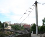
Bridgemeister ID: 354 (added before 2003)Name: Spokane Falls I Location: Spokane, Washington , USA Crossing: Spokane River Coordinates: 47.66276 N 117.42269 W Maps: Acme , GeoHack , Google , OpenStreetMap Use: Footbridge Status: In use (last checked: 2024) Main Cables: Wire (steel) Suspended Spans: 1 Main Span: 1 x 68.9 meters (226 feet) estimated
This entry refers to the southernmost of the two footbridges at this location. 2022, March 30: Reopened, but in need of further repairs. Unclear if it was closed because its companion bridge was also closed for repairs or for other safety reasons. 2023, May: Closed for extensive repairs. 2024, March: Reopened upon complation of repairs. Connects to Spokane Falls II - Spokane, Washington, USA . Bridgemeister ID: 355 (added before 2003)Name: Spokane Falls II Location: Spokane, Washington , USA Crossing: Spokane River Coordinates: 47.66374 N 117.42298 W Maps: Acme , GeoHack , Google , OpenStreetMap Use: Footbridge Status: In use (last checked: 2022) Main Cables: Wire (steel) Suspended Spans: 1 Main Span: 1 x 90.2 meters (296 feet) estimated
This entry refers to the northernmost of the two footbridges at this location. 2019, April: Closed awaiting deck repairs. 2022, March 30: Reopened following completion of repairs including deck replacement. Connects to Spokane Falls I - Spokane, Washington, USA . Collapsed September 13, 1842 under weight of troops (ONC). Bridgemeister ID: 1304 (added 2004-04-09)Name: Swinger Location: Owensboro vicinity, Kentucky , USA At or Near Feature: Panther Creek Park Coordinates: 37.716904 N 87.222139 W Maps: Acme , GeoHack , Google , OpenStreetMap Use: Footbridge Status: In use (last checked: 2021) Main Cables: Wire (steel) Suspended Spans: 1
Bridgemeister ID: 1982 (added 2005-12-02)Name: Swinging Also Known As: Haviland Avenue Location: Audubon, New Jersey , USA Crossing: Haviland Avenue gully Use: Footbridge Status: Demolished, 1942 Main Cables: Wire
Bridgemeister ID: 361 (added before 2003)Name: Swinging Also Known As: Orange Grove Location: Catonsville, Maryland , USA Crossing: Patapsco River At or Near Feature: Patapsco Valley State Park Coordinates: 39.241086 N 76.749746 W Maps: Acme , GeoHack , Google , OpenStreetMap Use: Footbridge Status: In use (last checked: 2009) Main Cables: Wire (steel) Suspended Spans: 1
Bridgemeister ID: 3332 (added 2019-12-07)Name: Swinging Also Known As: Orange Grove Location: Catonsville, Maryland , USA Crossing: Patapsco River At or Near Feature: Patapsco Valley State Park Coordinates: 39.241433 N 76.749293 W Maps: Acme , GeoHack , Google , OpenStreetMap Use: Footbridge Status: Removed Main Cables: Wire
Bridgemeister ID: 1442 (added 2004-07-31)Name: Swinging Location: Browns Park National Wildlife Refuge vicinity, Colorado , USA Crossing: Green River Coordinates: 40.827833 N 109.030444 W Maps: Acme , GeoHack , Google , OpenStreetMap Use: Vehicular (one-lane) Status: In use (last checked: 2019) Main Cables: Wire (steel) Suspended Spans: 1 Main Span: 1 x 96.3 meters (316 feet) estimated
June 2014: Damaged when a tractor, well over the posted weight limit, tried to cross and broke through the bridge deck. Reopened August 23, 2018 after an "extensive reconstruction" that completely replaced the deck and possibly cables. After reconstruction, the weight limit was increased from 3 tons to 20 tons. November 2009: Closed due to safety concerns after six cable strrands were found to be broken. Repaired June-August 2010 and reopened. Bridgemeister ID: 358 (added before 2003)Name: Swinging Location: Carthage and Carterville, Missouri , USA Crossing: Center Creek At or Near Feature: Lakeside Park Use: Footbridge Suspended Spans: 1
Was in use in early 1900's. Bridgemeister ID: 1910 (added 2005-10-08)Name: Swinging Location: Dallas, Oregon , USA Crossing: Rickreall Creek At or Near Feature: Delbert Hunter Arboretum and Botanical Garden, Dallas City Park Coordinates: 44.924933 N 123.324833 W Maps: Acme , GeoHack , Google , OpenStreetMap Use: Footbridge Status: In use (last checked: 2021) Main Cables: Wire (steel) Suspended Spans: 1 Main Span: 1
Bridgemeister ID: 1266 (added 2004-03-14)Name: Swinging Location: Danville, Indiana , USA Crossing: White Lick Creek At or Near Feature: Ellis Park Coordinates: 39.762317 N 86.5152 W Maps: Acme , GeoHack , Google , OpenStreetMap Use: Footbridge Status: In use (last checked: 2005) Main Cables: Wire Suspended Spans: 1 Main Span: 1 x 41.8 meters (137 feet) estimated
Destroyed by flood before 2003. Supposedly was located across the street from Coffey's General Store which is still in existence as of 2020. Coordinates indicate approximate location based on that description. Closed since 2016 after an inspection deemed it unsafe. Was mentioned in local press several times in 2019 and 2020 with the community upset that no action was taken to repair the bridge which provided a convenient means of reaching downtown Elkins. Various articles in this time frame refer to the bridge as 76 or 80 years old. Bridgemeister ID: 1617 (added 2005-02-26)Name: Swinging Location: Everett, Pennsylvania , USA Crossing: Raystown Branch Juniata River Coordinates: 40.01670 N 78.3539 W Maps: Acme , GeoHack , Google , OpenStreetMap Use: Vehicular (one-lane) Status: In use (last checked: 2021) Main Cables: Wire (steel) Suspended Spans: 3 Main Span: 1 x 43 meters (141 feet) estimated Side Spans: 1 x 11 meters (36 feet) estimated,
Crossed a channel of the Kennebec River to Mill Island. Appears to have been located at the coordinates provided here. Bridgemeister ID: 871 (added 2003-08-30)Name: Swinging Location: Fort Mill, South Carolina , USA Crossing: Steele Creek At or Near Feature: Anne Springs Close Greenway Coordinates: 35.040867 N 80.939233 W Maps: Acme , GeoHack , Google , OpenStreetMap Use: Footbridge Status: In use (last checked: 2012) Main Cables: Wire Suspended Spans: 1
Bridgemeister ID: 1119 (added 2004-01-09)Name: Swinging Location: Greenville, Ohio , USA Crossing: Greenville Creek At or Near Feature: Greenville City Park Coordinates: 40.109252 N 84.630494 W Maps: Acme , GeoHack , Google , OpenStreetMap Use: Footbridge Status: In use (last checked: 2007) Main Cables: Wire (steel) Suspended Spans: 1
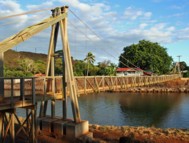
Destroyed by Hurricane Iniki, 1992. Rebuilt. Temporarily closed, week of January 10, 2005, because of damage due to storm. HA20050114: "A portion of the bridge has completely split apart from the end support at the town side of the bridge, said Al Afos of the county Roads Division." Appears to have reopened later in 2005. Near (footbridge) - Hanapepe vicinity, Hawaii, USA . Bridgemeister ID: 259 (added before 2003)Name: Swinging Location: Iron Mountain, Michigan , USA At or Near Feature: Twin Falls vicinity Use: Footbridge Main Cables: Wire
Bridgemeister ID: 918 (added 2003-10-17)Name: Swinging Location: James Creek, Raystown Lake vicinity, Pennsylvania , USA Crossing: Trough Creek At or Near Feature: Trough Creek State Park Coordinates: 40.32213 N 78.13003 W Maps: Acme , GeoHack , Google , OpenStreetMap Use: Footbridge Status: In use (last checked: 2020) Main Cables: Wire Suspended Spans: 1 Main Span: 1 x 30.5 meters (100 feet) estimated
Bridgemeister ID: 310 (added before 2003)Name: Swinging Location: Kinzel Springs (Townsend), Tennessee , USA Crossing: Little River Use: Footbridge Main Cables: Wire
There are at least two swinging bridge locations at Townsend, Tennessee. There have been at least two bridges at this location known as Kinzel Springs (also Sunshine) at the western end of Townsend. This entry is for the older of the two Kinzel Springs bridges. Bridgemeister ID: 1138 (added 2004-01-17)Name: Swinging Location: Kinzel Springs (Townsend), Tennessee , USA Crossing: Little River Coordinates: 35.68701 N 83.79791 W Maps: Acme , GeoHack , Google , OpenStreetMap Use: Footbridge Status: Closed, 2019 (last checked: 2020) Main Cables: Wire (steel) Suspended Spans: 1
There are at least two swinging bridge locations at Townsend, Tennessee. There have been at least two bridges at this location known as Kinzel Springs (also Sunshine) at the western end of Townsend. This entry is for the present-day (2020) of the Kinzel Springs bridges. 2019: Closed due to decaying timber structural members. 2020, June: Repairs started. Expected to be reopened in 2020. Bridgemeister ID: 607 (added 2003-01-14)Name: Swinging Location: Little Falls vicinity, Minnesota , USA Crossing: Pike Creek At or Near Feature: Lindbergh State Park Use: Footbridge Status: Removed
From David Denenberg: "I stopped by this park in 2006 and asked at the park station if the bridge was still in existence. They said there were some short modern steel footbridges, but no suspension bridges remaining. The person I spoke with knew such a bridge had existed at one point, in the park, but suspected it had been removed years ago. I hope he was right because I decided not to pay the permit fee and verify for myself." Now known as the Curtis Davis Bridge, the suspended span appears to have been replaced with a truss with, apparently, non-functional suspension cables. The original suspension bridge towers remain. Bridgemeister ID: 1310 (added 2004-04-10)Name: Swinging Location: Nowata, Oklahoma , USA Status: Removed Main Cables: Wire
Bridgemeister ID: 1490 (added 2004-09-19)Name: Swinging Location: Paintsville, Kentucky , USA Crossing: Big Sandy River Levisa Fork At or Near Feature: Paintsville Country Club Coordinates: 37.808576 N 82.773829 W Maps: Acme , GeoHack , Google , OpenStreetMap Use: Footbridge and Golf cart Status: In use (last checked: 2019) Main Cables: Wire (steel) Suspended Spans: 1 Main Span: 1 x 112.8 meters (370 feet)
Used by golf carts. Just barely wide enough for one golf cart. Bridgemeister ID: 564 (added before 2003)Name: Swinging Location: Palenville, New York , USA Crossing: Kaaterskill Creek Coordinates: 42.17399 N 74.02395 W Maps: Acme , GeoHack , Google , OpenStreetMap Use: Footbridge Status: Destroyed, 2011 (last checked: 2011) Main Cables: Wire Suspended Spans: 1 Main Span: 1 x 24.4 meters (80 feet)
Destroyed by flood following Hurricane Irene, 2011. Do you have any information or photos for these bridges that you would like to share? Please email david.denenberg@bridgemeister.com .
Mail | Facebook | Twitter
