Suspension Bridges Crossing Colorado River
This is a list of all 16 bridges from the suspension bridge inventory crossing Colorado River. Please note that different rivers with the same name will be grouped together. For example, selecting 'Bear Creek' shows bridges across several different Bear Creeks. Also, similarly named rivers are grouped separately. For example, 'River Dee' (UK) bridges are grouped separately from 'Dee River' (Australia) bridges. Wherever you see a Bridgemeister ID number click it to isolate the bridge on its own page.
Related Lists:
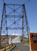
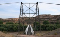
1916: Dewey
Moab vicinity, Utah, USA - Colorado River
| Bridgemeister ID: | 135 (added before 2003) |
| Year Completed: | 1916 |
| Name: | Dewey |
| Location: | Moab vicinity, Utah, USA |
| Crossing: | Colorado River |
| Coordinates: | 38.81187 N 109.30333 W |
| Maps: | Acme, GeoHack, Google, OpenStreetMap |
| Use: | Vehicular (one-lane) |
| Status: | Derelict, since April, 2008 (last checked: 2008) |
| Main Cables: | Wire (steel) |
| Suspended Spans: | 1 |
| Main Span: | 1 x 151.2 meters (496 feet) estimated |
Notes:
- Restored as footbridge, 2000.
- Deck destroyed by fire April 6, 2008. News reports stated a nearby brush fire (started by a young boy playing with matches) ignited the bridge.
External Links:
1920: Kaibab Trail
Grand Canyon National Park, Arizona, USA - Colorado River
| Bridgemeister ID: | 2186 (added 2007-01-15) |
| Year Completed: | 1920 |
| Name: | Kaibab Trail |
| Location: | Grand Canyon National Park, Arizona, USA |
| Crossing: | Colorado River |
| Principals: | George C. Goodwin |
| References: | AAJ |
| Use: | Footbridge |
| Status: | Replaced, 1928 |
| Main Cables: | Wire |
| Suspended Spans: | 1 |
Notes:
- Replaced by 1928 Kaibab Trail (Black, South Kaibab) - Bright Angel Campground vicinity, Arizona, USA.
External Links:
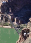
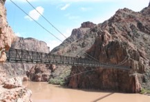
1928: Kaibab Trail
Bright Angel Campground vicinity, Arizona, USA - Colorado River
| Bridgemeister ID: | 155 (added before 2003) |
| Year Completed: | 1928 |
| Name: | Kaibab Trail |
| Also Known As: | Black, South Kaibab |
| Location: | Bright Angel Campground vicinity, Arizona, USA |
| Crossing: | Colorado River |
| At or Near Feature: | Grand Canyon National Park |
| Coordinates: | 36.10076 N 112.08918 W |
| Maps: | Acme, GeoHack, Google, OpenStreetMap |
| Principals: | Ward P. Webber, John H. Lawrence |
| Use: | Footbridge |
| Status: | In use (last checked: 2007) |
| Main Cables: | Wire (steel) |
| Suspended Spans: | 1 |
| Main Span: | 1 x 126.8 meters (416 feet) estimated |
| Deck width: | 5 feet |
Notes:
- Replaced 1920 Kaibab Trail - Grand Canyon National Park, Arizona, USA.
- Near Silver - Bright Angel Campground vicinity, Arizona, USA.
External Links:
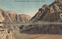
1931: Buchanan Dam
Buchanan Dam, Texas, USA - Colorado River
| Bridgemeister ID: | 2514 (added 2009-12-30) |
| Year Completed: | 1931 |
| Name: | Buchanan Dam |
| Location: | Buchanan Dam, Texas, USA |
| Crossing: | Colorado River |
| Use: | Vehicular (one-lane) |
| Status: | Removed |
| Main Cables: | Wire (steel) |
| Suspended Spans: | 1 |
Notes:
- Large one-lane suspension bridge built during the construction of Buchanan Dam.
1939: (suspension bridge)
Bend, Texas, USA - Colorado River
| Bridgemeister ID: | 1616 (added 2005-02-26) |
| Year Completed: | 1939 |
| Name: | (suspension bridge) |
| Location: | Bend, Texas, USA |
| Crossing: | Colorado River |
| Principals: | Austin Bridge Co. |
| References: | AUB |
| Use: | Vehicular |
| Status: | Removed |
| Main Cables: | Wire (steel) |
| Suspended Spans: | 3 |
| Main Span: | 1 |
| Side Spans: | 2 |
Notes:
- Similar to 1939 Regency - Regency, Texas, USA. The Bend bridge is pictured in AUB. At first, I thought it was the nearby Regency bridge, but upon closer inspection, the Bend bridge had suspended approach spans. Regency did not. Otherwise, they are very similar in appearance, both having been built in the same year by the same company.
1939: Regency
Regency, Texas, USA - Colorado River
| Bridgemeister ID: | 195 (added before 2003) |
| Year Completed: | 1939 |
| Name: | Regency |
| Location: | Regency, Texas, USA |
| Crossing: | Colorado River |
| Coordinates: | 31.41167 N 98.84667 W |
| Maps: | Acme, GeoHack, Google, OpenStreetMap |
| Principals: | Austin Bridge Co. |
| References: | AUB |
| Use: | Vehicular (one-lane) |
| Status: | In use (last checked: 2008) |
| Main Cables: | Wire (steel) |
| Suspended Spans: | 1 |
| Main Span: | 1 x 103.6 meters (340 feet) |
Notes:
- Similar to 1939 (suspension bridge) - Bend, Texas, USA.
External Links:
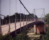
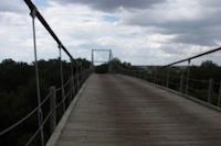
1957: Glen Canyon
Glen Canyon Dam, Arizona, USA - Colorado River
| Bridgemeister ID: | 1191 (added 2004-01-25) |
| Year Completed: | 1957 |
| Name: | Glen Canyon |
| Location: | Glen Canyon Dam, Arizona, USA |
| Crossing: | Colorado River |
| Principals: | Kiewit-Judson Pacific Murphy Co. |
| Use: | Footbridge |
| Status: | Removed |
| Main Cables: | Wire (steel) |
| Suspended Spans: | 1 |
| Main Span: | 1 x 390.1 meters (1,280 feet) |
Notes:
- Very long, very high footbridge spanning the canyon. Originally built for bridge workers building the Glen Canyon Bridge (the large deck arch next to the dam). Survived at least until 1959.
- From a Roebling ad in the July 1958 issue of Civil Engineering: "The bridge was completed in sixty days and features a steel mesh deck, to reduce wind resistance. Construction was started by lowering two 5/8 in. cables to the bottom of the west side of the gorge, transporting them across the river by boat and raising them on the east side by block and tackle. The six main suspension cables are 1 3/4 in. diameter prestretched galvanized bridge strands. From them are hung sixty-four 5/8 in. suspenders, attached to 7 ft-wide floor beams. The wire mesh floor is laid on eight 1 in. diameter deck cables. These in turn are supported every twenty feet by the floor beams. For safety, four handrail cables are attached to the suspenders. To add stability in strong winds, two 1 3/4 in. bridge strand wind brace cables run below the deck on either side for its length."
External Links:
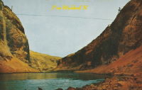
(pipeline bridge)
Blythe, California and Ehrenberg, Arizona, USA - Colorado River
| Bridgemeister ID: | 2522 (added 2010-01-02) |
| Name: | (pipeline bridge) |
| Location: | Blythe, California and Ehrenberg, Arizona, USA |
| Crossing: | Colorado River |
| Coordinates: | 33.60182 N 114.53324 W |
| Maps: | Acme, GeoHack, Google, OpenStreetMap |
| Use: | Pipeline |
| Status: | Extant (last checked: 2010) |
| Main Cables: | Wire (steel) |
| Suspended Spans: | 1 |
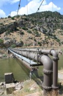
(pipeline bridge)
Glenwood Springs, Colorado, USA - Colorado River
| Bridgemeister ID: | 2225 (added 2007-03-18) |
| Name: | (pipeline bridge) |
| Location: | Glenwood Springs, Colorado, USA |
| Crossing: | Colorado River |
| Coordinates: | 39.55085 N 107.31878 W |
| Maps: | Acme, GeoHack, Google, OpenStreetMap |
| Use: | Pipeline |
| Status: | Extant (last checked: 2006) |
| Main Cables: | Wire (steel) |
| Suspended Spans: | 1 |
| Main Span: | 1 x 61 meters (200 feet) estimated |
Notes:
- Span length of approximately 200 feet is for the suspended pipeline. Patrick O'Donnell estimates the anchorage-to-anchorage distance is 450 feet.
(pipeline bridge)
Palisade vicinity, Colorado, USA - Colorado River
| Bridgemeister ID: | 2240 (added 2007-03-28) |
| Name: | (pipeline bridge) |
| Location: | Palisade vicinity, Colorado, USA |
| Crossing: | Colorado River |
| Coordinates: | 39.12223 N 108.32207 W |
| Maps: | Acme, GeoHack, Google, OpenStreetMap |
| Use: | Pipeline |
| Status: | Extant (last checked: 2006) |
| Main Cables: | Wire (steel) |
(pipeline bridge)
Topock, Arizona and Needles vicinity, California, USA - Colorado River
| Bridgemeister ID: | 1507 (added 2004-10-09) |
| Name: | (pipeline bridge) |
| Location: | Topock, Arizona and Needles vicinity, California, USA |
| Crossing: | Colorado River |
| Coordinates: | 34.71531 N 114.48255 W |
| Maps: | Acme, GeoHack, Google, OpenStreetMap |
| Use: | Pipeline |
| Status: | Extant (last checked: 2004) |
| Main Cables: | Wire (steel) |
| Suspended Spans: | 1 |
Notes:
- One of two pipeline suspension bridges at this location (adjacent to the I-40 crossing). This one has triangular towers.
- Near (pipeline bridge) - Topock, Arizona and Needles vicinity, California, USA.
External Links:
(pipeline bridge)
Topock, Arizona and Needles vicinity, California, USA - Colorado River
| Bridgemeister ID: | 1508 (added 2004-10-09) |
| Name: | (pipeline bridge) |
| Location: | Topock, Arizona and Needles vicinity, California, USA |
| Crossing: | Colorado River |
| Coordinates: | 34.71587 N 114.48617 W |
| Maps: | Acme, GeoHack, Google, OpenStreetMap |
| Use: | Pipeline |
| Status: | Extant (last checked: 2004) |
| Main Cables: | Wire (steel) |
| Suspended Spans: | 1 |
Notes:
- One of two pipeline suspension bridges at this location (adjacent to the I-40 crossing). This one has rectangular towers.
- Near (pipeline bridge) - Topock, Arizona and Needles vicinity, California, USA.
External Links:
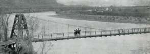
(suspension bridge)
Palisade, Colorado, USA - Colorado River
| Bridgemeister ID: | 296 (added before 2003) |
| Name: | (suspension bridge) |
| Location: | Palisade, Colorado, USA |
| Crossing: | Colorado River |
| Status: | Removed |
| Main Cables: | Wire |
| Suspended Spans: | 1 |
Hamilton Dam
Blufton, Texas, USA - Colorado River
| Bridgemeister ID: | 4949 (added 2020-08-08) |
| Name: | Hamilton Dam |
| Location: | Blufton, Texas, USA |
| Crossing: | Colorado River |
| Status: | Removed |
| Main Cables: | Wire (steel) |
Notes:
- Completed 1930s during construction of the Hamilton (now Buchanan) Dam. Appears to have been a large one-lane bridge. Likely removed during 1930s.
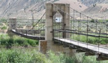
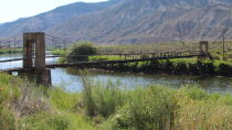
James Craig Bair Sheep Ranch
Dotsero vicinity, Colorado, USA - Colorado River
| Bridgemeister ID: | 822 (added 2003-05-31) |
| Name: | James Craig Bair Sheep Ranch |
| Location: | Dotsero vicinity, Colorado, USA |
| Crossing: | Colorado River |
| At or Near Feature: | Glenwood Canyon vicinity |
| Coordinates: | 39.64485 N 107.07813 W |
| Maps: | Acme, GeoHack, Google, OpenStreetMap |
| Use: | Footbridge and Stock |
| Status: | Extant (last checked: 2020) |
| Main Cables: | Wire (steel) |
| Suspended Spans: | 2 |
| Main Span: | 1 x 64 meters (210 feet) estimated |
| Side Span: | 1 x 16.5 meters (54 feet) estimated |
Silver
Bright Angel Campground vicinity, Arizona, USA - Colorado River
| Bridgemeister ID: | 351 (added before 2003) |
| Name: | Silver |
| Location: | Bright Angel Campground vicinity, Arizona, USA |
| Crossing: | Colorado River |
| At or Near Feature: | Grand Canyon National Park |
| Coordinates: | 36.09745 N 112.09550 W |
| Maps: | Acme, GeoHack, Google, OpenStreetMap |
| Use: | Footbridge and Pipeline |
| Status: | In use (last checked: 2020) |
| Main Cables: | Wire (steel) |
| Suspended Spans: | 1 |
| Main Span: | 1 x 149.4 meters (490 feet) |
Notes:
- 2020, September: Closed due to structural concerns. Reopened a week later after a formal structural assessment and some stabilization work. Additional maintenance planned for near future.
- Near 1928 Kaibab Trail (Black, South Kaibab) - Bright Angel Campground vicinity, Arizona, USA.

Do you have any information or photos for these bridges that you would like to share? Please email david.denenberg@bridgemeister.com.