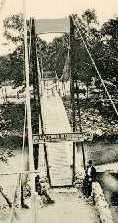
Suspension Bridges Completed 1900-1909 (1-100 of 122)
This is a list of bridges 1 through 100 (of 122 total) from the suspension bridge inventory completed in the decade 1900-1909. Wherever you see a Bridgemeister ID number click it to isolate the bridge on its own page.
Related Lists:
1900: Dunes
Bighouse, Melvich Bay vicinity, Scotland, United Kingdom - Halladale River
| Bridgemeister ID: | 2567 (added 2012-02-05) |
| Year Completed: | 1900 |
| Name: | Dunes |
| Location: | Bighouse, Melvich Bay vicinity, Scotland, United Kingdom |
| Crossing: | Halladale River |
| Coordinates: | 58.55716 N 3.91118 W |
| Maps: | Acme, GeoHack, Google, OpenStreetMap |
| References: | HBR |
| Use: | Footbridge |
| Status: | Removed |
| Main Cables: | Wire |
1900: Mafeking
Raven Quay, New Zealand - Kaiapoi River
| Bridgemeister ID: | 680 (added 2003-03-08) |
| Year Completed: | 1900 |
| Name: | Mafeking |
| Also Known As: | Revell's |
| Location: | Raven Quay, New Zealand |
| Crossing: | Kaiapoi River |
| Coordinates: | 43.377701 S 172.651679 E |
| Maps: | Acme, GeoHack, Google, OpenStreetMap |
| Principals: | Thompson and Murphy |
| References: | GAP |
| Use: | Footbridge |
| Status: | Modified, 1973 |
Notes:
- GAP: Modified 1973, suspension elements removed.
- Coordinates are for the current (2020) crossing known as the Mafeking footbridge, but unclear if this structure is related to the suspension bridge. Revell street intersects the Kaiapoi River 900 feet east of this location and may be another possible location of the former suspension bridge.
- Similar to 1893 Mandeville (Swing) - Kaiapoi, New Zealand.
- Similar to Butcher's Ford (Durrell's Ford, Hassall's Ford, Butchers) - Kaiapoi, New Zealand.
1900: New River
Nuttallburg and South Nuttall, West Virginia, USA - New River
| Bridgemeister ID: | 347 (added before 2003) |
| Year Completed: | 1900 |
| Name: | New River |
| Also Known As: | Swinging |
| Location: | Nuttallburg and South Nuttall, West Virginia, USA |
| Crossing: | New River |
| Coordinates: | 38.047482 N 81.035972 W |
| Maps: | Acme, GeoHack, Google, OpenStreetMap |
| References: | AAJ, HBE |
| Use: | Footbridge |
| Status: | Only towers remain (last checked: 2006) |
| Main Cables: | Wire |
| Suspended Spans: | 1 |
| Main Span: | 1 x 103.6 meters (340 feet) |
| Deck width: | 6 feet |
Notes:
- At least one of the towers is still standing, as of 2006.
- Coordinates are for likely location of the bridge, based on historical maps.
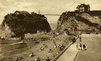
1900: Newquay
Newquay, Cornwall, England, United Kingdom
| Bridgemeister ID: | 800 (added 2003-03-29) |
| Year Completed: | 1900 |
| Name: | Newquay |
| Location: | Newquay, Cornwall, England, United Kingdom |
| Coordinates: | 50.415743 N 5.082486 W |
| Maps: | Acme, GeoHack, Google, OpenStreetMap |
| Principals: | Louis Harper |
| References: | HARPER |
| Use: | Footbridge |
| Status: | In use (last checked: 2019) |
| Main Cables: | Wire |
| Suspended Spans: | 1 |
| Main Span: | 1 x 30.5 meters (100 feet) estimated |
| Deck width: | 4 feet |
Notes:
- Douglas Harper notes: "The pylons have been swathed in concrete, presumably for protection against the elements."
External Links:
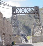
1900: Ojuela
Mapimí, Torreon vicinity, Durango, Mexico
| Bridgemeister ID: | 1043 (added 2003-12-06) |
| Year Completed: | 1900 |
| Name: | Ojuela |
| Also Known As: | Mapimi, Mampimi, Miampimi |
| Location: | Mapimí, Torreon vicinity, Durango, Mexico |
| Coordinates: | 25.791768 N 103.790706 W |
| Maps: | Acme, GeoHack, Google, OpenStreetMap |
| Principals: | Santiago Minguín, William Hildenbrand?, Henry G. Tyrell |
| References: | AAJ, HBE, PTS2 |
| Use: | Vehicular |
| Status: | Restricted to foot traffic (last checked: 2019) |
| Main Cables: | Wire (steel) |
| Suspended Spans: | 1 |
| Main Span: | 1 x 271.5 meters (890.7 feet) estimated |
Notes:
- Misspelled on every long span bridge list I've ever seen, this long narrow footbridge is located at Mapimí, Mexico.
- AAJ notes this bridge as having a 10-foot wide roadway and having been built by William Hildenbrand. The present-day bridge's deck measures only 1.8 meters and is restricted to foot traffic. In HBE, Tyrell takes credit for the design of the bridge and also notes the 10-foot roadway (though, HBE was probably a source for AAJ).
External Links:
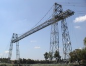
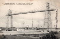
1900: Rochefort-Martrou Transporter
Rochefort, Charente-Maritime, France - Charente River
| Bridgemeister ID: | 949 (added 2003-10-30) |
| Year Completed: | 1900 |
| Name: | Rochefort-Martrou Transporter |
| Also Known As: | Matrou Transporter |
| Location: | Rochefort, Charente-Maritime, France |
| Crossing: | Charente River |
| Coordinates: | 45.91613 N 0.960638 W |
| Maps: | Acme, GeoHack, Google, OpenStreetMap |
| Principals: | Ferdinand Arnodin |
| References: | AAJ, BPF |
| Use: | Transporter |
| Status: | In use (last checked: 2022) |
| Main Cables: | Wire (steel) |
| Suspended Spans: | 1 |
| Main Span: | 1 x 129 meters (423.2 feet) |
Notes:
- Eckhard Bernstorff notes (data from the information table at the machinery building, where the motor to pull the platform is installed): Main Span 129 m (the high truss towers have a wide basis, the length from saddle to saddle is 139.75 m, and the length of the whole "tableau" including side parts is 175.5m), width between rails 8m. The Rochefort Transporter is well in use [2005], in the summer on all days people can use the "ferry" which is attached to the rails under the bridge.
External Links:
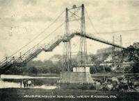
1900: Upper
Easton, Pennsylvania, USA - Lehigh River
| Bridgemeister ID: | 366 (added before 2003) |
| Year Completed: | 1900 |
| Name: | Upper |
| Location: | Easton, Pennsylvania, USA |
| Crossing: | Lehigh River |
| Principals: | Henry G. Tyrell, John McNeal |
| References: | AAJ, DSL20030414, EN19001122, HBE, PTS2, WGE20030513 |
| Use: | Footbridge |
| Status: | Demolished, 1955 |
| Main Cables: | Wire (steel) |
| Suspended Spans: | 3 |
| Main Spans: | 2 x 85 meters (279 feet) |
| Side Span: | 1 x 33.5 meters (110 feet) |
Notes:
- According to Tyrell, "[It] joins Dock Street on the lower side of the river with Glendon Avenue on the upper side, 90 feet above it. To overcome this difference in elevation of the two ends without incurring excessive expense for approach, the bridge floor was made to descend on a grade of 7.2 per cent from the upper bank to meet stairs rising from Dock Street..."
1900: Youngblood
Union Church, Mississippi, USA - Fifteenmile Creek
| Bridgemeister ID: | 6427 (added 2021-08-10) |
| Year Completed: | 1900 |
| Name: | Youngblood |
| Location: | Union Church, Mississippi, USA |
| Crossing: | Fifteenmile Creek |
| Coordinates: | 31.633587 N 90.814317 W |
| Maps: | Acme, GeoHack, Google, OpenStreetMap |
| Principals: | J.K. Gallbreath |
| Use: | Vehicular (one-lane) |
| Status: | Collapsed, 2016 |
| Main Cables: | Wire (steel) |
Notes:
- As of the late 2010s, it appears that the pylons and cables are still present.
- 1915: Repaired by W.H. Groome and Son incorporating an improved anchoring system.
External Links:
- MDAH Historic Resources Inventory Fact Sheet - Youngblood Suspension Bridge. Several photos of the remnants of the bridge and a few pre-collapse photos.
- NPGallery Asset Detail - Youngblood Bridge. National Register of Historic Places site survey.
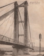
1901: Aramon
Aramon, Gard, France - Rhône River
| Bridgemeister ID: | 6432 (added 2021-08-12) |
| Year Completed: | 1901 |
| Name: | Aramon |
| Location: | Aramon, Gard, France |
| Crossing: | Rhône River |
| References: | PTS2 |
| Use: | Vehicular |
| Status: | Destroyed, August 15, 1944 |
| Main Cables: | Wire (steel) |
1901: Drahtsteg
Lingenau and Egg, Austria - Subersach River
| Bridgemeister ID: | 1408 (added 2004-07-04) |
| Year Completed: | 1901 |
| Name: | Drahtsteg |
| Location: | Lingenau and Egg, Austria |
| Crossing: | Subersach River |
| Coordinates: | 47.441867 N 9.9117 E |
| Maps: | Acme, GeoHack, Google, OpenStreetMap |
| Use: | Footbridge |
| Status: | In use (last checked: 2004) |
| Main Cables: | Wire |
| Suspended Spans: | 1 |
1901: Queanbeyan
Queanbeyan, New South Wales, Australia - Queanbeyan River
| Bridgemeister ID: | 425 (added before 2003) |
| Year Completed: | 1901 |
| Name: | Queanbeyan |
| Location: | Queanbeyan, New South Wales, Australia |
| Crossing: | Queanbeyan River |
| Status: | Destroyed, 1925 |
| Main Span: | 1 |
Notes:
- Destroyed by flood 1925.
- Replaced by 1938 Queanbeyan - Queanbeyan, New South Wales, Australia.
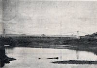
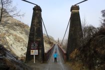
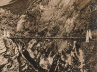
1901: Skippers
Maori Point vicinity, New Zealand - Upper Shotover River
| Bridgemeister ID: | 679 (added 2003-03-08) |
| Year Completed: | 1901 |
| Name: | Skippers |
| Location: | Maori Point vicinity, New Zealand |
| Crossing: | Upper Shotover River |
| At or Near Feature: | Skippers Canyon |
| Coordinates: | 44.844355 S 168.686769 E |
| Maps: | Acme, GeoHack, Google, OpenStreetMap |
| Principals: | John Black, A.J. Fraser Co. |
| References: | GAP |
| Use: | Vehicular (one-lane) |
| Status: | In use (last checked: 2017) |
| Main Cables: | Wire (steel) |
| Suspended Spans: | 1 |
| Main Span: | 1 x 96.3 meters (315.9 feet) |
Notes:
- Replaced 1868 Skippers Canyon - Maori Point vicinity, New Zealand at a nearby location.
External Links:
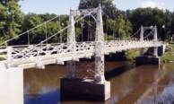
1901: VCSU Footbridge
Valley City, North Dakota, USA - Sheyenne River
| Bridgemeister ID: | 592 (added 2003-01-05) |
| Year Completed: | 1901 |
| Name: | VCSU Footbridge |
| Location: | Valley City, North Dakota, USA |
| Crossing: | Sheyenne River |
| At or Near Feature: | Valley City State Univ. |
| Coordinates: | 46.92000 N 98.00288 W |
| Maps: | Acme, GeoHack, Google, OpenStreetMap |
| Principals: | Dibley and Robinson Bridge Co. |
| Use: | Footbridge |
| Status: | In use (last checked: 2021) |
| Main Cables: | Wire |
| Suspended Spans: | 3 |
| Main Span: | 1 x 27.4 meters (90 feet) |
| Side Spans: | 2 x 9.1 meters (30 feet) |
Notes:
- Rebuilt 1994.
1902: (footbridge)
Littleton, New Hampshire, USA - Ammonoosuc River
| Bridgemeister ID: | 2917 (added 2019-09-15) |
| Year Completed: | 1902 |
| Name: | (footbridge) |
| Location: | Littleton, New Hampshire, USA |
| Crossing: | Ammonoosuc River |
| Status: | Destroyed, 1938 |
| Main Cables: | Wire |
| Suspended Spans: | 1 |
Notes:
- Destroyed during the Great New England Hurricane, 1938.
- Replaced by 1939 Curran - Littleton, New Hampshire, USA.
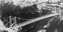
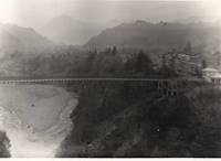
1902: (suspension bridge)
Chichibu, Saitama, Japan - Arakawa River
| Bridgemeister ID: | 5051 (added 2020-08-28) |
| Year Completed: | 1902 |
| Name: | (suspension bridge) |
| Location: | Chichibu, Saitama, Japan |
| Crossing: | Arakawa River |
| Coordinates: | 35.961412 N 138.975878 E |
| Maps: | Acme, GeoHack, Google, OpenStreetMap |
| Status: | Dismantled, 1980 |
| Main Cables: | Wire (steel) |
| Suspended Spans: | 1 |
Notes:
- Another suspension bridge was built on its piers (c. 2020) as part of the Gravity Park attraction.
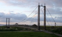
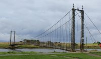
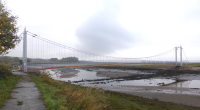
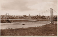
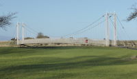
1902: Alexandra
Tain, Ross-Shire, Scotland, United Kingdom - River Tain
| Bridgemeister ID: | 2350 (added 2007-08-18) |
| Year Completed: | 1902 |
| Name: | Alexandra |
| Location: | Tain, Ross-Shire, Scotland, United Kingdom |
| Crossing: | River Tain |
| Coordinates: | 57.81496 N 4.04622 W |
| Maps: | Acme, GeoHack, Google, OpenStreetMap |
| Principals: | Rose Street Foundry (Inverness) |
| Use: | Footbridge |
| Status: | In use (last checked: 2018) |
| Main Cables: | Wire (steel) |
| Suspended Spans: | 1 |
| Main Span: | 1 x 43 meters (141 feet) |
Notes:
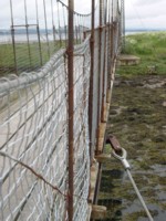
- Closed, 2011. Sign posted at the bridge in 2011 stated "No pedestrians beyond this point. Footbridge Closed. Imminent Danger of Collapse."
- Most news stories on the bridge's condition state it was closed continuously, due to deteriorating conditions, from 2011 through 2015, but this was not entirely accurate. The bridge was open in August 2014, but restricted to two people at a time (see accompanying photo sets). Closed again, sometime soon after. Contract awarded for refurbishment, April 2015.
1902: Bonny-sur-Loire
Bonny-sur-Loire and Beaulieu-sur-Loire, Loiret, France - Loire River
| Bridgemeister ID: | 1178 (added 2004-01-24) |
| Year Completed: | 1902 |
| Name: | Bonny-sur-Loire |
| Location: | Bonny-sur-Loire and Beaulieu-sur-Loire, Loiret, France |
| Crossing: | Loire River |
| Use: | Vehicular |
| Status: | Replaced |
| Main Cables: | Wire |
| Suspended Spans: | 3 |
| Main Spans: | 3 |
Notes:
External Links:

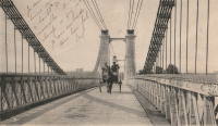
1902: Gobbins
Whitehead vicinity, Northern Ireland, United Kingdom
| Bridgemeister ID: | 1357 (added 2004-05-15) |
| Year Completed: | 1902 |
| Name: | Gobbins |
| Location: | Whitehead vicinity, Northern Ireland, United Kingdom |
| At or Near Feature: | Gobbins Cliff Path |
| Coordinates: | 54.808223 N 5.691737 W |
| Maps: | Acme, GeoHack, Google, OpenStreetMap |
| Use: | Footbridge |
| Status: | Replaced, 2015 |
| Main Cables: | Wire |
| Suspended Spans: | 1 |
Notes:
- 2014-2015: Gobbins Cliff Path restored to its original condition, including replacement of the suspension bridge.
- Replaced by 2015 Gobbins - Whitehead vicinity, Northern Ireland, United Kingdom.

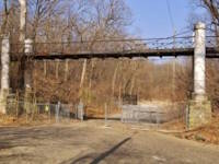
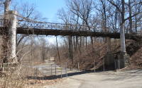
| Bridgemeister ID: | 2535 (added 2011-12-27) |
| Year Completed: | 1902 |
| Name: | Iron |
| Location: | Peoria, Illinois, USA |
| At or Near Feature: | Glen Oak Park |
| Coordinates: | 40.716042 N 89.573082 W |
| Maps: | Acme, GeoHack, Google, OpenStreetMap |
| Use: | Footbridge |
| Status: | Closed, 2003 (last checked: 2016) |
| Main Cables: | Wire |
| Suspended Spans: | 3 |
| Main Span: | 1 x 15.2 meters (50 feet) |
| Side Spans: | 2 x 7.6 meters (25 feet) |
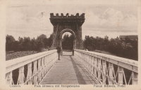
1902: Parcul Bibescu
Craiova, Romania
| Bridgemeister ID: | 523 (added before 2003) |
| Year Completed: | 1902 |
| Name: | Parcul Bibescu |
| Location: | Craiova, Romania |
| At or Near Feature: | Romanescu Park |
| Coordinates: | 44.300091 N 23.810388 E |
| Maps: | Acme, GeoHack, Google, OpenStreetMap |
| Use: | Footbridge |
| Status: | In use (last checked: 2020) |
| Main Cables: | Wire (steel) |
| Suspended Spans: | 1 |
Notes:
- Major renovation completed, October 2020.
External Links:
1902: Salisbury's
Golden Bay, New Zealand - Aorere River
| Bridgemeister ID: | 683 (added 2003-03-08) |
| Year Completed: | 1902 |
| Name: | Salisbury's |
| Location: | Golden Bay, New Zealand |
| Crossing: | Aorere River |
| References: | GAP |
| Use: | Footbridge |
| Status: | Destroyed, December 28, 2010 |
| Main Cables: | Wire |
| Suspended Spans: | 1 |
| Main Span: | 1 x 37.2 meters (122 feet) |
Notes:
- Destroyed by flood.
External Links:
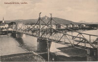
1902: Salzach
Laufen, Germany and Oberndorf, Austria - Salzach River
| Bridgemeister ID: | 933 (added 2003-10-25) |
| Year Completed: | 1902 |
| Name: | Salzach |
| Location: | Laufen, Germany and Oberndorf, Austria |
| Crossing: | Salzach River |
| Coordinates: | 47.939727 N 12.938722 E |
| Maps: | Acme, GeoHack, Google, OpenStreetMap |
| Use: | Vehicular (two-lane), with walkway |
| Status: | In use (last checked: 2019) |
| Main Cables: | Riveted plate |
| Suspended Spans: | 3 |
| Main Span: | 1 |
| Side Spans: | 2 |
Notes:
- Hybrid truss/suspension bridge where truss comes up to meet the cables for much of the main span. The "cables" appear to be riveted plates.
- Similar to Great Volkhov - Novgorod, Novgorod Oblast, Russia.
External Links:
1902: Swinging
Skowhegan, Maine, USA - Kennebec River
| Bridgemeister ID: | 1577 (added 2004-12-19) |
| Year Completed: | 1902 |
| Name: | Swinging |
| Location: | Skowhegan, Maine, USA |
| Crossing: | Kennebec River |
| References: | KJ20030410 |
| Use: | Footbridge |
| Status: | Demolished, 1936 |
| Main Cables: | Wire |
Notes:
- Destroyed by flood, 1936.
- Replaced 1888 Swinging - Skowhegan, Maine, USA.
- Replaced by 1936 Swinging - Skowhegan, Maine, USA.
1902: Tursoli
Tursoli, Nepal
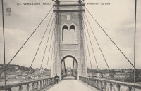
1902: Vernaison
Vernaison, Métropole de Lyon, France - Rhône River
| Bridgemeister ID: | 6431 (added 2021-08-11) |
| Year Completed: | 1902 |
| Name: | Vernaison |
| Location: | Vernaison, Métropole de Lyon, France |
| Crossing: | Rhône River |
| Coordinates: | 45.646369 N 4.815423 E |
| Maps: | Acme, GeoHack, Google, OpenStreetMap |
| Principals: | Ferdinand Arnodin |
| References: | AAJ, PTS2 |
| Use: | Vehicular |
| Status: | Destroyed, June 1940 |
| Main Cables: | Wire (steel) |
Notes:
- Later at same location 1959 Vernaison - Vernaison and Solaize, Métropole de Lyon, France.
External Links:
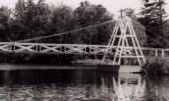
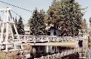
1902: Wanakena
Wanakena, New York, USA - Oswegatchie River
| Bridgemeister ID: | 109 (added before 2003) |
| Year Completed: | 1902 |
| Name: | Wanakena |
| Location: | Wanakena, New York, USA |
| Crossing: | Oswegatchie River |
| Coordinates: | 44.133217 N 74.921317 W |
| Maps: | Acme, GeoHack, Google, OpenStreetMap |
| Principals: | Rich Lumber Co. |
| Use: | Footbridge |
| Status: | Removed, 2014 |
| Main Cables: | Wire |
| Suspended Spans: | 1 |
| Main Span: | 1 x 52.1 meters (171 feet) |
Notes:
- Heavily damaged by ice jam, January 2014. Later dismantled.
- Near (footbridge) - Fine, Wanakena vicinity, New York, USA.
- Replaced by 2017 Wanakena - Wanakena, New York, USA.
External Links:
1903: Caperton
Caperton vicinity, West Virginia, USA - New River
| Bridgemeister ID: | 1422 (added 2004-07-17) |
| Year Completed: | 1903 |
| Name: | Caperton |
| Location: | Caperton vicinity, West Virginia, USA |
| Crossing: | New River |
| Coordinates: | 38.021856 N 81.028479 W |
| Maps: | Acme, GeoHack, Google, OpenStreetMap |
| References: | AAJ, HBE, PTS2 |
| Use: | Footbridge |
| Status: | Removed |
| Main Cables: | Wire |
| Suspended Spans: | 1 |
| Main Span: | 1 x 155.4 meters (510 feet) |
Notes:
- Removed by the 1960s, probably earlier.
1903: Chobhar
Kathmandu vicinity, Nepal - Bagmati River
| Bridgemeister ID: | 2175 (added 2007-01-13) |
| Year Completed: | 1903 |
| Name: | Chobhar |
| Also Known As: | Chobar, Chundra |
| Location: | Kathmandu vicinity, Nepal |
| Crossing: | Bagmati River |
| At or Near Feature: | Chobhar Gorge |
| Coordinates: | 27.658921 N 85.293695 E |
| Maps: | Acme, GeoHack, Google, OpenStreetMap |
| Principals: | Louis Harper, Harpers Limited |
| References: | HARPER |
| Use: | Footbridge |
| Status: | In use (last checked: 2019) |
| Main Cables: | Wire |
| Suspended Spans: | 1 |
| Main Span: | 1 x 39.6 meters (130 feet) |
| Deck width: | 4 feet |
External Links:
1903: Elisabeth
Budapest, Hungary - Danube River
| Bridgemeister ID: | 426 (added before 2003) |
| Year Completed: | 1903 |
| Name: | Elisabeth |
| Also Known As: | Elizabeth, Erzsébet |
| Location: | Budapest, Hungary |
| Crossing: | Danube River |
| Principals: | Aurel Czekelius, M. Nagy |
| References: | AAJ, BMA, HBE, PTS2, SA19050909 |
| Use: | Vehicular, with walkway |
| Status: | Destroyed, 1945 |
| Main Cables: | Eyebar |
| Suspended Spans: | 3 |
| Main Span: | 1 x 289.9 meters (951 feet) |
| Side Spans: | 2 x 44.2 meters (145 feet) |
Notes:
- Replaced by 1964 Elisabeth (Erzsébet) - Budapest, Hungary.
External Links:

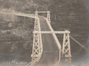
1903: Maldon
Picton vicinity, New South Wales, Australia - Nepean River
| Bridgemeister ID: | 427 (added before 2003) |
| Year Completed: | 1903 |
| Name: | Maldon |
| Location: | Picton vicinity, New South Wales, Australia |
| Crossing: | Nepean River |
| Coordinates: | 34.202104 S 150.632321 E |
| Maps: | Acme, GeoHack, Google, OpenStreetMap |
| Principals: | E.M. de Burgh |
| References: | STC |
| Use: | Vehicular (one-lane) |
| Status: | Derelict (last checked: 2020) |
| Main Cables: | Wire (steel) |
| Suspended Spans: | 1 |
| Main Span: | 1 x 68.9 meters (226 feet) |
Notes:
- Timber towers damaged by fire, replaced with steel towers 1939.
External Links:
- Maldon Suspension Bridge, Jan 28th 2020 - YouTube. Close-up drone footage of the derelict bridge.
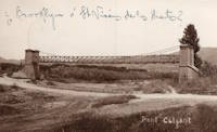
1903: Passera de la Riera de Torrelles
Sant Vicenç dels Horts, Spain - Riera de Torrelles
| Bridgemeister ID: | 8164 (added 2024-02-03) |
| Year Completed: | 1903 |
| Name: | Passera de la Riera de Torrelles |
| Location: | Sant Vicenç dels Horts, Spain |
| Crossing: | Riera de Torrelles |
| Coordinates: | 41.386417 N 2.015944 E |
| Maps: | Acme, GeoHack, Google, OpenStreetMap |
| Use: | Footbridge |
| Status: | Demolished, 1967 |
| Suspended Spans: | 1 |
Notes:
- The pillars from one of the towers has been preserved as a monument at the coordinates provided here. Unclear if this was the exact location of the bridge.
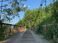
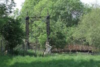
1903: Pickhill
Pickhill, Wales, United Kingdom - River Dee
| Bridgemeister ID: | 4562 (added 2020-06-01) |
| Year Completed: | 1903 |
| Name: | Pickhill |
| Also Known As: | Pickhill Meadows |
| Location: | Pickhill, Wales, United Kingdom |
| Crossing: | River Dee |
| Coordinates: | 53.017265 N 2.884666 W |
| Maps: | Acme, GeoHack, Google, OpenStreetMap |
| Principals: | David Rowell & Co. |
| Use: | Vehicular (one-lane) |
| Status: | Restricted to foot traffic (last checked: 2020) |
| Main Cables: | Wire (steel) |
| Suspended Spans: | 1 |
| Main Span: | 1 x 41 meters (134.5 feet) |
| Deck width: | 3 meters |
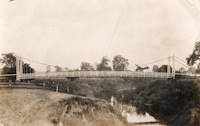
1903: Sands
Swalwell, England, United Kingdom - River Derwent
| Bridgemeister ID: | 1251 (added 2004-02-21) |
| Year Completed: | 1903 |
| Name: | Sands |
| Also Known As: | Hikey |
| Location: | Swalwell, England, United Kingdom |
| Crossing: | River Derwent |
| Coordinates: | 54.956267 N 1.6877 W |
| Maps: | Acme, GeoHack, Google, OpenStreetMap |
| Principals: | David Rowell & Co. |
| Use: | Footbridge |
| Status: | In use (last checked: 2007) |
| Main Cables: | Wire |
| Suspended Spans: | 1 |


| Bridgemeister ID: | 3881 (added 2020-03-08) |
| Year Completed: | 1903 |
| Name: | Teigen |
| Also Known As: | Vikvar |
| Location: | Mebonden, Selbu, Trøndelag, Norway |
| Crossing: | Nea |
| Coordinates: | 63.221980 N 11.013930 E |
| Maps: | Acme, GeoHack, Google, kart.1881.no, OpenStreetMap |
| Status: | Dismantled, 1924 |
| Suspended Spans: | 1 |
| Main Span: | 1 x 60 meters (196.9 feet) estimated |
Notes:
- Replaced by an adjacent suspension bridge and subsequently dismantled and reerected at another location.
- Moved to 1926 Henmo - Østeraunet, Aunet, Tydal and Henmo, Aunet, Tydal, Trøndelag, Norway.
- Replaced by 1922 Teigen (Vikvar) - Mebonden, Selbu, Trøndelag, Norway.
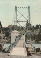
1903: Ticonic
Waterville, Maine, USA - Kennebec River
| Bridgemeister ID: | 110 (added before 2003) |
| Year Completed: | 1903 |
| Name: | Ticonic |
| Also Known As: | Tupenny, Two Cent |
| Location: | Waterville, Maine, USA |
| Crossing: | Kennebec River |
| Coordinates: | 44.55073 N 69.62728 W |
| Maps: | Acme, GeoHack, Google, OpenStreetMap |
| Principals: | Edwin D. Graves |
| References: | AAJ, HBE, PTS2 |
| Use: | Footbridge |
| Status: | In use (last checked: 2009) |
| Main Cables: | Wire |
| Suspended Spans: | 1 |
| Main Span: | 1 x 121.9 meters (400 feet) |
| Deck width: | 6 feet |
External Links:
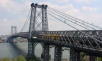
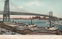
1903: Williamsburg
New York and Brooklyn, New York, USA - East River
| Bridgemeister ID: | 111 (added before 2003) |
| Year Completed: | 1903 |
| Name: | Williamsburg |
| Location: | New York and Brooklyn, New York, USA |
| Crossing: | East River |
| Coordinates: | 40.71355 N 73.97226 W |
| Maps: | Acme, GeoHack, Google, OpenStreetMap |
| Principals: | L.L. Buck |
| References: | AAJ, BAAW, BAR, BBR, BPL, GBD, HBE, PTS2, SJR |
| Use: | Rail (light rail) and Vehicular (major highway), with walkway |
| Status: | In use (last checked: 2022) |
| Main Cables: | Wire (steel) |
| Suspended Spans: | 1 |
| Main Span: | 1 x 487.7 meters (1,600 feet) |
Notes:
- Became longest suspension bridge by eclipsing 1883 Brooklyn (Great East River) - New York and Brooklyn, New York, USA.
- Eclipsed by new longest suspension bridge 1924 Bear Mountain - Anthony's Nose and Bear Mountain, New York, USA.
- Near 1883 Brooklyn (Great East River) - New York and Brooklyn, New York, USA.
- Near 1909 Manhattan - New York and Brooklyn, New York, USA.
External Links:
1904: (footbridge)
Conwy, Wales, United Kingdom - River Conwy
| Bridgemeister ID: | 512 (added before 2003) |
| Year Completed: | 1904 |
| Name: | (footbridge) |
| Location: | Conwy, Wales, United Kingdom |
| Crossing: | River Conwy |
| Coordinates: | 53.280346 N 3.823733 W |
| Maps: | Acme, GeoHack, Google, OpenStreetMap |
| Principals: | Alfred Thorne |
| Use: | Footbridge |
| Status: | Removed |
| Main Cables: | Wire (steel) |
| Suspended Spans: | 1 |
Notes:
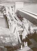
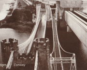
- This entry refers to the steel suspension footbridge nestled between Telford's suspension bridge and Stephenson's rail bridge. Click the photo to get a better view of this bridge. According to Susan Ellis, Senior Archivist of the Conwy County Borough Council, the bridge was built on the recommendation of John J. Webster who was hired to inspect Telford's suspension bridge in 1902 "following fears about the safety of its condition. He reported back making various recommendation for strengthening the bridge, including that a separate footbridge be constructed."
- This footbridge was in existence until at least 1957.
- Next to 1826 Conwy (Conway) - Conwy, Wales, United Kingdom.
Annotated Citations:
- "Conway Suspension Bridge." The Engineer, 20 May 1904.
This detailed account of the 1904 reinforcement of Telford's adjacent bridge does not mention the existence of, or building of, an additional footbridge. It does describe adding a cantilevered walkway to one side of Telford's bridge. This walkway was, indeed, built, and can be seen in the linked image on the left side of the older bridge. Thus, it is not entirely clear whether this bridge was actually constructed in 1904 and the work of Alfred Thorne (who was very much associated with the Telford bridge reinforcement project)
1904: (suspension bridge)
Mt. Bruce, New Zealand - Ruamahanga River
| Bridgemeister ID: | 686 (added 2003-03-08) |
| Year Completed: | 1904 |
| Name: | (suspension bridge) |
| Location: | Mt. Bruce, New Zealand |
| Crossing: | Ruamahanga River |
| Principals: | Joseph Dawson |
| References: | GAP |
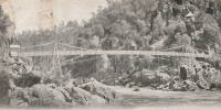
1904: Alexandra
Launceston, Tasmania, Australia - South Esk River
| Bridgemeister ID: | 428 (added before 2003) |
| Year Completed: | 1904 |
| Name: | Alexandra |
| Also Known As: | Basin |
| Location: | Launceston, Tasmania, Australia |
| Crossing: | South Esk River |
| At or Near Feature: | First Basin Water, Cataract Gorge Reserve |
| Principals: | C. St John David, Salisbury's Foundry Co. |
| References: | STC |
| Use: | Footbridge |
| Status: | Destroyed, 1929 |
| Main Cables: | Wire |
| Suspended Spans: | 3 |
| Main Span: | 1 x 45.7 meters (149.9 feet) |
| Side Spans: | 2 x 10.7 meters (35.1 feet) |
Notes:
- Washed away by flood, 1929.
- Near 1895 Duck Reach - Launceston, Tasmania, Australia.
- Replaced by 1930 Alexandra (Basin) - Launceston, Tasmania, Australia of similar construction.
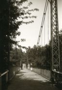
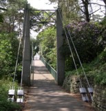
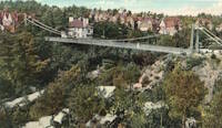
1904: Alum Chine
Bournemouth, England, United Kingdom - Alum Chine
| Bridgemeister ID: | 785 (added 2003-03-16) |
| Year Completed: | 1904 |
| Name: | Alum Chine |
| Location: | Bournemouth, England, United Kingdom |
| Crossing: | Alum Chine |
| Coordinates: | 50.7143 N 1.90058 W |
| Maps: | Acme, GeoHack, Google, OpenStreetMap |
| Principals: | David Rowell & Co. |
| Use: | Footbridge |
| Status: | In use (last checked: 2020) |
| Main Cables: | Wire |
| Suspended Spans: | 1 |
Notes:
- Renovated, 1973. Refurbished, 2004.
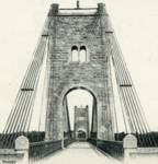
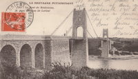
1904: Bonhomme
Kervignac, Morbihan, France - Blavet River
| Bridgemeister ID: | 1115 (added 2004-01-05) |
| Year Completed: | 1904 |
| Name: | Bonhomme |
| Location: | Kervignac, Morbihan, France |
| Crossing: | Blavet River |
| Coordinates: | 47.764878 N 3.302251 W |
| Maps: | Acme, GeoHack, Google, OpenStreetMap |
| Principals: | Ferdinand Arnodin |
| References: | AAJ, BPF, PTS2 |
| Use: | Vehicular |
| Status: | Only towers remain, since 1980 (last checked: 2019) |
| Main Cables: | Wire |
| Suspended Spans: | 3 |
| Main Span: | 1 x 163.1 meters (535 feet) |
| Side Spans: | 2 x 36.9 meters (121 feet) |
Notes:
- Deck and cables removed, 1980.
External Links:
1904: Brazos
Brazos, Texas, USA - Brazos River
| Bridgemeister ID: | 1857 (added 2005-07-17) |
| Year Completed: | 1904 |
| Name: | Brazos |
| Location: | Brazos, Texas, USA |
| Crossing: | Brazos River |
| Principals: | William Flinn |
| References: | HAERTX98 |
| Use: | Vehicular |
| Status: | Removed |
| Main Cables: | Wire |
| Suspended Spans: | 3 |
| Main Span: | 1 x 91.4 meters (300 feet) |
| Side Spans: | 2 x 45.7 meters (150 feet) |
1904: Dark Valley
Graford and Palo Pinto, Texas, USA - Brazos River
| Bridgemeister ID: | 921 (added 2003-10-18) |
| Year Completed: | 1904 |
| Name: | Dark Valley |
| Location: | Graford and Palo Pinto, Texas, USA |
| Crossing: | Brazos River |
| Principals: | William Flinn |
| References: | BRAZ, HAERTX98 |
| Use: | Vehicular |
| Status: | Demolished, 1958 |
| Main Cables: | Wire (steel) |
| Suspended Spans: | 5 |
| Main Spans: | 2 x 76.2 meters (250 feet) |
| Side Spans: | 1 x 24.4 meters (80 feet), 2 x 38.1 meters (125 feet) |
| Deck width: | 16 feet |
Notes:
- The TxDOT Bridge Division website shows an image of this bridge with caption "The Dark Valley Bridge is shown here before its demolition in 1958," but BRAZ describes it as being destroyed by a flood on October 31, 1981. The TxDOT information is likely correct.
1904: Desmons
Brignon, Gard, France - Gardon River
| Bridgemeister ID: | 6982 (added 2022-04-03) |
| Year Completed: | 1904 |
| Name: | Desmons |
| Location: | Brignon, Gard, France |
| Crossing: | Gardon River |
| Use: | Vehicular |
| Status: | Destroyed, October, 1907 |
| Main Cables: | Wire |
| Suspended Spans: | 1 |
| Main Span: | 1 |
Notes:
- 1907, October: Destroyed by flood.
- Replaced by 1913 Desmons - Brignon, Gard, France.
External Links:
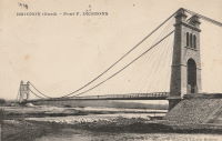
1904: Elan Village
Elan, Rhayader, Wales, United Kingdom - River Elan
| Bridgemeister ID: | 1255 (added 2004-02-28) |
| Year Completed: | 1904 |
| Name: | Elan Village |
| Location: | Elan, Rhayader, Wales, United Kingdom |
| Crossing: | River Elan |
| Coordinates: | 52.27099 N 3.56900 W |
| Maps: | Acme, GeoHack, Google, OpenStreetMap |
| Principals: | Birmingham Water Corporation |
| Status: | Closed, 1988 (last checked: 2013) |
| Suspended Spans: | 1 |
Notes:
- Rebuilt twice.
External Links:
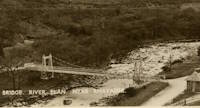
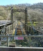
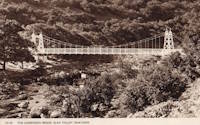
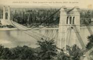
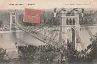
1904: Jons-Niévroz
Jons, Rhône and Niévroz, Ain, France - Rhône River
| Bridgemeister ID: | 2033 (added 2006-04-23) |
| Year Completed: | 1904 |
| Name: | Jons-Niévroz |
| Location: | Jons, Rhône and Niévroz, Ain, France |
| Crossing: | Rhône River |
| References: | AAJ |
| Use: | Vehicular |
| Status: | Destroyed, 1940 |
| Suspended Spans: | 1 |
| Main Span: | 1 x 200 meters (656.2 feet) |
Notes:
- Destroyed, 1940, during WWII.
- Similar to 1912 Groslée - Groslée, Ain and Brangues, Isère, France.
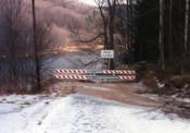
1904: Lordville-Equinunk
Lordville, New York and Equinunk, Pennsylvania, USA - Delaware River
| Bridgemeister ID: | 112 (added before 2003) |
| Year Completed: | 1904 |
| Name: | Lordville-Equinunk |
| Location: | Lordville, New York and Equinunk, Pennsylvania, USA |
| Crossing: | Delaware River |
| Coordinates: | 41.867745 N 75.213789 W |
| Maps: | Acme, GeoHack, Google, OpenStreetMap |
| Principals: | Owego Bridge Company |
| References: | BDR, BOL, BPL, HHP |
| Use: | Vehicular (one-lane) |
| Status: | Demolished, 1986 |
| Main Cables: | Eyebar (steel) |
| Suspended Spans: | 2 |
| Main Span: | 1 x 105.8 meters (347 feet) |
| Side Span: | 1 x 17.1 meters (56 feet) |
Notes:
- Eyebar suspension bridge.
- Replaced 1869 Lordville - Lordville, New York and Equinunk, Pennsylvania, USA.
External Links:
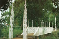
1904: Lugard
Zungeru, Nigeria
| Bridgemeister ID: | 8149 (added 2024-02-03) |
| Year Completed: | 1904 |
| Name: | Lugard |
| Location: | Zungeru, Nigeria |
| Coordinates: | 10.505250 N 7.453500 E |
| Maps: | Acme, GeoHack, Google, OpenStreetMap |
| Use: | Footbridge |
| Status: | In use (last checked: 2020) |
| Suspended Spans: | 1 |
Notes:
- Originally constructed in Zungeru, this bridge has been relocated twice. The coordinates provided here are the current location of the bridge in Kaduna.
External Links:
1904: Moline Swinging
Moline, Kansas, USA - Wildcat Creek
| Bridgemeister ID: | 294 (added before 2003) |
| Year Completed: | 1904 |
| Name: | Moline Swinging |
| Location: | Moline, Kansas, USA |
| Crossing: | Wildcat Creek |
| Coordinates: | 37.36578 N 96.30433 W |
| Maps: | Acme, GeoHack, Google, OpenStreetMap |
| Use: | Footbridge |
| Status: | In use (last checked: 2010) |
| Main Cables: | Wire |
| Main Span: | 1 x 31.4 meters (103 feet) estimated |
| Side Spans: | 1 x 10.4 meters (34 feet) estimated, 1 x 10.7 meters (35 feet) estimated |
External Links:
1904: Pomeroy's
Bainham, Golden Bay, New Zealand - Aorere River
| Bridgemeister ID: | 684 (added 2003-03-08) |
| Year Completed: | 1904 |
| Name: | Pomeroy's |
| Also Known As: | James's |
| Location: | Bainham, Golden Bay, New Zealand |
| Crossing: | Aorere River |
| References: | GAP |
Notes:
1904: Riegelsville
Riegelsville, Pennsylvania and Riegelsville, New Jersey, USA - Delaware River
| Bridgemeister ID: | 113 (added before 2003) |
| Year Completed: | 1904 |
| Name: | Riegelsville |
| Location: | Riegelsville, Pennsylvania and Riegelsville, New Jersey, USA |
| Crossing: | Delaware River |
| Coordinates: | 40.59427 N 75.19062 W |
| Maps: | Acme, GeoHack, Google, OpenStreetMap |
| Principals: | John A. Roebling's Sons Co., S. A. Cooney |
| References: | BDR, BPL, SSS |
| Use: | Vehicular (two-lane, heavy vehicles), with walkway |
| Status: | In use (last checked: 2007) |
| Main Cables: | Wire (steel) |
| Suspended Spans: | 3 |
| Main Spans: | 3 |
External Links:
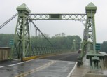
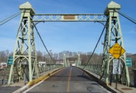
1904: Upper
Warsaw, Missouri, USA - Osage River
| Bridgemeister ID: | 2537 (added 2011-12-28) |
| Year Completed: | 1904 |
| Name: | Upper |
| Also Known As: | Swinging |
| Location: | Warsaw, Missouri, USA |
| Crossing: | Osage River |
| Coordinates: | 38.244449 N 93.387608 W |
| Maps: | Acme, GeoHack, Google, OpenStreetMap |
| Principals: | Joseph A. Dice, Dr. Daniel M. Eddy |
| References: | BOTO |
| Use: | Vehicular |
| Status: | Destroyed, 1924 |
| Main Cables: | Wire |
Notes:
- Destroyed by a tornado.
- Replaced by 1927 Upper (Swinging) - Warsaw, Missouri, USA.
1905: (footbridge)
Peradeniya, Sri Lanka - Mahaweli Ganga
| Bridgemeister ID: | 2446 (added 2008-04-23) |
| Year Completed: | 1905 |
| Name: | (footbridge) |
| Location: | Peradeniya, Sri Lanka |
| Crossing: | Mahaweli Ganga |
| At or Near Feature: | Royal Botanical Gardens |
| Coordinates: | 7.276585 N 80.593782 E |
| Maps: | Acme, GeoHack, Google, OpenStreetMap |
| Use: | Footbridge |
| Status: | In use (last checked: 2022) |
| Main Cables: | Wire (steel) |
| Suspended Spans: | 3 |
| Main Span: | 1 |
| Side Spans: | 2 |
External Links:
1905: Apley
Apley Park, England, United Kingdom - River Severn
| Bridgemeister ID: | 769 (added 2003-03-13) |
| Year Completed: | 1905 |
| Name: | Apley |
| Also Known As: | Linley |
| Location: | Apley Park, England, United Kingdom |
| Crossing: | River Severn |
| Coordinates: | 52.581949 N 2.434328 W |
| Maps: | Acme, GeoHack, Google, OpenStreetMap |
| Principals: | David Rowell & Co. |
| Use: | Vehicular (one-lane) |
| Status: | In use (last checked: 2011) |
| Main Cables: | Wire (steel) |
| Main Span: | 1 |
Notes:
- Capable of carrying light vehicular traffic.
External Links:

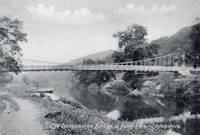
1905: Byram
Byram, Mississippi, USA - Pearl River
| Bridgemeister ID: | 115 (added before 2003) |
| Year Completed: | 1905 |
| Name: | Byram |
| Location: | Byram, Mississippi, USA |
| Crossing: | Pearl River |
| Coordinates: | 32.176683 N 90.243467 W |
| Maps: | Acme, GeoHack, Google, OpenStreetMap |
| References: | GBD |
| Use: | Vehicular |
| Status: | Restricted to foot traffic, since early 1987 (last checked: 2021) |
| Main Cables: | Wire (steel) |
| Suspended Spans: | 3 |
| Main Span: | 1 x 61 meters (200 feet) |
| Side Spans: | 2 x 24.4 meters (80 feet) |
Notes:
- 1987: Closed to vehicular traffic.
- 2006: Vandalized. In December of 2006 after several reports of vandalism, George Britt writes: "I walked the bridge December 24, 2006. It is in rough shape but you can still walk on it if you are careful. Vandals have started fires on the bridge span damaging the planks. Some planks are missing. There is also considerable graffiti about."
- 2008: Scheduled for restoration (repair of deck boards and grafitti).
- 2015: Overdue renovation completed.
External Links:
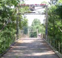
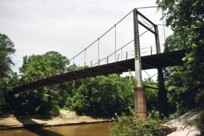
1905: Cambus O'May
Ballater, Scotland, United Kingdom - River Dee
| Bridgemeister ID: | 429 (added before 2003) |
| Year Completed: | 1905 |
| Name: | Cambus O'May |
| Also Known As: | Gordon |
| Location: | Ballater, Scotland, United Kingdom |
| Crossing: | River Dee |
| Coordinates: | 57.065803 N 2.956825 W |
| Maps: | Acme, GeoHack, Google, OpenStreetMap |
| Principals: | James Abernethy & Co. |
| References: | BC2, BC3, BEM, HARPER, HBR, NTB |
| Use: | Footbridge |
| Status: | In use (last checked: April, 2021) |
| Main Cables: | Wire (steel) |
| Suspended Spans: | 1 |
| Main Span: | 1 x 51.8 meters (170 feet) |
Notes:
- 1988: Refurbished (HBR)
- 2015, December: Damaged by the River Dee flood caused by Storm Frank. Closed indefinitely. Repairs expected to start in 2020.
- 2020, August 31: Repairs underway, expected to be completed in approximately 16 weeks.
- 2020, December: Storm Frank repairs now expected to be completed in January 2021.
- 2021, January: Completion of repairs delayed due to COVID-19 pandemic "stay at home" recommendations.
- 2021, April 1: Repairs completed, bridge reopened.
External Links:
- Cambus O' May | Harper Bridges
- The Happy Pontist: Scottish Bridges: 20. Cambus O'May Footbridge
- The Happy Pontist: Scottish Bridges: 43. Cambus O' May Bridge (revisited)
- The Happy Pontist: Scottish Bridges: 55. Cambus O'May Bridge (after the flood)
- Structurae - Structure ID 20019638

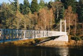
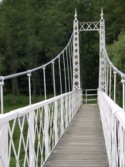
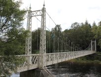
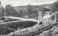
1905: Kelso
Kelso, Washington, USA - Cowlitz River
| Bridgemeister ID: | 1651 (added 2005-03-19) |
| Year Completed: | 1905 |
| Name: | Kelso |
| Location: | Kelso, Washington, USA |
| Crossing: | Cowlitz River |
| References: | AAJ, PTS2 |
| Use: | Vehicular |
| Status: | Collapsed, Jan. 3, 1923 |
| Main Cables: | Wire (steel) |
| Suspended Spans: | 1 |
| Main Span: | 1 x 91.4 meters (300 feet) |
Notes:
- Washed out, 1906. Rebuilt, 1907. Collapsed, 1923, killing "12 to 15 persons" when one of the cables parted with the anchorage.
External Links:
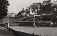
1905: Makartsteg
Salzburg, Austria - Salzach River
| Bridgemeister ID: | 647 (added 2003-02-17) |
| Year Completed: | 1905 |
| Name: | Makartsteg |
| Location: | Salzburg, Austria |
| Crossing: | Salzach River |
| Coordinates: | 47.801666 N 13.042172 E |
| Maps: | Acme, GeoHack, Google, OpenStreetMap |
| Use: | Footbridge |
| Status: | Demolished, 2000 |
| Main Cables: | Riveted plate |
| Suspended Spans: | 3 |
| Main Span: | 1 |
| Side Spans: | 2 |
Notes:
- 1967: Dismantled and supposedly replaced with a bridge that was referred to as a "swinging bridge." However, it appears several components of the original bridge were reassembled with a new deck. The bridge was finally demolished in 2000 and replaced with the bridge presently (2020s) known as the Marko-Feingold-Steg.
1905: Mangarere Road
Mangaweka, New Zealand - Rangitikei River
| Bridgemeister ID: | 687 (added 2003-03-08) |
| Year Completed: | 1905 |
| Name: | Mangarere Road |
| Location: | Mangaweka, New Zealand |
| Crossing: | Rangitikei River |
| References: | GAP |
| Use: | Vehicular (one-lane) |
| Main Cables: | Wire (steel) |
| Suspended Spans: | 1 |
External Links:
1905: Market Street
Steubenville, Ohio and East Steubenville, West Virginia, USA - Ohio River
| Bridgemeister ID: | 114 (added before 2003) |
| Year Completed: | 1905 |
| Name: | Market Street |
| Location: | Steubenville, Ohio and East Steubenville, West Virginia, USA |
| Crossing: | Ohio River |
| Coordinates: | 40.35833 N 80.61167 W |
| Maps: | Acme, GeoHack, Google, OpenStreetMap |
| Principals: | Hermann Laub |
| References: | AAJ, BPL, PTS2 |
| Use: | Vehicular (two-lane) |
| Status: | Closed, December 2023 |
| Main Cables: | Wire (steel) |
| Suspended Spans: | 3 |
| Main Span: | 1 x 207.3 meters (680 feet) |
| Side Spans: | 2 x 79.2 meters (260 feet) |
Notes:
- 2023, December: Closed by WVDOT because of safety concerns.
- Near 1928 Fort Steuben - Steubenville, Ohio and Weirton, West Virginia, USA.
External Links:
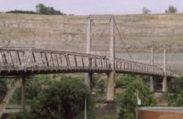
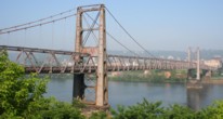
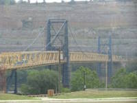
1905: Newell
East Liverpool, Ohio and Newell, West Virginia, USA - Ohio River
| Bridgemeister ID: | 117 (added before 2003) |
| Year Completed: | 1905 |
| Name: | Newell |
| Location: | East Liverpool, Ohio and Newell, West Virginia, USA |
| Crossing: | Ohio River |
| Coordinates: | 40.62167 N 80.595 W |
| Maps: | Acme, GeoHack, Google, OpenStreetMap |
| Principals: | Edwin Kirtland Morse, Dravo Company |
| References: | AAJ, BPL, PTS2 |
| Use: | Vehicular (two-lane), with walkway |
| Status: | In use (last checked: 2022) |
| Main Cables: | Wire (steel) |
| Suspended Spans: | 3 |
| Main Span: | 1 x 228.6 meters (750 feet) |
| Side Spans: | 2 |
Annotated Citations:
- Huba, Stephen. "There’s a new owner for the Newell Bridge." The Weirton Daily Times, 6 May 2022, www.weirtondailytimes.com/news/local-news/2022/05/theres-a-new-owner-for-the-newell-bridge/.
"Frank Six of Six Enterprises in Newell, assumed ownership Wednesday of one of the oldest suspension bridges on the Ohio River for an undisclosed sum from HLC Holdings Inc., parent company of the Fiesta Tableware Co., formerly known as the Homer Laughlin China Co."
- Bobby-Gilbert, Jo-Ann., "Fiesta Tableware Parent Sells Iconic Newell Bridge." The Business Journal, 5 May 2022, businessjournaldaily.com/fiesta-tableware-parent-sells-iconic-newell-bridge/.
"After 116 years of ownership by HLC Holdings Inc., parent company of The Fiesta Tableware Co., the Newell Bridge and Railway Co. changed hands at midnight Wednesday. Officials of Fiesta Tableware, formerly known as Homer Laughlin China Co., announced that the bridge has been purchased by Frank Six, owner of Six Enterprises in Newell."
External Links:

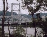
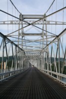
1905: Pangburn
Pangburn, Arkansas, USA - Little Red River
| Bridgemeister ID: | 7785 (added 2023-08-18) |
| Year Completed: | 1905 |
| Name: | Pangburn |
| Location: | Pangburn, Arkansas, USA |
| Crossing: | Little Red River |
| Coordinates: | 35.437946 N 91.845140 W |
| Maps: | Acme, GeoHack, Google, OpenStreetMap |
| Use: | Vehicular |
| Status: | Removed, 1958 |
| Main Cables: | Wire |
| Main Span: | 1 |
| Side Spans: | 2 |
External Links:
1905: Priorsford
Peebles, Scotland, United Kingdom - River Tweed
| Bridgemeister ID: | 1441 (added 2004-07-31) |
| Year Completed: | 1905 |
| Name: | Priorsford |
| Location: | Peebles, Scotland, United Kingdom |
| Crossing: | River Tweed |
| Coordinates: | 55.649532 N 3.187578 W |
| Maps: | Acme, GeoHack, Google, OpenStreetMap |
| Principals: | Robert Inglis |
| References: | BC3 |
| Use: | Footbridge |
| Status: | In use (last checked: 2014) |
| Main Cables: | Wire (steel) |
| Main Span: | 1 x 29.6 meters (97 feet) |
External Links:
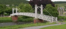

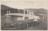
1905: Quimiri
Quimiri, Peru - Rio Chanchamayo
| Bridgemeister ID: | 6020 (added 2021-07-02) |
| Year Completed: | 1905 |
| Name: | Quimiri |
| Also Known As: | Kimiri |
| Location: | Quimiri, Peru |
| Crossing: | Rio Chanchamayo |
| Coordinates: | 11.033115 S 75.316588 W |
| Maps: | Acme, GeoHack, Google, OpenStreetMap |
| Use: | Vehicular |
| Status: | In use (last checked: 2021) |
| Main Cables: | Wire (steel) |
| Suspended Spans: | 1 |
| Main Span: | 1 |
1905: Saint-Martin
Saint-Martin-d'Ardèche, Ardèche and Aiguèze, Gard, France - Ardèche River
| Bridgemeister ID: | 1523 (added 2004-10-10) |
| Year Completed: | 1905 |
| Name: | Saint-Martin |
| Location: | Saint-Martin-d'Ardèche, Ardèche and Aiguèze, Gard, France |
| Crossing: | Ardèche River |
| Coordinates: | 44.3007 N 4.567283 E |
| Maps: | Acme, GeoHack, Google, OpenStreetMap |
| Use: | Vehicular (one-lane) |
| Status: | In use (last checked: 2005) |
| Main Cables: | Wire |
| Suspended Spans: | 1 |
External Links:
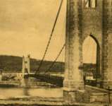
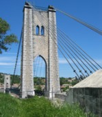
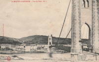
1905: Swinging
Riverside, Illinois, USA - Des Plaines River
| Bridgemeister ID: | 2617 (added 2018-12-30) |
| Year Completed: | 1905 |
| Name: | Swinging |
| Location: | Riverside, Illinois, USA |
| Crossing: | Des Plaines River |
| Coordinates: | 41.825603 N 87.817864 W |
| Maps: | Acme, GeoHack, Google, OpenStreetMap |
| Use: | Footbridge |
| Status: | Replaced, 1940 |
| Main Cables: | Wire |
| Suspended Spans: | 1 |
Notes:
- This replacement bridge appears to have been problematic. Most available images show some combination of mid-span supports assisting the suspension cables and failing deck.
- Replaced 1893 Watson's - Riverside, Illinois, USA.
- Replaced by 1940 H. Wallace Caldwell Memorial (Swinging) - Riverside, Illinois, USA.
1905: Tuscumbia
Tuscumbia, Missouri, USA - Osage River
| Bridgemeister ID: | 1977 (added 2005-11-27) |
| Year Completed: | 1905 |
| Name: | Tuscumbia |
| Location: | Tuscumbia, Missouri, USA |
| Crossing: | Osage River |
| Coordinates: | 38.23526 N 92.44763 W |
| Maps: | Acme, GeoHack, Google, OpenStreetMap |
| Principals: | Joseph Dice |
| References: | BOTO |
| Use: | Vehicular (one-lane) |
| Status: | Replaced, 1933 |
| Main Cables: | Wire |
| Main Span: | 1 |
| Side Spans: | 2 |
Notes:
- Some remains still visible at site, 2007.
- Near (suspension bridge) - Tuscumbia vicinity, Missouri, USA.
External Links:
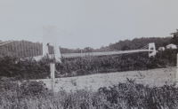
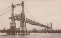
1905: Widnes-Runcorn Transporter
Runcorn, England, United Kingdom - River Mersey, Manchester Ship Canal
| Bridgemeister ID: | 954 (added 2003-10-31) |
| Year Completed: | 1905 |
| Name: | Widnes-Runcorn Transporter |
| Location: | Runcorn, England, United Kingdom |
| Crossing: | River Mersey, Manchester Ship Canal |
| Principals: | J.J. Webster, J.T. Wood, Charles Smith |
| References: | AAJ, BRB, HBE |
| Use: | Transporter |
| Status: | Removed |
| Main Cables: | Wire (steel) |
| Suspended Spans: | 1 |
| Main Span: | 1 x 304.8 meters (1,000 feet) |
External Links:
1905: Zhalantun
Xinghua (兴华), Zhalantun (扎兰屯市), Hulunbuir (呼伦贝尔市), Inner Mongolia, China
| Bridgemeister ID: | 8448 (added 2024-03-10) |
| Year Completed: | 1905 |
| Name: | Zhalantun |
| Location: | Xinghua (兴华), Zhalantun (扎兰屯市), Hulunbuir (呼伦贝尔市), Inner Mongolia, China |
| At or Near Feature: | 呼伦贝尔市扎兰屯吊桥公园 - Hulunbuir Suspension Bridge Park |
| Coordinates: | 48.019111 N 122.727806 E |
| Maps: | Acme, GeoHack, Google, OpenStreetMap |
| Use: | Footbridge |
| Status: | In use (last checked: 2023) |
| Main Cables: | Chain |
| Suspended Spans: | 1 |
External Links:
1906: (suspension bridge)
Cuorgnè vicinity, Turin, Italy - Orco River
| Bridgemeister ID: | 6832 (added 2021-12-31) |
| Year Completed: | 1906 |
| Name: | (suspension bridge) |
| Location: | Cuorgnè vicinity, Turin, Italy |
| Crossing: | Orco River |
| Main Cables: | Wire |
| Main Span: | 1 |
Notes:
- Exact location unclear, but likely removed.
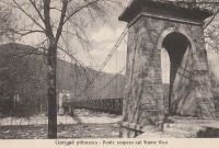
| Bridgemeister ID: | 3917 (added 2020-03-20) |
| Year Completed: | 1906 |
| Name: | Auma |
| Location: | Auma, Tynset, Innlandet, Norway |
| Crossing: | Glomma |
| Coordinates: | 62.21952 N 10.65307 E |
| Maps: | Acme, GeoHack, Google, kart.1881.no, OpenStreetMap |
| Use: | Vehicular (one-lane) |
| Status: | Removed |
| Main Cables: | Wire (steel) |
| Suspended Spans: | 1 |
| Main Span: | 1 x 67 meters (219.8 feet) estimated |
Notes:
- Removed prior to replacement by a truss bridge constructed on the same piers in 1961.
External Links:
1906: Baton
Baton River valley vicinity, New Zealand - Motueka River
| Bridgemeister ID: | 689 (added 2003-03-08) |
| Year Completed: | 1906 |
| Name: | Baton |
| Location: | Baton River valley vicinity, New Zealand |
| Crossing: | Motueka River |
| References: | GAP |
| Use: | Footbridge and Stock |
| Status: | Replaced, 1961 |
| Main Cables: | Wire |
| Suspended Spans: | 1 |
| Main Span: | 1 x 91.4 meters (299.9 feet) |
Notes:
- GAP: Replaced 1961.
External Links:
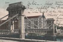
1906: Borsigsteg
Berlin, Germany - Spree River
| Bridgemeister ID: | 5692 (added 2021-04-01) |
| Year Completed: | 1906 |
| Name: | Borsigsteg |
| Also Known As: | Borsig |
| Location: | Berlin, Germany |
| Crossing: | Spree River |
| Coordinates: | 52.520874 N 13.339195 E |
| Maps: | Acme, GeoHack, Google, OpenStreetMap |
| Use: | Footbridge |
| Status: | Destroyed, April 1945 |
| Main Cables: | Eyebar (steel) |
| Suspended Spans: | 1 |
Notes:
- Abutments are still present (as of 2021).
- 1915: Damaged and rebuilt.
1906: Brannon's Crossing
Weatherford vicinity, Parker County, Texas, USA - Brazos River
| Bridgemeister ID: | 1298 (added 2004-03-28) |
| Year Completed: | 1906 |
| Name: | Brannon's Crossing |
| Location: | Weatherford vicinity, Parker County, Texas, USA |
| Crossing: | Brazos River |
| Coordinates: | 32.66256 N 98.03288 W |
| Maps: | Acme, GeoHack, Google, OpenStreetMap |
| Principals: | Mitchell & Pigg |
| References: | HAERTX98 |
| Use: | Vehicular |
| Status: | Replaced, 1934 |
| Main Cables: | Wire (steel) |
| Main Span: | 1 x 134.1 meters (440 feet) |
Notes:
- Tony King believes he found the former location of this bridge a few hundred yards south of the I-20 Brazos River crossing west of Weatherford. This location is near a road named "Brannon Bridge Circle." Tony writes: "Just downstream from the modern Interstate 20 bridge in western Parker County, I've noticed a concrete and iron structure, and happened to take a photo of it recently. I've noticed the structure a couple of times in the past (most recently in May of 2007) while hiking a well-worn foot/ATV path that parallels the west bank of the river as it flows almost due south from the Interstate to Meeks Bend." The structure in Tony's photo appears to be a pier or support footing. The coordinates given here are Tony's approximation of the location of the structure.
- Built as part of the same contract as the Tin Top bridge.
- Similar to 1906 Tin Top (Hightower Valley) - Tin Top, Texas, USA.
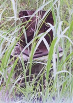
| Bridgemeister ID: | 3936 (added 2020-03-21) |
| Year Completed: | 1906 |
| Name: | Dølplass |
| Location: | Straalsjöaasen, Alvdal, Innlandet, Norway |
| Crossing: | Folla |
| Coordinates: | 62.19207 N 10.45023 E |
| Maps: | Acme, GeoHack, Google, kart.1881.no, OpenStreetMap |
| Use: | Vehicular (one-lane) |
| Status: | Removed |
| Main Cables: | Wire |
| Suspended Spans: | 1 |
| Main Span: | 1 x 40 meters (131.2 feet) estimated |
Notes:
- Rebuilt 1940. Unclear if the bridge was completely replaced at this point.
- Based on historic aerial images, removed between 1969 and 2004.
External Links:
1906: Forsæt
Forset, Brandvoll, Troms og Finnmark, Norway - Salangselva
| Bridgemeister ID: | 4077 (added 2020-04-04) |
| Year Completed: | 1906 |
| Name: | Forsæt |
| Location: | Forset, Brandvoll, Troms og Finnmark, Norway |
| Crossing: | Salangselva |
| Coordinates: | 68.774663 N 18.165802 E |
| Maps: | Acme, GeoHack, Google, kart.1881.no, OpenStreetMap |
| Use: | Vehicular (one-lane) |
| Status: | Removed |
| Main Cables: | Wire (steel) |
| Suspended Spans: | 1 |
| Main Span: | 1 x 27 meters (88.6 feet) |
External Links:
1906: Gulsvik
Gulsvik, Granheim, Flå, Viken, Norway - Hallingdalselva
| Bridgemeister ID: | 2864 (added 2019-09-08) |
| Year Completed: | 1906 |
| Name: | Gulsvik |
| Location: | Gulsvik, Granheim, Flå, Viken, Norway |
| Crossing: | Hallingdalselva |
| Coordinates: | 60.386333 N 9.578184 E |
| Maps: | Acme, GeoHack, Google, kart.1881.no, OpenStreetMap |
| Use: | Vehicular (one-lane) |
| Status: | Restricted to foot traffic (last checked: 2019) |
| Main Cables: | Wire (steel) |
| Suspended Spans: | 1 |
| Main Span: | 1 x 97 meters (318.2 feet) |
Notes:
- Upon completion claimed to be Scandinavia's longest suspension bridge.
- Bypassed 1971.
- Near 1940 (suspension bridge) - Gulsvik, Granheim, Flå, Viken, Norway.
External Links:
- DigitaltMuseum - Gamle Gulsvik hengebru i Flå
- DigitaltMuseum - Gamle Gulsvik hengebru under bygging 1903-1906
- DigitaltMuseum - Gamle Gulsvik hengebru under bygging 1903-1906
- DigitaltMuseum - Gamle Gulsvik hengebru under bygging 1903-1906
- DigitaltMuseum - Gamle Gulsvik hengebru under bygging 1903-1906
- DigitaltMuseum - Gamle Gulsvik hengebru under bygging 1903-1906
- DigitaltMuseum - Gamle Gulsvik hengebru under bygging 1903-1906
- DigitaltMuseum - Gamle Gulsvik hengebru under bygging 1903-1906
- DigitaltMuseum - Gulsvik bru på Hallingdalsvegen åpnet i 1906 og var i sin tid Skandinavias lengste hengebru
- DigitaltMuseum - Gulsvik hengebru ferdigbygd i 1905.når den vart bygd var den skandinavias lengste hengebru 92 m. Vart forsøkt sprengt av norske pionerstyrker 25 april 1940
- Structurae - Structure ID 20087388
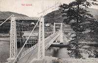
1906: Montfrin
Montfrin, Gard, France - Gardon River
| Bridgemeister ID: | 7275 (added 2022-07-22) |
| Year Completed: | 1906 |
| Name: | Montfrin |
| Location: | Montfrin, Gard, France |
| Crossing: | Gardon River |
| Use: | Vehicular |
| Status: | Removed |
| Main Cables: | Wire |
| Main Spans: | 2 |
Notes:
- Replaced 1838 Montfrin - Montfrin, Gard, France.
External Links:
- Art-et-Histoire - Nouveau pont suspendu de Montfrin - 1907. Suspects the bridge opened in 1907. The year 1906 is seen very prominently on the bridge tower, but the bridge may not have opened in 1906.
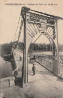
1906: Newport Transporter
Newport, Wales, United Kingdom - River Usk
| Bridgemeister ID: | 939 (added 2003-10-25) |
| Year Completed: | 1906 |
| Name: | Newport Transporter |
| Location: | Newport, Wales, United Kingdom |
| Crossing: | River Usk |
| Coordinates: | 51.570642 N 2.985246 W |
| Maps: | Acme, GeoHack, Google, OpenStreetMap |
| Principals: | Ferdinand Arnodin |
| References: | AAJ, NTB |
| Use: | Transporter |
| Status: | In use (last checked: 2011) |
| Main Cables: | Wire (steel) |
| Suspended Spans: | 1 |
| Main Span: | 1 x 196.6 meters (645 feet) |
External Links:
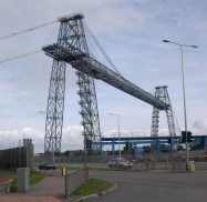
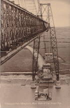
1906: Puketapu-Moteo
Puketapu, Hawke's Bay, New Zealand - Tutaekuri River
| Bridgemeister ID: | 688 (added 2003-03-08) |
| Year Completed: | 1906 |
| Name: | Puketapu-Moteo |
| Also Known As: | Puketapu Swing |
| Location: | Puketapu, Hawke's Bay, New Zealand |
| Crossing: | Tutaekuri River |
| References: | GAP |
| Use: | Vehicular |
| Status: | Replaced, 1963 |
| Main Cables: | Wire (steel) |
| Main Span: | 1 x 129 meters (423.2 feet) |
Annotated Citations:
- Fowler, Michael. "Historic HB: After much ado the swing bridge was finally built." Hawke's Bay Today, 5 May 2022, www.nzherald.co.nz/hawkes-bay-today/news/historic-hb-after-much-ado-the-swing-bridge-was-finally-built/ZHUL7ZJHBPX3OML74PN6PUGJ6I/
"The swing bridge, at 494 feet (150m) in length was believed to have been the longest single-span structure of its type in the North Island. There was ten 700 feet (213m) supporting cables of plough steel (high quality steel containing carbon, used to make wire ropes) imported from England."
External Links:
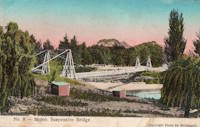
1906: Schönausteg
Berne, Switzerland - Aare River
| Bridgemeister ID: | 1396 (added 2004-07-04) |
| Year Completed: | 1906 |
| Name: | Schönausteg |
| Location: | Berne, Switzerland |
| Crossing: | Aare River |
| Coordinates: | 46.934417 N 7.445883 E |
| Maps: | Acme, GeoHack, Google, OpenStreetMap |
| References: | AAJ |
| Use: | Footbridge |
| Status: | In use (last checked: 2017) |
| Main Cables: | Eyebar (steel) |
| Suspended Spans: | 1 |
| Main Span: | 1 x 53.3 meters (174.88 feet) |
| Deck width: | 8.2 feet |
External Links:
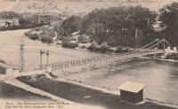
1906: Swinging
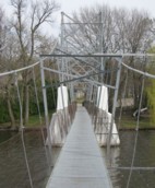
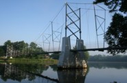
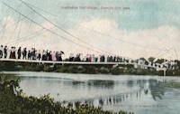
Charles City, Iowa, USA - Cedar River
| Bridgemeister ID: | 118 (added before 2003) |
| Year Completed: | 1906 |
| Name: | Swinging |
| Also Known As: | Charles City, Clark Street |
| Location: | Charles City, Iowa, USA |
| Crossing: | Cedar River |
| Coordinates: | 43.070433 N 92.685517 W |
| Maps: | Acme, GeoHack, Google, OpenStreetMap |
| Principals: | Charles Hart, O.B. Zimmerman |
| Use: | Footbridge |
| Status: | Destroyed (last checked: 2008) |
| Main Cables: | Wire |
| Suspended Spans: | 3 |
| Main Span: | 1 x 90.8 meters (298 feet) estimated |
| Side Spans: | 1 x 41.5 meters (136 feet) estimated, 1 x 9.1 meters (30 feet) estimated |
Notes:
- Bids accepted for refurbishment, expected to be completed October, 2007.
- Destroyed by floodwaters June 8, 2008.
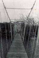
1906: Tin Top
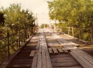
Tin Top, Texas, USA - Brazos River
| Bridgemeister ID: | 119 (added before 2003) |
| Year Completed: | 1906 |
| Name: | Tin Top |
| Also Known As: | Hightower Valley |
| Location: | Tin Top, Texas, USA |
| Crossing: | Brazos River |
| Coordinates: | 32.575956 N 97.822697 W |
| Maps: | Acme, GeoHack, Google, OpenStreetMap |
| Principals: | Mitchell & Pigg |
| References: | BRAZ, HAERTX98 |
| Use: | Vehicular |
| Status: | Collapsed, Jan. 31, 1982 under weight of snow |
| Main Cables: | Wire (steel) |
| Main Span: | 1 x 121.9 meters (400 feet) |
Notes:
- Some internet resources suggest the "Tin Top" and "Hightower" suspension bridges were separate nearby structures, however, this does not appear to have been the case. Both names were used to describe the same structure and USGS topographical maps from the 1950s label the bridge due south of Tin Top as "Hightower". Mitchell and Pigg did build a similar structure, at Brannon's Crossing. The 2015 National Register of Historic Places Registration Form for "Historic Road Infrastructure of Texas, 1866-1965", the Texas Department of Transportation writes: "In 1905 [Mitchell and Pigg] constructed the practically identical Brannon's Crossing and Hightower Valley Bridges across the Brazos in Parker County. The former was a 440-foot clear span while the later, also known as Tin Top, was 400 feet."
- The coordinates appear to be the exact location of a pier remaining (as of 2020) from this bridge. The alignment indicated by the pier appears to exactly match the location of this bridge as indicated by 1958 USGS topographical map of the area.
- Similar to 1906 Brannon's Crossing - Weatherford vicinity, Parker County, Texas, USA.
1906: Trellins
Vinay vicinity, Isère, France - Isère River
| Bridgemeister ID: | 1423 (added 2004-07-17) |
| Year Completed: | 1906 |
| Name: | Trellins |
| Location: | Vinay vicinity, Isère, France |
| Crossing: | Isère River |
| Coordinates: | 45.19536 N 5.42482 E |
| Maps: | Acme, GeoHack, Google, OpenStreetMap |
| References: | AAJ |
| Use: | Vehicular |
| Status: | Derelict (last checked: 2009) |
| Main Cables: | Wire |
| Suspended Spans: | 3 |
| Main Span: | 1 x 146.6 meters (481 feet) |
| Side Spans: | 2 x 25.3 meters (83 feet) |
Notes:
- 2022: Still standing, but suspenders and deck have been removed.
External Links:
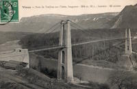
1906: Wilford
West Bridgford, Nottingham, England, United Kingdom - River Trent
| Bridgemeister ID: | 1087 (added 2004-01-01) |
| Year Completed: | 1906 |
| Name: | Wilford |
| Also Known As: | Nottingham, Meadows, Welbeck |
| Location: | West Bridgford, Nottingham, England, United Kingdom |
| Crossing: | River Trent |
| Coordinates: | 52.933167 N 1.137967 W |
| Maps: | Acme, GeoHack, Google, OpenStreetMap |
| Use: | Pipeline and Footbridge |
| Status: | In use (last checked: 2017) |
| Main Cables: | Wire |
| Suspended Spans: | 1 |
| Main Span: | 1 x 68.6 meters (225 feet) |
| Deck width: | 12 feet |
Notes:
- Designed primarily to carry water and gas mains, but also carries a wide footpath.
- Closed, July 2008, after reports of falling debris. In December 2008, Severn Trent Water announced plans to refurbish the bridge in 2009. Bridge was reopened February 12, 2010.
External Links:

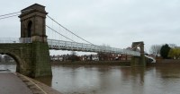
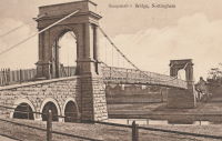
1907: (footbridge)
Hooversville, Pennsylvania, USA - Stony Creek
| Bridgemeister ID: | 1569 (added 2004-12-05) |
| Year Completed: | 1907 |
| Name: | (footbridge) |
| Location: | Hooversville, Pennsylvania, USA |
| Crossing: | Stony Creek |
| Coordinates: | 40.147818 N 78.913939 W |
| Maps: | Acme, GeoHack, Google, OpenStreetMap |
| Use: | Footbridge |
| Status: | Destroyed, 1996 |
| Main Cables: | Wire |
Notes:
- According to plaque on bridge, destroyed by flood on January 19, 1996.
- Replaced by 1996 (footbridge) - Hooversville, Pennsylvania, USA.
1907: Douglas
Franz Josef Glacier vicinity, New Zealand - Waiho River
| Bridgemeister ID: | 770 (added 2003-03-13) |
| Year Completed: | 1907 |
| Name: | Douglas |
| Location: | Franz Josef Glacier vicinity, New Zealand |
| Crossing: | Waiho River |
| Coordinates: | 43.418226 S 170.180737 E |
| Maps: | Acme, GeoHack, Google, OpenStreetMap |
| Use: | Footbridge |
| Status: | In use (last checked: 2019) |
| Main Cables: | Wire (steel) |
| Suspended Spans: | 1 |
External Links:
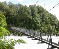
1907: Gokak Falls
Gokak, Karnataka, India - Ghataprabha River
| Bridgemeister ID: | 2219 (added 2007-03-04) |
| Year Completed: | 1907 |
| Name: | Gokak Falls |
| Location: | Gokak, Karnataka, India |
| Crossing: | Ghataprabha River |
| At or Near Feature: | Gokak Falls |
| Coordinates: | 16.191958 N 74.776933 E |
| Maps: | Acme, GeoHack, Google, OpenStreetMap |
| Use: | Footbridge |
| Status: | In use (last checked: 2019) |
| Main Cables: | Wire |
| Suspended Spans: | 4 |
| Main Spans: | 2 |
| Side Spans: | 2 |
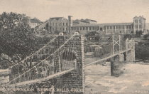
1907: Mangaltar
Mangaltar Bazar (मंगलटार बजार) vicinity, Nepal - Roshi Khola
| Bridgemeister ID: | 6434 (added 2021-08-12) |
| Year Completed: | 1907 |
| Name: | Mangaltar |
| Location: | Mangaltar Bazar (मंगलटार बजार) vicinity, Nepal |
| Crossing: | Roshi Khola |
| Coordinates: | 27.493573 N 85.730552 E |
| Maps: | Acme, GeoHack, Google, OpenStreetMap |
| Principals: | Louis Harper, Harpers Limited |
| Use: | Footbridge |
| Status: | In use (last checked: 2021) |
| Main Cables: | Wire (steel) |
| Suspended Spans: | 1 |
External Links:
1907: Romney
Kendal, England, United Kingdom - River Kent
| Bridgemeister ID: | 2426 (added 2008-03-12) |
| Year Completed: | 1907 |
| Name: | Romney |
| Also Known As: | Dockwray |
| Location: | Kendal, England, United Kingdom |
| Crossing: | River Kent |
| Coordinates: | 54.33595 N 2.74507 W |
| Maps: | Acme, GeoHack, Google, OpenStreetMap |
| Use: | Footbridge |
| Status: | In use (last checked: 2010) |
| Main Cables: | Wire |
Notes:
- Coordinates are for the current location of the bridge. It was moved there (from its original location where Romney Road meets the River Kent in Kendal) in the 1990s. A sign at the current (2011) bridge says: "The bridge was erected in 1993 on the initiative of Kendal Civic Society. It incorporates part of the structure of the former Romeny Footbridge erected in 1907..."
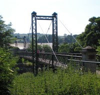
| Bridgemeister ID: | 3970 (added 2020-03-22) |
| Year Completed: | 1907 |
| Name: | Sand |
| Location: | Malangen, Troms og Finnmark, Norway |
| Crossing: | Sandselva |
| Coordinates: | 69.396363 N 18.604359 E |
| Maps: | Acme, GeoHack, Google, kart.1881.no, OpenStreetMap |
| Use: | Vehicular (one-lane) |
| Status: | Removed |
| Main Cables: | Wire (steel) |
| Suspended Spans: | 1 |
| Main Span: | 1 x 30 meters (98.4 feet) estimated |
External Links:
1907: Sandy Creek
Mackay, Queensland, Australia - Sandy Creek
| Bridgemeister ID: | 527 (added before 2003) |
| Year Completed: | 1907 |
| Name: | Sandy Creek |
| Location: | Mackay, Queensland, Australia |
| Crossing: | Sandy Creek |
| Coordinates: | 21.267726 S 149.138815 E |
| Maps: | Acme, GeoHack, Google, OpenStreetMap |
| References: | STC |
| Use: | Vehicular (one-lane) |
| Status: | Removed |
| Main Cables: | Wire |
| Suspended Spans: | 1 |
Notes:
- Damaged in 1957 and 1958 by overweight vehicles. Bridge was repaired each time. Structure was still standing when a replacement was completed in 1966.
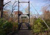
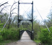
1907: Swinging
Kansas City, Missouri, USA - Blue River
| Bridgemeister ID: | 120 (added before 2003) |
| Year Completed: | 1907 |
| Name: | Swinging |
| Location: | Kansas City, Missouri, USA |
| Crossing: | Blue River |
| At or Near Feature: | Swope Park, Kansas City Zoo |
| Coordinates: | 39.00165 N 94.5244 W |
| Maps: | Acme, GeoHack, Google, OpenStreetMap |
| Principals: | Midland Bridge Co. |
| Use: | Footbridge |
| Status: | In use (last checked: 2020) |
| Main Cables: | Wire (steel) |
| Suspended Spans: | 1 |
| Main Span: | 1 x 69.2 meters (227 feet) |
| Deck width: | 8 feet |
1907: Vulcan
Vulcan, West Virginia and Pike County, Kentucky, USA - Tug Fork Big Sandy River
| Bridgemeister ID: | 2141 (added 2006-11-02) |
| Year Completed: | 1907 |
| Name: | Vulcan |
| Location: | Vulcan, West Virginia and Pike County, Kentucky, USA |
| Crossing: | Tug Fork Big Sandy River |
| References: | AAJ |
| Use: | Footbridge |
| Status: | Removed |
| Main Cables: | Wire |
| Main Span: | 1 x 121.9 meters (400 feet) |
Notes:
- On Page 13 of the December 27, 1967 edition of West Virginia's The Charleston Gazette newspaper, there is a photograph of this footbridge with a Jeep driving across. The caption reads: "Pedestrian bridge at Vulcan... is used by vehicles because it provides a route over the Tug River to Kentucky. A citizen's group has complained that the bridge is not strong enough to support cars." The photograph accompanies an article "Road Reform Call Urged" that says the bridge is "regularly used by Jeeps and small cars." Note the date of the article, December 27, 1967 is 12 days after the Silver Bridge disaster at Point Pleasant, West Virginia.
- Near (footbridge) - Vulcan, West Virginia and Pike County, Kentucky, USA. Although similar in appearance, these appear to have been different bridges.
1908: (suspension bridge)
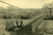
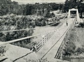
Aztec, New Mexico, USA - Las Animas River
| Bridgemeister ID: | 2505 (added 2009-03-07) |
| Year Completed: | 1908 |
| Name: | (suspension bridge) |
| Location: | Aztec, New Mexico, USA |
| Crossing: | Las Animas River |
| Principals: | Thurston and Co. |
| Use: | Vehicular (one-lane) |
| Status: | Removed |
| Main Cables: | Wire |
| Suspended Spans: | 1 |
1908: (suspension bridge)
Isokylä, Ylistaro vicinity, Finland
| Bridgemeister ID: | 2969 (added 2019-10-12) |
| Year Completed: | 1908 |
| Name: | (suspension bridge) |
| Location: | Isokylä, Ylistaro vicinity, Finland |
| Coordinates: | 62.950875 N 22.451695 E |
| Maps: | Acme, GeoHack, Google, OpenStreetMap |
| Use: | Vehicular (one-lane) |
| Status: | In use (last checked: 2009) |
| Main Cables: | Wire (steel) |
| Suspended Spans: | 1 |
1908: Bailey
Warsaw vicinity, Missouri, USA - Osage River
| Bridgemeister ID: | 3516 (added 2019-12-24) |
| Year Completed: | 1908 |
| Name: | Bailey |
| Location: | Warsaw vicinity, Missouri, USA |
| Crossing: | Osage River |
| Principals: | Joseph A. Dice |
| References: | BOTO |
| Use: | Vehicular |
| Status: | Removed |
| Main Cables: | Wire (steel) |
Notes:
- Location inundated by the Harry S. Truman Reservoir.
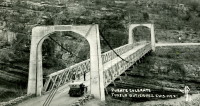
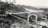
1908: Belisario Domínguez
Tuxtla Gutiérrez, Chiapas, Mexico - Rio Grijalva
| Bridgemeister ID: | 3219 (added 2019-11-11) |
| Year Completed: | 1908 |
| Name: | Belisario Domínguez |
| Also Known As: | Porfirio Díaz |
| Location: | Tuxtla Gutiérrez, Chiapas, Mexico |
| Crossing: | Rio Grijalva |
| Coordinates: | 16.742344 N 93.034593 W |
| Maps: | Acme, GeoHack, Google, OpenStreetMap |
| Use: | Vehicular (two-lane) |
| Status: | Only towers remain (last checked: 2021) |
| Main Cables: | Wire (steel) |
| Suspended Spans: | 1 |
Notes:
- 1955: Failed due to a truck colliding with part of the bridge. Adjacent replacement was already under construction.
- 2021: Towers are still present and one set of suspension cables is carrying a small pipeline. Unclear how long the bridge has been in this state.
External Links:
- Puente Belisario Domínguez en Chiapa de Corzo, que atravesaba el Río Grijalva alrededor de 1955. - Facebook
- Puente Belisario Domínguez, Chiapas, México - YouTube
| Bridgemeister ID: | 3911 (added 2020-03-15) |
| Year Completed: | 1908 |
| Name: | Erlinesset |
| Location: | Tolga, Østerdalen, Innlandet, Norway |
| Crossing: | Glomma |
| Coordinates: | 62.42619 N 11.09129 E |
| Maps: | Acme, GeoHack, Google, kart.1881.no, OpenStreetMap |
| Use: | Vehicular (one-lane) |
| Status: | In use (last checked: 2019) |
| Main Cables: | Wire (steel) |
| Suspended Spans: | 2 |
| Main Spans: | 2 x 42.5 meters (139.4 feet) estimated |
Notes:
- Restored 1951 and 1999.
External Links:
Do you have any information or photos for these bridges that you would like to share? Please email david.denenberg@bridgemeister.com.
