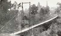
Suspension Bridges Completed 1910-1919 (101-117 of 117)
This is a list of bridges 101 through 117 (of 117 total) from the suspension bridge inventory completed in the decade 1910-1919. Wherever you see a Bridgemeister ID number click it to isolate the bridge on its own page.
Related Lists:
1918: Ookui
Yamaura, Komoro City, Nagano, Japan - Chikuma River
| Bridgemeister ID: | 6958 (added 2022-02-19) |
| Year Completed: | 1918 |
| Name: | Ookui |
| Also Known As: | Ookui-bashi, 大杭橋 |
| Location: | Yamaura, Komoro City, Nagano, Japan |
| Crossing: | Chikuma River |
| Coordinates: | 36.302159 N 138.422041 E |
| Maps: | Acme, GeoHack, Google, OpenStreetMap |
| Use: | Vehicular |
| Status: | Derelict (last checked: 2022) |
| Main Cables: | Wire (steel) |
| Suspended Spans: | 1 |
| Main Span: | 1 x 50 meters (164 feet) estimated |
Notes:
- 2019: Heavily damaged by typhoon. Appears to have already been closed to all traffic prior.
1918: Opiki Toll
Rangitane, New Zealand - Manawatu River
| Bridgemeister ID: | 698 (added 2003-03-08) |
| Year Completed: | 1918 |
| Name: | Opiki Toll |
| Also Known As: | Akers Toll |
| Location: | Rangitane, New Zealand |
| Crossing: | Manawatu River |
| Coordinates: | 40.431841 S 175.468575 E |
| Maps: | Acme, GeoHack, Google, OpenStreetMap |
| Principals: | Joseph Dawson |
| References: | AAJ, GAP, PTS2 |
| Use: | Vehicular |
| Status: | Derelict (last checked: 2024) |
| Main Cables: | Wire (steel) |
| Main Span: | 1 |
Notes:
- 1969: Bypassed.
- 2023, September: After many years of the main cables and suspenders hanging with no deck, one of the main cables collapsed.
- 2024, March: The collapsed main cable is raised back into position. The bridge, however, is still a just derelict monument with no deck.
External Links:
- ‘Iconic’ Ōpiki Bridge partly collapses in Manawatū River - nzherald.co.nz. Article regarding the September 2023 main cable collapse.
| Bridgemeister ID: | 4084 (added 2020-04-04) |
| Year Completed: | 1918 |
| Name: | Rånåsfoss |
| Location: | Rånåsfoss, Viken, Norway |
| Crossing: | Glomma |
| Coordinates: | 60.030429 N 11.329303 E |
| Maps: | Acme, GeoHack, Google, kart.1881.no, OpenStreetMap |
| Use: | Vehicular (one-lane) |
| Status: | Replaced |
| Main Cables: | Wire (steel) |
| Main Span: | 1 x 184 meters (603.7 feet) estimated |
Notes:
- Patrick S. O'Donnell notes: "This bridge was built in 1918 as a provisional suspension bridge to facilitate the construction of the dam a little less than a half kilometer downstream. Then it was built over and transformed into the 1927 Rånåsfoss bridge. It appears everything of the original bridge was replaced or new, except the lattice towers which in effect became rebar and are now encased in concrete. New anchorage pits were dug and new anchor eyebars placed within to accept the new main cables."
- Replaced by 1927 Rånåsfoss - Rånåsfoss, Viken, Norway.
External Links:
1918: Swinging
Old Hickory, Nashville and Goodlettsville, Nashville, Tennessee, USA - Cumberland River
| Bridgemeister ID: | 587 (added 2003-01-05) |
| Year Completed: | 1918 |
| Name: | Swinging |
| Location: | Old Hickory, Nashville and Goodlettsville, Nashville, Tennessee, USA |
| Crossing: | Cumberland River |
| At or Near Feature: | Hadley Bend |
| Coordinates: | 36.289002 N 86.685355 W |
| Maps: | Acme, GeoHack, Google, OpenStreetMap |
| Principals: | William G. Grove, American Bridge Co. |
| References: | AAJ, PTS2 |
| Use: | Vehicular (one-lane) |
| Status: | Removed |
| Main Cables: | Wire (steel) |
| Suspended Spans: | 1 |
| Main Span: | 1 x 164.6 meters (540 feet) |
| Deck width: | 8 feet |
Notes:
- Coordinates provided are approximate based on current-day (2021) location of Swinging Bridge Road.
External Links:
- Bridgehunter.com | Old Hickory Suspension Bridge
- DuPont High School Alumni Association - The Swinging Bridge. According to the description in this article provided by Old Hickory Branch Library this large bridge had a 540-foot main span and was used for vehicular traffic. "The suspension bridge... Was diverted from its original destination in South America because of the urgency of the war effort. It was built for pedestrian traffic and used only for that purpose at first... Upon determination that the bridge was capable of handling light traffic, a flagman was stationed at each end of the bridge on a 24-hour-a-day basis and cars began using the one-lane span." Kris Brummett adds: "The 540 foot span had no supports to prevent sideways movement and literally swayed back and forth. The bridge was used until 1929."
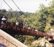
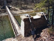
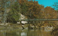
1918: Turkey Run State Park
Parke County, Indiana, USA - Sugar Creek
| Bridgemeister ID: | 269 (added before 2003) |
| Year Completed: | 1918 |
| Name: | Turkey Run State Park |
| Location: | Parke County, Indiana, USA |
| Crossing: | Sugar Creek |
| At or Near Feature: | Turkey Run State Park |
| Coordinates: | 39.88926 N 87.19948 W |
| Maps: | Acme, GeoHack, Google, OpenStreetMap |
| References: | IMB |
| Use: | Footbridge |
| Status: | In use (last checked: 2021) |
| Main Cables: | Wire (steel) |
| Suspended Spans: | 1 |
| Main Span: | 1 x 58.5 meters (192 feet) estimated |
Notes:
- IMB states, "The original bridge collapsed into Sugar Creek in 1917... the state's Department of Natural Resources promptly replaced the old with current structure."
- James Rader writes in 2008: "Three years ago flooding came up high enough to allow a couple of uprooted Sycamore trees to hit the bridge ripping out a large section of the wood railing and flooring from the middle of the bridge. Bridge was immediately closed. Structural analysis was completed and repairs were made including all new floor planks. Bridge is in great condition and should serve for many many more years to come."
External Links:
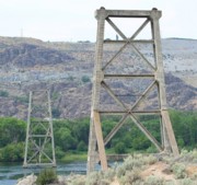
1919: Beebe
Beebe and Chelan, Washington, USA - Columbia River
| Bridgemeister ID: | 1188 (added 2004-01-24) |
| Year Completed: | 1919 |
| Name: | Beebe |
| Location: | Beebe and Chelan, Washington, USA |
| Crossing: | Columbia River |
| Coordinates: | 47.81308 N 119.97245 W |
| Maps: | Acme, GeoHack, Google, OpenStreetMap |
| Principals: | A. Munster, Wenatchee-Beebe Orchard Co. |
| References: | AAJ, PTS2, SPW |
| Use: | Pipeline and Vehicular |
| Status: | Only towers remain, since 1963 (last checked: 2022) |
| Main Cables: | Wire (steel) |
| Suspended Spans: | 1 |
| Main Span: | 1 x 192.6 meters (632 feet) |
| Deck width: | 12 feet |
Notes:
- The towers are still standing next to the current US97 crossing at Beebe.
- AAJ: Private bridge, built primarily to carry water to the owner's orchard, but also carried a roadway.
External Links:
- The Beebe Bridge | Empire Press | wenatcheeworld.com. Article about the history of the bridge.
- Structurae - Structure ID 20052092
1919: Boyacá
Irra, Colombia - Cauca River
| Bridgemeister ID: | 2019 (added 2006-01-14) |
| Year Completed: | 1919 |
| Name: | Boyacá |
| Also Known As: | Irra |
| Location: | Irra, Colombia |
| Crossing: | Cauca River |
| Status: | Removed |
| Suspended Spans: | 1 |
| Main Span: | 1 x 120 meters (393.7 feet) |
1919: Coon Box Fork
Lorman, Fayette vicinity, Mississippi, USA - Shankstown Creek
| Bridgemeister ID: | 6426 (added 2021-08-10) |
| Year Completed: | 1919 |
| Name: | Coon Box Fork |
| Location: | Lorman, Fayette vicinity, Mississippi, USA |
| Crossing: | Shankstown Creek |
| Coordinates: | 31.789613 N 91.068857 W |
| Maps: | Acme, GeoHack, Google, OpenStreetMap |
| Principals: | Schuster and Jacob, Robert Taylor |
| Use: | Vehicular (one-lane) |
| Status: | Destroyed, 1990 |
| Main Cables: | Wire (steel) |
| Suspended Spans: | 3 |
| Main Span: | 1 |
| Side Spans: | 2 |
Notes:
- Some sources suggest the bridge survived until 2010, but this appears to be unlikely. Coordinates provided are for the current Shankstown Creek crossing of Coon Box Road. The suspension bridge may have been on a slightly different alignment.
- 1927: Repaired by W.H. Groome and Son incorporating an improved anchoring system.
External Links:
- MDAH Historic Resources Inventory Fact Sheet - Coon Box Fork Suspension Bridge. Photographs available here suggest remnants of the bridge are visible in the creek.
- NPGallery Asset Detail - Coon Box Fork Bridge. National Register of Historic Places site survey. Presents a brief history of the bridge, but perhaps confuses the matter of its location. States: "Swinging suspension bridge and county road right-of-way along Coon Box Road where the said bridge crosses North Fork Coles Creek." Current-day (2021) Coon Box Road crosses Shankstown Creek near North Fork Coles Creek, but never crosses North Fork Coles Creek. Historic maps of the area place the mid-1900s Shankstown Creek crossing of Coon Box Fork at roughly the same location as the current crossing (the coordinates provided in this record). Looking at historic satellite images of the location, the suspension bridge was probably on an alignment no more than 100 feet north of the current Coon Box Road Shankstown Creek bridge.
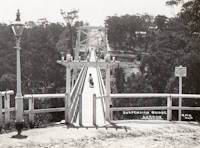
1919: Gordon
Gordon, New South Wales, Australia - Stony Creek
| Bridgemeister ID: | 8163 (added 2024-02-03) |
| Year Completed: | 1919 |
| Name: | Gordon |
| Location: | Gordon, New South Wales, Australia |
| Crossing: | Stony Creek |
| Coordinates: | 33.750472 S 151.156917 E |
| Maps: | Acme, GeoHack, Google, OpenStreetMap |
| Use: | Footbridge |
| Status: | Removed |
| Main Cables: | Wire |
| Main Span: | 1 x 67.1 meters (220 feet) |
External Links:
- 23 Jun 1919 - GORDON SUSPENSION BRIDGE. - Trove. Article from The Sydney Morning Herald dated Monday June 23 1919 titled "Gordon Suspension Bridge" regarding the grand opening of the bridge. The article indicates the bridge was on the alignment of Rosedale Road over Stony Creek.
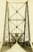
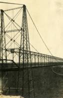
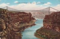
1919: Hansen
Twin Falls vicinity, Idaho, USA - Snake River
| Bridgemeister ID: | 334 (added before 2003) |
| Year Completed: | 1919 |
| Name: | Hansen |
| Location: | Twin Falls vicinity, Idaho, USA |
| Crossing: | Snake River |
| Principals: | Freygang and Trocon |
| References: | AAJ, PTS2 |
| Use: | Vehicular (two-lane) |
| Status: | Replaced, 1966 |
| Main Cables: | Wire (steel) |
| Suspended Spans: | 1 |
| Main Span: | 1 x 185.3 meters (608 feet) |
| Deck width: | 17 feet |
External Links:
1919: Morgan's
Parinui, Manawatu-Wanganui, New Zealand - Mangapurua Stream
| Bridgemeister ID: | 7655 (added 2023-06-10) |
| Year Completed: | 1919 |
| Name: | Morgan's |
| Location: | Parinui, Manawatu-Wanganui, New Zealand |
| Crossing: | Mangapurua Stream |
| At or Near Feature: | Bridge to Nowhere Walk |
| Coordinates: | 39.270940 S 174.972349 E |
| Maps: | Acme, GeoHack, Google, OpenStreetMap |
| Status: | Derelict, since c. 1930s |
| Main Cables: | Wire |
| Main Span: | 1 |
Notes:
- 2022: Remnants are still visible adjacent to its replacement concrete deck arch bridge (1936) known as the "Bridge to Nowhere".
External Links:
1919: Parys
Parys, South Africa - Vaal River
| Bridgemeister ID: | 2900 (added 2019-09-13) |
| Year Completed: | 1919 |
| Name: | Parys |
| Location: | Parys, South Africa |
| Crossing: | Vaal River |
| Coordinates: | 26.894181 S 27.457217 E |
| Maps: | Acme, GeoHack, Google, OpenStreetMap |
| Use: | Footbridge |
| Status: | In use (last checked: 2019) |
| Main Cables: | Wire (steel) |
| Suspended Spans: | 3 |
| Main Span: | 1 |
| Side Spans: | 2 |
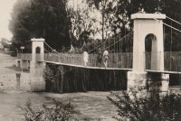
(footbridge)
Burnt Ranch vicinity, California, USA - Trinity River
| Bridgemeister ID: | 2408 (added 2007-12-24) |
| Name: | (footbridge) |
| Location: | Burnt Ranch vicinity, California, USA |
| Crossing: | Trinity River |
| At or Near Feature: | Six Rivers National Forest |
| Use: | Footbridge |
| Status: | Removed |
| Main Cables: | Wire |
| Suspended Spans: | 1 |
Notes:
- Completed 1915-1917, likely removed, 1970s.
- An article in the October 29, 1971 edition of The Times-Standard (Eureka, California) describes this bridge as being located over the Trinity River at New River. USGS topographical maps show a footbridge a few hundred yards north of the intersection of the two rivers at Gray Falls. The article has a photograph of the bridge and describes its possible replacement. The bridge was already closed at the time of the article: "A 50 year-old picturesque footbridge across the Trinity River at New River will be replaced if special funds can be obtained by the Six Rivers Nalional Forest, the federal agency has decided. 'Strong supportive response from people throughout the area to the continued need for a bridge' was reported by Forest Supervisor Bob Allison. The responses came after the Forest Service solicited comments in August on the replacement need for the span. The new bridge would be nearly as possible a replica of the present bridge constructed sometime between 1915 - 1917 by Jim and John Larson. It served as the main link between Denny and the outside world."
(suspension bridge)
Kneeland vicinity, California, USA - Mad River
| Bridgemeister ID: | 6778 (added 2021-10-28) |
| Name: | (suspension bridge) |
| Location: | Kneeland vicinity, California, USA |
| Crossing: | Mad River |
| Coordinates: | 40.662591 N 123.838166 W |
| Maps: | Acme, GeoHack, Google, OpenStreetMap |
| Use: | Vehicular |
| Status: | Only towers remain (last checked: 2021) |
| Main Cables: | Wire (steel) |
| Main Span: | 1 |
Notes:
- Likely built in the 1910s, a suspension bridge once crossed the Mad River at the end of Jack Shaw Road. At least one tower is still standing as of the early 2020s.
Choctaw Creek
Bells vicinity, Grayson County, Texas, USA - Choctaw Creek
| Bridgemeister ID: | 133 (added before 2003) |
| Name: | Choctaw Creek |
| Location: | Bells vicinity, Grayson County, Texas, USA |
| Crossing: | Choctaw Creek |
| Coordinates: | 33.650717 N 96.480981 W |
| Maps: | Acme, GeoHack, Google, OpenStreetMap |
| Principals: | William H. C. Greer |
| References: | HAERTX98 |
| Use: | Vehicular (one-lane) |
| Status: | Derelict (last checked: 2018) |
| Main Cables: | Wire |
| Suspended Spans: | 1 |
Notes:
- Likely built in the 1910s.
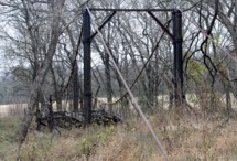
| Bridgemeister ID: | 4203 (added 2020-04-08) |
| Name: | Lauvøya |
| Location: | Grønvollfoss, Notodden, Vestfold Og Telemark, Norway |
| Crossing: | Tinne |
| Coordinates: | 59.651457 N 9.220381 E |
| Maps: | Acme, GeoHack, Google, kart.1881.no, OpenStreetMap |
| Use: | Footbridge |
| Status: | Extant (last checked: 2019) |
| Main Cables: | Wire (steel) |
| Suspended Spans: | 1 |
| Main Span: | 1 x 65.5 meters (214.9 feet) estimated |
Notes:
- Completed in time frame 1913-1917.
External Links:
Do you have any information or photos for these bridges that you would like to share? Please email david.denenberg@bridgemeister.com.
