Undated Suspension Bridges (5,201-5,300 of 5,681)
This is a list of bridges 5,201 through 5,300 (of 5,681 total) having no year of completion in the suspension bridge inventory. Wherever you see a Bridgemeister ID number click it to isolate the bridge on its own page.
Related Lists:
| Bridgemeister ID: | 7982 (added 2023-12-02) |
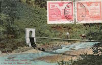
| Name: | Rio Cobre |
| Location: | Los Bajos del Cobre, Soná District, Veraguas, Panama |
| Crossing: | Rio Cobre |
| Coordinates: | 8.047694 N 81.322722 W |
| Maps: | Acme, GeoHack, Google, OpenStreetMap |
| Use: | Vehicular (one-lane) |
| Status: | Removed, c. 2008-2013 |
| Main Cables: | Wire (steel) |
| Suspended Spans: | 1 |
| Main Span: | 1 x 114 meters (374 feet) estimated |
Notes:
- Moved from 1927 San Pablo - Soná, Veraguas, Panama. The bridge had been dismantled, likely in the late 1900s and reassembled across the Rio Cobre where it survived until some point in the 2008-2013 timeframe.
Ripley
Ripley, Oklahoma, USA - Cimarron River
| Bridgemeister ID: | 5586 (added 2020-12-22) |
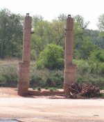
| Name: | Ripley |
| Location: | Ripley, Oklahoma, USA |
| Crossing: | Cimarron River |
| Coordinates: | 36.028302 N 96.905843 W |
| Maps: | Acme, GeoHack, Google, OpenStreetMap |
| Use: | Vehicular |
| Status: | Only towers remain (last checked: 2020) |
| Main Cables: | Wire (steel) |
| Main Span: | 1 |
Notes:
- Pier and abutment remnants of this bridge are still present (2020).
- Replaced 1909 Ripley - Ripley, Oklahoma, USA.
Risheng Penglai
Yanchao District, Kaohsiung City, Taiwan - A-kung-tien (Agongdian) Reservoir
| Bridgemeister ID: | 2689 (added 2019-05-26) |
| Name: | Risheng Penglai |
| Also Known As: | 日昇蓬萊吊橋 |
| Location: | Yanchao District, Kaohsiung City, Taiwan |
| Crossing: | A-kung-tien (Agongdian) Reservoir |
| Coordinates: | 22.807178 N 120.356520 E |
| Maps: | Acme, GeoHack, Google, OpenStreetMap |
| Use: | Footbridge |
| Status: | In use (last checked: 2023) |
| Main Cables: | Wire (steel) |
| Suspended Spans: | 2 |
| Main Span: | 1 |
| Side Span: | 1 |
Notes:
External Links:
| Bridgemeister ID: | 4399 (added 2020-04-18) |
| Name: | Risnes |
| Location: | Risnes, Norway |
| Crossing: | Äkrogjen |
| Coordinates: | 58.655769 N 6.946164 E |
| Maps: | Acme, GeoHack, Google, kart.1881.no, OpenStreetMap |
| Use: | Vehicular |
| Status: | In use (last checked: 2019) |
| Main Cables: | Wire (steel) |
| Suspended Spans: | 1 |
| Main Span: | 1 x 61 meters (200.1 feet) estimated |
External Links:
Riverfront
Kingsport, Tennessee, USA - Holston River
| Bridgemeister ID: | 1086 (added 2004-01-01) |
| Name: | Riverfront |
| Also Known As: | Swinging |
| Location: | Kingsport, Tennessee, USA |
| Crossing: | Holston River |
| At or Near Feature: | Riverfront Park, Heritage Park |
| Coordinates: | 36.550017 N 82.586383 W |
| Maps: | Acme, GeoHack, Google, OpenStreetMap |
| Use: | Footbridge |
| Status: | In use (last checked: 2022) |
| Main Cables: | Wire (steel) |
| Suspended Spans: | 1 |
| Main Span: | 1 x 73.2 meters (240 feet) estimated |
Notes:
- 2007, October: Closed due to structural issues.
- 2009-2010: Repaired late 2009 or 2010 and reopened.
- 2021, May: Closed due to "hazardous conditions" pending repairs. Work expected to start in July.
- 2021, July: Bridge remains closed indefinitely. City of Kingsport soliciting more bids for repair work.
- 2022, April: Repairs in progress.
- 2022, June: Repairs completed, bridge reopened.
Annotated Citations:
- Hightower, Cliff. "Swinging bridge under repairs." The Kingsport Times News, 25 Apr. 2022, www.timesnews.net/news/swinging-bridge-under-repairs/article_2f96a368-c4cb-11ec-beff-2f8670dafd5b.html
"Inland [Construction] will replace all of the bridge’s existing wooden joists with new ones, while the existing chain link fencing and tension wire along the sides will be replaced with new, vinyl-coated green fencing."
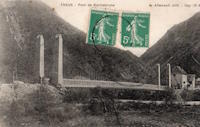
Rochebrune
Théus, Hautes-Alpes, France - Durance River
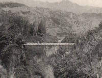
| Bridgemeister ID: | 7752 (added 2023-07-21) |
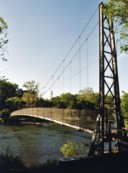
| Name: | Rochebrune |
| Location: | Théus, Hautes-Alpes, France |
| Crossing: | Durance River |
| Coordinates: | 44.460137 N 6.198517 E |
| Maps: | Acme, GeoHack, Google, OpenStreetMap |
| Use: | Vehicular |
| Status: | Removed |
| Main Cables: | Wire |
| Suspended Spans: | 1 |
Rochsburg
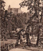
Rochsburg, Lunzenau, Saxony, Germany - Zwickauer Mulde River
| Bridgemeister ID: | 2258 (added 2007-04-18) |
| Name: | Rochsburg |
| Also Known As: | Schwankender |
| Location: | Rochsburg, Lunzenau, Saxony, Germany |
| Crossing: | Zwickauer Mulde River |
| Coordinates: | 50.945537 N 12.762093 E |
| Maps: | Acme, GeoHack, Google, OpenStreetMap |
| Use: | Footbridge |
| Status: | Destroyed, 1954, by flood |
| Suspended Spans: | 1 |
Notes:
- Completed c. 1878.
- Replaced by 1954 Rochsburg - Rochsburg, Lunzenau, Saxony, Germany.
Rock Cut Farm
Baoba, Pennsylvania, USA - Lackawaxen River
| Bridgemeister ID: | 3792 (added 2020-03-01) |
| Name: | Rock Cut Farm |
| Also Known As: | Baoba |
| Location: | Baoba, Pennsylvania, USA |
| Crossing: | Lackawaxen River |
| Coordinates: | 41.479527 N 75.094446 W |
| Maps: | Acme, GeoHack, Google, OpenStreetMap |
| Use: | Footbridge |
| Status: | Replaced |
| Main Cables: | Wire |
Notes:
- Replaced by Rock Cut Farm (Baoba) - Baoba, Pennsylvania, USA.

Rock Cut Farm
Baoba, Pennsylvania, USA - Lackawaxen River
| Bridgemeister ID: | 3793 (added 2020-03-01) |
| Name: | Rock Cut Farm |
| Also Known As: | Baoba |
| Location: | Baoba, Pennsylvania, USA |
| Crossing: | Lackawaxen River |
| Coordinates: | 41.479367 N 75.094167 W |
| Maps: | Acme, GeoHack, Google, OpenStreetMap |
| Use: | Footbridge |
| Status: | Destroyed, June 2006 |
| Main Cables: | Wire (steel) |
| Suspended Spans: | 1 |
Notes:
- Destroyed by flood, June 2006.
- Replaced Rock Cut Farm (Baoba) - Baoba, Pennsylvania, USA.
- Replaced by 2007 Rock Cut Farm (Baoba) - Baoba, Pennsylvania, USA.
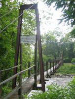
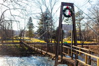
Rockbridge Baths
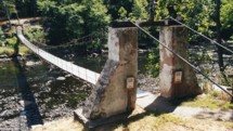
Rockbridge Baths, Virginia, USA - Maury River
| Bridgemeister ID: | 793 (added 2003-03-28) |
| Name: | Rockbridge Baths |
| Location: | Rockbridge Baths, Virginia, USA |
| Crossing: | Maury River |
| Coordinates: | 37.90029 N 79.40998 W |
| Maps: | Acme, GeoHack, Google, OpenStreetMap |
| Principals: | VDOT |
| Use: | Footbridge |
| Status: | In use (last checked: 2021) |
| Main Cables: | Wire (steel) |
| Suspended Spans: | 1 |
| Main Span: | 1 x 56.7 meters (186 feet) estimated |
Notes:
| Bridgemeister ID: | 3890 (added 2020-03-14) |
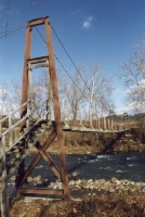
| Name: | Rognes |
| Location: | Rognes, Trøndelag, Norway |
| Crossing: | Gaula |
| Coordinates: | 63.003640 N 10.456500 E |
| Maps: | Acme, GeoHack, Google, kart.1881.no, OpenStreetMap |
| Use: | Vehicular (one-lane) |
| Status: | Replaced |
| Main Cables: | Wire (steel) |
| Main Span: | 1 x 69.5 meters (228 feet) estimated |
Notes:
- Replaced by Rognes - Rognes, Trøndelag, Norway.
Rognes
Rognes, Trøndelag, Norway - Gaula River
| Bridgemeister ID: | 3891 (added 2020-03-14) |
| Name: | Rognes |
| Location: | Rognes, Trøndelag, Norway |
| Crossing: | Gaula River |
| Coordinates: | 63.00369 N 10.45654 E |
| Maps: | Acme, GeoHack, Google, kart.1881.no, OpenStreetMap |
| Use: | Vehicular (one-lane) |
| Status: | In use (last checked: 2019) |
| Main Cables: | Wire (steel) |
| Suspended Spans: | 1 |
| Main Span: | 1 x 81 meters (265.7 feet) estimated |
Notes:
- Replaced Rognes - Rognes, Trøndelag, Norway.
Rokubuchinotsuri
Totsukawa, Nara, Japan - Kumano River
| Bridgemeister ID: | 7911 (added 2023-10-21) |
| Name: | Rokubuchinotsuri |
| Also Known As: | 鹿淵の吊橋 |
| Location: | Totsukawa, Nara, Japan |
| Crossing: | Kumano River |
| Coordinates: | 33.888843 N 135.760790 E |
| Maps: | Acme, GeoHack, Google, OpenStreetMap |
| Use: | Footbridge |
| Status: | In use (last checked: 2021) |
| Main Cables: | Wire (steel) |
| Suspended Spans: | 1 |
| Bridgemeister ID: | 3790 (added 2020-02-29) |
| Name: | Rollset |
| Location: | Rollset, Selbu, Trøndelag, Norway |
| Crossing: | Nea |
| Coordinates: | 63.18308 N 11.18911 E |
| Maps: | Acme, GeoHack, Google, kart.1881.no, OpenStreetMap |
| Use: | Vehicular (one-lane) |
| Status: | In use (last checked: 2019) |
| Main Cables: | Wire (steel) |
| Suspended Spans: | 1 |
| Main Span: | 1 x 10² meters (334.6 feet) estimated |
Notes:
- Completed at some point between 1952-1962.
| Bridgemeister ID: | 3944 (added 2020-03-21) |
| Name: | Romsdalssetra |
| Location: | Folldal, Innlandet, Norway |
| Crossing: | Einunna |
| Coordinates: | 62.25965 N 10.19534 E |
| Maps: | Acme, GeoHack, Google, kart.1881.no, OpenStreetMap |
| Use: | Footbridge |
| Status: | In use (last checked: 2019) |
| Main Cables: | Wire (steel) |
| Suspended Spans: | 1 |
| Main Span: | 1 x 41 meters (134.5 feet) estimated |
Rong Chong
Rong Chong, West Bengal, India - Riyang Khola
| Bridgemeister ID: | 5877 (added 2021-05-18) |
| Name: | Rong Chong |
| Location: | Rong Chong, West Bengal, India |
| Crossing: | Riyang Khola |
| Coordinates: | 26.961946 N 88.414486 E |
| Maps: | Acme, GeoHack, Google, OpenStreetMap |
| Use: | Footbridge |
| Status: | Derelict (last checked: 2018) |
| Main Cables: | Wire |
| Main Span: | 1 |
Notes:
Rong Chong
Rong Chong, West Bengal, India - Riyang Khola
| Bridgemeister ID: | 5878 (added 2021-05-18) |
| Name: | Rong Chong |
| Location: | Rong Chong, West Bengal, India |
| Crossing: | Riyang Khola |
| Coordinates: | 26.962140 N 88.414509 E |
| Maps: | Acme, GeoHack, Google, OpenStreetMap |
| Use: | Footbridge |
| Status: | In use (last checked: 2018) |
| Main Cables: | Wire (steel) |
| Main Span: | 1 |
Notes:
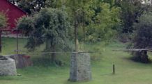
Roop's Mill
Roop's Mill, Westminster vicinity, Maryland, USA - Meadow Branch Creek
| Bridgemeister ID: | 1497 (added 2004-09-26) |
| Name: | Roop's Mill |
| Location: | Roop's Mill, Westminster vicinity, Maryland, USA |
| Crossing: | Meadow Branch Creek |
| Coordinates: | 39.590281 N 77.032552 W |
| Maps: | Acme, GeoHack, Google, OpenStreetMap |
| Use: | Footbridge |
| Status: | Derelict (last checked: 2004) |
| Main Cables: | Wire |
| Suspended Spans: | 4 |
| Main Spans: | 2 |
| Side Spans: | 2 |
Rooster Branch
Oneida, Kentucky, USA - South Fork Kentucky River
| Bridgemeister ID: | 4960 (added 2020-08-09) |
| Name: | Rooster Branch |
| Location: | Oneida, Kentucky, USA |
| Crossing: | South Fork Kentucky River |
| Coordinates: | 37.321095 N 83.665840 W |
| Maps: | Acme, GeoHack, Google, OpenStreetMap |
| Use: | Footbridge |
| Status: | Extant (last checked: 2020) |
| Main Cables: | Wire |
Rope
Kardzhali, Bulgaria - Arda River
| Bridgemeister ID: | 4929 (added 2020-07-31) |
| Name: | Rope |
| Also Known As: | Въжен |
| Location: | Kardzhali, Bulgaria |
| Crossing: | Arda River |
| Coordinates: | 41.630450 N 25.365551 E |
| Maps: | Acme, GeoHack, Google, OpenStreetMap |
| Use: | Footbridge |
| Status: | In use (last checked: 2020) |
| Main Cables: | Wire (steel) |
| Suspended Spans: | 1 |
Notes:
- Despite being known as the "Rope" bridge, this is a large steel cabled suspension bridge with a main span that appears to exceed 180 meters.
Roquemaure
Roquemaure, Gard and Orange, Vaucluse, France - Rhône River
| Bridgemeister ID: | 1736 (added 2005-04-19) |
| Name: | Roquemaure |
| Location: | Roquemaure, Gard and Orange, Vaucluse, France |
| Crossing: | Rhône River |
| Coordinates: | 44.071967 N 4.768917 E |
| Maps: | Acme, GeoHack, Google, OpenStreetMap |
| Use: | Vehicular (two-lane, heavy vehicles), with walkway |
| Status: | In use (last checked: 2019) |
| Main Cables: | Wire (steel) |
| Suspended Spans: | 3 |
| Main Span: | 1 |
| Side Spans: | 2 |
Notes:
- Replaced 1835 Roquemaure - Roquemaure, Gard and Orange, Vaucluse, France. One span of the older bridge is still standing next to the replacement.
External Links:

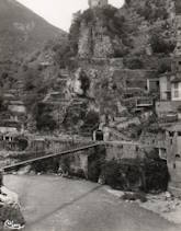
Roquestéron-Grasse
Roquestéron and La Roque-en-Provence, Alpes-Maritimes, France - L'Esteron
| Bridgemeister ID: | 7933 (added 2023-10-28) |
| Name: | Roquestéron-Grasse |
| Location: | Roquestéron and La Roque-en-Provence, Alpes-Maritimes, France |
| Crossing: | L'Esteron |
| Coordinates: | 43.871917 N 7.005972 E |
| Maps: | Acme, GeoHack, Google, OpenStreetMap |
| Use: | Footbridge |
| Status: | In use (last checked: 2023) |
| Main Cables: | Wire (steel) |
| Suspended Spans: | 1 |
Rosenau
Kempten, Germany - Iller River
| Bridgemeister ID: | 4637 (added 2020-06-09) |
| Name: | Rosenau |
| Location: | Kempten, Germany |
| Crossing: | Iller River |
| Coordinates: | 47.719165 N 10.323338 E |
| Maps: | Acme, GeoHack, Google, OpenStreetMap |
| Use: | Footbridge |
| Status: | In use (last checked: 2019) |
| Main Cables: | Wire (steel) |
| Suspended Spans: | 1 |
External Links:
| Bridgemeister ID: | 3999 (added 2020-03-27) |
| Name: | Rostein |
| Location: | Dokka, Nordre Land, Innlandet, Norway |
| Crossing: | Etna |
| Coordinates: | 60.82829 N 10.05281 E |
| Maps: | Acme, GeoHack, Google, kart.1881.no, OpenStreetMap |
| Use: | Vehicular |
| Status: | Extant (last checked: 2017) |
| Main Cables: | Wire (steel) |
| Suspended Spans: | 1 |
| Main Span: | 1 x 52.2 meters (171.3 feet) estimated |
External Links:
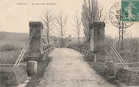
Rouazes
Mareuil-lès-Meaux, Voisins vicinity, Seine-et-Marne, France - Chalifert Canal
| Bridgemeister ID: | 7369 (added 2022-11-05) |
| Name: | Rouazes |
| Location: | Mareuil-lès-Meaux, Voisins vicinity, Seine-et-Marne, France |
| Crossing: | Chalifert Canal |
| Coordinates: | 48.908282 N 2.849197 E |
| Maps: | Acme, GeoHack, Google, OpenStreetMap |
| Use: | Vehicular (one-lane) |
| Status: | Removed |
| Main Cables: | Wire |
| Suspended Spans: | 1 |
Notes:
- 2022: Remnants of the pylons and anchorages are present.
- Similar to Esbly - Esbly, Seine-et-Marne, France.
Roudoule
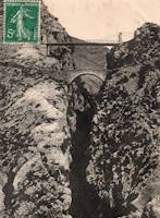
La Croix-sur-Roudoule, Puget-Théniers vicinity, Alpes-Maritimes, France - Roudoule River
| Bridgemeister ID: | 4552 (added 2020-05-31) |
| Name: | Roudoule |
| Location: | La Croix-sur-Roudoule, Puget-Théniers vicinity, Alpes-Maritimes, France |
| Crossing: | Roudoule River |
| Coordinates: | 43.986245 N 6.869900 E |
| Maps: | Acme, GeoHack, Google, OpenStreetMap |
| Use: | Vehicular (one-lane) |
| Status: | In use (last checked: 2019) |
| Main Cables: | Wire |
| Suspended Spans: | 1 |
External Links:
Roussanes
Roussanes, Clairac vicinity, Lot-et-Garonne, France - Lot River
| Bridgemeister ID: | 3747 (added 2020-02-16) |
| Name: | Roussanes |
| Also Known As: | Clairac |
| Location: | Roussanes, Clairac vicinity, Lot-et-Garonne, France |
| Crossing: | Lot River |
| Coordinates: | 44.372753 N 0.438374 E |
| Maps: | Acme, GeoHack, Google, OpenStreetMap |
| Use: | Vehicular (one-lane), with walkway |
| Status: | In use (last checked: 2016) |
| Main Cables: | Wire |
| Suspended Spans: | 1 |
Notes:
External Links:
Rudraprayag
Rudraprayag (रूद्रप्रयाग), Uttarakhand, India - Alakananda River
| Bridgemeister ID: | 7104 (added 2022-06-04) |
| Name: | Rudraprayag |
| Location: | Rudraprayag (रूद्रप्रयाग), Uttarakhand, India |
| Crossing: | Alakananda River |
| Coordinates: | 30.287639 N 78.984097 E |
| Maps: | Acme, GeoHack, Google, OpenStreetMap |
| Use: | Vehicular |
| Status: | Removed |
| Suspended Spans: | 1 |
| Main Span: | 1 x 61 meters (200 feet) estimated |
Notes:
- The suspension bridge was immediately adjacent to the present day (2022) truss bridge.
External Links:
- Facebook - Rudraprayag. Image posted March, 2013, showing the current truss bridge with remnants of the adjacent suspension bridge visible.
- Google Maps - Rudraprayag Bridge. Image date September, 2021, showing the current truss bridge with possible remnants of the adjacent suspension bridge visible on the far bank of the river.
Ruedas
Barichara and Zapatoca, Santander, Colombia - Rio Suárez
| Bridgemeister ID: | 7234 (added 2022-07-16) |
| Name: | Ruedas |
| Location: | Barichara and Zapatoca, Santander, Colombia |
| Crossing: | Rio Suárez |
| Coordinates: | 6.713714 N 73.249301 W |
| Maps: | Acme, GeoHack, Google, OpenStreetMap |
| Status: | Only towers remain |
| Main Span: | 1 |
Notes:
External Links:
- Google Maps - Puente Rudeas. Image showing the remains of the bridge, posted January 2022.
- YouTube - PUENTE RUEDAS - ZAPATOCA SANTANDER. Video featuring the remains of the bridge, posted August 2016.
Ruedas
Barichara and Zapatoca, Santander, Colombia - Rio Suárez
| Bridgemeister ID: | 7235 (added 2022-07-16) |
| Name: | Ruedas |
| Location: | Barichara and Zapatoca, Santander, Colombia |
| Crossing: | Rio Suárez |
| Coordinates: | 6.713675 N 73.249350 W |
| Maps: | Acme, GeoHack, Google, OpenStreetMap |
| Status: | In use (last checked: 2022) |
| Main Cables: | Wire (steel) |
Notes:
External Links:
- Google Maps - Puente Rudeas. Image showing the bridge and the remains of the former bridge at this location, posted January 2022.
- YouTube - PUENTE RUEDAS - ZAPATOCA SANTANDER. Video featuring the bridge and the remains of the former bridge at this location, posted August 2016.
Ruffey Trail
Templestowe Lower, Victoria, Australia - Yarra River
| Bridgemeister ID: | 2862 (added 2019-09-08) |
| Name: | Ruffey Trail |
| Location: | Templestowe Lower, Victoria, Australia |
| Crossing: | Yarra River |
| Coordinates: | 37.752838 S 145.117476 E |
| Maps: | Acme, GeoHack, Google, OpenStreetMap |
| Use: | Footbridge |
| Status: | In use (last checked: 2019) |
| Main Cables: | Wire (steel) |
| Bridgemeister ID: | 4006 (added 2020-03-28) |
| Name: | Rustebakkbrua |
| Location: | Begnadalen, Bagn vicinity, Innlandet, Norway |
| Crossing: | Begna |
| Coordinates: | 60.70094 N 9.72038 E |
| Maps: | Acme, GeoHack, Google, kart.1881.no, OpenStreetMap |
| Use: | Vehicular (one-lane) |
| Status: | In use (last checked: 2013) |
| Main Cables: | Wire (steel) |
| Suspended Spans: | 1 |
| Main Span: | 1 x 60 meters (196.9 feet) estimated |
Notes:
- Based on historic aerial images, constructed prior to 1973.
Ryujin
Murayama, Yamagata, Japan - Mogami River
| Bridgemeister ID: | 2092 (added 2006-07-03) |
| Name: | Ryujin |
| Also Known As: | 竜神の吊橋 |
| Location: | Murayama, Yamagata, Japan |
| Crossing: | Mogami River |
| Coordinates: | 38.490794 N 140.347427 E |
| Maps: | Acme, GeoHack, Google, OpenStreetMap |
| Use: | Footbridge |
| Status: | In use (last checked: 2018) |
| Main Cables: | Wire (steel) |
Notes:
- Distinct from the huge same-named Ryujin footbridge located elsewhere in Japan.
Sabonreng
Lompulle, Soppeng Regency, South Sulawesi, Indonesia - Walanae River
| Bridgemeister ID: | 5725 (added 2021-04-03) |
| Name: | Sabonreng |
| Location: | Lompulle, Soppeng Regency, South Sulawesi, Indonesia |
| Crossing: | Walanae River |
| Coordinates: | 4.278863 S 119.973206 E |
| Maps: | Acme, GeoHack, Google, OpenStreetMap |
| Status: | Extant (last checked: 2020) |
Saghutar
Saghutar (साँघुटार), Ramechhap, Nepal - Likhu Khola
| Bridgemeister ID: | 6433 (added 2021-08-12) |
| Name: | Saghutar |
| Also Known As: | Sanghutar |
| Location: | Saghutar (साँघुटार), Ramechhap, Nepal |
| Crossing: | Likhu Khola |
| Coordinates: | 27.350639 N 86.218460 E |
| Maps: | Acme, GeoHack, Google, OpenStreetMap |
| Principals: | Louis Harper, Harpers Limited |
| Use: | Footbridge |
| Status: | In use (last checked: 2021) |
| Main Cables: | Wire (steel) |
| Suspended Spans: | 1 |
| Main Span: | 1 |
External Links:
- Sanghatur | Harper Bridges. Built in timeframe 1900-1908.
| Bridgemeister ID: | 3720 (added 2020-02-15) |
| Name: | Sagmo |
| Location: | Harran, Grong, Trøndelag, Norway |
| Crossing: | Namsen |
| Coordinates: | 64.556385 N 12.478902 E |
| Maps: | Acme, GeoHack, Google, kart.1881.no, OpenStreetMap |
| Use: | Vehicular (one-lane) |
| Status: | In use (last checked: 2010) |
| Main Cables: | Wire (steel) |
| Suspended Spans: | 1 |
| Main Span: | 1 x 10³ meters (337.9 feet) estimated |
| Bridgemeister ID: | 6175 (added 2021-07-08) |
| Name: | Sai Yok |
| Also Known As: | สะพานแขวนไทรโยค |
| Location: | Sai Yok, Sai Yok District, Kanchanaburi, Thailand |
| Crossing: | Khwae Noi |
| At or Near Feature: | Sai Yok National Park - อุทยานแห่งชาติไทรโยค |
| Coordinates: | 14.434858 N 98.851237 E |
| Maps: | Acme, GeoHack, Google, OpenStreetMap |
| Use: | Footbridge |
| Status: | In use (last checked: 2020) |
| Main Cables: | Wire (steel) |
| Main Span: | 1 |
Saint-Ambroix
Saint-Ambroix, Gard, France - Cèze River
| Bridgemeister ID: | 4064 (added 2020-03-30) |
| Name: | Saint-Ambroix |
| Location: | Saint-Ambroix, Gard, France |
| Crossing: | Cèze River |
| References: | AAJ |
| Use: | Vehicular |
| Status: | Removed |
| Main Cables: | Wire (iron) |
| Suspended Spans: | 1 |
Notes:
- AAJ supposes this bridge was completed in 1841 based on a contract let in 1840 proposing an 18-month construction period.
Saint-Bauzille-de-Putois
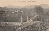
Saint-Bauzille-de-Putois, Hérault, France - Hérault River
| Bridgemeister ID: | 1096 (added 2004-01-02) |
| Name: | Saint-Bauzille-de-Putois |
| Location: | Saint-Bauzille-de-Putois, Hérault, France |
| Crossing: | Hérault River |
| Coordinates: | 43.890409 N 3.731778 E |
| Maps: | Acme, GeoHack, Google, OpenStreetMap |
| Use: | Vehicular (one-lane) |
| Status: | In use (last checked: 2018) |
| Main Cables: | Wire |
| Suspended Spans: | 1 |
Notes:
External Links:
Saint-Bauzille-de-Putois
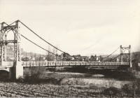
Saint-Bauzille-de-Putois, Hérault, France - Hérault River
| Bridgemeister ID: | 1933 (added 2005-10-28) |
| Name: | Saint-Bauzille-de-Putois |
| Location: | Saint-Bauzille-de-Putois, Hérault, France |
| Crossing: | Hérault River |
| Status: | Replaced |
Notes:

Saint-Denis-de-Pile
Saint-Denis-de-Pile and Bonzac, Gironde, France - Isle River
| Bridgemeister ID: | 7507 (added 2023-01-02) |
| Name: | Saint-Denis-de-Pile |
| Location: | Saint-Denis-de-Pile and Bonzac, Gironde, France |
| Crossing: | Isle River |
| Coordinates: | 44.993251 N 0.207369 W |
| Maps: | Acme, GeoHack, Google, OpenStreetMap |
| Use: | Vehicular |
| Status: | Replaced |
| Main Cables: | Wire (iron) |
Notes:
External Links:
Saint-Didier-sous-Aubenas
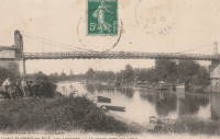
Saint-Didier-sous-Aubenas, Ardèche, France - Ardèche River
| Bridgemeister ID: | 2929 (added 2019-09-16) |
| Name: | Saint-Didier-sous-Aubenas |
| Location: | Saint-Didier-sous-Aubenas, Ardèche, France |
| Crossing: | Ardèche River |
| Coordinates: | 44.603719 N 4.419774 E |
| Maps: | Acme, GeoHack, Google, OpenStreetMap |
| Use: | Vehicular |
| Status: | Replaced, 1936 |
Notes:
Saint-Fontunat-sur-Eyrieux
Saint-Fontunat-sur-Eyrieux, Ardèche, France - Eyrieux River
| Bridgemeister ID: | 1565 (added 2004-11-28) |
| Name: | Saint-Fontunat-sur-Eyrieux |
| Also Known As: | Pourchaire |
| Location: | Saint-Fontunat-sur-Eyrieux, Ardèche, France |
| Crossing: | Eyrieux River |
| Coordinates: | 44.815748 N 4.707325 E |
| Maps: | Acme, GeoHack, Google, OpenStreetMap |
| Principals: | Camille Seguin, Marc Seguin |
| References: | BPF |
| Use: | Footbridge |
| Status: | Only towers remain (last checked: 2021) |
| Main Cables: | Wire (iron) |
| Main Span: | 1 |
| Side Span: | 1 |
Notes:
- BPF and other sources list this bridge as having been completed in 1821 or 1823, but it is very unlikely the bridge was completed that early. An abandoned pier for another bridge is visible in some images of the bridge. It is possible there was another, earlier, bridge at this location for which the early 1820s completion date may be applicable. Other sources suggest the suspension bridge represented here was completed in 1893.
External Links:
Saint-Gaultier
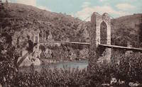
Saint-Gaultier, Indre, France - Creuse River
| Bridgemeister ID: | 7384 (added 2022-11-24) |
| Name: | Saint-Gaultier |
| Location: | Saint-Gaultier, Indre, France |
| Crossing: | Creuse River |
| Status: | Removed |
| Suspended Spans: | 1 |
Saint-Georges-de-Commiers
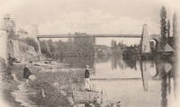
Saint-Georges-de-Commiers and Vif, Isère, France - Drac River
| Bridgemeister ID: | 7318 (added 2022-08-31) |
| Name: | Saint-Georges-de-Commiers |
| Location: | Saint-Georges-de-Commiers and Vif, Isère, France |
| Crossing: | Drac River |
| Coordinates: | 45.043942 N 5.694915 E |
| Maps: | Acme, GeoHack, Google, OpenStreetMap |
| Use: | Vehicular |
| Status: | Removed |
| Suspended Spans: | 1 |
Saint-Georges-sur-Cher
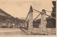
Saint-Georges-sur-Cher, Loir-et-Cher, France - Cher River
| Bridgemeister ID: | 7321 (added 2022-09-01) |
| Name: | Saint-Georges-sur-Cher |
| Location: | Saint-Georges-sur-Cher, Loir-et-Cher, France |
| Crossing: | Cher River |
| Use: | Vehicular |
| Status: | Removed |
| Main Cables: | Wire |
| Suspended Spans: | 1 |
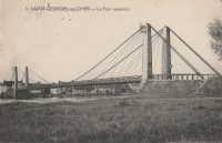
Saint-Georges-sur-Loire
Saint-Georges-sur-Loire and Chalonnes-sur-Loire, Maine-et-Loire, France - Loire River
| Bridgemeister ID: | 8039 (added 2023-12-23) |
| Name: | Saint-Georges-sur-Loire |
| Location: | Saint-Georges-sur-Loire and Chalonnes-sur-Loire, Maine-et-Loire, France |
| Crossing: | Loire River |
| Coordinates: | 47.368389 N 0.754194 W |
| Maps: | Acme, GeoHack, Google, OpenStreetMap |
| Use: | Vehicular |
| Status: | Removed |
| Suspended Spans: | 4 |
| Main Spans: | 2 |
| Side Spans: | 2 |
Notes:
- Near 1841 Chalonnes - Chalonnes-sur-Loire, Maine-et-Loire, France. Both bridges were likely completed around the same time by the Seguin Brothers.
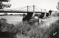
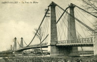
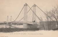
Saint-Gilles
Saint-Gilles-du-Gard, Gard and Arles, Bouches-du-Rhône, France - Petit Rhône River
| Bridgemeister ID: | 4908 (added 2020-07-19) |
| Name: | Saint-Gilles |
| Location: | Saint-Gilles-du-Gard, Gard and Arles, Bouches-du-Rhône, France |
| Crossing: | Petit Rhône River |
| Coordinates: | 43.665899 N 4.452714 E |
| Maps: | Acme, GeoHack, Google, OpenStreetMap |
| Use: | Vehicular |
| Status: | Replaced, 1938 |
| Main Cables: | Wire |
| Suspended Spans: | 1 |
Notes:
External Links:
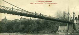
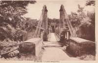
Saint-Julien
Saint-Julien, Haute-Garonne, France - Garonne River
| Bridgemeister ID: | 1685 (added 2005-03-26) |
| Name: | Saint-Julien |
| Location: | Saint-Julien, Haute-Garonne, France |
| Crossing: | Garonne River |
| Use: | Vehicular (one-lane) |
| Status: | Removed |
| Main Cables: | Wire |
Saint-Lattier
Saint-Lattier, Isère and Eymeux, Drôme, France - Isère River
| Bridgemeister ID: | 4913 (added 2020-07-19) |
| Name: | Saint-Lattier |
| Also Known As: | Eymeux |
| Location: | Saint-Lattier, Isère and Eymeux, Drôme, France |
| Crossing: | Isère River |
| Coordinates: | 45.084972 N 5.183313 E |
| Maps: | Acme, GeoHack, Google, OpenStreetMap |
| Use: | Vehicular (one-lane) |
| Status: | In use (last checked: 2020) |
| Main Cables: | Wire (steel) |
| Suspended Spans: | 1 |
| Main Span: | 1 x 10⁸ meters (354.3 feet) estimated |
Notes:
- At former location of 1857 Saint-Lattier - Saint-Lattier, Isère and Eymeux, Drôme, France.
External Links:
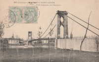
Saint-Léger
Saint-Léger and Aiguillon, Lot-et-Garonne, France - Garonne River
| Bridgemeister ID: | 7322 (added 2022-09-01) |
| Name: | Saint-Léger |
| Location: | Saint-Léger and Aiguillon, Lot-et-Garonne, France |
| Crossing: | Garonne River |
| Coordinates: | 44.289545 N 0.320319 E |
| Maps: | Acme, GeoHack, Google, OpenStreetMap |
| Use: | Vehicular |
| Status: | Removed |
| Main Cables: | Wire |
| Suspended Spans: | 1 |
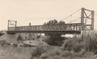
Saint-Marcel-sur-Aude
Saint-Marcel-sur-Aude and Marcorignan, Aude, France - Aude River
| Bridgemeister ID: | 6744 (added 2021-10-23) |
| Name: | Saint-Marcel-sur-Aude |
| Location: | Saint-Marcel-sur-Aude and Marcorignan, Aude, France |
| Crossing: | Aude River |
| Coordinates: | 43.234206 N 2.926368 E |
| Maps: | Acme, GeoHack, Google, OpenStreetMap |
| Status: | Removed |
| Main Cables: | Wire (steel) |
| Suspended Spans: | 1 |
Notes:
- This bridge was likely a tempoary replacement for the 1929 concrete bridge that collapsed at this location in 1954.
- At former location of 1834 Saint-Marcel-sur-Aude - Saint-Marcel-sur-Aude and Marcorignan, Aude, France.
Saint-Mesmin
Saint-Mesmin, Dordogne, France - Auvézère River
| Bridgemeister ID: | 5592 (added 2020-12-23) |
| Name: | Saint-Mesmin |
| Location: | Saint-Mesmin, Dordogne, France |
| Crossing: | Auvézère River |
| At or Near Feature: | Cascade du Saut Ruban |
| Coordinates: | 45.354308 N 1.208481 E |
| Maps: | Acme, GeoHack, Google, OpenStreetMap |
| Use: | Footbridge |
| Status: | In use (last checked: 2020) |
| Main Cables: | Wire (steel) |
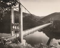
Saint-Projet
Arches, Mauriac vicinity, Cantal and Neuvic, Corrèze, France - Dordogne River
| Bridgemeister ID: | 5578 (added 2020-12-20) |
| Name: | Saint-Projet |
| Location: | Arches, Mauriac vicinity, Cantal and Neuvic, Corrèze, France |
| Crossing: | Dordogne River |
| Coordinates: | 45.286816 N 2.279728 E |
| Maps: | Acme, GeoHack, Google, OpenStreetMap |
| Use: | Vehicular (two-lane) |
| Status: | In use (last checked: 2021) |
| Main Cables: | Wire (steel) |
| Suspended Spans: | 1 |
Saint-Romain-des-Iles
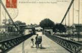
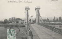
Saint-Romain-des-Iles, Saône-et-Loire and Ain, France - Saône River
| Bridgemeister ID: | 2130 (added 2006-10-22) |
| Name: | Saint-Romain-des-Iles |
| Location: | Saint-Romain-des-Iles, Saône-et-Loire and Ain, France |
| Crossing: | Saône River |
| References: | AAJ |
| Use: | Vehicular |
| Status: | Removed |
| Main Cables: | Wire |
Notes:
- Completed during or before 1840.
Saint-Symphorien
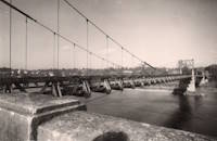
Tours, Indre-et-Loire, France - Loire River
| Bridgemeister ID: | 7839 (added 2023-09-03) |
| Name: | Saint-Symphorien |
| Location: | Tours, Indre-et-Loire, France |
| Crossing: | Loire River |
| At or Near Feature: | l'Île Aucard |
| Coordinates: | 47.398291 N 0.692937 E |
| Maps: | Acme, GeoHack, Google, OpenStreetMap |
| Status: | Replaced |
| Main Cables: | Wire (steel) |
| Suspended Spans: | 3 |
| Main Spans: | 3 |
Notes:
- This is a replacement for the three-span southern Saint-Symphorien bridge. It's unclear if this wood-towered bridge is a result of the 1943 reconstruction following the 1940 French army destruction of the bridge or the reconstruction following the 1944 German army destruction of the bridge.
- Replaced 1847 Saint-Symphorien - Tours, Indre-et-Loire, France.
- Connects to 1847 Saint-Symphorien - Tours, Indre-et-Loire, France. It's unclear whether the northern two-span Saint-Symphorien bridge was similarly reconstructed in the 1940s.
- Replaced by 1963 Saint-Symphorien - Tours, Indre-et-Loire, France.
External Links:
Saint-Vallier
Saint-Vallier, Drôme, France - Rhône River
| Bridgemeister ID: | 1754 (added 2005-04-20) |
| Name: | Saint-Vallier |
| Location: | Saint-Vallier, Drôme, France |
| Crossing: | Rhône River |
| Use: | Vehicular |
| Status: | Removed |
| Main Cables: | Wire (iron) |
Notes:
- Likely completed early 1830s.
- Similar to 1830 Bourg-Saint-Andéol - Bourg-Saint-Andéol, Ardèche, France.
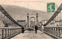
Saint-Vit
Saint-Vit and Roset-Fluans, Doubs, France - Doubs River
| Bridgemeister ID: | 2228 (added 2007-03-18) |
| Name: | Saint-Vit |
| Location: | Saint-Vit and Roset-Fluans, Doubs, France |
| Crossing: | Doubs River |
| Use: | Vehicular |
| Status: | Removed |
| Main Cables: | Wire |
Notes:
- See (suspension bridge) - Saint-Vit and Roset-Fluans, Doubs, France. Unclear if one bridge replaced the other at the same location.
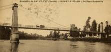
Sainte-Livrade
Sainte-Livrade-sur-Lot, Lot-et-Garonne, France - Lot River
| Bridgemeister ID: | 7317 (added 2022-08-30) |
| Name: | Sainte-Livrade |
| Location: | Sainte-Livrade-sur-Lot, Lot-et-Garonne, France |
| Crossing: | Lot River |
| Coordinates: | 44.402316 N 0.586925 E |
| Maps: | Acme, GeoHack, Google, OpenStreetMap |
| Use: | Vehicular |
| Status: | Removed |
External Links:
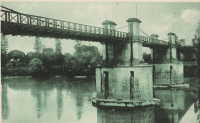
Sair Sapata
Bhopal, Madhya Pradesh, India - Upper Lake
| Bridgemeister ID: | 3094 (added 2019-10-27) |
| Name: | Sair Sapata |
| Location: | Bhopal, Madhya Pradesh, India |
| Crossing: | Upper Lake |
| Coordinates: | 23.215256 N 77.375853 E |
| Maps: | Acme, GeoHack, Google, OpenStreetMap |
| Status: | In use (last checked: 2019) |
| Main Cables: | Wire (steel) |
| Suspended Spans: | 3 |
| Main Span: | 1 |
| Side Spans: | 2 |
Sakanagafuchitsuri
Yamakiha Keihokushuzancho, Ukyo Ward, Kyoto, Japan - Katsura River
| Bridgemeister ID: | 7433 (added 2022-12-10) |
| Name: | Sakanagafuchitsuri |
| Also Known As: | 魚ヶ渕吊り橋, Uogafuchi |
| Location: | Yamakiha Keihokushuzancho, Ukyo Ward, Kyoto, Japan |
| Crossing: | Katsura River |
| Coordinates: | 35.140886 N 135.630193 E |
| Maps: | Acme, GeoHack, Google, OpenStreetMap |
| Use: | Vehicular |
| Status: | In use (last checked: 2022) |
| Main Cables: | Wire (steel) |
| Suspended Spans: | 1 |
Saldaña
Saldaña, Tolima, Colombia - Rio Saldaña
| Bridgemeister ID: | 7088 (added 2022-05-29) |
| Name: | Saldaña |
| Location: | Saldaña, Tolima, Colombia |
| Crossing: | Rio Saldaña |
| Coordinates: | 3.934620 N 75.018847 W |
| Maps: | Acme, GeoHack, Google, OpenStreetMap |
| Use: | Vehicular (one-lane) |
| Status: | Removed |
| Main Cables: | Wire (steel) |
| Suspended Spans: | 1 |
External Links:
- Facebook - PUENTE FERROVIARIO Y DE AUTOMOTORES DE SALDAÑA TOLIMA COLOMBIA. Image of the bridge, posted July 2013.
- Facebook - PUENTE SALDAÑA. Image of the bridge, posted May 2018.
Salies-du-Salat
Salies-du-Salat, Haute-Garonne, France - Salat River
| Bridgemeister ID: | 2058 (added 2006-06-03) |
| Name: | Salies-du-Salat |
| Location: | Salies-du-Salat, Haute-Garonne, France |
| Crossing: | Salat River |
| Use: | Vehicular (one-lane) |
| Status: | Removed |
| Main Cables: | Wire |
| Suspended Spans: | 1 |
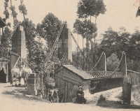
| Bridgemeister ID: | 5755 (added 2021-04-04) |
| Name: | Saling Ban Kaeng |
| Also Known As: | สะพานสลิงบ้านแก่ง |
| Location: | Ban Kaeng, Tron District, Uttaradit, Thailand |
| Crossing: | Nan River |
| Coordinates: | 17.443753 N 100.137239 E |
| Maps: | Acme, GeoHack, Google, OpenStreetMap |
| Use: | Footbridge |
| Status: | In use (last checked: 2021) |
| Main Cables: | Wire (steel) |
| Suspended Spans: | 1 |
| Main Span: | 1 x 242 meters (794 feet) estimated |
Salubalo
Salubalo, Sumarorong, Mamasa Regency, West Sulawesi, Indonesia - Mamasa River
| Bridgemeister ID: | 6839 (added 2022-01-01) |
| Name: | Salubalo |
| Location: | Salubalo, Sumarorong, Mamasa Regency, West Sulawesi, Indonesia |
| Crossing: | Mamasa River |
| Coordinates: | 3.131056 S 119.300610 E |
| Maps: | Acme, GeoHack, Google, OpenStreetMap |
| Use: | Footbridge |
| Status: | In use (last checked: 2021) |
| Main Cables: | Wire (steel) |
| Main Span: | 1 x 53.6 meters (176 feet) estimated |
External Links:
Samain
Saint-léger-aux-Bois vicinity, Oise, France - Oise River
| Bridgemeister ID: | 1817 (added 2005-05-21) |
| Name: | Samain |
| Location: | Saint-léger-aux-Bois vicinity, Oise, France |
| Crossing: | Oise River |
| Use: | Vehicular (one-lane) |
| Status: | Derelict |
External Links:
- Balade vers les étangs et l'Oise (link reported not working). Built during World War I by the Germans.
Samoli
Samoli, Himachal Pradesh, India - Pabbar River
| Bridgemeister ID: | 5384 (added 2020-11-25) |
| Name: | Samoli |
| Also Known As: | समोली |
| Location: | Samoli, Himachal Pradesh, India |
| Crossing: | Pabbar River |
| Coordinates: | 31.202813 N 77.770440 E |
| Maps: | Acme, GeoHack, Google, OpenStreetMap |
| Use: | Vehicular (one-lane) |
| Status: | In use (last checked: 2020) |
| Main Cables: | Wire (steel) |
| Suspended Spans: | 1 |
Samste
Samste, Bhutan
| Bridgemeister ID: | 4377 (added 2020-04-12) |
| Name: | Samste |
| Location: | Samste, Bhutan |
| Coordinates: | 26.926933 N 89.042624 E |
| Maps: | Acme, GeoHack, Google, OpenStreetMap |
| Use: | Vehicular (one-lane) |
| Status: | In use (last checked: 2019) |
| Main Cables: | Wire (steel) |
| Suspended Spans: | 2 |
| Main Spans: | 1 x 124.5 meters (408.5 feet) estimated, 1 x 115.5 meters (378.9 feet) estimated |
San Cristóbal
San Cristóbal, Medellin, Antioquia, Colombia - Quebrada Iguana
| Bridgemeister ID: | 6848 (added 2022-01-01) |
| Name: | San Cristóbal |
| Location: | San Cristóbal, Medellin, Antioquia, Colombia |
| Crossing: | Quebrada Iguana |
| Coordinates: | 6.276767 N 75.635926 W |
| Maps: | Acme, GeoHack, Google, OpenStreetMap |
| Use: | Footbridge |
| Status: | In use (last checked: 2021) |
| Main Cables: | Wire (steel) |
| Suspended Spans: | 1 |
| Main Span: | 1 |
San Francisco
Uchiza, Peru
| Bridgemeister ID: | 7470 (added 2022-12-25) |
| Name: | San Francisco |
| Location: | Uchiza, Peru |
| Coordinates: | 8.486166 S 76.463191 W |
| Maps: | Acme, GeoHack, Google, OpenStreetMap |
| Use: | Vehicular (one-lane) |
| Status: | In use |
| Main Cables: | Wire (steel) |
| Suspended Spans: | 1 |
| Main Span: | 1 x 145 meters (475.7 feet) estimated |
External Links:
- Facebook. Post with several images of deck refurbishment, posted July 2, 2021.
- Facebook. Post with several images of ongoing work around the bridge, posted June 23, 2021.
- Facebook. Post with several images of the finished work on and around the bridge, posted August 4, 2021.
- Google Maps - Puente San Francisco. Several images of the bridge.
- Wikimedia - Puente San Francisco. Image of the bridge, 2007.
San Isidro de Picará
El Pintado, Filadelfia, Caldas, Colombia - Cauca River
| Bridgemeister ID: | 2020 (added 2006-01-14) |
| Name: | San Isidro de Picará |
| Also Known As: | Pintado |
| Location: | El Pintado, Filadelfia, Caldas, Colombia |
| Crossing: | Cauca River |
| Coordinates: | 5.331773 N 75.636210 W |
| Maps: | Acme, GeoHack, Google, OpenStreetMap |
| Use: | Vehicular (one-lane) |
| Status: | Restricted to foot traffic (last checked: 2005) |
| Main Cables: | Wire |
| Suspended Spans: | 1 |
Notes:
- Likely completed 1885 or 1886.
San Luis de Shuaro
San Luis de Shuaro, Peru
San Miguel
Cepitá, Santander, Colombia
San Miguel
Jauja, Peru - Mantaro River
| Bridgemeister ID: | 5966 (added 2021-06-30) |
| Name: | San Miguel |
| Location: | Jauja, Peru |
| Crossing: | Mantaro River |
| Coordinates: | 11.800599 S 75.483507 W |
| Maps: | Acme, GeoHack, Google, OpenStreetMap |
| Status: | Derelict (last checked: 2019) |
| Main Cables: | Wire |
| Suspended Spans: | 1 |
Sanmai
Yumoto, Hakone, Kanagawa, Japan - Haya River
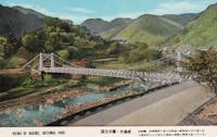
| Bridgemeister ID: | 7906 (added 2023-10-21) |
| Name: | Sanmai |
| Location: | Yumoto, Hakone, Kanagawa, Japan |
| Crossing: | Haya River |
| Coordinates: | 35.233472 N 139.108694 E |
| Maps: | Acme, GeoHack, Google, OpenStreetMap |
| Use: | Vehicular |
| Status: | Removed |
| Suspended Spans: | 1 |
Santa Elena
Santa Elena, Congüime, Ecuador - Rio Nangaritza
| Bridgemeister ID: | 7724 (added 2023-07-07) |
| Name: | Santa Elena |
| Location: | Santa Elena, Congüime, Ecuador |
| Crossing: | Rio Nangaritza |
| Coordinates: | 4.078250 S 78.643139 W |
| Maps: | Acme, GeoHack, Google, OpenStreetMap |
| Use: | Footbridge |
| Status: | Extant (last checked: 2023) |
| Main Span: | 1 |
Notes:
Santo Cristo
Quiches, Ancash and La Libertad, Peru - Marañón River
| Bridgemeister ID: | 7242 (added 2022-07-16) |
| Name: | Santo Cristo |
| Location: | Quiches, Ancash and La Libertad, Peru |
| Crossing: | Marañón River |
| Coordinates: | 8.372299 S 77.449082 W |
| Maps: | Acme, GeoHack, Google, OpenStreetMap |
| Status: | Extant (last checked: 2020) |
| Main Span: | 1 x 72 meters (236.2 feet) estimated |
Notes:
- Appears to be in derelict condition since the late 2010s.
External Links:
Saprai
Sayogi and Shiwa, Himachal Pradesh, India - Beas River
| Bridgemeister ID: | 5250 (added 2020-11-07) |
| Name: | Saprai |
| Also Known As: | सप्राई ब्रिज |
| Location: | Sayogi and Shiwa, Himachal Pradesh, India |
| Crossing: | Beas River |
| Coordinates: | 31.687359 N 77.045802 E |
| Maps: | Acme, GeoHack, Google, OpenStreetMap |
| Use: | Vehicular (one-lane) |
| Status: | In use (last checked: 2020) |
| Main Cables: | Wire (steel) |
| Suspended Spans: | 1 |
Saravella
Lawata vicinity, Khyber Pakhtunkhwa, Pakistan - Bara River
| Bridgemeister ID: | 7415 (added 2022-12-06) |
| Name: | Saravella |
| Location: | Lawata vicinity, Khyber Pakhtunkhwa, Pakistan |
| Crossing: | Bara River |
| Coordinates: | 33.908843 N 71.064459 E |
| Maps: | Acme, GeoHack, Google, OpenStreetMap |
| Status: | In use (last checked: 2022) |
| Suspended Spans: | 1 |
External Links:
- Twitter. Video of the refurbished bridge, posted September 8, 2022.
Sardar Hayat Khan
Pirkot, Azad Jammu and Kashmir, Pakistan
Sarunami
Kawanehon, Shizuoka, Japan - Sumata River
| Bridgemeister ID: | 5336 (added 2020-11-12) |
| Name: | Sarunami |
| Also Known As: | 猿並橋 |
| Location: | Kawanehon, Shizuoka, Japan |
| Crossing: | Sumata River |
| Coordinates: | 35.181160 N 138.122223 E |
| Maps: | Acme, GeoHack, Google, OpenStreetMap |
| Use: | Footbridge |
| Status: | In use (last checked: 2020) |
| Main Cables: | Wire (steel) |
| Bridgemeister ID: | 7526 (added 2023-01-14) |
| Name: | Sarunokazura |
| Also Known As: | 猿のかずら橋, Monkey |
| Location: | Yamagori Fukiaicho, Chuo Ward, Kobe, Hyogo, Japan |
| At or Near Feature: | Nunobiki Falls |
| Coordinates: | 34.710285 N 135.193328 E |
| Maps: | Acme, GeoHack, Google, OpenStreetMap |
| Use: | Footbridge |
| Status: | In use (last checked: 2021) |
| Main Cables: | Wire (steel) |
| Suspended Spans: | 1 |
Sasabue
Minakami, Gunma, Japan - Tone River
| Bridgemeister ID: | 6091 (added 2021-07-04) |
| Name: | Sasabue |
| Also Known As: | 笹笛橋 |
| Location: | Minakami, Gunma, Japan |
| Crossing: | Tone River |
| At or Near Feature: | Sasabuedoji Park - 笹笛童子公園 |
| Coordinates: | 36.761104 N 138.970816 E |
| Maps: | Acme, GeoHack, Google, OpenStreetMap |
| Use: | Footbridge |
| Status: | In use (last checked: 2022) |
| Main Cables: | Wire (steel) |
| Suspended Spans: | 1 |
| Main Span: | 1 |
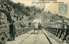
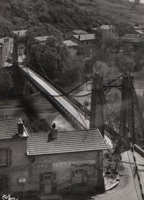
Saut du Loup
Le Saut Du Loup and Beaulieu, Puy-De-Dôme, France - Allier River
| Bridgemeister ID: | 1648 (added 2005-03-19) |
| Name: | Saut du Loup |
| Location: | Le Saut Du Loup and Beaulieu, Puy-De-Dôme, France |
| Crossing: | Allier River |
| Coordinates: | 45.452584 N 3.303547 E |
| Maps: | Acme, GeoHack, Google, OpenStreetMap |
| Use: | Vehicular (one-lane), with walkway |
| Status: | Removed, c. 1960s |
| Main Cables: | Wire |
| Suspended Spans: | 1 |
Savignac-de-l'Isle
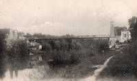
Savignac-de-l'Isle, Gironde, France - Isle River
| Bridgemeister ID: | 7846 (added 2023-09-04) |
| Name: | Savignac-de-l'Isle |
| Location: | Savignac-de-l'Isle, Gironde, France |
| Crossing: | Isle River |
| Coordinates: | 44.987175 N 0.233164 W |
| Maps: | Acme, GeoHack, Google, OpenStreetMap |
| Use: | Vehicular |
| Status: | Removed |
| Suspended Spans: | 1 |
Notes:
- Completed in the 1890s. It likely replaced another suspension bridge completed in 1840.
External Links:
Sawit
Jatitengah, Central Java, Indonesia
| Bridgemeister ID: | 3025 (added 2019-10-13) |
| Name: | Sawit |
| Location: | Jatitengah, Central Java, Indonesia |
| Coordinates: | 7.092778 S 111.060306 E |
| Maps: | Acme, GeoHack, Google, OpenStreetMap |
| Use: | Footbridge and Motorcycle |
| Status: | In use (last checked: 2018) |
| Main Cables: | Wire (steel) |
Säpilä
Säpilä, Finland - Kokemäenjoki
| Bridgemeister ID: | 3291 (added 2019-11-24) |
| Name: | Säpilä |
| Location: | Säpilä, Finland |
| Crossing: | Kokemäenjoki |
| Coordinates: | 61.307271 N 22.385716 E |
| Maps: | Acme, GeoHack, Google, OpenStreetMap |
| Use: | Footbridge |
| Status: | In use (last checked: 2021) |
| Main Cables: | Wire (steel) |
| Main Span: | 1 x 126 meters (413.4 feet) estimated |
Sörbron
Ljusne, Sweden
| Bridgemeister ID: | 7853 (added 2023-09-15) |
| Name: | Sörbron |
| Location: | Ljusne, Sweden |
| Coordinates: | 61.206789 N 17.121874 E |
| Maps: | Acme, GeoHack, Google, OpenStreetMap |
| Status: | Removed |
| Main Cables: | Wire (steel) |
| Suspended Spans: | 2 |
| Main Spans: | 2 |
Notes:
- The coordinates provided here appear to be one of the locations of this bridge. It was possibly relocated to a nearby location in the 1970s.
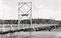
Sörnzig-Fischheim
Sörnzig and Fischheim, Saxony, Germany - Zwickauer Mulde River
| Bridgemeister ID: | 2260 (added 2007-01-12) |
| Name: | Sörnzig-Fischheim |
| Location: | Sörnzig and Fischheim, Saxony, Germany |
| Crossing: | Zwickauer Mulde River |
| Coordinates: | 51.021732 N 12.789948 E |
| Maps: | Acme, GeoHack, Google, OpenStreetMap |
| Use: | Footbridge |
| Status: | Destroyed, 1954, by flood |
| Suspended Spans: | 1 |
Notes:
- Completed 1800s.
- Replaced by 1958 Sörnzig-Fischheim - Sörnzig and Fischheim, Saxony, Germany.
School Street
Chester, Vermont, USA - Williams River Middle Branch
| Bridgemeister ID: | 2532 (added 2011-12-25) |
| Name: | School Street |
| Location: | Chester, Vermont, USA |
| Crossing: | Williams River Middle Branch |
| Coordinates: | 43.2628 N 72.59928 W |
| Maps: | Acme, GeoHack, Google, OpenStreetMap |
| Use: | Footbridge |
| Status: | In use (last checked: 2009) |
| Main Cables: | Wire (steel) |
Notes:
- Sign at bridge states: "Destroyed August 1976, Rebuilt 1977"
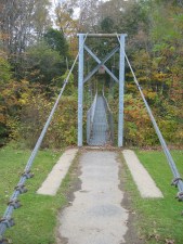
Schwanenbrücke
Halle, Sachsen-Anhalt, Germany - Wilde Saale River
| Bridgemeister ID: | 2248 (added 2007-03-28) |
| Name: | Schwanenbrücke |
| Location: | Halle, Sachsen-Anhalt, Germany |
| Crossing: | Wilde Saale River |
| Coordinates: | 51.494189 N 11.945050 E |
| Maps: | Acme, GeoHack, Google, OpenStreetMap |
| Use: | Footbridge |
| Status: | In use (last checked: 2019) |
| Main Cables: | Wire (steel) |
Notes:
Sector
Sector, Romney, West Virginia, USA - South Branch Potomac River
| Bridgemeister ID: | 4922 (added 2020-07-26) |
| Name: | Sector |
| Location: | Sector, Romney, West Virginia, USA |
| Crossing: | South Branch Potomac River |
| Coordinates: | 39.227030 N 78.853329 W |
| Maps: | Acme, GeoHack, Google, OpenStreetMap |
| References: | AAJ |
| Use: | Vehicular |
| Status: | Removed |
| Main Cables: | Wire |
| Suspended Spans: | 2 |
| Main Spans: | 1 x 18.3 meters (60 feet), 1 x 27.4 meters (90 feet) |
Notes:
- Coordinates are approximate location of this bridge, believed to be where present day (2020) Fleming-Sector Road would have continued to intersect the river. Location was also known as Glebe Station.
External Links:
| Bridgemeister ID: | 4401 (added 2020-04-18) |
| Name: | Seland |
| Location: | Tonstad vicinity, Sirdal, Agder, Norway |
| Crossing: | Sira |
| Coordinates: | 58.697039 N 6.727609 E |
| Maps: | Acme, GeoHack, Google, kart.1881.no, OpenStreetMap |
| Use: | Vehicular |
| Status: | Removed |
| Main Span: | 1 x 36 meters (118.1 feet) estimated |
Notes:
- Removed prior to 2004.
Semuc Champey
Lanquín vicinity, Guatemala - Rio Cahabon
| Bridgemeister ID: | 2701 (added 2019-06-15) |
| Name: | Semuc Champey |
| Location: | Lanquín vicinity, Guatemala |
| Crossing: | Rio Cahabon |
| Coordinates: | 15.538168 N 89.954009 W |
| Maps: | Acme, GeoHack, Google, OpenStreetMap |
| Use: | Vehicular (one-lane) |
| Status: | In use (last checked: 2018) |
| Main Cables: | Wire (steel) |
| Suspended Spans: | 1 |
Do you have any information or photos for these bridges that you would like to share? Please email david.denenberg@bridgemeister.com.
