Suspension Bridges of Ardèche
This is a list of all 39 bridges from the suspension bridge inventory for Ardèche in France. Wherever you see a Bridgemeister ID number click it to isolate the bridge on its own page.
Related Lists:
1822: (footbridge)
Annonay, Ardèche, France - Cance River
| Bridgemeister ID: | 375 (added before 2003) |
| Year Completed: | 1822 |
| Name: | (footbridge) |
| Location: | Annonay, Ardèche, France |
| Crossing: | Cance River |
| Principals: | Marc Seguin, Camille Seguin, Jules Seguin, Paul Seguin, Charles Seguin |
| References: | AAJ, BBR, GHD, LAB, TTSB |
| Use: | Footbridge |
| Status: | Removed |
| Main Cables: | Wire (iron) |
| Suspended Spans: | 1 |
| Main Span: | 1 x 18 meters (59.1 feet) |
Notes:
- Test structure, but recognized as first wire bridge in France.
- See 1865 Moulin - Vernosc-lès-Annonay, Ardèche, France.
External Links:
1825: Tain-Tournon
Tournon-sur-Rhône, Ardèche and Tain, Drôme, France - Rhône River
| Bridgemeister ID: | 378 (added before 2003) |
| Year Completed: | 1825 |
| Name: | Tain-Tournon |
| Location: | Tournon-sur-Rhône, Ardèche and Tain, Drôme, France |
| Crossing: | Rhône River |
| Principals: | Marc Seguin |
| References: | AAJ, ASB, BBR, BPF, GHD, LAB, MOS, PTS2, TTSB |
| Use: | Vehicular |
| Status: | Removed, 1965 |
| Main Cables: | Wire (iron) |
| Suspended Spans: | 2 |
| Main Spans: | 2 x 85 meters (278.88 feet) |
| Deck width: | 13.75 feet |
Notes:
- Often credited as being the first large wire suspension bridge in France (and elsewhere). Rebuilt 1847 as a footbridge. Removed 1965.
- Near 1849 Marc Seguin - Tournon-sur-Rhône, Ardèche and Tain-L'Hermitage, Drôme, France.
- Near 1958 Gustave Toursier - Tournon-sur-Rhône, Ardèche and Tain-L'Hermitage, Drôme, France.
External Links:
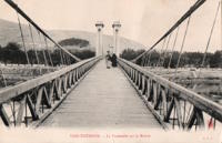
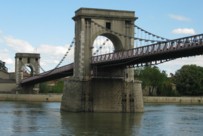
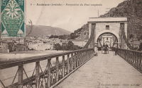
1827: Andance
Andance, Ardèche and Andancette, Drôme, France - Rhône River
| Bridgemeister ID: | 976 (added 2003-11-14) |
| Year Completed: | 1827 |
| Name: | Andance |
| Location: | Andance, Ardèche and Andancette, Drôme, France |
| Crossing: | Rhône River |
| Coordinates: | 45.242194 N 4.801638 E |
| Maps: | Acme, GeoHack, Google, OpenStreetMap |
| Principals: | Marc Seguin |
| References: | AAJ, ASB |
| Use: | Vehicular (one-lane) |
| Status: | In use (last checked: 2009) |
| Main Cables: | Wire (iron) |
| Suspended Spans: | 2 |
| Main Spans: | 2 |
Notes:
- Destroyed August 30, 1944. Rebuilt 1946.
External Links:
1828: Doux
St Jean de Muzols and Tournon-sur-Rhône, Ardèche, France - Doux River
| Bridgemeister ID: | 1984 (added 2005-12-02) |
| Year Completed: | 1828 |
| Name: | Doux |
| Location: | St Jean de Muzols and Tournon-sur-Rhône, Ardèche, France |
| Crossing: | Doux River |
| Coordinates: | 45.074384 N 4.816741 E |
| Maps: | Acme, GeoHack, Google, OpenStreetMap |
| Status: | Removed, 1857 |
Notes:
External Links:
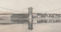
1828: Sablons
Sablons, Isère and Serrières, Ardèche, France - Rhône River
| Bridgemeister ID: | 890 (added 2003-09-06) |
| Year Completed: | 1828 |
| Name: | Sablons |
| Location: | Sablons, Isère and Serrières, Ardèche, France |
| Crossing: | Rhône River |
| Principals: | Marc Seguin |
| References: | AAJ, ASB |
| Use: | Vehicular |
| Status: | Replaced, 1933 |
| Main Cables: | Wire (iron) |
| Main Spans: | 2 x 101 meters (331.38 feet) |
| Deck width: | 13.12 feet |
Notes:
External Links:
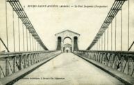
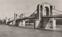
1830: Bourg-Saint-Andéol
Bourg-Saint-Andéol, Ardèche, France - Rhône River
| Bridgemeister ID: | 1719 (added 2005-04-05) |
| Year Completed: | 1830 |
| Name: | Bourg-Saint-Andéol |
| Location: | Bourg-Saint-Andéol, Ardèche, France |
| Crossing: | Rhône River |
| References: | AAJ |
| Use: | Vehicular |
| Status: | Replaced, 1971 |
| Main Cables: | Wire (iron) |
| Suspended Spans: | 3 |
| Main Spans: | 1 x 88.9 meters (291.7 feet), 1 x 85.7 meters (281.2 feet), 1 x 87 meters (285.4 feet) |
Notes:
- 1944: Heavily damaged.
- 1945: Repaired and reopened.
- Similar to Saint-Vallier - Saint-Vallier, Drôme, France.
External Links:
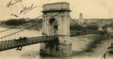
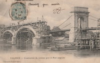
1830: Valence
Valence, Drôme and Guilherand-Granges, Ardèche, France - Rhône River
| Bridgemeister ID: | 631 (added 2003-01-20) |
| Year Completed: | 1830 |
| Name: | Valence |
| Location: | Valence, Drôme and Guilherand-Granges, Ardèche, France |
| Crossing: | Rhône River |
| Coordinates: | 44.932022 N 4.882951 E |
| Maps: | Acme, GeoHack, Google, OpenStreetMap |
| Principals: | Marc Seguin |
| References: | ASB, PTS2 |
| Use: | Vehicular |
| Status: | Removed |
| Main Cables: | Wire (iron) |
| Suspended Spans: | 2 |
| Main Spans: | 2 x 110 meters (360.9 feet) |
| Deck width: | 7 meters |
Notes:
- Two side spans meeting at a single midstream tower.
- Later at same location 1949 (footbridge) - Valence, Drôme and Guilherand-Granges, Ardèche, France.
External Links:
1832: Les Vans
Les Vans and Les Assions, Ardèche, France - Chassezac River
| Bridgemeister ID: | 2415 (added 2007-12-31) |
| Year Completed: | 1832 |
| Name: | Les Vans |
| Location: | Les Vans and Les Assions, Ardèche, France |
| Crossing: | Chassezac River |
| Coordinates: | 44.416248 N 4.155727 E |
| Maps: | Acme, GeoHack, Google, OpenStreetMap |
| Use: | Vehicular |
| Status: | Removed |
| Suspended Spans: | 1 |
External Links:

1832: Vals-les-bains
Vals-les-bains and Labégude, Ardèche, France - Ardèche River
| Bridgemeister ID: | 1761 (added 2005-04-22) |
| Year Completed: | 1832 |
| Name: | Vals-les-bains |
| Location: | Vals-les-bains and Labégude, Ardèche, France |
| Crossing: | Ardèche River |
| References: | AAJ |
| Use: | Vehicular |
| Main Cables: | Wire (iron) |
Notes:
- AAJ notes the contract was let in late 1831 and guesses at 1833 as the year of completion. 1832 is more likely given the rate at which these early iron wire French bridges were constructed.
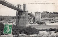
1837: Vallon
Vallon-Pont-D'arc and Salavas, Ardèche, France - Ardèche River
| Bridgemeister ID: | 1766 (added 2005-04-22) |
| Year Completed: | 1837 |
| Name: | Vallon |
| Also Known As: | Salavas |
| Location: | Vallon-Pont-D'arc and Salavas, Ardèche, France |
| Crossing: | Ardèche River |
| Coordinates: | 44.398624 N 4.385082 E |
| Maps: | Acme, GeoHack, Google, OpenStreetMap |
| References: | AAJ |
| Use: | Vehicular |
| Status: | Removed |
| Main Cables: | Wire |
| Main Spans: | 2 |
Notes:
- The current (2022) bridge at this location is built on the piers of the suspension bridge.
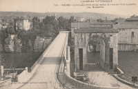
1838: Ruoms
Ruoms and Labeaume, Ardèche, France - Ardèche River
| Bridgemeister ID: | 7314 (added 2022-08-28) |
| Year Completed: | 1838 |
| Name: | Ruoms |
| Also Known As: | Les Brasseries |
| Location: | Ruoms and Labeaume, Ardèche, France |
| Crossing: | Ardèche River |
| Coordinates: | 44.456715 N 4.334095 E |
| Maps: | Acme, GeoHack, Google, OpenStreetMap |
| Use: | Vehicular |
| Status: | Only towers remain (last checked: 2022) |
| Main Span: | 1 |
External Links:
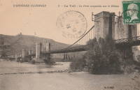
1839: Teil
Le Teil, Ardèche and Montélimar, Drôme, France - Rhône River
| Bridgemeister ID: | 1733 (added 2005-04-06) |
| Year Completed: | 1839 |
| Name: | Teil |
| Location: | Le Teil, Ardèche and Montélimar, Drôme, France |
| Crossing: | Rhône River |
| Coordinates: | 44.552213 N 4.691909 E |
| Maps: | Acme, GeoHack, Google, OpenStreetMap |
| References: | AAJ |
| Status: | Replaced, 1931 |
| Main Cables: | Wire (iron) |
| Suspended Spans: | 4 |
| Main Spans: | 4 |
| Deck width: | 19.68 feet |
Notes:
- Damaged by flood, 1840. Rebuilt and reopened, 1843. Damaged by floods, 1856 and 1881.
- Replaced by 1931 Teil - Le Teil, Ardèche and Montélimar, Drôme, France.
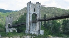
1842: Rochemaure
Rochemaure, Ardèche and Ancône, Drôme, France - Rhône River
| Bridgemeister ID: | 950 (added 2003-10-31) |
| Year Completed: | 1842 |
| Name: | Rochemaure |
| Location: | Rochemaure, Ardèche and Ancône, Drôme, France |
| Crossing: | Rhône River |
| Coordinates: | 44.583117 N 4.71035 E |
| Maps: | Acme, GeoHack, Google, OpenStreetMap |
| References: | BPF |
| Use: | Vehicular (one-lane) |
| Status: | Only towers remain (last checked: 2021) |
| Main Cables: | Wire |
| Suspended Spans: | 2 |
| Main Spans: | 2 |
Notes:
- Failed 1856, rebuilt 1858, destroyed 1940 (war), rebuilt 1942, destroyed 1944 (war), rebuilt 1946, restricted to pedestrians, 1983. Abandoned in the 1990s. Stood in a derelict state for several years.
- 2013: Work is completed to replace the derelict deck with a suspension footbridge that sits on the original piers but does not use the towers of the former suspension bridge. This new installation is tracked separately.
- Replaced by 2013 Himalayenne (Rochemaure, Himalayan) - Rochemaure, Ardèche, France.
External Links:
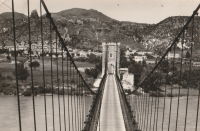
1846: Montpezat
Montpezat-sous-Bauzon, Ardèche, France - Fontaulière River
| Bridgemeister ID: | 2159 (added 2006-12-10) |
| Year Completed: | 1846 |
| Name: | Montpezat |
| Location: | Montpezat-sous-Bauzon, Ardèche, France |
| Crossing: | Fontaulière River |
| Coordinates: | 44.704903 N 4.216498 E |
| Maps: | Acme, GeoHack, Google, OpenStreetMap |
| Use: | Vehicular (one-lane) |
| Status: | Demolished, 1912 |
| Main Cables: | Wire |
| Suspended Spans: | 1 |
External Links:
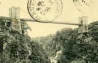
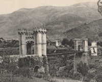
1847: Donzère
Donzère, Drôme and Viviers, Ardèche, France - Rhône River
| Bridgemeister ID: | 970 (added 2003-11-13) |
| Year Completed: | 1847 |
| Name: | Donzère |
| Also Known As: | Robinet |
| Location: | Donzère, Drôme and Viviers, Ardèche, France |
| Crossing: | Rhône River |
| Coordinates: | 44.452367 N 4.6981 E |
| Maps: | Acme, GeoHack, Google, OpenStreetMap |
| References: | AAJ, BPF |
| Use: | Vehicular (one-lane) |
| Status: | In use (last checked: 2021) |
| Main Cables: | Wire (iron) |
| Suspended Spans: | 3 |
| Main Spans: | 3 x 100 meters (328.1 feet) estimated |
External Links:
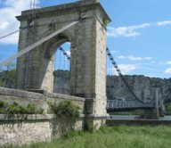
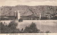
1847: Viviers
Viviers, Ardèche and Drôme, France - Rhône River
| Bridgemeister ID: | 1961 (added 2005-11-05) |
| Year Completed: | 1847 |
| Name: | Viviers |
| Location: | Viviers, Ardèche and Drôme, France |
| Crossing: | Rhône River |
| Coordinates: | 44.481667 N 4.699698 E |
| Maps: | Acme, GeoHack, Google, OpenStreetMap |
| References: | AAJ |
| Use: | Vehicular (one-lane) |
| Status: | Destroyed, 1944 |
| Main Cables: | Wire |
Notes:
- Later at same location 1954 Viviers - Viviers, Ardèche and Châteauneuf-Du-Rhône, Drôme, France.
External Links:
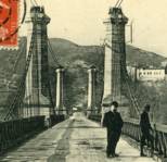
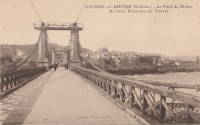
1849: Le Pouzin
Le Pouzin, Ardèche, France - Rhône River
| Bridgemeister ID: | 1153 (added 2004-01-18) |
| Year Completed: | 1849 |
| Name: | Le Pouzin |
| Location: | Le Pouzin, Ardèche, France |
| Crossing: | Rhône River |
| Principals: | Adolphe Boulland |
| References: | AAJ |
| Use: | Vehicular |
| Status: | Destroyed, 1940 |
| Main Cables: | Wire (iron) |
| Suspended Spans: | 3 |
| Main Spans: | 3 x 100 meters (328.1 feet) |
External Links:
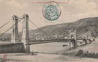
1849: Marc Seguin
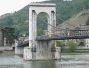
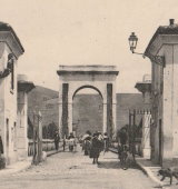
Tournon-sur-Rhône, Ardèche and Tain-L'Hermitage, Drôme, France - Rhône River
| Bridgemeister ID: | 975 (added 2003-11-14) |
| Year Completed: | 1849 |
| Name: | Marc Seguin |
| Location: | Tournon-sur-Rhône, Ardèche and Tain-L'Hermitage, Drôme, France |
| Crossing: | Rhône River |
| Coordinates: | 45.068638 N 4.834972 E |
| Maps: | Acme, GeoHack, Google, OpenStreetMap |
| Principals: | Marc Seguin |
| References: | AAJ, BPF |
| Use: | Vehicular |
| Status: | Restricted to foot traffic (last checked: 2021) |
| Main Cables: | Wire (iron) |
| Suspended Spans: | 2 |
| Main Spans: | 2 |
Notes:
- A second bridge at Tournon, by Seguin, approximately 100 meters downstream from his 1825 bridge. Restored 1989.
- Near 1825 Tain-Tournon - Tournon-sur-Rhône, Ardèche and Tain, Drôme, France.
- Near 1958 Gustave Toursier - Tournon-sur-Rhône, Ardèche and Tain-L'Hermitage, Drôme, France.
External Links:
1856: Ollières
Les Ollières-sur-Eyrieux, Ardèche, France - Eyrieux River
| Bridgemeister ID: | 4882 (added 2020-07-18) |
| Year Completed: | 1856 |
| Name: | Ollières |
| Location: | Les Ollières-sur-Eyrieux, Ardèche, France |
| Crossing: | Eyrieux River |
| Coordinates: | 44.804655 N 4.614687 E |
| Maps: | Acme, GeoHack, Google, OpenStreetMap |
| References: | AAJ |
| Use: | Vehicular |
| Status: | Removed |
Notes:
- AAJ assumes completion in 1856 based on an 18-month contract let in August 1854. Appears to have been a quite dramatic bridge, with very large castellated towers, on an alignment adjacent to the current twin-arch bridge.
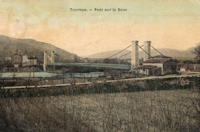
1859: Doux
St Jean de Muzols and Tournon-sur-Rhône, Ardèche, France - Doux River
| Bridgemeister ID: | 5661 (added 2021-01-01) |
| Year Completed: | 1859 |
| Name: | Doux |
| Location: | St Jean de Muzols and Tournon-sur-Rhône, Ardèche, France |
| Crossing: | Doux River |
| Coordinates: | 45.074919 N 4.816389 E |
| Maps: | Acme, GeoHack, Google, OpenStreetMap |
| References: | AAJ |
| Use: | Vehicular |
| Status: | Removed |
| Main Cables: | Wire |
| Suspended Spans: | 1 |
Notes:
External Links:
1865: Moulin
Vernosc-lès-Annonay, Ardèche, France - Cance River
| Bridgemeister ID: | 4553 (added 2020-05-31) |
| Year Completed: | 1865 |
| Name: | Moulin |
| Location: | Vernosc-lès-Annonay, Ardèche, France |
| Crossing: | Cance River |
| Coordinates: | 45.210908 N 4.703327 E |
| Maps: | Acme, GeoHack, Google, OpenStreetMap |
| Status: | Removed |
| Main Cables: | Wire (iron) |
| Suspended Spans: | 1 |
Notes:
- Structurae equates this bridge (which was replaced in 2012-2013) to the famous Seguin Brothers test structure at Annonay. Other sources suggest the derelict bridge replaced in 2012-2013 only dated to the 1860s. The detailed description and depiction of the Seguin's Annonay bridge in Tom F. Peters book on early 19th-century suspension bridges definitely does not resemble the 19th-century Moulin bridge. Peters describes the 1822-1823 Seguin bridge as a very narrow, very light, catwalk-style bridge. Peters additionally describes the main cables: "It had a single continuous parallel wire cable made of eight 1.23mm (no. 8 gauge) wires."
- Replaced by 2013 Moulin - Vernosc-lès-Annonay, Ardèche, France.
- See 1822 (footbridge) - Annonay, Ardèche, France.
External Links:
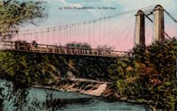
1891: Livron
Livron-sur-Drôme, Drôme and La Voulte-sur-Rhône, Ardèche, France - Petit Rhône River
| Bridgemeister ID: | 1806 (added 2005-05-19) |
| Year Completed: | 1891 |
| Name: | Livron |
| Location: | Livron-sur-Drôme, Drôme and La Voulte-sur-Rhône, Ardèche, France |
| Crossing: | Petit Rhône River |
| Coordinates: | 44.795194 N 4.796055 E |
| Maps: | Acme, GeoHack, Google, OpenStreetMap |
| Use: | Vehicular (one-lane) |
| Status: | In use (last checked: 2022) |
| Main Cables: | Wire |
| Suspended Spans: | 1 |
| Main Span: | 1 x 101 meters (331.4 feet) estimated |
Notes:
External Links:
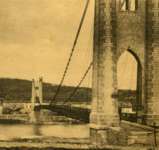
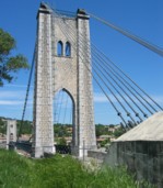
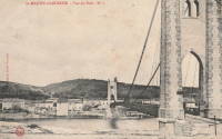
1905: Saint-Martin
Saint-Martin-d'Ardèche, Ardèche and Aiguèze, Gard, France - Ardèche River
| Bridgemeister ID: | 1523 (added 2004-10-10) |
| Year Completed: | 1905 |
| Name: | Saint-Martin |
| Location: | Saint-Martin-d'Ardèche, Ardèche and Aiguèze, Gard, France |
| Crossing: | Ardèche River |
| Coordinates: | 44.3007 N 4.567283 E |
| Maps: | Acme, GeoHack, Google, OpenStreetMap |
| Use: | Vehicular (one-lane) |
| Status: | In use (last checked: 2005) |
| Main Cables: | Wire |
| Suspended Spans: | 1 |
External Links:
1931: Teil
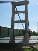
Le Teil, Ardèche and Montélimar, Drôme, France - Rhône River
| Bridgemeister ID: | 1549 (added 2004-11-13) |
| Year Completed: | 1931 |
| Name: | Teil |
| Location: | Le Teil, Ardèche and Montélimar, Drôme, France |
| Crossing: | Rhône River |
| Coordinates: | 44.5519 N 4.692617 E |
| Maps: | Acme, GeoHack, Google, OpenStreetMap |
| References: | AAJ, BPF |
| Use: | Vehicular (two-lane, heavy vehicles), with walkway |
| Status: | In use (last checked: 2005) |
| Main Cables: | Wire (steel) |
| Suspended Spans: | 1 |
| Main Span: | 1 x 235 meters (771 feet) |
Notes:
- Destroyed, 1944. Rebuilt, 1950.
- Replaced 1839 Teil - Le Teil, Ardèche and Montélimar, Drôme, France.
External Links:
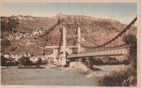
1933: Sablons
Sablons, Isère and Serrières, Ardèche, France - Rhône River
| Bridgemeister ID: | 891 (added 2003-09-06) |
| Year Completed: | 1933 |
| Name: | Sablons |
| Location: | Sablons, Isère and Serrières, Ardèche, France |
| Crossing: | Rhône River |
| Status: | Destroyed, 1944 |
Notes:
- Replaced 1828 Sablons - Sablons, Isère and Serrières, Ardèche, France.
- Replaced by 1951 Sablons - Sablons, Isère and Serrières, Ardèche, France.
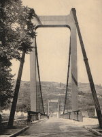
1936: Saint-Didier-sous-Aubenas
Saint-Didier-sous-Aubenas, Ardèche, France - Ardèche River
| Bridgemeister ID: | 2930 (added 2019-09-16) |
| Year Completed: | 1936 |
| Name: | Saint-Didier-sous-Aubenas |
| Location: | Saint-Didier-sous-Aubenas, Ardèche, France |
| Crossing: | Ardèche River |
| Coordinates: | 44.604219 N 4.419136 E |
| Maps: | Acme, GeoHack, Google, OpenStreetMap |
| Use: | Vehicular (two-lane) |
| Status: | Collapsed, 1995 |
| Main Cables: | Wire (steel) |
Notes:
- Collapsed, 1995. One tower remains.
- Replaced Saint-Didier-sous-Aubenas - Saint-Didier-sous-Aubenas, Ardèche, France.
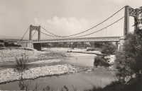
1949: (footbridge)
Valence, Drôme and Guilherand-Granges, Ardèche, France - Rhône River
| Bridgemeister ID: | 6517 (added 2021-08-27) |
| Year Completed: | 1949 |
| Name: | (footbridge) |
| Location: | Valence, Drôme and Guilherand-Granges, Ardèche, France |
| Crossing: | Rhône River |
| Coordinates: | 44.931773 N 4.883700 E |
| Maps: | Acme, GeoHack, Google, OpenStreetMap |
| Use: | Footbridge |
| Status: | Removed, 1960s |
| Main Cables: | Wire (steel) |
| Main Spans: | 2 |
Notes:
- At former location of 1830 Valence - Valence, Drôme and Guilherand-Granges, Ardèche, France.
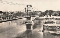
1951: Sablons
Sablons, Isère and Serrières, Ardèche, France - Rhône River
| Bridgemeister ID: | 892 (added 2003-09-06) |
| Year Completed: | 1951 |
| Name: | Sablons |
| Location: | Sablons, Isère and Serrières, Ardèche, France |
| Crossing: | Rhône River |
| Coordinates: | 45.318183 N 4.766867 E |
| Maps: | Acme, GeoHack, Google, OpenStreetMap |
| References: | BPF |
| Use: | Vehicular (two-lane, heavy vehicles), with walkway |
| Status: | In use (last checked: 2005) |
| Main Cables: | Wire (steel) |
| Suspended Spans: | 1 |
| Main Span: | 1 x 185 meters (607 feet) |
Notes:
External Links:
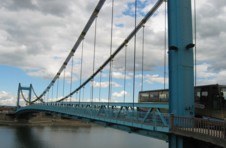
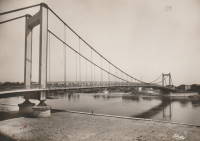
1954: Viviers
Viviers, Ardèche and Châteauneuf-Du-Rhône, Drôme, France - Rhône River
| Bridgemeister ID: | 1545 (added 2004-11-05) |
| Year Completed: | 1954 |
| Name: | Viviers |
| Location: | Viviers, Ardèche and Châteauneuf-Du-Rhône, Drôme, France |
| Crossing: | Rhône River |
| Coordinates: | 44.481583 N 4.698717 E |
| Maps: | Acme, GeoHack, Google, OpenStreetMap |
| Use: | Vehicular (two-lane, heavy vehicles), with walkway |
| Status: | In use (last checked: 2021) |
| Main Cables: | Wire (steel) |
| Suspended Spans: | 3 |
| Main Span: | 1 |
| Side Spans: | 2 |
Notes:
- At former location of 1847 Viviers - Viviers, Ardèche and Drôme, France.
External Links:
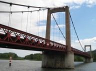
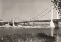
1958: Gustave Toursier
Tournon-sur-Rhône, Ardèche and Tain-L'Hermitage, Drôme, France - Rhône River
| Bridgemeister ID: | 1455 (added 2004-08-14) |
| Year Completed: | 1958 |
| Name: | Gustave Toursier |
| Location: | Tournon-sur-Rhône, Ardèche and Tain-L'Hermitage, Drôme, France |
| Crossing: | Rhône River |
| Coordinates: | 45.066638 N 4.840666 E |
| Maps: | Acme, GeoHack, Google, OpenStreetMap |
| Use: | Vehicular (two-lane, heavy vehicles), with walkway |
| Status: | In use (last checked: 2022) |
| Main Cables: | Wire (steel) |
| Suspended Spans: | 3 |
| Main Span: | 1 x 144 meters (472.4 feet) estimated |
| Side Spans: | 2 |
Notes:
- Near 1825 Tain-Tournon - Tournon-sur-Rhône, Ardèche and Tain, Drôme, France.
- Near 1849 Marc Seguin - Tournon-sur-Rhône, Ardèche and Tain-L'Hermitage, Drôme, France.
External Links:
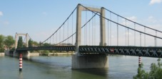
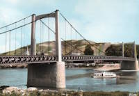
2013: Himalayenne
Rochemaure, Ardèche, France - Rhône River
| Bridgemeister ID: | 6717 (added 2021-10-12) |
| Year Completed: | 2013 |
| Name: | Himalayenne |
| Also Known As: | Rochemaure, Himalayan |
| Location: | Rochemaure, Ardèche, France |
| Crossing: | Rhône River |
| At or Near Feature: | ViaRhôna Cycle Path |
| Coordinates: | 44.582660 N 4.711102 E |
| Maps: | Acme, GeoHack, Google, OpenStreetMap |
| Use: | Footbridge |
| Status: | In use (last checked: 2021) |
| Main Cables: | Wire (steel) |
Notes:
- Built on the rehabilitated piers of the older Rochemaure bridge.
- Replaced 1842 Rochemaure - Rochemaure, Ardèche and Ancône, Drôme, France.
External Links:
2013: Moulin
Vernosc-lès-Annonay, Ardèche, France - Cance River
| Bridgemeister ID: | 3195 (added 2019-11-10) |
| Year Completed: | 2013 |
| Name: | Moulin |
| Location: | Vernosc-lès-Annonay, Ardèche, France |
| Crossing: | Cance River |
| Coordinates: | 45.210761 N 4.703166 E |
| Maps: | Acme, GeoHack, Google, OpenStreetMap |
| Use: | Footbridge |
| Status: | In use (last checked: 2020) |
| Main Cables: | Wire |
| Suspended Spans: | 1 |
Notes:
- Effectively a reproduction of the prior Moulin bridge.
- Replaced 1865 Moulin - Vernosc-lès-Annonay, Ardèche, France.
External Links:
(suspension bridge)
Sainte-Marguerite-Lafigère, Ardèche and Gard, France - Chassezac River
| Bridgemeister ID: | 3180 (added 2019-11-09) |
| Name: | (suspension bridge) |
| Location: | Sainte-Marguerite-Lafigère, Ardèche and Gard, France |
| Crossing: | Chassezac River |
| Use: | Vehicular (one-lane) |
| Status: | Removed |
| Suspended Spans: | 1 |
Beauchastel
Beauchastel, Ardèche, France - Eyrieux River
| Bridgemeister ID: | 4063 (added 2020-03-30) |
| Name: | Beauchastel |
| Location: | Beauchastel, Ardèche, France |
| Crossing: | Eyrieux River |
| References: | AAJ |
| Use: | Vehicular |
| Status: | Removed |
| Main Cables: | Wire (iron) |
Notes:
- AAJ supposes this bridge was completed in 1842 based on a contract let in 1840 proposing a two-year construction period, but other material suggest the bridge was built later.
External Links:
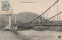
Chemin de l'Ile
Montélimar, Drôme and Le Teil, Ardèche, France - Canal de Dérivation de Montélimar
| Bridgemeister ID: | 2218 (added 2007-02-14) |
| Name: | Chemin de l'Ile |
| Location: | Montélimar, Drôme and Le Teil, Ardèche, France |
| Crossing: | Canal de Dérivation de Montélimar |
| Coordinates: | 44.534814 N 4.726179 E |
| Maps: | Acme, GeoHack, Google, OpenStreetMap |
| Use: | Vehicular (one-lane), with walkway |
| Status: | In use (last checked: 2018) |
| Main Cables: | Wire (steel) |
| Suspended Spans: | 3 |
| Main Span: | 1 |
| Side Spans: | 2 |
External Links:
Issoux
Les Issoux, Vals-des-Bains and Lalevade-d'Ardèche, Ardèche, France - Ardèche River
| Bridgemeister ID: | 7856 (added 2023-09-15) |
| Name: | Issoux |
| Location: | Les Issoux, Vals-des-Bains and Lalevade-d'Ardèche, Ardèche, France |
| Crossing: | Ardèche River |
| Use: | Footbridge |
| Status: | Removed |
| Suspended Spans: | 1 |
External Links:
- Facebook - Ancienne passerelle des Issoux. Image of the bridge.
- Facebook - Ancienne passerelle des Issoux. Image of the bridge.
- Facebook - Ancienne passerelle des Issoux. Image of the bridge.
- Facebook - La passerelle des Issoux 1962 Archives départementales. Image of the bridge.
- Facebook - La passerelle des Issoux 1962 Archives départementales. Image of the bridge.
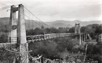
La Palisse
La Palisse, Cros-de-Géorand vicinity, Ardèche, France - Loire River
| Bridgemeister ID: | 2316 (added 2007-05-05) |
| Name: | La Palisse |
| Location: | La Palisse, Cros-de-Géorand vicinity, Ardèche, France |
| Crossing: | Loire River |
| Coordinates: | 44.779846 N 4.102626 E |
| Maps: | Acme, GeoHack, Google, OpenStreetMap |
| Use: | Vehicular (two-lane), with walkway |
| Status: | In use (last checked: 2021) |
| Main Cables: | Wire (steel) |
| Suspended Spans: | 1 |
External Links:
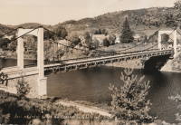
Saint-Didier-sous-Aubenas
Saint-Didier-sous-Aubenas, Ardèche, France - Ardèche River
| Bridgemeister ID: | 2929 (added 2019-09-16) |
| Name: | Saint-Didier-sous-Aubenas |
| Location: | Saint-Didier-sous-Aubenas, Ardèche, France |
| Crossing: | Ardèche River |
| Coordinates: | 44.603719 N 4.419774 E |
| Maps: | Acme, GeoHack, Google, OpenStreetMap |
| Use: | Vehicular |
| Status: | Replaced, 1936 |
Notes:
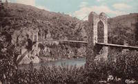
Saint-Fontunat-sur-Eyrieux
Saint-Fontunat-sur-Eyrieux, Ardèche, France - Eyrieux River
| Bridgemeister ID: | 1565 (added 2004-11-28) |
| Name: | Saint-Fontunat-sur-Eyrieux |
| Also Known As: | Pourchaire |
| Location: | Saint-Fontunat-sur-Eyrieux, Ardèche, France |
| Crossing: | Eyrieux River |
| Coordinates: | 44.815748 N 4.707325 E |
| Maps: | Acme, GeoHack, Google, OpenStreetMap |
| Principals: | Camille Seguin, Marc Seguin |
| References: | BPF |
| Use: | Footbridge |
| Status: | Only towers remain (last checked: 2021) |
| Main Cables: | Wire (iron) |
| Main Span: | 1 |
| Side Span: | 1 |
Notes:
- BPF and other sources list this bridge as having been completed in 1821 or 1823, but it is very unlikely the bridge was completed that early. An abandoned pier for another bridge is visible in some images of the bridge. It is possible there was another, earlier, bridge at this location for which the early 1820s completion date may be applicable. Other sources suggest the suspension bridge represented here was completed in 1893.
External Links:
Do you have any information or photos for these bridges that you would like to share? Please email david.denenberg@bridgemeister.com.