Suspension Bridges of Cantal
This is a list of all 5 bridges from the suspension bridge inventory for Cantal in France. Wherever you see a Bridgemeister ID number click it to isolate the bridge on its own page.
Related Lists:
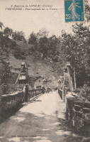
1841: Vernéjoux
Vernéjoux, Corrèze and Cantal, France - Dordogne River
| Bridgemeister ID: | 1988 (added 2005-12-02) |
| Year Completed: | 1841 |
| Name: | Vernéjoux |
| Location: | Vernéjoux, Corrèze and Cantal, France |
| Crossing: | Dordogne River |
| Coordinates: | 45.365917 N 2.367694 E |
| Maps: | Acme, GeoHack, Google, OpenStreetMap |
| Use: | Vehicular (one-lane) |
| Status: | Removed |
| Main Cables: | Wire |
| Suspended Spans: | 1 |
Notes:
- May have been replaced in 1929 by another suspension bridge that was destroyed in 1944 during WWII.
- 2023: Remnants of a former suspension bridge still exist below the current concrete arch bridge and are visible when the water level is low.
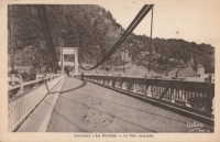
1935: Devèze
Thérondels vicinity, Aveyron and Paulhenc, Cantal, France - Lac de Sarrans
| Bridgemeister ID: | 2321 (added 2007-05-05) |
| Year Completed: | 1935 |
| Name: | Devèze |
| Also Known As: | Laussac |
| Location: | Thérondels vicinity, Aveyron and Paulhenc, Cantal, France |
| Crossing: | Lac de Sarrans |
| At or Near Feature: | Presqu'île De Laussac |
| Coordinates: | 44.861586 N 2.769710 E |
| Maps: | Acme, GeoHack, Google, OpenStreetMap |
| Use: | Vehicular (one-lane) |
| Status: | In use (last checked: 2020) |
| Main Cables: | Wire (steel) |
| Suspended Spans: | 1 |
Notes:
External Links:
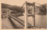
1935: Tréboul
Thérondels vicinity, Aveyron and Sainte-Marie, Cantal, France - Lac de Sarrans
| Bridgemeister ID: | 1989 (added 2005-12-02) |
| Year Completed: | 1935 |
| Name: | Tréboul |
| Location: | Thérondels vicinity, Aveyron and Sainte-Marie, Cantal, France |
| Crossing: | Lac de Sarrans |
| Coordinates: | 44.872780 N 2.867253 E |
| Maps: | Acme, GeoHack, Google, OpenStreetMap |
| Use: | Vehicular (one-lane) |
| Status: | In use (last checked: 2014) |
| Main Cables: | Wire (steel) |
| Suspended Spans: | 1 |
Notes:
External Links:

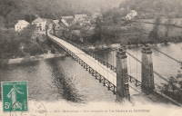
Nauzenac
Nauzenac, Mauriac vicinity, Cantal and Corrèze, France - Dordogne River
| Bridgemeister ID: | 1973 (added 2005-11-27) |
| Name: | Nauzenac |
| Location: | Nauzenac, Mauriac vicinity, Cantal and Corrèze, France |
| Crossing: | Dordogne River |
| Use: | Vehicular (one-lane) |
| Main Cables: | Wire |
| Suspended Spans: | 1 |
Notes:
- Village of Nauzenac was apparently inundated after construction of L'Aigle Dam.
Saint-Projet
Arches, Mauriac vicinity, Cantal and Neuvic, Corrèze, France - Dordogne River
| Bridgemeister ID: | 5578 (added 2020-12-20) |
| Name: | Saint-Projet |
| Location: | Arches, Mauriac vicinity, Cantal and Neuvic, Corrèze, France |
| Crossing: | Dordogne River |
| Coordinates: | 45.286816 N 2.279728 E |
| Maps: | Acme, GeoHack, Google, OpenStreetMap |
| Use: | Vehicular (two-lane) |
| Status: | In use (last checked: 2021) |
| Main Cables: | Wire (steel) |
| Suspended Spans: | 1 |
Do you have any information or photos for these bridges that you would like to share? Please email david.denenberg@bridgemeister.com.