Suspension Bridges of Drôme
This is a list of all 23 bridges from the suspension bridge inventory for Drôme in France. Wherever you see a Bridgemeister ID number click it to isolate the bridge on its own page.
Related Lists:
1824: Galaure
Saint-Vallier, Drôme, France - Galaure River
| Bridgemeister ID: | 1824 (added 2005-05-30) |
| Year Completed: | 1824 |
| Name: | Galaure |
| Location: | Saint-Vallier, Drôme, France |
| Crossing: | Galaure River |
| Principals: | Seguin Brothers |
| References: | GHD, MOS |
| Status: | Collapsed, 1844 |
| Main Cables: | Wire (iron) |
| Suspended Spans: | 1 |
| Main Span: | 1 x 30 meters (98.4 feet) |
Notes:
- GHD: Built as an experimental bridge in preparation for the Tain-Tournon Bridge. Collapsed 1844.
- Sometimes "Galore".
- See 1825 Tain-Tournon - Tournon-sur-Rhône, Ardèche and Tain, Drôme, France.
External Links:
1825: Tain-Tournon
Tournon-sur-Rhône, Ardèche and Tain, Drôme, France - Rhône River
| Bridgemeister ID: | 378 (added before 2003) |
| Year Completed: | 1825 |
| Name: | Tain-Tournon |
| Location: | Tournon-sur-Rhône, Ardèche and Tain, Drôme, France |
| Crossing: | Rhône River |
| Principals: | Marc Seguin |
| References: | AAJ, ASB, BBR, BPF, GHD, LAB, MOS, PTS2, TTSB |
| Use: | Vehicular |
| Status: | Removed, 1965 |
| Main Cables: | Wire (iron) |
| Suspended Spans: | 2 |
| Main Spans: | 2 x 85 meters (278.88 feet) |
| Deck width: | 13.75 feet |
Notes:
- Often credited as being the first large wire suspension bridge in France (and elsewhere). Rebuilt 1847 as a footbridge. Removed 1965.
- Near 1849 Marc Seguin - Tournon-sur-Rhône, Ardèche and Tain-L'Hermitage, Drôme, France.
- Near 1958 Gustave Toursier - Tournon-sur-Rhône, Ardèche and Tain-L'Hermitage, Drôme, France.
External Links:
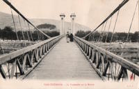
1827: Andance
Andance, Ardèche and Andancette, Drôme, France - Rhône River
| Bridgemeister ID: | 976 (added 2003-11-14) |
| Year Completed: | 1827 |
| Name: | Andance |
| Location: | Andance, Ardèche and Andancette, Drôme, France |
| Crossing: | Rhône River |
| Coordinates: | 45.242194 N 4.801638 E |
| Maps: | Acme, GeoHack, Google, OpenStreetMap |
| Principals: | Marc Seguin |
| References: | AAJ, ASB |
| Use: | Vehicular (one-lane) |
| Status: | In use (last checked: 2009) |
| Main Cables: | Wire (iron) |
| Suspended Spans: | 2 |
| Main Spans: | 2 |
Notes:
- Destroyed August 30, 1944. Rebuilt 1946.
External Links:
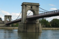
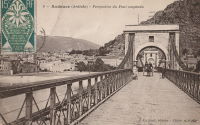
1830: Valence
Valence, Drôme and Guilherand-Granges, Ardèche, France - Rhône River
| Bridgemeister ID: | 631 (added 2003-01-20) |
| Year Completed: | 1830 |
| Name: | Valence |
| Location: | Valence, Drôme and Guilherand-Granges, Ardèche, France |
| Crossing: | Rhône River |
| Coordinates: | 44.932022 N 4.882951 E |
| Maps: | Acme, GeoHack, Google, OpenStreetMap |
| Principals: | Marc Seguin |
| References: | ASB, PTS2 |
| Use: | Vehicular |
| Status: | Removed |
| Main Cables: | Wire (iron) |
| Suspended Spans: | 2 |
| Main Spans: | 2 x 110 meters (360.9 feet) |
| Deck width: | 7 meters |
Notes:
- Two side spans meeting at a single midstream tower.
- Later at same location 1949 (footbridge) - Valence, Drôme and Guilherand-Granges, Ardèche, France.
External Links:
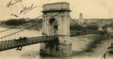
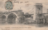
1839: Teil
Le Teil, Ardèche and Montélimar, Drôme, France - Rhône River
| Bridgemeister ID: | 1733 (added 2005-04-06) |
| Year Completed: | 1839 |
| Name: | Teil |
| Location: | Le Teil, Ardèche and Montélimar, Drôme, France |
| Crossing: | Rhône River |
| Coordinates: | 44.552213 N 4.691909 E |
| Maps: | Acme, GeoHack, Google, OpenStreetMap |
| References: | AAJ |
| Status: | Replaced, 1931 |
| Main Cables: | Wire (iron) |
| Suspended Spans: | 4 |
| Main Spans: | 4 |
| Deck width: | 19.68 feet |
Notes:
- Damaged by flood, 1840. Rebuilt and reopened, 1843. Damaged by floods, 1856 and 1881.
- Replaced by 1931 Teil - Le Teil, Ardèche and Montélimar, Drôme, France.
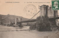
1842: Rochemaure
Rochemaure, Ardèche and Ancône, Drôme, France - Rhône River
| Bridgemeister ID: | 950 (added 2003-10-31) |
| Year Completed: | 1842 |
| Name: | Rochemaure |
| Location: | Rochemaure, Ardèche and Ancône, Drôme, France |
| Crossing: | Rhône River |
| Coordinates: | 44.583117 N 4.71035 E |
| Maps: | Acme, GeoHack, Google, OpenStreetMap |
| References: | BPF |
| Use: | Vehicular (one-lane) |
| Status: | Only towers remain (last checked: 2021) |
| Main Cables: | Wire |
| Suspended Spans: | 2 |
| Main Spans: | 2 |
Notes:
- Failed 1856, rebuilt 1858, destroyed 1940 (war), rebuilt 1942, destroyed 1944 (war), rebuilt 1946, restricted to pedestrians, 1983. Abandoned in the 1990s. Stood in a derelict state for several years.
- 2013: Work is completed to replace the derelict deck with a suspension footbridge that sits on the original piers but does not use the towers of the former suspension bridge. This new installation is tracked separately.
- Replaced by 2013 Himalayenne (Rochemaure, Himalayan) - Rochemaure, Ardèche, France.
External Links:
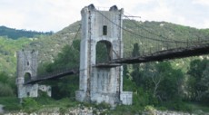
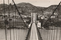
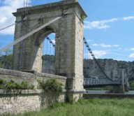
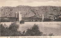
1847: Donzère
Donzère, Drôme and Viviers, Ardèche, France - Rhône River
| Bridgemeister ID: | 970 (added 2003-11-13) |
| Year Completed: | 1847 |
| Name: | Donzère |
| Also Known As: | Robinet |
| Location: | Donzère, Drôme and Viviers, Ardèche, France |
| Crossing: | Rhône River |
| Coordinates: | 44.452367 N 4.6981 E |
| Maps: | Acme, GeoHack, Google, OpenStreetMap |
| References: | AAJ, BPF |
| Use: | Vehicular (one-lane) |
| Status: | In use (last checked: 2021) |
| Main Cables: | Wire (iron) |
| Suspended Spans: | 3 |
| Main Spans: | 3 x 100 meters (328.1 feet) estimated |
External Links:
1847: Viviers
Viviers, Ardèche and Drôme, France - Rhône River
| Bridgemeister ID: | 1961 (added 2005-11-05) |
| Year Completed: | 1847 |
| Name: | Viviers |
| Location: | Viviers, Ardèche and Drôme, France |
| Crossing: | Rhône River |
| Coordinates: | 44.481667 N 4.699698 E |
| Maps: | Acme, GeoHack, Google, OpenStreetMap |
| References: | AAJ |
| Use: | Vehicular (one-lane) |
| Status: | Destroyed, 1944 |
| Main Cables: | Wire |
Notes:
- Later at same location 1954 Viviers - Viviers, Ardèche and Châteauneuf-Du-Rhône, Drôme, France.
External Links:
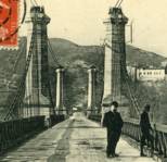
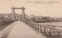
1849: Marc Seguin
Tournon-sur-Rhône, Ardèche and Tain-L'Hermitage, Drôme, France - Rhône River
| Bridgemeister ID: | 975 (added 2003-11-14) |
| Year Completed: | 1849 |
| Name: | Marc Seguin |
| Location: | Tournon-sur-Rhône, Ardèche and Tain-L'Hermitage, Drôme, France |
| Crossing: | Rhône River |
| Coordinates: | 45.068638 N 4.834972 E |
| Maps: | Acme, GeoHack, Google, OpenStreetMap |
| Principals: | Marc Seguin |
| References: | AAJ, BPF |
| Use: | Vehicular |
| Status: | Restricted to foot traffic (last checked: 2021) |
| Main Cables: | Wire (iron) |
| Suspended Spans: | 2 |
| Main Spans: | 2 |
Notes:
- A second bridge at Tournon, by Seguin, approximately 100 meters downstream from his 1825 bridge. Restored 1989.
- Near 1825 Tain-Tournon - Tournon-sur-Rhône, Ardèche and Tain, Drôme, France.
- Near 1958 Gustave Toursier - Tournon-sur-Rhône, Ardèche and Tain-L'Hermitage, Drôme, France.
External Links:
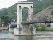
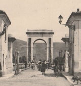
1857: Saint-Lattier
Saint-Lattier, Isère and Eymeux, Drôme, France - Isère River
| Bridgemeister ID: | 7385 (added 2022-11-24) |
| Year Completed: | 1857 |
| Name: | Saint-Lattier |
| Location: | Saint-Lattier, Isère and Eymeux, Drôme, France |
| Crossing: | Isère River |
| Use: | Vehicular |
| Status: | Replaced |
| Main Cables: | Wire |
| Suspended Spans: | 1 |
Notes:
- Later at same location Saint-Lattier (Eymeux) - Saint-Lattier, Isère and Eymeux, Drôme, France. Unclear if the newer bridge was a direct replacement for the older bridge.
External Links:
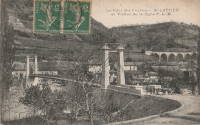
1875: Saint-Nazaire
Saint-Nazaire-en-Royans, Drôme and Saint-Hilaire-du-Rosier, Isère, France - Isère River
| Bridgemeister ID: | 7328 (added 2022-09-02) |
| Year Completed: | 1875 |
| Name: | Saint-Nazaire |
| Location: | Saint-Nazaire-en-Royans, Drôme and Saint-Hilaire-du-Rosier, Isère, France |
| Crossing: | Isère River |
| Coordinates: | 45.067313 N 5.243247 E |
| Maps: | Acme, GeoHack, Google, OpenStreetMap |
| Use: | Vehicular |
| Status: | Removed |
| Main Cables: | Wire |
| Suspended Spans: | 1 |
External Links:
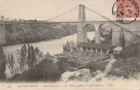
1891: Livron
Livron-sur-Drôme, Drôme and La Voulte-sur-Rhône, Ardèche, France - Petit Rhône River
| Bridgemeister ID: | 1806 (added 2005-05-19) |
| Year Completed: | 1891 |
| Name: | Livron |
| Location: | Livron-sur-Drôme, Drôme and La Voulte-sur-Rhône, Ardèche, France |
| Crossing: | Petit Rhône River |
| Coordinates: | 44.795194 N 4.796055 E |
| Maps: | Acme, GeoHack, Google, OpenStreetMap |
| Use: | Vehicular (one-lane) |
| Status: | In use (last checked: 2022) |
| Main Cables: | Wire |
| Suspended Spans: | 1 |
| Main Span: | 1 x 101 meters (331.4 feet) estimated |
Notes:
External Links:
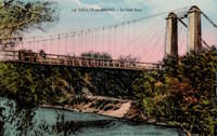
1931: Teil
Le Teil, Ardèche and Montélimar, Drôme, France - Rhône River
| Bridgemeister ID: | 1549 (added 2004-11-13) |
| Year Completed: | 1931 |
| Name: | Teil |
| Location: | Le Teil, Ardèche and Montélimar, Drôme, France |
| Crossing: | Rhône River |
| Coordinates: | 44.5519 N 4.692617 E |
| Maps: | Acme, GeoHack, Google, OpenStreetMap |
| References: | AAJ, BPF |
| Use: | Vehicular (two-lane, heavy vehicles), with walkway |
| Status: | In use (last checked: 2005) |
| Main Cables: | Wire (steel) |
| Suspended Spans: | 1 |
| Main Span: | 1 x 235 meters (771 feet) |
Notes:
- Destroyed, 1944. Rebuilt, 1950.
- Replaced 1839 Teil - Le Teil, Ardèche and Montélimar, Drôme, France.
External Links:
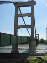
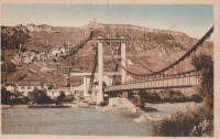
1949: (footbridge)
Valence, Drôme and Guilherand-Granges, Ardèche, France - Rhône River
| Bridgemeister ID: | 6517 (added 2021-08-27) |
| Year Completed: | 1949 |
| Name: | (footbridge) |
| Location: | Valence, Drôme and Guilherand-Granges, Ardèche, France |
| Crossing: | Rhône River |
| Coordinates: | 44.931773 N 4.883700 E |
| Maps: | Acme, GeoHack, Google, OpenStreetMap |
| Use: | Footbridge |
| Status: | Removed, 1960s |
| Main Cables: | Wire (steel) |
| Main Spans: | 2 |
Notes:
- At former location of 1830 Valence - Valence, Drôme and Guilherand-Granges, Ardèche, France.
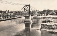
1954: Viviers
Viviers, Ardèche and Châteauneuf-Du-Rhône, Drôme, France - Rhône River
| Bridgemeister ID: | 1545 (added 2004-11-05) |
| Year Completed: | 1954 |
| Name: | Viviers |
| Location: | Viviers, Ardèche and Châteauneuf-Du-Rhône, Drôme, France |
| Crossing: | Rhône River |
| Coordinates: | 44.481583 N 4.698717 E |
| Maps: | Acme, GeoHack, Google, OpenStreetMap |
| Use: | Vehicular (two-lane, heavy vehicles), with walkway |
| Status: | In use (last checked: 2021) |
| Main Cables: | Wire (steel) |
| Suspended Spans: | 3 |
| Main Span: | 1 |
| Side Spans: | 2 |
Notes:
- At former location of 1847 Viviers - Viviers, Ardèche and Drôme, France.
External Links:
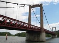
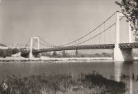
1958: Gustave Toursier
Tournon-sur-Rhône, Ardèche and Tain-L'Hermitage, Drôme, France - Rhône River
| Bridgemeister ID: | 1455 (added 2004-08-14) |
| Year Completed: | 1958 |
| Name: | Gustave Toursier |
| Location: | Tournon-sur-Rhône, Ardèche and Tain-L'Hermitage, Drôme, France |
| Crossing: | Rhône River |
| Coordinates: | 45.066638 N 4.840666 E |
| Maps: | Acme, GeoHack, Google, OpenStreetMap |
| Use: | Vehicular (two-lane, heavy vehicles), with walkway |
| Status: | In use (last checked: 2022) |
| Main Cables: | Wire (steel) |
| Suspended Spans: | 3 |
| Main Span: | 1 x 144 meters (472.4 feet) estimated |
| Side Spans: | 2 |
Notes:
- Near 1825 Tain-Tournon - Tournon-sur-Rhône, Ardèche and Tain, Drôme, France.
- Near 1849 Marc Seguin - Tournon-sur-Rhône, Ardèche and Tain-L'Hermitage, Drôme, France.
External Links:
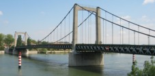
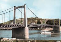
(footbridge)
Auberives-en-Royans, Isère and Drôme, France - Bourne River
| Bridgemeister ID: | 5564 (added 2020-12-19) |
| Name: | (footbridge) |
| Location: | Auberives-en-Royans, Isère and Drôme, France |
| Crossing: | Bourne River |
| Coordinates: | 45.055189 N 5.325440 E |
| Maps: | Acme, GeoHack, Google, OpenStreetMap |
| Use: | Footbridge |
| Status: | In use (last checked: 2020) |
| Main Cables: | Wire (steel) |
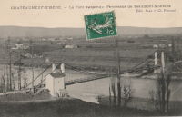
Châteauneuf-sur-Isère
Châteauneuf-sur-Isère and Beaumont-Monteux, Drôme, France - Isère River
| Bridgemeister ID: | 4879 (added 2020-07-18) |
| Name: | Châteauneuf-sur-Isère |
| Location: | Châteauneuf-sur-Isère and Beaumont-Monteux, Drôme, France |
| Crossing: | Isère River |
| Use: | Vehicular |
| Status: | Removed |
| Main Cables: | Wire (iron) |
External Links:
Chemin de l'Ile
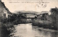
Montélimar, Drôme and Le Teil, Ardèche, France - Canal de Dérivation de Montélimar
| Bridgemeister ID: | 2218 (added 2007-02-14) |
| Name: | Chemin de l'Ile |
| Location: | Montélimar, Drôme and Le Teil, Ardèche, France |
| Crossing: | Canal de Dérivation de Montélimar |
| Coordinates: | 44.534814 N 4.726179 E |
| Maps: | Acme, GeoHack, Google, OpenStreetMap |
| Use: | Vehicular (one-lane), with walkway |
| Status: | In use (last checked: 2018) |
| Main Cables: | Wire (steel) |
| Suspended Spans: | 3 |
| Main Span: | 1 |
| Side Spans: | 2 |
External Links:
Manne
Saint-Thomas-en-Royans, Drôme and Saint-Just-de-Claix, Auberives-en-Royans vicinity, Isère, France - Bourne River
| Bridgemeister ID: | 8079 (added 2023-12-24) |
| Name: | Manne |
| Location: | Saint-Thomas-en-Royans, Drôme and Saint-Just-de-Claix, Auberives-en-Royans vicinity, Isère, France |
| Crossing: | Bourne River |
| Coordinates: | 45.061056 N 5.280528 E |
| Maps: | Acme, GeoHack, Google, OpenStreetMap |
| Use: | Vehicular |
| Status: | Removed |
| Suspended Spans: | 1 |
Notes:
- Presumably, a suspension bridge was built at this location in the 1840s. Later, the towers and abutments were reused for an unusual arch bridge.
External Links:
- Art-et-Histoire - Pont de Manne - 1846
- Bibliothèque numérique patrimoniale. Image of the unusual arch bridge.
- Saint-Thomas-en-Royans.- Le pont de Manne sur la rivière la Bourne, reliant Saint-Thomas et Saint-Juste-de-Claix (Isère).. Image of the unusual arch bridge.
Pierrelatte
Pierrelatte, Drôme, France - Donzère Canal
| Bridgemeister ID: | 1587 (added 2005-01-22) |
| Name: | Pierrelatte |
| Location: | Pierrelatte, Drôme, France |
| Crossing: | Donzère Canal |
| Coordinates: | 44.364983 N 4.73105 E |
| Maps: | Acme, GeoHack, Google, OpenStreetMap |
| Use: | Vehicular (two-lane, heavy vehicles), with walkway |
| Status: | In use (last checked: 2005) |
| Main Cables: | Wire (steel) |
| Suspended Spans: | 3 |
| Main Span: | 1 |
| Side Spans: | 2 |
| Characteristics: | Self-anchored |
Notes:
- Self-anchored.
External Links:
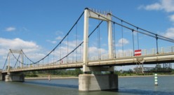
Saint-Lattier
Saint-Lattier, Isère and Eymeux, Drôme, France - Isère River
| Bridgemeister ID: | 4913 (added 2020-07-19) |
| Name: | Saint-Lattier |
| Also Known As: | Eymeux |
| Location: | Saint-Lattier, Isère and Eymeux, Drôme, France |
| Crossing: | Isère River |
| Coordinates: | 45.084972 N 5.183313 E |
| Maps: | Acme, GeoHack, Google, OpenStreetMap |
| Use: | Vehicular (one-lane) |
| Status: | In use (last checked: 2020) |
| Main Cables: | Wire (steel) |
| Suspended Spans: | 1 |
| Main Span: | 1 x 10⁸ meters (354.3 feet) estimated |
Notes:
- At former location of 1857 Saint-Lattier - Saint-Lattier, Isère and Eymeux, Drôme, France.
External Links:
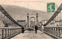
Saint-Vallier
Saint-Vallier, Drôme, France - Rhône River
| Bridgemeister ID: | 1754 (added 2005-04-20) |
| Name: | Saint-Vallier |
| Location: | Saint-Vallier, Drôme, France |
| Crossing: | Rhône River |
| Use: | Vehicular |
| Status: | Removed |
| Main Cables: | Wire (iron) |
Notes:
- Likely completed early 1830s.
- Similar to 1830 Bourg-Saint-Andéol - Bourg-Saint-Andéol, Ardèche, France.
Do you have any information or photos for these bridges that you would like to share? Please email david.denenberg@bridgemeister.com.