Suspension Bridges of Indre-et-Loire
This is a list of all 17 bridges from the suspension bridge inventory for Indre-et-Loire in France. Wherever you see a Bridgemeister ID number click it to isolate the bridge on its own page.
Related Lists:
1832: L'Ile-Bouchard
Saint Maurice, L'Île-Bouchard and Saint-Gilles, L'Île-Bouchard, Indre-et-Loire, France - Vienne River
| Bridgemeister ID: | 1605 (added 2005-02-06) |
| Year Completed: | 1832 |
| Name: | L'Ile-Bouchard |
| Location: | Saint Maurice, L'Île-Bouchard and Saint-Gilles, L'Île-Bouchard, Indre-et-Loire, France |
| Crossing: | Vienne River |
| Coordinates: | 47.119399 N 0.424522 E |
| Maps: | Acme, GeoHack, Google, OpenStreetMap |
| References: | AAJ |
| Use: | Vehicular (one-lane), with walkway |
| Status: | Destroyed, 1944 |
| Main Cables: | Wire (iron) |
| Suspended Spans: | 2 |
| Main Span: | 1 x 80 meters (262.48 feet) |
| Deck width: | 13.12 feet |
Notes:
- One of two bridges separated by a short distance across an island.
- Connects to 1832 L'Ile-Bouchard - Saint Maurice, L'Île-Bouchard and Saint-Gilles, L'Île-Bouchard, Indre-et-Loire, France.
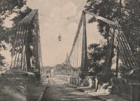
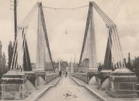
1832: L'Ile-Bouchard
Saint Maurice, L'Île-Bouchard and Saint-Gilles, L'Île-Bouchard, Indre-et-Loire, France - Vienne River
| Bridgemeister ID: | 6609 (added 2021-09-05) |
| Year Completed: | 1832 |
| Name: | L'Ile-Bouchard |
| Location: | Saint Maurice, L'Île-Bouchard and Saint-Gilles, L'Île-Bouchard, Indre-et-Loire, France |
| Crossing: | Vienne River |
| Coordinates: | 47.120994 N 0.425181 E |
| Maps: | Acme, GeoHack, Google, OpenStreetMap |
| References: | AAJ |
| Use: | Vehicular (one-lane), with walkway |
| Status: | Destroyed, 1944 |
| Main Cables: | Wire (iron) |
| Suspended Spans: | 1 |
| Main Span: | 1 x 85 meters (278.89 feet) |
| Deck width: | 13.12 feet |
Notes:
- One of two bridges separated by a short distance across an island.
- Connects to 1832 L'Ile-Bouchard - Saint Maurice, L'Île-Bouchard and Saint-Gilles, L'Île-Bouchard, Indre-et-Loire, France.
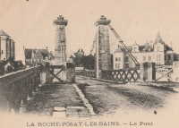
1832: La Roche-Posay
La Roche-Posay, Vienne and Indre-et-Loire, France - Creuse River
| Bridgemeister ID: | 1601 (added 2005-02-06) |
| Year Completed: | 1832 |
| Name: | La Roche-Posay |
| Also Known As: | La Roche-Posay-les-Bains |
| Location: | La Roche-Posay, Vienne and Indre-et-Loire, France |
| Crossing: | Creuse River |
| Use: | Vehicular |
| Status: | Replaced, 1937 |
| Main Cables: | Wire (iron) |
| Suspended Spans: | 1 |
Notes:

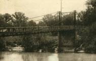
1837: Port-Boulet
Port-Boulet, Bourgueil vicinity, Indre-et-Loire, France - Loire River
| Bridgemeister ID: | 1773 (added 2005-04-22) |
| Year Completed: | 1837 |
| Name: | Port-Boulet |
| Location: | Port-Boulet, Bourgueil vicinity, Indre-et-Loire, France |
| Crossing: | Loire River |
| Principals: | Seguin Brothers |
| References: | AAJ |
| Status: | Destroyed, 1871 |
| Main Cables: | Wire (iron) |
External Links:
1847: Saint-Symphorien
Tours, Indre-et-Loire, France - Loire River
| Bridgemeister ID: | 1755 (added 2005-04-20) |
| Year Completed: | 1847 |
| Name: | Saint-Symphorien |
| Location: | Tours, Indre-et-Loire, France |
| Crossing: | Loire River |
| At or Near Feature: | l'Île Aucard |
| Coordinates: | 47.398776 N 0.692994 E |
| Maps: | Acme, GeoHack, Google, OpenStreetMap |
| Principals: | Seguin Brothers |
| References: | AAJ |
| Use: | Vehicular (one-lane), with walkway |
| Status: | Replaced |
| Main Cables: | Wire (iron) |
| Suspended Spans: | 3 |
| Main Spans: | 3 |
Notes:
- This was the three-span south section of the Saint-Symphorien bridge.
- 1940-1944: The Saint-Symphorien bridge is destroyed by French troops in June 1940 to slow the German army. Repaired in 1943. Destroyed again in 1944 by the German army. It is unclear whether both the north and south bridges were destroyed during these events.
- Connects to 1847 Saint-Symphorien - Tours, Indre-et-Loire, France.
- Replaced by Saint-Symphorien - Tours, Indre-et-Loire, France.
External Links:
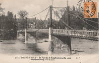
1847: Saint-Symphorien
Tours, Indre-et-Loire, France - Loire River
| Bridgemeister ID: | 7838 (added 2023-09-03) |
| Year Completed: | 1847 |
| Name: | Saint-Symphorien |
| Location: | Tours, Indre-et-Loire, France |
| Crossing: | Loire River |
| At or Near Feature: | l'Île Aucard |
| Coordinates: | 47.401440 N 0.693325 E |
| Maps: | Acme, GeoHack, Google, OpenStreetMap |
| Principals: | Seguin Brothers |
| Use: | Vehicular (one-lane) |
| Status: | Removed |
| Main Cables: | Wire (iron) |
| Suspended Spans: | 2 |
| Main Spans: | 2 |
Notes:
- This was the original two-span north section of the Saint-Symphorien bridge.
- 1875, June 12: The deck of the northern bridge is wrecked by wind. The bridge is repaired.
- 1940-1944: The Saint-Symphorien bridge is destroyed by French troops in June 1940 to slow the German army. Repaired in 1943. Destroyed again in 1944 by the German army. It is unclear whether both the north and south bridges were destroyed during these events.
- Connects to 1847 Saint-Symphorien - Tours, Indre-et-Loire, France.
- Connects to Saint-Symphorien - Tours, Indre-et-Loire, France.
- Replaced by 1963 Saint-Symphorien - Tours, Indre-et-Loire, France.
External Links:
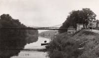
1849: Langeais
Langeais, Indre-et-Loire, France - Loire River
| Bridgemeister ID: | 6718 (added 2021-10-16) |
| Year Completed: | 1849 |
| Name: | Langeais |
| Location: | Langeais, Indre-et-Loire, France |
| Crossing: | Loire River |
| Coordinates: | 47.319030 N 0.404770 E |
| Maps: | Acme, GeoHack, Google, OpenStreetMap |
| References: | AAJ, BPF |
| Use: | Vehicular |
| Status: | Replaced |
| Main Spans: | 3 |
| Side Spans: | 2 |
Notes:
- Damaged by lightning 1859 and repaired. Cables cut during war 1870 and repaired in 1874.
- Replaced by 1937 Langeais - Langeais, Indre-et-Loire, France. However, the 1849 bridge may have been largely before the 1937 bridge.
External Links:

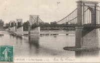
1855: Saint-Cyr
Tours and Saint-Cyr, Indre-et-Loire, France - Loire River
| Bridgemeister ID: | 1645 (added 2005-03-18) |
| Year Completed: | 1855 |
| Name: | Saint-Cyr |
| Also Known As: | Napoleon, Bonaparte |
| Location: | Tours and Saint-Cyr, Indre-et-Loire, France |
| Crossing: | Loire River |
| Principals: | Escarraguel Brothers |
| Use: | Vehicular |
| Status: | Demolished, 1943 |
| Main Cables: | Wire (iron) |
External Links:
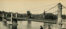
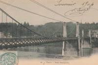
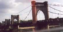
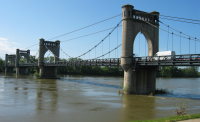
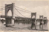
1937: Langeais
Langeais, Indre-et-Loire, France - Loire River
| Bridgemeister ID: | 1029 (added 2003-11-30) |
| Year Completed: | 1937 |
| Name: | Langeais |
| Location: | Langeais, Indre-et-Loire, France |
| Crossing: | Loire River |
| Coordinates: | 47.319667 N 0.404217 E |
| Maps: | Acme, GeoHack, Google, OpenStreetMap |
| References: | AAJ, BPF |
| Use: | Vehicular (two-lane), with walkway |
| Status: | In use (last checked: 2021) |
| Main Cables: | Wire (steel) |
| Suspended Spans: | 5 |
| Main Spans: | 3 x 90 meters (295.29 feet) |
| Side Spans: | 2 x 45 meters (147.64 feet) |
Notes:
- 1940: Deck collapsed.
- 1946: Repaired, but carrying just a footbridge.
- 1950: Rebuilt as a vehicular bridge.
- 1983: Reinforced to support heavier traffic.
- Replaced 1849 Langeais - Langeais, Indre-et-Loire, France.
External Links:
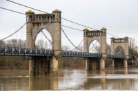
1963: Saint-Symphorien
Tours, Indre-et-Loire, France - Loire River
| Bridgemeister ID: | 7840 (added 2023-09-03) |
| Year Completed: | 1963 |
| Name: | Saint-Symphorien |
| Location: | Tours, Indre-et-Loire, France |
| Crossing: | Loire River |
| At or Near Feature: | l'Île Aucard |
| Coordinates: | 47.399002 N 0.693011 E |
| Maps: | Acme, GeoHack, Google, OpenStreetMap |
| Status: | Restricted to foot traffic (last checked: 2023) |
| Main Cables: | Wire (steel) |
| Suspended Spans: | 3 |
| Main Spans: | 3 |
Notes:
- This is the present-day (2020s) three-span southern Saint-Symphorien bridge.
- Replaced Saint-Symphorien - Tours, Indre-et-Loire, France.
- Connects to 1963 Saint-Symphorien - Tours, Indre-et-Loire, France.
External Links:
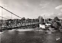
1963: Saint-Symphorien
Tours, Indre-et-Loire, France - Loire River
| Bridgemeister ID: | 7841 (added 2023-09-03) |
| Year Completed: | 1963 |
| Name: | Saint-Symphorien |
| Location: | Tours, Indre-et-Loire, France |
| Crossing: | Loire River |
| At or Near Feature: | l'Île Aucard |
| Coordinates: | 47.401695 N 0.693334 E |
| Maps: | Acme, GeoHack, Google, OpenStreetMap |
| Status: | Restricted to foot traffic (last checked: 2023) |
| Main Cables: | Wire (steel) |
| Suspended Spans: | 2 |
| Main Spans: | 2 |
Notes:
- This is the present-day (2020s) two-span northern Saint-Symphorien bridge.
- Replaced 1847 Saint-Symphorien - Tours, Indre-et-Loire, France.
- Connects to 1963 Saint-Symphorien - Tours, Indre-et-Loire, France.
External Links:
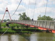
2001: (footbridge)
Tours, Indre-et-Loire, France - Cher River
| Bridgemeister ID: | 1019 (added 2003-11-22) |
| Year Completed: | 2001 |
| Name: | (footbridge) |
| Location: | Tours, Indre-et-Loire, France |
| Crossing: | Cher River |
| Coordinates: | 47.37155 N 0.682467 E |
| Maps: | Acme, GeoHack, Google, OpenStreetMap |
| Principals: | Alain Spielmann |
| Use: | Footbridge |
| Status: | In use (last checked: 2005) |
| Main Cables: | Wire (steel) |
| Suspended Spans: | 1 |
Notes:
- Monocable from A-shaped towers.
External Links:
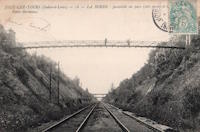
(footbridge)
Joué-lèz-Tours, Indre-et-Loire, France
| Bridgemeister ID: | 7758 (added 2023-07-23) |
| Name: | (footbridge) |
| Location: | Joué-lèz-Tours, Indre-et-Loire, France |
| Coordinates: | 47.335385 N 0.668899 E |
| Maps: | Acme, GeoHack, Google, OpenStreetMap |
| Use: | Footbridge |
| Status: | Removed |
| Main Cables: | Wire |
| Suspended Spans: | 1 |
Notes:
- Coordinates provided appear to be the approximate vicinity of the bridge, crossing the north/south rail line.
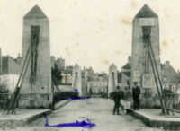
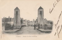
Cormery
Cormery and Truyes, Indre-et-Loire, France - Indre River
| Bridgemeister ID: | 1939 (added 2005-10-29) |
| Name: | Cormery |
| Location: | Cormery and Truyes, Indre-et-Loire, France |
| Crossing: | Indre River |
| Principals: | Joseph Chaley |
| References: | AAJ |
| Status: | Removed |
| Main Cables: | Wire (iron) |
Lesigny
Lesigny, Vienne and Indre-et-Loire, France - Creuse River
| Bridgemeister ID: | 2230 (added 2007-03-19) |
| Name: | Lesigny |
| Location: | Lesigny, Vienne and Indre-et-Loire, France |
| Crossing: | Creuse River |
| Use: | Vehicular |
| Status: | Removed |
| Main Cables: | Chain (iron) |
| Suspended Spans: | 1 |
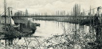
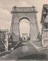
Saint-Symphorien
Tours, Indre-et-Loire, France - Loire River
| Bridgemeister ID: | 7839 (added 2023-09-03) |
| Name: | Saint-Symphorien |
| Location: | Tours, Indre-et-Loire, France |
| Crossing: | Loire River |
| At or Near Feature: | l'Île Aucard |
| Coordinates: | 47.398291 N 0.692937 E |
| Maps: | Acme, GeoHack, Google, OpenStreetMap |
| Status: | Replaced |
| Main Cables: | Wire (steel) |
| Suspended Spans: | 3 |
| Main Spans: | 3 |
Notes:
- This is a replacement for the three-span southern Saint-Symphorien bridge. It's unclear if this wood-towered bridge is a result of the 1943 reconstruction following the 1940 French army destruction of the bridge or the reconstruction following the 1944 German army destruction of the bridge.
- Replaced 1847 Saint-Symphorien - Tours, Indre-et-Loire, France.
- Connects to 1847 Saint-Symphorien - Tours, Indre-et-Loire, France. It's unclear whether the northern two-span Saint-Symphorien bridge was similarly reconstructed in the 1940s.
- Replaced by 1963 Saint-Symphorien - Tours, Indre-et-Loire, France.
External Links:
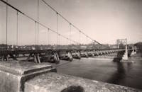
Yzeures-sur-Creuse
Yzeures-sur-Creuse, Indre-et-Loire, France - Creuse River
| Bridgemeister ID: | 1184 (added 2004-01-24) |
| Name: | Yzeures-sur-Creuse |
| Location: | Yzeures-sur-Creuse, Indre-et-Loire, France |
| Crossing: | Creuse River |
| Use: | Vehicular |
| Status: | Removed |
| Main Cables: | Wire (iron) |
Notes:
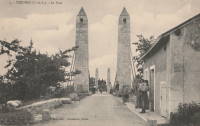
- Near 1832 La Roche-Posay (La Roche-Posay-les-Bains) - La Roche-Posay, Vienne and Indre-et-Loire, France.
Do you have any information or photos for these bridges that you would like to share? Please email david.denenberg@bridgemeister.com.