Suspension Bridges of Pennsylvania (101-119 of 119)
This is a list of bridges 101 through 119 (of 119 total) from the suspension bridge inventory for Pennsylvania in USA. Wherever you see a Bridgemeister ID number click it to isolate the bridge on its own page.
Related Lists:
(suspension bridge)
Apollo, Pennsylvania, USA - Kiskiminetas River
| Bridgemeister ID: | 4928 (added 2020-07-28) |
| Name: | (suspension bridge) |
| Location: | Apollo, Pennsylvania, USA |
| Crossing: | Kiskiminetas River |
| Use: | Vehicular |
| Status: | Collapsed, February, 1884 |
| Main Cables: | Wire |
Notes:
- Many American newspapers carried a brief story on February 29, 1884 or March 1, 1884 noting the failure of a wire suspension bridge at Apollo that sent two men and their horses into the river, killing one man and drowning the horses. The accounts are all similar, but with various misspellings and slight inconsistencies. From a Dakota Territory newspaper: "A wire bridge spanning the Kiskaminet river at Apollo, Pa., parted immediately over the pier in the middle of the river, and went down with a crash. William Henderson and Harry Yeneins were crossing the rivor with a load of sheet iron, and were thrown into the river. Henderson escaped with a cold bath, but Yenkins and the two horses were drowned." A Kansas newspaper: "A wire bridge spanning the Kiskamingo river, at Apollo, Pa., parted its wire cables on Tuesday, immediately over the pier in the middle of the river, and went down with a crash. Wm. Henderson and Harry Jenkins who were crossing with a loaded team, were thrown into the river. Jenkins and tho two horses were drowned."
(suspension bridge)
Cambridge Springs, Pennsylvania, USA - French Creek
| Bridgemeister ID: | 1007 (added 2003-11-21) |
| Name: | (suspension bridge) |
| Location: | Cambridge Springs, Pennsylvania, USA |
| Crossing: | French Creek |
| Status: | Replaced, 1906 |
Notes:
- Completed, 1870s.
(suspension bridge)
Jersey Shore vicinity, Pennsylvania, USA - Pine Creek
| Bridgemeister ID: | 1662 (added 2005-03-20) |
| Name: | (suspension bridge) |
| Location: | Jersey Shore vicinity, Pennsylvania, USA |
| Crossing: | Pine Creek |
| Coordinates: | 41.197030 N 77.291830 W |
| Maps: | Acme, GeoHack, Google, OpenStreetMap |
| Use: | Vehicular |
| Status: | Removed |
External Links:
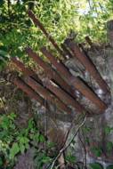
Baker
Ogdonia, Barbours vicinity, Pennsylvania, USA - Ogdonia Creek
| Bridgemeister ID: | 2037 (added 2006-05-07) |
| Name: | Baker |
| Location: | Ogdonia, Barbours vicinity, Pennsylvania, USA |
| Crossing: | Ogdonia Creek |
| At or Near Feature: | Camp Lycogis |
| Coordinates: | 41.41165 N 76.7085 W |
| Maps: | Acme, GeoHack, Google, OpenStreetMap |
| Use: | Footbridge |
| Status: | In use |
| Main Cables: | Wire |
| Suspended Spans: | 1 |
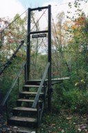
Boughton
Titusville vicinity, Venango County, Pennsylvania, USA - Oil Creek
| Bridgemeister ID: | 867 (added 2003-08-23) |
| Name: | Boughton |
| Location: | Titusville vicinity, Venango County, Pennsylvania, USA |
| Crossing: | Oil Creek |
| At or Near Feature: | Oil Creek State Park |
| Coordinates: | 41.59955 N 79.64521 W |
| Maps: | Acme, GeoHack, Google, OpenStreetMap |
| Use: | Footbridge |
| Status: | In use (last checked: 2005) |
| Main Cables: | Wire |
| Suspended Spans: | 1 |
| Main Span: | 1 x 39.6 meters (130 feet) |
Notes:
- The Pennsylvania Department of Conservation and Natural Resources posted an advisory, effective February 28, 2005, that this bridge was closed until further notice. This is likely a temporary closing.
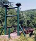
Chester D. Wolfe Memorial
Barbours vicinity, Pennsylvania, USA - Loyalsock Creek
| Bridgemeister ID: | 1878 (added 2005-09-24) |
| Name: | Chester D. Wolfe Memorial |
| Location: | Barbours vicinity, Pennsylvania, USA |
| Crossing: | Loyalsock Creek |
| Coordinates: | 41.38142 N 76.83792 W |
| Maps: | Acme, GeoHack, Google, OpenStreetMap |
| Use: | Footbridge |
| Status: | In use (last checked: 2005) |
| Main Cables: | Wire |
| Suspended Spans: | 1 |
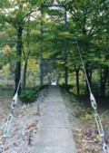
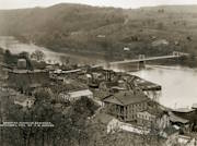
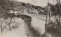
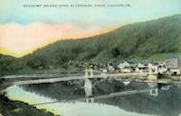
Economy
Tidioute, Pennsylvania, USA - Allegheny River
| Bridgemeister ID: | 302 (added before 2003) |
| Name: | Economy |
| Location: | Tidioute, Pennsylvania, USA |
| Crossing: | Allegheny River |
| Coordinates: | 41.680713 N 79.412452 W |
| Maps: | Acme, GeoHack, Google, OpenStreetMap |
| Use: | Vehicular |
| Status: | Removed |
| Main Cables: | Wire (steel) |
| Suspended Spans: | 2 |
| Main Spans: | 2 |
Gorge Trail (Lower)
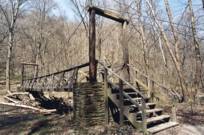
Rostraver, Pennsylvania, USA - Cedar Creek
| Bridgemeister ID: | 1958 (added 2005-11-05) |
| Name: | Gorge Trail (Lower) |
| Location: | Rostraver, Pennsylvania, USA |
| Crossing: | Cedar Creek |
| At or Near Feature: | Cedar Creek Park |
| Coordinates: | 40.1781 N 79.780533 W |
| Maps: | Acme, GeoHack, Google, OpenStreetMap |
| Use: | Footbridge |
| Status: | In use (last checked: 2005) |
| Main Cables: | Wire |
| Suspended Spans: | 1 |
| Main Span: | 1 x 18.3 meters (60 feet) estimated |
Notes:
Gorge Trail (Upper)
Rostraver, Pennsylvania, USA - Cedar Creek
| Bridgemeister ID: | 1992 (added 2005-12-03) |
| Name: | Gorge Trail (Upper) |
| Location: | Rostraver, Pennsylvania, USA |
| Crossing: | Cedar Creek |
| At or Near Feature: | Cedar Creek Park |
| Coordinates: | 40.171717 N 79.7834 W |
| Maps: | Acme, GeoHack, Google, OpenStreetMap |
| Use: | Footbridge |
| Status: | In use (last checked: 2005) |
| Main Cables: | Wire |
| Suspended Spans: | 1 |
| Main Span: | 1 x 12.8 meters (42 feet) estimated |
Notes:
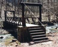
Labelle Preparation Plant
Vestaburg and Labelle, Pennsylvania, USA - Monongahela River
| Bridgemeister ID: | 2536 (added 2011-12-27) |
| Name: | Labelle Preparation Plant |
| Location: | Vestaburg and Labelle, Pennsylvania, USA |
| Crossing: | Monongahela River |
| Coordinates: | 40.01213 N 79.98867 W |
| Maps: | Acme, GeoHack, Google, OpenStreetMap |
| Use: | Conveyor |
| Status: | Demolished (last checked: 2011) |
| Main Cables: | Wire (steel) |
| Suspended Spans: | 1 |
| Main Span: | 1 |
Notes:
- Likely built 1949-1953. Huge derelict industrial conveyor suspension bridge, mostly demolished by 2011. Patrick S. O'Donnell estimated the main span at approximately 750 feet.
- Mostly demolished as of late 2011.
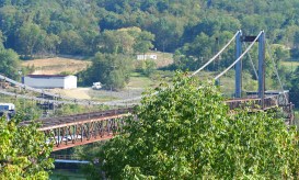
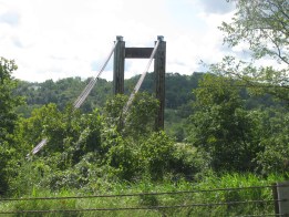
Overholt Distillery Swinging
Adelaide and Broad Ford, Pennsylvania, USA - Youghiogheny River
| Bridgemeister ID: | 2358 (added 2007-09-08) |
| Name: | Overholt Distillery Swinging |
| Location: | Adelaide and Broad Ford, Pennsylvania, USA |
| Crossing: | Youghiogheny River |
| Coordinates: | 40.04610 N 79.61201 W |
| Maps: | Acme, GeoHack, Google, OpenStreetMap |
| Status: | Derelict (last checked: 2009) |
| Main Cables: | Wire |
| Suspended Spans: | 6 |
| Main Spans: | 4 |
| Side Spans: | 2 |

Penn Public Service Co.
Rockwood, Pennsylvania, USA - Casselman River
| Bridgemeister ID: | 349 (added before 2003) |
| Name: | Penn Public Service Co. |
| Location: | Rockwood, Pennsylvania, USA |
| Crossing: | Casselman River |
| References: | SJR |
| Main Cables: | Wire (steel) |
| Suspended Spans: | 1 |
Rock Cut Farm
Baoba, Pennsylvania, USA - Lackawaxen River
| Bridgemeister ID: | 3792 (added 2020-03-01) |
| Name: | Rock Cut Farm |
| Also Known As: | Baoba |
| Location: | Baoba, Pennsylvania, USA |
| Crossing: | Lackawaxen River |
| Coordinates: | 41.479527 N 75.094446 W |
| Maps: | Acme, GeoHack, Google, OpenStreetMap |
| Use: | Footbridge |
| Status: | Replaced |
| Main Cables: | Wire |
Notes:
- Replaced by Rock Cut Farm (Baoba) - Baoba, Pennsylvania, USA.

Rock Cut Farm
Baoba, Pennsylvania, USA - Lackawaxen River
| Bridgemeister ID: | 3793 (added 2020-03-01) |
| Name: | Rock Cut Farm |
| Also Known As: | Baoba |
| Location: | Baoba, Pennsylvania, USA |
| Crossing: | Lackawaxen River |
| Coordinates: | 41.479367 N 75.094167 W |
| Maps: | Acme, GeoHack, Google, OpenStreetMap |
| Use: | Footbridge |
| Status: | Destroyed, June 2006 |
| Main Cables: | Wire (steel) |
| Suspended Spans: | 1 |
Notes:
- Destroyed by flood, June 2006.
- Replaced Rock Cut Farm (Baoba) - Baoba, Pennsylvania, USA.
- Replaced by 2007 Rock Cut Farm (Baoba) - Baoba, Pennsylvania, USA.
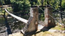
Swinging
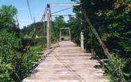
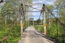
Everett, Pennsylvania, USA - Raystown Branch Juniata River
| Bridgemeister ID: | 1617 (added 2005-02-26) |
| Name: | Swinging |
| Location: | Everett, Pennsylvania, USA |
| Crossing: | Raystown Branch Juniata River |
| Coordinates: | 40.01670 N 78.3539 W |
| Maps: | Acme, GeoHack, Google, OpenStreetMap |
| Use: | Vehicular (one-lane) |
| Status: | In use (last checked: 2021) |
| Main Cables: | Wire (steel) |
| Suspended Spans: | 3 |
| Main Span: | 1 x 43 meters (141 feet) estimated |
| Side Spans: | 1 x 11 meters (36 feet) estimated, 1 x 12.5 meters (41 feet) estimated |
Swinging
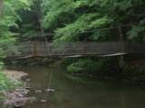
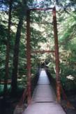
James Creek, Raystown Lake vicinity, Pennsylvania, USA - Trough Creek
| Bridgemeister ID: | 918 (added 2003-10-17) |
| Name: | Swinging |
| Location: | James Creek, Raystown Lake vicinity, Pennsylvania, USA |
| Crossing: | Trough Creek |
| At or Near Feature: | Trough Creek State Park |
| Coordinates: | 40.32213 N 78.13003 W |
| Maps: | Acme, GeoHack, Google, OpenStreetMap |
| Use: | Footbridge |
| Status: | In use (last checked: 2020) |
| Main Cables: | Wire |
| Suspended Spans: | 1 |
| Main Span: | 1 x 30.5 meters (100 feet) estimated |
Swinging
Prompton, Pennsylvania, USA - Lackawaxen River West Branch
| Bridgemeister ID: | 2340 (added 2007-08-11) |
| Name: | Swinging |
| Location: | Prompton, Pennsylvania, USA |
| Crossing: | Lackawaxen River West Branch |
| Coordinates: | 41.58233 N 75.32416 W |
| Maps: | Acme, GeoHack, Google, OpenStreetMap |
| Use: | Footbridge |
| Status: | In use (last checked: 2007) |
| Main Cables: | Wire |
| Suspended Spans: | 1 |
| Main Span: | 1 x 27.4 meters (90 feet) |
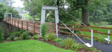
Swinging
South Connellsville, Pennsylvania, USA - Youghiogheny River
| Bridgemeister ID: | 8093 (added 2023-12-25) |
| Name: | Swinging |
| Location: | South Connellsville, Pennsylvania, USA |
| Crossing: | Youghiogheny River |
| Coordinates: | 39.988 N 79.591 W |
| Maps: | Acme, GeoHack, Google, OpenStreetMap |
| Use: | Footbridge |
| Status: | Removed |
| Main Cables: | Wire |
| Main Span: | 1 |
External Links:
- Facebook. Old image of the bridge. Posted December 9, 2012.
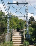
Windgap
Pittsburgh and McKees Rock, Pennsylvania, USA - Chartiers Creek
| Bridgemeister ID: | 370 (added before 2003) |
| Name: | Windgap |
| Also Known As: | McKees Rocks |
| Location: | Pittsburgh and McKees Rock, Pennsylvania, USA |
| Crossing: | Chartiers Creek |
| Coordinates: | 40.46333 N 80.07409 W |
| Maps: | Acme, GeoHack, Google, OpenStreetMap |
| References: | BOP |
| Use: | Footbridge |
| Status: | Removed, c. 2005 |
| Main Cables: | Wire (steel) |
| Suspended Spans: | 1 |
Notes:
- Damaged by flood (due to Hurricane Ivan), September 17, 2004. Removed, c. 2005.
External Links:
Do you have any information or photos for these bridges that you would like to share? Please email david.denenberg@bridgemeister.com.