Suspension Bridges 1850-1883 (201-258 of 258)
This is a list of bridges 201 through 258 (of 258 total) in the suspension bridge inventory completed from 1850 through 1883, the year the Brooklyn Bridge was completed. Wherever you see a Bridgemeister ID number click it to isolate the bridge on its own page.
Related Lists:
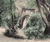
1874: Isidora
Lota, Chile
| Bridgemeister ID: | 7930 (added 2023-10-22) |
| Year Completed: | 1874 |
| Name: | Isidora |
| Location: | Lota, Chile |
| At or Near Feature: | Parque Isidora Cousiño De Lota |
| Status: | Only towers remain (last checked: 2023) |
External Links:
- Google Maps - Fuerte de Lota. Image of a suriving bridge tower, December 2022.
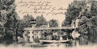
1874: Palmengarten
Frankfurt, Germany
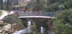
1875: (footbridge)
Castle Bergedorf, Bergedorf, Hamburg, Germany - castle moat
| Bridgemeister ID: | 799 (added 2003-03-29) |
| Year Completed: | 1875 |
| Name: | (footbridge) |
| Location: | Castle Bergedorf, Bergedorf, Hamburg, Germany |
| Crossing: | castle moat |
| Coordinates: | 53.489417 N 10.212 E |
| Maps: | Acme, GeoHack, Google, OpenStreetMap |
| Use: | Footbridge |
| Status: | In use (last checked: 2005) |
| Main Cables: | Wire |
| Suspended Spans: | 1 |
| Main Span: | 1 x 6.9 meters (22.6 feet) |
| Deck width: | 2 meters |
1875: (suspension bridge)
Clyde, New Zealand - Clutha River
| Bridgemeister ID: | 662 (added 2003-03-08) |
| Year Completed: | 1875 |
| Name: | (suspension bridge) |
| Location: | Clyde, New Zealand |
| Crossing: | Clutha River |
| Coordinates: | 45.190381 S 169.315298 E |
| Maps: | Acme, GeoHack, Google, OpenStreetMap |
| Principals: | L.D. Macgeorge, William Grant |
| References: | GAP |
| Status: | Destroyed, 1878 |
Notes:
- GAP: Destroyed by flood 1878.
- Replaced by 1881 Clyde - Clyde, New Zealand.
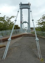
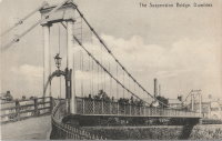
1875: Nith
Dumfries, Scotland, United Kingdom - River Nith
| Bridgemeister ID: | 524 (added before 2003) |
| Year Completed: | 1875 |
| Name: | Nith |
| Also Known As: | Biddall's |
| Location: | Dumfries, Scotland, United Kingdom |
| Crossing: | River Nith |
| Coordinates: | 55.065120 N 3.610292 W |
| Maps: | Acme, GeoHack, Google, OpenStreetMap |
| Principals: | J. Willett |
| Use: | Footbridge |
| Status: | In use (last checked: 2022) |
| Main Cables: | Chain (iron) |
| Suspended Spans: | 1 |
| Main Span: | 1 |
External Links:

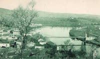
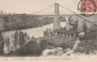
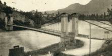
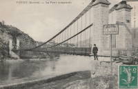
1875: Saint-Nazaire
Saint-Nazaire-en-Royans, Drôme and Saint-Hilaire-du-Rosier, Isère, France - Isère River
| Bridgemeister ID: | 7328 (added 2022-09-02) |
| Year Completed: | 1875 |
| Name: | Saint-Nazaire |
| Location: | Saint-Nazaire-en-Royans, Drôme and Saint-Hilaire-du-Rosier, Isère, France |
| Crossing: | Isère River |
| Coordinates: | 45.067313 N 5.243247 E |
| Maps: | Acme, GeoHack, Google, OpenStreetMap |
| Use: | Vehicular |
| Status: | Removed |
| Main Cables: | Wire |
| Suspended Spans: | 1 |
External Links:
1875: Swinging
Arroyo Grande, California, USA - Arroyo Grande Creek
| Bridgemeister ID: | 307 (added before 2003) |
| Year Completed: | 1875 |
| Name: | Swinging |
| Location: | Arroyo Grande, California, USA |
| Crossing: | Arroyo Grande Creek |
| Coordinates: | 35.12336 N 120.57703 W |
| Maps: | Acme, GeoHack, Google, OpenStreetMap |
| Principals: | Newton Short |
| Use: | Footbridge |
| Status: | In use (last checked: 2007) |
| Main Cables: | Wire |
| Suspended Spans: | 1 |
| Main Span: | 1 x 52.1 meters (171 feet) |
Notes:
- A rotary club plaque at the bridge reads, "To connect his properties, Newton Short built this swinging bridge without sides about 1875. Sides were added after 1902. The bridge was given to the City of Arroyo Grande on July 14, 1911,... Due to severe storm damage, the bridge was rebuilt in 1995."
1875: Swinging
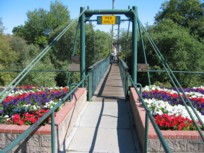
Frederick, Maryland, USA - Carroll Creek
| Bridgemeister ID: | 253 (added before 2003) |
| Year Completed: | 1875 |
| Name: | Swinging |
| Location: | Frederick, Maryland, USA |
| Crossing: | Carroll Creek |
| At or Near Feature: | Baker Park |
| Coordinates: | 39.415033 N 77.4208 W |
| Maps: | Acme, GeoHack, Google, OpenStreetMap |
| Use: | Footbridge |
| Status: | In use (last checked: 2022) |
| Main Cables: | Wire |
| Suspended Spans: | 1 |
Notes:
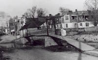
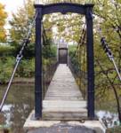
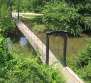
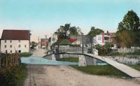
- The black and white photo shows the same bridge at its original location on Bentz Street (then Mill Alley). It was later moved to Baker Park, and then moved again (in 1927, 1928, or 1930 according to various sources) to its present location, another location in Baker Park.
- Local legend states this bridge was used by Stonewall Jackson and his troops when they entered Frederick on September 10, 1862.
- Closed March, 2008 due to safety concerns. Eventually reopened.
- Near 2006 William O. Lee (Carroll Creek Park) - Frederick, Maryland, USA.
External Links:
- Baker Park - Maryland Historic District. States bridge was built in 1875.
- Structurae - Structure ID 20011117
1876: Brunner
Brunner, New Zealand - Grey River / Māwheranui
| Bridgemeister ID: | 414 (added before 2003) |
| Year Completed: | 1876 |
| Name: | Brunner |
| Location: | Brunner, New Zealand |
| Crossing: | Grey River / Māwheranui |
| Coordinates: | 42.433068 S 171.324420 E |
| Maps: | Acme, GeoHack, Google, OpenStreetMap |
| Principals: | John Carruthers |
| References: | GAP |
| Use: | Vehicular and Rail |
| Status: | Restricted to foot traffic (last checked: 2017) |
| Main Cables: | Wire |
| Suspended Spans: | 1 |
Notes:
- GAP: Collapsed just before opening due to anchor plate failure, rebuilt. Rebuilt again 1925-1926. Towers replaced 1963-1964.

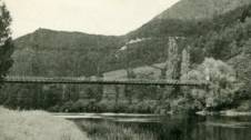
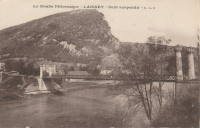
1876: Laissey
Laissey, Doubs, France - Doubs River
| Bridgemeister ID: | 2171 (added 2007-01-13) |
| Year Completed: | 1876 |
| Name: | Laissey |
| Location: | Laissey, Doubs, France |
| Crossing: | Doubs River |
| Coordinates: | 47.298411 N 6.236290 E |
| Maps: | Acme, GeoHack, Google, OpenStreetMap |
| Use: | Vehicular |
| Status: | Removed |
External Links:
1876: Lamagistère
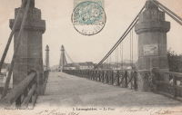
Lamagistère, Tarn-et-Garonne, France - Garonne River
| Bridgemeister ID: | 7175 (added 2022-07-01) |
| Year Completed: | 1876 |
| Name: | Lamagistère |
| Location: | Lamagistère, Tarn-et-Garonne, France |
| Crossing: | Garonne River |
| Coordinates: | 44.122921 N 0.819276 E |
| Maps: | Acme, GeoHack, Google, OpenStreetMap |
| Use: | Vehicular |
| Status: | Destroyed, 1930 |
| Main Cables: | Wire |
| Suspended Spans: | 2 |
| Main Spans: | 2 |
Notes:
- 1930: Destroyed by flood.
- Replaced 1850 Lamagistère - Lamagistère, Tarn-et-Garonne, France.
- Replaced by 1933 Lamagistère - Lamagistère, Tarn-et-Garonne, France.
External Links:
1876: Linwood
Linwood, Ohio, USA - Little Miami River
| Bridgemeister ID: | 82 (added before 2003) |
| Year Completed: | 1876 |
| Name: | Linwood |
| Location: | Linwood, Ohio, USA |
| Crossing: | Little Miami River |
| Principals: | Cincinnati Bridge Co. |
| References: | EOV |
| Status: | Removed |
Notes:
- Replaced after 1913 flood damage.
1876: Nile River
Charleston, New Zealand - Nile (Waitakere) River
| Bridgemeister ID: | 659 (added 2003-03-08) |
| Year Completed: | 1876 |
| Name: | Nile River |
| Location: | Charleston, New Zealand |
| Crossing: | Nile (Waitakere) River |
| Coordinates: | 41.899278 S 171.443694 E |
| Maps: | Acme, GeoHack, Google, OpenStreetMap |
| Principals: | Arthur Dudley Dobson |
| References: | GAP |
| Use: | Vehicular |
| Status: | Removed |
| Suspended Spans: | 1 |
Notes:
- A new suspension bridge was installed on the same piers in the 2020-2021 time frame.
- Later at same location 2021 Waitakere/Nile River - Charleston, New Zealand.
External Links:
1876: Petroleum Street
Oil City, Pennsylvania, USA - Allegheny River
| Bridgemeister ID: | 83 (added before 2003) |
| Year Completed: | 1876 |
| Name: | Petroleum Street |
| Also Known As: | Oil City |
| Location: | Oil City, Pennsylvania, USA |
| Crossing: | Allegheny River |
| Principals: | Charles Roebling |
| References: | AAJ, HAERPA461, HBE, PTS2, TRS |
| Use: | Vehicular |
| Status: | Removed |
| Main Cables: | Wire |
| Suspended Spans: | 3 |
| Main Span: | 1 x 152.4 meters (500 feet) |
| Side Spans: | 2 |
Notes:
- AAJ: Rebuilt, 1884, 1905.
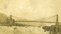
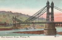
1876: Point
Pittsburgh, Pennsylvania, USA - Monongahela River
| Bridgemeister ID: | 84 (added before 2003) |
| Year Completed: | 1876 |
| Name: | Point |
| Location: | Pittsburgh, Pennsylvania, USA |
| Crossing: | Monongahela River |
| Principals: | Edward Hemberle |
| References: | AAJ, BOP, BPL, HBE, IEA, ONF, PBR, PTS2, SA19000106 |
| Use: | Vehicular and Rail (streetcar) |
| Status: | Demolished, 1927 |
| Main Cables: | Eyebar |
| Suspended Spans: | 1 |
| Main Span: | 1 x 243.8 meters (800 feet) |
| Deck width: | 34 feet |
Notes:
- Partial floor collapse requiring extensive repairs, December 24, 1903. Repaired, 1904. Demolished 1927.
External Links:
1876: Zoar
Stevenson vicinity, Connecticut, USA - Housatonic River
| Bridgemeister ID: | 85 (added before 2003) |
| Year Completed: | 1876 |
| Name: | Zoar |
| Location: | Stevenson vicinity, Connecticut, USA |
| Crossing: | Housatonic River |
| Use: | Vehicular (one-lane) |
| Status: | Demolished, 1919 |
| Main Cables: | Wire |
| Suspended Spans: | 1 |
Notes:
- Located on the road connecting Monroe to Oxford, until 1919 when the Stevenson Dam was built.
- May have been significantly widened, c. 1910.

1877: (suspension bridge)
Kent, Ohio, USA - Cuyahoga River
| Bridgemeister ID: | 1979 (added 2005-11-27) |
| Year Completed: | 1877 |
| Name: | (suspension bridge) |
| Location: | Kent, Ohio, USA |
| Crossing: | Cuyahoga River |
| Status: | Removed |
| Main Cables: | Wire (iron) |
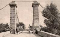
1877: Canet
Ventenac-en-Minervois and Canet, Aude, France - Aude River
| Bridgemeister ID: | 5658 (added 2021-01-01) |
| Year Completed: | 1877 |
| Name: | Canet |
| Location: | Ventenac-en-Minervois and Canet, Aude, France |
| Crossing: | Aude River |
| Coordinates: | 43.240039 N 2.855134 E |
| Maps: | Acme, GeoHack, Google, OpenStreetMap |
| References: | AAJ |
| Use: | Vehicular |
| Status: | Removed |
| Main Cables: | Wire |
| Suspended Spans: | 1 |
Notes:
- Piers are still present (in 2020) next to the current Aude River crossing at this location.
1877: Cottaneva
Cottaneva Creek, Rockport, California, USA - Rockport Bay, Pacific Ocean
| Bridgemeister ID: | 1152 (added 2004-01-18) |
| Year Completed: | 1877 |
| Name: | Cottaneva |
| Location: | Cottaneva Creek, Rockport, California, USA |
| Crossing: | Rockport Bay, Pacific Ocean |
| Coordinates: | 39.736703 N 123.832585 W |
| Maps: | Acme, GeoHack, Google, OpenStreetMap |
| Principals: | Pacific Bridge Co. |
| References: | AAJ |
| Use: | Vehicular (one-lane) |
| Status: | Removed |
| Main Cables: | Wire (iron) |
| Suspended Spans: | 1 |
| Main Span: | 1 x 82.3 meters (270 feet) |
Notes:
- This bridge was part of the Rockport lumber mill (Mendocino County). The bridge stretched over ocean to a large rock in the bay.
- Jakkula cites two sources describing the cables as steel.
- Don Sayenga transcribed one of Jakkula's references, The Iron Age Volume XX , No. 3 (August 2, 1877) Page 1: "A Steel Wire Suspension Bridge In California"
The Pacific Bridge Company are building in Mendocino county, California at Cottoneva, a suspension bridge which is described as follows "The distance from center to center of the saddles on the towers is 270 feet. The deflection or fall of the cable is 23 feet 6 inches. The cables are built in the same manner as those of the Clifton bridge at Niagara. The steel wire is about No. 11 Birmingham gauge, and is protected against rust by immersing in a bath which it a fine coat of zinc. There are eleven wires in each strand, seven strands in each rope, and seven ropes in each cable. The ropes are not twisted together to form the cable but gathered up every six feet by the suspender bands. Each rope is warranted to bear a strain of 60 tons. It is made fast to an independent anchor bar, 1 by 3 inches in diameter, and forming links 18 feet long, until connection is made with the anchors. The anchors are of cast iron, 3-1/2 by 3 feet in surface, weigh 1000 pounds each, and are placed 14 feet below the surface of the rock. Great care was taken in securing the anchors in place by means of cross I beams which run under the rock on either side. The lower part of each pit was enlarged to so as to form a hemispherical chamber, and the rock work, set in Portland cement, which is built upon the anchor, is so constructed that the upward strain is transmitted to the sides. The towers are of red wood. There are four posts 10 x 10 inches and two 10 x 12 inches, giving an effective area of 640 inches to withstand the strain of the cables on the tower. The wooden truss to prevent vertical vibration is 8 feet high and of the Howe truss pattern. The 270 feet of the bridge is divided into 45 pannels. The longest suspenders, 44 in number are of 7/8 inch steel wire, the 42 shorter ones are of 1-1/8 inch solid iron. The estimated dead load of the bridge is 1000 pounds per linear foot; live load, one ton per linear foot; in all, one and one half tons, or one fifth of actual breaking load. The bridge will be completed in about 30 days and promises to be a structure which the builders may well be proud of."
Don writes: "[In] Jakkula's last citation, he is saying that this is factory-made wire rope... The construction of the wire rope (7 by 11) used in the main cables is not common for the USA as of 1877; in fact it is extremely uncommon. The wire ropes used at Clifton/Niagara were made in England -- it wouldn't surprise me if these were made in England too."
1877: Jhulaghat
Juluaghat, Dasharathchanda, Nepal and Jhulaghat, Uttarakhand, India - Sharda River
| Bridgemeister ID: | 4344 (added 2020-04-11) |
| Year Completed: | 1877 |
| Name: | Jhulaghat |
| Also Known As: | झुलाघाट |
| Location: | Juluaghat, Dasharathchanda, Nepal and Jhulaghat, Uttarakhand, India |
| Crossing: | Sharda River |
| Coordinates: | 29.571577 N 80.382849 E |
| Maps: | Acme, GeoHack, Google, OpenStreetMap |
| Use: | Vehicular (one-lane) |
| Status: | Restricted to foot traffic (last checked: 2023) |
| Main Cables: | Eyebar |
| Suspended Spans: | 1 |
Notes:
- 2022-2023: Damaged during 2022 monsoon season. Reopened October 2023.
External Links:
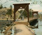
1877: Lead Mine
Gorham, New Hampshire, USA
| Bridgemeister ID: | 1198 (added 2004-01-28) |
| Year Completed: | 1877 |
| Name: | Lead Mine |
| Also Known As: | Hutchinson |
| Location: | Gorham, New Hampshire, USA |
| Principals: | Timothy H. Hutchinson |
| Use: | Vehicular (one-lane) |
| Status: | Collapsed, 1921 |
| Main Cables: | Wire |
| Suspended Spans: | 1 |
Notes:
- Provided access to Mascot Mine. Collapsed, 1921.
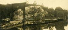
1877: Minneapolis
Minneapolis, Minnesota, USA - Mississippi River
| Bridgemeister ID: | 86 (added before 2003) |
| Year Completed: | 1877 |
| Name: | Minneapolis |
| Location: | Minneapolis, Minnesota, USA |
| Crossing: | Mississippi River |
| At or Near Feature: | Nicollet Island |
| Principals: | Thomas M. Griffith |
| References: | AAJ, BPL, HBE, PTS2 |
| Use: | Vehicular, with walkway |
| Status: | Replaced, 1890 |
| Main Cables: | Wire (iron) |
| Suspended Spans: | 1 |
| Main Span: | 1 x 205.8 meters (675.1 feet) |
| Deck width: | 32 feet |
Notes:
- Replaced 1855 Minneapolis (St. Anthony's Falls) - Minneapolis, Minnesota, USA.
- Later at same location 1990 Hennepin Avenue (Father Louis Hennepin) - Minneapolis, Minnesota, USA.
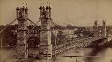
1877: Netherby
Kirksandrew-upon-Esk, Longtown vicinity, Cumbria and Netherby, England, United Kingdom - River Esk
| Bridgemeister ID: | 2369 (added 2007-09-28) |
| Year Completed: | 1877 |
| Name: | Netherby |
| Location: | Kirksandrew-upon-Esk, Longtown vicinity, Cumbria and Netherby, England, United Kingdom |
| Crossing: | River Esk |
| Coordinates: | 55.03855 N 2.95261 W |
| Maps: | Acme, GeoHack, Google, OpenStreetMap |
| Use: | Footbridge |
| Status: | In use (last checked: 2012) |
| Main Cables: | Wire |
| Suspended Spans: | 1 |
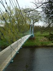
1877: Punalur
Punalur, Kerala, India - Kallada River
| Bridgemeister ID: | 415 (added before 2003) |
| Year Completed: | 1877 |
| Name: | Punalur |
| Location: | Punalur, Kerala, India |
| Crossing: | Kallada River |
| Coordinates: | 9.018114 N 76.927620 E |
| Maps: | Acme, GeoHack, Google, OpenStreetMap |
| Principals: | Albert Henry |
| Use: | Vehicular (one-lane) |
| Status: | Restricted to foot traffic (last checked: 2019) |
| Main Cables: | Eyebar |
| Suspended Spans: | 3 |
| Main Span: | 1 |
| Side Spans: | 2 |
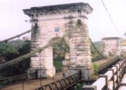
1877: Victoria
Mandi, Himachal Pradesh, India - Beas River
| Bridgemeister ID: | 2750 (added 2019-06-23) |
| Year Completed: | 1877 |
| Name: | Victoria |
| Location: | Mandi, Himachal Pradesh, India |
| Crossing: | Beas River |
| Coordinates: | 31.712668 N 76.933310 E |
| Maps: | Acme, GeoHack, Google, OpenStreetMap |
| Use: | Vehicular (one-lane) |
| Status: | In use (last checked: 2019) |
| Main Cables: | Wire |
| Suspended Spans: | 1 |
External Links:
1878: (suspension bridge)
New Zealand - Hawea River
| Bridgemeister ID: | 664 (added 2003-03-08) |
| Year Completed: | 1878 |
| Name: | (suspension bridge) |
| Location: | New Zealand |
| Crossing: | Hawea River |
| Principals: | William Grant, McKellar |
| References: | GAP |
1878: Maynard Street
Williamsport, Pennsylvania, USA - Susquehanna River
| Bridgemeister ID: | 2140 (added 2006-10-31) |
| Year Completed: | 1878 |
| Name: | Maynard Street |
| Location: | Williamsport, Pennsylvania, USA |
| Crossing: | Susquehanna River |
| Use: | Vehicular |
| Status: | Removed |
| Main Cables: | Wire |
Notes:
- Damaged by flood, June 1, 1889. Rebuilt, but unclear if rebuilt as a suspension bridge. May have been rebuilt as a truss bridge.
- Near 1865 Market Street - Williamsport, Pennsylvania, USA.
1878: Sedgwick
Sedgwick and Sizergh, England, United Kingdom - River Kent
| Bridgemeister ID: | 1313 (added 2004-04-16) |
| Year Completed: | 1878 |
| Name: | Sedgwick |
| Also Known As: | Low Park Woods, New Sedgwick |
| Location: | Sedgwick and Sizergh, England, United Kingdom |
| Crossing: | River Kent |
| Coordinates: | 54.281 N 2.7564 W |
| Maps: | Acme, GeoHack, Google, OpenStreetMap |
| Principals: | Francis James Willacy |
| Use: | Footbridge |
| Status: | In use (last checked: 2010) |
| Suspended Spans: | 1 |
Notes:
- 1988-1989: Restoration project completed
- 2022, August-September: Bridge closed for repairs. Reopened.
- Similar to 1862 (footbridge) - Greystead, England, United Kingdom.
External Links:
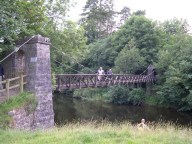
1878: Spider
Crewe, England, United Kingdom
| Bridgemeister ID: | 1843 (added 2005-07-15) |
| Year Completed: | 1878 |
| Name: | Spider |
| Also Known As: | Midge |
| Location: | Crewe, England, United Kingdom |
| Use: | Rail |
| Status: | Demolished, 1939 |
| Main Cables: | Wire |
Notes:
- Carried a narrow gauge rail line over several tracks at the Crewe Locomotive Works. Used as a footbridge, 1929-1939.
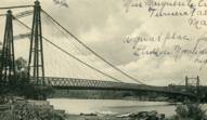
1878: Upper
Turners Falls, Montague, Massachusetts, USA - Connecticut River
| Bridgemeister ID: | 87 (added before 2003) |
| Year Completed: | 1878 |
| Name: | Upper |
| Also Known As: | Red |
| Location: | Turners Falls, Montague, Massachusetts, USA |
| Crossing: | Connecticut River |
| Principals: | J.W. Shipman |
| References: | CCR |
| Use: | Vehicular |
| Status: | Dismantled, 1942 |
| Main Cables: | Wire |
Notes:
External Links:
1879: Azuqueca
Azuqueca de Henares, Guadalajara, Spain - Henares River
| Bridgemeister ID: | 7625 (added 2023-05-27) |
| Year Completed: | 1879 |
| Name: | Azuqueca |
| Location: | Azuqueca de Henares, Guadalajara, Spain |
| Crossing: | Henares River |
| Coordinates: | 40.555941 N 3.246655 W |
| Maps: | Acme, GeoHack, Google, OpenStreetMap |
| Use: | Footbridge |
| Status: | Derelict (last checked: 2022) |
| Suspended Spans: | 1 |
External Links:
- Azuqueca: SOS Save "The Hanging Bridge". Blog devoted to saving the bridge. Includes many photos.
- Maneti Lugares qUe Disfrutar: Puente Colgante Rio Henares Azuqueca De Henares (Guadalajara)
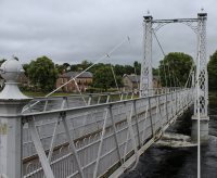
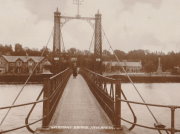
1879: Infirmary
Inverness, Scotland, United Kingdom - River Ness
| Bridgemeister ID: | 539 (added before 2003) |
| Year Completed: | 1879 |
| Name: | Infirmary |
| Location: | Inverness, Scotland, United Kingdom |
| Crossing: | River Ness |
| Coordinates: | 57.471653 N 4.228844 W |
| Maps: | Acme, GeoHack, Google, OpenStreetMap |
| Principals: | C. R. Manners |
| References: | HBR |
| Use: | Footbridge |
| Status: | In use (last checked: 2021) |
| Main Cables: | Wire |
| Suspended Spans: | 3 |
| Main Span: | 1 x 61 meters (200 feet) |
| Side Spans: | 2 x 12.8 meters (42 feet) |
Notes:
- 2020, November: Highland Council likely to close bridge if funding for urgent repairs cannot be raised.
- 2021, July: Reopened after interim repairs completed. Future major refurbishment expected.
- Companion to 1881 Greig Street (Wobbly) - Inverness, Scotland, United Kingdom.
Annotated Citations:
- Glen, Louise. “Closure Fears for Iconic Inverness Bridge Facing Huge Repair Bill.” Inverness Courier, 21 Apr. 2021, www.inverness-courier.co.uk/news/closure-fears-for-iconic-inverness-bridge-facing-huge-repair-235713/.
"Fears have been raised that decades of under investment in an iconic city bridge could see it closed permanently. Members of Ballifeary Community Council believe the cost of fixing and upgrading the Infirmary Bridge to bring it up to modern standards may be more than £1 million..."
- Duncan, Ian. "The future of Infirmary Bridge secured into the 2040s as Highland Council's Economy and Infrastructure Committee today agrees up to £550,000 in funding for repairs." Inverness Courier, 05 May 2021, www.inverness-courier.co.uk/news/the-future-of-infirmary-bridge-secured-into-the-2040s-237340/.
"Highland Council's Economy and Infrastructure Committee agreed today to include up to £550,000 for repairs for Infirmary Bridge… 'It will be 2022 before the repairs are completed, but once done the bridge's life will be extended for a further 20 to 25 years.'"
External Links:

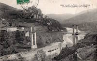
1879: Saint-Ilpize
Saint-Ilpize, Haute-Loire, France - Allier River
| Bridgemeister ID: | 1097 (added 2004-01-02) |
| Year Completed: | 1879 |
| Name: | Saint-Ilpize |
| Location: | Saint-Ilpize, Haute-Loire, France |
| Crossing: | Allier River |
| Coordinates: | 45.198556 N 3.386866 E |
| Maps: | Acme, GeoHack, Google, OpenStreetMap |
| Principals: | Ferdinand Arnodin |
| References: | AAJ, BPF, HBE, PTS2 |
| Use: | Vehicular (one-lane) |
| Status: | In use (last checked: 2020) |
| Main Cables: | Wire |
| Suspended Spans: | 3 |
| Main Span: | 1 x 70.35 meters (230.8 feet) |
| Side Spans: | 2 |
| Deck width: | 18 feet |
Notes:
- The side spans are supported solely by inclined stays, not suspenders from the main cables.
- Closed to all traffic on July 15, 2004 due to damage to the deck, possibly caused by an overloaded truck. Repaired and reopened.
External Links:
1879: Shaky
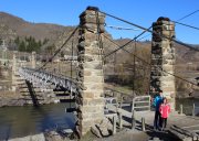
Alexandra, New Zealand - Manuherikia River
| Bridgemeister ID: | 665 (added 2003-03-08) |
| Year Completed: | 1879 |
| Name: | Shaky |
| Also Known As: | Manuherikia |
| Location: | Alexandra, New Zealand |
| Crossing: | Manuherikia River |
| Coordinates: | 45.253846 S 169.398651 E |
| Maps: | Acme, GeoHack, Google, OpenStreetMap |
| Principals: | L.D. Macgeorge, William Grant, McKellar |
| References: | GAP |
| Use: | Vehicular (one-lane) |
| Status: | Restricted to foot traffic (last checked: 2017) |
| Main Cables: | Wire |
| Suspended Spans: | 1 |
Notes:
- Restored as a pedestrian-only bridge, 1952. Refurbished, 2009.
- Near 1882 Alexandra - Alexandra, New Zealand.
1879: Swing
Monymusk, Scotland, United Kingdom - River Don
| Bridgemeister ID: | 2192 (added 2007-01-26) |
| Year Completed: | 1879 |
| Name: | Swing |
| Location: | Monymusk, Scotland, United Kingdom |
| Crossing: | River Don |
| Principals: | Harper & Co. |
| References: | HARPER |
| Use: | Footbridge |
| Status: | Demolished, c. 2005 |
| Main Cables: | Wire |
| Suspended Spans: | 1 |
| Main Span: | 1 x 32.6 meters (107 feet) |
External Links:

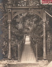
1879: Viljandi
Viljandi, Estonia
| Bridgemeister ID: | 2654 (added 2019-03-03) |
| Year Completed: | 1879 |
| Name: | Viljandi |
| Location: | Viljandi, Estonia |
| At or Near Feature: | Viljandi Castle Park |
| Coordinates: | 58.358912 N 25.594293 E |
| Maps: | Acme, GeoHack, Google, OpenStreetMap |
| Principals: | Felser and Co. |
| Use: | Footbridge |
| Status: | In use (last checked: 2018) |
| Suspended Spans: | 1 |
Notes:
- 1931: Relocated from original location at Tarvastu Manor. Coordinates provided here represent the new location of the bridge.
- 1995: Reconstructed.
1880: Birkhall
Birkhall, Ballater, Scotland, United Kingdom - River Muick
| Bridgemeister ID: | 2193 (added 2007-01-26) |
| Year Completed: | 1880 |
| Name: | Birkhall |
| Location: | Birkhall, Ballater, Scotland, United Kingdom |
| Crossing: | River Muick |
| Coordinates: | 57.028215 N 3.072693 W |
| Maps: | Acme, GeoHack, Google, OpenStreetMap |
| Principals: | Harper & Co. |
| References: | HARPER |
| Use: | Footbridge |
| Status: | Destroyed, December, 2015 |
| Main Cables: | Wire |
| Suspended Spans: | 1 |
| Main Span: | 1 x 18.3 meters (60 feet) |
Notes:
- 2015, December: Destroyed by flooding during Storm Frank.
- Replaced by Birkhall - Birkhall, Ballater, Scotland, United Kingdom.
External Links:
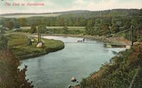
1880: Burnhervie
Burnhervie, Inverurie vicinity, Scotland, United Kingdom - River Don
| Bridgemeister ID: | 2174 (added 2007-01-13) |
| Year Completed: | 1880 |
| Name: | Burnhervie |
| Location: | Burnhervie, Inverurie vicinity, Scotland, United Kingdom |
| Crossing: | River Don |
| Coordinates: | 57.261024 N 2.440063 W |
| Maps: | Acme, GeoHack, Google, OpenStreetMap |
| Principals: | Harper & Co. |
| References: | HARPER |
| Use: | Footbridge |
| Status: | Collapsed, 1979 |
| Main Cables: | Wire |
| Main Span: | 1 x 30.5 meters (100 feet) |
Notes:
- Completed c. 1880. Douglas Harper writes: "The original bridge was built by Harper & Co, Aberdeen, around 1880 and its timber pylons were replaced with cast iron ones. In 1979 when overloaded during a raft race a bank stay cable failed and a major rebuild was undertaken by the local authority. This version was similar to its predecessor but was repalced in 2005 by a cable stayed bridge."
- Replaced by 1980 Shakin - Burnhervie, Inverurie vicinity, Scotland, United Kingdom.
External Links:
1880: Daniel O'Connell
Ophir, New Zealand - Manuherikia River
| Bridgemeister ID: | 666 (added 2003-03-08) |
| Year Completed: | 1880 |
| Name: | Daniel O'Connell |
| Location: | Ophir, New Zealand |
| Crossing: | Manuherikia River |
| Coordinates: | 45.110783 S 169.590268 E |
| Maps: | Acme, GeoHack, Google, OpenStreetMap |
| Principals: | L.D. Macgeorge, J.S. Derby, R. Edgar |
| References: | GAP |
| Use: | Vehicular (one-lane) |
| Status: | In use (last checked: 2018) |
| Main Cables: | Wire |
| Suspended Spans: | 1 |
| Main Span: | 1 x 65.5 meters (214.9 feet) |
External Links:
1880: Fitzroy
Rockhampton, Queensland, Australia - Fitzroy River
| Bridgemeister ID: | 416 (added before 2003) |
| Year Completed: | 1880 |
| Name: | Fitzroy |
| Location: | Rockhampton, Queensland, Australia |
| Crossing: | Fitzroy River |
| Principals: | F. J. Byerley, Owen Jones |
| References: | AAJ, STC |
| Use: | Vehicular |
| Status: | Demolished, 1956 |
| Main Cables: | Chain (iron) |
| Suspended Spans: | 6 |
| Main Spans: | 4 x 70.7 meters (232 feet) |
| Side Spans: | 2 x 26.5 meters (86.9 feet) |
| Deck width: | 21 feet |
Notes:
- Damaged during flood, 1890. Repaired, 1891.
External Links:
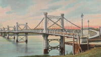
1880: Kawarau Gorge
Kawarau Gorge, Central Otago, New Zealand - Kawarau River Gorge
| Bridgemeister ID: | 667 (added 2003-03-08) |
| Year Completed: | 1880 |
| Name: | Kawarau Gorge |
| Location: | Kawarau Gorge, Central Otago, New Zealand |
| Crossing: | Kawarau River Gorge |
| Coordinates: | 45.008882 S 168.899938 E |
| Maps: | Acme, GeoHack, Google, OpenStreetMap |
| Principals: | H.P. Higginson, A.R.W Fulton, W.C. Edwards |
| References: | AAJ, GAP |
| Use: | Vehicular (one-lane) |
| Status: | Restricted to foot traffic (last checked: 2017) |
| Main Cables: | Wire (iron) |
| Suspended Spans: | 1 |
| Main Span: | 1 x 91.4 meters (300 feet) |
Notes:
- Appears to now be used solely as a bungee-jumping platform.
External Links:
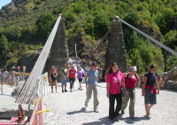
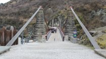
1880: Rosentalbrücke
Braunschweig, Niedersachsen, Germany - Westlicher Umflutgraben, Oker River
| Bridgemeister ID: | 1409 (added 2004-07-04) |
| Year Completed: | 1880 |
| Name: | Rosentalbrücke |
| Location: | Braunschweig, Niedersachsen, Germany |
| Crossing: | Westlicher Umflutgraben, Oker River |
| At or Near Feature: | Inselwall |
| Coordinates: | 52.2686 N 10.5143 E |
| Maps: | Acme, GeoHack, Google, OpenStreetMap |
| Use: | Footbridge |
| Status: | In use (last checked: 2006) |
| Suspended Spans: | 1 |
| Main Span: | 1 x 36 meters (118.1 feet) |
| Deck width: | 1.7 meters |
Notes:
- Eckhard Bernstorff notes: "Suspended with connections from 'chains' to towers, gravity anchored in the ground (backstays), but 'hangers' not adjustable (like truss)."
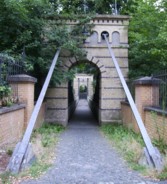
1880: Suspension Pier
Seaview, Isle of Wight, England, United Kingdom
| Bridgemeister ID: | 2409 (added 2007-12-24) |
| Year Completed: | 1880 |
| Name: | Suspension Pier |
| Location: | Seaview, Isle of Wight, England, United Kingdom |
| References: | AAJ |
| Use: | Footbridge |
| Status: | Destroyed, December, 1950 |
| Main Spans: | 3 |
1881: Clyde
Clyde, New Zealand - Clutha River
| Bridgemeister ID: | 663 (added 2003-03-08) |
| Year Completed: | 1881 |
| Name: | Clyde |
| Location: | Clyde, New Zealand |
| Crossing: | Clutha River |
| Coordinates: | 45.190387 S 169.315977 E |
| Maps: | Acme, GeoHack, Google, OpenStreetMap |
| Principals: | William Grant, McKellar |
| References: | GAP |
| Use: | Vehicular (one-lane) |
| Status: | Replaced, 1936 |
| Main Cables: | Wire |
| Suspended Spans: | 3 |
| Main Span: | 1 |
| Side Spans: | 2 |
Notes:
- Replaced by a large single-span truss bridge that sits on the suspension bridge piers.
- Replaced 1875 (suspension bridge) - Clyde, New Zealand.
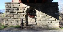
1881: Cromdale
Cromdale, Scotland, United Kingdom - River Spey
| Bridgemeister ID: | 2194 (added 2007-01-26) |
| Year Completed: | 1881 |
| Name: | Cromdale |
| Location: | Cromdale, Scotland, United Kingdom |
| Crossing: | River Spey |
| Coordinates: | 57.341944 N 3.553111 W |
| Maps: | Acme, GeoHack, Google, OpenStreetMap |
| Principals: | Harper & Co. |
| References: | HARPER |
| Use: | Footbridge |
| Status: | Collapsed, 1892 |
| Main Cables: | Wire |
| Main Span: | 1 x 59.4 meters (195 feet) |
Notes:
- Replaced by 1894 Cromdale - Cromdale, Scotland, United Kingdom.
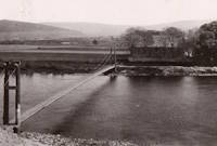
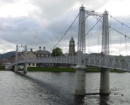
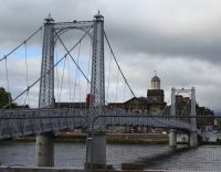
1881: Greig Street
Inverness, Scotland, United Kingdom - River Ness
| Bridgemeister ID: | 538 (added before 2003) |
| Year Completed: | 1881 |
| Name: | Greig Street |
| Also Known As: | Wobbly |
| Location: | Inverness, Scotland, United Kingdom |
| Crossing: | River Ness |
| Coordinates: | 57.479111 N 4.229796 W |
| Maps: | Acme, GeoHack, Google, OpenStreetMap |
| References: | HBR |
| Use: | Footbridge |
| Status: | In use (last checked: 2021) |
| Main Cables: | Wire |
| Suspended Spans: | 3 |
| Main Span: | 1 |
| Side Spans: | 2 |
Notes:
- Companion to 1879 Infirmary - Inverness, Scotland, United Kingdom.
- Near 1855 Ness - Inverness, Scotland, United Kingdom. In some photos, the two bridges are visible within a few hundred yards of each other.
External Links:
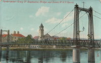
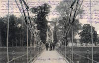
1881: Kettenbrücke
Leipzig, Germany
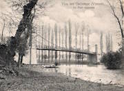
1881: Vicq-sur-Gartempe
Vicq-sur-Gartempe, Vienne, France - Gartempe River
| Bridgemeister ID: | 3996 (added 2020-03-27) |
| Year Completed: | 1881 |
| Name: | Vicq-sur-Gartempe |
| Location: | Vicq-sur-Gartempe, Vienne, France |
| Crossing: | Gartempe River |
| Use: | Vehicular |
| Status: | Removed |
| Main Cables: | Wire |
Notes:
- Replaced 1840 Vicq-sur-Gartempe - Vicq-sur-Gartempe and Champagne, Vienne, France.
- Replaced by 1931 Vicq-sur-Gartempe - Vicq-sur-Gartempe, Vienne, France.
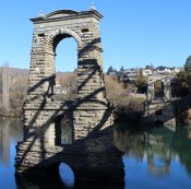
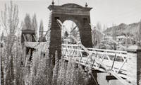
1882: Alexandra
Alexandra, New Zealand - Clutha River
| Bridgemeister ID: | 668 (added 2003-03-08) |
| Year Completed: | 1882 |
| Name: | Alexandra |
| Location: | Alexandra, New Zealand |
| Crossing: | Clutha River |
| Coordinates: | 45.258245 S 169.391270 E |
| Maps: | Acme, GeoHack, Google, OpenStreetMap |
| Principals: | L.D. Macgeorge, Jeremiah Drummey, Robert Hay |
| References: | GAP |
| Use: | Vehicular (one-lane) |
| Status: | Only towers remain (last checked: 2017) |
| Main Cables: | Wire |
| Main Span: | 1 x 79.9 meters (262.1 feet) |
Notes:
- Bypassed, 1958, at which point the bridge deck and cables were removed leaving only the towers.
- Near 1879 Shaky (Manuherikia) - Alexandra, New Zealand.
External Links:
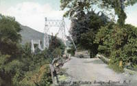
1882: Fitch's
Elmira, New York, USA - Chemung River
| Bridgemeister ID: | 88 (added before 2003) |
| Year Completed: | 1882 |
| Name: | Fitch's |
| Also Known As: | Fitches, Fisches, Lumbermens |
| Location: | Elmira, New York, USA |
| Crossing: | Chemung River |
| Coordinates: | 42.082409 N 76.866470 W |
| Maps: | Acme, GeoHack, Google, OpenStreetMap |
| Use: | Vehicular (one-lane) |
| Status: | Removed |
| Main Cables: | Wire |
| Main Span: | 1 |
External Links:
- Fitch Family History and Genealogy. Although this bridge is known by a variety of names (and misspellings), this Fitch family site states Daniel Hollenbeck Fitch contributed $10,000 to the construction of the bridge and refer to it as "Fitch's Bridge".
1882: Long Creek
Melvern vicinity, Kansas, USA - Long Creek
| Bridgemeister ID: | 2062 (added 2006-06-03) |
| Year Completed: | 1882 |
| Name: | Long Creek |
| Location: | Melvern vicinity, Kansas, USA |
| Crossing: | Long Creek |
| At or Near Feature: | Francis Crossing |
| Principals: | Wilden Bridge Company |
| Use: | Vehicular (one-lane) |
| Status: | Removed, c. 1970 |
Notes:
- In the June 18, 1970 edition of the Daily Tribune newspaper (Great Bend, Kansas) an article titled "Last Suspension Bridge to Fall" describes this bridge: "The suspension bridge appears to be going the way of the old covered bridge in Kansas. At least, the particular type of suspension span represented by Osage County Bridge No. 18 may be gone when this structure is replaced within two years. L.D. Pierce, Osage County engineer, said he believes this 'homemade' suspension bridge probably is the last of its kind in this state. He said it was built in 1882 from a pencil-drawn plan that probably was prepared by asurveyor or a millwright. He said it was constructed with materials that could be found in any hardware store and lumber yard. For example, cables are No. 9 gauge wire, bound together. Pierce said at one time there were five or six of these bridges in Osage County. The 100-foot span over Long Creek has been closed to traffic since 1967."
- See Long Creek - Melvern, Kansas, USA.
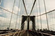
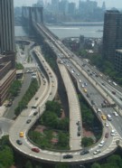
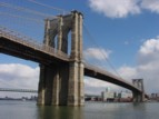
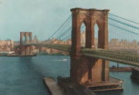
1883: Brooklyn
New York and Brooklyn, New York, USA - East River
| Bridgemeister ID: | 89 (added before 2003) |
| Year Completed: | 1883 |
| Name: | Brooklyn |
| Also Known As: | Great East River |
| Location: | New York and Brooklyn, New York, USA |
| Crossing: | East River |
| Coordinates: | 40.706 N 73.99667 W |
| Maps: | Acme, GeoHack, Google, OpenStreetMap |
| Principals: | John A. Roebling, Washington A. Roebling |
| References: | AAJ, BAAW, BBR, BBTS, BC3, BFL, BLD, BMA, BOB, BOU, BPL, COB, CTW, GB, GBD, HBE, LAB, LACE, NG198305, ONF, PTS2, SJR |
| Use: | Rail (light rail) and Vehicular (major highway), with walkway |
| Status: | In use (last checked: 2022) |
| Main Cables: | Wire (steel) |
| Suspended Spans: | 3 |
| Main Span: | 1 x 486.3 meters (1,595.5 feet) |
| Side Spans: | 2 x 283.5 meters (930 feet) |
| Deck width: | 85 feet |
Notes:
- Became longest suspension bridge by eclipsing 1869 Clifton (Niagara-Clifton, Falls View, First Falls View) - Niagara Falls, New York, USA and Niagara Falls, Ontario, Canada.
- Eclipsed by new longest suspension bridge 1903 Williamsburg - New York and Brooklyn, New York, USA.
- Next to 1909 Manhattan - New York and Brooklyn, New York, USA.
- Near 1903 Williamsburg - New York and Brooklyn, New York, USA.
External Links:
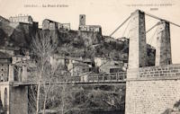
1883: Chilhac
Chilhac, Haute-Loire, France - Allier River
| Bridgemeister ID: | 1131 (added 2004-01-15) |
| Year Completed: | 1883 |
| Name: | Chilhac |
| Location: | Chilhac, Haute-Loire, France |
| Crossing: | Allier River |
| Coordinates: | 45.154731 N 3.437122 E |
| Maps: | Acme, GeoHack, Google, OpenStreetMap |
| Use: | Vehicular (one-lane) |
| Status: | In use (last checked: 2019) |
| Main Cables: | Wire |
| Suspended Spans: | 1 |
External Links:
1883: Swinging
Skowhegan, Maine, USA - Kennebec River
| Bridgemeister ID: | 1575 (added 2004-12-19) |
| Year Completed: | 1883 |
| Name: | Swinging |
| Location: | Skowhegan, Maine, USA |
| Crossing: | Kennebec River |
| References: | KJ20030410 |
| Use: | Footbridge |
| Status: | Collapsed, 1888 |
| Main Cables: | Wire (steel) |
Notes:
- KJ20030410: "[The] span collapsed in 1888: it turned out the steel cables were not all steel, they had a core of hemp, according to the history 'Skowhegan on the Kennebec'."
- Replaced by 1888 Swinging - Skowhegan, Maine, USA.
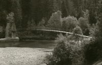
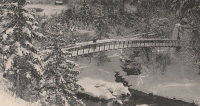
1883: Turrian
Château-d'Oex, Switzerland - Sarine River
| Bridgemeister ID: | 2878 (added 2019-09-13) |
| Year Completed: | 1883 |
| Name: | Turrian |
| Location: | Château-d'Oex, Switzerland |
| Crossing: | Sarine River |
| Coordinates: | 46.468703 N 7.135172 E |
| Maps: | Acme, GeoHack, Google, OpenStreetMap |
| Use: | Footbridge |
| Status: | In use (last checked: 2019) |
| Main Cables: | Wire (steel) |
| Suspended Spans: | 1 |
External Links:
1883: Yenne
Yenne, Savoie and Ain, France - Rhône River
| Bridgemeister ID: | 1968 (added 2005-11-26) |
| Year Completed: | 1883 |
| Name: | Yenne |
| Location: | Yenne, Savoie and Ain, France |
| Crossing: | Rhône River |
| Coordinates: | 45.706294 N 5.751086 E |
| Maps: | Acme, GeoHack, Google, OpenStreetMap |
| References: | AGP |
| Use: | Vehicular (one-lane) |
| Status: | Destroyed, 1940 |
| Main Cables: | Wire |
| Suspended Spans: | 1 |
Notes:
- 1940: Destroyed during WWII.
- Later at same location 1951 Yenne - Yenne, Savoie and Ain, France.
Do you have any information or photos for these bridges that you would like to share? Please email david.denenberg@bridgemeister.com.
