Suspension Bridges 1910-1931 (201-300 of 357)
This is a list of bridges 201 through 300 (of 357 total) in the suspension bridge inventory completed from 1910 through 1931, the year the George Washington Bridge was completed. Wherever you see a Bridgemeister ID number click it to isolate the bridge on its own page.
Related Lists:
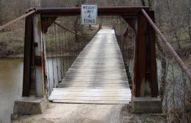
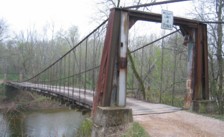
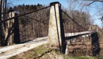
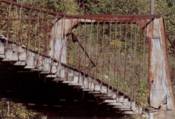
1925: Kliethermes
St. Anthony vicinity, Missouri, USA - Tavern Creek
| Bridgemeister ID: | 609 (added 2003-01-14) |
| Year Completed: | 1925 |
| Name: | Kliethermes |
| Also Known As: | Brumley |
| Location: | St. Anthony vicinity, Missouri, USA |
| Crossing: | Tavern Creek |
| Coordinates: | 38.178223 N 92.322981 W |
| Maps: | Acme, GeoHack, Google, OpenStreetMap |
| Principals: | Joseph A. Dice |
| References: | BOTO |
| Use: | Vehicular (one-lane) |
| Status: | Removed, March, 2008 |
| Main Cables: | Wire (steel) |
| Suspended Spans: | 1 |
| Main Span: | 1 x 65.8 meters (215.8 feet) |
| Deck width: | 10.8 feet |
Notes:
- Renovated, 1988. Closed, Spring 2006. Subsequently demolished in 2008.
- Completed circa 1925.
- Similar to 1925 Buechter - St. Anthony vicinity, Missouri, USA.
External Links:
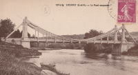
1925: Luzancy
Luzancy, Seine-et-Marne, France - Marne River
| Bridgemeister ID: | 4920 (added 2020-07-26) |
| Year Completed: | 1925 |
| Name: | Luzancy |
| Location: | Luzancy, Seine-et-Marne, France |
| Crossing: | Marne River |
| References: | AAJ, PTS2 |
| Use: | Vehicular |
| Status: | Destroyed |
| Main Cables: | Reinforced Concrete |
| Suspended Spans: | 1 |
Notes:
- Described as a "rigid suspension bridge of reinforced concrete."
- Replaced 1831 Luzancy - Luzancy, Seine-et-Marne, France.
- Similar to 1926 Laon - Laon, Aisne, France.
- Similar to Pommiers - Pommiers, Aisne, France.
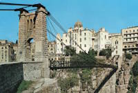
1925: Mellah Slimane
Constantine, Algeria - Oued Rhumel
| Bridgemeister ID: | 1117 (added 2004-01-05) |
| Year Completed: | 1925 |
| Name: | Mellah Slimane |
| Also Known As: | Perrégaux |
| Location: | Constantine, Algeria |
| Crossing: | Oued Rhumel |
| Coordinates: | 36.366261 N 6.615007 E |
| Maps: | Acme, GeoHack, Google, OpenStreetMap |
| Principals: | Ferdinand Arnodin |
| Use: | Footbridge |
| Status: | In use (last checked: 2019) |
| Main Cables: | Wire (steel) |
| Suspended Spans: | 1 |
| Main Span: | 1 x 125 meters (410.1 feet) |
| Deck width: | 2.4 meters |
External Links:
- Mellah Slimane Bridge - Wikipedia
- Perregaux Footbridge - HighestBridges.com
- Structurae - Structure ID 20009826
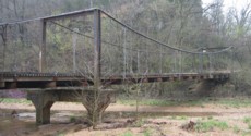
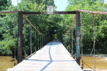
1925: Mill Creek
Brumley vicinity, Missouri, USA - Mill Creek
| Bridgemeister ID: | 342 (added before 2003) |
| Year Completed: | 1925 |
| Name: | Mill Creek |
| Location: | Brumley vicinity, Missouri, USA |
| Crossing: | Mill Creek |
| Coordinates: | 38.078408 N 92.524264 W |
| Maps: | Acme, GeoHack, Google, OpenStreetMap |
| Principals: | Joseph A. Dice |
| References: | BOTO |
| Use: | Vehicular (one-lane) |
| Status: | In use (last checked: 2020) |
| Main Cables: | Wire (steel) |
| Suspended Spans: | 2 |
| Main Span: | 1 x 29.3 meters (96 feet) estimated |
| Side Span: | 1 |
| Deck width: | 11.1 feet |
Notes:
- Original cables now assisted by additional steel cables.
- Similar to 1924 Kemna - St. Elizabeth, Missouri, USA.
- Near 1922 Glaize (Auglaize, Grand Glaize, Grand Auglaize) - Brumley vicinity, Missouri, USA. The bridges are less than half a mile apart.
External Links:

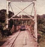
1925: Pandora
Pandora, Limón, Costa Rica - Estrella River
| Bridgemeister ID: | 436 (added before 2003) |
| Year Completed: | 1925 |
| Name: | Pandora |
| Also Known As: | Southeast Passage |
| Location: | Pandora, Limón, Costa Rica |
| Crossing: | Estrella River |
| Coordinates: | 9.736861 N 82.962167 W |
| Maps: | Acme, GeoHack, Google, OpenStreetMap |
| References: | PTS2, USS |
| Use: | Vehicular (one-lane) |
| Status: | Extant (last checked: 2022) |
| Main Cables: | Wire (steel) |
| Suspended Spans: | 1 |
| Main Span: | 1 x 73.2 meters (240 feet) |
Notes:
- Originally built with a set of tram tracks designed for cars hauling bananas.
- Next to (footbridge) - Pandora, Limón, Costa Rica.
1925: Powhatan
Powhatan, Arkansas, USA - Black River
1925: Springvale
Taihape vicinity, New Zealand - Rangitikei River
| Bridgemeister ID: | 713 (added 2003-03-08) |
| Year Completed: | 1925 |
| Name: | Springvale |
| Location: | Taihape vicinity, New Zealand |
| Crossing: | Rangitikei River |
| Coordinates: | 39.488097 S 176.033601 E |
| Maps: | Acme, GeoHack, Google, OpenStreetMap |
| References: | GAP |
| Use: | Vehicular (one-lane) |
| Status: | Restricted to foot traffic (last checked: 2015) |
| Main Cables: | Wire (steel) |
| Suspended Spans: | 1 |
External Links:
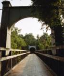
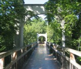
1925: Swinging
River Falls, Wisconsin, USA - Kinnickinnic River South Fork
| Bridgemeister ID: | 1193 (added 2004-01-25) |
| Year Completed: | 1925 |
| Name: | Swinging |
| Location: | River Falls, Wisconsin, USA |
| Crossing: | Kinnickinnic River South Fork |
| At or Near Feature: | Glen Park |
| Coordinates: | 44.853817 N 92.6333 W |
| Maps: | Acme, GeoHack, Google, OpenStreetMap |
| Use: | Footbridge |
| Status: | In use (last checked: 2006) |
| Main Cables: | Wire (steel) |
| Suspended Spans: | 3 |
| Main Span: | 1 x 39.6 meters (130 feet) |
| Side Spans: | 2 x 9.1 meters (30 feet) |
Notes:
- Rehabilitated, 1985.
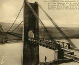
1925: Térénez
Landévennec vicinity and Rosnoen vicinity, Finistère, France - Aulne River
| Bridgemeister ID: | 1912 (added 2005-10-08) |
| Year Completed: | 1925 |
| Name: | Térénez |
| Location: | Landévennec vicinity and Rosnoen vicinity, Finistère, France |
| Crossing: | Aulne River |
| Coordinates: | 48.269120 N 4.262766 W |
| Maps: | Acme, GeoHack, Google, OpenStreetMap |
| Use: | Vehicular |
| Status: | Destroyed, 1944 |
| Main Cables: | Wire |
| Main Span: | 1 x 272 meters (892.4 feet) |
Notes:
- Coordinates are approximate, adjacent to the two subsequent replacement bridges.
- Replaced by 1952 Térénez - Landévennec vicinity and Rosnoen vicinity, Finistère, France.
External Links:
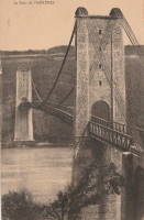
1925: Wind River
Carson, Washington, USA - Wind River
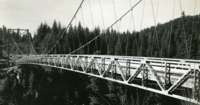
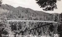
| Bridgemeister ID: | 1004 (added 2003-11-21) |
| Year Completed: | 1925 |
| Name: | Wind River |
| Location: | Carson, Washington, USA |
| Crossing: | Wind River |
| References: | SPW |
| Use: | Vehicular |
| Status: | Replaced, 1961 |
| Main Cables: | Wire (steel) |
| Suspended Spans: | 1 |
Notes:
- Circa 1930's steel vehicular suspension bridge. Bypassed, 1961 (by the Conrad Lundy Jr. bridge) and removed some time after.
- Replaced 1913 Wind River - Carson, Washington, USA.

1926: (suspension bridge)
Arero, Tolaga Bay vicinity, New Zealand
| Bridgemeister ID: | 720 (added 2003-03-08) |
| Year Completed: | 1926 |
| Name: | (suspension bridge) |
| Location: | Arero, Tolaga Bay vicinity, New Zealand |
| References: | GAP |
1926: (suspension bridge)
Fort Collins, Colorado, USA - Cache La Poudre River
| Bridgemeister ID: | 2327 (added 2007-06-11) |
| Year Completed: | 1926 |
| Name: | (suspension bridge) |
| Location: | Fort Collins, Colorado, USA |
| Crossing: | Cache La Poudre River |
| Coordinates: | 40.578366 N 105.045251 W |
| Maps: | Acme, GeoHack, Google, OpenStreetMap |
| Status: | Extant (last checked: 2019) |
| Main Cables: | Wire |
Notes:
- Suspended flume, carried waste material away from the Great Western Sugar Co. factory. Has not been used since 1950s.
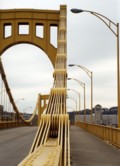
1926: Andy Warhol
Pittsburgh, Pennsylvania, USA - Allegheny River
| Bridgemeister ID: | 148 (added before 2003) |
| Year Completed: | 1926 |
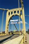
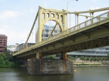
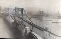
| Name: | Andy Warhol |
| Also Known As: | Seventh Street |
| Location: | Pittsburgh, Pennsylvania, USA |
| Crossing: | Allegheny River |
| Coordinates: | 40.44626 N 80.00145 W |
| Maps: | Acme, GeoHack, Google, OpenStreetMap |
| Principals: | Vernon R. Covell, T.J. Wilkerson, A.D. Nutter, H.E. Dodge, Stanley L. Roush |
| References: | AAJ, BOP, BPL, PBR, PTS2, USS |
| Use: | Vehicular (four-lane), with walkway |
| Status: | In use (last checked: 2014) |
| Main Cables: | Eyebar (steel) |
| Suspended Spans: | 3 |
| Main Span: | 1 x 134.7 meters (442 feet) |
| Side Spans: | 2 x 67.4 meters (221 feet) |
| Deck width: | 62 feet |
| Characteristics: | Self-anchored |
Notes:
- Self-anchored.
- Replaced 1884 North Side (Seventh Street) - Pittsburgh, Pennsylvania, USA.
- Next to 1927 Rachel Carson (Ninth Street) - Pittsburgh, Pennsylvania, USA.
- Next to 1928 Roberto Clemente (Sixth Street) - Pittsburgh, Pennsylvania, USA.
External Links:
1926: Arapuni
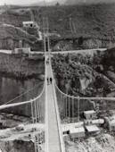
Arapuni Power Station, New Zealand - Waikato River
| Bridgemeister ID: | 714 (added 2003-03-08) |
| Year Completed: | 1926 |
| Name: | Arapuni |
| Location: | Arapuni Power Station, New Zealand |
| Crossing: | Waikato River |
| Coordinates: | 38.070585 S 175.644480 E |
| Maps: | Acme, GeoHack, Google, OpenStreetMap |
| Principals: | David Rowell & Co., Armstrong Whitworth |
| References: | GAP |
| Use: | Footbridge |
| Status: | In use (last checked: 2019) |
| Main Cables: | Wire (steel) |
| Suspended Spans: | 1 |
External Links:
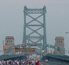
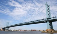
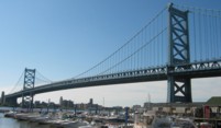
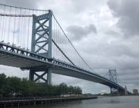
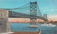
1926: Benjamin Franklin
Philadelphia, Pennsylvania and Camden, New Jersey, USA - Delaware River
| Bridgemeister ID: | 145 (added before 2003) |
| Year Completed: | 1926 |
| Name: | Benjamin Franklin |
| Also Known As: | Philadelphia-Camden |
| Location: | Philadelphia, Pennsylvania and Camden, New Jersey, USA |
| Crossing: | Delaware River |
| Coordinates: | 39.95333 N 75.135 W |
| Maps: | Acme, GeoHack, Google, OpenStreetMap |
| Principals: | Modjeski, Webster, Ball, Moiseff |
| References: | AAJ, BBR, BFL, BONJ, BPL, DRB, GBD, PTL, PTS2, USS |
| Use: | Vehicular (major highway) and Rail (subway), with walkway |
| Status: | In use (last checked: 2007) |
| Main Cables: | Wire (steel) |
| Suspended Spans: | 3 |
| Main Span: | 1 x 533.4 meters (1,750 feet) |
| Side Spans: | 2 x 219.3 meters (719.5 feet) |
| Deck width: | 125.5 feet |
Notes:
- Became longest suspension bridge by eclipsing 1924 Bear Mountain - Anthony's Nose and Bear Mountain, New York, USA.
- Eclipsed by new longest suspension bridge 1929 Ambassador - Detroit, Michigan, USA and Windsor, Ontario, Canada.
- Near 1957 Walt Whitman - Philadelphia, Pennsylvania and Camden, New Jersey, USA.
External Links:
1926: Bertrand Road
Huirangi, New Zealand - Waitara River
| Bridgemeister ID: | 716 (added 2003-03-08) |
| Year Completed: | 1926 |
| Name: | Bertrand Road |
| Location: | Huirangi, New Zealand |
| Crossing: | Waitara River |
| Coordinates: | 39.047336 S 174.254549 E |
| Maps: | Acme, GeoHack, Google, OpenStreetMap |
| Principals: | N.C. Fookes |
| References: | GAP |
| Use: | Vehicular (one-lane) |
| Status: | In use, 2006 (last checked: 2017) |
| Main Cables: | Wire (steel) |
| Suspended Spans: | 1 |
| Main Span: | 1 x 61 meters (200.1 feet) |
Notes:
- Closed to vehicular traffic, 1985. Closed to all traffic, 2004. Refurbished and subsequently reopened 2006.
- Damaged by over-sized truck May 20, 2017 and closed. Reopened July 2017.
- Replaced 1897 Bertrand Road (Tikorangi) - Huirangi, New Zealand.
External Links:
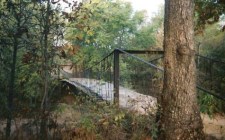
1926: Boeckman
St. Elizabeth, Missouri, USA - Big Tavern Creek
| Bridgemeister ID: | 608 (added 2003-01-14) |
| Year Completed: | 1926 |
| Name: | Boeckman |
| Location: | St. Elizabeth, Missouri, USA |
| Crossing: | Big Tavern Creek |
| Coordinates: | 38.22667 N 92.24 W |
| Maps: | Acme, GeoHack, Google, OpenStreetMap |
| Principals: | Joseph A. Dice |
| References: | BOTO |
| Use: | Vehicular |
| Status: | Replaced, 2003 |
| Main Cables: | Wire (steel) |
| Suspended Spans: | 1 |
| Main Span: | 1 x 48.8 meters (160 feet) |
| Deck width: | 12.4 feet |
Notes:
- Federal Highway Administration year 2000 data listed 1910 as the year of completion.
- Original timber towers replaced with steel towers, 1988.
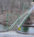
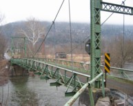
1926: Corbett
Corbett, New York, USA - East Branch Delaware River
| Bridgemeister ID: | 324 (added before 2003) |
| Year Completed: | 1926 |
| Name: | Corbett |
| Also Known As: | Corbett and Stuart |
| Location: | Corbett, New York, USA |
| Crossing: | East Branch Delaware River |
| Coordinates: | 42.04633 N 75.02768 W |
| Maps: | Acme, GeoHack, Google, OpenStreetMap |
| Principals: | John A. Roebling's Sons Co. |
| References: | SJR |
| Use: | Vehicular (one-lane) |
| Status: | In use (last checked: 2005) |
| Main Cables: | Wire (steel) |
| Suspended Spans: | 1 |
1926: Dhakuria
Rabindra Sarovar, Kolkata, West Bengal, India - Rabindra Sarovar Lake
| Bridgemeister ID: | 2847 (added 2019-07-07) |
| Year Completed: | 1926 |
| Name: | Dhakuria |
| Location: | Rabindra Sarovar, Kolkata, West Bengal, India |
| Crossing: | Rabindra Sarovar Lake |
| Coordinates: | 22.511127 N 88.355322 E |
| Maps: | Acme, GeoHack, Google, OpenStreetMap |
| Use: | Footbridge |
| Status: | In use (last checked: 2019) |
| Main Cables: | Wire (steel) |
| Suspended Spans: | 1 |
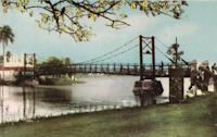
1926: Eustaquio Palacios
Roldanillo vicinity and Zarzal vicinity, Colombia - Cauca River
| Bridgemeister ID: | 2012 (added 2006-01-04) |
| Year Completed: | 1926 |
| Name: | Eustaquio Palacios |
| Location: | Roldanillo vicinity and Zarzal vicinity, Colombia |
| Crossing: | Cauca River |
| Coordinates: | 4.405070 N 76.101374 W |
| Maps: | Acme, GeoHack, Google, OpenStreetMap |
| Use: | Vehicular (one-lane) |
| Status: | Derelict (last checked: 2007) |
| Main Cables: | Wire (steel) |
| Suspended Spans: | 1 |
Notes:
- Bypassed, 1978. Still standing, but partially dismantled.
- Next to (pipeline bridge) - Roldanillo vicinity and Zarzal vicinity, Colombia.
1926: Fron
Fron, Llandyssil, Wales, United Kingdom - River Severn
| Bridgemeister ID: | 4617 (added 2020-06-07) |
| Year Completed: | 1926 |
| Name: | Fron |
| Location: | Fron, Llandyssil, Wales, United Kingdom |
| Crossing: | River Severn |
| Coordinates: | 52.568132 N 3.207281 W |
| Maps: | Acme, GeoHack, Google, OpenStreetMap |
| Principals: | David Rowell & Co. |
| Use: | Footbridge |
| Status: | Extant (last checked: 2009) |
| Main Cables: | Wire (steel) |
External Links:
| Bridgemeister ID: | 3880 (added 2020-03-08) |
| Year Completed: | 1926 |
| Name: | Henmo |
| Location: | Østeraunet, Aunet, Tydal and Henmo, Aunet, Tydal, Trøndelag, Norway |
| Crossing: | Nea |
| Coordinates: | 63.04982 N 11.58648 E |
| Maps: | Acme, GeoHack, Google, kart.1881.no, OpenStreetMap |
| Use: | Vehicular (one-lane) |
| Status: | Replaced, 1975 |
| Main Cables: | Wire (steel) |
| Main Span: | 1 x 60 meters (196.9 feet) estimated |
Notes:
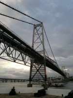
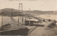
1926: Hercilio Luz
Florianopolis, Santa Catarina, Brazil
| Bridgemeister ID: | 437 (added before 2003) |
| Year Completed: | 1926 |
| Name: | Hercilio Luz |
| Also Known As: | Florianopolis |
| Location: | Florianopolis, Santa Catarina, Brazil |
| Coordinates: | 27.59393 S 48.56619 W |
| Maps: | Acme, GeoHack, Google, OpenStreetMap |
| Principals: | David B. Steinman, Holton D. Robinson |
| References: | AAJ, ADDS, BBR, PTS2, USS |
| Use: | Vehicular (two-lane, heavy vehicles), with walkway |
| Status: | In use (last checked: 2011) |
| Main Cables: | Eyebar (steel) |
| Suspended Spans: | 1 |
| Main Span: | 1 x 339.5 meters (1,113.75 feet) |
| Deck width: | 37 feet |
External Links:
1926: Hidalgo-Reynosa International
Hidalgo, Texas, USA and Reynosa, Tamaulipas, Mexico - Rio Grande
| Bridgemeister ID: | 146 (added before 2003) |
| Year Completed: | 1926 |
| Name: | Hidalgo-Reynosa International |
| Location: | Hidalgo, Texas, USA and Reynosa, Tamaulipas, Mexico |
| Crossing: | Rio Grande |
| Principals: | Austin Bridge Co. |
| References: | AAJ, AUB, HAERTX98, PTS2 |
| Use: | Vehicular |
| Status: | Demolished, 1960's |
| Main Cables: | Wire (steel) |
| Suspended Spans: | 1 |
| Main Span: | 1 x 137.2 meters (450 feet) |
Notes:
- Damaged by flood, 1933. Rebuilt, 1934. Cables failed, 1939. Rebuilt.
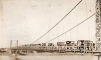
1926: La Guasca
El Peñol and Policarpa, Narino, Colombia - Patia River
| Bridgemeister ID: | 7648 (added 2023-06-03) |
| Year Completed: | 1926 |
| Name: | La Guasca |
| Also Known As: | Puerto Rico |
| Location: | El Peñol and Policarpa, Narino, Colombia |
| Crossing: | Patia River |
| Coordinates: | 1.594139 N 77.429486 W |
| Maps: | Acme, GeoHack, Google, OpenStreetMap |
| Principals: | Julio Souza Alves |
| Use: | Vehicular (one-lane) |
| Status: | Demolished, 2003 and 2020-2021 |
| Main Cables: | Wire (steel) |
Notes:
- 2003: Much of the bridge is dynamited. Stone towers remain.
- 2020 (or early 2021): The stone towers are demolished to make way for a replacement bridge.
External Links:
- Alcalde de Policarpa, en Nariño, dinamitó una joya de la ingeniería portuguesa de 100 años de antigüedad. Article about the history of the bridge and its destruction.
- Facebook. Several images of Claudia Cabrera, former mayor of Policarpa, escorted across a pulley system installed between the bridge towers.
- Facebook. Older image of the bridge with deck intact.
- Facebook. Work progressing on the replacement bridge. November 1, 2022.
- Google Maps - Puente De La Guaca. Image with the remaining towers visible, September 2018.
- Google Maps - Puente De La Guaca. Image taken in front of one of the towers, September 2018.
- Google Maps - Puente De La Guaca. Image of remaining tower , September 2018.
| Bridgemeister ID: | 8219 (added 2024-02-06) |
| Year Completed: | 1926 |
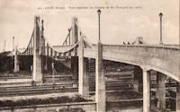
| Name: | Laon |
| Location: | Laon, Aisne, France |
| Coordinates: | 49.571000 N 3.635639 E |
| Maps: | Acme, GeoHack, Google, OpenStreetMap |
| References: | PTS2 |
| Use: | Vehicular |
| Status: | In use (last checked: 2023) |
| Main Cables: | Reinforced Concrete |
| Suspended Spans: | 2 |
| Side Spans: | 2 |
Notes:
- Rigid reinforced concrete suspension bridge.
- Similar to 1925 Luzancy - Luzancy, Seine-et-Marne, France.
- Similar to Pommiers - Pommiers, Aisne, France.
External Links:
1926: Lower Hurunui
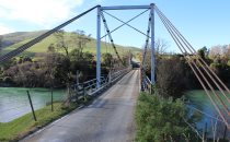
North Canterbury, New Zealand - Hurunui River
| Bridgemeister ID: | 719 (added 2003-03-08) |
| Year Completed: | 1926 |
| Name: | Lower Hurunui |
| Location: | North Canterbury, New Zealand |
| Crossing: | Hurunui River |
| Coordinates: | 42.907226 S 173.273596 E |
| Maps: | Acme, GeoHack, Google, OpenStreetMap |
| Principals: | H.F. Toogood |
| References: | GAP |
| Use: | Vehicular (one-lane) |
| Status: | In use (last checked: 2017) |
| Main Cables: | Wire (steel) |
Notes:
- GAP: Refurbished, 1983.
- Not entirely clear the bridge described in GAP as the "Lower Hurunui" bridge near the mouth of the Hurunui is the same bridge as the present day bridge carrying Blythe Road. The detailed description of the 1926 bridge does not seem to match the current structure. However, Thornton also implied major changes to the bridge during the 1983 refurbishment.
1926: Nassau
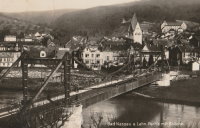
Nassau, Rheinland-Pfalz, Germany - Lahn River
| Bridgemeister ID: | 1133 (added 2004-01-16) |
| Year Completed: | 1926 |
| Name: | Nassau |
| Location: | Nassau, Rheinland-Pfalz, Germany |
| Crossing: | Lahn River |
| Coordinates: | 50.311299 N 7.795710 E |
| Maps: | Acme, GeoHack, Google, OpenStreetMap |
| References: | AAJ |
| Use: | Vehicular (two-lane) |
| Status: | Removed (last checked: 2004) |
| Main Cables: | Riveted plate |
| Main Span: | 1 x 74.9 meters (245.75 feet) |
Notes:
- The "cables" of this bridge appear to have been steel plates riveted together. The deck is plate girder. Not surprisingly, recent photos of the bridge show it resting on two intermediate piers. AAJ describes the cables: "'laminated chains' made of flat iron plates, there being two such chains to a side, each of five plates riveted together."
- Replaced 1830 (suspension bridge) - Nassau, Germany.
- Replaced by 2005 Nassau - Nassau, Rheinland-Pfalz, Germany.
External Links:
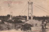
| Bridgemeister ID: | 7273 (added 2022-07-22) |
| Year Completed: | 1926 |
| Name: | Oiselay |
| Location: | Sorgues, Vaucluse, France |
| Coordinates: | 44.023850 N 4.843694 E |
| Maps: | Acme, GeoHack, Google, OpenStreetMap |
| Use: | Vehicular (one-lane) |
| Status: | Closed (last checked: 2021) |
| Main Cables: | Wire (steel) |
| Suspended Spans: | 1 |
| Main Span: | 1 x 151 meters (495.4 feet) estimated |
1926: Oriente
Oriente, Jiménez, Cartago, Costa Rica - Pejibaye River
| Bridgemeister ID: | 438 (added before 2003) |
| Year Completed: | 1926 |
| Name: | Oriente |
| Location: | Oriente, Jiménez, Cartago, Costa Rica |
| Crossing: | Pejibaye River |
| Coordinates: | 9.834250 N 83.681556 W |
| Maps: | Acme, GeoHack, Google, OpenStreetMap |
| References: | PTS2, USS |
| Use: | Vehicular |
| Status: | Removed, c. 2002-2015 |
| Main Cables: | Wire (steel) |
| Suspended Spans: | 1 |
| Main Span: | 1 x 45.7 meters (150 feet) |
Notes:
- Built with a set of tram tracks designed for cars hauling fruit.
- Older sources refer to the "Pejivalle" river.
- Removed at some point in the 2002-2015 time frame.
1926: Satok
Kuching, Sarawak, Malaysia - Sarawak River
| Bridgemeister ID: | 1574 (added 2004-12-12) |
| Year Completed: | 1926 |
| Name: | Satok |
| Also Known As: | Yellow |
| Location: | Kuching, Sarawak, Malaysia |
| Crossing: | Sarawak River |
| Coordinates: | 1.554709 N 110.324370 E |
| Maps: | Acme, GeoHack, Google, OpenStreetMap |
| Use: | Footbridge and Pipeline |
| Status: | Collapsed, 2004 |
| Main Cables: | Wire (steel) |
| Suspended Spans: | 1 |
| Main Span: | 1 x 130 meters (426.5 feet) |
Notes:
- 1992: Closed to pedestrian traffic.
- 2004, October 7: Collapsed. Was still closed to pedestrian traffic at the time of the collapse, but was still carrying the local water supply.
- Later at same location 2021 Satok - Kuching, Sarawak, Malaysia.
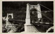
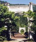
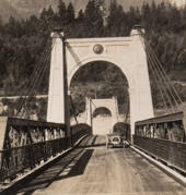
1926: Second Alexandra
Spuzzum, British Columbia, Canada - Fraser River
| Bridgemeister ID: | 147 (added before 2003) |
| Year Completed: | 1926 |
| Name: | Second Alexandra |
| Location: | Spuzzum, British Columbia, Canada |
| Crossing: | Fraser River |
| At or Near Feature: | Caribou Highway |
| Coordinates: | 49.70739 N 121.41669 W |
| Maps: | Acme, GeoHack, Google, OpenStreetMap |
| References: | BPL |
| Use: | Vehicular (one-lane) |
| Status: | Restricted to foot traffic (last checked: 2021) |
| Main Cables: | Wire (steel) |
| Suspended Spans: | 1 |
| Main Span: | 1 x 82.3 meters (270 feet) |
Notes:
1926: Shirakawa
Shirakawa, Gifu, Japan - Hida River
| Bridgemeister ID: | 3206 (added 2019-11-10) |
| Year Completed: | 1926 |
| Name: | Shirakawa |
| Also Known As: | 白川橋 |
| Location: | Shirakawa, Gifu, Japan |
| Crossing: | Hida River |
| Coordinates: | 35.579518 N 137.186653 E |
| Maps: | Acme, GeoHack, Google, OpenStreetMap |
| Use: | Vehicular (one-lane) |
| Status: | Restricted to foot traffic (last checked: 2014) |
| Main Cables: | Wire (steel) |
| Suspended Spans: | 3 |
| Main Span: | 1 x 74.6 meters (244.8 feet) |
| Side Spans: | 2 x 20 meters (65.6 feet) |
External Links:
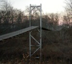
1926: Swinging
Pawhuska, Oklahoma, USA - Bird Creek
| Bridgemeister ID: | 3061 (added 2019-10-26) |
| Year Completed: | 1926 |
| Name: | Swinging |
| Location: | Pawhuska, Oklahoma, USA |
| Crossing: | Bird Creek |
| Coordinates: | 36.659110 N 96.341366 W |
| Maps: | Acme, GeoHack, Google, OpenStreetMap |
| Principals: | J.M. Buckley |
| Use: | Footbridge |
| Status: | In use (last checked: 2019) |
| Main Cables: | Wire (steel) |
1926: Yunguita
Colombia - Suaza River
| Bridgemeister ID: | 439 (added before 2003) |
| Year Completed: | 1926 |
| Name: | Yunguita |
| Location: | Colombia |
| Crossing: | Suaza River |
| References: | USS |
| Use: | Vehicular |
| Main Cables: | Wire (steel) |
| Suspended Spans: | 1 |
| Main Span: | 1 x 103.3 meters (339 feet) |
| Deck width: | 10 feet |
External Links:
1927: (footbridge)
Forst, Germany - Lusatian Neisse River
| Bridgemeister ID: | 5562 (added 2020-12-19) |
| Year Completed: | 1927 |
| Name: | (footbridge) |
| Location: | Forst, Germany |
| Crossing: | Lusatian Neisse River |
| Coordinates: | 51.748356 N 14.659815 E |
| Maps: | Acme, GeoHack, Google, OpenStreetMap |
| References: | AAJ |
| Use: | Footbridge |
| Status: | Removed |
| Main Cables: | Eyebar (steel) |
| Suspended Spans: | 3 |
| Main Span: | 1 x 39.6 meters (129.89 feet) |
| Side Spans: | 2 x 19.8 meters (64.94 feet) |
Notes:
- Coordinates are for likely alignment of this former bridge, with at least one pier remaining (as of 2020).
1927: (footbridge)
Töpeln and Wöllsdorf, Saxony, Germany - Zschopau River
| Bridgemeister ID: | 2301 (added 2007-04-26) |
| Year Completed: | 1927 |
| Name: | (footbridge) |
| Location: | Töpeln and Wöllsdorf, Saxony, Germany |
| Crossing: | Zschopau River |
| Use: | Footbridge |
| Status: | Destroyed, 2002, by flood |
| Main Cables: | Wire (steel) |
| Suspended Spans: | 1 |
Notes:
- Replaced by a cable-stayed bridge April, 2004.
1927: (suspension bridge)
Neals Landing, Donalsonville vicinity, Georgia and Jackson County, Florida, USA - Chattahoochee River
| Bridgemeister ID: | 2145 (added 2006-11-05) |
| Year Completed: | 1927 |
| Name: | (suspension bridge) |
| Location: | Neals Landing, Donalsonville vicinity, Georgia and Jackson County, Florida, USA |
| Crossing: | Chattahoochee River |
| Principals: | Austin Bridge Co. |
| References: | PTS2, RRC |
| Use: | Vehicular |
| Status: | Removed |
| Main Cables: | Wire |
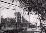
Notes:
- Condemned, 1953, due to sinking foundation.
- Follow the image for more information about this bridge and location.
| Bridgemeister ID: | 3931 (added 2020-03-20) |
| Year Completed: | 1927 |
| Name: | Bingsfoss |
| Location: | Sørumsand, Lillestrøm, Viken, Norway |
| Crossing: | Glomma |
| Coordinates: | 59.98854 N 11.26129 E |
| Maps: | Acme, GeoHack, Google, kart.1881.no, OpenStreetMap |
| Use: | Vehicular |
| Status: | Removed, 1978 |
| Main Cables: | Wire (steel) |
| Suspended Spans: | 1 |
| Main Span: | 1 x 132 meters (433.1 feet) estimated |
External Links:
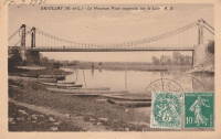
1927: Briollay
Briollay, Maine-et-Loire, France - Sarthe River
| Bridgemeister ID: | 6700 (added 2021-10-03) |
| Year Completed: | 1927 |
| Name: | Briollay |
| Location: | Briollay, Maine-et-Loire, France |
| Crossing: | Sarthe River |
| Use: | Vehicular |
| Status: | Removed |
| Main Cables: | Wire |
Notes:
1927: Bryan-Fannin
Telephone, Bonham vicinity, Fannin County, Texas and Bryan County, Oklahoma, USA - Red River
| Bridgemeister ID: | 602 (added 2003-01-11) |
| Year Completed: | 1927 |
| Name: | Bryan-Fannin |
| Also Known As: | Telephone, Snow's Ferry, Bryant-Fannin |
| Location: | Telephone, Bonham vicinity, Fannin County, Texas and Bryan County, Oklahoma, USA |
| Crossing: | Red River |
| Coordinates: | 33.844484 N 96.011125 W |
| Maps: | Acme, GeoHack, Google, OpenStreetMap |
| Principals: | Austin Bridge Co. |
| References: | AUB, PTS2 |
| Use: | Vehicular |
| Status: | Collapsed, December, 1940 |
| Main Cables: | Wire (steel) |
| Suspended Spans: | 3 |
| Main Span: | 1 |
| Side Spans: | 2 |
Notes:
- Sometimes referenced as "Bryant-Fannin". The bridge unquestionably connected Fannin County to Bryan County, Oklahoma, but according to a www.rootsweb.com article (Fannin County TXGenWeb - Ferry's in Fannin County, from Pat Pryor, by Kathy J. Ellis) it was erected at a site known as "Bryant's Crossing" named for a local, Dave Bryant. The Steinman inventory lists it as "Bryan-Fannin". AUB mentions it as "Bryant-Fannin". The Rootsweb article also mentions it collapsed in 1940 under weight of a truck.
- An article in the December 6, 1940 issue of The Port Arthur News (Texas) titled: "Suspension Bridge Plunges Into Red River" describes the collapse: "Owners of a $75,000 tollbridge which plunged into the Red River Wednesday when a suspension cable anchor pulled loose were undecided today whether it would be rebuilt. The bridge, owned by the Austin Bridge company of Dallas, was near Telephone, Tex., 12 miles north of here, and was several miles from a principal highway. Most of the traffic from the Bonham area toward Oklahoma is across a structure built recently to replace a toll bridge at nearby Sowell's bluff that collapsed in 1930. Mrs. Jim Freeman, toll keeper, said she heard a 'rumble' and looked up to see the 'deadman anchor' pull loose, throwing the entire weight of the 1,300 foot span on the other cable. It snapped, and the flooring and steel framework of the bridge sagged into the water. No one was on the structure when it fell."
- Remains of three piers are still visible, 2019.
1927: Chartrouse
Arles, Bouches-du-Rhône, France - Rhône River
| Bridgemeister ID: | 4846 (added 2020-07-11) |
| Year Completed: | 1927 |
| Name: | Chartrouse |
| Location: | Arles, Bouches-du-Rhône, France |
| Crossing: | Rhône River |
| At or Near Feature: | Lône des Pilotes |
| Coordinates: | 43.463752 N 4.743590 E |
| Maps: | Acme, GeoHack, Google, OpenStreetMap |
| Use: | Vehicular (one-lane) |
| Status: | In use (last checked: 2019) |
| Main Cables: | Wire (steel) |
| Suspended Spans: | 1 |
External Links:
1927: Durant-Bonham
Bonham vicinity, Fannin County, Texas and Yuba/Durant vicinity, Oklahoma, USA - Red River
| Bridgemeister ID: | 603 (added 2003-01-11) |
| Year Completed: | 1927 |
| Name: | Durant-Bonham |
| Also Known As: | Sowell's Bluff |
| Location: | Bonham vicinity, Fannin County, Texas and Yuba/Durant vicinity, Oklahoma, USA |
| Crossing: | Red River |
| Principals: | Austin Bridge Co. |
| References: | AUB, PTS2 |
| Use: | Vehicular |
| Status: | Collapsed, 1934 |
| Main Cables: | Wire (steel) |
Notes:
- According to a rootsweb article (Fannin County TXGenWeb - Ferry's in Fannin County, from Pat Pryor, by Kathy J. Ellis), "when in 1932 this bridge fell, many people said that acid had been put on the cables to break them so that people from Oklahoma could not cross to Bonham." However, the true date of collapse may have been in 1934. The February 2, 1934 issue of The Daily Oklahoman has a front-page article with a photo of the bridge with collapsed deck. The photo is captioned: "The Red River Bridge on Highway 22 Near Durant After the Midnight Crash," and the article reads: "Here Is the debris of a $60,000 investment made by the states of Oklahoma and Texas eight months ago when they purchased the Bonham-Durant bridge across the Red river on highway 22. Three of the five spans of the 1,500-foot suspension bridge turned upside down and dropped into the river bed when a four-Inch wire cable rusted and broke in two about 15 feet from the ground on the Texas side. A lull in the usual heavy traffic across the bridge prevented accidents. The crash came at midnight, and one motorist had barely reached the Texas side when the cable gave away. Other motorists stopped their cars just in time to witness the spans of the bridge crash 40 feet into the stream. The bridge was built in 1926 and was operated as a toll bridge until 1933 when the two states bought it and made it a free crossing."
- In the October 1989 edition of the Oklahoma Water News an article (excerpted from an article in The Chronicles of Oklahoma by Dr. Bernice N. Crockett) states: "On January 15, 1934, a norther of terrific force came up which cause the Sowell's Bluff Bridge to fall. At 1 a.m. the wire cables on the Fannin side of the river became twisted, then snapped, broken in half, and the entire massive structure fell into the river below -- a complete wreck."
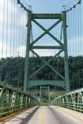
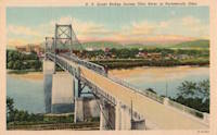
1927: General U.S. Grant
Portsmouth, Ohio and Fullerton, Kentucky, USA - Ohio River
| Bridgemeister ID: | 151 (added before 2003) |
| Year Completed: | 1927 |
| Name: | General U.S. Grant |
| Location: | Portsmouth, Ohio and Fullerton, Kentucky, USA |
| Crossing: | Ohio River |
| Coordinates: | 38.725 N 82.99833 W |
| Maps: | Acme, GeoHack, Google, OpenStreetMap |
| Principals: | Robinson and Steinman, J.E. Greiner, Dravo Co. |
| References: | AAJ, PTS2, SSS |
| Use: | Vehicular (two-lane, heavy vehicles) |
| Status: | Demolished, July 2001 |
| Main Cables: | Wire (steel) |
| Suspended Spans: | 3 |
| Main Span: | 1 x 213.4 meters (700 feet) |
| Side Spans: | 2 x 106.7 meters (350 feet) |
| Deck width: | 28.5 feet |
Notes:
- AAJ: "Recabled" in 1939.
External Links:
1927: Hellestraumen
Helle, Vaksdal, Vestland, Norway - Hellestraumen
| Bridgemeister ID: | 4412 (added 2020-04-19) |
| Year Completed: | 1927 |
| Name: | Hellestraumen |
| Location: | Helle, Vaksdal, Vestland, Norway |
| Crossing: | Hellestraumen |
| Coordinates: | 60.564000 N 5.753306 E |
| Maps: | Acme, GeoHack, Google, kart.1881.no, OpenStreetMap |
| Use: | Vehicular (one-lane) |
| Status: | In use (last checked: 2019) |
| Main Cables: | Wire (steel) |
| Suspended Spans: | 1 |
| Main Span: | 1 x 53 meters (173.9 feet) estimated |
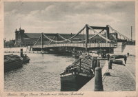
1927: Hugo Preuss
Berlin, Germany - Berlin-Spandau Ship Canal
| Bridgemeister ID: | 2090 (added 2006-07-02) |
| Year Completed: | 1927 |
| Name: | Hugo Preuss |
| Also Known As: | Hugo Preuß, Humboldthafen, Admiral Scheer |
| Location: | Berlin, Germany |
| Crossing: | Berlin-Spandau Ship Canal |
| Coordinates: | 52.523580 N 13.372238 E |
| Maps: | Acme, GeoHack, Google, OpenStreetMap |
| References: | AAJ, PTS2 |
| Use: | Vehicular |
| Status: | Destroyed, 1945 |
| Main Cables: | Eyebar |
| Suspended Spans: | 3 |
| Main Span: | 1 |
| Side Spans: | 2 |
| Characteristics: | Self-anchored |
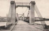
1927: Jargeau
Jargeau and Saint-Denis-de-l'Hôtel, Loiret, France - Loire River
| Bridgemeister ID: | 6805 (added 2021-11-21) |
| Year Completed: | 1927 |
| Name: | Jargeau |
| Also Known As: | Saint-Denis-de-l'Hôtel |
| Location: | Jargeau and Saint-Denis-de-l'Hôtel, Loiret, France |
| Crossing: | Loire River |
| Coordinates: | 47.868650 N 2.124035 E |
| Maps: | Acme, GeoHack, Google, OpenStreetMap |
| Use: | Vehicular |
| Status: | Replaced, 1965 |
| Main Cables: | Wire (steel) |
Notes:
- 1937: Strengthened.
- 1940: Partially destroyed to slow advancing German troops.
- 1943: Repairs completed and bridge reopened.
- 1944: Partially destroyed.
- 1944-1945: Repaired and reopened.
- 1965: Closed and replaced due to concerns about deteriorating main cable strength.
- Replaced 1834 Jargeau (Saint-Denis-de-l'Hôtel) - Jargeau and Saint-Denis-de-l'Hôtel, Loiret, France.
External Links:
1927: Limestone Ford
Awatere Valley, Marlborough, New Zealand
| Bridgemeister ID: | 722 (added 2003-03-08) |
| Year Completed: | 1927 |
| Name: | Limestone Ford |
| Location: | Awatere Valley, Marlborough, New Zealand |
| References: | GAP |
| Status: | Replaced |
Notes:
- GAP: Replaced, early 1970's.
1927: Mediacanoa
Buga, Colombia - Cauca River
| Bridgemeister ID: | 2010 (added 2006-01-04) |
| Year Completed: | 1927 |
| Name: | Mediacanoa |
| Location: | Buga, Colombia |
| Crossing: | Cauca River |
| References: | PTS2 |
| Use: | Vehicular |
| Status: | Replaced |
| Main Cables: | Wire (steel) |
| Suspended Spans: | 1 |
| Main Span: | 1 x 110 meters (360.9 feet) |
1927: Miyoshi
Tokushima, Tokushima, Japan - Yoshino River
| Bridgemeister ID: | 1145 (added 2004-01-17) |
| Year Completed: | 1927 |
| Name: | Miyoshi |
| Location: | Tokushima, Tokushima, Japan |
| Crossing: | Yoshino River |
| References: | BAAW |
| Status: | Removed |
| Main Cables: | Wire |
| Main Span: | 1 x 139.9 meters (459 feet) |
Notes:
- BAAW: suspension cables removed, 1989, replaced by arches. However, the modified structure (pictured in BAAW) appears to be more of a continuous truss than an arch-based structure. The bridge appears to have been subsequently removed entirely as there are no current (as of 2020) Yoshino River bridges near Myoshi resembling the bridge.
1927: Montjean-sur-Loire
Montjean-sur-Loire, Maine-et-Loire, France - Loire River
| Bridgemeister ID: | 1602 (added 2005-02-06) |
| Year Completed: | 1927 |
| Name: | Montjean-sur-Loire |
| Location: | Montjean-sur-Loire, Maine-et-Loire, France |
| Crossing: | Loire River |
| Coordinates: | 47.395958 N 0.858340 W |
| Maps: | Acme, GeoHack, Google, OpenStreetMap |
| References: | AAJ, PTS2 |
| Use: | Vehicular |
| Status: | Destroyed, 1936 |
| Main Cables: | Wire |
| Suspended Spans: | 6 |
| Main Spans: | 4 |
| Side Spans: | 2 |
Notes:
- 1935: One of the towers fails in a windstorm causing part of the bridge to collapse.
- 1936: The remainder of the derelict bridge is wrecked by a flood.
- Replaced 1840 Montjean-sur-Loire - Montjean-sur-Loire, Maine-et-Loire, France.
- Replaced by 1938 Montjean-sur-Loire - Montjean-sur-Loire, Maine-et-Loire, France.
External Links:
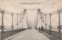
1927: Orellana
El Rancho, El Progresso, Guatemala - Rio Motagua
| Bridgemeister ID: | 1481 (added 2004-09-04) |
| Year Completed: | 1927 |
| Name: | Orellana |
| Location: | El Rancho, El Progresso, Guatemala |
| Crossing: | Rio Motagua |
| Use: | Vehicular |
| Main Cables: | Wire |
External Links:
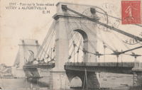
1927: Port à l'Anglais
Alfortville and Vitry-sur-Seine, Val-de-Marne, France - Seine River
| Bridgemeister ID: | 1114 (added 2004-01-05) |
| Year Completed: | 1927 |
| Name: | Port à l'Anglais |
| Location: | Alfortville and Vitry-sur-Seine, Val-de-Marne, France |
| Crossing: | Seine River |
| Coordinates: | 48.797333 N 2.41875 E |
| Maps: | Acme, GeoHack, Google, OpenStreetMap |
| References: | AAJ, BC3, BPF, PTS2 |
| Use: | Vehicular (three-lane), with walkway |
| Status: | In use (last checked: 2021) |
| Main Cables: | Wire |
| Suspended Spans: | 3 |
| Main Span: | 1 x 124 meters (406.8 feet) |
| Side Spans: | 1 x 54 meters (177.2 feet), 1 x 52 meters (170.6 feet) |
| Deck width: | 40 feet |
Notes:
- This bridge was originally built with the Gisclard suspension system. Such bridges are not included in the Bridgemeister suspension bridge inventory. However, at some point the suspension system was modified to be more similar to a standard suspension bridge. It isn't clear when this modification occurred.
- Near Créteil (Saint-Maur) - Créteil-sur-Marne and Saint-Maur-des-Fossés, Val-de-Marne, France.
External Links:
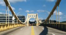
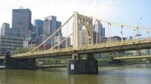
1927: Rachel Carson
Pittsburgh, Pennsylvania, USA - Allegheny River
| Bridgemeister ID: | 150 (added before 2003) |
| Year Completed: | 1927 |
| Name: | Rachel Carson |
| Also Known As: | Ninth Street |
| Location: | Pittsburgh, Pennsylvania, USA |
| Crossing: | Allegheny River |
| Coordinates: | 40.44669 N 79.99980 W |
| Maps: | Acme, GeoHack, Google, OpenStreetMap |
| Principals: | Vernon R. Covell, T.J. Wilkerson, A.D. Nutter, H.E. Dodge, Stanley L. Roush |
| References: | AAJ, BOP, BPL, PBR, PTS2, USS |
| Use: | Vehicular (four-lane), with walkway |
| Status: | In use (last checked: 2014) |
| Main Cables: | Eyebar (steel) |
| Suspended Spans: | 3 |
| Main Span: | 1 x 131.1 meters (430 feet) |
| Side Spans: | 2 x 65.5 meters (215 feet) |
| Characteristics: | Self-anchored |
Notes:
- Self-anchored.
- Next to 1926 Andy Warhol (Seventh Street) - Pittsburgh, Pennsylvania, USA.
- Next to 1928 Roberto Clemente (Sixth Street) - Pittsburgh, Pennsylvania, USA.
External Links:


1927: Ravine
Douglass College Campus, New Brunswick, New Jersey, USA
| Bridgemeister ID: | 877 (added 2003-08-31) |
| Year Completed: | 1927 |
| Name: | Ravine |
| Also Known As: | Old Bouncer, Kissing |
| Location: | Douglass College Campus, New Brunswick, New Jersey, USA |
| Coordinates: | 40.485867 N 74.43495 W |
| Maps: | Acme, GeoHack, Google, OpenStreetMap |
| References: | BONJ |
| Use: | Footbridge |
| Status: | In use (last checked: 2020) |
| Main Cables: | Wire (steel) |
| Suspended Spans: | 1 |
| Main Span: | 1 x 30.8 meters (101 feet) estimated |
External Links:
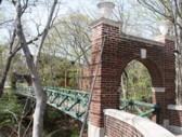
| Bridgemeister ID: | 3930 (added 2020-03-20) |
| Year Completed: | 1927 |
| Name: | Rånåsfoss |
| Location: | Rånåsfoss, Viken, Norway |
| Crossing: | Glomma |
| Coordinates: | 60.031390 N 11.327592 E |
| Maps: | Acme, GeoHack, Google, kart.1881.no, OpenStreetMap |
| Use: | Vehicular (one-lane) |
| Status: | In use (last checked: 2019) |
| Main Cables: | Wire (steel) |
| Suspended Spans: | 1 |
| Main Span: | 1 x 184 meters (603.7 feet) estimated |
Notes:
- Rehabilitation completed, 2016.
- Replaced 1918 Rånåsfoss - Rånåsfoss, Viken, Norway.
External Links:
1927: Saint Jo
Illinois Bend, Saint Jo vicinity, Texas and Wilson vicinity, Oklahoma, USA - Red River
| Bridgemeister ID: | 601 (added 2003-01-11) |
| Year Completed: | 1927 |
| Name: | Saint Jo |
| Also Known As: | Airline, Air-Line |
| Location: | Illinois Bend, Saint Jo vicinity, Texas and Wilson vicinity, Oklahoma, USA |
| Crossing: | Red River |
| Coordinates: | 33.917051 N 97.486010 W |
| Maps: | Acme, GeoHack, Google, OpenStreetMap |
| Principals: | Austin Bridge Co. |
| References: | AUB, PTS2 |
| Use: | Vehicular (one-lane) |
| Status: | Removed |
| Main Cables: | Wire (steel) |
| Suspended Spans: | 1 |
| Main Span: | 1 x 213.4 meters (700 feet) |
External Links:
- St Jo "Airline" Suspension Bridge over the Red River Texas - Facebook. Coordinates provided here are based on the research presented in this Bridgehunting Texas Facebook group post.
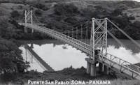
1927: San Pablo
Soná, Veraguas, Panama - Rio San Pablo
| Bridgemeister ID: | 7981 (added 2023-12-02) |
| Year Completed: | 1927 |
| Name: | San Pablo |
| Location: | Soná, Veraguas, Panama |
| Crossing: | Rio San Pablo |
| Coordinates: | 8.000111 N 81.296694 W |
| Maps: | Acme, GeoHack, Google, OpenStreetMap |
| Use: | Vehicular (one-lane) |
| Status: | Dismantled |
| Main Cables: | Wire (steel) |
| Suspended Spans: | 1 |
Notes:
- Dismantled and relocated to a crossing north of Soná where it survived until some point in the 2008-2013 time frame.
- Moved to Rio Cobre - Los Bajos del Cobre, Soná District, Veraguas, Panama.
External Links:
- Facebook. History of the bridge.
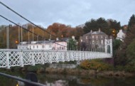
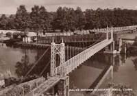
| Bridgemeister ID: | 553 (added before 2003) |
| Year Completed: | 1927 |
| Name: | Shaky |
| Also Known As: | Shakey, Daly's |
| Location: | Cork, Ireland |
| Crossing: | River Lee |
| At or Near Feature: | Sunday's Well, Fitzgerald's Park |
| Coordinates: | 51.896585 N 8.499218 W |
| Maps: | Acme, GeoHack, Google, OpenStreetMap |
| Principals: | David Rowell & Co. |
| Use: | Footbridge |
| Status: | In use (last checked: 2020) |
| Main Cables: | Wire (steel) |
| Suspended Spans: | 1 |
Notes:
- 2019, September: Dismantled for refurbishment, expected to be completed in early 2020.
- 2020, September: Refurbishment stalled during contract negotiations with contract. Bridge has been reassembled with new cables but work is not completed.
- 2020, October: Completion of refurbishment still on hold as two companies involved in the project go into examinership.
- 2020, December: Restored bridge reopens.
External Links:
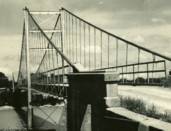
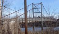
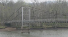
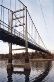
1927: Upper
Warsaw, Missouri, USA - Osage River
| Bridgemeister ID: | 1070 (added 2003-12-27) |
| Year Completed: | 1927 |
| Name: | Upper |
| Also Known As: | Swinging |
| Location: | Warsaw, Missouri, USA |
| Crossing: | Osage River |
| Coordinates: | 38.244110 N 93.388767 W |
| Maps: | Acme, GeoHack, Google, OpenStreetMap |
| Principals: | Joseph A. Dice |
| References: | BOTO |
| Use: | Vehicular (one-lane) |
| Status: | Restricted to foot traffic (last checked: 2020) |
| Main Cables: | Wire (steel) |
| Suspended Spans: | 2 |
| Main Span: | 1 x 152.4 meters (500 feet) estimated |
| Side Span: | 1 x 29 meters (95 feet) estimated |
Notes:
- Joseph Dice supervised the construction of this bridge to replace the 1904 structure destroyed in a tornado in 1924. A postcard of this bridge reads: "built in 1927 by the Benton County Court and by popular subscription of citizens to replace a similar bridge destroyed by a windstorm two years earlier. Structure swings on two wire cables imbedded and anchored in concrete and stone. The towers and floor beams are of steel while the floor is of wood. A state highway crosses this bridge."
- Reopened for pedestrians, 2007, after being closed for several years.
- Replaced 1904 Upper (Swinging) - Warsaw, Missouri, USA.
External Links:
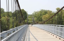
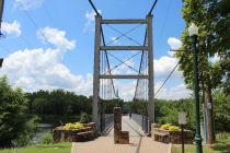
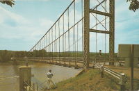
1927: Waiho Gorge
Franz Josef Glacier vicinity, New Zealand - Waiho River
| Bridgemeister ID: | 721 (added 2003-03-08) |
| Year Completed: | 1927 |
| Name: | Waiho Gorge |
| Location: | Franz Josef Glacier vicinity, New Zealand |
| Crossing: | Waiho River |
| Coordinates: | 43.393202 S 170.180682 E |
| Maps: | Acme, GeoHack, Google, OpenStreetMap |
| References: | GAP |
| Use: | Vehicular |
| Status: | Removed, c. 1990 |
| Main Cables: | Wire (steel) |
| Suspended Spans: | 1 |
| Main Span: | 1 x 91.4 meters (300 feet) |
External Links:
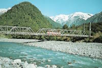
1927: White Star
Dayhoit, Kentucky, USA - Cumberland River
| Bridgemeister ID: | 2556 (added 2012-01-01) |
| Year Completed: | 1927 |
| Name: | White Star |
| Location: | Dayhoit, Kentucky, USA |
| Crossing: | Cumberland River |
| Use: | Vehicular (one-lane) |
| Status: | Removed |
| Main Cables: | Wire |
Notes:
- The town of Dayhoit has also been known as Day, White Star, and Wilhoit.
External Links:
1928: (suspension bridge)
Galesburg, Illinois, USA - Lake Bracken
| Bridgemeister ID: | 280 (added before 2003) |
| Year Completed: | 1928 |
| Name: | (suspension bridge) |
| Location: | Galesburg, Illinois, USA |
| Crossing: | Lake Bracken |
| At or Near Feature: | Lake Bracken Country Club Boat Harbor |
| Coordinates: | 40.861999 N 90.350571 W |
| Maps: | Acme, GeoHack, Google, OpenStreetMap |
| Use: | Footbridge |
| Status: | In use (last checked: 2021) |
| Main Cables: | Wire |
| Suspended Spans: | 1 |
1928: (suspension bridge)
Rio Rico, Mexico and Mercedes, Texas, USA - Rio Grande
| Bridgemeister ID: | 3914 (added 2020-03-20) |
| Year Completed: | 1928 |
| Name: | Åbrua |
| Also Known As: | Aaen |
| Location: | Tynset, Innlandet, Norway |
| Crossing: | Glomma |
| Coordinates: | 62.288617 N 10.823438 E |
| Maps: | Acme, GeoHack, Google, kart.1881.no, OpenStreetMap |
| Use: | Vehicular (one-lane) |
| Status: | Replaced, 1980 |
| Main Cables: | Wire (steel) |
| Suspended Spans: | 1 |
| Main Span: | 1 x 10⁹ meters (357.6 feet) estimated |
Notes:
- Heavily damaged by flood, likely prior to 1969. Appears to have been repaired before being replaced with another suspension bridge in 1980.
- Replaced by 1980 Åbrua (Aaen) - Tynset, Innlandet, Norway.
External Links:
1928: Bernardo Arango
La Virginia vicinity and Cerritos vicinity, Colombia - Cauca River
| Bridgemeister ID: | 2016 (added 2006-01-14) |
| Year Completed: | 1928 |
| Name: | Bernardo Arango |
| Location: | La Virginia vicinity and Cerritos vicinity, Colombia |
| Crossing: | Cauca River |
| Coordinates: | 4.891980 N 75.882927 W |
| Maps: | Acme, GeoHack, Google, OpenStreetMap |
| Use: | Vehicular (one-lane) |
| Status: | In use (last checked: 2019) |
| Main Cables: | Wire (steel) |
| Suspended Spans: | 1 |
| Main Span: | 1 x 190 meters (623.4 feet) |
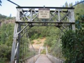
1928: Colfax-Iowa Hill
Colfax vicinity, California, USA - North Fork American River
| Bridgemeister ID: | 588 (added 2003-01-05) |
| Year Completed: | 1928 |
| Name: | Colfax-Iowa Hill |
| Location: | Colfax vicinity, California, USA |
| Crossing: | North Fork American River |
| Coordinates: | 39.09993 N 120.92480 W |
| Maps: | Acme, GeoHack, Google, OpenStreetMap |
| Use: | Vehicular (one-lane) |
| Status: | Restricted to foot traffic (last checked: 2021) |
| Main Cables: | Wire (steel) |
| Suspended Spans: | 1 |
Notes:
1928: Des Arc
Des Arc, Arkansas, USA - White River
| Bridgemeister ID: | 152 (added before 2003) |
| Year Completed: | 1928 |
| Name: | Des Arc |
| Also Known As: | Swinging |
| Location: | Des Arc, Arkansas, USA |
| Crossing: | White River |
| Coordinates: | 34.974811 N 91.487684 W |
| Maps: | Acme, GeoHack, Google, OpenStreetMap |
| Principals: | Austin Bridge Co |
| References: | AUB, PTS2 |
| Use: | Vehicular |
| Status: | Demolished, August 1970 |
| Main Cables: | Wire (steel) |
| Suspended Spans: | 3 |
| Main Span: | 1 x 198.1 meters (650 feet) |
| Side Spans: | 2 x 97.5 meters (320 feet) |
Notes:
- The coordinates provided here indicate the approximate alignment of the bridge, about 0.5 miles southeast of the current (2020s) Des Arc White River crossing. The bridge delivered traffic near the east end of East Chester Street in Des Arc.
External Links:
1928: Fort Steuben
Steubenville, Ohio and Weirton, West Virginia, USA - Ohio River
| Bridgemeister ID: | 154 (added before 2003) |
| Year Completed: | 1928 |
| Name: | Fort Steuben |
| Location: | Steubenville, Ohio and Weirton, West Virginia, USA |
| Crossing: | Ohio River |
| Coordinates: | 40.37833 N 80.615 W |
| Maps: | Acme, GeoHack, Google, OpenStreetMap |
| Principals: | Dravo Co. |
| References: | AAJ, PTS2 |
| Use: | Vehicular (two-lane, heavy vehicles), with walkway |
| Status: | Demolished, February 2012 (last checked: 2012) |
| Main Cables: | Wire (steel) |
| Suspended Spans: | 3 |
| Main Span: | 1 x 209.9 meters (688.75 feet) |
| Side Spans: | 2 x 86.3 meters (283 feet) |
| Deck width: | 20.25 feet |
Notes:
- January 2009: Closed indefinitely following inspections revealing major deterioration. Demolished in 2012.
- Near 1905 Market Street - Steubenville, Ohio and East Steubenville, West Virginia, USA.
External Links:
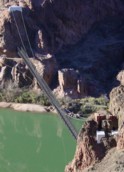
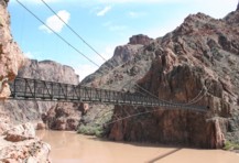
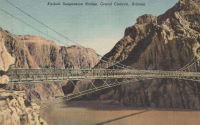
1928: Kaibab Trail
Bright Angel Campground vicinity, Arizona, USA - Colorado River
| Bridgemeister ID: | 155 (added before 2003) |
| Year Completed: | 1928 |
| Name: | Kaibab Trail |
| Also Known As: | Black, South Kaibab |
| Location: | Bright Angel Campground vicinity, Arizona, USA |
| Crossing: | Colorado River |
| At or Near Feature: | Grand Canyon National Park |
| Coordinates: | 36.10076 N 112.08918 W |
| Maps: | Acme, GeoHack, Google, OpenStreetMap |
| Principals: | Ward P. Webber, John H. Lawrence |
| Use: | Footbridge |
| Status: | In use (last checked: 2007) |
| Main Cables: | Wire (steel) |
| Suspended Spans: | 1 |
| Main Span: | 1 x 126.8 meters (416 feet) estimated |
| Deck width: | 5 feet |
Notes:
- Replaced 1920 Kaibab Trail - Grand Canyon National Park, Arizona, USA.
- Near Silver - Bright Angel Campground vicinity, Arizona, USA.
External Links:
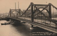
1928: Kiyosu
Chuo City, Tokyo, Japan - Sumida River
| Bridgemeister ID: | 440 (added before 2003) |
| Year Completed: | 1928 |
| Name: | Kiyosu |
| Also Known As: | 清洲橋 |
| Location: | Chuo City, Tokyo, Japan |
| Crossing: | Sumida River |
| Coordinates: | 35.682395 N 139.792022 E |
| Maps: | Acme, GeoHack, Google, OpenStreetMap |
| Principals: | Yutaka Tanaka |
| References: | AAJ, BAAW, PTS2, SSS |
| Use: | Vehicular (four-lane), with walkway |
| Status: | In use (last checked: 2022) |
| Main Cables: | Eyebar (steel) |
| Suspended Spans: | 3 |
| Main Span: | 1 x 91.4 meters (299.9 feet) |
| Side Spans: | 2 |
| Deck width: | 85 feet |
| Characteristics: | Self-anchored |
Notes:
- Self-anchored.
- 2019: Major rehabilitation in progress.
External Links:
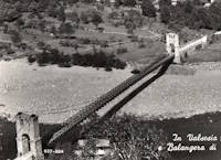
1928: Morca
Morca and Balangera, Italy - Sesia River
| Bridgemeister ID: | 2677 (added 2019-03-30) |
| Year Completed: | 1928 |
| Name: | Morca |
| Location: | Morca and Balangera, Italy |
| Crossing: | Sesia River |
| Coordinates: | 45.821768 N 8.214935 E |
| Maps: | Acme, GeoHack, Google, OpenStreetMap |
| Principals: | Giuseppe Magistrini |
| Use: | Vehicular (one-lane) |
| Status: | In use (last checked: 2022) |
| Main Cables: | Wire (steel) |
| Suspended Spans: | 1 |
| Main Span: | 1 x 93 meters (305.1 feet) estimated |
External Links:
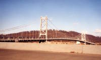
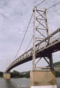
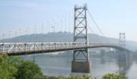
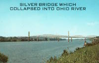
1928: Point Pleasant
Point Pleasant, West Virginia and Kanauga, Gallipolis vicinity, Ohio, USA - Ohio River
| Bridgemeister ID: | 156 (added before 2003) |
| Year Completed: | 1928 |
| Name: | Point Pleasant |
| Also Known As: | Silver |
| Location: | Point Pleasant, West Virginia and Kanauga, Gallipolis vicinity, Ohio, USA |
| Crossing: | Ohio River |
| Coordinates: | 38.845 N 82.141111 W |
| Maps: | Acme, GeoHack, Google, OpenStreetMap |
| Principals: | J.E. Greiner Co. |
| References: | AAJ, BDO, ENR19290620a, ENR19290620b, GBD, LAB, PTS2, SSS |
| Use: | Vehicular, with walkway |
| Status: | Collapsed, 1967 |
| Main Cables: | Eyebar (steel) |
| Suspended Spans: | 3 |
| Main Span: | 1 x 213.4 meters (700 feet) |
| Side Spans: | 2 x 115.8 meters (380 feet) |
| Deck width: | 27 feet |
Notes:
- Hybrid truss, suspension bridge. Collapsed December 15, 1967 while full with traffic. 46 people died.
- Companion to 1928 Saint Marys (Hi Carpenter, Short Route) - Saint Marys, West Virginia and Newport, Ohio, USA.
External Links:

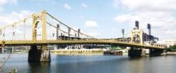
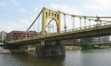
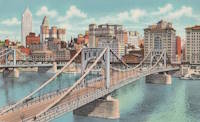
1928: Roberto Clemente
Pittsburgh, Pennsylvania, USA - Allegheny River
| Bridgemeister ID: | 158 (added before 2003) |
| Year Completed: | 1928 |
| Name: | Roberto Clemente |
| Also Known As: | Sixth Street |
| Location: | Pittsburgh, Pennsylvania, USA |
| Crossing: | Allegheny River |
| Coordinates: | 40.44558 N 80.00332 W |
| Maps: | Acme, GeoHack, Google, OpenStreetMap |
| Principals: | Vernon R. Covell, T.J. Wilkerson, A.D. Nutter, H.E. Dodge, Stanley L. Roush |
| References: | AAJ, BOP, BPL, PBR, PTS2, SSS, USS |
| Use: | Vehicular (four-lane), with walkway |
| Status: | In use (last checked: 2014) |
| Main Cables: | Eyebar (steel) |
| Suspended Spans: | 3 |
| Main Span: | 1 x 131.1 meters (430 feet) |
| Side Spans: | 2 x 65.5 meters (215 feet) |
| Characteristics: | Self-anchored |
Notes:
- Self-anchored.
- Next to 1926 Andy Warhol (Seventh Street) - Pittsburgh, Pennsylvania, USA.
- Next to 1927 Rachel Carson (Ninth Street) - Pittsburgh, Pennsylvania, USA.
External Links:

1928: Roma-Miguel Alemán International
Roma, Texas, USA and Ciudad Miguel Alemán, Mexico - Rio Grande
| Bridgemeister ID: | 157 (added before 2003) |
| Year Completed: | 1928 |
| Name: | Roma-Miguel Alemán International |
| Also Known As: | Roma-San Pedro International |
| Location: | Roma, Texas, USA and Ciudad Miguel Alemán, Mexico |
| Crossing: | Rio Grande |
| Coordinates: | 26.403821 N 99.018856 W |
| Maps: | Acme, GeoHack, Google, OpenStreetMap |
| Principals: | George Cole, Starr County Bridge Co., Compañía del Puente de San Pedro de Roma |
| References: | HAERTX98, PTS2 |
| Use: | Vehicular |
| Status: | Closed, 1979 (last checked: 2023) |
| Main Cables: | Wire (steel) |
| Suspended Spans: | 1 |
| Main Span: | 1 x 192 meters (629.9 feet) |
| Deck width: | 6.9 meters |
Notes:
- Closed. Scheduled to be restored as pedestrian crossing.
External Links:
1928: Saint Marys
Saint Marys, West Virginia and Newport, Ohio, USA - Ohio River
| Bridgemeister ID: | 159 (added before 2003) |
| Year Completed: | 1928 |
| Name: | Saint Marys |
| Also Known As: | Hi Carpenter, Short Route |
| Location: | Saint Marys, West Virginia and Newport, Ohio, USA |
| Crossing: | Ohio River |
| Principals: | J.E. Greiner Co. |
| References: | BPL, GBD, PTS2 |
| Use: | Vehicular |
| Status: | Demolished, 1971 |
| Main Cables: | Eyebar (steel) |
| Suspended Spans: | 3 |
| Main Span: | 1 x 213.4 meters (700 feet) |
| Side Spans: | 2 |
Notes:
- Same design as the Silver Bridge that famously collapsed in 1967. Demolished 1971 as a precautionary measure because the engineers decided they could not tell if it suffered from the same flaw as the Silver Bridge without dismantling the eyebars.
- Companion to 1928 Point Pleasant (Silver) - Point Pleasant, West Virginia and Kanauga, Gallipolis vicinity, Ohio, USA.
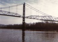
1928: Saint-Hubert
Port Saint-Hubert, Plouër-sur-Rance vicinity and La Ville-es-Nonais, Côtes-d'Armor, France - Rance River
| Bridgemeister ID: | 1492 (added 2004-09-19) |
| Year Completed: | 1928 |
| Name: | Saint-Hubert |
| Location: | Port Saint-Hubert, Plouër-sur-Rance vicinity and La Ville-es-Nonais, Côtes-d'Armor, France |
| Crossing: | Rance River |
| Use: | Vehicular |
| Status: | Destroyed, 1944 |
| Main Cables: | Wire |
| Suspended Spans: | 1 |
Notes:
- Replaced by 1959 Saint-Hubert - Port Saint-Hubert, Plouër-sur-Rance vicinity and La Ville-es-Nonais, Côtes-d'Armor, France.
External Links:
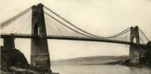
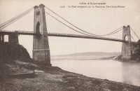
1928: Senumstad
Væting, Birkenes, Agder, Norway - Tovdalselva
| Bridgemeister ID: | 4320 (added 2020-04-10) |
| Year Completed: | 1928 |
| Name: | Senumstad |
| Location: | Væting, Birkenes, Agder, Norway |
| Crossing: | Tovdalselva |
| Coordinates: | 58.417324 N 8.291204 E |
| Maps: | Acme, GeoHack, Google, kart.1881.no, OpenStreetMap |
| Use: | Footbridge |
| Status: | Replaced, 1957 |
Notes:
- Replaced by 1957 Senumstad - Væting, Birkenes, Agder, Norway.
1928: Tamate
Kashiwara, Osaka, Japan - Ishi River
| Bridgemeister ID: | 4651 (added 2020-06-17) |
| Year Completed: | 1928 |
| Name: | Tamate |
| Also Known As: | 玉手橋 |
| Location: | Kashiwara, Osaka, Japan |
| Crossing: | Ishi River |
| Coordinates: | 34.566634 N 135.621691 E |
| Maps: | Acme, GeoHack, Google, OpenStreetMap |
| Status: | Restricted to foot traffic (last checked: 2019) |
| Main Cables: | Wire (steel) |
| Suspended Spans: | 5 |
| Main Spans: | 3 |
| Side Spans: | 2 |
External Links:
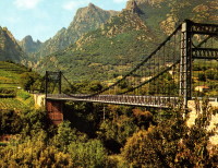
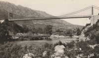
| Bridgemeister ID: | 1449 (added 2004-07-31) |
| Year Completed: | 1928 |
| Name: | Tarassac |
| Location: | St. Martin-de-l'Arcon vicinity, Hérault, France |
| Crossing: | Orb River |
| Coordinates: | 43.564766 N 2.974529 E |
| Maps: | Acme, GeoHack, Google, OpenStreetMap |
| References: | BC3 |
| Use: | Vehicular (one-lane) |
| Status: | In use (last checked: 2019) |
| Main Cables: | Wire (steel) |
| Suspended Spans: | 1 |
| Main Span: | 1 x 104.2 meters (342 feet) |
Notes:
External Links:
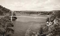
| Bridgemeister ID: | 2731 (added 2019-06-22) |
| Year Completed: | 1928 |
| Name: | Ulvøya |
| Also Known As: | Ulvøybrua |
| Location: | Oslo, Norway |
| Crossing: | Ulvøysund |
| Coordinates: | 59.872686 N 10.777882 E |
| Maps: | Acme, GeoHack, Google, kart.1881.no, OpenStreetMap |
| Use: | Vehicular (one-lane) |
| Status: | In use (last checked: 2019) |
| Main Cables: | Wire (steel) |
| Suspended Spans: | 1 |
| Main Span: | 1 x 143 meters (469.2 feet) |
External Links:
1928: Volonne
Volonne, Alpes-de-Haute-Provence, France - Durance River
| Bridgemeister ID: | 2004 (added 2005-12-26) |
| Year Completed: | 1928 |
| Name: | Volonne |
| Location: | Volonne, Alpes-de-Haute-Provence, France |
| Crossing: | Durance River |
| Use: | Vehicular |
| Status: | Destroyed, 1944 |
Notes:
- Replaced 1845 Volonne - Volonne, Alpes-de-Haute-Provence, France.
- Replaced by 1949 Volonne - Volonne, Alpes-de-Haute-Provence, France.
External Links:
1928: Zapata
Zapata, Texas, USA and Ciudad Guerrero, Mexico - Rio Grande
| Bridgemeister ID: | 1445 (added 2004-07-31) |
| Year Completed: | 1928 |
| Name: | Zapata |
| Location: | Zapata, Texas, USA and Ciudad Guerrero, Mexico |
| Crossing: | Rio Grande |
| References: | HAERTX98, PTS2 |
| Use: | Vehicular |
| Status: | Inundated, 1953 |
| Main Cables: | Wire (steel) |
| Suspended Spans: | 3 |
| Main Span: | 1 x 165 meters (541.3 feet) |
| Side Spans: | 2 |
Notes:
- Inundated during creation of Falcon Reservoir.
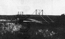
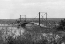
| Bridgemeister ID: | 4463 (added 2020-04-26) |
| Year Completed: | 1929 |
| Name: | (suspension bridge) |
| Location: | Gol, Viken, Norway |
| Crossing: | Vesleåne |
| Coordinates: | 60.698535 N 8.951871 E |
| Maps: | Acme, GeoHack, Google, kart.1881.no, OpenStreetMap |
| Status: | Removed |
| Main Cables: | Wire |
| Suspended Spans: | 1 |
| Main Span: | 1 x 26 meters (85.3 feet) estimated |
Notes:
- Removed at some point between 1972 and 2006.
External Links:
1929: (suspension bridge)
Ngapakira, New Zealand - Ruakituri River
| Bridgemeister ID: | 725 (added 2003-03-08) |
| Year Completed: | 1929 |
| Name: | (suspension bridge) |
| Location: | Ngapakira, New Zealand |
| Crossing: | Ruakituri River |
1929: (suspension bridge)
Waimata Valley, Gisborne vicinity, New Zealand - Waimata River
| Bridgemeister ID: | 728 (added 2003-03-08) |
| Year Completed: | 1929 |
| Name: | (suspension bridge) |
| Location: | Waimata Valley, Gisborne vicinity, New Zealand |
| Crossing: | Waimata River |
| References: | GAP |
1929: Ambassador
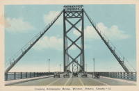
Detroit, Michigan, USA and Windsor, Ontario, Canada - Detroit River
| Bridgemeister ID: | 160 (added before 2003) |
| Year Completed: | 1929 |
| Name: | Ambassador |
| Location: | Detroit, Michigan, USA and Windsor, Ontario, Canada |
| Crossing: | Detroit River |
| Coordinates: | 42.31210 N 83.07402 W |
| Maps: | Acme, GeoHack, Google, OpenStreetMap |
| Principals: | Jonathan Jones, McClintic-Marshall |
| References: | AAJ, AMB, GBD, PTS2 |
| Use: | Vehicular (major highway) |
| Status: | In use (last checked: 2022) |
| Main Cables: | Wire (steel) |
| Suspended Spans: | 1 |
| Main Span: | 1 x 563.9 meters (1,850 feet) |
| Deck width: | 55 feet |
Notes:
- Became longest suspension bridge by eclipsing 1926 Benjamin Franklin (Philadelphia-Camden) - Philadelphia, Pennsylvania and Camden, New Jersey, USA.
- Eclipsed by new longest suspension bridge 1931 George Washington (GWB) - New York, New York and Fort Lee, New Jersey, USA.
External Links:


1929: Auburn-Coloma
Auburn and Coloma, California, USA - North Fork American River
| Bridgemeister ID: | 1624 (added 2005-02-27) |
| Year Completed: | 1929 |
| Name: | Auburn-Coloma |
| Location: | Auburn and Coloma, California, USA |
| Crossing: | North Fork American River |
| Principals: | Smith Brothers |
| Use: | Vehicular (one-lane) |
| Status: | Replaced, 1948 |
| Main Cables: | Wire |
| Suspended Spans: | 1 |
Notes:

| Bridgemeister ID: | 4017 (added 2020-03-28) |
| Year Completed: | 1929 |
| Name: | Borglund |
| Location: | Borglund, Veme, Ringerike, Viken, Norway |
| Crossing: | Sogna |
| Coordinates: | 60.20807 N 10.05918 E |
| Maps: | Acme, GeoHack, Google, kart.1881.no, OpenStreetMap |
| Use: | Footbridge |
| Status: | In use (last checked: 2020) |
| Main Cables: | Wire (steel) |
| Suspended Spans: | 1 |
| Main Span: | 1 x 65.5 meters (214.9 feet) estimated |
| Deck width: | ~2 meters |
Notes:
- Major rehabilitation completed, 2017, including complete replacement of towers.
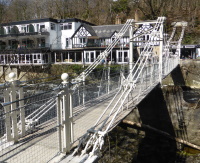
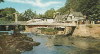
1929: Chainbridge
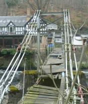
Berwyn, Llangollen, Wales, United Kingdom - River Dee
| Bridgemeister ID: | 1303 (added 2004-04-09) |
| Year Completed: | 1929 |
| Name: | Chainbridge |
| Also Known As: | Chain |
| Location: | Berwyn, Llangollen, Wales, United Kingdom |
| Crossing: | River Dee |
| Coordinates: | 52.98025 N 3.1946 W |
| Maps: | Acme, GeoHack, Google, OpenStreetMap |
| Principals: | Sir Henry Robertson |
| Use: | Footbridge |
| Status: | In use (last checked: 2019) |
| Main Cables: | Chain |
| Suspended Spans: | 1 |
| Main Span: | 1 |
Notes:
- Crosses both River Dee and Llangollen Canal
- A thorough report on these bridges was published in 2010 by the Royal Commission on the Ancient and Historical Monuments of Wales (RCAHMW), Chain Bridge, Llantysilio, Denbighshire. The Pickering bridge (built 1817, according to the report) was contructed with the deck laid on the chains. This bridge was removed in 1870 but appears not to have been replaced until at least 1876. The new bridge, not simply refurbished, was constructed with the deck supported by the chains underneath, but in an "underspanned" fashion with small pillars resting on the chains, supporting a level deck. This bridge was destroyed by flood on Feb. 16, 1928. The report also investigates whether the chains of the current (1929) bridge are the original chains from the 1817 Pickering bridge and concludes there is evidence "supporting the hypothesis that the chains we see on the bridge today are same as those put on the bridge in 1817" and adds "If the present chains are the originals, there is little reason to doubt that they are the oldest suspension bridge chains in the western world."
- 2015: Underwent major restoration and reopened.
External Links:
- Chainbridge Hotel. The bridge is situated next to the hotel. Their web site notes the original "chain bridge" at this location was built in 1814 by Exuperious Pickering and was refurbished in 1870 and rebuilt in 1929.
- Structurae - Structure ID 20074318
1929: Creighton's
Inangahua County, New Zealand - Maruia River
| Bridgemeister ID: | 724 (added 2003-03-08) |
| Year Completed: | 1929 |
| Name: | Creighton's |
| Location: | Inangahua County, New Zealand |
| Crossing: | Maruia River |
| References: | GAP |
1929: Fox River
Fox Glacier, New Zealand - Fox River
| Bridgemeister ID: | 729 (added 2003-03-08) |
| Year Completed: | 1929 |
| Name: | Fox River |
| Location: | Fox Glacier, New Zealand |
| Crossing: | Fox River |
| Coordinates: | 43.487188 S 170.029302 E |
| Maps: | Acme, GeoHack, Google, OpenStreetMap |
| References: | GAP |
| Use: | Footbridge |
| Status: | In use (last checked: 2014) |
| Main Cables: | Wire (steel) |
| Suspended Spans: | 1 |
| Main Span: | 1 x 70 meters (229.7 feet) |
External Links:
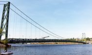
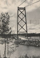
1929: Grand Mère
Grand-Mère, Quebec, Canada - St. Maurice River
| Bridgemeister ID: | 162 (added before 2003) |
| Year Completed: | 1929 |
| Name: | Grand Mère |
| Location: | Grand-Mère, Quebec, Canada |
| Crossing: | St. Maurice River |
| Coordinates: | 46.620117 N 72.6794 W |
| Maps: | Acme, GeoHack, Google, OpenStreetMap |
| Principals: | Robinson and Steinman |
| References: | AAJ, BC3, BPL, PTS2, SJR |
| Use: | Vehicular (two-lane, heavy vehicles), with walkway |
| Status: | In use (last checked: 2019) |
| Main Cables: | Wire (steel) |
| Suspended Spans: | 1 |
| Main Span: | 1 x 289.2 meters (948.8 feet) |
| Deck width: | 26 feet |
External Links:
1929: Hinckesman's Access Road
Frasertown vicinity, Hawke's Bay, New Zealand - Mangapoike River
| Bridgemeister ID: | 726 (added 2003-03-08) |
| Year Completed: | 1929 |
| Name: | Hinckesman's Access Road |
| Location: | Frasertown vicinity, Hawke's Bay, New Zealand |
| Crossing: | Mangapoike River |
| Principals: | T. Delaney |
| References: | GAP |
| Use: | Vehicular |
| Status: | Destroyed, 1935 |
Notes:
- GAP: Destroyed by flood, 1935.
- Replaced by 1936 Hinckesman's Access Road - Frasertown vicinity, Hawke's Bay, New Zealand.
1929: Hipólito Yrigoyen
Necochea and Quequén, Argentina - Rio Quequén
| Bridgemeister ID: | 441 (added before 2003) |
| Year Completed: | 1929 |
| Name: | Hipólito Yrigoyen |
| Also Known As: | Rio Quequén |
| Location: | Necochea and Quequén, Argentina |
| Crossing: | Rio Quequén |
| Coordinates: | 38.552048 S 58.725680 W |
| Maps: | Acme, GeoHack, Google, OpenStreetMap |
| Principals: | P. Palazzo |
| References: | AAJ, SSS |
| Use: | Vehicular (two-lane), with walkway |
| Status: | In use (last checked: 2019) |
| Main Cables: | Wire (steel) |
| Suspended Spans: | 3 |
| Main Span: | 1 x 150 meters (492 feet) |
| Side Spans: | 2 x 59.7 meters (196 feet) |
External Links:
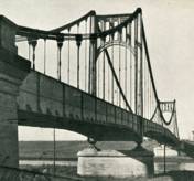
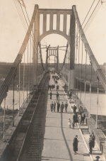
| Bridgemeister ID: | 2378 (added 2007-10-21) |
| Year Completed: | 1929 |
| Name: | Idabel-Clarksville |
| Location: | Idabel vicinity, Oklahoma and Clarksville vicinity, Texas, USA |
| Crossing: | Red River |
| Principals: | Austin Bridge Co. |
| References: | AUB |
| Use: | Vehicular |
| Status: | Destroyed, 1933 |
| Main Cables: | Wire (steel) |
| Suspended Spans: | 3 |
| Main Span: | 1 x 213.4 meters (700 feet) |
| Side Spans: | 2 x 76.2 meters (250 feet) |
| Deck width: | 16 feet |
Notes:
- The November 1933 issue of The Wisconsin Engineer (a publication of the University of Wisconsin) has an article by C.W.P. Walter about research that was being performed by the University of Wisconsin's Engineering Department: "The particular hardware laden contrivance [in the Engineering Building] is a half-model of the Red River Bridge which carried light highway traffic between Clarksville, Texas, and Idabel, Oklahoma. In the early part of this year movement of the Red River as a result of flood waters washed away one of the intermediate piers supporting the end spans, and cause the cable to drop and be subjected to impact loading. It was contended by the company owning the bridge that the cable was overstressed and injured to such an extent that it would be necessary for the insurance company to replace the cable as well as the pier. A committee... was appointed to investigate the questions involved. While the investigation proceeded the Red River continued to scour away the foundation of the existing piers, ultimately causing the bridge to collapse completely."
- AUB mentions this bridge very briefly: "In 1928, [Jim Diamond] was employed by Austin Bridge Company as a consultant on the super-structure and cable work for the White River bridge at Des Arc. Later in the same year, he represented the owners as job engineer on the bridge built by the Company across Red River above Clarksville, Texas."
- Apparently this bridge was damaged by flood the same week it was supposed to open. In the October 1989 edition of the Oklahoma Water News an article (excerpted from an article in The Chronicles of Oklahoma by Dr. Bernice N. Crockett) writes: "The Austin Bridge Company completed the bridge May 19, 1929, but on May 23, when more than 400 people went to see the new bridge opened, an estimated 40 feet of the Red River bank had caved in near the bridge. Heavy rains continued to hinder road construction. A resident near the bridge recalled the night of May 19, 1929, as the night the river changed its course, and by morning had moved the entire structure into Oklahoma." The bridge eventually opened on June 20.
- The Friday December 30, 1932 edition of The Port Arthur News ran an article "Red River Bridge Damaged By Water". Texarkana, Dec. 30 (1932).: "High stages in Red River, that earlier this week demolished the Texas side approach to the privately owned suspension bridge [?] miles north of Clarksville on highway 37 to Idabel have been in recession since Wednesday but indicated continued heavy rains such as last night are expected to bring additional high water with probably further damage to the bridge. More than 50 feet of the approach is gone and the ground piers have crumpled, leaving the anchor cables alone holding the bridge in place."
- It appears the final end to this short-lived bridge didn't come until late May, 1933 when it was completely destroyed by flood.
External Links:
- Historic Suspension Bridges: Advent of the State Highway Department. This Texas Department of Transportation page mentions: "Five of the eleven suspension bridges built by [Austin Bridge Company] were toll bridges over the Red River. The Red River is notorious for its volatile, melting, red clay banks. The bridge between Clarksville, Texas, and Idabel, Oklahoma, was built by ABC in 1928, and washed out during flooding in 1932."
1929: Kane's
Melbourne, Victoria, Australia - Yarra River
| Bridgemeister ID: | 443 (added before 2003) |
| Year Completed: | 1929 |
| Name: | Kane's |
| Location: | Melbourne, Victoria, Australia |
| Crossing: | Yarra River |
| At or Near Feature: | Yarra Bend Park, Studley Park |
| Coordinates: | 37.80006 S 145.00966 E |
| Maps: | Acme, GeoHack, Google, OpenStreetMap |
| Use: | Footbridge |
| Status: | In use (last checked: 2022) |
| Main Cables: | Wire (steel) |
| Suspended Spans: | 1 |
| Main Span: | 1 x 64 meters (210 feet) estimated |
Notes:
- Rebuilt 1935.
1929: Köln-Mülheim
Köln (Cologne) and Mülheim, North Rhine-Westphalia, Germany - Rhine River
| Bridgemeister ID: | 1426 (added 2004-07-18) |
| Year Completed: | 1929 |
| Name: | Köln-Mülheim |
| Location: | Köln (Cologne) and Mülheim, North Rhine-Westphalia, Germany |
| Crossing: | Rhine River |
| Coordinates: | 50.963968 N 6.996659 E |
| Maps: | Acme, GeoHack, Google, OpenStreetMap |
| Principals: | Adolf Abel |
| References: | AAJ |
| Use: | Vehicular, with walkway |
| Status: | Destroyed, 1944 |
| Main Cables: | Wire (steel) |
| Suspended Spans: | 3 |
| Main Span: | 1 x 317 meters (1,040 feet) |
| Side Spans: | 2 x 91.4 meters (300 feet) |
| Deck width: | 91.5 feet |
| Characteristics: | Self-anchored |
Notes:
External Links:
1929: Lakshman Jhula
Rishikesh, Uttarakhand, India - Ganges River
| Bridgemeister ID: | 442 (added before 2003) |
| Year Completed: | 1929 |
| Name: | Lakshman Jhula |
| Location: | Rishikesh, Uttarakhand, India |
| Crossing: | Ganges River |
| Coordinates: | 30.126454 N 78.329753 E |
| Maps: | Acme, GeoHack, Google, OpenStreetMap |
| Principals: | P.H. Tillard |
| Use: | Footbridge |
| Status: | In use (last checked: 2019) |
| Main Cables: | Wire (steel) |
| Suspended Spans: | 1 |
External Links:
1929: McPhaul
Yuma, Arizona, USA - Gila River
| Bridgemeister ID: | 161 (added before 2003) |
| Year Completed: | 1929 |
| Name: | McPhaul |
| Also Known As: | Dome, Gila River |
| Location: | Yuma, Arizona, USA |
| Crossing: | Gila River |
| Coordinates: | 32.75969 N 114.42158 W |
| Maps: | Acme, GeoHack, Google, OpenStreetMap |
| Principals: | Levy Construction Company |
| References: | AAJ, SJR, YS20041217 |
| Use: | Vehicular (one-lane) |
| Status: | Closed (last checked: 2008) |
| Main Cables: | Wire (steel) |
| Suspended Spans: | 1 |
| Main Span: | 1 x 283.5 meters (930.1 feet) |
| Deck width: | 16 feet |
Notes:
- YS20041217: Renamed McPhaul Bridge in honor of Henry Harrison "Harry" McPhaul, "the only Yuma resident who ever became an Arizona Ranger." Bypassed, 1968. 150 feet of deck damaged by fire, 1990.
External Links:
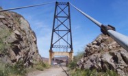
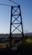
Do you have any information or photos for these bridges that you would like to share? Please email david.denenberg@bridgemeister.com.