Undated/Unnamed Suspension Footbridges (101-200 of 1,747)
This is a list of bridges 101 through 200 (of 1,747 total) in the suspension bridge inventory that are undated and unnamed footbridges. Wherever you see a Bridgemeister ID number click it to isolate the bridge on its own page.
Related Lists:
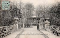
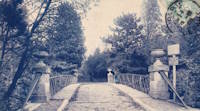
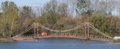
Bridgemeister ID: 7904 (added 2023-10-15)Name: (footbridge) Location: Île de Bercy and Île de Reuilly, Paris , France Crossing: Lac Daumesnil Coordinates: 48.831052 N 2.412569 E Maps: Acme , GeoHack , Google , OpenStreetMap Use: Footbridge Status: In use (last checked: 2023) Main Cables: Wire Suspended Spans: 1
Bridgemeister ID: 7188 (added 2022-07-04)Name: (footbridge) Location: Ba'ba Tapua, Matangnga, Polewali Mandar Regency, West Sulawesi , Indonesia Coordinates: 3.275485 S 119.225259 E Maps: Acme , GeoHack , Google , OpenStreetMap Use: Footbridge Status: In use (last checked: 2015) Main Cables: Wire (steel) Main Span: 1 x 30.5 meters (100 feet) estimated
Completed at some point in 2013 or 2014. Facebook . Several images of the bridge, posted May 25, 2015. One image clearly shows the year "2013" painted on a tower, but in this area that sometimes designates the year the tower was erected not the year the bridge was completed.Bridgemeister ID: 6888 (added 2022-01-15)Name: (footbridge) Location: Baños de Agua Santa, Ecuador Crossing: Rio Pastaza Coordinates: 1.387133 S 78.413061 W Maps: Acme , GeoHack , Google , OpenStreetMap Use: Footbridge Status: In use (last checked: 2020) Main Cables: Wire (steel) Suspended Spans: 1
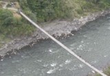
Bridgemeister ID: 2024 (added 2006-02-11)Name: (footbridge) Location: Baños vicinity, Ecuador Crossing: Pastaza River At or Near Feature: on the road to Puyo Use: Footbridge Status: In use (last checked: 2005) Main Cables: Wire Suspended Spans: 1
Bridgemeister ID: 3118 (added 2019-10-29)Name: (footbridge) Location: Baños, Ecuador Crossing: Rio Pastaza Coordinates: 1.394176 S 78.424923 W Maps: Acme , GeoHack , Google , OpenStreetMap Use: Footbridge Status: In use (last checked: 2017) Main Cables: Wire (steel) Suspended Spans: 1
Bridgemeister ID: 7148 (added 2022-06-25)Name: (footbridge) Location: Baños, Ecuador At or Near Feature: Agoyan Waterfall Coordinates: 1.402204 S 78.368902 W Maps: Acme , GeoHack , Google , OpenStreetMap Use: Footbridge Status: In use (last checked: 2018) Main Cables: Wire (steel) Suspended Spans: 1 Main Span: 1
Bridgemeister ID: 7225 (added 2022-07-10)Name: (footbridge) Location: Babahoyo, Los Rios, Ecuador Crossing: Rio San Pablo Coordinates: 1.796872 S 79.528713 W Maps: Acme , GeoHack , Google , OpenStreetMap Use: Footbridge Status: In use (last checked: 2015) Main Cables: Wire (steel) Suspended Spans: 1 Main Span: 1
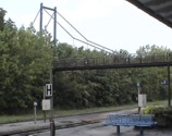
Bridgemeister ID: 2484 (added 2008-12-22)Name: (footbridge) Location: Bad Axe vicinity, Michigan , USA Coordinates: 43.78363 N 82.94364 W Maps: Acme , GeoHack , Google , OpenStreetMap Use: Footbridge Status: Extant (last checked: 2008) Main Span: 1
Bridgemeister ID: 2244 (added 2007-03-28)Name: (footbridge) Location: Bad Hütten and Unterlangnau, Baden-Württemberg, Germany Crossing: Argen River Coordinates: 47.630887 N 9.649808 E Maps: Acme , GeoHack , Google , OpenStreetMap Use: Footbridge Status: Extant (last checked: 2009) Main Cables: Wire Suspended Spans: 1
This cables, suspenders, and deck of this bridge are entirely hemp rope. At first quick glance, it has the appearance of any ordinary short-span suspension footbridge, but except for the towers, it's all rope. Bridgemeister ID: 2160 (added 2006-12-11)Name: (footbridge) Location: Bad Windsheim, Bavaria, Germany Coordinates: 49.506743 N 10.413097 E Maps: Acme , GeoHack , Google , OpenStreetMap Principals: Schlaich Bergermann Partner Use: Footbridge Status: In use (last checked: 2019) Main Cables: Eyebar (steel) Suspended Spans: 2 Main Span: 1 x 19.5 meters (64 feet) Side Span: 1 x 12.9 meters (42.3 feet) Deck width: 2.2 meters
Appears to have been largely destroyed at some point in the 2019-2021 time frame. Bridgemeister ID: 5684 (added 2021-03-26)Name: (footbridge) Location: Bagope, Peña Blanca vicinity, Honduras At or Near Feature: Lake Yojoa Coordinates: 14.935128 N 88.007859 W Maps: Acme , GeoHack , Google , OpenStreetMap Use: Footbridge Status: In use (last checked: 2018) Main Cables: Wire (steel) Suspended Spans: 1
Bridgemeister ID: 1883 (added 2005-09-24)Name: (footbridge) Location: Baie-Comeau vicinity, Quebec , Canada Crossing: Reservoir Manic Deaux Coordinates: 49.202117 N 68.34245 W Maps: Acme , GeoHack , Google , OpenStreetMap Use: Footbridge and Snowmobile Status: In use (last checked: 2005) Main Cables: Wire (steel) Suspended Spans: 1 Main Span: 1 x 90 meters (295.3 feet) estimated
Bridgemeister ID: 7656 (added 2023-06-10)Name: (footbridge) Location: Bajo Laguna, San Luis, San José Province, Costa Rica Crossing: Rio Turrobares Coordinates: 9.855294 N 84.512401 W Maps: Acme , GeoHack , Google , OpenStreetMap Use: Footbridge Status: Extant (last checked: 2022) Main Span: 1 x 122 meters (400.3 feet) estimated
Bridgemeister ID: 2060 (added 2006-06-03)Name: (footbridge) Location: Bakertown vicinity, New York , USA Coordinates: 43.402783 N 74.127383 W Maps: Acme , GeoHack , Google , OpenStreetMap Use: Footbridge Status: In use (last checked: 2006) Suspended Spans: 1
Bridgemeister ID: 7013 (added 2022-05-14)Name: (footbridge) Location: Bakola (बकोला), Uttarakhand , India Crossing: Lan Gad Coordinates: 30.432333 N 79.020581 E Maps: Acme , GeoHack , Google , OpenStreetMap Use: Footbridge Status: In use (last checked: 2018) Main Cables: Wire (steel) Suspended Spans: 1 Main Span: 1 x 70 meters (229.7 feet) estimated
Bridgemeister ID: 8525 (added 2024-03-24)Name: (footbridge) Location: Balakhu (बलखु) and Solpathana (सोल्पाठाना), Nepal Crossing: Sunkoshi Coordinates: 27.230956 N 86.330011 E Maps: Acme , GeoHack , Google , OpenStreetMap Use: Footbridge Status: Extant (last checked: 2023) Main Span: 1 x 180.7 meters (593 feet) estimated
Completed at some point in 2013 or 2014. Bridgemeister ID: 8526 (added 2024-03-24)Name: (footbridge) Location: Balakhu (बलखु) and Solpathana (सोल्पाठाना), Nepal Crossing: Sunkoshi Coordinates: 27.201181 N 86.356200 E Maps: Acme , GeoHack , Google , OpenStreetMap Use: Footbridge Status: Extant (last checked: 2023) Main Span: 1 x 184.1 meters (604 feet) estimated
Completed at some point in the 2008-2020 time frame. Bridgemeister ID: 1875 (added 2005-09-22)Name: (footbridge) Location: Baldwin vicinity, Iowa , USA Crossing: Bear Creek At or Near Feature: Eden Valley County Refuge Coordinates: 42.04455 N 90.86093 W Maps: Acme , GeoHack , Google , OpenStreetMap Use: Footbridge Status: In use (last checked: 2007) Suspended Spans: 1 Main Span: 1 x 27.4 meters (90 feet)
Bridgemeister ID: 2530 (added 2010-05-19)Name: (footbridge) Location: Ballindalloch vicinity, Scotland , United Kingdom Crossing: Allt a'Gheallaidh At or Near Feature: Speyside Way Coordinates: 57.4225 N 3.3745 W Maps: Acme , GeoHack , Google , OpenStreetMap Use: Footbridge Status: In use (last checked: 2009) Main Cables: Wire (steel) Suspended Spans: 1 Main Span: 1 x 24.8 meters (81.5 feet)
Bridgemeister ID: 1864 (added 2005-08-01)Name: (footbridge) Location: Baltimore, Maryland , USA At or Near Feature: Druid Hill Park Coordinates: 39.326730 N 76.646482 W Maps: Acme , GeoHack , Google , OpenStreetMap Use: Footbridge Status: In use (last checked: 2021) Main Cables: Wire (steel) Suspended Spans: 1
Bridgemeister ID: 4369 (added 2020-04-12)Name: (footbridge) Location: Bame, Nepal Crossing: Bheri River Coordinates: 28.586629 N 82.000248 E Maps: Acme , GeoHack , Google , OpenStreetMap Use: Footbridge Status: Extant (last checked: 2019) Main Span: 1 x 180.5 meters (592.2 feet) estimated
Bridgemeister ID: 5040 (added 2020-08-23)Name: (footbridge) Location: Ban Na, Si Samrong District, Sukhothai, Thailand Crossing: Yom River Coordinates: 17.164695 N 99.835829 E Maps: Acme , GeoHack , Google , OpenStreetMap Use: Footbridge Status: Closed (last checked: 2014) Main Cables: Wire (steel) Suspended Spans: 1
Bridgemeister ID: 7077 (added 2022-05-27)Name: (footbridge) Location: Banaue, Ifugao, Philippines Coordinates: 16.933529 N 121.141050 E Maps: Acme , GeoHack , Google , OpenStreetMap Use: Footbridge Status: In use (last checked: 2018) Main Cables: Wire (steel) Suspended Spans: 1
Bridgemeister ID: 7078 (added 2022-05-27)Name: (footbridge) Location: Banaue, Ifugao, Philippines Coordinates: 16.912427 N 121.061670 E Maps: Acme , GeoHack , Google , OpenStreetMap Use: Footbridge Status: In use (last checked: 2022) Main Cables: Wire (steel)
There are two closely adjacent suspension bridges at this location as of the late 2010s. This entry represents the older of the two, which is derelict. The other bridge is newer, in use, but is of the "drooping" style typically omitted from the inventory. Bridgemeister ID: 8160 (added 2024-02-03)Name: (footbridge) Location: Bangapani (बुन्गापनी), Uttarakhand , India Crossing: Goriganga Coordinates: 29.95926 N 80.30458 E Maps: Acme , GeoHack , Google , OpenStreetMap Use: Footbridge Status: In use (last checked: 2022) Main Cables: Wire (steel) Main Span: 1 x 45 meters (147.6 feet) estimated
Bangapani's suspension bridge is in a dilapidated condition - amurajala.com . Article about the poor condition of the bridge. Dated January 19, 2016. Translated from the article: "The condition of the suspension bridge built on Gori in Bangapani has become very bad. The asphalt on the bridge has started falling apart. There are holes on the bridge at many places. The feet of pedestrians and animals are getting stuck in these holes…"Facebook . Image of the bridge after recent flooding. June 28, 2013.Google Maps . Image of three men posing on the bridge. October 2022.Google Maps - Bangapani Guest House . Image with the bridge visible. January 2022.Bridgemeister ID: 6368 (added 2021-07-26)Name: (footbridge) Location: Banjh (बाँझ), Nepal Coordinates: 29.564439 N 80.862567 E Maps: Acme , GeoHack , Google , OpenStreetMap Use: Footbridge Status: Extant (last checked: 2021) Main Span: 1
Bridgemeister ID: 2830 (added 2019-07-04)Name: (footbridge) Location: Baoshan, Hsinchu County, Taiwan Crossing: Pao-shan Reservoir Coordinates: 24.747207 N 121.052170 E Maps: Acme , GeoHack , Google , OpenStreetMap Use: Footbridge Status: In use (last checked: 2016) Main Cables: Wire (steel) Suspended Spans: 3 Main Span: 1 Side Spans: 2
Facebook . Image of a person on the bridge. Posted May 12, 2015.Facebook . Image of the bridge. Posted December 2, 2015.Bridgemeister ID: 6269 (added 2021-07-19)Name: (footbridge) Location: Barawal Bandi, Khyber Pakhtunkhwa, Pakistan Coordinates: 35.088809 N 71.767442 E Maps: Acme , GeoHack , Google , OpenStreetMap Use: Footbridge Status: In use (last checked: 2018) Main Cables: Wire (steel) Main Spans: 1 x 74.1 meters (243 feet) estimated,
Bridgemeister ID: 6289 (added 2021-07-22)Name: (footbridge) Location: Barawal Bandi, Upper Dir District, Khyber Pakhtunkhwa, Pakistan Crossing: Baraul Khwar Coordinates: 35.103265 N 71.778643 E Maps: Acme , GeoHack , Google , OpenStreetMap Use: Footbridge Status: Extant (last checked: 2020) Main Cables: Wire Main Span: 1 x 50.6 meters (166 feet) estimated
Bridgemeister ID: 1375 (added 2004-07-03)Name: (footbridge) Location: Barbours Creek vicinity, Virginia , USA Crossing: Craig Creek Coordinates: 37.54998 N 80.01515 W Maps: Acme , GeoHack , Google , OpenStreetMap Principals: VDOT Use: Footbridge Status: In use (last checked: 2004) Main Cables: Wire (steel) Suspended Spans: 1 Main Span: 1 x 61.3 meters (201 feet) estimated
Bridgemeister ID: 5181 (added 2020-10-04)Name: (footbridge) Location: Barcis, Pordenone, Italy Crossing: Torrente Pentina Coordinates: 46.188938 N 12.542967 E Maps: Acme , GeoHack , Google , OpenStreetMap Use: Footbridge Status: In use (last checked: 2011) Main Cables: Wire (steel) Suspended Spans: 1
Bridgemeister ID: 4996 (added 2020-08-16)Name: (footbridge) Location: Barra do Itapocu, Araquari, Santa Catarina, Brazil Crossing: Lagoa da Cruz Coordinates: 26.552829 S 48.654915 W Maps: Acme , GeoHack , Google , OpenStreetMap Use: Footbridge Status: In use (last checked: 2020) Main Cables: Wire (steel) Suspended Spans: 1
Bridgemeister ID: 4997 (added 2020-08-16)Name: (footbridge) Location: Barra Velha, Santa Catarina, Brazil Crossing: Lagoa de Barra Velha Coordinates: 26.599758 S 48.674018 W Maps: Acme , GeoHack , Google , OpenStreetMap Use: Footbridge Status: In use (last checked: 2022) Main Cables: Wire (steel) Suspended Spans: 4 Main Spans: 2 Side Spans: 2
Bridgemeister ID: 7779 (added 2023-08-18)Name: (footbridge) Location: Barrio Flaminia, Sarapiquí, Heredia Province, Costa Rica Crossing: Río Puerto Viejo At or Near Feature: Estación Biológica La Selva Coordinates: 10.431271 N 84.005016 W Maps: Acme , GeoHack , Google , OpenStreetMap Use: Footbridge Status: In use (last checked: 2021) Main Cables: Wire (steel) Main Span: 1
Bridgemeister ID: 2445 (added 2008-04-23)Name: (footbridge) Location: Barwick, Breathitt County, Kentucky , USA Crossing: North Fork Kentucky River Coordinates: 37.37142 N 83.35669 W Maps: Acme , GeoHack , Google , OpenStreetMap Use: Footbridge Status: In use (last checked: 2008) Main Cables: Wire Suspended Spans: 4 Main Spans: 1 x 39.6 meters (130 feet), Side Spans: 1 x 36.6 meters (120 feet),
Bridgemeister ID: 6521 (added 2021-08-28)Name: (footbridge) Location: Basi, Alpurai vicinity, Khyber Pakhtunkhwa, Pakistan Crossing: Ghorband Khwar Coordinates: 34.899041 N 72.665587 E Maps: Acme , GeoHack , Google , OpenStreetMap Principals: Sarhad Rural Support Programme (SRSP) Use: Footbridge Status: In use (last checked: 2021) Main Cables: Wire (steel) Suspended Spans: 1 Main Span: 1 x 31.1 meters (102 feet) estimated
Completed at some point in 2011-2013 time frame. Replaced a bridge slightly to the west that may have been a suspension bridge. Bridgemeister ID: 808 (added 2003-05-28)Name: (footbridge) Location: Batavia, Illinois , USA Crossing: Fox River At or Near Feature: Clark Park Coordinates: 41.846869 N 88.307962 W Maps: Acme , GeoHack , Google , OpenStreetMap Use: Footbridge Status: Removed, c. 2005-2007 Main Cables: Wire (steel) Suspended Spans: 1 Main Span: 1 x 25 meters (82 feet) estimated Deck width: 1.5 meters
There were two small footbridges at this location. This record represents the bridge that connected from the Batavia side (west) of the Fox River to a small island. The other bridge is about 200 feet away and connects the first island to another island. Removed at some point between 2005 and 2007. Connects to (footbridge) - Batavia, Illinois, USA . Bridgemeister ID: 1840 (added 2005-07-09)Name: (footbridge) Location: Batavia, Illinois , USA Crossing: Fox River At or Near Feature: Clark Park Coordinates: 41.846270 N 88.307685 W Maps: Acme , GeoHack , Google , OpenStreetMap Use: Footbridge Status: Closed (last checked: 2021) Main Cables: Wire (steel) Suspended Spans: 1 Main Span: 1 x 25 meters (82 feet) estimated Deck width: 1.5 meters
Bridgemeister ID: 3356 (added 2019-12-15)Name: (footbridge) Location: Batopilas, Chihuahua, Mexico Coordinates: 27.026366 N 107.738538 W Maps: Acme , GeoHack , Google , OpenStreetMap Use: Footbridge Status: In use (last checked: 2019) Main Cables: Wire (steel)
Bridgemeister ID: 2229 (added 2007-03-19)Name: (footbridge) Location: Baturaden, Banyumas District, Central Java , Indonesia Use: Footbridge Status: Collapsed, October, 2006 Main Cables: Wire
Collapsed October, 2006 under weight of sightseers, reportedly killing 5 and injuring 24. Bridgemeister ID: 6587 (added 2021-09-04)Name: (footbridge) Location: Bau, Tana Toraja Regency, South Sulawesi , Indonesia Crossing: Sadang River Coordinates: 3.284866 S 119.694045 E Maps: Acme , GeoHack , Google , OpenStreetMap Use: Footbridge Status: In use (last checked: 2021) Main Cables: Wire (steel) Suspended Spans: 1 Main Span: 1 x 59.1 meters (194 feet) estimated
Bridgemeister ID: 3082 (added 2019-10-26)Name: (footbridge) Location: Bauska, Latvia Crossing: Musa River Coordinates: 56.400216 N 24.197436 E Maps: Acme , GeoHack , Google , OpenStreetMap Use: Footbridge Status: In use (last checked: 2017) Main Cables: Wire (steel) Suspended Spans: 1
Bridgemeister ID: 4207 (added 2020-04-08)Name: (footbridge) Location: Bø, Vestfold Og Telemark, Norway Crossing: Bøelva Coordinates: 59.410216 N 8.927449 E Maps: Acme , GeoHack , Google , kart.1881.no , OpenStreetMap Use: Footbridge Status: In use (last checked: 2019) Main Cables: Wire (steel) Main Span: 1 x 59.25 meters (194.4 feet) estimated
Bridgemeister ID: 4208 (added 2020-04-08)Name: (footbridge) Location: Bø, Vestfold Og Telemark, Norway Crossing: Bøelva Coordinates: 59.408759 N 8.959738 E Maps: Acme , GeoHack , Google , kart.1881.no , OpenStreetMap Use: Footbridge Status: Removed Main Cables: Wire Main Span: 1 x 62 meters (203.4 feet) estimated Deck width: ~1 meter
Bridgemeister ID: 4516 (added 2020-05-02)Name: (footbridge) Location: Bøen, Rjukan, Tinn, Vestfold og Telemark, Norway Crossing: Måna Coordinates: 59.877932 N 8.596171 E Maps: Acme , GeoHack , Google , kart.1881.no , OpenStreetMap Use: Footbridge Status: Replaced Main Cables: Wire (steel) Suspended Spans: 1 Main Span: 1 x 40 meters (131.2 feet) estimated
Bridgemeister ID: 2267 (added 2007-04-21)Name: (footbridge) Location: Beatrice vicinity, Nebraska , USA Crossing: Cub Creek At or Near Feature: Homestead National Monument Coordinates: 40.29049 N 96.83587 W Maps: Acme , GeoHack , Google , OpenStreetMap Use: Footbridge Status: In use (last checked: 2006) Main Cables: Wire (steel) Suspended Spans: 1 Main Span: 1 x 24.4 meters (80 feet)
Bridgemeister ID: 2457 (added 2008-09-20)Name: (footbridge) Location: Beatrice vicinity, Ritchie County, West Virginia , USA Crossing: South Fork Hughes River Use: Footbridge Status: In use (last checked: 2008) Main Cables: Wire Suspended Spans: 1 Main Span: 1
Coordinates and photos of this private bridge have been withheld at the request of the owner. Bridgemeister ID: 4702 (added 2020-06-20)Name: (footbridge) Location: Belaya Kalitva, Rostov Oblast, Russia Crossing: Reka Kalitva Coordinates: 48.180509 N 40.793238 E Maps: Acme , GeoHack , Google , OpenStreetMap Use: Footbridge Status: In use (last checked: 2019) Main Cables: Wire (steel) Suspended Spans: 1
Bridgemeister ID: 5862 (added 2021-05-16)Name: (footbridge) Location: Beli Iskar, Bulgaria Crossing: Cherni Iskar At or Near Feature: Чакърови поляни Coordinates: 42.294807 N 23.541663 E Maps: Acme , GeoHack , Google , OpenStreetMap Use: Footbridge Status: In use (last checked: 2021) Main Cables: Wire (steel) Main Span: 1
Facebook . Image of the damaged bridge. Posted January 18, 2016.Facebook . Image of the damaged bridge. Posted January 17, 2016.Jembatan Gantung di Muaraenim Putus, Dua Warga Nyaris Tewas . Article dated January 19, 2016, translated: "Two residents of Belimbing Village almost died when they were swept away by the current after the suspension bridge they were crossing broke when they were hit by the overflowing waters of the Lematang River, in Belimbing Village, Belimbing District, Muaraenim Regency, Sunday (17/1) at around 17.30…"Facebook . Image of the approach to the new bridge. Posted October 17, 2017.Facebook . Image of the bridge. A tower for the bridge destroyed in January 2016 is visible to the left of the new bridge tower in the background. Posted July 28, 2018.Facebook . Several images of people on the bridge soon after it opened. Posted January 3, 2018.Bridgemeister ID: 1372 (added 2004-07-03)Name: (footbridge) Location: Bellamy vicinity, Virginia , USA Crossing: Copper Creek Coordinates: 36.66061 N 82.68509 W Maps: Acme , GeoHack , Google , OpenStreetMap Principals: VDOT Use: Footbridge Status: In use (last checked: 2004) Main Cables: Wire (steel) Suspended Spans: 3 Main Span: 1 x 26.5 meters (87 feet) estimated Side Spans: 1 x 6.1 meters (20 feet) estimated,
Bridgemeister ID: 1378 (added 2004-07-03)Name: (footbridge) Location: Bellamy vicinity, Virginia , USA Crossing: Copper Creek Coordinates: 36.66067 N 82.67929 W Maps: Acme , GeoHack , Google , OpenStreetMap Use: Footbridge Status: In use (last checked: 2004) Main Cables: Wire (steel) Suspended Spans: 2 Main Span: 1 x 27.4 meters (90 feet) estimated Side Span: 1 x 14 meters (46 feet) estimated
Carries a private pier that extends into the Long Island Sound. Bridgemeister ID: 1622 (added 2005-02-27)Name: (footbridge) Location: Bellefonte, Pennsylvania , USA Crossing: Spring Creek At or Near Feature: Talleyrand Park Coordinates: 40.910683 N 77.781517 W Maps: Acme , GeoHack , Google , OpenStreetMap Use: Footbridge Status: In use (last checked: 2007) Main Cables: Wire Suspended Spans: 1
Bridgemeister ID: 2220 (added 2007-03-11)Name: (footbridge) Location: Bellepoint vicinity, Ohio , USA Crossing: Mill Creek Coordinates: 40.248596 N 83.163559 W Maps: Acme , GeoHack , Google , OpenStreetMap Use: Footbridge Status: Derelict (last checked: 2007) Main Cables: Wire
Bridgemeister ID: 1056 (added 2003-12-13)Name: (footbridge) Location: Belton vicinity, Texas , USA Crossing: Lampasas River At or Near Feature: Chalk Ridge Falls Park Coordinates: 31.018 N 97.525 W Maps: Acme , GeoHack , Google , OpenStreetMap Use: Footbridge Status: In use (last checked: 2020) Main Cables: Wire (steel) Suspended Spans: 1
Short footbridge with wood towers near Stillhouse Hollow Lake Dam. Bridgemeister ID: 5002 (added 2020-08-16)Name: (footbridge) Location: Benedito Novo, Santa Catarina, Brazil Crossing: Rio Benedito Coordinates: 26.783978 S 49.365241 W Maps: Acme , GeoHack , Google , OpenStreetMap Use: Footbridge Status: In use (last checked: 2019) Main Cables: Wire (steel) Suspended Spans: 1
Bridgemeister ID: 4615 (added 2020-06-07)Name: (footbridge) Location: Benešov u Semil and Slaná, Czechia Crossing: Jizera River Coordinates: 50.595235 N 15.361863 E Maps: Acme , GeoHack , Google , OpenStreetMap Use: Footbridge Status: In use (last checked: 2014) Main Cables: Wire (steel) Suspended Spans: 1 Main Span: 1 x 50 meters (164 feet) estimated
Bridgemeister ID: 4900 (added 2020-07-18)Name: (footbridge) Location: Benighat and Ghyalchok, Nepal Crossing: Trishuli River Coordinates: 27.808944 N 84.756091 E Maps: Acme , GeoHack , Google , OpenStreetMap Use: Footbridge Status: In use (last checked: 2019) Main Cables: Wire (steel) Suspended Spans: 1
Bridgemeister ID: 4825 (added 2020-07-04)Name: (footbridge) Location: Benighat, Nepal Crossing: Trishuli River Coordinates: 27.817172 N 84.809304 E Maps: Acme , GeoHack , Google , OpenStreetMap Use: Footbridge Status: In use (last checked: 2017) Main Cables: Wire (steel) Suspended Spans: 1
Bridgemeister ID: 2411 (added 2007-12-25)Name: (footbridge) Location: Benton Harbor, Michigan , USA At or Near Feature: Eastman Springs Use: Footbridge
Bridgemeister ID: 4478 (added 2020-04-26)Name: (footbridge) Location: Berlevåg, Troms og Finnmark, Norway Crossing: Gentjejgohka Coordinates: 70.652143 N 29.174046 E Maps: Acme , GeoHack , Google , kart.1881.no , OpenStreetMap Use: Footbridge Status: In use (last checked: 2019) Main Cables: Wire (steel) Suspended Spans: 1 Main Span: 1 x 40 meters (131.2 feet) estimated
Built prior to 1970. Claimed to be Europe's northernmost suspension bridge. Bridgemeister ID: 7352 (added 2022-10-22)Name: (footbridge) Location: Beroun, Czechia Crossing: Berounka Coordinates: 49.977854 N 14.072694 E Maps: Acme , GeoHack , Google , OpenStreetMap Use: Footbridge Status: In use (last checked: 2022) Main Cables: Wire (steel) Suspended Spans: 3 Main Span: 1 x 62 meters (203.4 feet) estimated Side Spans: 2
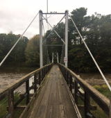
Bridgemeister ID: 292 (added before 2003)Name: (footbridge) Location: Bethel, Marshfield vicinity, Wisconsin , USA Crossing: Dexter Lake At or Near Feature: North Wood County Park Coordinates: 44.5186 N 90.14035 W Maps: Acme , GeoHack , Google , OpenStreetMap Use: Footbridge Status: In use (last checked: 2021) Main Cables: Wire (steel) Suspended Spans: 1 Main Span: 1 x 45.7 meters (150 feet) estimated
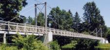
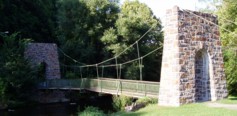
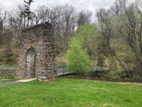
Bridgemeister ID: 805 (added 2003-03-30)Name: (footbridge) Location: Bethlehem, Pennsylvania , USA Crossing: Monocacy Creek At or Near Feature: Monocacy Park Coordinates: 40.64248 N 75.38225 W Maps: Acme , GeoHack , Google , OpenStreetMap Use: Footbridge Status: In use (last checked: 2021) Main Cables: Wire (steel) Suspended Spans: 1
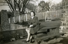
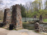
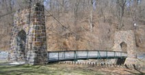
2004: Damaged by flooding during Hurricane Ivan. Remained closed through 2005. Built in 1920s. Bridgemeister ID: 1495 (added 2004-09-24)Name: (footbridge) Location: Bethlehem, Pennsylvania , USA Crossing: Saucon Creek At or Near Feature: Saucon Park Coordinates: 40.603255 N 75.346362 W Maps: Acme , GeoHack , Google , OpenStreetMap Use: Footbridge Status: In use (last checked: 2021) Main Cables: Wire (steel) Suspended Spans: 1
Bridgemeister ID: 5628 (added 2020-12-28)Name: (footbridge) Location: Bhagawati, Nepal Coordinates: 28.874432 N 82.490111 E Maps: Acme , GeoHack , Google , OpenStreetMap Use: Footbridge Status: In use (last checked: 2020) Main Cables: Wire (steel) Main Span: 1
Bridgemeister ID: 6438 (added 2021-08-12)Name: (footbridge) Location: Bhairabanath (भैरबनाथ), Nepal Crossing: Seti River Coordinates: 29.476622 N 81.008113 E Maps: Acme , GeoHack , Google , OpenStreetMap Use: Footbridge Status: Extant (last checked: 2021) Main Span: 1
Do you have any information or photos for these bridges that you would like to share? Please email david.denenberg@bridgemeister.com .
Mail | Facebook | Twitter
