Undated/Unnamed Suspension Footbridges (1,301-1,400 of 1,747)
This is a list of bridges 1,301 through 1,400 (of 1,747 total) in the suspension bridge inventory that are undated and unnamed footbridges. Wherever you see a Bridgemeister ID number click it to isolate the bridge on its own page.
Related Lists:
Bridgemeister ID: 5580 (added 2020-12-21)Name: (footbridge) Location: Rybnyk, Lviv Oblast, Ukraine Crossing: Stryi River Coordinates: 49.183083 N 23.309000 E Maps: Acme , GeoHack , Google , OpenStreetMap Use: Footbridge Status: In use (last checked: 2019) Main Cables: Wire Main Spans: 2
Bridgemeister ID: 1531 (added 2004-10-30)Name: (footbridge) Location: Rygnestad, Valle, Agder, Norway Crossing: Otra Coordinates: 59.262417 N 7.47135 E Maps: Acme , GeoHack , Google , kart.1881.no , OpenStreetMap Use: Footbridge Status: In use (last checked: 2022) Main Cables: Wire (steel) Suspended Spans: 1
Bridgemeister ID: 4009 (added 2020-03-28)Name: (footbridge) Location: Sabah, Malaysia Crossing: Danum River At or Near Feature: Danum Valley Conservation Area Coordinates: 4.965361 N 117.803054 E Maps: Acme , GeoHack , Google , OpenStreetMap Use: Footbridge Status: In use (last checked: 2017) Main Cables: Wire (steel)
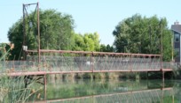
Short footbridge with tall green towers. Bridgemeister ID: 2589 (added 2014-04-14)Name: (footbridge) Location: Saint-Juste-du-Lac, Quebec , Canada Crossing: Touladi River Coordinates: 47.675142 N 68.795619 W Maps: Acme , GeoHack , Google , OpenStreetMap Use: Footbridge Status: In use (last checked: 2019) Main Cables: Wire (steel) Suspended Spans: 1 Main Span: 1 x 48.8 meters (160 feet) estimated
Bridgemeister ID: 869 (added 2003-08-30)Name: (footbridge) Location: Salem, Utah , USA Crossing: Salem Lake Coordinates: 40.05256 N 111.67755 W Maps: Acme , GeoHack , Google , OpenStreetMap Use: Footbridge Status: In use (last checked: 2006) Main Cables: Wire (steel) Suspended Spans: 1 Main Span: 1 x 25.9 meters (85 feet) estimated
After collapse, main span rebuilt by suspending a large donated highway overhead sign truss making an effective through truss. Bridgemeister ID: 1554 (added 2004-11-23)Name: (footbridge) Location: Salida, Colorado , USA Crossing: Arkansas River Use: Footbridge Main Cables: Wire Suspended Spans: 1
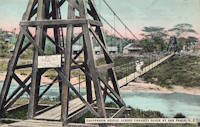
Call numbers X-13282 and CHS.X5149 of the Denver Public Library's Western History Photos collection show a suspension footbridge (circa 1890-1910) near the base of Tenderfoot Hill. Bridgemeister ID: 6692 (added 2021-09-26)Name: (footbridge) Location: Salimbongan, Lembang, Pinrang Regency and Mesakada, Batulappa, Pinrang Regency, South Sulawesi , Indonesia Crossing: Mamasa River Coordinates: 3.402054 S 119.579808 E Maps: Acme , GeoHack , Google , OpenStreetMap Use: Footbridge Status: In use (last checked: 2017) Main Cables: Wire (steel) Main Span: 1
Bridgemeister ID: 872 (added 2003-08-30)Name: (footbridge) Location: Salina vicinity, Kansas , USA Crossing: Mulberry Creek Coordinates: 38.88861 N 97.59963 W Maps: Acme , GeoHack , Google , OpenStreetMap Use: Footbridge Status: In use (last checked: 2010) Suspended Spans: 3 Main Span: 1 x 23.5 meters (77 feet) estimated Side Spans: 1 x 11.6 meters (38 feet) estimated,
Bridgemeister ID: 7232 (added 2022-07-16)Name: (footbridge) Location: Salitre, Guayas, Ecuador Crossing: Rio Vinces Coordinates: 1.832370 S 79.810956 W Maps: Acme , GeoHack , Google , OpenStreetMap Use: Footbridge Status: In use (last checked: 2020) Main Cables: Wire (steel) Main Span: 1
Bridgemeister ID: 6885 (added 2022-01-15)Name: (footbridge) Location: Salurindu, Mamasa Regency, West Sulawesi , Indonesia Coordinates: 2.841889 S 119.150639 E Maps: Acme , GeoHack , Google , OpenStreetMap Use: Footbridge Status: Extant (last checked: 2019) Main Cables: Wire Main Span: 1 x 23.8 meters (78 feet) estimated
Bridgemeister ID: 6437 (added 2021-08-12)Name: (footbridge) Location: Samari (समारी) vicinity, Nepal Coordinates: 27.947441 N 84.988637 E Maps: Acme , GeoHack , Google , OpenStreetMap Use: Footbridge Status: Extant (last checked: 2021) Main Span: 1
Bridgemeister ID: 6853 (added 2022-01-02)Name: (footbridge) Location: Sambirejo, Trenggalek Regency and Pogalan, Trenggalek Regency, East Java , Indonesia Coordinates: 8.062699 S 111.730974 E Maps: Acme , GeoHack , Google , OpenStreetMap Use: Footbridge Status: In use (last checked: 2016) Main Cables: Wire (steel) Suspended Spans: 1
Bridgemeister ID: 7421 (added 2022-12-09)Name: (footbridge) Location: Samdrup Jongkhar, Bhutan Crossing: Darranga Nadi At or Near Feature: Samdrup Jongkhar Primary School Coordinates: 26.803383 N 91.501170 E Maps: Acme , GeoHack , Google , OpenStreetMap Use: Footbridge Status: Destroyed, c. August 2015 Main Cables: Wire (steel) Main Span: 1 x 42 meters (137.8 feet) estimated
2015, August: Deck wrecked by flood. Bridgemeister ID: 7698 (added 2023-07-04)Name: (footbridge) Location: San Antonio de Guadalupe, Ecuador Crossing: Rio Yacuambi Coordinates: 3.805917 S 78.899250 W Maps: Acme , GeoHack , Google , OpenStreetMap Status: Extant (last checked: 2020) Main Span: 1 x 70 meters (229.7 feet) estimated
Bridgemeister ID: 8064 (added 2023-12-24)Name: (footbridge) Location: San Fransisco, Veraguas, Panama Crossing: Rio Santa Maria Coordinates: 8.378889 N 81.063806 W Maps: Acme , GeoHack , Google , OpenStreetMap Use: Footbridge Status: In use (last checked: 2023) Main Cables: Wire (steel) Main Span: 1 x 85 meters (278.9 feet) estimated
Bridgemeister ID: 8065 (added 2023-12-24)Name: (footbridge) Location: San Fransisco, Veraguas, Panama Crossing: Rio Santa Maria Coordinates: 8.378833 N 81.063750 W Maps: Acme , GeoHack , Google , OpenStreetMap Use: Footbridge Status: Extant (last checked: 2023) Main Span: 1 x 74 meters (242.8 feet) estimated
Bridgemeister ID: 7448 (added 2022-12-24)Name: (footbridge) Location: San Jacinto, El Salvador Crossing: Rio Suquiapa Coordinates: 13.993408 N 89.436522 W Maps: Acme , GeoHack , Google , OpenStreetMap Use: Footbridge Status: In use (last checked: 2020) Main Cables: Wire (steel) Suspended Spans: 1 Main Span: 1 x 41.1 meters (135 feet) estimated
Built at some point in the 2005-2009 time frame. Bridgemeister ID: 7379 (added 2022-11-24)Name: (footbridge) Location: San Jose Guayabal vicinity, El Salvador Crossing: El Sillero Coordinates: 13.853428 N 89.141571 W Maps: Acme , GeoHack , Google , OpenStreetMap Use: Footbridge Status: In use (last checked: 2019) Main Cables: Wire (steel) Suspended Spans: 1 Main Span: 1 x 24.4 meters (80 feet) estimated
Twitter . Images of the bridge, posted November 1, 2019.Perhaps the smallest suspension bridge serving as an international crossing. Bridgemeister ID: 7505 (added 2023-01-02)Name: (footbridge) Location: San Miguel Ocotepeque and Antigua Ocotepeque, Honduras Crossing: Rio Lempa Coordinates: 14.405619 N 89.204375 W Maps: Acme , GeoHack , Google , OpenStreetMap Use: Footbridge Status: Collapsed, c. June 2022 Main Cables: Wire (steel) Main Span: 1 x 62.2 meters (204 feet) estimated
2022, June: Destroyed by flood. Facebook . Image of the bridge, posted November 1, 2017.Facebook . Image of the bridge, posted December 31, 2017.Facebook . Image of the bridge, posted May 13, 2012.Facebook . Image of the collapsed bridge, posted June 21, 2022.Facebook . Image of the collapsed bridge, posted June 21, 2022.Bridgemeister ID: 7449 (added 2022-12-24)Name: (footbridge) Location: San Pablo Tacachico, El Salvador Crossing: Rio Suquiapa Coordinates: 13.982125 N 89.329325 W Maps: Acme , GeoHack , Google , OpenStreetMap Use: Footbridge Status: Only towers remain, since c. 2020 Main Cables: Wire (steel) Suspended Spans: 1 Main Span: 1 x 42.4 meters (139 feet) estimated
Likely wrecked by Tropical Storm Amanda in 2020. Facebook . Image of the bridge, posted July 1, 2016.Facebook . Image of the bridge, posted September 13, 2016.Facebook . Image of the bridge taken just after Tropical Storm Amanda floods devastated the area. Posted June 14, 2020.Coordinates indicate the approximate location at the former town of San Pablo. The area was inundated by the formation of Gatun Lake. Bridgemeister ID: 4953 (added 2020-08-08)Name: (footbridge) Location: San Sebastián, Puerto Rico , USA At or Near Feature: Hacienda La Fe Adventure Park Coordinates: 18.345750 N 66.992278 W Maps: Acme , GeoHack , Google , OpenStreetMap Use: Footbridge Status: In use (last checked: 2019) Main Cables: Wire (steel) Suspended Spans: 1
Bridgemeister ID: 7643 (added 2023-05-29)Name: (footbridge) Location: San Vicente de Tagua Tagua, San Vicente, Chile Crossing: Estero Zamprano Coordinates: 34.452551 S 71.153271 W Maps: Acme , GeoHack , Google , OpenStreetMap Use: Footbridge Status: In use (last checked: 2022) Main Cables: Wire (steel) Suspended Spans: 1
Bridgemeister ID: 1957 (added 2005-11-05)Name: (footbridge) Location: Sankt Daniel and Weidenburg, Austria Crossing: Gail River Coordinates: 46.657590 N 13.053811 E Maps: Acme , GeoHack , Google , OpenStreetMap Use: Footbridge Status: Extant (last checked: 2019) Main Cables: Wire
Bridgemeister ID: 5241 (added 2020-11-01)Name: (footbridge) Location: Sano Gemela, Nepal Crossing: Dudh Koshi Coordinates: 27.736349 N 86.711629 E Maps: Acme , GeoHack , Google , OpenStreetMap Use: Footbridge Status: Extant (last checked: 2020) Main Cables: Wire (steel) Suspended Spans: 1
Adjacent to a newer simple suspension bridge not listed in the inventory. Bridgemeister ID: 515 (added before 2003)Name: (footbridge) Location: Sant Esteve de la Sarga vicinity, Lleida, Catalonia, Spain At or Near Feature: Mont-rebei Gorge Coordinates: 42.088969 N 0.685679 E Maps: Acme , GeoHack , Google , OpenStreetMap Use: Footbridge Status: In use (last checked: 2020) Main Cables: Wire Suspended Spans: 1
Bridgemeister ID: 5003 (added 2020-08-16)Name: (footbridge) Location: Santa Cruz da Figueira, Águas Mornas, Santa Catarina, Brazil Crossing: Rio Cubatão Coordinates: 27.720997 S 48.887940 W Maps: Acme , GeoHack , Google , OpenStreetMap Use: Footbridge Status: In use (last checked: 2019) Main Cables: Wire (steel) Suspended Spans: 1
Bridgemeister ID: 6895 (added 2022-01-16)Name: (footbridge) Location: Santa Rosa, Huancabamba, Peru Coordinates: 10.454470 S 75.495485 W Maps: Acme , GeoHack , Google , OpenStreetMap Use: Footbridge Status: In use (last checked: 2013) Main Cables: Wire (steel) Suspended Spans: 3 Main Span: 1 Side Spans: 2
Bridgemeister ID: 6896 (added 2022-01-16)Name: (footbridge) Location: Santa Rosa, Huancabamba, Peru Coordinates: 10.460370 S 75.489043 W Maps: Acme , GeoHack , Google , OpenStreetMap Use: Footbridge Status: In use (last checked: 2013) Main Cables: Wire (steel) Suspended Spans: 1 Main Span: 1
Bridgemeister ID: 3451 (added 2019-12-22)Name: (footbridge) Location: Santa Teresa District, Peru Crossing: Urubamba River Coordinates: 13.095828 S 72.610192 W Maps: Acme , GeoHack , Google , OpenStreetMap Use: Footbridge Status: In use (last checked: 2017) Main Cables: Wire (steel)
Bridgemeister ID: 4132 (added 2020-04-06)Name: (footbridge) Location: Santianes de Tornín, Spain Crossing: Sella River Coordinates: 43.307162 N 5.131203 W Maps: Acme , GeoHack , Google , OpenStreetMap Use: Footbridge Status: Extant (last checked: 2014) Main Cables: Wire (steel) Suspended Spans: 1
Bridgemeister ID: 6383 (added 2021-07-27)Name: (footbridge) Location: Santillán, Asturias, Spain Crossing: Sella River Coordinates: 43.273513 N 5.143758 W Maps: Acme , GeoHack , Google , OpenStreetMap Use: Footbridge Status: Extant (last checked: 2021) Main Cables: Wire (steel) Main Span: 1
Bridgemeister ID: 5339 (added 2020-11-12)Name: (footbridge) Location: Sanyoonoda, Yamaguchi , Japan Coordinates: 34.033180 N 131.188667 E Maps: Acme , GeoHack , Google , OpenStreetMap Use: Footbridge Status: In use (last checked: 2020) Main Cables: Wire (steel) Main Span: 1 x 110 meters (360.9 feet) estimated
Bridgemeister ID: 3577 (added 2019-12-29)Name: (footbridge) Location: Sanzhi District, New Taipei City, Taiwan Coordinates: 25.261619 N 121.489722 E Maps: Acme , GeoHack , Google , OpenStreetMap Use: Footbridge Status: Removed, 2013-2015 Main Cables: Wire (steel)
Removed at some point between August 2013 and November 2015. Replaced with an arch pedestrian bridge. Bridgemeister ID: 5288 (added 2020-11-08)Name: (footbridge) Location: Saping and Dolalghat, Nepal Crossing: Sunkoshi Coordinates: 27.640947 N 85.709766 E Maps: Acme , GeoHack , Google , OpenStreetMap Use: Footbridge Status: In use (last checked: 2019) Main Cables: Wire (steel)
Bridgemeister ID: 2383 (added 2007-11-07)Name: (footbridge) Location: Sarasota vicinity, Florida , USA At or Near Feature: Myakka River State Park Coordinates: 27.245110 N 82.302434 W Maps: Acme , GeoHack , Google , OpenStreetMap Use: Footbridge Status: In use (last checked: 2019) Main Cables: Wire (steel)
Appears to be removed or derelict in 2010s satellite imagery. Bridgemeister ID: 5827 (added 2021-04-15)Name: (footbridge) Location: Sarov (Саров), Nizhny Novgorod Oblast, Russia Crossing: Reka Satis Coordinates: 54.928714 N 43.329557 E Maps: Acme , GeoHack , Google , OpenStreetMap Use: Footbridge Status: In use (last checked: 2020) Main Span: 1 Characteristics: Hinged cables
Unconventional suspension system with overlapping asymmetric cables. Similar to 1889 Fiorentini (Ferro, Soldo, Soldino) - Rome, Italy . Similar to 1936 Kindee - Kindee, Ellenborough vicinity, New South Wales, Australia . Similar to 1951 Marias River (Pugsley) - Chester vicinity, Montana, USA . Similar to Allan - Segenhoe, Scone vicinity, New South Wales, Australia . Similar to Ininskiy (Ининский) - Inya (Иня), Altai Republic, Russia . Similar to Reku Vel' - Solginskiy (Солгинский), Arkhangelsk Oblast, Russia . Bridgemeister ID: 4603 (added 2020-06-07)Name: (footbridge) Location: Sarya, Vitebskaya, Belarus Crossing: Sar'yanka Coordinates: 55.910743 N 27.888797 E Maps: Acme , GeoHack , Google , OpenStreetMap Use: Footbridge Status: In use (last checked: 2020) Main Cables: Wire (steel) Suspended Spans: 1
Bridgemeister ID: 5935 (added 2021-06-27)Name: (footbridge) Location: Satipo, Peru Crossing: Rio de Satipo Coordinates: 11.255506 S 74.634601 W Maps: Acme , GeoHack , Google , OpenStreetMap Use: Footbridge Status: In use (last checked: 2014) Main Cables: Wire (steel) Main Span: 1
Bridgemeister ID: 4994 (added 2020-08-16)Name: (footbridge) Location: São Paulo, Brazil Coordinates: 23.207771 S 47.296369 W Maps: Acme , GeoHack , Google , OpenStreetMap Use: Footbridge Status: In use (last checked: 2020) Main Cables: Wire (steel) Suspended Spans: 1
Appears to connect the rooftop Memorial do Rio Tietê to a trail alongside the Tietê River effectively crossing the rooftop of an adjacent building, not actually crossing the river. Its bridge, cables, and deck are painted a color similar to the brickwork of the building making this large footbridge somewhat camouflaged and very difficult to discern in present day (2020) satellite images. Near (footbridge) - São Paulo, Brazil . Bridgemeister ID: 6891 (added 2022-01-16)Name: (footbridge) Location: Sölden, Austria Coordinates: 46.954182 N 11.013118 E Maps: Acme , GeoHack , Google , OpenStreetMap Use: Footbridge Status: In use (last checked: 2022) Main Cables: Wire (steel) Main Span: 1
Bridgemeister ID: 4015 (added 2020-03-28)Name: (footbridge) Location: Sørgefoss, Viken, Norway Crossing: Sogna Coordinates: 60.14824 N 10.20097 E Maps: Acme , GeoHack , Google , kart.1881.no , OpenStreetMap Use: Footbridge Status: Extant (last checked: 2019) Main Cables: Wire Suspended Spans: 1 Main Span: 1 x 34 meters (111.5 feet) estimated
Based on historical aerial images, constructed prior to 1947. Bridgemeister ID: 2469 (added 2008-12-19)Name: (footbridge) Location: Schramm Park State Recreation Area, Sarpy County, Nebraska , USA Use: Footbridge Status: In use (last checked: 2023) Main Cables: Wire (steel) Suspended Spans: 1 Main Span: 1 x 28.3 meters (93 feet)
Bridgemeister ID: 2286 (added 2007-04-23)Name: (footbridge) Location: Sedona vicinity, Arizona , USA Crossing: Oak Creek Coordinates: 34.96007 N 111.75343 W Maps: Acme , GeoHack , Google , OpenStreetMap Use: Footbridge Status: In use (last checked: 2012) Main Cables: Wire (steel) Suspended Spans: 1
Patrick S. O'Donnell provided a rough main span estimate of 120 feet. Bridgemeister ID: 7311 (added 2022-08-27)Name: (footbridge) Location: Seema (सीमा) and Osla, Uttarakhand , India Crossing: Barasu Gad Coordinates: 31.118111 N 78.351533 E Maps: Acme , GeoHack , Google , OpenStreetMap Use: Footbridge Status: In use (last checked: 2022) Main Cables: Wire (steel) Suspended Spans: 1 Main Span: 1 x 60.7 meters (199 feet) estimated
Bridgemeister ID: 7547 (added 2023-03-18)Name: (footbridge) Location: Sekarwangi, Cibadak, Sukabumi Regency, West Java , Indonesia Coordinates: 6.909446 S 106.778335 E Maps: Acme , GeoHack , Google , OpenStreetMap Use: Footbridge Status: Extant (last checked: 2021) Main Cables: Wire
Possibly two suspension bridges at this location starting in the mid-2010s. Google Maps . Image with one, possibly two, suspension bridges in the distance.Bridgemeister ID: 6974 (added 2022-03-27)Name: (footbridge) Location: Sem (सेम) and Nandaprayag (नंदप्रयाग), Uttarakhand , India Crossing: Nandakini River Coordinates: 30.330939 N 79.317942 E Maps: Acme , GeoHack , Google , OpenStreetMap Use: Footbridge Status: Destroyed, c. June, 2013 Main Cables: Wire (steel) Suspended Spans: 1 Main Span: 1 x 40 meters (131.2 feet) estimated
Appears to have been destroyed by the catastrophic Uttarakhand flooding in June 2013. Bridgemeister ID: 5116 (added 2020-09-06)Name: (footbridge) Location: Semboku, Akita , Japan Coordinates: 39.610407 N 140.665680 E Maps: Acme , GeoHack , Google , OpenStreetMap Use: Footbridge Status: In use (last checked: 2017) Main Cables: Wire (steel)
Bridgemeister ID: 7097 (added 2022-06-03)Name: (footbridge) Location: Semikarakorsk (Семикаракорск), Rostov Oblast, Russia Coordinates: 47.528528 N 40.814294 E Maps: Acme , GeoHack , Google , OpenStreetMap Use: Footbridge Status: In use (last checked: 2022) Main Cables: Wire (steel) Suspended Spans: 1 Main Span: 1 x 120 meters (393.7 feet) estimated
Bridgemeister ID: 3091 (added 2019-10-27)Name: (footbridge) Location: Seoraksan National Park, South Korea At or Near Feature: Yukdam Falls Coordinates: 38.164863 N 128.501127 E Maps: Acme , GeoHack , Google , OpenStreetMap Use: Footbridge Status: In use (last checked: 2017) Main Cables: Wire (steel) Suspended Spans: 1
Bridgemeister ID: 7177 (added 2022-07-02)Name: (footbridge) Location: Sepporraki, Bulo, Polewali Mandar Regency, West Sulawesi , Indonesia Coordinates: 3.224115 S 119.177368 E Maps: Acme , GeoHack , Google , OpenStreetMap Use: Footbridge Status: In use (last checked: 2020) Main Cables: Wire (steel) Main Span: 1
Completed at some point in the 2014-2016 time frame. Facebook . Several images showing the bridge, posted April 2020.Bridgemeister ID: 7190 (added 2022-07-04)Name: (footbridge) Location: Sepporraki, Bulo, Polewali Mandar Regency, West Sulawesi , Indonesia Coordinates: 3.196177 S 119.172548 E Maps: Acme , GeoHack , Google , OpenStreetMap Use: Footbridge Status: In use (last checked: 2020) Main Cables: Wire (steel) Main Span: 1
Completed at some point between late 2016 and 2018. Facebook . Image of the bridge, posted November 2020.Bridgemeister ID: 4897 (added 2020-07-18)Name: (footbridge) Location: Setidobhan, Nepal Coordinates: 28.140347 N 83.844258 E Maps: Acme , GeoHack , Google , OpenStreetMap Use: Footbridge Status: Extant (last checked: 2019)
Bridgemeister ID: 1327 (added 2004-04-28)Name: (footbridge) Location: Seven Fountains, Virginia , USA Crossing: Narrow Passage Creek Coordinates: 38.85500 N 78.40410 W Maps: Acme , GeoHack , Google , OpenStreetMap Principals: VDOT Use: Footbridge Status: Removed Main Cables: Wire (steel) Suspended Spans: 1 Main Span: 1 x 25 meters (82 feet) estimated
Adjacent to Seven Fountains Rd. low-water vehicle crossing. Bridgemeister ID: 1636 (added 2005-03-13)Name: (footbridge) Location: Shattuck Clearing vicinity and Long Lake vicinity, New York , USA Crossing: Moose River At or Near Feature: Northville-Lake Placid Trail Use: Footbridge Status: In use (last checked: 2004) Main Cables: Wire
Bridgemeister ID: 1637 (added 2005-03-13)Name: (footbridge) Location: Shattuck Clearing vicinity and Long Lake vicinity, New York , USA Crossing: Cold River At or Near Feature: Northville-Lake Placid Trail Use: Footbridge Status: In use (last checked: 2004) Main Cables: Wire
Located at a hydroelectrical plant. 2011, September: At this point, the bridge is in a derelict state with large sections of the deck missing. 2014: At some point since 2011, the bridge is removed except for the abutments. Bridgemeister ID: 4886 (added 2020-07-18)Name: (footbridge) Location: Shimokitayama, Nara , Japan Crossing: Nishino River Coordinates: 34.002138 N 135.961669 E Maps: Acme , GeoHack , Google , OpenStreetMap Use: Footbridge Status: In use (last checked: 2013) Main Cables: Wire (steel) Suspended Spans: 1
Bridgemeister ID: 5102 (added 2020-09-05)Name: (footbridge) Location: Shinano, Nagano , Japan Crossing: Seki River At or Near Feature: Naena Falls, 妙高 苗名滝 Coordinates: 36.849128 N 138.134554 E Maps: Acme , GeoHack , Google , OpenStreetMap Use: Footbridge Status: In use (last checked: 2020) Main Cables: Wire (steel) Suspended Spans: 1
Bridgemeister ID: 4261 (added 2020-04-10)Name: (footbridge) Location: Shirahama, Wakayama , Japan Crossing: Hiki River Coordinates: 33.669004 N 135.521700 E Maps: Acme , GeoHack , Google , OpenStreetMap Use: Footbridge Status: Extant (last checked: 2019) Main Cables: Wire (steel) Main Span: 1 x 99 meters (324.8 feet) estimated
Bridgemeister ID: 3207 (added 2019-11-10)Name: (footbridge) Location: Shirakawa, Gifu , Japan Crossing: Hida River Coordinates: 35.565571 N 137.186784 E Maps: Acme , GeoHack , Google , OpenStreetMap Use: Footbridge Status: In use (last checked: 2019) Main Cables: Wire (steel) Suspended Spans: 1
Bridgemeister ID: 5844 (added 2021-05-13)Name: (footbridge) Location: Shiso, Hyogo , Japan At or Near Feature: Harafudō Falls, 原不動滝 Coordinates: 35.199819 N 134.503872 E Maps: Acme , GeoHack , Google , OpenStreetMap Use: Footbridge Status: In use (last checked: 2018) Main Cables: Wire (steel) Suspended Spans: 1
One of several suspension bridges around Harafudō Falls. This bridge's deck appears to be currently (as of 2010s) supported by substantial I-beams such that it is highly doubtful the bridge is functioning as a suspension bridge. Near Harafudō - Shiso, Hyogo, Japan . Near Harafudō - Shiso, Hyogo, Japan . Bridgemeister ID: 6871 (added 2022-01-06)Name: (footbridge) Location: Shivaraj (शिवराज), Kapilvastu District, Nepal Coordinates: 27.702804 N 82.819518 E Maps: Acme , GeoHack , Google , OpenStreetMap Use: Footbridge Status: In use (last checked: 2022) Main Cables: Wire (steel) Main Span: 1 x 263 meters (862.9 feet) estimated
Bridgemeister ID: 6959 (added 2022-02-19)Name: (footbridge) Location: Shlisselburg (Шлиссельбург), Leningrad Oblast, Russia Coordinates: 59.944382 N 31.029646 E Maps: Acme , GeoHack , Google , OpenStreetMap Use: Footbridge Status: Derelict (last checked: 2022) Suspended Spans: 1
Bridgemeister ID: 4679 (added 2020-06-20)Name: (footbridge) Location: Shreekrishna Gandaki, Nepal Crossing: Aadhi Khola Coordinates: 27.978886 N 83.588797 E Maps: Acme , GeoHack , Google , OpenStreetMap Use: Footbridge Status: In use (last checked: 2018) Main Cables: Wire (steel) Main Span: 1
Bridgemeister ID: 3346 (added 2019-12-14)Name: (footbridge) Location: Shymplong, Meghalaya , India Coordinates: 25.099921 N 92.354410 E Maps: Acme , GeoHack , Google , OpenStreetMap Use: Footbridge Status: In use (last checked: 2019) Main Cables: Wire (steel)
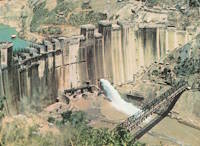
Likely a temporary bridge built for use during the construction of Kariba Dam (1955-1959). Do you have any information or photos for these bridges that you would like to share? Please email david.denenberg@bridgemeister.com .
Mail | Facebook | Twitter
