Undated/Unnamed Suspension Footbridges (1,601-1,700 of 1,747)
This is a list of bridges 1,601 through 1,700 (of 1,747 total) in the suspension bridge inventory that are undated and unnamed footbridges. Wherever you see a Bridgemeister ID number click it to isolate the bridge on its own page.
Related Lists:
Bridgemeister ID: 4465 (added 2020-04-26)Name: (footbridge) Location: Tveito, Rjukan, Tinn, Vestfold og Telemark, Norway Crossing: Måna Coordinates: 59.878142 N 8.629825 E Maps: Acme , GeoHack , Google , kart.1881.no , OpenStreetMap Use: Footbridge Status: Removed Main Cables: Wire Main Span: 1 x 36.5 meters (119.8 feet) estimated
Build prior to 1961. Removed at some point between 1975 and 2006. Bridgemeister ID: 7349 (added 2022-10-15)Name: (footbridge) Location: Twin Falls, Idaho , USA Crossing: Snake River At or Near Feature: Shoshone Falls Coordinates: 42.596689 N 114.400463 W Maps: Acme , GeoHack , Google , OpenStreetMap Use: Footbridge Status: In use (last checked: 2022) Main Cables: Wire (steel) Suspended Spans: 1 Main Span: 1 x 63 meters (206.7 feet) estimated
Bridgemeister ID: 8273 (added 2024-02-08)Name: (footbridge) Location: Twin Peaks, Benguet, Philippines Crossing: Bued River Coordinates: 16.258500 N 120.552694 E Maps: Acme , GeoHack , Google , OpenStreetMap Use: Footbridge Status: In use (last checked: 2022) Main Cables: Wire (steel) Suspended Spans: 1
Bridgemeister ID: 8274 (added 2024-02-08)Name: (footbridge) Location: Twin Peaks, Benguet, Philippines Crossing: Bued River At or Near Feature: Bridal Veil Falls Coordinates: 16.248861 N 120.543167 E Maps: Acme , GeoHack , Google , OpenStreetMap Use: Footbridge Status: Extant (last checked: 2022) Main Cables: Wire (steel) Main Span: 1
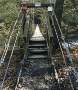
Bridgemeister ID: 786 (added 2003-03-22)Name: (footbridge) Location: Tyro vicinity, Virginia , USA Crossing: Tye River At or Near Feature: Appalachian Trail Coordinates: 37.83738 N 79.02061 W Maps: Acme , GeoHack , Google , OpenStreetMap Use: Footbridge Status: In use (last checked: 2007) Main Cables: Wire (steel) Suspended Spans: 1 Main Span: 1 x 75.6 meters (248 feet)
Bridgemeister ID: 4488 (added 2020-04-28)Name: (footbridge) Location: Tyssedal, Ullensvang, Vestland, Norway Crossing: Tysso At or Near Feature: former channel of Coordinates: 60.117140 N 6.557148 E Maps: Acme , GeoHack , Google , kart.1881.no , OpenStreetMap Use: Footbridge Status: Removed Main Cables: Wire (steel) Suspended Spans: 1
Bridgemeister ID: 6863 (added 2022-01-02)Name: (footbridge) Location: Uhailanu, Aralle, Mamasa Regency, West Sulawesi , Indonesia Coordinates: 2.912426 S 119.140450 E Maps: Acme , GeoHack , Google , OpenStreetMap Use: Footbridge Status: In use (last checked: 2019) Main Cables: Wire (steel) Main Span: 1 x 39.6 meters (130 feet) estimated
Bridgemeister ID: 6865 (added 2022-01-02)Name: (footbridge) Location: Uhailanu, Aralle, Mamasa Regency, West Sulawesi , Indonesia Coordinates: 2.913337 S 119.136711 E Maps: Acme , GeoHack , Google , OpenStreetMap Use: Footbridge Status: In use (last checked: 2018) Main Cables: Wire (steel) Suspended Spans: 1 Main Span: 1 x 38.1 meters (125 feet) estimated
Built at some point in the 2015-2017 time frame. Facebook . Image of the bridge, posted 2018.Facebook . Image of the bridge, posted 2018.2014: Heavily damaged by a storm. Repaired. Bridgemeister ID: 5825 (added 2021-04-15)Name: (footbridge) Location: Ulyanovsk (Ульяновск), Ulyanovsk Oblast, Russia Crossing: Reka Sviyaga Coordinates: 54.340004 N 48.322257 E Maps: Acme , GeoHack , Google , OpenStreetMap Use: Footbridge Status: In use (last checked: 2020) Main Cables: Wire (steel) Suspended Spans: 3 Main Spans: 2,
Bridgemeister ID: 7916 (added 2023-10-22)Name: (footbridge) Location: Umegashima, Aoi Ward, Shizuoka , Japan Crossing: Abe River Coordinates: 35.300887 N 138.341125 E Maps: Acme , GeoHack , Google , OpenStreetMap Use: Footbridge Status: Extant (last checked: 2021) Main Cables: Wire (steel) Main Span: 1
Bridgemeister ID: 4590 (added 2020-06-06)Name: (footbridge) Location: Umhausen, Austria At or Near Feature: Stuibenfall Coordinates: 47.125684 N 10.948807 E Maps: Acme , GeoHack , Google , OpenStreetMap Use: Footbridge Status: In use (last checked: 2019) Main Cables: Wire (steel)
Bridgemeister ID: 7805 (added 2023-08-21)Name: (footbridge) Location: Uppoor (ಉಪ್ಪೂರು) and Bramavara (ಬ್ರಹ್ಮಾವರ), Karnataka , India Crossing: Madisalu Hole Coordinates: 13.407745 N 74.756614 E Maps: Acme , GeoHack , Google , OpenStreetMap Use: Footbridge Status: In use (last checked: 2022) Main Cables: Wire (steel) Main Span: 1
Bridgemeister ID: 4482 (added 2020-04-26)Name: (footbridge) Location: Upsete vicinity, Voss, Vestland, Norway Crossing: Kleivelvi Coordinates: 60.701744 N 6.936201 E Maps: Acme , GeoHack , Google , kart.1881.no , OpenStreetMap Use: Footbridge Status: Derelict (last checked: 2019) Main Cables: Wire Suspended Spans: 1 Main Span: 1 x 27 meters (88.6 feet) estimated
Derelict since some point between 2013-2016. Deck is wrecked, probably by flood. Based on historic aerial images, built before 1958. Bridgemeister ID: 6200 (added 2021-07-15)Name: (footbridge) Location: Ust'-Koksa (Усть-Кокса), Altai Republic, Russia Crossing: Reka Koksa Coordinates: 50.267049 N 85.616621 E Maps: Acme , GeoHack , Google , OpenStreetMap Use: Footbridge Status: In use (last checked: 2020) Main Cables: Wire (steel) Suspended Spans: 1
Bridgemeister ID: 3725 (added 2020-02-15)Name: (footbridge) Location: Ustron, Poland Crossing: Vistula River Coordinates: 49.696820 N 18.833516 E Maps: Acme , GeoHack , Google , OpenStreetMap Use: Footbridge Status: In use (last checked: 2020) Main Cables: Wire (steel) Suspended Spans: 1
Bridgemeister ID: 5313 (added 2020-11-11)Name: (footbridge) Location: Vadaktėliai, Lithuania Crossing: Vadaktis Coordinates: 55.630264 N 24.118562 E Maps: Acme , GeoHack , Google , OpenStreetMap Use: Footbridge Status: In use (last checked: 2020) Main Cables: Wire (steel) Suspended Spans: 1
Bridgemeister ID: 7638 (added 2023-05-28)Name: (footbridge) Location: Valdivia, Antioquia, Colombia Crossing: Cauca River Coordinates: 7.338668 N 75.346602 W Maps: Acme , GeoHack , Google , OpenStreetMap Use: Footbridge Status: In use (last checked: 2022) Main Cables: Wire (steel) Suspended Spans: 1
Bridgemeister ID: 531 (added before 2003)Name: (footbridge) Location: Valkeakoski, Finland Crossing: Apia Canal Coordinates: 61.272471 N 24.047243 E Maps: Acme , GeoHack , Google , OpenStreetMap Use: Footbridge Status: In use (last checked: 2019) Main Cables: Wire (steel)
Bridgemeister ID: 4514 (added 2020-05-02)Name: (footbridge) Location: Vang, Innlandet, Norway Crossing: Dingla Coordinates: 61.289214 N 8.580259 E Maps: Acme , GeoHack , Google , kart.1881.no , OpenStreetMap Use: Footbridge Status: In use Main Cables: Wire (steel) Suspended Spans: 1 Main Span: 1 x 12.5 meters (41 feet) estimated
Appears to have been a temporary footbridge following the destruction of a multi-span arch bridge. Bridgemeister ID: 7868 (added 2023-09-17)Name: (footbridge) Location: Vålådalen, Sweden Crossing: Vålån River Coordinates: 63.142072 N 12.968548 E Maps: Acme , GeoHack , Google , OpenStreetMap Use: Footbridge Status: In use (last checked: 2022) Main Cables: Wire (steel) Suspended Spans: 1
Looks like it may be used by snowmobiles. Instagram . Image of the bridge, posted July 31, 2022.Bridgemeister ID: 2978 (added 2019-10-12)Name: (footbridge) Location: Veliko Tarnovo, Bulgaria Crossing: Yantra River Coordinates: 43.087219 N 25.654068 E Maps: Acme , GeoHack , Google , OpenStreetMap Use: Footbridge Status: In use (last checked: 2017) Suspended Spans: 3 Main Span: 1 Side Spans: 2
Bridgemeister ID: 4016 (added 2020-03-28)Name: (footbridge) Location: Veme, Ringerike, Viken, Norway Crossing: Sogna Coordinates: 60.19972 N 10.11270 E Maps: Acme , GeoHack , Google , kart.1881.no , OpenStreetMap Use: Footbridge Status: Extant (last checked: 2019) Suspended Spans: 1 Main Span: 1 x 41 meters (134.5 feet) estimated
Based on historic aerial images, completed prior to 1959. Bridgemeister ID: 4512 (added 2020-05-02)Name: (footbridge) Location: Verdal, Trøndelag, Norway Crossing: Helgåa Coordinates: 63.827063 N 12.269431 E Maps: Acme , GeoHack , Google , kart.1881.no , OpenStreetMap Use: Footbridge Status: In use Main Cables: Wire (steel) Suspended Spans: 1 Main Span: 1 x 30.5 meters (100.1 feet) estimated
Based on historical aerial images, built at some point between 1967 and 1983. Bridgemeister ID: 7630 (added 2023-05-27)Name: (footbridge) Location: Verkhnedneprovskii (Верхнеднепровский) and Martynkovo (Мартынково), Smolensk Oblast, Russia Crossing: Dnieper River Coordinates: 54.991927 N 33.377791 E Maps: Acme , GeoHack , Google , OpenStreetMap Use: Footbridge Status: In use (last checked: 2023) Main Cables: Wire Suspended Spans: 1
Bridgemeister ID: 6119 (added 2021-07-04)Name: (footbridge) Location: Villa Lanquin, Rio Negro and Neuquen, Argentina Crossing: Rio Limay Coordinates: 40.894819 S 71.039442 W Maps: Acme , GeoHack , Google , OpenStreetMap Use: Footbridge Status: In use (last checked: 2019) Main Cables: Wire (steel) Suspended Spans: 1 Main Span: 1
Bridgemeister ID: 8299 (added 2024-02-09)Name: (footbridge) Location: Vinces, Ecuador Crossing: River Vinces Coordinates: 1.554222 S 79.753333 W Maps: Acme , GeoHack , Google , OpenStreetMap Use: Footbridge Status: In use (last checked: 2023) Main Cables: Wire (steel) Suspended Spans: 1 Main Span: 1 x 131 meters (429.8 feet) estimated
Bridgemeister ID: 3364 (added 2019-12-20)Name: (footbridge) Location: Viruppakka, Kerala , India Crossing: Aloor River At or Near Feature: Vazhani Dam Coordinates: 10.633921 N 76.305940 E Maps: Acme , GeoHack , Google , OpenStreetMap Use: Footbridge Status: In use (last checked: 2019) Main Cables: Wire (steel)
Bridgemeister ID: 6969 (added 2022-03-26)Name: (footbridge) Location: Vojska (Војска), Serbia Crossing: Great Morava Coordinates: 44.083564 N 21.190873 E Maps: Acme , GeoHack , Google , OpenStreetMap Use: Footbridge Status: In use (last checked: 2021) Main Cables: Wire (steel) Suspended Spans: 1 Main Span: 1 x 175 meters (574.1 feet) estimated
Bridgemeister ID: 3002 (added 2019-10-13)Name: (footbridge) Location: Vythiri, Kerala , India Coordinates: 11.557448 N 76.045292 E Maps: Acme , GeoHack , Google , OpenStreetMap Use: Footbridge Status: In use (last checked: 2019) Main Cables: Wire (steel) Suspended Spans: 1
Narrow footbridge with short timber towers. Appears to also carry a narrow pipeline across the deck. One of two nearby likely derelict suspension bridges across arms of the Verdigris. May be a third nearby suspension bridge across the arm of the Verdigris into which Strawberry Creek flows. Near (footbridge) - Wagoner County, Oklahoma, USA . One of two nearby likely derelict suspension bridges across arms of the Verdigris. May be a third nearby suspension bridge across the arm of the Verdigris into which Strawberry Creek flows. Near (footbridge) - Wagoner County, Oklahoma, USA . Bridgemeister ID: 753 (added 2003-03-08)Name: (footbridge) Location: Waimana Gorge, Bay of Plenty, New Zealand Crossing: Waimana Gorge References: GAP Use: Footbridge
Bridgemeister ID: 3070 (added 2019-10-26)Name: (footbridge) Location: Waitakere, New Zealand Coordinates: 36.886752 S 174.519026 E Maps: Acme , GeoHack , Google , OpenStreetMap Use: Footbridge Status: In use (last checked: 2005) Main Cables: Wire (steel)
Near Cascades Falls at the Falls Road parking area. Bridgemeister ID: 2204 (added 2007-02-11)Name: (footbridge) Location: Waldbreitbach, Rheinland-Pfalz, Germany Crossing: Wied River Coordinates: 50.553218 N 7.426136 E Maps: Acme , GeoHack , Google , OpenStreetMap Use: Footbridge Status: Destroyed, 1956 Main Cables: Wire (steel) Suspended Spans: 1
Bridgemeister ID: 2987 (added 2019-10-13)Name: (footbridge) Location: Wamena vicinity, Jayawijaya Regency, Papua , Indonesia Coordinates: 4.188537 S 139.010867 E Maps: Acme , GeoHack , Google , OpenStreetMap Use: Footbridge Status: In use (last checked: 2014) Main Cables: Wire (steel)
Bridgemeister ID: 2835 (added 2019-07-04)Name: (footbridge) Location: Wanfeng, Ren'ai Township, Nantou County, Taiwan Coordinates: 23.951163 N 121.073658 E Maps: Acme , GeoHack , Google , OpenStreetMap Use: Footbridge Status: In use Main Cables: Wire
Bridgemeister ID: 5038 (added 2020-08-23)Name: (footbridge) Location: Wang Thong, Si Samrong District, Sukhothai, Thailand Crossing: Yom River Coordinates: 17.127496 N 99.823439 E Maps: Acme , GeoHack , Google , OpenStreetMap Use: Footbridge Status: In use (last checked: 2014) Main Cables: Wire (steel)
Bridgemeister ID: 5039 (added 2020-08-23)Name: (footbridge) Location: Wang Thong, Si Samrong District, Sukhothai, Thailand Crossing: Yom River Coordinates: 17.142442 N 99.828910 E Maps: Acme , GeoHack , Google , OpenStreetMap Use: Footbridge Status: In use (last checked: 2014) Main Cables: Wire (steel) Suspended Spans: 1
Bridgemeister ID: 5037 (added 2020-08-23)Name: (footbridge) Location: Wang Yai, Si Samrong District, Sukhothai, Thailand Crossing: Yom River Coordinates: 17.109271 N 99.822596 E Maps: Acme , GeoHack , Google , OpenStreetMap Use: Footbridge Status: In use (last checked: 2014) Main Cables: Wire (steel)
Bridgemeister ID: 4365 (added 2020-04-11)Name: (footbridge) Location: Wangdue Phodrang, Bhutan Crossing: Puna Tsang Chu Coordinates: 27.456866 N 89.906665 E Maps: Acme , GeoHack , Google , OpenStreetMap Use: Footbridge Status: Extant (last checked: 2013) Main Cables: Wire (steel) Suspended Spans: 1
Bridgemeister ID: 1067 (added 2003-12-27)Name: (footbridge) Location: Wauwatosa, Wisconsin , USA Crossing: Menomonee River At or Near Feature: Hoyt Park Coordinates: 43.05428 N 88.02231 W Maps: Acme , GeoHack , Google , OpenStreetMap Use: Footbridge Status: In use (last checked: 2012) Main Cables: Wire (steel) Suspended Spans: 1 Main Span: 1 x 25.3 meters (83 feet) estimated
2017: Closed due to safety concerns. 2021: Non-suspension replacement construction expected to start in late 2021. Bridgemeister ID: 5775 (added 2021-04-08)Name: (footbridge) Location: Wellington, New Zealand At or Near Feature: Zealandia Ecosanctuary Coordinates: 41.297664 S 174.746791 E Maps: Acme , GeoHack , Google , OpenStreetMap Use: Footbridge Status: In use (last checked: 2021) Main Cables: Wire (steel) Suspended Spans: 1
Bridgemeister ID: 1697 (added 2005-03-28)Name: (footbridge) Location: Weng'an, Guizhou , China Use: Footbridge Status: Removed Main Cables: Wire
This bridge was adjacent to the Jiangjiehe arch bridge completed in 1995. Eric Sakowski notes that the arch bridge is 863 feet above the valley floor and this suspension bridge was likely about 650 feet high. Bridgemeister ID: 3787 (added 2020-02-29)Name: (footbridge) Location: West Monroe, Louisiana , USA Coordinates: 32.546234 N 92.162354 W Maps: Acme , GeoHack , Google , OpenStreetMap Use: Footbridge Status: In use (last checked: 2019) Main Cables: Wire (steel) Suspended Spans: 1
Coordinates are suspected location of this bridge along the alignment of the present day (2020) non-suspension footbridge in West Union. Bridgemeister ID: 5698 (added 2021-04-01)Name: (footbridge) Location: Wewang Riu, East Luwu Regency, South Sulawesi , Indonesia Coordinates: 2.637392 S 121.091412 E Maps: Acme , GeoHack , Google , OpenStreetMap Use: Footbridge Status: In use (last checked: 2017) Main Cables: Wire (steel) Suspended Spans: 1
Bridgemeister ID: 5858 (added 2021-05-15)Name: (footbridge) Location: Weybridge, Vermont , USA Crossing: Otter Creek At or Near Feature: Belden Falls Coordinates: 44.051929 N 73.177332 W Maps: Acme , GeoHack , Google , OpenStreetMap Use: Footbridge Status: In use (last checked: 2021) Main Cables: Wire (steel) Suspended Spans: 1
Bridgemeister ID: 5859 (added 2021-05-15)Name: (footbridge) Location: Weybridge, Vermont , USA Crossing: Otter Creek At or Near Feature: Belden Falls Coordinates: 44.051998 N 73.177593 W Maps: Acme , GeoHack , Google , OpenStreetMap Use: Footbridge Status: In use (last checked: 2021) Main Cables: Wire (steel)
Bridgemeister ID: 1053 (added 2003-12-12)Name: (footbridge) Location: Whitehorse, Yukon , Canada Crossing: Yukon River At or Near Feature: Kishwoot Island Park Coordinates: 60.72929 N 135.05673 W Maps: Acme , GeoHack , Google , OpenStreetMap Use: Footbridge Status: In use Main Cables: Wire Suspended Spans: 1 Main Span: 1 x 57.9 meters (190 feet) estimated
Bridgemeister ID: 305 (added before 2003)Name: (footbridge) Location: Whitneyville, Connecticut , USA Crossing: Lake Whitney At or Near Feature: New Haven Country Club Use: Footbridge Status: Removed Main Cables: Wire (steel) Suspended Spans: 1
Bridgemeister ID: 8179 (added 2024-02-05)Name: (footbridge) Location: Wiang Thong, Sung Men District, Phrae, Thailand Crossing: Yom River Coordinates: 18.119222 N 100.113833 E Maps: Acme , GeoHack , Google , OpenStreetMap Use: Footbridge Status: In use (last checked: 2022) Main Cables: Wire (steel) Suspended Spans: 1 Main Span: 1
Bridgemeister ID: 8263 (added 2024-02-08)Name: (footbridge) Location: Wiang Thong, Sung Men District, Phrae, Thailand Crossing: Yom River Coordinates: 18.116889 N 100.124833 E Maps: Acme , GeoHack , Google , OpenStreetMap Use: Footbridge Status: In use (last checked: 2024) Main Cables: Wire (steel) Suspended Spans: 1
2024, January: Deck damaged when a driver accidentally attempted to drive a car across the footbridge instead of using the adjacent road bridge. Bridgemeister ID: 3556 (added 2019-12-26)Name: (footbridge) Location: Wiang, Chiang Saen Distrct, Chiang Rai, Thailand Coordinates: 20.373665 N 100.074420 E Maps: Acme , GeoHack , Google , OpenStreetMap Use: Footbridge Status: In use (last checked: 2019) Main Cables: Wire (steel)
On the grounds of the Four Seasons Tented Camp Golden Triangle resort. Bridgemeister ID: 1060 (added 2003-12-13)Name: (footbridge) Location: Wichita Falls, Texas , USA Crossing: Wichita River At or Near Feature: Lucy Park Coordinates: 33.917 N 98.51218 W Maps: Acme , GeoHack , Google , OpenStreetMap Use: Footbridge Status: In use (last checked: 2012) Main Cables: Wire
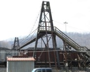
This private bridge spans 16 sets of rail tracks at Williamson. Patrick S. O'Donnell provided a rough main span estimate of 175 feet. Bridgemeister ID: 796 (added 2003-03-28)Name: (footbridge) Location: Williamsville vicinity, Virginia , USA Crossing: Bullpasture River At or Near Feature: Highland Wildlife Management Area Coordinates: 38.21390 N 79.59108 W Maps: Acme , GeoHack , Google , OpenStreetMap Use: Footbridge Status: In use Main Cables: Wire Suspended Spans: 1 Main Span: 1 x 49.4 meters (162 feet) estimated
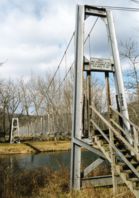
Adjacent to Chapman Landing Rd. low-water vehicular crossing near area known as "Narrow Passage" where Narrow Passage Creek flows into the Shenandoah. The side span against the hillside is suspended. Bridgemeister ID: 2510 (added 2009-12-30)Name: (footbridge) Location: Wilmore, McDowell County, West Virginia , USA Crossing: Tug Fork Big Sandy River Coordinates: 37.45758 N 81.75380 W Maps: Acme , GeoHack , Google , OpenStreetMap Use: Footbridge Status: In use (last checked: 2015) Main Cables: Wire (steel) Suspended Spans: 2 Main Span: 1 x 48.8 meters (160 feet) Side Span: 1 x 6.7 meters (22 feet)
Bridgemeister ID: 1354 (added 2004-05-15)Name: (footbridge) Location: Wilson Hill vicinity, Virginia , USA Crossing: Powell River Coordinates: 36.61521 N 83.29997 W Maps: Acme , GeoHack , Google , OpenStreetMap Principals: VDOT Use: Footbridge Status: In use (last checked: 2004) Main Cables: Wire Suspended Spans: 2 Main Span: 1 x 61 meters (200 feet) estimated Side Span: 1 x 15.8 meters (52 feet) estimated
Bridgemeister ID: 1364 (added 2004-07-02)Name: (footbridge) Location: Wilson Hill vicinity, Virginia , USA Crossing: Powell River Coordinates: 36.63608 N 83.22846 W Maps: Acme , GeoHack , Google , OpenStreetMap Principals: VDOT Use: Footbridge Status: In use (last checked: 2004) Main Cables: Wire (steel) Suspended Spans: 2 Main Span: 1 x 74.7 meters (245 feet) estimated Side Span: 1 x 15.2 meters (50 feet) estimated
Bridgemeister ID: 3811 (added 2020-03-01)Name: (footbridge) Location: Wilstacy, Kentucky , USA Crossing: Quicksand Creek Coordinates: 37.558230 N 83.285530 W Maps: Acme , GeoHack , Google , OpenStreetMap Use: Footbridge Status: In use (last checked: 2007) Main Cables: Wire (steel) Suspended Spans: 3 Main Span: 1 x 27.4 meters (90 feet) estimated Side Spans: 2
Bridgemeister ID: 2746 (added 2019-06-23)Name: (footbridge) Location: Winterset, Iowa , USA Crossing: North River At or Near Feature: Guye Woods County Park Coordinates: 41.416563 N 93.957499 W Maps: Acme , GeoHack , Google , OpenStreetMap Use: Footbridge Status: In use (last checked: 2015) Main Cables: Wire (steel)
Bridgemeister ID: 7095 (added 2022-05-29)Name: (footbridge) Location: Wolfhurst, Bridgeport, Ohio , USA Crossing: Wheeling Creek Coordinates: 40.067440 N 80.788920 W Maps: Acme , GeoHack , Google , OpenStreetMap Use: Footbridge Status: Extant (last checked: 2021) Main Span: 1 x 37.5 meters (123 feet) estimated
Do you have any information or photos for these bridges that you would like to share? Please email david.denenberg@bridgemeister.com .
Mail | Facebook | Twitter
