Undated/Unnamed Suspension Footbridges (301-400 of 1,747)
This is a list of bridges 301 through 400 (of 1,747 total) in the suspension bridge inventory that are undated and unnamed footbridges. Wherever you see a Bridgemeister ID number click it to isolate the bridge on its own page.
Related Lists:
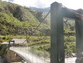
Bridgemeister ID: 8271 (added 2024-02-08)Name: (footbridge) Location: Camp 3 vicinity, Benguet, Philippines Crossing: Bued River Coordinates: 16.296028 N 120.598083 E Maps: Acme , GeoHack , Google , OpenStreetMap Use: Footbridge Status: In use (last checked: 2022) Main Span: 1 x 37 meters (121.4 feet) estimated
Bridgemeister ID: 8272 (added 2024-02-08)Name: (footbridge) Location: Camp 3 vicinity, Benguet, Philippines Crossing: Bued River Coordinates: 16.286944 N 120.583250 E Maps: Acme , GeoHack , Google , OpenStreetMap Use: Footbridge Status: In use (last checked: 2023) Main Cables: Wire (steel) Suspended Spans: 1 Main Span: 1 x 91 meters (298.6 feet) estimated
Bridgemeister ID: 2507 (added 2009-12-29)Name: (footbridge) Location: Camp Italiano vicinity, Torres del Paine, Chile Use: Footbridge Status: In use (last checked: 2020) Main Cables: Wire Suspended Spans: 1
Bridgemeister ID: 6231 (added 2021-07-17)Name: (footbridge) Location: Cancura, Osorno, Chile Crossing: Rahue River Coordinates: 40.760684 S 72.966358 W Maps: Acme , GeoHack , Google , OpenStreetMap Use: Footbridge Status: In use (last checked: 2021) Main Cables: Wire (steel) Main Span: 1
Bridgemeister ID: 1800 (added 2005-05-17)Name: (footbridge) Location: Cannobio, Italy Crossing: Cannobino River Coordinates: 46.062843 N 8.691344 E Maps: Acme , GeoHack , Google , OpenStreetMap Use: Footbridge Status: In use (last checked: 2020) Main Cables: Wire (steel) Suspended Spans: 2 Main Span: 1 x 63 meters (206.7 feet) Side Span: 1 x 19 meters (62.3 feet) Deck width: 1.3 meters
Appears to have been rebuilt in late 2000s or early 2010s. The height of the towers were extended and the suspended side span eliminated. Bridgemeister ID: 7498 (added 2023-01-01)Name: (footbridge) Location: Cantón El Gramal, La Palma, El Salvador Crossing: Rio Nunuapa Coordinates: 14.296743 N 89.175150 W Maps: Acme , GeoHack , Google , OpenStreetMap Use: Footbridge Status: In use (last checked: 2021) Main Cables: Wire (iron) Suspended Spans: 1
Bridgemeister ID: 7492 (added 2022-12-30)Name: (footbridge) Location: Canton La Ruda vicinity, Masahuat, El Salvador Crossing: Rio Lempa Coordinates: 14.154030 N 89.407071 W Maps: Acme , GeoHack , Google , OpenStreetMap Use: Footbridge Status: In use (last checked: 2013) Main Cables: Wire (steel) Main Span: 1 x 91.4 meters (300 feet) estimated
Bridgemeister ID: 2105 (added 2006-08-26)Name: (footbridge) Location: Canton vicinity, South Dakota , USA Crossing: Sargeant Creek At or Near Feature: Newton Hills State Park Coordinates: 43.2241 N 96.5803 W Maps: Acme , GeoHack , Google , OpenStreetMap Use: Footbridge Status: In use (last checked: 2006) Main Cables: Wire Suspended Spans: 1 Main Span: 1 x 16.2 meters (53 feet) estimated
Bridgemeister ID: 2106 (added 2006-08-26)Name: (footbridge) Location: Canton vicinity, South Dakota , USA Crossing: Sargeant Creek At or Near Feature: Newton Hills State Park Coordinates: 43.227333 N 96.57695 W Maps: Acme , GeoHack , Google , OpenStreetMap Use: Footbridge Status: In use (last checked: 2006) Main Cables: Wire Suspended Spans: 1 Main Span: 1 x 14.9 meters (49 feet) estimated
Bridgemeister ID: 1899 (added 2005-10-02)Name: (footbridge) Location: Cap-Rouge, Quebec City, Quebec , Canada Coordinates: 46.76315 N 71.355333 W Maps: Acme , GeoHack , Google , OpenStreetMap Use: Footbridge Status: In use (last checked: 2005) Main Cables: Wire (steel)
Bridgemeister ID: 773 (added 2003-03-14)Name: (footbridge) Location: Carnation, Washington , USA Crossing: Snoqualmie River At or Near Feature: Tolt-McDonald Park Coordinates: 47.64391 N 121.9251 W Maps: Acme , GeoHack , Google , OpenStreetMap Use: Footbridge Status: In use (last checked: 2015) Main Cables: Wire (steel) Suspended Spans: 1 Main Span: 1 x 90.5 meters (297 feet) estimated
Bridgemeister ID: 1356 (added 2004-05-15)Name: (footbridge) Location: Carrol Mill vicinity, Virginia , USA Crossing: Hardy Creek Coordinates: 36.66879 N 83.25842 W Maps: Acme , GeoHack , Google , OpenStreetMap Principals: VDOT Use: Footbridge Status: In use (last checked: 2004) Main Cables: Wire Suspended Spans: 1 Main Span: 1 x 18.3 meters (60 feet) estimated
Bridgemeister ID: 1355 (added 2004-05-15)Name: (footbridge) Location: Carrol Mill, Virginia , USA Crossing: Hardy Creek Coordinates: 36.67238 N 83.26071 W Maps: Acme , GeoHack , Google , OpenStreetMap Principals: VDOT Use: Footbridge Status: In use (last checked: 2004) Main Cables: Wire Suspended Spans: 1 Main Span: 1 x 12.2 meters (40 feet) estimated
Bridgemeister ID: 1381 (added 2004-07-03)Name: (footbridge) Location: Carter Ferry, Clinchport vicinity, Virginia , USA Crossing: Clinch River Coordinates: 36.69280 N 82.69012 W Maps: Acme , GeoHack , Google , OpenStreetMap Principals: VDOT Use: Footbridge Status: In use (last checked: 2004) Main Cables: Wire (steel) Suspended Spans: 3 Main Span: 1 x 68.6 meters (225 feet) estimated Side Spans: 1 x 29 meters (95 feet) estimated,
Bridgemeister ID: 3198 (added 2019-11-10)Name: (footbridge) Location: Castellar de Tost vicinity, Lleida, Spain Crossing: Segre River Coordinates: 42.264975 N 1.357872 E Maps: Acme , GeoHack , Google , OpenStreetMap Use: Footbridge Status: In use (last checked: 2018) Main Cables: Wire (steel)
Bridgemeister ID: 2594 (added 2014-04-14)Name: (footbridge) Location: Causapscal, Quebec , Canada Crossing: Matapédia River Coordinates: 48.352598 N 67.223151 W Maps: Acme , GeoHack , Google , OpenStreetMap Use: Footbridge Status: In use (last checked: 2018) Main Cables: Wire (steel) Suspended Spans: 3 Main Span: 1 x 48.8 meters (160 feet) estimated Side Spans: 1 x 6.1 meters (20 feet) estimated,
Bridgemeister ID: 7207 (added 2022-07-08)Name: (footbridge) Location: Cazones de Herrera, Veracruz, Mexico Crossing: Cazones River Coordinates: 20.706484 N 97.313810 W Maps: Acme , GeoHack , Google , OpenStreetMap Use: Footbridge Status: Closed, 2021 Main Cables: Wire (steel) Main Spans: 2
2021: Damaged by Hurricane Grace. Closed awaiting repairs or replacement. Bridgemeister ID: 1853 (added 2005-07-16)Name: (footbridge) Location: Cedar Rapids, Iowa , USA At or Near Feature: Ellis Park Use: Footbridge Suspended Spans: 1
Bridgemeister ID: 5917 (added 2021-05-29)Name: (footbridge) Location: Celje, Slovenia Crossing: Savinja Coordinates: 46.232912 N 15.219454 E Maps: Acme , GeoHack , Google , OpenStreetMap Use: Footbridge Status: In use (last checked: 2021) Main Cables: Wire (steel) Suspended Spans: 1
Bridgemeister ID: 2274 (added 2007-04-21)Name: (footbridge) Location: Celo vicinity, North Carolina , USA Crossing: South Toe River Coordinates: 35.86893 N 82.17425 W Maps: Acme , GeoHack , Google , OpenStreetMap Use: Footbridge Status: In use (last checked: 2007) Main Cables: Wire (steel) Suspended Spans: 1 Main Span: 1 x 36.6 meters (120 feet) estimated
Bridgemeister ID: 4134 (added 2020-04-06)Name: (footbridge) Location: Ceneya, Asturias, Spain Crossing: Sella River Coordinates: 43.235895 N 5.092046 W Maps: Acme , GeoHack , Google , OpenStreetMap Use: Footbridge Status: Extant (last checked: 2014) Main Cables: Wire (steel)
Bridgemeister ID: 6380 (added 2021-07-27)Name: (footbridge) Location: Chame, Nepal Crossing: Marsyangdi River Coordinates: 28.552013 N 84.241436 E Maps: Acme , GeoHack , Google , OpenStreetMap Use: Footbridge Status: In use (last checked: 2018) Main Cables: Wire (steel) Suspended Spans: 1 Main Span: 1
Bridgemeister ID: 2481 (added 2008-12-21)Name: (footbridge) Location: Chancellorsville, Virginia , USA Crossing: Clear Lake Coordinates: 38.30128 N 77.65755 W Maps: Acme , GeoHack , Google , OpenStreetMap Use: Footbridge Status: In use (last checked: 2008) Main Cables: Wire (steel) Suspended Spans: 1
Bridgemeister ID: 1387 (added 2004-07-03)Name: (footbridge) Location: Charlton vicinity, Virginia , USA Crossing: Craig Creek Coordinates: 37.58205 N 79.99082 W Maps: Acme , GeoHack , Google , OpenStreetMap Principals: VDOT Use: Footbridge Status: In use (last checked: 2004) Main Cables: Wire (steel) Suspended Spans: 1 Main Span: 1 x 56.4 meters (185 feet) estimated
Bridgemeister ID: 1335 (added 2004-05-01)Name: (footbridge) Location: Chatham Hill vicinity, Virginia , USA Crossing: North Fork Holston River Coordinates: 36.95624 N 81.49294 W Maps: Acme , GeoHack , Google , OpenStreetMap Principals: VDOT Use: Footbridge Status: In use (last checked: 2004) Main Cables: Wire Suspended Spans: 1 Main Span: 1 x 22.6 meters (74 feet) estimated
Bridgemeister ID: 1339 (added 2004-05-02)Name: (footbridge) Location: Chatham Hill vicinity, Virginia , USA Crossing: North Fork Holston River Coordinates: 36.95690 N 81.49520 W Maps: Acme , GeoHack , Google , OpenStreetMap Principals: VDOT Use: Footbridge Status: In use (last checked: 2004) Main Cables: Wire Suspended Spans: 1 Main Span: 1 x 28.3 meters (93 feet) estimated
Bridgemeister ID: 7362 (added 2022-10-29)Name: (footbridge) Location: Chaucalla, Yanaquihua, Condesuyos, Peru Crossing: Rio Ocoña Coordinates: 15.593640 S 73.090480 W Maps: Acme , GeoHack , Google , OpenStreetMap Use: Footbridge Status: Only towers remain, since January, 2019 Main Cables: Wire (steel) Suspended Spans: 1
Bridgemeister ID: 1260 (added 2004-03-13)Name: (footbridge) Location: Chauga Heights vicinity, South Carolina , USA Crossing: Chauga River At or Near Feature: Chau Ram County Park Coordinates: 34.68241 N 83.1468 W Maps: Acme , GeoHack , Google , OpenStreetMap Use: Footbridge Status: In use (last checked: 2009) Main Cables: Wire (steel) Suspended Spans: 1 Main Span: 1 x 53.3 meters (175 feet)
Douglas E. McClure writes (in 2009): "This bridge span is 175 feet and was constructed a few years ago. The earlier bridge was also a swinging bridge at the same location and type, but was washed out during heavy rains. The new bridge was raised 5 feet." Bridgemeister ID: 4056 (added 2020-03-29)Name: (footbridge) Location: Chaughada, Nepal Crossing: Likhu River Coordinates: 27.895730 N 85.232686 E Maps: Acme , GeoHack , Google , OpenStreetMap Use: Footbridge Status: In use (last checked: 2017) Main Cables: Wire (steel)
Bridgemeister ID: 5821 (added 2021-04-14)Name: (footbridge) Location: Chayofa, Santa Cruz de Tenerife, Spain At or Near Feature: Jungle Park Coordinates: 28.078989 N 16.696127 W Maps: Acme , GeoHack , Google , OpenStreetMap Use: Footbridge Status: In use (last checked: 2021) Main Cables: Rope Suspended Spans: 1
Bridgemeister ID: 2562 (added 2012-02-04)Name: (footbridge) Location: Cheat Lake vicinity, West Virginia , USA Crossing: Cheat River At or Near Feature: Lake Lynn Power House and Dam Coordinates: 39.72056 N 79.85580 W Maps: Acme , GeoHack , Google , OpenStreetMap Use: Footbridge Status: Extant (last checked: 2011) Main Cables: Wire
Bridgemeister ID: 3886 (added 2020-03-13)Name: (footbridge) Location: Chemal (Чемал), Altai Republic, Russia Coordinates: 51.391291 N 86.003713 E Maps: Acme , GeoHack , Google , OpenStreetMap Use: Footbridge Status: In use (last checked: 2020) Main Cables: Wire Suspended Spans: 1
Bridgemeister ID: 6075 (added 2021-07-04)Name: (footbridge) Location: Chemal (Чемал), Altai Republic, Russia Crossing: Katun River At or Near Feature: Ostrov Patmos (Остров Патмос) Coordinates: 51.398186 N 86.000859 E Maps: Acme , GeoHack , Google , OpenStreetMap Use: Footbridge Status: In use (last checked: 2021) Main Cables: Wire (steel) Main Span: 1
Bridgemeister ID: 8415 (added 2024-03-03)Name: (footbridge) Location: Chemal (Чемал), Altai Republic, Russia Crossing: Katun River Coordinates: 51.390917 N 85.999167 E Maps: Acme , GeoHack , Google , OpenStreetMap Use: Footbridge Status: Derelict (last checked: 2023) Main Cables: Wire Suspended Spans: 1
Instagram . Image of the derelict bridge. Posted September 22, 2021.Bridgemeister ID: 5314 (added 2020-11-11)Name: (footbridge) Location: Chernyakhovsk, Kaliningrad Oblast, Russia Crossing: Angrapa River Coordinates: 54.640392 N 21.822244 E Maps: Acme , GeoHack , Google , OpenStreetMap Use: Footbridge Status: In use (last checked: 2020) Main Cables: Wire (steel) Suspended Spans: 1
Bridgemeister ID: 2604 (added 2014-04-14)Name: (footbridge) Location: Cherokee vicinity, North Carolina , USA Crossing: Oconaluftee River At or Near Feature: Chief Saunooke Trading Post Coordinates: 35.499332 N 83.304113 W Maps: Acme , GeoHack , Google , OpenStreetMap Use: Footbridge Status: Closed (last checked: 2016) Main Cables: Wire Suspended Spans: 2 Main Span: 1 x 36.6 meters (120 feet) estimated Side Span: 1 x 12.2 meters (40 feet) estimated
Bridgemeister ID: 2726 (added 2019-06-22)Name: (footbridge) Location: Cherry Grove vicinity, Pennsylvania , USA Crossing: Tionesta Creek At or Near Feature: Chapman State Park Coordinates: 41.744371 N 79.182978 W Maps: Acme , GeoHack , Google , OpenStreetMap Use: Footbridge Status: In use (last checked: 2018) Main Cables: Wire (steel) Suspended Spans: 1
Bridgemeister ID: 6281 (added 2021-07-19)Name: (footbridge) Location: Chhangchhangdi (छाङ्छाङ्दी) and Waling (वालिङ), Nepal Crossing: Aadhi Khola Coordinates: 28.005677 N 83.777517 E Maps: Acme , GeoHack , Google , OpenStreetMap Use: Footbridge Status: In use (last checked: 2019) Main Cables: Wire (steel) Suspended Spans: 1 Main Span: 1
Bridgemeister ID: 7584 (added 2023-04-30)Name: (footbridge) Location: Chhatanga (छतंगा), Uttarakhand , India Crossing: Yamuna River Coordinates: 30.824427 N 78.244032 E Maps: Acme , GeoHack , Google , OpenStreetMap Use: Footbridge Status: Extant (last checked: 2019) Main Cables: Wire (steel) Suspended Spans: 1 Main Span: 1 x 60 meters (196.9 feet) estimated
Southern approach appears to have been damaged by flooding around 2012. Bridgemeister ID: 8101 (added 2023-12-25)Name: (footbridge) Location: Chhepetar and Satdobato, Nepal Crossing: Daraudi Khola Coordinates: 27.996861 N 84.567194 E Maps: Acme , GeoHack , Google , OpenStreetMap Use: Footbridge Status: Extant (last checked: 2023) Main Cables: Wire Suspended Spans: 1
Google Maps . Image of the nearby road bridge with the suspension bridge visible in the distance. March 2020.Bridgemeister ID: 8154 (added 2024-02-03)Name: (footbridge) Location: Chhintang (छिन्ताङ) and Belaka, Nepal Crossing: Sunkoshi Coordinates: 26.913531 N 87.156328 E Maps: Acme , GeoHack , Google , OpenStreetMap Use: Footbridge Status: In use (last checked: 2021) Main Cables: Wire (steel) Suspended Spans: 1 Main Span: 1 x 243 meters (797.2 feet) estimated
Bridgemeister ID: 8100 (added 2023-12-25)Name: (footbridge) Location: Chhoprak (छोप्राक) and Gorkha (गोरखा), Nepal Crossing: Daraudi Khola Coordinates: 28.026333 N 84.591833 E Maps: Acme , GeoHack , Google , OpenStreetMap Use: Footbridge Status: Extant (last checked: 2023) Main Span: 1 x 300 meters (984.3 feet) estimated
Completed at some point in the 2021-2023 time frame. Bridgemeister ID: 2435 (added 2008-04-22)Name: (footbridge) Location: Chillca, Peru Crossing: Urubamba River At or Near Feature: Inca Trail 82 Km Checkpoint Coordinates: 13.215849 S 72.384193 W Maps: Acme , GeoHack , Google , OpenStreetMap Use: Footbridge Status: In use (last checked: 2015) Main Cables: Wire (steel) Suspended Spans: 1
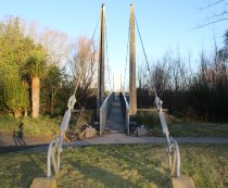
Bridgemeister ID: 3210 (added 2019-11-10)Name: (footbridge) Location: Chisinau, Moldova At or Near Feature: La Izvor Park Coordinates: 47.046556 N 28.791656 E Maps: Acme , GeoHack , Google , OpenStreetMap Use: Footbridge Status: In use (last checked: 2017) Main Cables: Wire (steel) Suspended Spans: 1
Bridgemeister ID: 7996 (added 2023-12-09)Name: (footbridge) Location: Chitakhevi (ჩითახევი), Georgia Crossing: Kura River Coordinates: 41.791493 N 43.303340 E Maps: Acme , GeoHack , Google , OpenStreetMap Use: Footbridge Status: In use (last checked: 2023) Main Cables: Wire (iron) Main Span: 1 x 64 meters (210 feet) estimated
Completed at some point in the 2013-2019 time frame. Bridgemeister ID: 4672 (added 2020-06-19)Name: (footbridge) Location: Chmyrivka, Kyiv Oblast, Ukraine Crossing: Ros' River Coordinates: 49.772093 N 30.021136 E Maps: Acme , GeoHack , Google , OpenStreetMap Use: Footbridge Status: In use (last checked: 2019) Main Cables: Wire (steel) Suspended Spans: 1
Bridgemeister ID: 6898 (added 2022-01-16)Name: (footbridge) Location: Chontabamba District, Oxapampa, Peru Crossing: Rio Chontabamba Coordinates: 10.599071 S 75.437196 W Maps: Acme , GeoHack , Google , OpenStreetMap Use: Footbridge Status: In use (last checked: 2013) Main Cables: Wire (steel) Suspended Spans: 1
Bridgemeister ID: 1854 (added 2005-07-16)Name: (footbridge) Location: Christchurch, New Zealand Crossing: Otukaikino Stream At or Near Feature: Waimairi Walkway, The Groynes Recreation Reserve Coordinates: 43.451467 S 172.606467 E Maps: Acme , GeoHack , Google , OpenStreetMap Use: Footbridge Status: In use (last checked: 2017) Main Cables: Wire (steel) Suspended Spans: 1
Bridgemeister ID: 5828 (added 2021-04-15)Name: (footbridge) Location: Chusovoy (Чусово́й), Perm Krai, Russia Crossing: Chusovaya River Coordinates: 58.282156 N 57.801246 E Maps: Acme , GeoHack , Google , OpenStreetMap Use: Footbridge Status: In use (last checked: 2019) Main Cables: Wire (steel) Suspended Spans: 2 Main Spans: 2 x 100 meters (328.1 feet) estimated
Bridgemeister ID: 7542 (added 2023-03-04)Name: (footbridge) Location: Cibadak, Sukabumi Regency, West Java , Indonesia Coordinates: 6.891043 S 106.775127 E Maps: Acme , GeoHack , Google , OpenStreetMap Use: Footbridge Status: In use (last checked: 2021) Main Cables: Wire Suspended Spans: 1
Bridgemeister ID: 7546 (added 2023-03-12)Name: (footbridge) Location: Cibadak, Sukabumi Regency, West Java , Indonesia Coordinates: 6.895111 S 106.778680 E Maps: Acme , GeoHack , Google , OpenStreetMap Use: Footbridge Status: In use (last checked: 2020) Main Cables: Wire (steel) Main Span: 1 x 29.9 meters (98 feet) estimated
Completed at some point in 2014 or 2015. Google Maps . Image with bridge barely visible behind buildings, October 2015.Bridgemeister ID: 6643 (added 2021-09-11)Name: (footbridge) Location: Cimarga, Lebak Regency, Banten , Indonesia Coordinates: 6.442054 S 106.223532 E Maps: Acme , GeoHack , Google , OpenStreetMap Use: Footbridge Status: In use Main Cables: Wire (steel) Main Span: 1
Bridgemeister ID: 2454 (added 2008-09-20)Name: (footbridge) Location: Cisco vicinity, Ritchie County, West Virginia , USA Crossing: North Fork Hughes River Coordinates: 39.15388 N 81.23820 W Maps: Acme , GeoHack , Google , OpenStreetMap Use: Footbridge Status: In use (last checked: 2021) Main Cables: Wire Suspended Spans: 2 Main Span: 1 x 38.1 meters (125 feet) estimated Side Span: 1 x 9.8 meters (32 feet) estimated
Bridgemeister ID: 5804 (added 2021-04-10)Name: (footbridge) Location: Clanezzo, Bergamo, Italy Crossing: Brembo Coordinates: 45.761153 N 9.603957 E Maps: Acme , GeoHack , Google , OpenStreetMap Use: Footbridge Status: In use (last checked: 2021) Main Cables: Wire Suspended Spans: 1
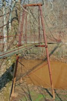
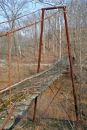
2007: Failed when one of the main cables snapped. Subsequently repaired. 2022: Destroyed by flood. Bridgemeister ID: 3824 (added 2020-03-01)Name: (footbridge) Location: Clayhole, Kentucky , USA Crossing: Troublesome Creek Coordinates: 37.474070 N 83.280920 W Maps: Acme , GeoHack , Google , OpenStreetMap Use: Footbridge Status: In use (last checked: 2007) Main Cables: Wire Main Span: 1 x 27.4 meters (90 feet) estimated Side Spans: 2
Bridgemeister ID: 1389 (added 2004-07-03)Name: (footbridge) Location: Clearwater Park vicinity, Virginia , USA Crossing: Jackson River Coordinates: 37.86373 N 79.98956 W Maps: Acme , GeoHack , Google , OpenStreetMap Principals: VDOT Use: Footbridge Status: In use (last checked: 2004) Main Cables: Wire (steel) Suspended Spans: 1 Main Span: 1 x 62.2 meters (204 feet) estimated
Bridgemeister ID: 873 (added 2003-08-31)Name: (footbridge) Location: Clifftop vicinity, West Virginia , USA Crossing: Glade Creek At or Near Feature: Babcock State Park Coordinates: 37.98300 N 80.94377 W Maps: Acme , GeoHack , Google , OpenStreetMap Use: Footbridge Status: In use (last checked: 2008) Main Cables: Wire Suspended Spans: 1 Main Span: 1 x 21.3 meters (70 feet) estimated
There is at least one 'droopy' swinging bridge in this park that is excluded from the Bridgemeister inventory. Bridgemeister ID: 1670 (added 2005-03-22)Name: (footbridge) Location: Clifton Ford vicinity and Webster Springs vicinity, West Virginia , USA Crossing: Elk River Coordinates: 38.57102 N 80.48879 W Maps: Acme , GeoHack , Google , OpenStreetMap Use: Footbridge Status: In use (last checked: 2005) Main Cables: Wire Suspended Spans: 1 Main Span: 1 x 70.1 meters (230 feet) estimated
Bridgemeister ID: 1671 (added 2005-03-22)Name: (footbridge) Location: Clifton Ford vicinity and Webster Springs vicinity, West Virginia , USA Crossing: Elk River Coordinates: 38.56377 N 80.48884 W Maps: Acme , GeoHack , Google , OpenStreetMap Use: Footbridge Status: In use (last checked: 2005) Main Cables: Wire Suspended Spans: 1 Main Span: 1 x 79.2 meters (260 feet) estimated
Bridgemeister ID: 1672 (added 2005-03-22)Name: (footbridge) Location: Clifton Ford vicinity and Webster Springs vicinity, West Virginia , USA Crossing: Elk River Coordinates: 38.55854 N 80.48617 W Maps: Acme , GeoHack , Google , OpenStreetMap Use: Footbridge Status: In use (last checked: 2005) Main Cables: Wire Suspended Spans: 1 Main Span: 1 x 63.4 meters (208 feet) estimated
Bridgemeister ID: 1673 (added 2005-03-22)Name: (footbridge) Location: Clifton Ford vicinity and Webster Springs vicinity, West Virginia , USA Crossing: Elk River Coordinates: 38.52709 N 80.47652 W Maps: Acme , GeoHack , Google , OpenStreetMap Use: Footbridge Status: In use (last checked: 2005) Main Cables: Wire Suspended Spans: 1 Main Span: 1 x 72.5 meters (238 feet) estimated
Bridgemeister ID: 1674 (added 2005-03-22)Name: (footbridge) Location: Clifton Ford vicinity and Webster Springs vicinity, West Virginia , USA Crossing: Elk River Coordinates: 38.52487 N 80.48331 W Maps: Acme , GeoHack , Google , OpenStreetMap Use: Footbridge Status: In use (last checked: 2005) Main Cables: Wire Suspended Spans: 1 Main Span: 1 x 55.8 meters (183 feet) estimated
Bridgemeister ID: 1675 (added 2005-03-22)Name: (footbridge) Location: Clifton Ford vicinity and Webster Springs vicinity, West Virginia , USA Crossing: Elk River Coordinates: 38.51794 N 80.48419 W Maps: Acme , GeoHack , Google , OpenStreetMap Use: Footbridge Status: In use (last checked: 2005) Main Cables: Wire Suspended Spans: 1 Main Span: 1 x 59.4 meters (195 feet) estimated
Bridgemeister ID: 1682 (added 2005-03-26)Name: (footbridge) Location: Clifton Ford vicinity and Webster Springs vicinity, West Virginia , USA Crossing: Elk River Coordinates: 38.59299 N 80.49238 W Maps: Acme , GeoHack , Google , OpenStreetMap Use: Footbridge Status: Derelict (last checked: 2005) Main Cables: Wire Suspended Spans: 1
Bridgemeister.com gives you the good, the bad, and the ugly. Bridgemeister ID: 1683 (added 2005-03-26)Name: (footbridge) Location: Clifton Ford vicinity and Webster Springs vicinity, West Virginia , USA Crossing: Elk River Coordinates: 38.50829 N 80.47778 W Maps: Acme , GeoHack , Google , OpenStreetMap Use: Footbridge Status: In use (last checked: 2005) Main Cables: Wire Suspended Spans: 1 Main Span: 1 x 77.1 meters (253 feet) estimated
Bridgemeister ID: 1391 (added 2004-07-03)Name: (footbridge) Location: Clinchport, Virginia , USA Crossing: Clinch River Coordinates: 36.673533 N 82.747483 W Maps: Acme , GeoHack , Google , OpenStreetMap Principals: VDOT Use: Footbridge Status: In use (last checked: 2020) Main Cables: Wire (steel) Suspended Spans: 1 Main Span: 1 x 86 meters (282 feet) estimated
Bridgemeister ID: 2384 (added 2007-11-08)Name: (footbridge) Location: Clintonville, Wisconsin , USA Crossing: Pigeon River At or Near Feature: Walter A. Olen Park Coordinates: 44.61846 N 88.75838 W Maps: Acme , GeoHack , Google , OpenStreetMap Use: Footbridge Status: In use (last checked: 2007) Main Cables: Wire (steel)
Bridgemeister ID: 2588 (added 2014-04-14)Name: (footbridge) Location: Coaticook, Quebec , Canada Crossing: Coaticook River At or Near Feature: Le Parc de la Gorge de Coaticook Use: Footbridge Status: In use (last checked: 2011) Main Cables: Wire Suspended Spans: 1 Main Span: 1 x 19.8 meters (65 feet) estimated
Bridgemeister ID: 4993 (added 2020-08-16)Name: (footbridge) Location: Colombo, Sri Lanka At or Near Feature: Viharamahadevi Park Coordinates: 6.914225 N 79.861322 E Maps: Acme , GeoHack , Google , OpenStreetMap Use: Footbridge Status: In use (last checked: 2020) Main Cables: Wire
Bridgemeister ID: 1884 (added 2005-09-24)Name: (footbridge) Location: Colville vicinity, Washington , USA Crossing: Mill Creek At or Near Feature: Douglas Falls Grange Park Coordinates: 48.6146 N 117.899917 W Maps: Acme , GeoHack , Google , OpenStreetMap Use: Footbridge Status: In use (last checked: 2005)
Bridgemeister ID: 7408 (added 2022-12-04)Name: (footbridge) Location: Condoto, Choco, Colombia Crossing: Rio Condoto Coordinates: 5.096590 N 76.694830 W Maps: Acme , GeoHack , Google , OpenStreetMap Use: Footbridge Status: In use (last checked: 2021) Main Cables: Wire (steel) Main Span: 1
Facebook . 2021, August 11: Image of the bridge.Facebook . 2021, November 3: Aerial image of the bridge.Bridgemeister ID: 8217 (added 2024-02-06)Name: (footbridge) Location: Constantine, Algeria At or Near Feature: Rhumel Gorge Use: Footbridge
Appears to have been located somewhere within the network of tunnels of the Rhumel Gorge. Do you have any information or photos for these bridges that you would like to share? Please email david.denenberg@bridgemeister.com .
Mail | Facebook | Twitter
