Undated/Unnamed Suspension Non-footbridges (1-100 of 2,340)
This is a list of bridges 1 through 100 (of 2,340 total) in the suspension bridge inventory that are undated, unnamed, and whose primary use is other than footbridge. Wherever you see a Bridgemeister ID number click it to isolate the bridge on its own page.
Related Lists:
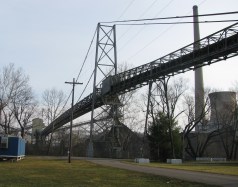
Bridgemeister ID: 2572 (added 2012-11-17)Name: (conveyor bridge) Location: Beverly vicinity, Ohio , USA Crossing: Muskingum River At or Near Feature: Muskingum River Power Plant Coordinates: 39.59230 N 81.68519 W Maps: Acme , GeoHack , Google , OpenStreetMap Use: Conveyor Status: Removed, c. 2015-2021 Main Cables: Wire (steel) Suspended Spans: 1
Approaches were dismantled by 2015. Another portion of the beltway collapsed during preparations for demolition in December 2015 killing the CEO of the demolition company. Unclear if the suspension span was completely demolished at this time. By 2021, the bridge appears to have been completely demolished. Bridgemeister ID: 7391 (added 2022-11-25)Name: (conveyor bridge) Location: Gary, West Virginia , USA Coordinates: 37.373762 N 81.558262 W Maps: Acme , GeoHack , Google , OpenStreetMap Use: Conveyor Status: Extant (last checked: 2020) Main Cables: Wire (steel) Main Span: 1 x 179 meters (587.3 feet) estimated
Bridgemeister ID: 2574 (added 2012-11-18)Name: (conveyor bridge) Location: Joliet, Illinois , USA Crossing: Des Plaines River At or Near Feature: Joliet 29 Generating Station Coordinates: 41.494281 N 88.119729 W Maps: Acme , GeoHack , Google , OpenStreetMap Use: Conveyor Status: Extant (last checked: 2012) Main Cables: Wire (steel)
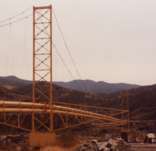
Bridgemeister ID: 2034 (added 2006-05-01)Name: (conveyor bridge) Location: Pasco vicinity, Washington , USA Crossing: Snake River At or Near Feature: Ice Harbor Lock and Dam Principals: John A. Roebling's Sons Use: Conveyor Status: Removed Main Cables: Wire (steel) Suspended Spans: 1 Main Span: 1 x 304.8 meters (1,000 feet)
Built late 1950s or 1960. Pictured and described in Roebling ad in July 1960 issue of Civil Engineering. Built to transport concrete aggregate during construction of the dam. Likely removed. Bridgemeister ID: 1951 (added 2005-11-04)Name: (conveyor bridge) Location: Starbrick, Pennsylvania , USA Crossing: Allegheny River Coordinates: 41.837083 N 79.20475 W Maps: Acme , GeoHack , Google , OpenStreetMap Use: Conveyor Status: Removed (last checked: 2008) Main Cables: Wire (steel) Suspended Spans: 1 Main Span: 1 x 115.8 meters (380 feet) estimated
Crossed a portion of the Allegheny River to Mead Island. Appears to have been removed 2006-2008. Jason Oliphant writes in early 2009: "The north shore suspension supports still exist but the bridge doesn't. I have no idea when it was taken down but I can say that it wasn't there in summer 2008." Bridgemeister ID: 6062 (added 2021-07-03)Name: (conveyor bridge) Location: Takahashi, Okayama , Japan Crossing: Nariwa River Coordinates: 34.786127 N 133.479621 E Maps: Acme , GeoHack , Google , OpenStreetMap Use: Conveyor Status: Extant (last checked: 2014) Main Cables: Wire (steel) Main Span: 1 x 122 meters (400.3 feet) estimated
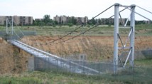
Bridgemeister ID: 1615 (added 2005-02-22)Name: (conveyor bridge) Location: Thornton, Colorado , USA Crossing: South Platte River Coordinates: 39.86809 N 104.92068 W Maps: Acme , GeoHack , Google , OpenStreetMap Use: Pipeline and Footbridge Status: Derelict (last checked: 2007) Main Cables: Wire (steel) Suspended Spans: 1 Main Span: 1 x 121.9 meters (400 feet) estimated
Bridgemeister ID: 1630 (added 2005-03-11)Name: (conveyor bridge) Location: Thornton, Colorado , USA Crossing: South Platte River Coordinates: 39.87968 N 104.90335 W Maps: Acme , GeoHack , Google , OpenStreetMap Use: Conveyor and Footbridge Status: In use (last checked: 2007) Main Cables: Wire (steel) Suspended Spans: 1 Main Span: 1 x 106.7 meters (350 feet)
Bridgemeister ID: 2971 (added 2019-10-12)Name: (flume bridge) Location: Grovane vicinity, Vennesla, Agder, Norway Coordinates: 58.309513 N 7.966079 E Maps: Acme , GeoHack , Google , kart.1881.no , OpenStreetMap Use: Flume Status: Extant (last checked: 2019) Main Cables: Wire (steel) Suspended Spans: 1
Bridgemeister ID: 2977 (added 2019-10-12)Name: (flume bridge) Location: Grovane vicinity, Vennesla, Agder, Norway Coordinates: 58.317199 N 7.953377 E Maps: Acme , GeoHack , Google , kart.1881.no , OpenStreetMap Use: Flume Status: Extant (last checked: 2016) Main Cables: Wire (steel) Suspended Spans: 1
Based on historic aerial images built prior to 1972 and removed between 1980 and 2004. Bridgemeister ID: 4200 (added 2020-04-08)Name: (flume bridge) Location: Notodden, Vestfold Og Telemark, Norway Crossing: Tinnåa At or Near Feature: Svelgfoss Gorge Coordinates: 59.583446 N 9.267132 E Maps: Acme , GeoHack , Google , kart.1881.no , OpenStreetMap Use: Flume Status: Extant (last checked: 2019) Main Span: 1 x 45 meters (147.6 feet) estimated
Bridgemeister ID: 4201 (added 2020-04-08)Name: (flume bridge) Location: Notodden, Vestfold Og Telemark, Norway Crossing: Tinnåa At or Near Feature: Svelgfossjuvet Coordinates: 59.589983 N 9.271374 E Maps: Acme , GeoHack , Google , kart.1881.no , OpenStreetMap Use: Flume Status: Extant (last checked: 2019) Main Span: 1 x 70 meters (229.7 feet) estimated
Bridgemeister ID: 1692 (added 2005-03-27)Name: (flume bridge) Location: Proctor, Vermont , USA Crossing: Otter Creek At or Near Feature: Sutherland Falls Use: Flume Status: Removed Main Cables: Wire
The postcard presented here doesn't show much, but other photos show a large wood-shingled tower at one end of the bridge. The bridge was likely completed in the late 1800s. Robert Ratti provided the following information: "it was a carrier of marble slurry from the Vermont Marble Co. and ended in the swamp nearby... In 1936, I lived right at the end of the swamp and climbed on that waste carrier many times." Bridgemeister ID: 4469 (added 2020-04-26)Name: (flume bridge) Location: Skotfoss, Skien, Vestfold og Telemark, Norway Crossing: Meierelva Coordinates: 59.207638 N 9.527812 E Maps: Acme , GeoHack , Google , kart.1881.no , OpenStreetMap Use: Flume Status: Removed Main Cables: Wire (steel) Main Spans: 1 x 100 meters (328.1 feet) estimated,
Bridgemeister ID: 5148 (added 2020-09-07)Name: (pipeline bridge) Location: Aizuwakamatsu, Fukushima , Japan Crossing: Aga River Coordinates: 37.403093 N 139.923350 E Maps: Acme , GeoHack , Google , OpenStreetMap Use: Pipeline Status: Extant (last checked: 2014) Main Cables: Wire (steel) Suspended Spans: 1 Main Span: 1 x 124 meters (406.8 feet) estimated
2019: Appears to be flood damaged. Bridgemeister ID: 3302 (added 2019-11-27)Name: (pipeline bridge) Location: Arequipa, Peru Crossing: Rio Chill Coordinates: 16.324340 S 71.525940 W Maps: Acme , GeoHack , Google , OpenStreetMap Use: Pipeline Status: Extant (last checked: 2014) Main Cables: Wire (steel)
Carrys a 66-inch water pipeline. Patrick O'Donnell estimates the length of the suspended portion of the span at 250 feet. Bridgemeister ID: 7229 (added 2022-07-16)Name: (pipeline bridge) Location: Babahoyo, Los Rios, Ecuador Crossing: Babahoyo River Coordinates: 1.797178 S 79.533913 W Maps: Acme , GeoHack , Google , OpenStreetMap Use: Pipeline Status: Extant (last checked: 2015) Main Cables: Wire (steel) Suspended Spans: 1 Main Span: 1 x 171 meters (561 feet) estimated
Small pipeline suspension bridge between two road bridges. Bridgemeister ID: 6788 (added 2021-10-29)Name: (pipeline bridge) Location: Bogor, West Java , Indonesia Crossing: Ciliwung At or Near Feature: Bogor Botanical Gardens Coordinates: 6.601567 S 106.801665 E Maps: Acme , GeoHack , Google , OpenStreetMap Use: Pipeline Status: Extant (last checked: 2020) Main Cables: Wire Suspended Spans: 1
Bridgemeister ID: 4827 (added 2020-07-05)Name: (pipeline bridge) Location: Bradford, Pennsylvania , USA Coordinates: 41.967963 N 78.625340 W Maps: Acme , GeoHack , Google , OpenStreetMap Use: Pipeline Status: Extant (last checked: 2020) Main Cables: Wire (steel) Suspended Spans: 1
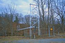
Bridgemeister ID: 2346 (added 2007-08-12)Name: (pipeline bridge) Location: Burgess Falls, Sparta vicinity, Tennessee , USA Crossing: Falling Water River At or Near Feature: Burgess Falls State Park Use: Pipeline Status: Derelict (last checked: 2007) Main Cables: Wire
Likely constructed in 1920s as part of the dam and powerhouse project at Burgess Falls. There may have been two of these bridges at this location. The current map for Burgess Falls State Park shows two historical "pipeline bridges." I have only seen images of one derelict suspension bridge. Burstall is in Saskatchewan, but the bridge appears to be located west of Burstall in Alberta. Bridgemeister ID: 5705 (added 2021-04-02)Name: (pipeline bridge) Location: Bydgoszcz, Poland Crossing: Brda Coordinates: 53.117059 N 18.061958 E Maps: Acme , GeoHack , Google , OpenStreetMap Use: Pipeline Status: Extant (last checked: 2020) Main Cables: Wire (steel) Main Span: 1
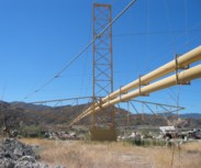
Bridgemeister ID: 1259 (added 2004-03-06)Name: (pipeline bridge) Location: Canyon Country, California , USA Crossing: Soledad Canyon Coordinates: 34.43219 N 118.39074 W Maps: Acme , GeoHack , Google , OpenStreetMap Use: Pipeline Status: In use (last checked: 2007) Main Cables: Wire (steel) Suspended Spans: 2 Main Span: 1 x 187.5 meters (615 feet) estimated Side Span: 1
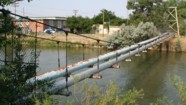
Bridgemeister ID: 2107 (added 2006-09-03)Name: (pipeline bridge) Location: Casper, Wyoming , USA Crossing: North Platte River Coordinates: 42.859117 N 106.327517 W Maps: Acme , GeoHack , Google , OpenStreetMap Use: Pipeline Status: Extant (last checked: 2006) Main Cables: Wire (steel) Suspended Spans: 1 Main Span: 1 x 61 meters (200 feet) estimated
Bridgemeister ID: 2329 (added 2007-07-04)Name: (pipeline bridge) Location: Castaic vicinity, California , USA Crossing: Castaic Creek Coordinates: 34.47552 N 118.61212 W Maps: Acme , GeoHack , Google , OpenStreetMap Use: Pipeline Status: Extant (last checked: 2007) Main Cables: Wire (steel) Suspended Spans: 2 Side Spans: 2
Bridgemeister ID: 8019 (added 2023-12-10)Name: (pipeline bridge) Location: Central Sauzal vicinity, Machali, Chile Crossing: Cachapoal River Coordinates: 34.269139 S 70.584722 W Maps: Acme , GeoHack , Google , OpenStreetMap Use: Pipeline Status: Extant (last checked: 2023) Main Cables: Wire (steel) Suspended Spans: 2 Main Span: 1 x 97 meters (318.2 feet) estimated Side Span: 1 x 50 meters (164 feet) estimated
Bridgemeister ID: 6395 (added 2021-07-27)Name: (pipeline bridge) Location: Chalat, Gilgit-Baltistan, Pakistan Crossing: Hunza River Coordinates: 36.256315 N 74.351727 E Maps: Acme , GeoHack , Google , OpenStreetMap Use: Pipeline Status: Extant (last checked: 2021) Main Span: 1 x 144.5 meters (474 feet) estimated
Bridgemeister ID: 2036 (added 2006-05-01)Name: (pipeline bridge) Location: Charleston, Tennessee , USA Crossing: Hiwassee River Principals: John A. Roebling's Sons Co., Pittsburgh Bridge & Iron Co. Use: Pipeline Main Cables: Wire (steel)
Built to connect Blaw-Knox chemical plan to nearby Bowaters Southern Paper Corp. Described in Roebling ad in March 1963 issue of Civil Engineering. Bridgemeister ID: 1573 (added 2004-12-11)Name: (pipeline bridge) Location: Chula Vista vicinity, California , USA Crossing: Otay River Coordinates: 32.6003 N 116.92888 W Maps: Acme , GeoHack , Google , OpenStreetMap Use: Pipeline Status: In use (last checked: 2004) Main Cables: Wire (steel) Suspended Spans: 1
Bridgemeister ID: 5984 (added 2021-07-01)Name: (pipeline bridge) Location: Chupaca, Peru Crossing: Rio Cunas Coordinates: 12.056637 S 75.273844 W Maps: Acme , GeoHack , Google , OpenStreetMap Use: Pipeline Status: Extant (last checked: 2021) Main Cables: Wire (steel) Suspended Spans: 1
Bridgemeister ID: 7783 (added 2023-08-18)Name: (pipeline bridge) Location: Colimes, Guayas, Ecuador Crossing: Rio Daule Coordinates: 1.548917 S 80.003660 W Maps: Acme , GeoHack , Google , OpenStreetMap Use: Pipeline Status: Extant (last checked: 2022) Main Span: 1 x 188 meters (616.8 feet) estimated
Patrick S. O'Donnell estimated the main span of this bridge at roughly 550 feet. Bridgemeister ID: 1413 (added 2004-07-04)Name: (pipeline bridge) Location: Covington, Virginia , USA Crossing: Potts Creek Coordinates: 37.75240 N 79.99713 W Maps: Acme , GeoHack , Google , OpenStreetMap Use: Pipeline Status: In use (last checked: 2008) Main Cables: Wire (steel) Suspended Spans: 1 Main Span: 1 x 61 meters (200 feet) estimated
Just barely visible to the north as your cross over Potts Creek on VA18 heading into Covington. Bridgemeister ID: 7939 (added 2023-10-29)Name: (pipeline bridge) Location: Cremona, Cremona, Italy Crossing: Po River Coordinates: 45.127917 N 9.995194 E Maps: Acme , GeoHack , Google , OpenStreetMap Use: Pipeline and Footbridge Status: Removed Main Cables: Wire (steel) Suspended Spans: 3 Main Span: 1 Side Spans: 2
Built at some point in the 1960s. Removed prior to 2003, but likely much earlier. Main span was likely 225-235 meters. Bridgemeister ID: 2432 (added 2008-04-22)Name: (pipeline bridge) Location: Curtis vicinity, Arkansas , USA Crossing: South Boat Ditch Use: Pipeline Status: Extant (last checked: 2008) Main Cables: Wire (steel) Suspended Spans: 1
Bridgemeister ID: 6696 (added 2021-10-02)Name: (pipeline bridge) Location: Dahimal, Gilgit-Baltistan, Pakistan Crossing: Gilgit River Coordinates: 36.201420 N 73.246198 E Maps: Acme , GeoHack , Google , OpenStreetMap Use: Pipeline Status: Extant (last checked: 2021) Main Cables: Wire (steel) Suspended Spans: 1 Main Span: 1 x 42.7 meters (140 feet) estimated
Built at some point after mid-2017. Immediately adjacent to a drooping suspension footbridge that is not included in the inventory. Bridgemeister ID: 7125 (added 2022-06-17)Name: (pipeline bridge) Location: Dearborn, Michigan , USA Crossing: Rouge River Coordinates: 42.290501 N 83.166260 W Maps: Acme , GeoHack , Google , OpenStreetMap Use: Pipeline Status: Extant (last checked: 2022) Main Cables: Wire (steel) Main Span: 1 x 76 meters (249.3 feet) estimated
Bridgemeister ID: 2108 (added 2006-09-03)Name: (pipeline bridge) Location: Durkee, Worland vicinity, Wyoming , USA Crossing: Big Horn River Coordinates: 44.125767 N 107.927817 W Maps: Acme , GeoHack , Google , OpenStreetMap Use: Pipeline Status: Extant (last checked: 2006) Main Cables: Wire (steel) Suspended Spans: 1
Bridgemeister ID: 8412 (added 2024-03-03)Name: (pipeline bridge) Location: Eagle Creek Township and Keener Township, Indiana , USA Crossing: Kankakee River Coordinates: 41.220361 N 87.270806 W Maps: Acme , GeoHack , Google , OpenStreetMap Use: Pipeline Status: Extant (last checked: 2023) Main Spans: 1 x 72 meters (236.2 feet) estimated,
One of six short suspended pipelines along a five mile stretch of, what appears to be, the same pipeline. This one, crossing the Kankakee River is the longest of the group by far. Connects to (pipeline bridge) - Eagle Creek Township, Indiana, USA . Connects to (pipeline bridge) - Eagle Creek Township, Indiana, USA . Connects to (pipeline bridge) - Eagle Creek Township, Indiana, USA . Connects to (pipeline bridge) - Keener Township, Indiana, USA . Connects to (pipeline bridge) - Keener Township, Indiana, USA . Bridgemeister ID: 8409 (added 2024-03-03)Name: (pipeline bridge) Location: Eagle Creek Township, Indiana , USA Crossing: Singleton Ditch Coordinates: 41.260667 N 87.300861 W Maps: Acme , GeoHack , Google , OpenStreetMap Use: Pipeline Status: Extant (last checked: 2023) Suspended Spans: 1 Main Span: 1 x 20 meters (65.6 feet) estimated
One of six short suspended pipelines along a five mile stretch of, what appears to be, the same pipeline. Connects to (pipeline bridge) - Eagle Creek Township and Keener Township, Indiana, USA . Connects to (pipeline bridge) - Eagle Creek Township, Indiana, USA . Connects to (pipeline bridge) - Eagle Creek Township, Indiana, USA . Connects to (pipeline bridge) - Keener Township, Indiana, USA . Connects to (pipeline bridge) - Keener Township, Indiana, USA . Bridgemeister ID: 8410 (added 2024-03-03)Name: (pipeline bridge) Location: Eagle Creek Township, Indiana , USA Crossing: Little Ditch Coordinates: 41.257639 N 87.298583 W Maps: Acme , GeoHack , Google , OpenStreetMap Use: Pipeline Status: Extant (last checked: 2023) Suspended Spans: 1 Main Span: 1 x 21 meters (68.9 feet) estimated
One of six short suspended pipelines along a five mile stretch of, what appears to be, the same pipeline. Connects to (pipeline bridge) - Eagle Creek Township and Keener Township, Indiana, USA . Connects to (pipeline bridge) - Eagle Creek Township, Indiana, USA . Connects to (pipeline bridge) - Eagle Creek Township, Indiana, USA . Connects to (pipeline bridge) - Keener Township, Indiana, USA . Connects to (pipeline bridge) - Keener Township, Indiana, USA . Bridgemeister ID: 8411 (added 2024-03-03)Name: (pipeline bridge) Location: Eagle Creek Township, Indiana , USA Crossing: Brown Ditch Coordinates: 41.239583 N 87.285444 W Maps: Acme , GeoHack , Google , OpenStreetMap Use: Pipeline Status: Extant (last checked: 2023) Suspended Spans: 1 Main Span: 1 x 16 meters (52.5 feet) estimated
One of six short suspended pipelines along a five mile stretch of, what appears to be, the same pipeline. Connects to (pipeline bridge) - Eagle Creek Township and Keener Township, Indiana, USA . Connects to (pipeline bridge) - Eagle Creek Township, Indiana, USA . Connects to (pipeline bridge) - Eagle Creek Township, Indiana, USA . Connects to (pipeline bridge) - Keener Township, Indiana, USA . Connects to (pipeline bridge) - Keener Township, Indiana, USA . Bridgemeister ID: 2109 (added 2006-09-03)Name: (pipeline bridge) Location: Eccles, Worland vicinity, Wyoming , USA Crossing: Big Horn River Coordinates: 44.15685 N 107.928117 W Maps: Acme , GeoHack , Google , OpenStreetMap Use: Pipeline Status: Extant (last checked: 2006) Main Cables: Wire (steel) Suspended Spans: 1
Patrick S. O'Donnell estimates the main span at 400 feet based on aerial imagery. Bridgemeister ID: 7768 (added 2023-08-17)Name: (pipeline bridge) Location: Escobal, Alajuela and San Pablo, San José Province, Costa Rica Crossing: Rio Tárcoles Coordinates: 9.922923 N 84.430955 W Maps: Acme , GeoHack , Google , OpenStreetMap Use: Pipeline Status: Extant (last checked: 2022) Main Span: 1
Bridgemeister ID: 2148 (added 2006-11-18)Name: (pipeline bridge) Location: Eugene vicinity, Oregon , USA Crossing: McKenzie River At or Near Feature: Armitage State Park vicinity Coordinates: 44.11456 N 123.05380 W Maps: Acme , GeoHack , Google , OpenStreetMap Use: Pipeline Status: Extant (last checked: 2006) Main Cables: Wire
Bridgemeister ID: 1820 (added 2005-05-21)Name: (pipeline bridge) Location: Fulton, Arkansas , USA Crossing: Red River Coordinates: 33.60368 N 93.81316 W Maps: Acme , GeoHack , Google , OpenStreetMap Use: Pipeline Status: Extant (last checked: 2007) Main Cables: Wire (steel) Suspended Spans: 3 Main Span: 1 Side Spans: 2
Call numbers ECD0860-1 and ECD0860-2 of the Arkansas History Commission's image archives show this large pipeline bridge. Bridgemeister ID: 1928 (added 2005-10-23)Name: (pipeline bridge) Location: Gelsenkirchen, North Rhine-Westphalia, Germany At or Near Feature: Gelsenkirchen Port Coordinates: 51.533124 N 7.067890 E Maps: Acme , GeoHack , Google , OpenStreetMap Use: Pipeline Status: Extant (last checked: 2019)
Bridgemeister ID: 8185 (added 2024-02-05)Name: (pipeline bridge) Location: Girón, Santander, Colombia Crossing: Rio Frio Coordinates: 7.066056 N 73.166333 W Maps: Acme , GeoHack , Google , OpenStreetMap Use: Pipeline Status: Extant (last checked: 2023) Main Cables: Wire (steel) Suspended Spans: 1
Bridgemeister ID: 2225 (added 2007-03-18)Name: (pipeline bridge) Location: Glenwood Springs, Colorado , USA Crossing: Colorado River Coordinates: 39.55085 N 107.31878 W Maps: Acme , GeoHack , Google , OpenStreetMap Use: Pipeline Status: Extant (last checked: 2006) Main Cables: Wire (steel) Suspended Spans: 1 Main Span: 1 x 61 meters (200 feet) estimated
Span length of approximately 200 feet is for the suspended pipeline. Patrick O'Donnell estimates the anchorage-to-anchorage distance is 450 feet. Bridgemeister ID: 7869 (added 2023-09-17)Name: (pipeline bridge) Location: Grassobbio, Bergamo, Italy Crossing: Serio Coordinates: 45.657637 N 9.732027 E Maps: Acme , GeoHack , Google , OpenStreetMap Use: Pipeline Status: Extant (last checked: 2023) Main Cables: Wire (steel) Suspended Spans: 3 Main Span: 1 x 101 meters (331.4 feet) estimated Side Spans: 2
Bridgemeister ID: 3975 (added 2020-03-22)Name: (pipeline bridge) Location: Greåker, Sarpsborg, Viken, Norway Crossing: Visterflo Coordinates: 59.26354 N 11.02993 E Maps: Acme , GeoHack , Google , kart.1881.no , OpenStreetMap Use: Pipeline Status: Extant (last checked: 2018) Suspended Spans: 1 Main Span: 1 x 60 meters (196.9 feet) estimated
Bridgemeister ID: 2215 (added 2007-02-13)Name: (pipeline bridge) Location: Helper vicinity, Utah , USA Crossing: Price River Coordinates: 39.70666 N 110.86906 W Maps: Acme , GeoHack , Google , OpenStreetMap Use: Pipeline Status: Extant (last checked: 2006) Main Cables: Wire Suspended Spans: 1 Main Span: 1 x 45.7 meters (150 feet) estimated
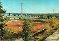
The bridge was adjacent to, and clearly visible from, the Washington Boulevard bridge. It was removed at some point between 2017 and 2019. The structure(s) at this location may be two separate but adjacent suspended pipelines. The postcard says "Suspension Bridge. Jefferson, S.D." The bridge pictured here may be a predecessor to the current pipeline suspension bridge at Ponca, Nebraska, eight miles west of Jefferson. Patrick S. O'Donnell visited this area in 2006 to photograph the Ponca bridge , but could not locate a pipeline bridge matching the postcard. In late 2006, Pete Rissell writes that one of the piers from this pipeline bridge is still visible in the middle of the Missouri River: "In the early 1970s I visited the Ponca State Park and noticed a single concrete bridge support in the middle of the Missouri River. I always thought it was strange because there were no abandoned road or rail right-of-ways in that location... I'm sure that this concrete support matches the one in the foreground shown on your website's postcard labeled "Suspension Bridge, Jefferson SD". My guess is that the current Ponca Pipeline bridge (photographed in 2006) is the replacement because the former suspension bridge had to be relocated due to river flooding. The old concrete support is located approximately 1 mile up-river (to the northwest) from the current pipeline bridge." This pier is visible in satellite imagery at the location provided with this inventory entry. In 2009, Dale Harkness writes: "I grew up on a farm only a few miles from the existing pipeline . I believe you are correct that the cement pier does belong to the original gas pipeline. My aunt told me that my grandfather was present while the bridge was being constructed. From my understanding, my grandfather had been filming the construction and almost photographed an unusual event where one of the piers crashed down to the ground after a failed attempt to raise it using a pivot." Dale also provided photos of the construction of the newer bridge in 1961. The replacement span appears to have been demolished in late 2006 or 2007. Replaced by 1961 (pipeline bridge) - Jefferson vicinity, South Dakota and Ponca State Park, Nebraska, USA . Bridgemeister ID: 6887 (added 2022-01-15)Name: (pipeline bridge) Location: Jenesano, Boyaca, Colombia Crossing: Rio Jenesano Coordinates: 5.384360 N 73.361741 W Maps: Acme , GeoHack , Google , OpenStreetMap Use: Pipeline Status: Extant (last checked: 2021) Main Cables: Wire Suspended Spans: 1
Bridgemeister ID: 6708 (added 2021-10-05)Name: (pipeline bridge) Location: Junction City, California , USA Crossing: Trinity River Use: Pipeline Status: Removed Main Cables: Wire Main Span: 1
Likely built in late 1800s, maybe early 1900s. Bridgemeister ID: 7303 (added 2022-08-07)Name: (pipeline bridge) Location: Karolin, Poznań, Poland Crossing: Warta River Coordinates: 52.440219 N 16.975219 E Maps: Acme , GeoHack , Google , OpenStreetMap Use: Pipeline Status: Extant (last checked: 2022) Main Cables: Wire (steel)
Bridgemeister ID: 8413 (added 2024-03-03)Name: (pipeline bridge) Location: Keener Township, Indiana , USA Crossing: Brent Ditch Coordinates: 41.206889 N 87.261222 W Maps: Acme , GeoHack , Google , OpenStreetMap Use: Pipeline Status: Extant (last checked: 2023) Suspended Spans: 1 Main Span: 1 x 14 meters (45.9 feet) estimated
One of six short suspended pipelines along a five mile stretch of, what appears to be, the same pipeline. Connects to (pipeline bridge) - Eagle Creek Township and Keener Township, Indiana, USA . Connects to (pipeline bridge) - Eagle Creek Township, Indiana, USA . Connects to (pipeline bridge) - Eagle Creek Township, Indiana, USA . Connects to (pipeline bridge) - Eagle Creek Township, Indiana, USA . Connects to (pipeline bridge) - Keener Township, Indiana, USA . Bridgemeister ID: 8414 (added 2024-03-03)Name: (pipeline bridge) Location: Keener Township, Indiana , USA Crossing: Dehaan Ditch Coordinates: 41.202500 N 87.258056 W Maps: Acme , GeoHack , Google , OpenStreetMap Use: Pipeline Status: Extant (last checked: 2023) Suspended Spans: 1 Main Span: 1 x 14.5 meters (47.6 feet) estimated
One of six short suspended pipelines along a five mile stretch of, what appears to be, the same pipeline. Connects to (pipeline bridge) - Eagle Creek Township and Keener Township, Indiana, USA . Connects to (pipeline bridge) - Eagle Creek Township, Indiana, USA . Connects to (pipeline bridge) - Eagle Creek Township, Indiana, USA . Connects to (pipeline bridge) - Eagle Creek Township, Indiana, USA . Connects to (pipeline bridge) - Keener Township, Indiana, USA . Just north of the US-190 Atchafalaya River crossing. Bridgemeister ID: 5954 (added 2021-06-30)Name: (pipeline bridge) Location: La Oroya, Peru Crossing: Mantaro River Coordinates: 11.516175 S 75.921634 W Maps: Acme , GeoHack , Google , OpenStreetMap Use: Pipeline Status: Extant (last checked: 2014) Main Cables: Wire (steel) Suspended Spans: 1
Bridgemeister ID: 5963 (added 2021-06-30)Name: (pipeline bridge) Location: La Oroya, Peru Crossing: Mantaro River Coordinates: 11.522438 S 75.897436 W Maps: Acme , GeoHack , Google , OpenStreetMap Use: Pipeline Status: Extant (last checked: 2021) Main Cables: Wire (steel) Suspended Spans: 1
Do you have any information or photos for these bridges that you would like to share? Please email david.denenberg@bridgemeister.com .
Mail | Facebook | Twitter
