Undated/Unnamed Suspension Non-footbridges (101-200 of 2,340)
This is a list of bridges 101 through 200 (of 2,340 total) in the suspension bridge inventory that are undated, unnamed, and whose primary use is other than footbridge. Wherever you see a Bridgemeister ID number click it to isolate the bridge on its own page.
Related Lists:
Bridgemeister ID: 6310 (added 2021-07-23)Name: (pipeline bridge) Location: Libiš, Czechia Crossing: Elbe River Coordinates: 50.278064 N 14.525232 E Maps: Acme , GeoHack , Google , OpenStreetMap Use: Pipeline Status: Extant (last checked: 2021) Main Span: 1 x 99 meters (324.8 feet) estimated
Located a few hundred yards southeast of the I-710/I-405 intersection. Visible to the south as you cross the Los Angeles River on I-405. Bridgemeister ID: 7518 (added 2023-01-13)Name: (pipeline bridge) Location: Marriott-Slaterville, Ogden vicinity, Utah , USA Crossing: Weber River Coordinates: 41.237267 N 112.013819 W Maps: Acme , GeoHack , Google , OpenStreetMap Use: Pipeline Status: Extant (last checked: 2022) Main Cables: Wire (steel) Suspended Spans: 1 Main Span: 1 x 45.4 meters (149 feet) estimated
Bridgemeister ID: 1815 (added 2005-05-19)Name: (pipeline bridge) Location: Melville, Louisiana , USA Crossing: Atchafalaya River Coordinates: 30.70815 N 91.738933 W Maps: Acme , GeoHack , Google , OpenStreetMap Use: Pipeline Status: Extant (last checked: 2021) Main Cables: Wire (steel) Suspended Spans: 3 Main Span: 1 x 609.9 meters (2,001 feet) estimated Side Spans: 2
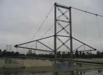
Patrick S. O'Donnell estimates the total suspended length of this huge pipeline bridge is 3,600 feet (2000-foot main span, 600- and 1050-foot side spans). Bridgemeister ID: 2361 (added 2007-09-08)Name: (pipeline bridge) Location: Montebello and Pico Rivera, California , USA Crossing: Rio Hondo At or Near Feature: Whittier Narrows Dam vicinity Coordinates: 34.01791 N 118.08627 W Maps: Acme , GeoHack , Google , OpenStreetMap Use: Pipeline Status: Removed, c. 2009-2011 Main Span: 1
Removed at some point in the 2009-2011 time frame. Bridgemeister ID: 8010 (added 2023-12-09)Name: (pipeline bridge) Location: Natakhtari (ნატახტარი) and Saguramo (საგურამო), Georgia Crossing: Aragvi River Coordinates: 41.910806 N 44.739444 E Maps: Acme , GeoHack , Google , OpenStreetMap Use: Pipeline Status: Extant (last checked: 2023) Main Spans: 6 x 159 meters (521.7 feet) estimated
Bridgemeister ID: 8082 (added 2023-12-24)Name: (pipeline bridge) Location: Nelahozeves, Mělník and Kralupy nad Vltavou, Mělník, Czechia Crossing: Vltava River Coordinates: 50.266222 N 14.306028 E Maps: Acme , GeoHack , Google , OpenStreetMap Use: Pipeline Status: Extant (last checked: 2019) Main Cables: Wire (steel) Suspended Spans: 1 Main Span: 1 x 160 meters (524.9 feet) estimated
Bridgemeister ID: 2040 (added 2006-05-07)Name: (pipeline bridge) Location: New Haven, Connecticut , USA Crossing: Quinnipiac River Coordinates: 41.320917 N 72.89015 W Maps: Acme , GeoHack , Google , OpenStreetMap Use: Pipeline Status: Extant (last checked: 2005) Main Cables: Wire (steel) Suspended Spans: 1 Main Span: 1 x 45.7 meters (150 feet) estimated
Bridgemeister ID: 6781 (added 2021-10-29)Name: (pipeline bridge) Location: Novomikhailovskii (Новомихайловский), Krasnodar Krai, Russia Crossing: Reka Nechepsukho Coordinates: 44.255891 N 38.852097 E Maps: Acme , GeoHack , Google , OpenStreetMap Use: Pipeline Status: Extant (last checked: 2019) Main Cables: Wire (steel) Suspended Spans: 1 Main Span: 1
Bridgemeister ID: 6222 (added 2021-07-17)Name: (pipeline bridge) Location: Orotina vicinity, Alajuela Province, Costa Rica Crossing: Rio Tárcoles Coordinates: 9.912271 N 84.479721 W Maps: Acme , GeoHack , Google , OpenStreetMap Use: Pipeline Status: Extant (last checked: 2021) Main Cables: Wire (steel) Main Span: 1 x 82.9 meters (272 feet) estimated
Bridgemeister ID: 6121 (added 2021-07-04)Name: (pipeline bridge) Location: Osorno, Chile Crossing: Rahue River Coordinates: 40.584360 S 73.154973 W Maps: Acme , GeoHack , Google , OpenStreetMap Use: Pipeline and Footbridge Status: Extant (last checked: 2021) Main Cables: Wire (steel) Suspended Spans: 1 Main Span: 1
Demolished at some point in 2022. Appears to have carried an electrical or communications conduit track, possibly an pipeline. Bridgemeister ID: 5928 (added 2021-06-27)Name: (pipeline bridge) Location: Paso Agres, Orotina vicinity, Costa Rica Crossing: Rio Tárcoles Coordinates: 9.879692 N 84.527795 W Maps: Acme , GeoHack , Google , OpenStreetMap Use: Pipeline Status: Extant (last checked: 2021) Main Cables: Wire (steel) Main Span: 1
Bridgemeister ID: 1727 (added 2005-04-05)Name: (pipeline bridge) Location: Paterson, New Jersey , USA Crossing: Passaic Falls Use: Pipeline Status: Removed Main Cables: Wire Suspended Spans: 1
The 1950's-era postcard shows a small suspension bridge behind the arch. Bridgemeister ID: 4758 (added 2020-06-28)Name: (pipeline bridge) Location: Pavia, Italy Crossing: Ticino River Coordinates: 45.172989 N 9.170309 E Maps: Acme , GeoHack , Google , OpenStreetMap Use: Pipeline Status: Extant (last checked: 2019) Main Cables: Wire (steel) Main Span: 1 x 240 meters (787.4 feet)
Bridgemeister ID: 2124 (added 2006-10-21)Name: (pipeline bridge) Location: Plains vicinity and Thompson Falls vicinity, Montana , USA Crossing: Clark Fork River Coordinates: 47.52982 N 115.05720 W Maps: Acme , GeoHack , Google , OpenStreetMap Use: Pipeline Status: Extant (last checked: 2006) Main Cables: Wire (steel) Suspended Spans: 1 Main Span: 1 x 274.3 meters (900 feet)
Bridgemeister ID: 6862 (added 2022-01-02)Name: (pipeline bridge) Location: Plandaan, Tulungagung Regency, East Java , Indonesia Coordinates: 8.055110 S 111.897790 E Maps: Acme , GeoHack , Google , OpenStreetMap Use: Pipeline Status: Extant (last checked: 2021) Main Cables: Wire (steel) Suspended Spans: 1
Bridgemeister ID: 2038 (added 2006-05-07)Name: (pipeline bridge) Location: Plattsmouth, Nebraska and Pacific Junction vicinity, Iowa , USA Crossing: Missouri River Coordinates: 41.0028 N 95.8679 W Maps: Acme , GeoHack , Google , OpenStreetMap Use: Pipeline Status: Extant (last checked: 2023) Main Cables: Wire (steel) Suspended Spans: 2 Main Span: 1 x 457.2 meters (1,500 feet) estimated Side Span: 1 x 228.6 meters (750 feet) estimated
Bridgemeister ID: 3229 (added 2019-11-11)Name: (pipeline bridge) Location: Ponte San Giovanni, Perugia, Italy Coordinates: 43.093200 N 12.451178 E Maps: Acme , GeoHack , Google , OpenStreetMap Use: Pipeline Status: Extant (last checked: 2011) Main Cables: Wire (steel)
Bridgemeister ID: 2841 (added 2019-07-06)Name: (pipeline bridge) Location: Prackovice nad Labem, Czechia Crossing: Elbe River Coordinates: 50.579858 N 14.036253 E Maps: Acme , GeoHack , Google , OpenStreetMap Use: Pipeline Status: Extant (last checked: 2019) Main Cables: Wire (steel) Suspended Spans: 1
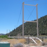
Bridgemeister ID: 2293 (added 2007-04-26)Name: (pipeline bridge) Location: Pyramid Lake vicinity and Liebre Gulch vicinity, California , USA Coordinates: 34.68632 N 118.73605 W Maps: Acme , GeoHack , Google , OpenStreetMap Use: Pipeline Status: In use (last checked: 2007) Main Cables: Wire (steel) Suspended Spans: 1 Main Span: 1 x 114.3 meters (375 feet)
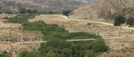
Bridgemeister ID: 2294 (added 2007-04-26)Name: (pipeline bridge) Location: Pyramid Lake vicinity, California , USA Crossing: Liebre Gulch Coordinates: 34.69553 N 118.73782 W Maps: Acme , GeoHack , Google , OpenStreetMap Use: Pipeline Status: In use (last checked: 2007) Main Cables: Wire (steel) Main Span: 1 x 152.4 meters (500 feet)
Bridgemeister ID: 2295 (added 2007-04-26)Name: (pipeline bridge) Location: Pyramid Lake vicinity, California , USA Crossing: Liebre Gulch Coordinates: 34.69357 N 118.73703 W Maps: Acme , GeoHack , Google , OpenStreetMap Use: Pipeline Status: In use (last checked: 2007) Main Cables: Wire (steel) Main Span: 1 x 61 meters (200 feet)
Bridgemeister ID: 2331 (added 2007-07-04)Name: (pipeline bridge) Location: Pyramid Lake vicinity, California , USA Crossing: Canada de Los Alamos At or Near Feature: Hungry Valley State Vehicular Rec. Area Coordinates: 34.70264 N 118.79825 W Maps: Acme , GeoHack , Google , OpenStreetMap Use: Pipeline Status: Extant (last checked: 2007) Main Cables: Wire (steel) Suspended Spans: 1
Visible from the Sundial cable-stayed bridge. Bridgemeister ID: 2823 (added 2019-07-04)Name: (pipeline bridge) Location: Ren'ai Township, Nantou County, Taiwan Coordinates: 23.917088 N 121.055192 E Maps: Acme , GeoHack , Google , OpenStreetMap Use: Pipeline Status: Extant (last checked: 2016) Main Cables: Wire
Bridgemeister ID: 3593 (added 2019-12-30)Name: (pipeline bridge) Location: Roldanillo vicinity and Zarzal vicinity, Colombia Crossing: Cauca River Coordinates: 4.405403 N 76.101366 W Maps: Acme , GeoHack , Google , OpenStreetMap Use: Pipeline Status: Extant (last checked: 2015) Main Cables: Wire (steel)
Bridgemeister ID: 7094 (added 2022-05-29)Name: (pipeline bridge) Location: Roseville, Ohio , USA Crossing: Moxahala Creek Coordinates: 39.800219 N 82.081253 W Maps: Acme , GeoHack , Google , OpenStreetMap Use: Pipeline Status: Extant (last checked: 2021) Main Cables: Wire (steel) Suspended Spans: 1 Main Span: 1
Bridgemeister ID: 2035 (added 2006-05-01)Name: (pipeline bridge) Location: Rumford, Maine , USA Principals: John A. Roebling's Sons Co. Use: Pipeline Main Cables: Wire (steel) Suspended Spans: 8
Described in a Roebling ad: "...carries 900 ft. of a 14 inch diameter stainless steel pulpline [built for Oxford Paper Co.] over a canal and uneven terrain. It has eight spans, the longest of which is 166 ft. Rigidity of the suspension system was achieved by running a pair of tie cables from one anchorage to the other, connecting all tower tops. The cost of a steel trestle to support this pulpline would have been much higher." See (footbridge) - Rumford, Maine, USA . The pipelines were constructed as part of the same project. Bridgemeister ID: 2330 (added 2007-07-04)Name: (pipeline bridge) Location: Santa Clarita and Valencia, California , USA Crossing: Santa Clara River Coordinates: 34.42707 N 118.57484 W Maps: Acme , GeoHack , Google , OpenStreetMap Use: Pipeline Status: Extant (last checked: 2007) Main Cables: Wire (steel) Suspended Spans: 3 Main Span: 1 Side Spans: 2
Bridgemeister ID: 3110 (added 2019-10-28)Name: (pipeline bridge) Location: Santa Maria de Nieva, Peru Crossing: Nieva River Coordinates: 4.593157 S 77.863501 W Maps: Acme , GeoHack , Google , OpenStreetMap Use: Pipeline Status: Extant (last checked: 2018) Main Cables: Wire
Bridgemeister ID: 7261 (added 2022-07-16)Name: (pipeline bridge) Location: Santiago de Méndez, Morona-Santiago, Ecuador Crossing: Rio Paute Coordinates: 2.712519 S 78.325938 W Maps: Acme , GeoHack , Google , OpenStreetMap Use: Pipeline Status: Extant (last checked: 2018) Main Cables: Wire (steel) Main Span: 1
Bridgemeister ID: 1511 (added 2004-10-09)Name: (pipeline bridge) Location: Savona, British Columbia , Canada Crossing: Thompson River Use: Pipeline Status: Extant (last checked: 2004) Main Cables: Wire (steel) Suspended Spans: 1 Main Span: 1 x 182.9 meters (600 feet)
Bridgemeister ID: 2655 (added 2019-03-03)Name: (pipeline bridge) Location: Sealy and Brookshire, Texas , USA Crossing: Brazos River Coordinates: 29.772165 N 96.036434 W Maps: Acme , GeoHack , Google , OpenStreetMap Use: Pipeline Status: Extant (last checked: 2014) Main Cables: Wire (steel)
Adjacent to I-10 Brazos River crossing. Bridgemeister ID: 3982 (added 2020-03-22)Name: (pipeline bridge) Location: Shirakawa, Gifu , Japan Crossing: Shō River Coordinates: 36.254784 N 136.896063 E Maps: Acme , GeoHack , Google , OpenStreetMap Use: Pipeline Status: Extant (last checked: 2019) Main Cables: Wire (steel) Suspended Spans: 1
Bridgemeister ID: 2597 (added 2014-04-14)Name: (pipeline bridge) Location: Skawina, Poland Coordinates: 49.975852 N 19.783271 E Maps: Acme , GeoHack , Google , OpenStreetMap Use: Pipeline Status: Extant (last checked: 2014)
Bridgemeister ID: 2132 (added 2006-10-22)Name: (pipeline bridge) Location: Spokane, Washington , USA Crossing: Spokane River Coordinates: 47.69664 N 117.47906 W Maps: Acme , GeoHack , Google , OpenStreetMap Use: Pipeline and Footbridge Status: Extant (last checked: 2022) Main Cables: Wire (steel) Suspended Spans: 1 Main Span: 1 x 106.7 meters (350 feet) estimated
Bridgemeister ID: 6623 (added 2021-09-06)Name: (pipeline bridge) Location: Sukasirna, Jonggol, Bogor and Sirnagalih, Bogor, West Java , Indonesia Coordinates: 6.479375 S 107.075284 E Maps: Acme , GeoHack , Google , OpenStreetMap Use: Pipeline Status: Extant (last checked: 2021) Main Cables: Wire (iron) Main Span: 1
Bridgemeister ID: 3833 (added 2020-03-01)Name: (pipeline bridge) Location: Surabaya, East Java , Indonesia Coordinates: 7.299689 S 112.737081 E Maps: Acme , GeoHack , Google , OpenStreetMap Use: Pipeline Status: Extant (last checked: 2019) Main Cables: Wire (steel) Suspended Spans: 1
Bridgemeister ID: 4379 (added 2020-04-12)Name: (pipeline bridge) Location: Thimphu Chu, Bhutan Crossing: Thimphu Chu Coordinates: 27.452146 N 89.653199 E Maps: Acme , GeoHack , Google , OpenStreetMap Use: Pipeline Status: Extant (last checked: 2013) Main Cables: Wire (steel) Suspended Spans: 1
Bridgemeister ID: 2125 (added 2006-10-21)Name: (pipeline bridge) Location: Thompson Falls vicinity, Montana , USA Crossing: Clark Fork River Coordinates: 47.57957 N 115.20910 W Maps: Acme , GeoHack , Google , OpenStreetMap Use: Pipeline Status: Extant (last checked: 2006) Main Cables: Wire (steel) Main Span: 1 x 274.3 meters (900 feet) estimated
Bridgemeister ID: 2126 (added 2006-10-21)Name: (pipeline bridge) Location: Thompson Falls vicinity, Montana , USA Crossing: Clark Fork River Coordinates: 47.57604 N 115.19292 W Maps: Acme , GeoHack , Google , OpenStreetMap Use: Pipeline Status: Extant (last checked: 2006) Main Cables: Wire (steel) Main Span: 1 x 176.8 meters (580 feet) estimated
Bridgemeister ID: 2127 (added 2006-10-21)Name: (pipeline bridge) Location: Thompson Falls vicinity, Montana , USA Crossing: Clark Fork River Coordinates: 47.56988 N 115.17832 W Maps: Acme , GeoHack , Google , OpenStreetMap Use: Pipeline Status: Extant (last checked: 2006) Main Cables: Wire (steel) Main Span: 1 x 189 meters (620 feet) estimated
Bridgemeister ID: 2128 (added 2006-10-21)Name: (pipeline bridge) Location: Thompson Falls, Montana , USA Crossing: Clark Fork River Coordinates: 47.58064 N 115.32105 W Maps: Acme , GeoHack , Google , OpenStreetMap Use: Pipeline Status: Extant (last checked: 2006) Main Cables: Wire (steel) Suspended Spans: 1 Main Span: 1 x 304.8 meters (1,000 feet) estimated
Bridgemeister ID: 3435 (added 2019-12-22)Name: (pipeline bridge) Location: Tinta, Peru Crossing: Highway 3S Coordinates: 14.121610 S 71.414306 W Maps: Acme , GeoHack , Google , OpenStreetMap Use: Pipeline Status: Extant (last checked: 2014) Main Cables: Wire Suspended Spans: 1
Bridgemeister ID: 5626 (added 2020-12-28)Name: (pipeline bridge) Location: Tonjong, Sukabumi, West Java , Indonesia Coordinates: 6.997694 S 106.606586 E Maps: Acme , GeoHack , Google , OpenStreetMap Use: Pipeline Status: Extant (last checked: 2019) Main Cables: Wire (steel) Suspended Spans: 1
Bridgemeister ID: 5620 (added 2020-12-28)Name: (pipeline bridge) Location: Ubrug, Warung Kiara, Sukabumi, West Java , Indonesia Coordinates: 6.948058 S 106.758202 E Maps: Acme , GeoHack , Google , OpenStreetMap Use: Pipeline Status: Extant (last checked: 2019) Main Cables: Wire (steel) Suspended Spans: 1
Bridgemeister ID: 5621 (added 2020-12-28)Name: (pipeline bridge) Location: Ubrug, Warung Kiara, Sukabumi, West Java , Indonesia Coordinates: 6.948169 S 106.758258 E Maps: Acme , GeoHack , Google , OpenStreetMap Use: Pipeline Status: Extant (last checked: 2019) Main Cables: Wire (steel) Suspended Spans: 1
There are two pipeline suspension bridges here, separated by just a few feet. This entry is for, what appears to be, the newer of the two bridges having tubular towers and a stiffening truss. Next to (pipeline bridge) - Ubrug, Warung Kiara, Sukabumi, West Java, Indonesia . Similar to (pipeline bridge) - Tonjong, Sukabumi, West Java, Indonesia . Bridgemeister ID: 8279 (added 2024-02-08)Name: (pipeline bridge) Location: Urcos, Peru Crossing: Urubamba River Coordinates: 13.676083 S 71.628722 W Maps: Acme , GeoHack , Google , OpenStreetMap Use: Pipeline Status: Extant (last checked: 2022) Main Cables: Wire (steel) Suspended Spans: 1
See Vemork - Vemork, Våer vicinity, Telemark, Norway . The pipeline was effectively a separate suspension bridge built on top of the main suspension bridge at Vemork resulting in a unique "stack" of two suspension bridges. The pipeline structure was removed at some point in the 1900s. Bridgemeister ID: 5309 (added 2020-11-11)Name: (pipeline bridge) Location: Villesse, Gorizia, Italy Crossing: Soča Coordinates: 45.855609 N 13.458577 E Maps: Acme , GeoHack , Google , OpenStreetMap Use: Pipeline Status: Removed, c. 2016 Main Cables: Wire (steel) Suspended Spans: 3
Appears to have been removed or destroyed around 2016. Just south of the I-10 Whisky Bay Pilot Channel crossing. Bridgemeister ID: 7926 (added 2023-10-22)Name: (pipeline bridge) Location: Wroclaw, Poland Crossing: Oder River Coordinates: 51.0973479 N 17.0856074 E Maps: Acme , GeoHack , Google , OpenStreetMap Use: Pipeline Status: Extant (last checked: 2023) Main Cables: Wire (steel) Suspended Spans: 1 Main Span: 1 x 318 meters (1,043.3 feet) estimated
Bridgemeister ID: 8127 (added 2024-01-13)Name: (pipeline bridge) Location: Xigu District (西固区), Lanzhou (兰州市), Gansu , China Crossing: Yellow River Coordinates: 36.158750 N 103.432750 E Maps: Acme , GeoHack , Google , OpenStreetMap Use: Pipeline Status: Extant (last checked: 2022) Main Span: 1 x 297 meters (974.4 feet) estimated
Bridgemeister ID: 7437 (added 2022-12-16)Name: (pipeline bridge) Location: Yopal and Aguazul, Casanare, Colombia Crossing: Rio Charte Coordinates: 5.255028 N 72.484250 W Maps: Acme , GeoHack , Google , OpenStreetMap Use: Pipeline Status: Extant (last checked: 2022) Main Cables: Wire (steel) Main Span: 1 x 178.3 meters (585 feet) estimated
Facebook . Image with bridge visible in the background, posted August 25, 2016.Bridgemeister ID: 2606 (added 2014-04-14)Name: (snowmobile bridge) Location: Cambridgeport, Vermont , USA Crossing: Saxtons River Use: Snowmobile Status: In use (last checked: 2008) Main Cables: Wire Suspended Spans: 1 Main Span: 1 x 42.7 meters (140 feet) estimated
Patrick S. O'Donnell notes the suspended span is aided by an intermediate pier not original to the bridge. Bridgemeister ID: 2592 (added 2014-04-14)Name: (snowmobile bridge) Location: Causapscal, Quebec , Canada Crossing: Causapscal River Use: Snowmobile Status: In use (last checked: 2011) Main Cables: Wire (steel) Suspended Spans: 1 Main Span: 1 x 51.8 meters (170 feet) estimated
Bridgemeister ID: 2478 (added 2008-12-21)Name: (snowmobile bridge) Location: Newry vicinity, Maine , USA Crossing: Bear River Coordinates: 44.52933 N 70.82639 W Maps: Acme , GeoHack , Google , OpenStreetMap Use: Snowmobile Status: In use (last checked: 2008) Main Cables: Wire (steel) Suspended Spans: 1 Main Span: 1 x 32 meters (105 feet)
Possibly built 1996. Sign on bridge says "Windy Valleys Sno-Mobile Club 1996". Bridgemeister ID: 2480 (added 2008-12-21)Name: (snowmobile bridge) Location: North Leeds vicinity, Maine , USA Crossing: Dead River Coordinates: 44.35437 N 70.15510 W Maps: Acme , GeoHack , Google , OpenStreetMap Use: Snowmobile Status: In use (last checked: 2008) Main Cables: Wire (steel) Suspended Spans: 1 Main Span: 1 x 56.4 meters (185 feet)
Bridgemeister ID: 2479 (added 2008-12-21)Name: (snowmobile bridge) Location: Roxbury, Maine , USA Crossing: Swift River Coordinates: 44.67360 N 70.60651 W Maps: Acme , GeoHack , Google , OpenStreetMap Use: Snowmobile Status: In use (last checked: 2008) Main Cables: Wire (steel) Suspended Spans: 1 Main Span: 1 x 42.7 meters (140 feet)
Bridgemeister ID: 2605 (added 2014-04-14)Name: (snowmobile bridge) Location: Saxtons River, Vermont , USA Crossing: Saxtons River Use: Snowmobile Status: In use (last checked: 2008) Main Cables: Wire Suspended Spans: 1 Main Span: 1 x 45.7 meters (150 feet) estimated
Bridgemeister ID: 5149 (added 2020-09-07)Name: (suspension bridge) Also Known As: 鹿瀬橋 Location: Aga, Niigata , Japan Crossing: Agano River Coordinates: 37.695035 N 139.482878 E Maps: Acme , GeoHack , Google , OpenStreetMap Use: Vehicular (one-lane) Status: Restricted to foot traffic (last checked: 2014) Main Cables: Wire (steel) Suspended Spans: 1 Main Span: 1 x 130.5 meters (428.1 feet) estimated
2019: Deck is in very rough shape, maintained with assortment of loose logs and wood planks. One approach appears to have been washed away at some point in the 2013-2016 time frame. Bridgemeister ID: 8479 (added 2024-03-17)Name: (suspension bridge) Location: Achaxiang (阿察镇), Baiyü (白玉县), Garzê (甘孜藏族自治州), Sichuan , China Coordinates: 31.016941 N 99.555301 E Maps: Acme , GeoHack , Google , OpenStreetMap Status: Extant (last checked: 2019) Main Span: 1 x 60 meters (196.9 feet) estimated
Bridgemeister ID: 8480 (added 2024-03-17)Name: (suspension bridge) Location: Achaxiang (阿察镇), Baiyü (白玉县), Garzê (甘孜藏族自治州), Sichuan , China Coordinates: 30.993992 N 99.551425 E Maps: Acme , GeoHack , Google , OpenStreetMap Status: Extant (last checked: 2019) Main Span: 1 x 57 meters (187 feet) estimated
Bridgemeister ID: 272 (added before 2003)Name: (suspension bridge) Location: Addison, New York , USA Crossing: Canisteo River Use: Vehicular (one-lane) Status: Removed Main Cables: Wire Suspended Spans: 1
Bridgemeister ID: 7151 (added 2022-06-25)Name: (suspension bridge) Location: Afrai Khet (अफ्री खेत), Uttarakhand , India Coordinates: 30.206744 N 78.959672 E Maps: Acme , GeoHack , Google , OpenStreetMap Status: Extant (last checked: 2021) Main Span: 1 x 50 meters (164 feet) estimated
Bridgemeister ID: 5150 (added 2020-09-07)Name: (suspension bridge) Location: Aga, Niigata , Japan Crossing: Agano River Coordinates: 37.703962 N 139.475629 E Maps: Acme , GeoHack , Google , OpenStreetMap Use: Vehicular (one-lane) Status: Closed (last checked: 2014) Main Cables: Wire (steel) Suspended Spans: 1 Main Span: 1 x 91 meters (298.6 feet) estimated
Do you have any information or photos for these bridges that you would like to share? Please email david.denenberg@bridgemeister.com .
Mail | Facebook | Twitter
