Undated/Named Suspension Bridges (301-400 of 1,567)
This is a list of bridges 301 through 400 (of 1,567 total) in the suspension bridge inventory that are undated named bridges. Wherever you see a Bridgemeister ID number click it to isolate the bridge on its own page.
Related Lists:
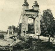
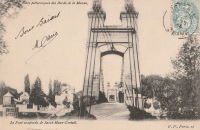
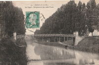
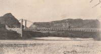
Bridgemeister ID: 2059 (added 2006-06-03)Name: Créteil Also Known As: Saint-Maur Location: Créteil-sur-Marne and Saint-Maur-des-Fossés, Val-de-Marne , France Crossing: Marne River Use: Vehicular (one-lane) Status: Removed Main Cables: Wire Suspended Spans: 1
Bridgemeister ID: 1978 (added 2005-11-27)Name: Cuddebackville Location: Cuddebackville and Godeffroy, New York , USA Crossing: Neversink River Use: Vehicular (one-lane) Status: Removed Main Cables: Wire (iron) Suspended Spans: 1
Completed c. 1850, replaced c. 1900s. Bridgemeister ID: 3116 (added 2019-10-29)Name: Cumandá Location: Cumandá vicinity, Ecuador Crossing: Rio Pastaza Coordinates: 1.452518 S 78.153815 W Maps: Acme , GeoHack , Google , OpenStreetMap Use: Vehicular (one-lane) Status: In use (last checked: 2018) Main Cables: Wire (steel)
Bridgemeister ID: 2787 (added 2019-06-30)Name: Cushihu Also Known As: 粗石斛吊橋 Location: Pinglin District, New Taipei City, Taiwan Coordinates: 24.952830 N 121.749591 E Maps: Acme , GeoHack , Google , OpenStreetMap Use: Footbridge Status: In use (last checked: 2015) Main Cables: Wire (steel) Suspended Spans: 1
Bridgemeister ID: 7495 (added 2022-12-30)Name: Cuyca Location: Cuyca, Colasay, Peru Crossing: Rio Chamaya Coordinates: 6.009487 S 78.860944 W Maps: Acme , GeoHack , Google , OpenStreetMap Use: Footbridge Status: Derelict, since March 2022 Main Cables: Wire (steel) Suspended Spans: 1 Main Span: 1 x 75 meters (246.1 feet) estimated
2022, March: Heavily damaged by flood. Bridgemeister ID: 2813 (added 2019-07-04)Name: Dabao Also Known As: 大豹吊橋 Location: Sanxia District, New Taipei City, Taiwan Coordinates: 24.869427 N 121.408924 E Maps: Acme , GeoHack , Google , OpenStreetMap Use: Footbridge Status: In use (last checked: 2019) Main Cables: Wire (steel) Suspended Spans: 1
Bridgemeister ID: 8110 (added 2024-01-06)Name: Dahan Gali Also Known As: Dhan Gali, Dangali Location: Pallal Mallahan, Rawalpindi, Punjab and Mirpur, Azad Jammu and Kashmir, Pakistan Crossing: Jhelum River Coordinates: 33.361259 N 73.567533 E Maps: Acme , GeoHack , Google , OpenStreetMap Use: Vehicular (one-lane) Status: Inundated, c. 2010 Main Cables: Wire (steel) Suspended Spans: 1 Main Span: 1 x 199.6 meters (655 feet) estimated
Location partially inundated behind the Mangla Dam after the reservoir capacity was increased in 2009. Bridgemeister ID: 6812 (added 2021-12-04)Name: Dain Also Known As: Chatorkhand Location: Chatorkhand, Gilgit-Baltistan, Pakistan Crossing: Karambar River Coordinates: 36.346528 N 73.834333 E Maps: Acme , GeoHack , Google , OpenStreetMap Use: Vehicular (one-lane) Status: In use Main Cables: Wire (steel) Suspended Spans: 1 Main Span: 1 x 186.2 meters (611 feet) estimated
Bridgemeister ID: 4109 (added 2020-04-05)Name: Dalsfoss Location: Sannidal, Kragerø, Vestfold Og Telemark, Norway Crossing: Lundereidelva Coordinates: 58.962502 N 9.321384 E Maps: Acme , GeoHack , Google , kart.1881.no , OpenStreetMap Use: Vehicular (one-lane) Status: In use (last checked: 2019) Main Cables: Wire (steel) Suspended Spans: 2 Main Spans: 1 x 41 meters (134.5 feet) estimated,
Bridgemeister ID: 3711 (added 2020-02-09)Name: Dalsnes Location: Dalsnes, Hegra vicinity, Stjørdal, Trøndelag, Norway Crossing: Forra Coordinates: 63.48559 N 11.28784 E Maps: Acme , GeoHack , Google , kart.1881.no , OpenStreetMap Use: Vehicular (one-lane) Status: In use (last checked: 2010) Main Cables: Wire (steel) Suspended Spans: 1 Main Span: 1 x 73.2 meters (240 feet) estimated
Bridgemeister ID: 4648 (added 2020-06-16)Name: Damanskiy Also Known As: Даманский, Damansky Location: Yaroslavskaya, Krasnodar Krai, Russia Crossing: Kotorosl River Coordinates: 57.620478 N 39.898030 E Maps: Acme , GeoHack , Google , OpenStreetMap Use: Footbridge Status: In use (last checked: 2019) Main Cables: Wire (steel) Suspended Spans: 3 Main Span: 1 x 88 meters (288.7 feet) estimated Side Spans: 2
Bridgemeister ID: 2826 (added 2019-07-04)Name: Danda Location: Xinyi Township, Nantou County, Taiwan Coordinates: 23.787197 N 121.011677 E Maps: Acme , GeoHack , Google , OpenStreetMap Use: Footbridge Status: Only towers remain (last checked: 2017) Main Cables: Wire (steel) Suspended Spans: 1
Bridge was still in use at least as late as 2007. Removed or destroyed at some point after. In 2019 only the towers remain. Bridgemeister ID: 2819 (added 2019-07-04)Name: Danlan Location: Shiding District, New Taipei City, Taiwan Coordinates: 25.004531 N 121.651588 E Maps: Acme , GeoHack , Google , OpenStreetMap Use: Footbridge Status: In use (last checked: 2018) Main Cables: Wire (steel) Suspended Spans: 2 Main Span: 1 Side Span: 1
Bridgemeister ID: 2795 (added 2019-07-04)Name: Danlin Location: Xinpi Township, Pingtung County, Taiwan Coordinates: 22.519956 N 120.629523 E Maps: Acme , GeoHack , Google , OpenStreetMap Use: Footbridge Status: In use Main Cables: Wire (steel)
Bridgemeister ID: 537 (added before 2003)Name: Danyor Also Known As: Danyore Location: Gilgit vicinity, Pakistan Crossing: Hunza River Coordinates: 35.92497 N 74.37201 E Maps: Acme , GeoHack , Google , OpenStreetMap Use: Vehicular (one-lane) Status: In use (last checked: 2012) Main Cables: Wire Suspended Spans: 1
Bridgemeister ID: 3244 (added 2019-11-16)Name: Dauwan Also Known As: 多望吊橋 Location: Datong Township, Yilan County, Taiwan Coordinates: 24.546160 N 121.507448 E Maps: Acme , GeoHack , Google , OpenStreetMap Use: Footbridge Status: In use (last checked: 2020) Main Cables: Wire (steel)
Bridgemeister ID: 3016 (added 2019-10-13)Name: David Scott Trail Location: Mawmyrsiang, Meghalaya , India Coordinates: 25.427530 N 91.752336 E Maps: Acme , GeoHack , Google , OpenStreetMap Use: Footbridge Status: In use (last checked: 2019) Main Cables: Wire (steel)
Bridgemeister ID: 3237 (added 2019-11-16)Name: Daxi Also Known As: 大溪橋 Location: Daxi, Taoyuan City, Taiwan Crossing: Dahan River Coordinates: 24.884920 N 121.283372 E Maps: Acme , GeoHack , Google , OpenStreetMap Use: Footbridge Status: In use (last checked: 2019) Main Cables: Wire (steel) Suspended Spans: 3 Main Spans: 3
Bridgemeister ID: 7249 (added 2022-07-16)Name: Deer View Also Known As: สะพานชมกวาง Location: Bang Luek, Mueang Chumphon District, Chumphon, Thailand Coordinates: 10.547492 N 99.196661 E Maps: Acme , GeoHack , Google , OpenStreetMap Use: Footbridge Status: In use (last checked: 2022) Main Cables: Wire (steel) Suspended Spans: 1
Bridgemeister ID: 4309 (added 2020-04-10)Name: Deheibashi Location: Hamamatsu, Shizuoka , Japan Crossing: Sugi River Coordinates: 35.045013 N 138.010321 E Maps: Acme , GeoHack , Google , OpenStreetMap Use: Vehicular (one-lane) Status: Closed (last checked: 2023) Main Cables: Wire (steel) Suspended Spans: 1
Twitter . Several images of the bridge. Posted October 13, 2023.Bridgemeister ID: 3555 (added 2019-12-26)Name: Depot Location: Kaiwhakauka Falls vicinity, Retaruke, New Zealand Coordinates: 39.132533 S 175.074265 E Maps: Acme , GeoHack , Google , OpenStreetMap Use: Footbridge Status: Collapsed, December 2014 Main Cables: Wire (steel) Suspended Spans: 1
Coordinates are approximate. This footbridge had been built in the early 2000s over and through the remains of the historic Depot truss bridge. In December 2014, the remains of the older bridge collapsed destroying the suspension bridge. Bridgemeister ID: 6798 (added 2021-10-30)Name: Derani Location: Derani, Sherqilla vicinity, Gilgit-Baltistan, Pakistan Crossing: Sher Gah Coordinates: 36.127927 N 74.035919 E Maps: Acme , GeoHack , Google , OpenStreetMap Use: Vehicular Status: In use (last checked: 2020) Main Cables: Wire Main Span: 1
Bridgemeister ID: 2596 (added 2014-04-14)Name: Des Chutes Du Ruisseau Creux Location: Saint-Alphonse-de-Caplan, Quebec , Canada Crossing: Bonaventure River Coordinates: 48.192363 N 65.563592 W Maps: Acme , GeoHack , Google , OpenStreetMap Use: Snowmobile and Footbridge Status: In use (last checked: 2018) Main Cables: Wire (steel) Suspended Spans: 1 Main Span: 1 x 79.2 meters (260 feet) estimated
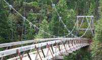
Bridgemeister ID: 2183 (added 2007-01-14)Name: Devils Creek Location: Ross Lake National Recreation Area, Washington , USA Crossing: Devils Creek At or Near Feature: North Cascades National Park Coordinates: 48.82405 N 121.03226 W Maps: Acme , GeoHack , Google , OpenStreetMap Use: Footbridge Status: In use (last checked: 2006) Main Cables: Wire (steel) Suspended Spans: 1 Main Span: 1 x 55.5 meters (182 feet)
Bridgemeister ID: 6166 (added 2021-07-07)Name: Dhandole Also Known As: हैंगिंग फूट ब्रिज धन्दोले Location: Ghanghol, Himachal Pradesh , India Coordinates: 31.948347 N 76.684777 E Maps: Acme , GeoHack , Google , OpenStreetMap Use: Footbridge Status: In use (last checked: 2021) Main Cables: Wire (steel) Suspended Spans: 1
Bridgemeister ID: 5456 (added 2020-11-26)Name: Dhari Devi Also Known As: Dharidevi Location: Kalyasaur (कल्यासौङ), Uttarakhand , India Crossing: Alakananda River At or Near Feature: Dhari Devi Temple Coordinates: 30.258213 N 78.877268 E Maps: Acme , GeoHack , Google , OpenStreetMap Status: In use (last checked: 2023) Main Cables: Wire (steel) Suspended Spans: 1
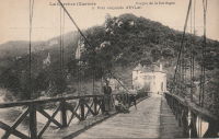
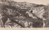
Bridgemeister ID: 7350 (added 2022-10-21)Name: Diable Also Known As: Devil's Location: Avrieux, L'Esseillon, and Modane vicinity, Savoie , France Crossing: Arc River Coordinates: 45.210125 N 6.738907 E Maps: Acme , GeoHack , Google , OpenStreetMap Use: Footbridge Status: Replaced Main Cables: Wire Suspended Spans: 1
Bridgemeister ID: 2184 (added 2007-01-14)Name: Diablo Lake Trail Location: Ross Lake National Recreation Area, Washington , USA Crossing: Skagit River At or Near Feature: North Cascades National Park Coordinates: 48.72857 N 121.07277 W Maps: Acme , GeoHack , Google , OpenStreetMap Use: Footbridge Status: In use (last checked: 2006) Main Cables: Wire (steel) Suspended Spans: 1 Main Span: 1 x 75.9 meters (249 feet)
Spans the Skagit River at the extreme northern end of Lake Diablo near the Ross Dam power house. Bridgemeister ID: 6929 (added 2022-01-22)Name: Dikiuram Location: Dikiuram, Tamenglong District, Manipur , India Crossing: Barak River Coordinates: 25.195102 N 93.602497 E Maps: Acme , GeoHack , Google , OpenStreetMap Use: Vehicular (one-lane) Status: In use (last checked: 2021) Main Cables: Wire (steel) Suspended Spans: 1 Main Span: 1 x 130 meters (426.5 feet) estimated
Bridgemeister ID: 2086 (added 2006-06-24)Name: Dinkytown Also Known As: "M" Bridge Location: Minneapolis, Minnesota , USA At or Near Feature: University of Minnesota Coordinates: 44.98 N 93.238267 W Maps: Acme , GeoHack , Google , OpenStreetMap Use: Footbridge Status: Closed (last checked: 2019) Main Cables: Wire (steel) Suspended Spans: 1
Connects University of Minnesota campus to Dinkytown neighborhood. Closed March 2008 for fear some heavily rusted plates could fail. Restored and reopened by early 2009, possibly sooner. Closed June 2018 due to "structural deterioration". Expected to be demolished in 2019. Moved from 1949 (footbridge) - Minneapolis, Minnesota, USA . The bridge was moved to its current location from the Bierman Field area of the same campus. Bridgemeister ID: 2224 (added 2007-03-17)Name: Diroontah Location: Jallabad vicinity, Afghanistan Principals: Rushworth Halliday Use: Vehicular (one-lane) Main Cables: Wire (steel) Suspended Spans: 1 Main Span: 1 x 93.3 meters (306 feet) Deck width: 10 feet
Bridgemeister ID: 5109 (added 2020-09-05)Name: Dogna Location: Dogna, Udine, Italy Crossing: Torrente Dogna Coordinates: 46.447863 N 13.318000 E Maps: Acme , GeoHack , Google , OpenStreetMap Use: Footbridge Status: In use (last checked: 2014) Main Cables: Wire (steel) Suspended Spans: 1
Bridgemeister ID: 7423 (added 2022-12-09)Name: Dolamara Location: Dolamara, Assam , India Coordinates: 26.565472 N 93.539351 E Maps: Acme , GeoHack , Google , OpenStreetMap Use: Footbridge Status: In use (last checked: 2022) Main Cables: Wire (steel) Main Span: 1
2020s: A truss span is sitting in on the piers of the former suspension bridge. Bridgemeister ID: 2783 (added 2019-06-30)Name: Donghe Also Known As: 東河吊橋 Location: Nanzhuang Township, Miaoli County, Taiwan Coordinates: 24.599301 N 121.038996 E Maps: Acme , GeoHack , Google , OpenStreetMap Use: Footbridge Status: In use (last checked: 2022) Main Cables: Wire (steel) Suspended Spans: 1 Main Span: 1 x 185 meters (607 feet) estimated
Bridgemeister ID: 2753 (added 2019-06-29)Name: Dongpu Also Known As: 東埔吊橋, Dongbudiao Location: Xinyi Township, Nantou County, Taiwan Coordinates: 23.560004 N 120.922835 E Maps: Acme , GeoHack , Google , OpenStreetMap Use: Footbridge Status: In use (last checked: 2019) Main Cables: Wire (steel) Suspended Spans: 1 Main Span: 1 x 200 meters (656.2 feet)
Bridgemeister ID: 5807 (added 2021-04-10)Name: Dongshan Also Known As: 東山吊橋 Location: Nantou City, Nantou County, Taiwan Coordinates: 23.936003 N 120.727422 E Maps: Acme , GeoHack , Google , OpenStreetMap Use: Footbridge Status: Derelict, since c. 2019 (last checked: 2019) Main Cables: Wire (steel) Suspended Spans: 1 Main Span: 1 x 66 meters (216.5 feet) estimated
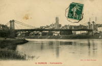
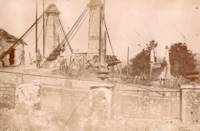
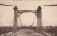
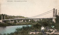
2014: Deck damaged at some point in 2013 or 2014. Bridge closed. 2017: Repaired at some point since 2014, open. 2019: Deck appears to have completely failed, unclear if it was due to flood or another reason. Bridge is closed. Bridgemeister ID: 1130 (added 2004-01-15)Name: Dormans Location: Dormans, Marne and Aisne , France Crossing: Marne River Coordinates: 49.075499 N 3.636878 E Maps: Acme , GeoHack , Google , OpenStreetMap Use: Vehicular (two-lane), with walkway Status: In use (last checked: 2016) Main Cables: Wire (steel) Suspended Spans: 1 Main Span: 1 x 81 meters (265.7 feet) estimated
Bridgemeister ID: 5063 (added 2020-08-29)Name: Doshi Kubo Also Known As: 道志 久保つり橋 Location: Doshi, Yamanashi , Japan Crossing: Doshi River Coordinates: 35.535608 N 139.085717 E Maps: Acme , GeoHack , Google , OpenStreetMap Use: Footbridge Status: In use (last checked: 2018) Main Cables: Wire (steel) Suspended Spans: 1
Bridgemeister ID: 3029 (added 2019-10-13)Name: Double Ten Also Known As: 雙十吊橋, Shuangshi, Shuang-Dong Location: Caotun, Nantou, Taiwan Coordinates: 23.984570 N 120.780614 E Maps: Acme , GeoHack , Google , OpenStreetMap Use: Footbridge Status: In use (last checked: 2019) Main Cables: Wire (steel) Suspended Spans: 3 Main Spans: 3
Bridgemeister ID: 1898 (added 2005-10-02)Name: Doushandiao Also Known As: 斗山吊橋, Dosang, Doosan Location: Dashi Village, Guoxing Township, Nantou County, Taiwan Coordinates: 23.985117 N 120.863117 E Maps: Acme , GeoHack , Google , OpenStreetMap Use: Footbridge Status: In use (last checked: 2023) Main Cables: Wire (steel) Suspended Spans: 1
Long narrow footbridge with tall narrow concrete towers. Nantou Dosang Suspension Bridge . Translated from page: "The Doosan Suspension Bridge was first built around 1961. It was destroyed by floods in 1986. In 1987, a new bridge was built about 50 meters upstream, and then it was disturbed by a typhoon. It was renovated again in 2011."Bridgemeister ID: 3482 (added 2019-12-23)Name: Dulai Location: Dulai and Garry, Abbottabad, Pakistan Crossing: Jhelum River Coordinates: 34.234554 N 73.479064 E Maps: Acme , GeoHack , Google , OpenStreetMap Use: Vehicular (one-lane) Status: In use (last checked: 2019) Main Cables: Wire Suspended Spans: 1
Bridgemeister ID: 7116 (added 2022-06-12)Name: Канатный Location: Rezina, Moldova Coordinates: 47.760396 N 28.954568 E Maps: Acme , GeoHack , Google , OpenStreetMap Use: Footbridge and Pipeline Status: In use (last checked: 2022) Main Cables: Wire (steel) Suspended Spans: 1 Main Span: 1 x 324 meters (1,063 feet) estimated
Popular bungee jumping site. Bridgemeister ID: 6358 (added 2021-07-26)Name: Eagle Falls Location: Great Falls, Montana , USA Crossing: Missouri River At or Near Feature: Eagle Falls, Black Eagle Dam Coordinates: 47.519905 N 111.262229 W Maps: Acme , GeoHack , Google , OpenStreetMap Use: Footbridge Status: Destroyed, June 6, 1908 Main Cables: Wire (steel) Main Span: 1 Side Span: 1
Completed early 1890s. 1908, June: Destroyed by flood. Black Eagle Dam - Wikipedia . From the article (retrieved 2021): "A 200-foot-long (61 m), 10-foot-wide (3.0 m) pedestrian suspension bridge ran from the bluffs above each powerhouse over the river." However, historic images of the bridge show it wa significantly longer with main and side spans of roughly 400 and 200 feet respectively.Bridgehunter.com | Eagle Falls Suspension Bridge Bridgemeister ID: 326 (added before 2003)Name: Eagle Mountain Pack Location: Clearwater National Forest, Idaho , USA Crossing: Lochsa River Coordinates: 46.430033 N 115.133567 W Maps: Acme , GeoHack , Google , OpenStreetMap Use: Pack Status: In use (last checked: 2007) Main Cables: Wire (steel) Suspended Spans: 1 Main Span: 1 x 39.6 meters (130 feet) estimated
Folsom's Rainbow Bridge occupies the location where this bridge stood. IHS: Bridge is purchased by Christian L. Ecklon (a local butcher) in 1872 from "Kinsey & Whitely." Mohi-ud-din, Noor. "Damaged suspension footbridge at Eco Park Baramulla poses risk to commuters." Rising Kashmir , 17 Feb. 2023, http://risingkashmir.com/damaged-suspension-footbridge-at-eco-park-baramulla-poses-risk-to-commuters ."Locals said the bridge has been neglected by the department responsible for its maintenance and that no steps have been taken to repair the damage. The bridge, which is a popular attraction for tourists and locals, has now become a cause for alarm. The safety of pedestrians, particularly during peak hours, is at risk as the damage has rendered the footbridge unsafe for use, locals said."
Bridgemeister ID: 3071 (added 2019-10-26)Name: Edgar Location: Arrow Junction, New Zealand Crossing: Arrow River At or Near Feature: Queenstown Trail - Arrow River Bridges Ride Coordinates: 45.001332 S 168.873649 E Maps: Acme , GeoHack , Google , OpenStreetMap Use: Footbridge Status: In use (last checked: 2022) Main Cables: Wire (steel) Suspended Spans: 1
Bridgemeister ID: 1001 (added 2003-11-17)Name: Eiffel Location: Giza, Egypt At or Near Feature: Giza Zoo Coordinates: 30.023836 N 31.214587 E Maps: Acme , GeoHack , Google , OpenStreetMap Principals: Gustave Eiffel Use: Footbridge Status: Closed, 1990s (last checked: 2020) Main Cables: Wire Suspended Spans: 1
2020: Egypt's Minister of Agriculture and Land Reclamation announced a partnership between Egypt and France to restore the bridge. A Cairo Times article (June 12, 1997) by Samir Raafat describes describes it as a "light suspension bridge built by Alexandre-Gustave Eiffel and brought to Cairo when [Khedive] Ismail visited the Paris Exhibition" which dates it to around 1900. Appeared to be closed for repairs or rehabilitation in 2019. Bridgemeister ID: 1699 (added 2005-03-28)Name: Eiserner Location: Eltmann vicinity, Bavaria, Germany Crossing: Main River Use: Footbridge Status: In use (last checked: 2005) Main Cables: Wire (steel) Suspended Spans: 1 Main Span: 1 x 50 meters (164 feet) Deck width: 1.5 meters
Bridgemeister ID: 7718 (added 2023-07-07)Name: El Cabo Location: Gualaceo and El Cabo, Ecuador Crossing: Rio Paute Coordinates: 2.862069 S 78.776452 W Maps: Acme , GeoHack , Google , OpenStreetMap Use: Vehicular (one-lane) Status: In use (last checked: 2022) Main Cables: Wire (steel) Suspended Spans: 1
Bridgemeister ID: 7230 (added 2022-07-16)Name: El Salto Location: Babahoyo, Los Rios, Ecuador Crossing: Babahoyo River Coordinates: 1.797506 S 79.535459 W Maps: Acme , GeoHack , Google , OpenStreetMap Use: Footbridge Status: In use (last checked: 2015) Main Cables: Wire (steel) Suspended Spans: 1 Main Span: 1
Bridgemeister ID: 7209 (added 2022-07-08)Name: El Torbes Location: El Torbes, Táchira, Venezuela Coordinates: 7.844487 N 72.196598 W Maps: Acme , GeoHack , Google , OpenStreetMap Use: Vehicular (one-lane) Status: In use (last checked: 2022) Main Cables: Wire (steel) Main Span: 1 x 41 meters (134.5 feet) estimated
Bridgemeister ID: 7458 (added 2022-12-24)Name: El Vado Location: El Vado, Cantón Potrero Sula vicinity, El Salvador Crossing: Rio Lempa Coordinates: 14.113753 N 89.408081 W Maps: Acme , GeoHack , Google , OpenStreetMap Use: Footbridge Status: In use Main Cables: Wire (steel) Main Span: 1 x 121.9 meters (400 feet) estimated
Facebook . Image of the bridge posted October 7, 2016.Facebook . Image of the bridge nearing completion of comprehensive rehabilitation project. Posted September 12, 2016.Facebook . Image of the bridge nearing completion of comprehensive rehabilitation project. Posted September 12, 2016.Facebook . Image of the bridge nearing completion of comprehensive rehabilitation project. Posted September 12, 2016.Facebook . Image of the bridge nearing completion of comprehensive rehabilitation project. Posted September 12, 2016.Facebook . Image of the bridge prior to rehabilitation. Posted September 25, 2015.Facebook . Image of the bridge prior to rehabilitation. Posted September 25, 2015.Facebook . Image of the bridge prior to rehabilitation. Posted September 25, 2015.Bridgemeister ID: 4508 (added 2020-05-02)Name: Eldsmoen Location: Hattfjelldal, Nordland, Norway Crossing: Susna Coordinates: 65.331850 N 14.319635 E Maps: Acme , GeoHack , Google , kart.1881.no , OpenStreetMap Use: Vehicular (one-lane) Status: In use Main Cables: Wire (steel) Suspended Spans: 1 Main Span: 1 x 40.5 meters (132.9 feet) estimated
Bridgemeister ID: 327 (added before 2003)Name: Elkhurst Location: Elkhurst, Clay County, West Virginia , USA Crossing: Elk River Coordinates: 38.45182 N 81.15428 W Maps: Acme , GeoHack , Google , OpenStreetMap Use: Vehicular (one-lane) Status: Closed, 2003 (last checked: 2004) Main Cables: Wire (steel) Suspended Spans: 3 Main Span: 1 Side Spans: 2
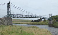
Very narrow vehicular suspension bridge. 4,200-pound weight limit imposed, 1968. Bridgemeister ID: 3674 (added 2020-01-26)Name: Elvanfoot Location: Elvanfoot, Scotland , United Kingdom Crossing: River Clyde Coordinates: 55.441074 N 3.654928 W Maps: Acme , GeoHack , Google , OpenStreetMap Principals: David Rowell & Co. Use: Footbridge Status: Closed, 2007 (last checked: 2020) Main Cables: Wire (steel) Main Span: 1 x 38.5 meters (126.3 feet) estimated
Bridgemeister ID: 4999 (added 2020-08-16)Name: Emílio Méier Location: Jaraguá Esquerdo, Jaraguá do Sul, Santa Catarina, Brazil Coordinates: 26.503567 S 49.092458 W Maps: Acme , GeoHack , Google , OpenStreetMap Use: Footbridge Status: In use (last checked: 2019) Main Cables: Wire Suspended Spans: 3 Main Span: 1 Side Spans: 2
Bridgemeister ID: 5025 (added 2020-08-17)Name: Emilio Meier Location: Jaraguá do Sul, Santa Catarina, Brazil Coordinates: 26.510215 S 49.113843 W Maps: Acme , GeoHack , Google , OpenStreetMap Use: Footbridge Status: In use (last checked: 2019) Main Cables: Wire
2005: Reported as damaged. Appears to have been replaced with a non-suspension bridge. Coordinates provided here are likely location of the former suspension bridge. Bridgemeister ID: 7771 (added 2023-08-17)Name: Eruvatty-Manikkal Also Known As: എരുവാട്ടി - മണിക്കൽ തൂക്കുപാലം Location: Eruvatty (എരുവട്ടി) and Manikkal (മണിക്കൽ), Kerala , India Crossing: Kuppam River Coordinates: 12.176194 N 75.418139 E Maps: Acme , GeoHack , Google , OpenStreetMap Use: Footbridge Status: In use (last checked: 2023) Main Cables: Wire (steel) Main Span: 1
Bridgemeister ID: 6890 (added 2022-01-16)Name: Estuari Gardens Location: Nusajaya, Johor, Malaysia Coordinates: 1.430377 N 103.653455 E Maps: Acme , GeoHack , Google , OpenStreetMap Use: Footbridge Status: In use (last checked: 2022) Main Cables: Rope Suspended Spans: 3 Main Span: 1 Side Spans: 2
Appears to have been completed in 2017 or 2018. Twitter . Thread with several images of the bridge.Bridgemeister ID: 864 (added 2003-08-23)Name: Eva Howe Stevens Also Known As: Rifle Range Location: Ithaca, New York , USA Crossing: Fall Creek Coordinates: 42.454983 N 76.45545 W Maps: Acme , GeoHack , Google , OpenStreetMap Use: Footbridge Status: In use (last checked: 2004) Main Cables: Wire (steel) Suspended Spans: 1 Main Span: 1 x 54.9 meters (180 feet) estimated
Bridgemeister ID: 1892 (added 2005-10-01)Name: Evergreen Also Known As: 長青橋 Location: Beitun District, Taichung City, Taiwan Coordinates: 24.17565 N 120.79165 E Maps: Acme , GeoHack , Google , OpenStreetMap Use: Footbridge Status: In use (last checked: 2005) Main Cables: Wire Suspended Spans: 1
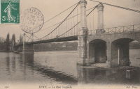
Bridgemeister ID: 2715 (added 2019-06-21)Name: Evry-Petit-Bourg Location: Étiolles, Soisy-sur-Seine vicinity and Évry, Essonne , France Crossing: Seine River Coordinates: 48.63661 N 2.455212 E Maps: Acme , GeoHack , Google , OpenStreetMap Use: Vehicular Status: Removed Main Cables: Wire Suspended Spans: 2 Main Spans: 2
Abutments still standing as of 2022. Bridgemeister ID: 2372 (added 2007-09-29)Name: Eyguians Location: Lagrand and Eyguians, Hautes-Alpes , France Crossing: Buëch River Use: Vehicular Status: Removed Suspended Spans: 1
Location inundated behind Chastang Dam. Coordinates are approximate location in the Dordogne valley. Unclear if the bridge was removed before the valley was inundated. Do you have any information or photos for these bridges that you would like to share? Please email david.denenberg@bridgemeister.com .
Mail | Facebook | Twitter
