Suspension Bridges of California (1-100 of 125)
This is a list of bridges 1 through 100 (of 125 total) from the suspension bridge inventory for California in USA. Wherever you see a Bridgemeister ID number click it to isolate the bridge on its own page.
Related Lists:
1852: Huse
Yeomet, California, USA - Cosumnes River
| Bridgemeister ID: | 1088 (added 2004-01-01) |
| Year Completed: | 1852 |
| Name: | Huse |
| Location: | Yeomet, California, USA |
| Crossing: | Cosumnes River |
| Coordinates: | 38.55323 N 120.84755 W |
| Maps: | Acme, GeoHack, Google, OpenStreetMap |
| Principals: | E.P. Bowman |
| Use: | Vehicular |
| Status: | Removed |
| Main Cables: | Wire (iron) |
Notes:
- Yeomet was located near the present day California Route 49 crossing of the Cosumnes River by the confluence of the North Fork and Middle Fork of the Cosumnes River. Yeomet was once known as "Forks of the Cosumnes." The location coordinates provided here are only to show the approximate location of the confluence and should not be considered the exact location of the bridge. This inventory entry represents the suspension bridge for which a photograph exists in the Lawrence & Houseworth collection titled "Suspension Bridge over the Cosumnes River, At Yeomet, El Dorado County". This image exists in several online archives.
- Barry Parr, consulting Erwin Gudde's California Gold Camps (University of California Press), writes that Gudde notes the bridge is located "at Yeomet and says it was marked on the County Map in 1866, and was owned by S.E. Huse for a decade. Of Yeomet, Gudde writes: 'Amador County. At the junction of the forks of Cosumnes River, formerly in El Dorado County'. Gudde says the camp developed in 1849 or 1850 and prospered for a number of years, but says nothing further about the bridge." Barry also notes that some sources cite Yeomet as located in Calaveras County, but this is because Amador County was created in 1854 from Calaveras County. Barry continues: "The California Division of Mines Bulletin 141, Geological Guidebook along Highway 49, mentions the Highway 49 bridge across the Cosumnes as also known as the Huse Bridge."
- The October 14, 1976 edition of The Mountain Democrat Times (Placerville, California) has an article about the Huse Bridge (from the Heritage Association of El Dorado) describing Huse's Bridge:
"E.P. Bowman, an early motel keeper in Yeomet had a ferry across the Cosumnes and by 1852 had built a bridge there (J.M. Watrous had a ferry there also). Traffic was heavy and... [the tolls were] as much a 'gold mine' as most of the nearby river claims which ran for miles above and below the town. (Yeomet falls was below the bridge). The famous Mother Lode crossed the river in the vicinity of the town. Samuel Huse bought the bridge at Yeomet in about 1862 and owned it until his death. His widow Laura sold the wire suspension bridge and the exclusive right to collect tolls to John Ballard and W.H. Martin in 1883. William Miller purchased the property in 1887."
It is unclear if the 1852 E.P. Bowman bridge was the same structure as the suspension bridge purchased by Huse ten years later, but it has been assumed here pending additional details. - An obituary for in the August 28, 1949 edition of the Oakland Tribune for Lilian Williams presents a stronger tie between E.P. Bowman and S.E. Huse: "With her foster parents, the E. P. Bowmans, Mrs. Williams spent her childhood in Oakland, San Francisco and Yeomet, between Plymouth and Placerville. Bowman and her foster uncle, S.E. Huse, owned a hotel at Yeomet. They also built and operated a toll bridge there on the Cosumnes River, over which most of the heavy machinery and mining equipment was transported to the old Mother Lode mines."
- See 1852 Wilson's - Cosumne, California, USA.
- See 1863 Lamb's - Latrobe vicinity and Plymouth vicinity, California, USA.
External Links:
1852: Wilson's
Cosumne, California, USA - Cosumnes River
| Bridgemeister ID: | 2116 (added 2006-09-10) |
| Year Completed: | 1852 |
| Name: | Wilson's |
| Location: | Cosumne, California, USA |
| Crossing: | Cosumnes River |
| Coordinates: | 38.49229 N 121.17183 W |
| Maps: | Acme, GeoHack, Google, OpenStreetMap |
| Principals: | W. D. Wilson |
| References: | DSL200106 |
| Use: | Vehicular |
| Status: | Removed |
| Main Cables: | Wire |
| Main Span: | 1 x 45.7 meters (150 feet) |
| Deck width: | 12 feet |
Notes:
- The location of this bridge was near the present day location of Cosumne in Sacramento County, just east of Sloughhouse. The location coordinates provided here are only to show the approximate location of present-day Cosumne and should not be considered the exact location of the bridge. Don Sayenga writes: "The exact location was at the intersection of [present-day] Dillard Road and State Route 16 a very short distance east of Sloughhouse, Sacramento County, California... The whole area at that time was known as Daylor's Ranch."
- Don Sayenga notes an F.W. Panhorst (of the California Highway Department) citation:
"Alta California July 27, 1852 reprinting an article from Sacramento Union mentions a wire suspension bridge built in Sacramento County across the Cosumnes. The span is described as 150 feet with a roadway width of 12 feet. One W.D. Wilson is mentioned as owner and designer. This structure, according to our best information, was the first suspension bridge in California."
- A January 14, 1862 Sacramento Bee article notes:
"The quartz mill and house of the brothers Wiley, just beyond Butte City, were carried away by the torrent. At Ione City, William's brick stable had fallen, and several other houses had met with a like fate. On Sutter creek, the loss and damage had been terrific - bridges and houses being carried off like chaff. Mr. Haywood, proprietor of a quartz mill on Sutter creek, had been a loser to the amount of at least $75,000. We have it from good authority that in the counties of Calaveras and Amador not a bridge is left standing. Below Ione City, it is thought that there has been loss of life."
which seems to imply a relationship between the Ione Valley, the Cosumnes River, and the bridge at Wilson's Exchange, but this may have just been coincidental that both "Ione Valley" and Wilson's Exchange were mentioned in the same paragraph; they are nearby. Present-day Ione is in Amador County a few miles east of Sacramento County. The Cosumnes River forms the northern border of Amador County several miles to the north of present-day Ione. Barry Parr notes that the Cosumnes River does not flow through the "Ione Valley," but Barry writes: "Recalling Daylor’s name in Historic Spots of California: 'Daylor established himself as a trader and hotel-keeper on the Cosumnes River about a mile east of Slough House. This place, which was at first known as Daylor’s Ranch, later became the Cosumnes post office.' (p. 290) The site of Cosumnes post office is about five miles downstream from Bridge House, and both are on the Sacramento-Ione Road.
"Last Saturday night, the reports of minute guns were heard, as if signals of distress, coming from the direction of a house where lived Mr. Martin and his family. The whole of Ione Valley was many feet under water. No boats were to be had, so that assistance might be rendered those in danger and distress. In a short time a heavy crash was heard, the signals of distress ceased, and our informant tells us that when he left the general impression was that Martin and his family had lost their lives. The wire suspension bridge over the Cosumnes river had disappeared - the house known as Wilson’s Exchange has also been washed away, and Daylor’s adobe house is flat with the ground. These facts go to show that throughout the mountain districts, as well as in the valleys, the destruction of property and loss of human life exceed the worst that was anticipated, and we shall hear repetitions of such tales of distress as the avenues for communication are gradually opened to us." - See 1852 Huse - Yeomet, California, USA.
- See 1863 Lamb's - Latrobe vicinity and Plymouth vicinity, California, USA.
External Links:
- Oliver Plummer. Transcription by Debbie Walke Gramlick of passage from An Illustrated History of Sacramento County, California. (by Hon. Win. J. Davis, Lewis Publishing Company, 1890, Pages 435-436) which sheds more light on W.D. Wilson.
"Mr. Wilson and part of the company concluded to seek the land of gold, while others kept to the original design of going to Oregon. On his arrival Mr. Wilson mined for a short time on Mormon Island and then moved to Hangtown, now Placerville, where in the winter of 1848-49 he built the first house erected in that place. The family then comprised six children; five more were born in California; nine grew to maturity and seven are living in 1889. In the spring of 1850 he moved down on the Cosumnes and purchased 6,000 acres of the Hartnell Grant, and built a tavern, long known as Wilson’s Exchange, across the river from what is now the Cosumnes post office. He was postmaster from the establishment of that office until 1868. He was by trade a millwright and built the first suspension bridge on the Cosumnes."
1853: O'Byrne's
Copperopolis vicinity, California, USA - Stanislaus River
| Bridgemeister ID: | 2324 (added 2007-05-06) |
| Year Completed: | 1853 |
| Name: | O'Byrne's |
| Location: | Copperopolis vicinity, California, USA |
| Crossing: | Stanislaus River |
| Use: | Vehicular |
| Status: | Destroyed, 1862 |
Notes:
- Different accounts describe this as a chain and wire suspension bridge. Collapsed November, 1853 under weight of oxen team. Rebuilt, but destroyed by flood, 1862. Replaced by a multi-span covered bridge.
- Name "O'Byrne's" appears to have originated with a "Patrick O. Byrne" who operated a ferry at this location prior to construction of the suspension bridge. After time, it became known as O'Byrne's Ferry.
1855: Whiskey Bar
El Dorado County, California, USA - American River
| Bridgemeister ID: | 3357 (added 2019-12-15) |
| Year Completed: | 1855 |
| Name: | Whiskey Bar |
| Also Known As: | Pioneer, Whisky |
| Location: | El Dorado County, California, USA |
| Crossing: | American River |
| Use: | Vehicular |
| Status: | Destroyed, 1862 |
| Main Cables: | Wire (iron) |
Notes:
- Destroyed by flood, 1862. Cables supposedly reused for the Rattlesnake Bar bridge.
- See 1862 Rattlesnake Bar - Folsom vicinity, California, USA.
1856: Bidwell Bar
Oroville, California, USA - Feather River
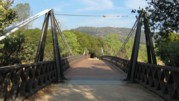
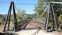
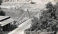
| Bridgemeister ID: | 52 (added before 2003) |
| Year Completed: | 1856 |
| Name: | Bidwell Bar |
| Location: | Oroville, California, USA |
| Crossing: | Feather River |
| Coordinates: | 39.537483 N 121.45415 W |
| Maps: | Acme, GeoHack, Google, OpenStreetMap |
| Principals: | Bidwell Bridge Co. |
| References: | BPL, DSL200106, LACE |
| Use: | Vehicular (one-lane) |
| Status: | Restricted to foot traffic (last checked: 2020) |
| Main Cables: | Wire (iron) |
| Suspended Spans: | 1 |
| Main Span: | 1 x 67.1 meters (220 feet) estimated |
Notes:
- Dismantled before completion of Oroville Dam and replaced by the 1965 high-level Bidwell Bar suspension bridge. The 1856 structure was later reassembled about 1.5 miles south of the new Bidwell Bar bridge. Coordinates provided here are for the current location of the bridge at Kelly Ridge.
- Replaced by 1965 Bidwell Bar - Oroville, California, USA.
External Links:
1856: Westmoreland's
Lancha Plana, California, USA - Mokelumne River
| Bridgemeister ID: | 1089 (added 2004-01-01) |
| Year Completed: | 1856 |
| Name: | Westmoreland's |
| Location: | Lancha Plana, California, USA |
| Crossing: | Mokelumne River |
| References: | DSL200106 |
| Status: | Inundated |
| Main Cables: | Wire (iron) |
Notes:
- Towers and cables were still standing in the 1940s. The location, including the entire former settlement of Lancha Plana, was inundated by the creation of the Camanche Reservoir in 1963. Unclear if remnants are still present (as is the case for some other inundated 19th-century California suspension bridges).
1860: Auburn-Coloma
Auburn and Coloma, California, USA - North Fork American River
| Bridgemeister ID: | 274 (added before 2003) |
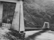
| Year Completed: | 1860 |
| Name: | Auburn-Coloma |
| Location: | Auburn and Coloma, California, USA |
| Crossing: | North Fork American River |
| Principals: | John Mollett |
| References: | PTS2 |
| Use: | Vehicular (one-lane) |
| Status: | Removed |
| Main Cables: | Wire (iron) |
| Suspended Spans: | 1 |
Notes:
- 1865 and 1866 are sometimes cited as the year of completion for this bridge.
- Replaced by 1929 Auburn-Coloma - Auburn and Coloma, California, USA.
1861: Weitchpec
Weitchpec, California, USA - Klamath River
| Bridgemeister ID: | 1090 (added 2004-01-01) |
| Year Completed: | 1861 |
| Name: | Weitchpec |
| Location: | Weitchpec, California, USA |
| Crossing: | Klamath River |
| Principals: | Andrew S. Hallidie |
| References: | DSL200106 |
| Use: | Vehicular |
| Status: | Removed |
| Main Cables: | Wire (iron) |
| Suspended Spans: | 1 |
Notes:
1862: (suspension bridge)
California, USA - Trinity River
| Bridgemeister ID: | 1093 (added 2004-01-01) |
| Year Completed: | 1862 |
| Name: | (suspension bridge) |
| Location: | California, USA |
| Crossing: | Trinity River |
| Principals: | Andrew S. Hallidie |
| References: | DSL200106 |
| Status: | Removed |
| Main Cables: | Wire (iron) |
1862: (suspension bridge)
California, USA - Stanislaus River
| Bridgemeister ID: | 1094 (added 2004-01-01) |
| Year Completed: | 1862 |
| Name: | (suspension bridge) |
| Location: | California, USA |
| Crossing: | Stanislaus River |
| Principals: | Andrew S. Hallidie |
| References: | DSL200106 |
| Status: | Removed |
| Main Cables: | Wire (iron) |
1862: (suspension bridge)
California, USA - Tuolumne River
| Bridgemeister ID: | 1095 (added 2004-01-01) |
| Year Completed: | 1862 |
| Name: | (suspension bridge) |
| Location: | California, USA |
| Crossing: | Tuolumne River |
| Principals: | Andrew S. Hallidie |
| References: | DSL200106 |
| Status: | Removed |
| Main Cables: | Wire |
1862: (suspension bridge)
McCourtney's Crossing, California, USA - Bear River
| Bridgemeister ID: | 1092 (added 2004-01-01) |
| Year Completed: | 1862 |
| Name: | (suspension bridge) |
| Location: | McCourtney's Crossing, California, USA |
| Crossing: | Bear River |
| Principals: | Andrew S. Hallidie |
| References: | DSL200106 |
| Status: | Removed |
| Main Cables: | Wire (iron) |
1862: Pine Street
Nevada City, California, USA - Deer Creek
| Bridgemeister ID: | 62 (added before 2003) |
| Year Completed: | 1862 |
| Name: | Pine Street |
| Location: | Nevada City, California, USA |
| Crossing: | Deer Creek |
| Principals: | Andrew S. Hallidie |
| References: | DSL200106 |
| Use: | Vehicular (one-lane) |
| Status: | Removed |
| Main Cables: | Wire (iron) |
| Suspended Spans: | 1 |
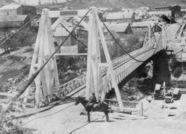
1862: Rattlesnake Bar
Folsom vicinity, California, USA - American River
| Bridgemeister ID: | 1091 (added 2004-01-01) |
| Year Completed: | 1862 |
| Name: | Rattlesnake Bar |
| Location: | Folsom vicinity, California, USA |
| Crossing: | American River |
| At or Near Feature: | Rattlesnake Bar |
| Coordinates: | 38.814397 N 121.091726 W |
| Maps: | Acme, GeoHack, Google, OpenStreetMap |
| Principals: | Andrew S. Hallidie |
| References: | DSL200106 |
| Use: | Vehicular (one-lane) |
| Status: | Collapsed, December 21, 1954 |
| Main Cables: | Wire (iron) |
| Suspended Spans: | 1 |
Notes:
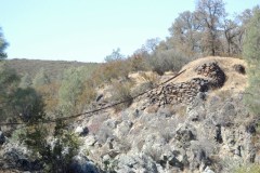
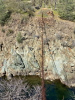
- The location of Rattlesnake Bar is closer to present-day Auburn than Folsom, near the location of Goose Flat marked on modern topographical maps of the region. The area was inundated during the creation of Folsom Lake, but the piers and abutments of the Rattlesnake Bar bridge are visible when the water level is low.
- Rodi Lee writes: "[The bridge] collapsed in 1954 when an overweight truck filled with manure crossed it. The driver was unhurt. There are newspaper articles about the incident (Auburn Journal, Auburn). There are some photos in the article as well. The bridge abutments show when the the lake water is low. The bridge was upstream of Wild Goose Flats."
- See 1855 Whiskey Bar (Pioneer, Whisky) - El Dorado County, California, USA. The cables of the Rattlesnake Bar bridge were reportedly reused from the damaged Whiskey Bar bridge.
External Links:
- 1057. The Suspension Bridge over the American River at Rattlesnake Bar, Placer County - Calisphere.org
- Rattlesnake Bridge - Christine's Blog. Several images of the remnants of the bridge.
1863: Lamb's
Latrobe vicinity and Plymouth vicinity, California, USA - Cosumnes River
| Bridgemeister ID: | 2117 (added 2006-09-10) |
| Year Completed: | 1863 |
| Name: | Lamb's |
| Location: | Latrobe vicinity and Plymouth vicinity, California, USA |
| Crossing: | Cosumnes River |
| Coordinates: | 38.52222 N 120.95587 W |
| Maps: | Acme, GeoHack, Google, OpenStreetMap |
| Use: | Vehicular (one-lane) |
| Status: | Derelict (last checked: 2020) |
| Main Cables: | Wire (iron) |
| Suspended Spans: | 1 |
Notes:
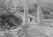
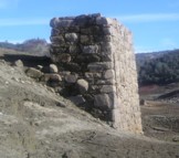
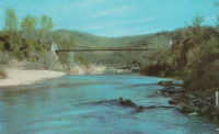
- The location coordinates provided here are the approximate location of this bridge, crossing the Cosumnes between present day El Dorado and Amador counties at Michigan Bar (as named on USGS topographical maps) on current Latrobe Road where Clark Creek meets the Cosumnes River. Note that USGS topographical maps show another, more prominently marked, "Michigan Bar" a few miles west in Sacramento County.
- A California Highways and Public Works article (unsure of exact citation but it may be the article on the history of California bridges that appeared in the 1941 June issue and was reprinted in the 1950 September/October issue) says "there were four [suspension bridges] on the Cosumnes River, one of which (Lamb's Bridge on the Latrobe-Plymouth Road) killed one man and seven horses when it fell in 1869."
- The October 14, 1976 edition of The Mountain Democrat Times (Placerville, California) has an article about the nearby Huse Bridge (from the Heritage Association of El Dorado) which mentions Lamb's Bridge: "...Lamb's Bridge, several miles downriver, was reconstructed in 1872 and was also a wire bridge of the same type [as Huse's]."
- The Statutes of California passed at the Fourteenth Session of the Legislature, 1863 records: "Chapter XLI. An Act to grant to Larkin Lamb and his Associates the right to construct and maintain a Toll Bridge across the Cosumnes River, in the Counties of Amador and El Dorado. Approved March 6, 1863. The People of the State of California, represented in Senate and Assembly, do enact as follows: Section 1. Larkin Lamb, and those he may associate with him, their heirs and assigns, shall have full power to build, erect, construct, and maintain a public toll bridge across the Cosumnes River, at a point about eighty (80) rods below Dutch Hill;..."
- A November 12, 2017 article in Ledger Dispatch (of Amador and Calaveras counties) titled "Vestiges of Amador-Communities Along the Cosumnes, Part VI: The Lower Reaches - Michigan Bar to Wisconsin Bar" by Deborah Coleen Cook gives a more complete history of Lamb's bridge citing the enactment (February 9, 1863) of the bill to permit construction, construction completing six months later, failure of one of the cables in 1869 under the weight of a large freight wagon, and another cable/anchorage failure in 1872 while the bridge was undergoing major repairs.
- See 1852 Huse - Yeomet, California, USA.
- See 1852 Wilson's - Cosumne, California, USA.
1867: Mosquito Road
Placerville, California, USA - South Fork American River
| Bridgemeister ID: | 2323 (added 2007-05-06) |
| Year Completed: | 1867 |
| Name: | Mosquito Road |
| Location: | Placerville, California, USA |
| Crossing: | South Fork American River |
| Coordinates: | 38.775791 N 120.748441 W |
| Maps: | Acme, GeoHack, Google, OpenStreetMap |
| Use: | Vehicular |
| Status: | Replaced |
| Main Cables: | Wire |
Notes:
- The February 23, 1995 edition of the Mountain Democrat (Placerville, California) has an article about the Mosquito crossing that mentions: "According to the El Dorado County History of 1883 by Paolo Sioli, 'Mosquito is connected to Placerville by a good wagon-road and a suspension bridge across the South Fork of the American River, a trail is running in the direction of Kelsey, the township center... The original bridge was constructed in 1867, and according to Orval Beckett, as quoted in the booklet, Mosquito Memories, 'This original bridge had no banisters on the sides. It was a suspension cable with No. 9 telephone wires strung between the supports. When you drove onto the bridge, it would 'swing and sway' much like we have seen in the movies. When one end went down the other went up, etc. Imagine the thrill!'"
- Replaced by 1939 Mosquito Road - Placerville, California, USA.
1875: Swinging
Arroyo Grande, California, USA - Arroyo Grande Creek
| Bridgemeister ID: | 307 (added before 2003) |
| Year Completed: | 1875 |
| Name: | Swinging |
| Location: | Arroyo Grande, California, USA |
| Crossing: | Arroyo Grande Creek |
| Coordinates: | 35.12336 N 120.57703 W |
| Maps: | Acme, GeoHack, Google, OpenStreetMap |
| Principals: | Newton Short |
| Use: | Footbridge |
| Status: | In use (last checked: 2007) |
| Main Cables: | Wire |
| Suspended Spans: | 1 |
| Main Span: | 1 x 52.1 meters (171 feet) |
Notes:
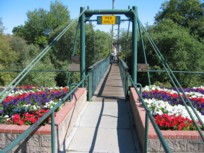
- A rotary club plaque at the bridge reads, "To connect his properties, Newton Short built this swinging bridge without sides about 1875. Sides were added after 1902. The bridge was given to the City of Arroyo Grande on July 14, 1911,... Due to severe storm damage, the bridge was rebuilt in 1995."
1877: Cottaneva
Cottaneva Creek, Rockport, California, USA - Rockport Bay, Pacific Ocean
| Bridgemeister ID: | 1152 (added 2004-01-18) |
| Year Completed: | 1877 |
| Name: | Cottaneva |
| Location: | Cottaneva Creek, Rockport, California, USA |
| Crossing: | Rockport Bay, Pacific Ocean |
| Coordinates: | 39.736703 N 123.832585 W |
| Maps: | Acme, GeoHack, Google, OpenStreetMap |
| Principals: | Pacific Bridge Co. |
| References: | AAJ |
| Use: | Vehicular (one-lane) |
| Status: | Removed |
| Main Cables: | Wire (iron) |
| Suspended Spans: | 1 |
| Main Span: | 1 x 82.3 meters (270 feet) |
Notes:
- This bridge was part of the Rockport lumber mill (Mendocino County). The bridge stretched over ocean to a large rock in the bay.
- Jakkula cites two sources describing the cables as steel.
- Don Sayenga transcribed one of Jakkula's references, The Iron Age Volume XX , No. 3 (August 2, 1877) Page 1: "A Steel Wire Suspension Bridge In California"
The Pacific Bridge Company are building in Mendocino county, California at Cottoneva, a suspension bridge which is described as follows "The distance from center to center of the saddles on the towers is 270 feet. The deflection or fall of the cable is 23 feet 6 inches. The cables are built in the same manner as those of the Clifton bridge at Niagara. The steel wire is about No. 11 Birmingham gauge, and is protected against rust by immersing in a bath which it a fine coat of zinc. There are eleven wires in each strand, seven strands in each rope, and seven ropes in each cable. The ropes are not twisted together to form the cable but gathered up every six feet by the suspender bands. Each rope is warranted to bear a strain of 60 tons. It is made fast to an independent anchor bar, 1 by 3 inches in diameter, and forming links 18 feet long, until connection is made with the anchors. The anchors are of cast iron, 3-1/2 by 3 feet in surface, weigh 1000 pounds each, and are placed 14 feet below the surface of the rock. Great care was taken in securing the anchors in place by means of cross I beams which run under the rock on either side. The lower part of each pit was enlarged to so as to form a hemispherical chamber, and the rock work, set in Portland cement, which is built upon the anchor, is so constructed that the upward strain is transmitted to the sides. The towers are of red wood. There are four posts 10 x 10 inches and two 10 x 12 inches, giving an effective area of 640 inches to withstand the strain of the cables on the tower. The wooden truss to prevent vertical vibration is 8 feet high and of the Howe truss pattern. The 270 feet of the bridge is divided into 45 pannels. The longest suspenders, 44 in number are of 7/8 inch steel wire, the 42 shorter ones are of 1-1/8 inch solid iron. The estimated dead load of the bridge is 1000 pounds per linear foot; live load, one ton per linear foot; in all, one and one half tons, or one fifth of actual breaking load. The bridge will be completed in about 30 days and promises to be a structure which the builders may well be proud of."
Don writes: "[In] Jakkula's last citation, he is saying that this is factory-made wire rope... The construction of the wire rope (7 by 11) used in the main cables is not common for the USA as of 1877; in fact it is extremely uncommon. The wire ropes used at Clifton/Niagara were made in England -- it wouldn't surprise me if these were made in England too."
1890: (flume bridge)
Trimmer, California, USA - Kings River
| Bridgemeister ID: | 3351 (added 2019-12-14) |
| Year Completed: | 1890 |
| Name: | (flume bridge) |
| Location: | Trimmer, California, USA |
| Crossing: | Kings River |
| Principals: | Pacific Bridge Co. |
| Use: | Flume |
| Status: | Removed |
| Main Cables: | Wire |
Notes:
- Large suspension bridge carrying a flume to transport lumber for the Kings River Lumber Company of Sanger, California.
1891: (suspension bridge)
San Francisco, California, USA - South Drive
| Bridgemeister ID: | 98 (added before 2003) |
| Year Completed: | 1891 |
| Name: | (suspension bridge) |
| Location: | San Francisco, California, USA |
| Crossing: | South Drive |
| At or Near Feature: | Golden Gate Park |
| Principals: | John A. Roebling's Sons Co. |
| Use: | Footbridge |
| Status: | Removed |
| Main Cables: | Wire |
| Suspended Spans: | 1 |
Notes:
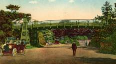
- Small footbridge. Replaced by tunnel by 1900.
1912: Orleans
Orleans, California, USA - Klamath River
| Bridgemeister ID: | 126 (added before 2003) |
| Year Completed: | 1912 |
| Name: | Orleans |
| Location: | Orleans, California, USA |
| Crossing: | Klamath River |
| Use: | Vehicular (one-lane) |
| Status: | Destroyed, 1936? |
| Main Cables: | Wire |
Notes:
- Some accounts state this bridge was destroyed by fire in 1921. A brief mention in the July 18, 1926 edition of The Fresno Bee implies it was destroyed in June of 1926.
- Replaced by 1940 Orleans - Orleans, California, USA.
External Links:
- Catalog Number 1983/001/SBPM01034 - Sacramento Bee. This "Center for Sacramento History" catalog entry suggests the bridge survived until 1936. Given the bridge was ultimately replaced in 1940, this later date makes more sense than some of the earlier claims of it being destroyed in the 1920s unless there were some intermediate reconstructions.
- Klamath River at Orleans - California State Library. This image shows a bridge of similar construction but apparently shorter span than the other images linked here. However, matching buildings seen in the background of multiple images place it at the same location. Given the muddled suspension bridge chronology at this location and frequency of Klamath River floods, it seems likely there were multiple reconstructions of this bridge.
- Orleans Bridge 1910 - California State Library. Image purporting to be the Orleans bridge under construction in 1910, but it does not appear to be the same location.
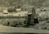
1912: Spruce Street
Hillcrest, San Diego, California, USA - Kate Sessions Canyon
| Bridgemeister ID: | 635 (added 2003-01-20) |
| Year Completed: | 1912 |
| Name: | Spruce Street |
| Location: | Hillcrest, San Diego, California, USA |
| Crossing: | Kate Sessions Canyon |
| At or Near Feature: | Bankers Hill Canyon |
| Coordinates: | 32.73878 N 117.16541 W |
| Maps: | Acme, GeoHack, Google, OpenStreetMap |
| Principals: | Edwin Capp |
| Use: | Footbridge |
| Status: | In use (last checked: 2021) |
| Main Cables: | Wire (steel) |
| Suspended Spans: | 2 |
| Main Span: | 1 x 91.4 meters (300 feet) |
| Side Span: | 1 |
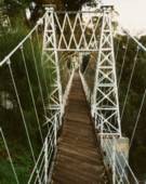
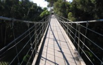
1913: South Fork Mule
Hyampom vicinity, California, USA - South Fork Trinity River
| Bridgemeister ID: | 1993 (added 2005-12-10) |
| Year Completed: | 1913 |
| Name: | South Fork Mule |
| Also Known As: | Limestairs |
| Location: | Hyampom vicinity, California, USA |
| Crossing: | South Fork Trinity River |
| At or Near Feature: | Six Rivers National Forest |
| Coordinates: | 40.719083 N 123.523217 W |
| Maps: | Acme, GeoHack, Google, OpenStreetMap |
| Use: | Footbridge |
| Status: | In use (last checked: 2013) |
| Main Cables: | Wire (steel) |
| Suspended Spans: | 1 |
Notes:
- 2006: The bridge is closed. Marilyn Renaker of the "Committee to Save the Mule Bridge" writes in late August, 2006: "Trinity County and the Forest Service would like to abandon the Mule Bridge. Hyampom had a town meeting about this and everyone was opposed to the removal of the bridge which has been a part of our community since 1913."
- 2010: Multi-year repair and reconstruction project started.
- 2013: Bridge is reopened.
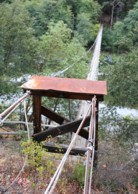
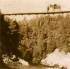
1914: Scotia-Rio Dell
Scotia and Rio Dell, California, USA - Eel River
| Bridgemeister ID: | 1150 (added 2004-01-18) |
| Year Completed: | 1914 |
| Name: | Scotia-Rio Dell |
| Location: | Scotia and Rio Dell, California, USA |
| Crossing: | Eel River |
| Use: | Vehicular (one-lane) |
| Status: | Destroyed, 1915 |
| Main Cables: | Wire |
| Suspended Spans: | 1 |
| Main Span: | 1 |
Notes:
- 1915: Destroyed by flood.
1917: Alderpoint
Alderpoint, California, USA - North Fork Eel River
| Bridgemeister ID: | 2232 (added 2007-03-19) |
| Year Completed: | 1917 |
| Name: | Alderpoint |
| Location: | Alderpoint, California, USA |
| Crossing: | North Fork Eel River |
| Coordinates: | 40.173364 N 123.603832 W |
| Maps: | Acme, GeoHack, Google, OpenStreetMap |
| Use: | Vehicular (one-lane) |
| Status: | Demolished, November, 1972 |
| Main Cables: | Wire (steel) |
| Suspended Spans: | 1 |
Notes:
- The Sunday November 5, 1972 edition of The Times Standard (Eureka, California) has three photos of the bridge collapsing. The caption is "Old Alderpoint Bridge Crashes into River." It continues: "Cables, securing the old Alderpoint Bridge across the North Fork of the Eel River, were cut Friday to send the structure splashing to the feet of the new concrete span that is replacing it. The $1-million new bridge was dedicated Saturday. The old suspension bridge was constructed in 1917."
- Coordinates are for the present-day (2021) bridge at this location. The suspension bridge was immediately adjacent.
1920: (suspension bridge)
Petrolia vicinity, California, USA - Mattole River
| Bridgemeister ID: | 4932 (added 2020-08-01) |
| Year Completed: | 1920 |
| Name: | (suspension bridge) |
| Location: | Petrolia vicinity, California, USA |
| Crossing: | Mattole River |
| Coordinates: | 40.276827 N 124.242913 W |
| Maps: | Acme, GeoHack, Google, OpenStreetMap |
| Use: | Vehicular |
| Status: | Replaced, 1974 |
| Main Cables: | Wire (steel) |
Notes:
- The June 29, 1974 edition of The Times-Standard of Eureka, California ran an article "Petrolia plans dedication" describing a new bridge dedicated to Elwyn "Ole" Lindley located 4.6 miles east of Petrolia: "the new re-enforced concrete girder with four bays replaced an old cable suspension bridge built in 1920." There is no other mention of the suspension bridge in the article. The location indicated by the coordinates given here is the location of the present day (2020) Lindley bridge crossing the Mattole River. It is unclear if this was the same Petrolia-area suspension bridge dismantled in 1962.
- See (suspension bridge) - Petrolia, California, USA. This entry may represent the same bridge.
1920: Fort Seward
Fort Seward, California, USA - Eel River
| Bridgemeister ID: | 5671 (added 2021-01-30) |
| Year Completed: | 1920 |
| Name: | Fort Seward |
| Location: | Fort Seward, California, USA |
| Crossing: | Eel River |
| Coordinates: | 40.227599 N 123.646996 W |
| Maps: | Acme, GeoHack, Google, OpenStreetMap |
| Use: | Vehicular (one-lane) |
| Status: | Removed |
| Main Cables: | Wire (steel) |
External Links:
1925: A.A. Hadley
Honeydew vicinity, California, USA - Mattole River
| Bridgemeister ID: | 589 (added 2003-01-05) |
| Year Completed: | 1925 |
| Name: | A.A. Hadley |
| Also Known As: | Mattole River, Lindley |
| Location: | Honeydew vicinity, California, USA |
| Crossing: | Mattole River |
| Coordinates: | 40.25 N 124.165 W |
| Maps: | Acme, GeoHack, Google, OpenStreetMap |
| Use: | Vehicular (one-lane) |
| Status: | In use (last checked: 2004) |
| Main Cables: | Wire (steel) |
| Suspended Spans: | 1 |
External Links:
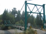
1925: Blair Grove
Miranda vicinity, California, USA - South Fok Eel River
| Bridgemeister ID: | 5667 (added 2021-01-30) |
| Year Completed: | 1925 |
| Name: | Blair Grove |
| Location: | Miranda vicinity, California, USA |
| Crossing: | South Fok Eel River |
| Coordinates: | 40.258954 N 123.841625 W |
| Maps: | Acme, GeoHack, Google, OpenStreetMap |
| Use: | Vehicular (one-lane) |
| Status: | Removed |
| Main Cables: | Wire (steel) |
| Main Span: | 1 |
Notes:
- May have been completed 1923-1924. Coordinates represent the suspected former location of this bridge.
- See 1925 A.A. Hadley (Mattole River, Lindley) - Honeydew vicinity, California, USA. The towers of the Blair Grove and Hadley bridges appear identical.
External Links:
1928: Colfax-Iowa Hill
Colfax vicinity, California, USA - North Fork American River
| Bridgemeister ID: | 588 (added 2003-01-05) |
| Year Completed: | 1928 |
| Name: | Colfax-Iowa Hill |
| Location: | Colfax vicinity, California, USA |
| Crossing: | North Fork American River |
| Coordinates: | 39.09993 N 120.92480 W |
| Maps: | Acme, GeoHack, Google, OpenStreetMap |
| Use: | Vehicular (one-lane) |
| Status: | Restricted to foot traffic (last checked: 2021) |
| Main Cables: | Wire (steel) |
| Suspended Spans: | 1 |
Notes:
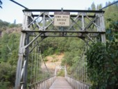
1929: Auburn-Coloma
Auburn and Coloma, California, USA - North Fork American River
| Bridgemeister ID: | 1624 (added 2005-02-27) |
| Year Completed: | 1929 |
| Name: | Auburn-Coloma |
| Location: | Auburn and Coloma, California, USA |
| Crossing: | North Fork American River |
| Principals: | Smith Brothers |
| Use: | Vehicular (one-lane) |
| Status: | Replaced, 1948 |
| Main Cables: | Wire |
| Suspended Spans: | 1 |
Notes:

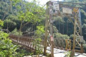
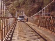
1930: Colfax-Foresthill
Yankee Jims, Colfax vicinity, California, USA - North Fork American River
| Bridgemeister ID: | 165 (added before 2003) |
| Year Completed: | 1930 |
| Name: | Colfax-Foresthill |
| Also Known As: | Yankee Jims |
| Location: | Yankee Jims, Colfax vicinity, California, USA |
| Crossing: | North Fork American River |
| Coordinates: | 39.040306 N 120.902667 W |
| Maps: | Acme, GeoHack, Google, OpenStreetMap |
| Use: | Vehicular (one-lane) |
| Status: | In use (last checked: 2023) |
| Main Cables: | Wire (steel) |
| Suspended Spans: | 1 |
| Main Span: | 1 x 53 meters (173.9 feet) estimated |
Notes:
- 2023: Replacement announced. The suspension bridge will be preserved and remain in place.
- Companion to 1928 Colfax-Iowa Hill - Colfax vicinity, California, USA.
External Links:
- Facebook - Placer County Government. Video discussing the history of the bridge and planned replacement project.
- Structurae - Structure ID 20011089
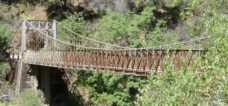
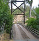
1930: Horse Creek
Horse Creek, California, USA - Klamath River
| Bridgemeister ID: | 586 (added 2003-01-05) |
| Year Completed: | 1930 |
| Name: | Horse Creek |
| Location: | Horse Creek, California, USA |
| Crossing: | Klamath River |
| Coordinates: | 41.824678 N 122.997667 W |
| Maps: | Acme, GeoHack, Google, OpenStreetMap |
| Use: | Vehicular (one-lane) |
| Status: | In use (last checked: 2012) |
| Main Cables: | Wire (steel) |
| Suspended Spans: | 1 |
Notes:
External Links:
1932: (suspension bridge)
Placer County and El Dorado County, California, USA - Rubicon River
| Bridgemeister ID: | 5595 (added 2020-12-23) |
| Year Completed: | 1932 |
| Name: | (suspension bridge) |
| Location: | Placer County and El Dorado County, California, USA |
| Crossing: | Rubicon River |
| Coordinates: | 38.984847 N 120.694431 W |
| Maps: | Acme, GeoHack, Google, OpenStreetMap |
| Principals: | John Lawrence, US Forest Service |
| Use: | Vehicular (one-lane) |
| Status: | Derelict, since 1965 (last checked: 2020) |
| Main Cables: | Wire (steel) |
| Suspended Spans: | 1 |
| Main Span: | 1 x 48.8 meters (160 feet) |
Notes:
- Damaged by flood resulting from Hell Hole Dam failure in 1965. Never repaired.
- The September 30, 1932 edition of The Mountain Democrat (of Placerville, California) describes how a high line cable hanging 240 feet above the bridge site to transport people and material to the bridge site since the road (a now abandoned section of the Rubicon Road) had not been built yet: "They have a cable (Mr. Lawrence calls it a high-line") stretched across the Rubicon canyon a distance of more than 1100 feet. The cable has a "sag" of 165 feet, and some 240 feet straight down from the middle of the cable is the site of the 160-foot suspension bridge. And so, when a bridge worker goes to work, he climbs into a wooden cage, which travels out on the high-line until it is directly over the bridge site, and then the cage descends to the bottom of the canyon." About the bridge: "And that was no easy job, for the bridge is of the suspension type, has a 160-foot span, has one traffic lane and is designed to support a fifteen ton load."
External Links:
1933: (suspension bridge)
Happy Camp vicinity, California, USA - Klamath River
| Bridgemeister ID: | 1011 (added 2003-11-21) |
| Year Completed: | 1933 |
| Name: | (suspension bridge) |
| Location: | Happy Camp vicinity, California, USA |
| Crossing: | Klamath River |
| Principals: | WPA |
| References: | AAJ |
| Use: | Vehicular (one-lane) |
| Status: | Dismantled |
| Main Cables: | Wire (steel) |
| Suspended Spans: | 1 |
| Main Span: | 1 x 91.4 meters (300 feet) |
Notes:
- Moved to Cassidy - Sierra National Forest, California, USA. The bridge was disassembled, shortened, and relocated in the 1950's to the Ansel Adams Wilderness, Minarets Ranger District, Sierra National Forest, California as the "Cassidy" suspension bridge.
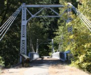
1933: Sims
Sims, California, USA - Sacramento River
| Bridgemeister ID: | 650 (added 2003-02-22) |
| Year Completed: | 1933 |
| Name: | Sims |
| Also Known As: | CCC |
| Location: | Sims, California, USA |
| Crossing: | Sacramento River |
| At or Near Feature: | Sims Camp |
| Coordinates: | 41.063433 N 122.360067 W |
| Maps: | Acme, GeoHack, Google, OpenStreetMap |
| Principals: | Raymond Huber, Civilian Conservation Corps |
| References: | AAJ |
| Use: | Vehicular (one-lane) |
| Status: | Restricted to foot traffic (last checked: 2021) |
| Main Cables: | Wire (steel) |
| Suspended Spans: | 1 |
| Main Span: | 1 x 48.8 meters (160 feet) |
Notes:
- CCC is "Civilian Conservation Corps".
1934: (footbridge)
Green Valley vicinity, California, USA - Bouquet Reservoir
| Bridgemeister ID: | 1890 (added 2005-10-01) |
| Year Completed: | 1934 |
| Name: | (footbridge) |
| Location: | Green Valley vicinity, California, USA |
| Crossing: | Bouquet Reservoir |
| References: | CE193408 |
| Use: | Footbridge |
| Status: | Removed |
| Main Cables: | Wire (steel) |
| Main Span: | 1 x 61 meters (200 feet) |
Notes:
- CE193408: "A bridge 276 ft long, consisting of a 200-ft suspension span and two equal shore spans, connects the [gate control] tower with the shore. The suspended span is supported by two prestressed cable strands and by arc-welded structural steel stiffening trusses." Article includes photo of the bridge and tower.
- Access bridge for the Bouquet Reservoir gate control tower. Likely completed 1933 or 1934.
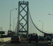
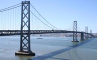
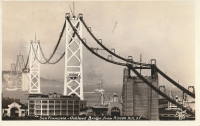
1936: San Francisco-Oakland Bay
Oakland and San Francisco, California, USA - San Francisco Bay
| Bridgemeister ID: | 184 (added before 2003) |
| Year Completed: | 1936 |
| Name: | San Francisco-Oakland Bay |
| Location: | Oakland and San Francisco, California, USA |
| Crossing: | San Francisco Bay |
| Coordinates: | 37.78667 N 122.39 W |
| Maps: | Acme, GeoHack, Google, OpenStreetMap |
| Principals: | C.H. Purcell, Glenn B. Woodruff |
| References: | AAJ, AZB, BAAW, BC3, BPL, GBD, LAB, OBB1, SFOM, USS |
| Use: | Vehicular (double-deck) |
| Status: | In use (last checked: 2022) |
| Main Cables: | Wire (steel) |
| Suspended Spans: | 6 |
| Main Spans: | 1 x 678 meters (2,224.4 feet), 1 x 673.6 meters (2,210 feet) |
| Side Spans: | 4 |
| Deck width: | 66 feet (58 feet roadway) |
Notes:
External Links:

1937: (suspension bridge)
Briceburg, California, USA - Merced River
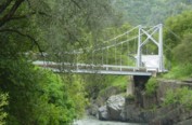
| Bridgemeister ID: | 642 (added 2003-02-16) |
| Year Completed: | 1937 |
| Name: | (suspension bridge) |
| Location: | Briceburg, California, USA |
| Crossing: | Merced River |
| Coordinates: | 37.604833 N 119.9669 W |
| Maps: | Acme, GeoHack, Google, OpenStreetMap |
| Use: | Vehicular (one-lane) |
| Status: | In use (last checked: 2016) |
| Main Cables: | Wire (steel) |
| Suspended Spans: | 1 |
Notes:
- Damaged by flood, 1999, when river level rose to approximately four feet above the bridge deck.

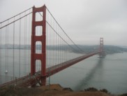
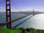
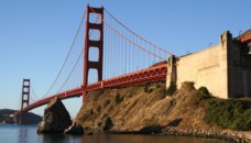
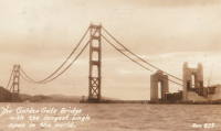
1937: Golden Gate
San Francisco and Marin County, California, USA - San Francisco Bay
| Bridgemeister ID: | 188 (added before 2003) |
| Year Completed: | 1937 |
| Name: | Golden Gate |
| Location: | San Francisco and Marin County, California, USA |
| Crossing: | San Francisco Bay |
| Coordinates: | 37.82 N 122.47667 W |
| Maps: | Acme, GeoHack, Google, OpenStreetMap |
| Principals: | Joseph B. Strauss, Leon Moisseiff, Charles A. Ellis, Irving F. Morrow |
| References: | AAJ, AZB, BAAW, BBR, BC3, BFL, BLD, BMA, BOU, BPL, BRU, COB, CTW, GAT, GBD, GGB, LAB, SPG |
| Use: | Vehicular (major highway), with walkway |
| Status: | In use (last checked: 2022) |
| Main Cables: | Wire (steel) |
| Suspended Spans: | 3 |
| Main Span: | 1 x 1,280.2 meters (4,200 feet) |
| Side Spans: | 2 x 343 meters (1,125.41 feet) |
| Deck width: | 80 feet |
Notes:
- Became longest suspension bridge by eclipsing 1931 George Washington (GWB) - New York, New York and Fort Lee, New Jersey, USA.
- Eclipsed by new longest suspension bridge 1964 Verrazzano Narrows (Verrazano Narrows) - Brooklyn and Staten Island, New York, USA.
External Links:

1938: Buker
Scott Bar vicinity, California, USA - Scott River
| Bridgemeister ID: | 581 (added 2003-01-01) |
| Year Completed: | 1938 |
| Name: | Buker |
| Also Known As: | Canyon Creek, Scott River |
| Location: | Scott Bar vicinity, California, USA |
| Crossing: | Scott River |
| At or Near Feature: | Klamath National Forest |
| Coordinates: | 41.63408 N 123.10570 W |
| Maps: | Acme, GeoHack, Google, OpenStreetMap |
| Use: | Vehicular (one-lane) |
| Status: | In use |
| Main Cables: | Wire (steel) |
| Suspended Spans: | 1 |
Notes:
- Restored 1998 (per plaque posted on bridge).
External Links:
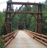
1938: Lake Mathews Outlet Tower
Corona vicinity, California, USA - Lake Mathews
| Bridgemeister ID: | 1891 (added 2005-10-01) |
| Year Completed: | 1938 |
| Name: | Lake Mathews Outlet Tower |
| Location: | Corona vicinity, California, USA |
| Crossing: | Lake Mathews |
| Coordinates: | 33.849279 N 117.455022 W |
| Maps: | Acme, GeoHack, Google, OpenStreetMap |
| References: | CE193806 |
| Use: | Footbridge |
| Status: | Removed |
| Main Cables: | Wire (steel) |
| Suspended Spans: | 1 |
Notes:
- Outlet tower access bridge. Likely completed 1938 with Cajalco (now Lake Matthews) Reservoir construction.
External Links:
- Intake structure of the Colorado River Aqueduct on the Colorado River, June 11, 1941 — Calisphere
- Water and Power Associates - Construction of the Colorado River Aqueduct. Multiple photos of the outlet tower and access bridge.
1939: Mosquito Road
Placerville, California, USA - South Fork American River
| Bridgemeister ID: | 346 (added before 2003) |
| Year Completed: | 1939 |
| Name: | Mosquito Road |
| Location: | Placerville, California, USA |
| Crossing: | South Fork American River |
| Coordinates: | 38.77582 N 120.74854 W |
| Maps: | Acme, GeoHack, Google, OpenStreetMap |
| Use: | Vehicular (one-lane) |
| Status: | In use (last checked: 2021) |
| Main Cables: | Wire (steel) |
| Suspended Spans: | 1 |
Notes:
External Links:

1940: Hawkins Bar
Trinity Village and Hawkins Bar, California, USA - Trinity River
| Bridgemeister ID: | 2343 (added 2007-08-12) |
| Year Completed: | 1940 |
| Name: | Hawkins Bar |
| Location: | Trinity Village and Hawkins Bar, California, USA |
| Crossing: | Trinity River |
| Use: | Vehicular |
| Status: | Removed |
| Main Cables: | Wire |
Notes:
- Deck destroyed by fire 1954. Repaired and reopened, 1956. Bypassed late 1970s or 1980.
- May have been the site of a previous suspension bridge completed 1904.
- See (suspension bridge) - Salyer and Willow Creek, California, USA.
- See (suspension bridge) - Willow Creek vicinity, California, USA.
1940: Orleans
Orleans, California, USA - Klamath River
| Bridgemeister ID: | 197 (added before 2003) |
| Year Completed: | 1940 |
| Name: | Orleans |
| Location: | Orleans, California, USA |
| Crossing: | Klamath River |
| Principals: | C.H. Purcell, Murphy Pacific Co. |
| References: | BPL, WOT |
| Status: | Destroyed, 1965 |
Notes:
- BPL: Washed away during 1965 floods. An article in the September 13, 1966 edition of the Humboldt Standard says it was destroyed by flood in 1964.
- Replaced 1912 Orleans - Orleans, California, USA.
- Replaced by 1967 Orleans - Orleans, California, USA.
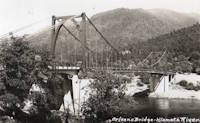
1954: Point Bonita Lighthouse
Golden Gate National Recreation Area, Marin County, California, USA
| Bridgemeister ID: | 882 (added 2003-09-06) |
| Year Completed: | 1954 |
| Name: | Point Bonita Lighthouse |
| Location: | Golden Gate National Recreation Area, Marin County, California, USA |
| Coordinates: | 37.815980 N 122.528878 W |
| Maps: | Acme, GeoHack, Google, OpenStreetMap |
| Use: | Footbridge |
| Status: | Removed |
| Main Cables: | Wire (steel) |
| Suspended Spans: | 1 |
Notes:
- Closed to the public, January 6, 2010. Subsequently removed and replaced.
- Replaced by 2012 Point Bonita Lighthouse - Golden Gate National Recreation Area, Marin County, California, USA.
External Links:
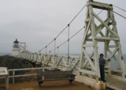
1957: Little Kern River
Golden Trout Wilderness, California, USA - Little Kern River
| Bridgemeister ID: | 2337 (added 2007-08-11) |
| Year Completed: | 1957 |
| Name: | Little Kern River |
| Location: | Golden Trout Wilderness, California, USA |
| Crossing: | Little Kern River |
| Coordinates: | 36.203814 N 118.457612 W |
| Maps: | Acme, GeoHack, Google, OpenStreetMap |
| Use: | Footbridge and Pack |
| Status: | In use (last checked: 2017) |
| Main Cables: | Wire (steel) |
| Suspended Spans: | 1 |
| Main Span: | 1 x 45.7 meters (150 feet) |
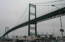
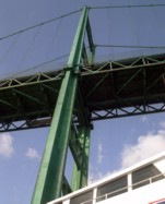
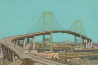
1963: Vincent Thomas
San Pedro, California, USA - Los Angeles Harbor
| Bridgemeister ID: | 217 (added before 2003) |
| Year Completed: | 1963 |
| Name: | Vincent Thomas |
| Also Known As: | San Pedro-Terminal Island |
| Location: | San Pedro, California, USA |
| Crossing: | Los Angeles Harbor |
| Coordinates: | 33.75 N 118.27 W |
| Maps: | Acme, GeoHack, Google, OpenStreetMap |
| Use: | Vehicular (four-lane) |
| Status: | In use (last checked: 2023) |
| Main Cables: | Wire (steel) |
| Suspended Spans: | 3 |
| Main Span: | 1 x 457.2 meters (1,500 feet) |
| Side Spans: | 2 x 154.4 meters (506.5 feet) |
Notes:
- 2023: US$706 million project to replace the bridge's deck expected to start in 2025 and complete in 2027.
External Links:
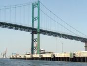

1965: Bidwell Bar
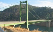
Oroville, California, USA - Feather River
| Bridgemeister ID: | 220 (added before 2003) |
| Year Completed: | 1965 |
| Name: | Bidwell Bar |
| Location: | Oroville, California, USA |
| Crossing: | Feather River |
| At or Near Feature: | Oroville Reservoir |
| Coordinates: | 39.54816 N 121.43006 W |
| Maps: | Acme, GeoHack, Google, OpenStreetMap |
| Principals: | California Department of Water Resources |
| Use: | Vehicular (two-lane, heavy vehicles), with walkway |
| Status: | In use (last checked: 2021) |
| Main Cables: | Wire (steel) |
| Suspended Spans: | 1 |
Notes:
External Links:
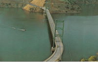
1965: Guy West
Sacramento, California, USA - American River
| Bridgemeister ID: | 221 (added before 2003) |
| Year Completed: | 1965 |
| Name: | Guy West |
| Location: | Sacramento, California, USA |
| Crossing: | American River |
| Coordinates: | 38.562367 N 121.42017 W |
| Maps: | Acme, GeoHack, Google, OpenStreetMap |
| References: | WOT |
| Use: | Footbridge |
| Status: | In use (last checked: 2022) |
| Main Cables: | Wire (steel) |
| Suspended Spans: | 1 |
| Main Span: | 1 x 183 meters (600.4 feet) |
Notes:
- WOT says completed 1968.
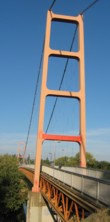
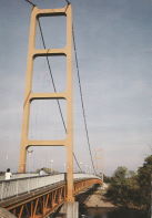
1967: Orleans
Orleans, California, USA - Klamath River
| Bridgemeister ID: | 223 (added before 2003) |
| Year Completed: | 1967 |
| Name: | Orleans |
| Location: | Orleans, California, USA |
| Crossing: | Klamath River |
| Coordinates: | 41.30167 N 123.53333 W |
| Maps: | Acme, GeoHack, Google, OpenStreetMap |
| Principals: | Ostap Bender, A.P. Bezzone, Jr. |
| References: | BCO, BPL, WOT |
| Use: | Vehicular (two-lane, heavy vehicles), with walkway |
| Status: | In use (last checked: 2021) |
| Main Cables: | Wire (steel) |
| Suspended Spans: | 3 |
| Main Span: | 1 x 131.1 meters (430 feet) |
| Side Spans: | 2 |
Notes:
- Replaced 1940 Orleans - Orleans, California, USA.
External Links:
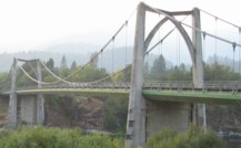
1974: (footbridge)
Hayfork, California, USA - Hayfork Creek
| Bridgemeister ID: | 6707 (added 2021-10-05) |
| Year Completed: | 1974 |
| Name: | (footbridge) |
| Location: | Hayfork, California, USA |
| Crossing: | Hayfork Creek |
| At or Near Feature: | Bar 717 Ranch |
| Coordinates: | 40.628631 N 123.371112 W |
| Maps: | Acme, GeoHack, Google, OpenStreetMap |
| Principals: | Paul Wills, Willy Wills, Ed Clark |
| Use: | Footbridge |
| Status: | In use (last checked: 2021) |
| Main Cables: | Wire (steel) |
| Main Span: | 1 |
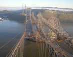
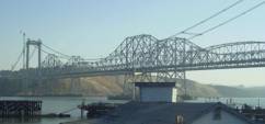
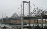
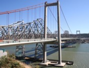
2003: Al Zampa Memorial
Crockett and Vallejo, California, USA - Carquinez Strait
| Bridgemeister ID: | 878 (added 2003-09-01) |
| Year Completed: | 2003 |
| Name: | Al Zampa Memorial |
| Location: | Crockett and Vallejo, California, USA |
| Crossing: | Carquinez Strait |
| Coordinates: | 38.06097 N 122.22639 W |
| Maps: | Acme, GeoHack, Google, OpenStreetMap |
| References: | AZB, BAR |
| Use: | Vehicular (major highway), with walkway |
| Status: | In use (last checked: 2018) |
| Main Cables: | Wire (steel) |
| Suspended Spans: | 3 |
| Main Span: | 1 x 728 meters (2,388.5 feet) |
| Side Spans: | 1 x 181 meters (593.8 feet), 1 x 147 meters (482.3 feet) |
External Links:
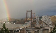
2003: Potwisha
Three Rivers vicinity, California, USA - Middle Fork Kaweah River
| Bridgemeister ID: | 2391 (added 2007-11-20) |
| Year Completed: | 2003 |
| Name: | Potwisha |
| Location: | Three Rivers vicinity, California, USA |
| Crossing: | Middle Fork Kaweah River |
| At or Near Feature: | Sequioa National Park |
| Coordinates: | 36.512310 N 118.800187 W |
| Maps: | Acme, GeoHack, Google, OpenStreetMap |
| Principals: | MCS Construction, Blair, Church & Flynn Consulting Engineers |
| Use: | Footbridge |
| Status: | In use (last checked: 2019) |
| Main Cables: | Wire (steel) |
| Suspended Spans: | 1 |
2006: (footbridge)
Mount Hermon, California, USA - Zayante Creek
| Bridgemeister ID: | 2222 (added 2007-03-15) |
| Year Completed: | 2006 |
| Name: | (footbridge) |
| Location: | Mount Hermon, California, USA |
| Crossing: | Zayante Creek |
| At or Near Feature: | Mount Hermon Christian Conference Center |
| Coordinates: | 37.05149 N 122.06182 W |
| Maps: | Acme, GeoHack, Google, OpenStreetMap |
| Principals: | Sahale, LLC |
| Use: | Footbridge |
| Status: | In use (last checked: 2007) |
| Main Cables: | Wire (steel) |
| Suspended Spans: | 1 |
Notes:
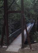
2011: Harbor Drive
San Diego, California, USA
| Bridgemeister ID: | 3252 (added 2019-11-16) |
| Year Completed: | 2011 |
| Name: | Harbor Drive |
| Location: | San Diego, California, USA |
| Coordinates: | 32.705049 N 117.156972 W |
| Maps: | Acme, GeoHack, Google, OpenStreetMap |
| Use: | Footbridge |
| Status: | In use (last checked: 2019) |
| Main Cables: | Wire (steel) |
External Links:
2012: Point Bonita Lighthouse
Golden Gate National Recreation Area, Marin County, California, USA
| Bridgemeister ID: | 4550 (added 2020-05-30) |
| Year Completed: | 2012 |
| Name: | Point Bonita Lighthouse |
| Location: | Golden Gate National Recreation Area, Marin County, California, USA |
| Coordinates: | 37.815823 N 122.529254 W |
| Maps: | Acme, GeoHack, Google, OpenStreetMap |
| Principals: | Flatiron Construction |
| Use: | Footbridge |
| Status: | In use (last checked: 2020) |
| Main Cables: | Wire (steel) |
| Suspended Spans: | 1 |
Notes:
2013: Fleish
Fleish, Mystic vicinity, California, USA - Truckee River
| Bridgemeister ID: | 6144 (added 2021-07-07) |
| Year Completed: | 2013 |
| Name: | Fleish |
| Location: | Fleish, Mystic vicinity, California, USA |
| Crossing: | Truckee River |
| At or Near Feature: | Tahoe-Pyramid Trail |
| Coordinates: | 39.452421 N 120.005687 W |
| Maps: | Acme, GeoHack, Google, OpenStreetMap |
| Use: | Footbridge |
| Status: | In use (last checked: 2021) |
| Main Cables: | Wire (steel) |
| Suspended Spans: | 1 |
Notes:
- Carries the Tahoe-Pyramid trail above the small dam at Fleish.
- Replaced (footbridge) - Fleish, Mystic vicinity, California, USA.
2013: San Francisco-Oakland Bay Eastern Span
Oakland and Yerba Buena Island, California, USA - San Francisco Bay
| Bridgemeister ID: | 2695 (added 2019-05-27) |
| Year Completed: | 2013 |
| Name: | San Francisco-Oakland Bay Eastern Span |
| Location: | Oakland and Yerba Buena Island, California, USA |
| Crossing: | San Francisco Bay |
| Coordinates: | 37.816217 N 122.356859 W |
| Maps: | Acme, GeoHack, Google, OpenStreetMap |
| Use: | Vehicular (major highway) |
| Status: | In use (last checked: 2024) |
| Main Cables: | Wire (steel) |
| Characteristics: | Self-anchored |
Notes:
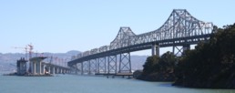
(footbridge)
Annapolis, California, USA - Wheatfield Fork Gualala River
| Bridgemeister ID: | 7672 (added 2023-06-15) |
| Name: | (footbridge) |
| Location: | Annapolis, California, USA |
| Crossing: | Wheatfield Fork Gualala River |
| At or Near Feature: | Camp Liahona Redwoods |
| Coordinates: | 38.678412 N 123.285527 W |
| Maps: | Acme, GeoHack, Google, OpenStreetMap |
| Use: | Footbridge |
| Status: | Extant (last checked: 2019) |
| Main Span: | 1 |
(footbridge)
Burnt Ranch vicinity, California, USA - Trinity River
| Bridgemeister ID: | 2408 (added 2007-12-24) |
| Name: | (footbridge) |
| Location: | Burnt Ranch vicinity, California, USA |
| Crossing: | Trinity River |
| At or Near Feature: | Six Rivers National Forest |
| Use: | Footbridge |
| Status: | Removed |
| Main Cables: | Wire |
| Suspended Spans: | 1 |
Notes:
- Completed 1915-1917, likely removed, 1970s.
- An article in the October 29, 1971 edition of The Times-Standard (Eureka, California) describes this bridge as being located over the Trinity River at New River. USGS topographical maps show a footbridge a few hundred yards north of the intersection of the two rivers at Gray Falls. The article has a photograph of the bridge and describes its possible replacement. The bridge was already closed at the time of the article: "A 50 year-old picturesque footbridge across the Trinity River at New River will be replaced if special funds can be obtained by the Six Rivers Nalional Forest, the federal agency has decided. 'Strong supportive response from people throughout the area to the continued need for a bridge' was reported by Forest Supervisor Bob Allison. The responses came after the Forest Service solicited comments in August on the replacement need for the span. The new bridge would be nearly as possible a replica of the present bridge constructed sometime between 1915 - 1917 by Jim and John Larson. It served as the main link between Denny and the outside world."
(footbridge)
Fleish, Mystic vicinity, California, USA - Truckee River
| Bridgemeister ID: | 1262 (added 2004-03-13) |
| Name: | (footbridge) |
| Location: | Fleish, Mystic vicinity, California, USA |
| Crossing: | Truckee River |
| Coordinates: | 39.452067 N 120.00555 W |
| Maps: | Acme, GeoHack, Google, OpenStreetMap |
| Use: | Footbridge |
| Status: | Replaced, 2013 |
| Main Cables: | Wire (steel) |
| Suspended Spans: | 1 |
| Main Span: | 1 x 61 meters (200 feet) estimated |
Notes:
- Crosses some a spillway just east of I-80 just before I-80 crosses from California to Nevada. North of Mystic in Sierra County.
- Jan Claire sends observations about the structure the bridge crosses: "The dam is a diverter. Water from the Truckee river is diverted into a canal which runs over to Verdi, Nevada at which point it is pumped up and over a hill and down into another river. Because this dam does not appear on the California Department of Water Resources inventory, I assume it is a long-ago-grandfathered dam operated under treaty with the state of Nevada for irrigation purposes. Satellite photos show this diverter-canal runs through what may still be, or probably was, farmland west of Verdi."
- Replaced by 2013 Fleish - Fleish, Mystic vicinity, California, USA.
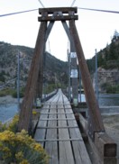
(footbridge)
Hayfork vicinity, California, USA - Hayfork Creek
| Bridgemeister ID: | 2023 (added 2006-02-05) |
| Name: | (footbridge) |
| Location: | Hayfork vicinity, California, USA |
| Crossing: | Hayfork Creek |
| Coordinates: | 40.592680 N 123.262755 W |
| Maps: | Acme, GeoHack, Google, OpenStreetMap |
| Use: | Footbridge |
| Status: | Derelict (last checked: 2007) |
| Main Cables: | Wire |
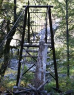
(footbridge)
Hayfork, California, USA - Hayfork Creek
| Bridgemeister ID: | 1480 (added 2004-09-04) |
| Name: | (footbridge) |
| Location: | Hayfork, California, USA |
| Crossing: | Hayfork Creek |
| Coordinates: | 40.552217 N 123.1815 W |
| Maps: | Acme, GeoHack, Google, OpenStreetMap |
| Use: | Footbridge |
| Status: | In use (last checked: 2005) |
| Main Cables: | Wire |
| Suspended Spans: | 1 |
| Main Span: | 1 x 91.4 meters (300 feet) estimated |
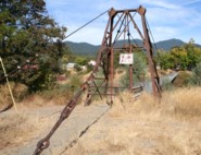
(footbridge)
Horse Creek, California, USA - Klamath River
| Bridgemeister ID: | 585 (added 2003-01-05) |
| Name: | (footbridge) |
| Location: | Horse Creek, California, USA |
| Crossing: | Klamath River |
| Use: | Footbridge |
| Status: | Replaced |
| Main Cables: | Wire |
Notes:
- Replaced by 1930 Horse Creek - Horse Creek, California, USA.
(footbridge)
Michigan Bluff vicinity and Last Chance vicinity, California, USA - North Fork of the Middle Fork American River
| Bridgemeister ID: | 2139 (added 2006-10-28) |
| Name: | (footbridge) |
| Location: | Michigan Bluff vicinity and Last Chance vicinity, California, USA |
| Crossing: | North Fork of the Middle Fork American River |
| At or Near Feature: | Last Chance Trail |
| Coordinates: | 39.10149 N 120.65495 W |
| Maps: | Acme, GeoHack, Google, OpenStreetMap |
| Use: | Footbridge and Pack |
| Status: | In use |
| Main Cables: | Wire (steel) |
| Suspended Spans: | 1 |
(footbridge)
Mount Hermon, California, USA - Bean Creek
| Bridgemeister ID: | 1838 (added 2005-07-03) |
| Name: | (footbridge) |
| Location: | Mount Hermon, California, USA |
| Crossing: | Bean Creek |
| At or Near Feature: | Mount Hermon Christian Conference Center |
| Coordinates: | 37.052667 N 122.06005 W |
| Maps: | Acme, GeoHack, Google, OpenStreetMap |
| Use: | Footbridge |
| Status: | In use (last checked: 2005) |
| Main Cables: | Wire |
| Suspended Spans: | 1 |
| Main Span: | 1 x 25.6 meters (84 feet) |
Notes:
- Near 2006 (footbridge) - Mount Hermon, California, USA.
- Near (footbridge) - Mount Hermon, California, USA.
- Near (footbridge) - Mount Hermon, California, USA.
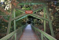
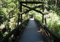
(footbridge)
Mount Hermon, California, USA - Zayante Creek
| Bridgemeister ID: | 1996 (added 2005-12-24) |
| Name: | (footbridge) |
| Location: | Mount Hermon, California, USA |
| Crossing: | Zayante Creek |
| At or Near Feature: | Mount Hermon Christian Conference Center |
| Use: | Footbridge |
| Status: | Replaced (last checked: 2006) |
Notes:
(footbridge)
Mount Hermon, California, USA - Zayante Creek
| Bridgemeister ID: | 2223 (added 2007-03-15) |
| Name: | (footbridge) |
| Location: | Mount Hermon, California, USA |
| Crossing: | Zayante Creek |
| At or Near Feature: | Mount Hermon Christian Conference Center |
| Use: | Footbridge |
| Status: | In use (last checked: 2007) |
| Main Cables: | Wire (steel) |
Notes:
- Near 2006 (footbridge) - Mount Hermon, California, USA.
- Near (footbridge) - Mount Hermon, California, USA.
- Near (footbridge) - Mount Hermon, California, USA.
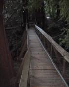
(footbridge)
Salyer vicinity, California, USA - South Fork Trinity River
| Bridgemeister ID: | 7129 (added 2022-06-19) |
| Name: | (footbridge) |
| Location: | Salyer vicinity, California, USA |
| Crossing: | South Fork Trinity River |
| Coordinates: | 40.841942 N 123.567809 W |
| Maps: | Acme, GeoHack, Google, OpenStreetMap |
| Use: | Footbridge |
| Status: | In use (last checked: 2022) |
| Main Cables: | Wire (steel) |
| Suspended Spans: | 1 |
| Main Span: | 1 x 78 meters (255.9 feet) estimated |
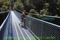
(footbridge)
Zumwalt Meadow, Cedar Grove, California, USA - Kings River
| Bridgemeister ID: | 6525 (added 2021-08-28) |
| Name: | (footbridge) |
| Location: | Zumwalt Meadow, Cedar Grove, California, USA |
| Crossing: | Kings River |
| At or Near Feature: | Sequoia & Kings Canyon National Parks |
| Coordinates: | 36.791148 N 118.600442 W |
| Maps: | Acme, GeoHack, Google, OpenStreetMap |
| Use: | Footbridge |
| Status: | In use (last checked: 2021) |
| Main Cables: | Wire (steel) |
| Main Span: | 1 |
(pipeline bridge)
Blythe, California and Ehrenberg, Arizona, USA - Colorado River
| Bridgemeister ID: | 2522 (added 2010-01-02) |
| Name: | (pipeline bridge) |
| Location: | Blythe, California and Ehrenberg, Arizona, USA |
| Crossing: | Colorado River |
| Coordinates: | 33.60182 N 114.53324 W |
| Maps: | Acme, GeoHack, Google, OpenStreetMap |
| Use: | Pipeline |
| Status: | Extant (last checked: 2010) |
| Main Cables: | Wire (steel) |
| Suspended Spans: | 1 |
(pipeline bridge)
Burbank, California, USA - Los Angeles River
| Bridgemeister ID: | 2523 (added 2010-01-02) |
| Name: | (pipeline bridge) |
| Location: | Burbank, California, USA |
| Crossing: | Los Angeles River |
| Coordinates: | 34.15051 N 118.32908 W |
| Maps: | Acme, GeoHack, Google, OpenStreetMap |
| Use: | Pipeline |
| Status: | Extant (last checked: 2009) |
| Main Cables: | Wire |
| Suspended Spans: | 1 |
(pipeline bridge)
Canyon Country, California, USA - Soledad Canyon
| Bridgemeister ID: | 1259 (added 2004-03-06) |
| Name: | (pipeline bridge) |
| Location: | Canyon Country, California, USA |
| Crossing: | Soledad Canyon |
| Coordinates: | 34.43219 N 118.39074 W |
| Maps: | Acme, GeoHack, Google, OpenStreetMap |
| Use: | Pipeline |
| Status: | In use (last checked: 2007) |
| Main Cables: | Wire (steel) |
| Suspended Spans: | 2 |
| Main Span: | 1 x 187.5 meters (615 feet) estimated |
| Side Span: | 1 |
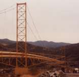
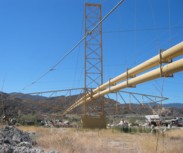
(pipeline bridge)
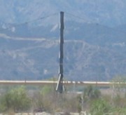
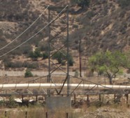
Castaic vicinity, California, USA - Castaic Creek
| Bridgemeister ID: | 2329 (added 2007-07-04) |
| Name: | (pipeline bridge) |
| Location: | Castaic vicinity, California, USA |
| Crossing: | Castaic Creek |
| Coordinates: | 34.47552 N 118.61212 W |
| Maps: | Acme, GeoHack, Google, OpenStreetMap |
| Use: | Pipeline |
| Status: | Extant (last checked: 2007) |
| Main Cables: | Wire (steel) |
| Suspended Spans: | 2 |
| Side Spans: | 2 |
(pipeline bridge)
Chula Vista vicinity, California, USA - Otay River
| Bridgemeister ID: | 1573 (added 2004-12-11) |
| Name: | (pipeline bridge) |
| Location: | Chula Vista vicinity, California, USA |
| Crossing: | Otay River |
| Coordinates: | 32.6003 N 116.92888 W |
| Maps: | Acme, GeoHack, Google, OpenStreetMap |
| Use: | Pipeline |
| Status: | In use (last checked: 2004) |
| Main Cables: | Wire (steel) |
| Suspended Spans: | 1 |
(pipeline bridge)
Elk, California, USA - Greenwood Creek
| Bridgemeister ID: | 5685 (added 2021-03-26) |
| Name: | (pipeline bridge) |
| Location: | Elk, California, USA |
| Crossing: | Greenwood Creek |
| Coordinates: | 39.126247 N 123.714382 W |
| Maps: | Acme, GeoHack, Google, OpenStreetMap |
| Principals: | Elk County Water District |
| Use: | Pipeline |
| Status: | In use (last checked: 2021) |
| Main Cables: | Wire (steel) |
(pipeline bridge)
Junction City, California, USA - Trinity River
| Bridgemeister ID: | 6708 (added 2021-10-05) |
| Name: | (pipeline bridge) |
| Location: | Junction City, California, USA |
| Crossing: | Trinity River |
| Use: | Pipeline |
| Status: | Removed |
| Main Cables: | Wire |
| Main Span: | 1 |
Notes:
- Likely built in late 1800s, maybe early 1900s.
External Links:
(pipeline bridge)
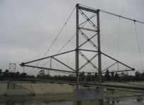
Long Beach, California, USA - Los Angeles River
| Bridgemeister ID: | 1525 (added 2004-10-16) |
| Name: | (pipeline bridge) |
| Location: | Long Beach, California, USA |
| Crossing: | Los Angeles River |
| Coordinates: | 33.82366 N 118.20550 W |
| Maps: | Acme, GeoHack, Google, OpenStreetMap |
| Use: | Pipeline |
| Status: | Extant (last checked: 2007) |
| Main Cables: | Wire (steel) |
| Suspended Spans: | 3 |
| Main Span: | 1 |
| Side Spans: | 2 |
Notes:
- Located a few hundred yards southeast of the I-710/I-405 intersection. Visible to the south as you cross the Los Angeles River on I-405.
(pipeline bridge)
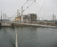
Long Beach, California, USA - San Gabriel River
| Bridgemeister ID: | 2170 (added 2007-01-12) |
| Name: | (pipeline bridge) |
| Location: | Long Beach, California, USA |
| Crossing: | San Gabriel River |
| Coordinates: | 33.76792 N 118.09772 W |
| Maps: | Acme, GeoHack, Google, OpenStreetMap |
| Use: | Pipeline |
| Status: | Extant (last checked: 2007) |
| Main Cables: | Wire (steel) |
| Suspended Spans: | 1 |
(pipeline bridge)
Mojave Heights, Victorville vicinity, California, USA - Mojave River
| Bridgemeister ID: | 2354 (added 2007-08-19) |
| Name: | (pipeline bridge) |
| Location: | Mojave Heights, Victorville vicinity, California, USA |
| Crossing: | Mojave River |
| Coordinates: | 34.56782 N 117.31254 W |
| Maps: | Acme, GeoHack, Google, OpenStreetMap |
| Use: | Pipeline |
| Status: | Extant (last checked: 2007) |
| Main Cables: | Wire (steel) |
(pipeline bridge)
Mokelumne City vicinity, California, USA - Cosumnes River
| Bridgemeister ID: | 2129 (added 2006-10-21) |
| Name: | (pipeline bridge) |
| Location: | Mokelumne City vicinity, California, USA |
| Crossing: | Cosumnes River |
| Coordinates: | 38.25772 N 121.43273 W |
| Maps: | Acme, GeoHack, Google, OpenStreetMap |
| Use: | Pipeline |
| Status: | Extant |
(pipeline bridge)
Montebello and Pico Rivera, California, USA - Rio Hondo
| Bridgemeister ID: | 2361 (added 2007-09-08) |
| Name: | (pipeline bridge) |
| Location: | Montebello and Pico Rivera, California, USA |
| Crossing: | Rio Hondo |
| At or Near Feature: | Whittier Narrows Dam vicinity |
| Coordinates: | 34.01791 N 118.08627 W |
| Maps: | Acme, GeoHack, Google, OpenStreetMap |
| Use: | Pipeline |
| Status: | Removed, c. 2009-2011 |
| Main Span: | 1 |
Notes:
- Removed at some point in the 2009-2011 time frame.
(pipeline bridge)
Pyramid Lake vicinity and Liebre Gulch vicinity, California, USA
| Bridgemeister ID: | 2293 (added 2007-04-26) |
| Name: | (pipeline bridge) |
| Location: | Pyramid Lake vicinity and Liebre Gulch vicinity, California, USA |
| Coordinates: | 34.68632 N 118.73605 W |
| Maps: | Acme, GeoHack, Google, OpenStreetMap |
| Use: | Pipeline |
| Status: | In use (last checked: 2007) |
| Main Cables: | Wire (steel) |
| Suspended Spans: | 1 |
| Main Span: | 1 x 114.3 meters (375 feet) |
Notes:
(pipeline bridge)
Pyramid Lake vicinity, California, USA - Liebre Gulch
| Bridgemeister ID: | 2294 (added 2007-04-26) |
| Name: | (pipeline bridge) |
| Location: | Pyramid Lake vicinity, California, USA |
| Crossing: | Liebre Gulch |
| Coordinates: | 34.69553 N 118.73782 W |
| Maps: | Acme, GeoHack, Google, OpenStreetMap |
| Use: | Pipeline |
| Status: | In use (last checked: 2007) |
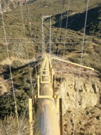
| Main Cables: | Wire (steel) |
| Main Span: | 1 x 152.4 meters (500 feet) |
Notes:
- Carries a 3-foot pipe at a height of 185 feet above the canyon.
- Next to (pipeline bridge) - Pyramid Lake vicinity, California, USA.
- Near (pipeline bridge) - Pyramid Lake vicinity and Liebre Gulch vicinity, California, USA.
(pipeline bridge)
Pyramid Lake vicinity, California, USA - Liebre Gulch
| Bridgemeister ID: | 2295 (added 2007-04-26) |
| Name: | (pipeline bridge) |
| Location: | Pyramid Lake vicinity, California, USA |
| Crossing: | Liebre Gulch |
| Coordinates: | 34.69357 N 118.73703 W |
| Maps: | Acme, GeoHack, Google, OpenStreetMap |
| Use: | Pipeline |
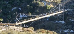
| Status: | In use (last checked: 2007) |
| Main Cables: | Wire (steel) |
| Main Span: | 1 x 61 meters (200 feet) |
Notes:
- Next to (pipeline bridge) - Pyramid Lake vicinity, California, USA.
- Near (pipeline bridge) - Pyramid Lake vicinity and Liebre Gulch vicinity, California, USA.
(pipeline bridge)
Pyramid Lake vicinity, California, USA - Canada de Los Alamos
| Bridgemeister ID: | 2331 (added 2007-07-04) |
| Name: | (pipeline bridge) |
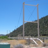
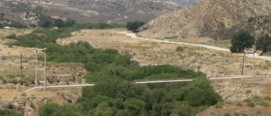
| Location: | Pyramid Lake vicinity, California, USA |
| Crossing: | Canada de Los Alamos |
| At or Near Feature: | Hungry Valley State Vehicular Rec. Area |
| Coordinates: | 34.70264 N 118.79825 W |
| Maps: | Acme, GeoHack, Google, OpenStreetMap |
| Use: | Pipeline |
| Status: | Extant (last checked: 2007) |
| Main Cables: | Wire (steel) |
| Suspended Spans: | 1 |
(pipeline bridge)
Redding, California, USA - Sacramento River
| Bridgemeister ID: | 1429 (added 2004-07-25) |
| Name: | (pipeline bridge) |
| Location: | Redding, California, USA |
| Crossing: | Sacramento River |
| Coordinates: | 40.59165 N 122.38395 W |
| Maps: | Acme, GeoHack, Google, OpenStreetMap |
| Use: | Pipeline |
| Status: | In use (last checked: 2004) |
| Main Cables: | Wire (steel) |
| Main Span: | 1 x 140.2 meters (460 feet) estimated |
Notes:
- Visible from the Sundial cable-stayed bridge.
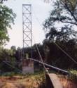
(pipeline bridge)
Santa Clarita and Valencia, California, USA - Santa Clara River
| Bridgemeister ID: | 2330 (added 2007-07-04) |
| Name: | (pipeline bridge) |
| Location: | Santa Clarita and Valencia, California, USA |
| Crossing: | Santa Clara River |
| Coordinates: | 34.42707 N 118.57484 W |
| Maps: | Acme, GeoHack, Google, OpenStreetMap |
| Use: | Pipeline |
| Status: | Extant (last checked: 2007) |
| Main Cables: | Wire (steel) |
| Suspended Spans: | 3 |
| Main Span: | 1 |
| Side Spans: | 2 |
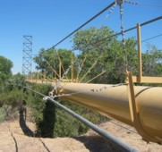
(pipeline bridge)
Topock, Arizona and Needles vicinity, California, USA - Colorado River
| Bridgemeister ID: | 1507 (added 2004-10-09) |
| Name: | (pipeline bridge) |
| Location: | Topock, Arizona and Needles vicinity, California, USA |
| Crossing: | Colorado River |
| Coordinates: | 34.71531 N 114.48255 W |
| Maps: | Acme, GeoHack, Google, OpenStreetMap |
| Use: | Pipeline |
| Status: | Extant (last checked: 2004) |
| Main Cables: | Wire (steel) |
| Suspended Spans: | 1 |
Notes:
- One of two pipeline suspension bridges at this location (adjacent to the I-40 crossing). This one has triangular towers.
- Near (pipeline bridge) - Topock, Arizona and Needles vicinity, California, USA.
External Links:
(pipeline bridge)
Topock, Arizona and Needles vicinity, California, USA - Colorado River
| Bridgemeister ID: | 1508 (added 2004-10-09) |
| Name: | (pipeline bridge) |
| Location: | Topock, Arizona and Needles vicinity, California, USA |
| Crossing: | Colorado River |
| Coordinates: | 34.71587 N 114.48617 W |
| Maps: | Acme, GeoHack, Google, OpenStreetMap |
| Use: | Pipeline |
| Status: | Extant (last checked: 2004) |
| Main Cables: | Wire (steel) |
| Suspended Spans: | 1 |
Notes:
- One of two pipeline suspension bridges at this location (adjacent to the I-40 crossing). This one has rectangular towers.
- Near (pipeline bridge) - Topock, Arizona and Needles vicinity, California, USA.
External Links:
(suspension bridge)
Bridgeville, California, USA - Van Duzen River
| Bridgemeister ID: | 2144 (added 2006-11-04) |
| Name: | (suspension bridge) |
| Location: | Bridgeville, California, USA |
| Crossing: | Van Duzen River |
| Use: | Vehicular |
| Main Cables: | Wire |
| Main Span: | 1 x 87.8 meters (288 feet) |
Notes:
- Erected late 1962 or 1963 after being moved from former location near Petrolia.
- Likely since removed.
- Moved from (suspension bridge) - Petrolia, California, USA.
(suspension bridge)
Henley, Hornbrook, California, USA - Klamath River
| Bridgemeister ID: | 1083 (added 2004-01-01) |
| Name: | (suspension bridge) |
| Location: | Henley, Hornbrook, California, USA |
| Crossing: | Klamath River |
| Coordinates: | 41.88649 N 122.55474 W |
| Maps: | Acme, GeoHack, Google, OpenStreetMap |
| Status: | Collapsed, c. 2010-2012 |
| Main Cables: | Wire |
| Suspended Spans: | 1 |
Notes:
- Appears to have collapsed (or was dismantled) at some point between 2010 and 2012.
- Patrick S. O'Donnell notes (in the 2000s): "It looked at one time it may have carried one lane of traffic from the early 20th century. It was barely standing, I did manage to walk across it."
(suspension bridge)
Junction City, California, USA - Trinity River
| Bridgemeister ID: | 2345 (added 2007-08-12) |
| Name: | (suspension bridge) |
| Location: | Junction City, California, USA |
| Crossing: | Trinity River |
| Use: | Vehicular |
| Main Cables: | Wire |
Notes:
- The reverse of the photograph says: "Old suspension bridge - Trinity Riv. 1 mile west of Junction City Ore. 9-16-57." The reference to Oregon appears to have been a mistake. Since Junction City, California is on the Trinity River it is assumed California's Junction City is the correct location. Junction City, Oregon is near the Willamette River.
- The bridge pictured here has likely since been removed.
(suspension bridge)
Kneeland vicinity, California, USA - Mad River
| Bridgemeister ID: | 6778 (added 2021-10-28) |
| Name: | (suspension bridge) |
| Location: | Kneeland vicinity, California, USA |
| Crossing: | Mad River |
| Coordinates: | 40.662591 N 123.838166 W |
| Maps: | Acme, GeoHack, Google, OpenStreetMap |
| Use: | Vehicular |
| Status: | Only towers remain (last checked: 2021) |
| Main Cables: | Wire (steel) |
| Main Span: | 1 |
Notes:
- Likely built in the 1910s, a suspension bridge once crossed the Mad River at the end of Jack Shaw Road. At least one tower is still standing as of the early 2020s.
(suspension bridge)
Korbel vicinity, California, USA - North Fork Mad River
| Bridgemeister ID: | 6737 (added 2021-10-17) |
| Name: | (suspension bridge) |
| Location: | Korbel vicinity, California, USA |
| Crossing: | North Fork Mad River |
| Coordinates: | 40.912293 N 123.915298 W |
| Maps: | Acme, GeoHack, Google, OpenStreetMap |
| Use: | Vehicular |
| Status: | Removed |
| Main Cables: | Wire (steel) |
| Suspended Spans: | 1 |
Notes:
- The coordinates provided here appear to be the location of a 1920s/1930s-era suspension bridge that carried the former US 299 across the North Fork Mad River on the same alignment where California "Old Highway 200" now crosses.
(suspension bridge)
Los Angeles and Glendale, California, USA - Los Angeles River
| Bridgemeister ID: | 2362 (added 2007-09-08) |
| Name: | (suspension bridge) |
| Location: | Los Angeles and Glendale, California, USA |
| Crossing: | Los Angeles River |
| Coordinates: | 34.11150 N 118.26317 W |
| Maps: | Acme, GeoHack, Google, OpenStreetMap |
| Use: | Pipeline |
| Status: | Extant (last checked: 2021) |
| Main Cables: | Wire (steel) |
| Main Span: | 1 |
Notes:
- USGS topographical maps note this is a "footbridge," but it is a pipeline bridge with maintenance foot access on top of the pipe.
(suspension bridge)
Petrolia, California, USA - Mattole River
| Bridgemeister ID: | 2143 (added 2006-11-04) |
| Name: | (suspension bridge) |
| Location: | Petrolia, California, USA |
| Crossing: | Mattole River |
| Use: | Vehicular |
| Status: | Dismantled, 1962 |
| Main Cables: | Wire |
| Main Span: | 1 x 87.8 meters (288 feet) |
Notes:
- There was an interesting saga regarding this bridge's dismantling and reconstruction at Bridgeville. Shirley Gundlach thought he had purchased the bridge from Humboldt County and proceeded to dismantle and move the bridge to Bridgeville. After he dismantled and moved the bridge, he was informed that multiple bids were being accepted and considered and he was not the high bidder. On August 14, 1962, Mr. Gundlach worked out a deal with the high bidder to take ownership of the bridge. The comedy of the situation was not lost on the locals. The August 11, 1962 edition of the Eureka Humboldt Standard ran an article that started:
"Humboldt County has some loose bridgework today -- suspension type. It's not really missing, because everyone knows where it is, but the old bridge over the Mattole River near Petrolia isn't there any more, despite the fact the county hasn't actually sold it yet. The 'fiasco' as one county official termed it, boils down to the fact a man apparently thought he had purchased the ancient structure, had it torn down and moved, then discovered no one in county circles would admit to having given him the go-ahead. Removal of the bridge gave one supervisor, Melvin Bareilles, quite a start last Sunday when he journeyed to the Mattole to look the structure over and see if the purchaser was getting a good deal. When he got there the abutments were bare, so to speak. Bareilles' interest in the condition of the bridge stems from the fact the chagrined 'purchaser' is his brother-in-law, Shirley Gundlach of Bridgeville. Removal came as a complete surprise to him, he claims. Supervisor Elwyn L. Lindley within whose district the bridge is supposed to be located, did a 'double-take' on the bridge in Ferndale last Saturday. As he was walking down the main street of Ferndale with his wife, she noted a dismantled structure going by on a truck and commented it appeared a gas well drilling rig was being hauled away. Lindley gave it a glance and started to walk on, but then did the double-take and knew immediately it was the old bridge, with which he has been familiar since boyhood days. Charles Shaller, director of public works, says he gave no go-ahead to remove the bridge. However, he admits he 'sold' Gundlach the idea of obtaining the structure for access to subdivision land on the Van Duzen River. 'I've been trying to get rid of that old bridge for the past four years, and hadn't been able to do it anywhere,' he commented. 'I guess if any blame has to be laid on someone, it will have to be me, although I cautioned Gundlach not to remove the bridge until it was sold as required under the law.'" - Damaged by flood, 1955. Out of service, 1959.
- Moved to (suspension bridge) - Bridgeville, California, USA.
- See 1920 (suspension bridge) - Petrolia vicinity, California, USA. This entry may represent the same bridge.
(suspension bridge)
Salyer and Willow Creek, California, USA - South Fork Trinity River
| Bridgemeister ID: | 1855 (added 2005-07-17) |
| Name: | (suspension bridge) |
| Location: | Salyer and Willow Creek, California, USA |
| Crossing: | South Fork Trinity River |
| Use: | Vehicular (one-lane) |
| Status: | Replaced, c. 1930 |
| Main Cables: | Wire |
| Suspended Spans: | 1 |
Notes:
- Was located near present-day CA 299 crossing of the Trinity River at the Humboldt/Trinity county lines.
- See 1940 Hawkins Bar - Trinity Village and Hawkins Bar, California, USA.
- See (suspension bridge) - Willow Creek vicinity, California, USA.
(suspension bridge)
White Hall vicinity, California, USA - South Fork American River
| Bridgemeister ID: | 2233 (added 2007-03-19) |
| Name: | (suspension bridge) |
| Location: | White Hall vicinity, California, USA |
| Crossing: | South Fork American River |
| Principals: | Walter Forbas |
| Status: | Replaced, c. 1984 |
| Main Cables: | Wire |
Notes:
- The May 9, 1984 edition of the Mountain Democrat and El Dorado News newspaper (Placerville, California) has a photo of this bridge with caption: "One of the old wooden suspension bridges that span the South Fork of the American River east of Whitehall is being replaced with a new I-beam bridge. The old bridge, built in the 1940s by Walter Forbas, was simply wearing out, according to Joe Rogers, who acquired the property in 1979 along with a partner, Gary Mahloch. The old bridge, built before rebars were available, had been beefed up with Model A frames. The new bridge will be 116 feet long and 12 feet wide and should be completed in about 45 days, said Rogers. The I-bars, two for each side bolted together, will be the base of the bridge. They will be covered with wooden planks and the sides will be of wrought iron."
Do you have any information or photos for these bridges that you would like to share? Please email david.denenberg@bridgemeister.com.