Suspension Bridges of Indiana
This is a list of all 26 bridges from the suspension bridge inventory for Indiana in USA. Wherever you see a Bridgemeister ID number click it to isolate the bridge on its own page.
Related Lists:
1873: Harrison
Harrison, Ohio and Dearborn County, Indiana, USA - Whitewater River
| Bridgemeister ID: | 81 (added before 2003) |
| Year Completed: | 1873 |
| Name: | Harrison |
| Location: | Harrison, Ohio and Dearborn County, Indiana, USA |
| Crossing: | Whitewater River |
| Principals: | James W. Shipman and Co. |
| References: | EOV |
| Use: | Vehicular (one-lane) |
| Status: | Destroyed, 1913, by flood |
| Main Cables: | Wire |
Notes:
- See 1868 Calloway's Ford (Whitewater, Harrison's) - Elizabethtown vicinity, Hamilton County, Ohio, USA.
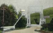
1892: (footbridge)
Anderson, Indiana, USA - White River
| Bridgemeister ID: | 6467 (added 2021-08-13) |
| Year Completed: | 1892 |
| Name: | (footbridge) |
| Location: | Anderson, Indiana, USA |
| Crossing: | White River |
| Use: | Footbridge |
| Status: | Destroyed, March 27, 1921 |
| Main Cables: | Wire (steel) |
| Suspended Spans: | 3 |
| Main Span: | 1 |
| Side Spans: | 2 |
Annotated Citations:
- Jackson, Stephen T. "If the River Could Talk: Bridges at 27 sites." The Herald Bulletin., 3 July 2016, www.heraldbulletin.com/community/if-the-river-could-talk-bridges-at-27-sites/article_0141fb64-6416-526d-baa4-752e97f65b95.html
"Opened March 7, 1892, in what would today be the shadow of the Eisenhower Bridge, was a suspension bridge built to carry pedestrian traffic from Anderson to Park Place. Twin support towers at each end of the bridge held the suspension span in between… The fun lasted until a flood brought it down March 27, 1921."
External Links:
1918: Turkey Run State Park
Parke County, Indiana, USA - Sugar Creek
| Bridgemeister ID: | 269 (added before 2003) |
| Year Completed: | 1918 |
| Name: | Turkey Run State Park |
| Location: | Parke County, Indiana, USA |
| Crossing: | Sugar Creek |
| At or Near Feature: | Turkey Run State Park |
| Coordinates: | 39.88926 N 87.19948 W |
| Maps: | Acme, GeoHack, Google, OpenStreetMap |
| References: | IMB |
| Use: | Footbridge |
| Status: | In use (last checked: 2021) |
| Main Cables: | Wire (steel) |
| Suspended Spans: | 1 |
| Main Span: | 1 x 58.5 meters (192 feet) estimated |
Notes:
- IMB states, "The original bridge collapsed into Sugar Creek in 1917... the state's Department of Natural Resources promptly replaced the old with current structure."
- James Rader writes in 2008: "Three years ago flooding came up high enough to allow a couple of uprooted Sycamore trees to hit the bridge ripping out a large section of the wood railing and flooring from the middle of the bridge. Bridge was immediately closed. Structural analysis was completed and repairs were made including all new floor planks. Bridge is in great condition and should serve for many many more years to come."
External Links:
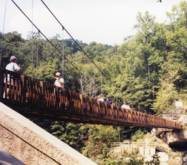
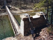
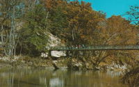
1923: Memorial Swinging
Winamac, Indiana, USA - Tippecanoe River
| Bridgemeister ID: | 849 (added 2003-07-27) |
| Year Completed: | 1923 |
| Name: | Memorial Swinging |
| Also Known As: | Soldiers and Sailors Memorial |
| Location: | Winamac, Indiana, USA |
| Crossing: | Tippecanoe River |
| At or Near Feature: | City Park |
| Coordinates: | 41.05245 N 86.59936 W |
| Maps: | Acme, GeoHack, Google, OpenStreetMap |
| Use: | Footbridge |
| Status: | In use (last checked: 2021) |
| Main Cables: | Wire (steel) |
| Suspended Spans: | 1 |
External Links:
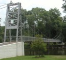
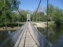
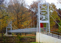
1939: Sullivan-Hutsonville
Hutsonville, Illinois and Sullivan, Indiana, USA - Wabash River
| Bridgemeister ID: | 196 (added before 2003) |
| Year Completed: | 1939 |
| Name: | Sullivan-Hutsonville |
| Location: | Hutsonville, Illinois and Sullivan, Indiana, USA |
| Crossing: | Wabash River |
| Coordinates: | 39.1101 N 87.6551 W |
| Maps: | Acme, GeoHack, Google, OpenStreetMap |
| Principals: | Steinman & Robinson, R.V. Milbank, Wisconsin Bridge & Iron Co., Charles J. Glasgow |
| References: | AAJ, BPL, IMB, SJR19880926 |
| Use: | Vehicular (two-lane), with walkway |
| Status: | Demolished, 1989 |
| Main Cables: | Wire (steel) |
| Suspended Spans: | 3 |
| Main Span: | 1 x 106.7 meters (350 feet) |
| Side Spans: | 2 x 45.7 meters (150 feet) |
| Deck width: | 20 feet |
| Characteristics: | Self-anchored |
Notes:
- Demolished 1989. This bridge was Steinman's attempt at a self-anchored suspension bridge and met a controversial demise in 1989. An article in the September 26, 1988 issue of the Springfield, IL "The State Journal-Register" describes the ongoing controversy. The company to which the $100,000 demolition contract was let offered to turn the money over to save the bridge. The locals agreed, but the company's Chief Engineer Stephen Schneider was quoted, "I think Indiana really wants to tear it down. They've been ... forced to send inspectors out every two weeks. I think they just want the headache gone." Gary Abell, spokesman for the Indiana Dept. Of Highways said its design is "not one of the best. It works in theory, but not in practice. This is like trying to save a mistake." After a lot of back-and-forth, the locals gave up, "We've had it with them. We don't want anything more to do with it. They can tear the damn thing down." Animosity toward this bridge continues 13 years after its demolition. In 2002, in an email to Wayne Grodkiewicz (who provided me with much information about this bridge), an INDOT representative said, "I am not sure why you are interested in that bridge, but from our stand point, it was a very poorly designed bridge that had many many problems from the day that it was completed, until it was brought down."
External Links:
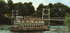
1966: (footbridge)
Indiana Beach, Indiana, USA - Lake Shafer
| Bridgemeister ID: | 879 (added 2003-09-01) |
| Year Completed: | 1966 |
| Name: | (footbridge) |
| Location: | Indiana Beach, Indiana, USA |
| Crossing: | Lake Shafer |
| Coordinates: | 40.787346 N 86.770724 W |
| Maps: | Acme, GeoHack, Google, OpenStreetMap |
| Use: | Footbridge |
| Status: | Extant (last checked: 2019) |
| Main Cables: | Wire (steel) |
Notes:
- Large multi-span footbridge that serves as entrance to Indiana Beach amusement park.
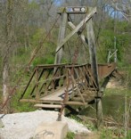
1988: (footbridge)
Richmond, Indiana, USA - Whitewater River
| Bridgemeister ID: | 2307 (added 2007-04-30) |
| Year Completed: | 1988 |
| Name: | (footbridge) |
| Location: | Richmond, Indiana, USA |
| Crossing: | Whitewater River |
| At or Near Feature: | Whitewater Gorge |
| Coordinates: | 39.83331 N 84.89902 W |
| Maps: | Acme, GeoHack, Google, OpenStreetMap |
| Use: | Footbridge |
| Status: | In use (last checked: 2007) |
| Main Cables: | Wire (steel) |
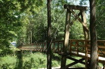
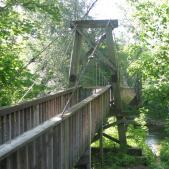
2004: Riley
Delphi, Indiana, USA - Deer Creek
| Bridgemeister ID: | 1785 (added 2005-05-17) |
| Year Completed: | 2004 |
| Name: | Riley |
| Location: | Delphi, Indiana, USA |
| Crossing: | Deer Creek |
| At or Near Feature: | Riley Park |
| Coordinates: | 40.585167 N 86.669383 W |
| Maps: | Acme, GeoHack, Google, OpenStreetMap |
| Use: | Footbridge |
| Status: | In use (last checked: 2006) |
| Main Cables: | Wire (steel) |
| Suspended Spans: | 1 |
Notes:
- This is (at least) the third suspension bridge at this site. The previous bridges were built in 1911, 1988, and 1998. All three were destroyed by flood. It is unclear if the previous suspension bridges qualify for the Bridgemeister inventory.
2005: (footbridge)
Cambridge City, Indiana, USA - Whitewater River
| Bridgemeister ID: | 2306 (added 2007-04-30) |
| Year Completed: | 2005 |
| Name: | (footbridge) |
| Location: | Cambridge City, Indiana, USA |
| Crossing: | Whitewater River |
| At or Near Feature: | Creitz Park |
| Coordinates: | 39.81527 N 85.16978 W |
| Maps: | Acme, GeoHack, Google, OpenStreetMap |
| Principals: | Milestone Construction Co., Jim Sweet |
| Use: | Footbridge |
| Status: | In use (last checked: 2008) |
| Main Cables: | Wire (steel) |
| Suspended Spans: | 1 |
Notes:
- Replaced a 1928 suspension bridge at the same location which had been destroyed by heavy snow and debris, December 2004. This predecessor appears to have been a drooping bridge.
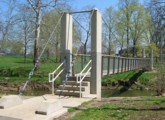
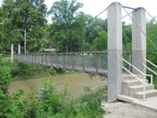
(footbridge)
Fort Wayne, Indiana, USA - St. Mary's River
| Bridgemeister ID: | 644 (added 2003-02-16) |
| Name: | (footbridge) |
| Location: | Fort Wayne, Indiana, USA |
| Crossing: | St. Mary's River |
| At or Near Feature: | Foster Park |
| Coordinates: | 41.04716 N 85.16566 W |
| Maps: | Acme, GeoHack, Google, OpenStreetMap |
| Use: | Footbridge |
| Status: | In use (last checked: 2019) |
| Main Cables: | Wire (steel) |
| Suspended Spans: | 1 |
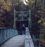
| Bridgemeister ID: | 258 (added before 2003) |
| Name: | (footbridge) |
| Location: | Indianapolis, Indiana, USA |
| At or Near Feature: | Riverside or Riverview Park |
| Use: | Footbridge |
| Status: | Destroyed, 1913 |
| Main Cables: | Wire |
Notes:
- Wayne Grodkiewicz reports, "I have been doing some investigation on the Riverview Park bridge in Indianapolis. From my investigation so far I have found that there was no Riverview Park in Indianapolis, however it was pointed out by Meg Purnsle from the Indianapolis Historical Society that postcard manufacturers often got names of places wrong on the cards. So it is probably Riverside Park. This park is 'on the corner' of 30th street and the White River. The park is still there in a way. It used to be an amusement park from 1903 to 1970. According to a 1915 map 30th street was extended over the White River and the existence of a foot bridge is not noted. So, the bad news is that this bridge was [probably] torn down sometime between 1912 and 1915. As far as Riverside Park, there is nothing there now but trees. There are some ornate concrete park bridges there now over the White River and the Canal." After further investigation, Wayne wrote: "I have been in contact with the Indiana Historical Society about the bridge at Riverside Park. They have told me there is no concrete documentation about the demise of this bridge but it is general consensus that it was destroyed in the flood of March 1913. It was never replaced."
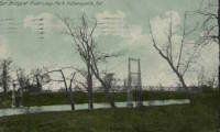
(footbridge)
Indianapolis, Indiana, USA - Indianapolis Motor Speedway
| Bridgemeister ID: | 2876 (added 2019-09-13) |
| Name: | (footbridge) |
| Location: | Indianapolis, Indiana, USA |
| Crossing: | Indianapolis Motor Speedway |
| Use: | Footbridge |
| Status: | Removed |
| Main Cables: | Wire (steel) |
| Suspended Spans: | 3 |
| Main Spans: | 3 |
Notes:
- There have been at least two suspension bridges at the speedway. This was a larger three-span wide footbridge that was in existence in 1909.
(footbridge)
Logansport, Indiana, USA - Wabash River
| Bridgemeister ID: | 1695 (added 2005-03-27) |
| Name: | (footbridge) |
| Location: | Logansport, Indiana, USA |
| Crossing: | Wabash River |
| Use: | Footbridge |
| Status: | Removed |
| Main Cables: | Wire |
| Suspended Spans: | 1 |
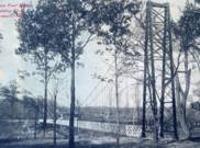
| Bridgemeister ID: | 2546 (added 2011-12-31) |
| Name: | (footbridge) |
| Location: | Merrillville, Indiana, USA |
| At or Near Feature: | Hidden Lake Park |
| Coordinates: | 41.50220 N 87.32817 W |
| Maps: | Acme, GeoHack, Google, OpenStreetMap |
| Use: | Footbridge |
| Status: | Collapsed, July 4, 2009 |
| Main Cables: | Wire |
Notes:
- Collapsed July 4, 2009 under weight of crowd attending an Independence Day celebration. Main span is said to have been about 90 feet.
(pipeline bridge)
Eagle Creek Township and Keener Township, Indiana, USA - Kankakee River
| Bridgemeister ID: | 8412 (added 2024-03-03) |
| Name: | (pipeline bridge) |
| Location: | Eagle Creek Township and Keener Township, Indiana, USA |
| Crossing: | Kankakee River |
| Coordinates: | 41.220361 N 87.270806 W |
| Maps: | Acme, GeoHack, Google, OpenStreetMap |
| Use: | Pipeline |
| Status: | Extant (last checked: 2023) |
| Main Spans: | 1 x 72 meters (236.2 feet) estimated, 1 x 25 meters (82 feet) estimated |
Notes:
- One of six short suspended pipelines along a five mile stretch of, what appears to be, the same pipeline. This one, crossing the Kankakee River is the longest of the group by far.
- Connects to (pipeline bridge) - Eagle Creek Township, Indiana, USA.
- Connects to (pipeline bridge) - Eagle Creek Township, Indiana, USA.
- Connects to (pipeline bridge) - Eagle Creek Township, Indiana, USA.
- Connects to (pipeline bridge) - Keener Township, Indiana, USA.
- Connects to (pipeline bridge) - Keener Township, Indiana, USA.
(pipeline bridge)
Eagle Creek Township, Indiana, USA - Singleton Ditch
| Bridgemeister ID: | 8409 (added 2024-03-03) |
| Name: | (pipeline bridge) |
| Location: | Eagle Creek Township, Indiana, USA |
| Crossing: | Singleton Ditch |
| Coordinates: | 41.260667 N 87.300861 W |
| Maps: | Acme, GeoHack, Google, OpenStreetMap |
| Use: | Pipeline |
| Status: | Extant (last checked: 2023) |
| Suspended Spans: | 1 |
| Main Span: | 1 x 20 meters (65.6 feet) estimated |
Notes:
- One of six short suspended pipelines along a five mile stretch of, what appears to be, the same pipeline.
- Connects to (pipeline bridge) - Eagle Creek Township and Keener Township, Indiana, USA.
- Connects to (pipeline bridge) - Eagle Creek Township, Indiana, USA.
- Connects to (pipeline bridge) - Eagle Creek Township, Indiana, USA.
- Connects to (pipeline bridge) - Keener Township, Indiana, USA.
- Connects to (pipeline bridge) - Keener Township, Indiana, USA.
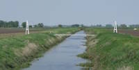
(pipeline bridge)
Eagle Creek Township, Indiana, USA - Little Ditch
| Bridgemeister ID: | 8410 (added 2024-03-03) |
| Name: | (pipeline bridge) |
| Location: | Eagle Creek Township, Indiana, USA |
| Crossing: | Little Ditch |
| Coordinates: | 41.257639 N 87.298583 W |
| Maps: | Acme, GeoHack, Google, OpenStreetMap |
| Use: | Pipeline |
| Status: | Extant (last checked: 2023) |
| Suspended Spans: | 1 |
| Main Span: | 1 x 21 meters (68.9 feet) estimated |
Notes:
- One of six short suspended pipelines along a five mile stretch of, what appears to be, the same pipeline.
- Connects to (pipeline bridge) - Eagle Creek Township and Keener Township, Indiana, USA.
- Connects to (pipeline bridge) - Eagle Creek Township, Indiana, USA.
- Connects to (pipeline bridge) - Eagle Creek Township, Indiana, USA.
- Connects to (pipeline bridge) - Keener Township, Indiana, USA.
- Connects to (pipeline bridge) - Keener Township, Indiana, USA.

(pipeline bridge)
Eagle Creek Township, Indiana, USA - Brown Ditch
| Bridgemeister ID: | 8411 (added 2024-03-03) |
| Name: | (pipeline bridge) |
| Location: | Eagle Creek Township, Indiana, USA |
| Crossing: | Brown Ditch |
| Coordinates: | 41.239583 N 87.285444 W |
| Maps: | Acme, GeoHack, Google, OpenStreetMap |
| Use: | Pipeline |
| Status: | Extant (last checked: 2023) |
| Suspended Spans: | 1 |
| Main Span: | 1 x 16 meters (52.5 feet) estimated |
Notes:
- One of six short suspended pipelines along a five mile stretch of, what appears to be, the same pipeline.
- Connects to (pipeline bridge) - Eagle Creek Township and Keener Township, Indiana, USA.
- Connects to (pipeline bridge) - Eagle Creek Township, Indiana, USA.
- Connects to (pipeline bridge) - Eagle Creek Township, Indiana, USA.
- Connects to (pipeline bridge) - Keener Township, Indiana, USA.
- Connects to (pipeline bridge) - Keener Township, Indiana, USA.
(pipeline bridge)
Gary, Indiana, USA - Grand Calumet River
| Bridgemeister ID: | 7122 (added 2022-06-17) |
| Name: | (pipeline bridge) |
| Location: | Gary, Indiana, USA |
| Crossing: | Grand Calumet River |
| Coordinates: | 41.608340 N 87.349447 W |
| Maps: | Acme, GeoHack, Google, OpenStreetMap |
| Use: | Pipeline |
| Status: | Extant (last checked: 2022) |
| Main Cables: | Wire (steel) |
| Main Span: | 1 x 61 meters (200.1 feet) estimated |
Notes:
(pipeline bridge)
Gary, Indiana, USA - Grand Calumet River
| Bridgemeister ID: | 7123 (added 2022-06-17) |
| Name: | (pipeline bridge) |
| Location: | Gary, Indiana, USA |
| Crossing: | Grand Calumet River |
| Coordinates: | 41.608436 N 87.349509 W |
| Maps: | Acme, GeoHack, Google, OpenStreetMap |
| Use: | Pipeline |
| Status: | Extant (last checked: 2022) |
| Main Cables: | Wire (steel) |
| Main Span: | 1 x 74 meters (242.8 feet) estimated |
Notes:
(pipeline bridge)
Gary, Indiana, USA - Grand Calumet River
| Bridgemeister ID: | 7124 (added 2022-06-17) |
| Name: | (pipeline bridge) |
| Location: | Gary, Indiana, USA |
| Crossing: | Grand Calumet River |
| Coordinates: | 41.608849 N 87.348776 W |
| Maps: | Acme, GeoHack, Google, OpenStreetMap |
| Use: | Pipeline |
| Status: | Extant |
| Main Cables: | Wire (steel) |
| Main Span: | 1 |
Notes:
(pipeline bridge)
Keener Township, Indiana, USA - Brent Ditch
| Bridgemeister ID: | 8413 (added 2024-03-03) |
| Name: | (pipeline bridge) |
| Location: | Keener Township, Indiana, USA |
| Crossing: | Brent Ditch |
| Coordinates: | 41.206889 N 87.261222 W |
| Maps: | Acme, GeoHack, Google, OpenStreetMap |
| Use: | Pipeline |
| Status: | Extant (last checked: 2023) |
| Suspended Spans: | 1 |
| Main Span: | 1 x 14 meters (45.9 feet) estimated |
Notes:
- One of six short suspended pipelines along a five mile stretch of, what appears to be, the same pipeline.
- Connects to (pipeline bridge) - Eagle Creek Township and Keener Township, Indiana, USA.
- Connects to (pipeline bridge) - Eagle Creek Township, Indiana, USA.
- Connects to (pipeline bridge) - Eagle Creek Township, Indiana, USA.
- Connects to (pipeline bridge) - Eagle Creek Township, Indiana, USA.
- Connects to (pipeline bridge) - Keener Township, Indiana, USA.
(pipeline bridge)
Keener Township, Indiana, USA - Dehaan Ditch
| Bridgemeister ID: | 8414 (added 2024-03-03) |
| Name: | (pipeline bridge) |
| Location: | Keener Township, Indiana, USA |
| Crossing: | Dehaan Ditch |
| Coordinates: | 41.202500 N 87.258056 W |
| Maps: | Acme, GeoHack, Google, OpenStreetMap |
| Use: | Pipeline |
| Status: | Extant (last checked: 2023) |
| Suspended Spans: | 1 |
| Main Span: | 1 x 14.5 meters (47.6 feet) estimated |
Notes:
- One of six short suspended pipelines along a five mile stretch of, what appears to be, the same pipeline.
- Connects to (pipeline bridge) - Eagle Creek Township and Keener Township, Indiana, USA.
- Connects to (pipeline bridge) - Eagle Creek Township, Indiana, USA.
- Connects to (pipeline bridge) - Eagle Creek Township, Indiana, USA.
- Connects to (pipeline bridge) - Eagle Creek Township, Indiana, USA.
- Connects to (pipeline bridge) - Keener Township, Indiana, USA.
Swinging
Danville, Indiana, USA - White Lick Creek
| Bridgemeister ID: | 1266 (added 2004-03-14) |
| Name: | Swinging |
| Location: | Danville, Indiana, USA |
| Crossing: | White Lick Creek |
| At or Near Feature: | Ellis Park |
| Coordinates: | 39.762317 N 86.5152 W |
| Maps: | Acme, GeoHack, Google, OpenStreetMap |
| Use: | Footbridge |
| Status: | In use (last checked: 2005) |
| Main Cables: | Wire |
| Suspended Spans: | 1 |
| Main Span: | 1 x 41.8 meters (137 feet) estimated |
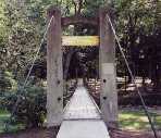
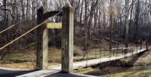
Trailhead Park
Delphi, Indiana, USA - Deer Creek
| Bridgemeister ID: | 2577 (added 2013-03-27) |
| Name: | Trailhead Park |
| Location: | Delphi, Indiana, USA |
| Crossing: | Deer Creek |
| At or Near Feature: | Delphi Trails Entrance |
| Coordinates: | 40.57327 N 86.68522 W |
| Maps: | Acme, GeoHack, Google, OpenStreetMap |
| Use: | Footbridge |
| Status: | In use (last checked: 2012) |
| Main Cables: | Wire (steel) |
| Suspended Spans: | 1 |
Do you have any information or photos for these bridges that you would like to share? Please email david.denenberg@bridgemeister.com.
