Suspension Bridges of Mississippi
This is a list of all 8 bridges from the suspension bridge inventory for Mississippi in USA. Wherever you see a Bridgemeister ID number click it to isolate the bridge on its own page.
Related Lists:
1860: Port Gibson
Grindstone Ford, Port Gibson vicinity, Mississippi, USA - Bayou Pierre
| Bridgemeister ID: | 1659 (added 2005-03-19) |
| Year Completed: | 1860 |
| Name: | Port Gibson |
| Location: | Grindstone Ford, Port Gibson vicinity, Mississippi, USA |
| Crossing: | Bayou Pierre |
| References: | PTS2 |
| Status: | Removed, circa 1920's |
Notes:
- Partially burned by retreating Confederate troops May 2nd, 1863 during the Vicksburg Campaign of the Civil War. Union troops extinquished the fire and quickly repaired the bridge.
- Demolished, circa 1920's. Descriptions for the Vicksburg Campaign imply there may have been another suspension bridge in the Port Gibson area.
1900: Youngblood
Union Church, Mississippi, USA - Fifteenmile Creek
| Bridgemeister ID: | 6427 (added 2021-08-10) |
| Year Completed: | 1900 |
| Name: | Youngblood |
| Location: | Union Church, Mississippi, USA |
| Crossing: | Fifteenmile Creek |
| Coordinates: | 31.633587 N 90.814317 W |
| Maps: | Acme, GeoHack, Google, OpenStreetMap |
| Principals: | J.K. Gallbreath |
| Use: | Vehicular (one-lane) |
| Status: | Collapsed, 2016 |
| Main Cables: | Wire (steel) |
Notes:
- As of the late 2010s, it appears that the pylons and cables are still present.
- 1915: Repaired by W.H. Groome and Son incorporating an improved anchoring system.
External Links:
- MDAH Historic Resources Inventory Fact Sheet - Youngblood Suspension Bridge. Several photos of the remnants of the bridge and a few pre-collapse photos.
- NPGallery Asset Detail - Youngblood Bridge. National Register of Historic Places site survey.
- Bridgehunter.com - BH46939
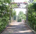
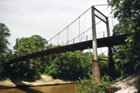
1905: Byram
Byram, Mississippi, USA - Pearl River
| Bridgemeister ID: | 115 (added before 2003) |
| Year Completed: | 1905 |
| Name: | Byram |
| Location: | Byram, Mississippi, USA |
| Crossing: | Pearl River |
| Coordinates: | 32.176683 N 90.243467 W |
| Maps: | Acme, GeoHack, Google, OpenStreetMap |
| References: | GBD |
| Use: | Vehicular |
| Status: | Restricted to foot traffic, since early 1987 (last checked: 2021) |
| Main Cables: | Wire (steel) |
| Suspended Spans: | 3 |
| Main Span: | 1 x 61 meters (200 feet) |
| Side Spans: | 2 x 24.4 meters (80 feet) |
Notes:
- 1987: Closed to vehicular traffic.
- 2006: Vandalized. In December of 2006 after several reports of vandalism, George Britt writes: "I walked the bridge December 24, 2006. It is in rough shape but you can still walk on it if you are careful. Vandals have started fires on the bridge span damaging the planks. Some planks are missing. There is also considerable graffiti about."
- 2008: Scheduled for restoration (repair of deck boards and grafitti).
- 2015: Overdue renovation completed.
External Links:
Image Sets:
1919: Coon Box Fork
Lorman, Fayette vicinity, Mississippi, USA - Shankstown Creek
| Bridgemeister ID: | 6426 (added 2021-08-10) |
| Year Completed: | 1919 |
| Name: | Coon Box Fork |
| Location: | Lorman, Fayette vicinity, Mississippi, USA |
| Crossing: | Shankstown Creek |
| Coordinates: | 31.789613 N 91.068857 W |
| Maps: | Acme, GeoHack, Google, OpenStreetMap |
| Principals: | Schuster and Jacob, Robert Taylor |
| Use: | Vehicular (one-lane) |
| Status: | Destroyed, 1990 |
| Main Cables: | Wire (steel) |
| Suspended Spans: | 3 |
| Main Span: | 1 |
| Side Spans: | 2 |
Notes:
- Some sources suggest the bridge survived until 2010, but this appears to be unlikely. Coordinates provided are for the current Shankstown Creek crossing of Coon Box Road. The suspension bridge may have been on a slightly different alignment.
- 1927: Repaired by W.H. Groome and Son incorporating an improved anchoring system.
External Links:
- MDAH Historic Resources Inventory Fact Sheet - Coon Box Fork Suspension Bridge. Photographs available here suggest remnants of the bridge are visible in the creek.
- NPGallery Asset Detail - Coon Box Fork Bridge. National Register of Historic Places site survey. Presents a brief history of the bridge, but perhaps confuses the matter of its location. States: "Swinging suspension bridge and county road right-of-way along Coon Box Road where the said bridge crosses North Fork Coles Creek." Current-day (2021) Coon Box Road crosses Shankstown Creek near North Fork Coles Creek, but never crosses North Fork Coles Creek. Historic maps of the area place the mid-1900s Shankstown Creek crossing of Coon Box Fork at roughly the same location as the current crossing (the coordinates provided in this record). Looking at historic satellite images of the location, the suspension bridge was probably on an alignment no more than 100 feet north of the current Coon Box Road Shankstown Creek bridge.
- Bridgehunter.com - BH46941
1920: Old Hill Place
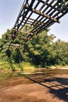
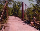
Fayette vicinity, Mississippi, USA - Coles Creek South Fork
| Bridgemeister ID: | 137 (added before 2003) |
| Year Completed: | 1920 |
| Name: | Old Hill Place |
| Location: | Fayette vicinity, Mississippi, USA |
| Crossing: | Coles Creek South Fork |
| Coordinates: | 31.669433 N 91.180917 W |
| Maps: | Acme, GeoHack, Google, OpenStreetMap |
| References: | GBD |
| Use: | Vehicular (one-lane) |
| Status: | Derelict (last checked: 2005) |
| Main Cables: | Wire (steel) |
External Links:
Image Sets:
1939: Swinging
Tishomingo State Park, Mississippi, USA - Bear Creek
| Bridgemeister ID: | 850 (added 2003-07-27) |
| Year Completed: | 1939 |
| Name: | Swinging |
| Location: | Tishomingo State Park, Mississippi, USA |
| Crossing: | Bear Creek |
| Coordinates: | 34.605183 N 88.17955 W |
| Maps: | Acme, GeoHack, Google, OpenStreetMap |
| Use: | Footbridge |
| Status: | In use (last checked: 2020) |
| Main Cables: | Wire (steel) |
| Suspended Spans: | 1 |
| Main Span: | 1 x 57.9 meters (190 feet) estimated |
Notes:
- Likely built by the CCC, this bridge has an interesting zig-zag pattern of suspenders. The suspenders are inclined and are continuous across the bridge like a shoelace with one set of eyelets at deck level and the other set of eyelets along the main cables.
External Links:
Image Sets:
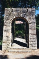
2017: Gulf Coast Research Laboratory Cedar Point
Ocean Springs, Mississippi, USA
| Bridgemeister ID: | 2670 (added 2019-03-15) |
| Year Completed: | 2017 |
| Name: | Gulf Coast Research Laboratory Cedar Point |
| Location: | Ocean Springs, Mississippi, USA |
| Coordinates: | 30.391250 N 88.776583 W |
| Maps: | Acme, GeoHack, Google, OpenStreetMap |
| Principals: | Seattle Bridge LLC |
| Use: | Footbridge |
| Status: | In use (last checked: 2017) |
| Main Cables: | Wire (steel) |
| Main Span: | 1 x 61.6 meters (202 feet) |
External Links:
Swinging
Panola County, Mississippi, USA
| Bridgemeister ID: | 2199 (added 2007-01-27) |
| Name: | Swinging |
| Location: | Panola County, Mississippi, USA |
| Use: | Vehicular |
| Main Cables: | Wire |
Notes:
- The exact location of this bridge is unclear, but a photo in the December 6, 1937 edition of The Delta Weekly (Greenville, Mississippi) shows a short-span vehicular suspension bridge captioned, "Swinging Bridge - Panola County".
Do you have any information or photos for these bridges that you would like to share? Please email david.denenberg@bridgemeister.com.
Mail | Facebook | X (Twitter) | Bluesky