Suspension Bridges of West Virginia (101-124 of 124)
This is a list of bridges 101 through 124 (of 124 total) from the suspension bridge inventory for West Virginia in USA. Wherever you see a Bridgemeister ID number click it to isolate the bridge on its own page.
Related Lists:
(suspension bridge)
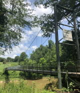
Clarksburg vicinity, West Virginia, USA - West Fork River
| Bridgemeister ID: | 3146 (added 2019-11-03) |
| Name: | (suspension bridge) |
| Location: | Clarksburg vicinity, West Virginia, USA |
| Crossing: | West Fork River |
| At or Near Feature: | Clarksburg Country Club |
| Coordinates: | 39.241973 N 80.364126 W |
| Maps: | Acme, GeoHack, Google, OpenStreetMap |
| Status: | In use (last checked: 2021) |
(suspension bridge)
Dorfee, Procious vicinity, Clay County, West Virginia, USA - Elk River
| Bridgemeister ID: | 4938 (added 2020-08-08) |
| Name: | (suspension bridge) |
| Location: | Dorfee, Procious vicinity, Clay County, West Virginia, USA |
| Crossing: | Elk River |
| Coordinates: | 38.451155 N 81.169155 W |
| Maps: | Acme, GeoHack, Google, OpenStreetMap |
| Status: | Derelict (last checked: 2020) |
| Main Cables: | Wire |
External Links:
(suspension bridge)
Falling Rock, West Virginia, USA - Elk River
| Bridgemeister ID: | 3288 (added 2019-11-23) |
| Name: | (suspension bridge) |
| Location: | Falling Rock, West Virginia, USA |
| Crossing: | Elk River |
| Coordinates: | 38.466899 N 81.401232 W |
| Maps: | Acme, GeoHack, Google, OpenStreetMap |
| Status: | Extant (last checked: 2019) |
(suspension bridge)
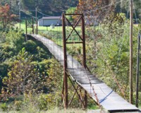
Ferrellsburg, West Virginia, USA - Guyandotte River
| Bridgemeister ID: | 2528 (added 2010-05-18) |
| Name: | (suspension bridge) |
| Location: | Ferrellsburg, West Virginia, USA |
| Crossing: | Guyandotte River |
| Coordinates: | 38.01376 N 82.08271 W |
| Maps: | Acme, GeoHack, Google, OpenStreetMap |
| Use: | Footbridge |
| Status: | In use (last checked: 2009) |
| Main Cables: | Wire (steel) |
| Suspended Spans: | 3 |
| Main Span: | 1 x 79.2 meters (260 feet) |
| Side Spans: | 1 x 15.8 meters (52 feet), 1 x 18.3 meters (60 feet) |
(suspension bridge)
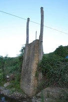
Franklin, West Virginia, USA - South Branch Potomac River
| Bridgemeister ID: | 4924 (added 2020-07-27) |
| Name: | (suspension bridge) |
| Location: | Franklin, West Virginia, USA |
| Crossing: | South Branch Potomac River |
| Coordinates: | 38.639645 N 79.332320 W |
| Maps: | Acme, GeoHack, Google, OpenStreetMap |
| Status: | Only towers remain (last checked: 2015) |
| Main Cables: | Wire |
External Links:
(suspension bridge)
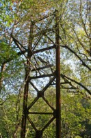
Hubball, West Virginia, USA - Guyandotte River
| Bridgemeister ID: | 2526 (added 2010-05-18) |
| Name: | (suspension bridge) |
| Location: | Hubball, West Virginia, USA |
| Crossing: | Guyandotte River |
| Coordinates: | 38.19713 N 82.19012 W |
| Maps: | Acme, GeoHack, Google, OpenStreetMap |
| Use: | Vehicular (one-lane) |
| Status: | Derelict (last checked: 2009) |
| Main Cables: | Wire |
| Main Span: | 1 |
Notes:
- Appears to have carried light vehicular traffic.
(suspension bridge)
Lenore, West Virginia, USA - Pigeon Creek
| Bridgemeister ID: | 2279 (added 2007-04-22) |
| Name: | (suspension bridge) |
| Location: | Lenore, West Virginia, USA |
| Crossing: | Pigeon Creek |
| Coordinates: | 37.79168 N 82.27318 W |
| Maps: | Acme, GeoHack, Google, OpenStreetMap |
| Use: | Vehicular (one-lane) |
| Status: | In use (last checked: 2007) |
| Main Cables: | Wire (steel) |
| Suspended Spans: | 2 |
| Main Span: | 1 x 40.5 meters (133 feet) estimated |
| Side Span: | 1 x 11 meters (36 feet) estimated |
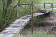
(suspension bridge)
Logan vicinity, West Virginia, USA - Guyandotte River
| Bridgemeister ID: | 3043 (added 2019-10-19) |
| Name: | (suspension bridge) |
| Location: | Logan vicinity, West Virginia, USA |
| Crossing: | Guyandotte River |
| Coordinates: | 37.827222 N 81.948611 W |
| Maps: | Acme, GeoHack, Google, OpenStreetMap |
| Status: | Only towers remain (last checked: 2016) |
| Main Cables: | Wire |
(suspension bridge)
Parsley Bottom, West Virginia, USA - Pigeon Creek
| Bridgemeister ID: | 2280 (added 2007-04-22) |
| Name: | (suspension bridge) |
| Location: | Parsley Bottom, West Virginia, USA |
| Crossing: | Pigeon Creek |
| Coordinates: | 37.78695 N 82.26205 W |
| Maps: | Acme, GeoHack, Google, OpenStreetMap |
| Use: | Vehicular (one-lane) |
| Status: | In use (last checked: 2007) |
| Main Cables: | Wire (steel) |
| Suspended Spans: | 3 |
| Main Span: | 1 x 20.4 meters (67 feet) |
| Side Spans: | 2 x 9.8 meters (32 feet) |
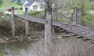
(suspension bridge)
Sheridan, West Virginia, USA - Guyandotte River
| Bridgemeister ID: | 2525 (added 2010-05-18) |
| Name: | (suspension bridge) |
| Location: | Sheridan, West Virginia, USA |
| Crossing: | Guyandotte River |
| Coordinates: | 38.24260 N 82.19645 W |
| Maps: | Acme, GeoHack, Google, OpenStreetMap |
| Use: | Vehicular (one-lane) |
| Status: | Derelict (last checked: 2009) |
| Main Cables: | Wire |
| Main Span: | 1 |
Notes:
- Listed as vehicular bridge due to "Jeep Bridge" notation on some topographical maps accompanying a footbridge symbol. The bridge appears to have been large enough to handle light vehicular traffic.
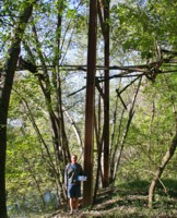
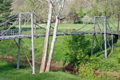
(suspension bridge)
Sissonville, West Virginia, USA - Pocatalico Creek
| Bridgemeister ID: | 1329 (added 2004-04-30) |
| Name: | (suspension bridge) |
| Location: | Sissonville, West Virginia, USA |
| Crossing: | Pocatalico Creek |
| Coordinates: | 38.553546 N 81.632531 W |
| Maps: | Acme, GeoHack, Google, OpenStreetMap |
| Use: | Vehicular (one-lane) |
| Status: | In use (last checked: 2010) |
| Main Cables: | Wire (steel) |
| Suspended Spans: | 1 |
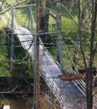
(suspension bridge)
West Union, West Virginia, USA - Middle Island Creek
| Bridgemeister ID: | 4940 (added 2020-08-08) |
| Name: | (suspension bridge) |
| Location: | West Union, West Virginia, USA |
| Crossing: | Middle Island Creek |
| Coordinates: | 39.338190 N 80.813029 W |
| Maps: | Acme, GeoHack, Google, OpenStreetMap |
| Use: | Vehicular (one-lane) |
| Status: | In use (last checked: 2013) |
| Main Cables: | Wire |
| Suspended Spans: | 1 |
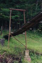
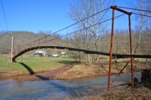
Big Run
Troy vicinity, Gilmer County, West Virginia, USA - Cove Creek
| Bridgemeister ID: | 557 (added before 2003) |
| Name: | Big Run |
| Location: | Troy vicinity, Gilmer County, West Virginia, USA |
| Crossing: | Cove Creek |
| Coordinates: | 39.04545 N 80.77028 W |
| Maps: | Acme, GeoHack, Google, OpenStreetMap |
| Use: | Footbridge |
| Status: | In use (last checked: 2008) |
| Main Cables: | Wire |
| Suspended Spans: | 3 |
| Main Span: | 1 |
| Side Spans: | 2 |
Notes:
Dry Fork
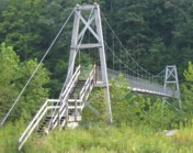
Hendricks vicinity, West Virginia, USA - Dry Fork Cheat River
| Bridgemeister ID: | 1336 (added 2004-05-01) |
| Name: | Dry Fork |
| Location: | Hendricks vicinity, West Virginia, USA |
| Crossing: | Dry Fork Cheat River |
| At or Near Feature: | Otter Creek Trail trailhead |
| Coordinates: | 39.04241 N 79.60825 W |
| Maps: | Acme, GeoHack, Google, OpenStreetMap |
| Use: | Footbridge |
| Status: | In use (last checked: 2004) |
| Main Cables: | Wire (steel) |
| Suspended Spans: | 1 |
Notes:
- South of Hendricks near where Otter Creek flows into the Dry Fork.
- Near (footbridge) - Hendricks, West Virginia, USA.
Elkhurst
Elkhurst, Clay County, West Virginia, USA - Elk River
| Bridgemeister ID: | 327 (added before 2003) |
| Name: | Elkhurst |
| Location: | Elkhurst, Clay County, West Virginia, USA |
| Crossing: | Elk River |
| Coordinates: | 38.45182 N 81.15428 W |
| Maps: | Acme, GeoHack, Google, OpenStreetMap |
| Use: | Vehicular (one-lane) |
| Status: | Closed, 2003 (last checked: 2004) |
| Main Cables: | Wire (steel) |
| Suspended Spans: | 3 |
| Main Span: | 1 |
| Side Spans: | 2 |
Notes:
- Very narrow vehicular suspension bridge.
- 4,200-pound weight limit imposed, 1968.
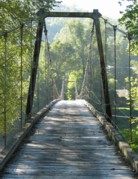
Last Chance
Brake, West Virginia, USA - South Fork South Branch Potomac River
| Bridgemeister ID: | 2387 (added 2007-11-18) |
| Name: | Last Chance |
| Location: | Brake, West Virginia, USA |
| Crossing: | South Fork South Branch Potomac River |
| Coordinates: | 38.90370 N 79.02941 W |
| Maps: | Acme, GeoHack, Google, OpenStreetMap |
| Use: | Footbridge |
| Status: | In use (last checked: 2007) |
| Main Cables: | Wire |
| Suspended Spans: | 1 |
| Main Span: | 1 x 65.5 meters (215 feet) |
Notes:
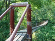
Long Bottom
Hinton, West Virginia, USA - New River
| Bridgemeister ID: | 2113 (added 2006-09-03) |
| Name: | Long Bottom |
| Location: | Hinton, West Virginia, USA |
| Crossing: | New River |
| Status: | Removed |
| Main Cables: | Wire (steel) |
Notes:
- From a sign at the New River Gorge visitors center: "Built in the 1920's, this suspension bridge connected the New River Lumber Company sawmill with the Long bottom train station on the other side of the New River. Rail cars pulled by a steel cable carried lumber to the railroad station."
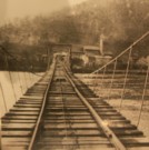
Pleasant Island
Elkview, West Virginia, USA - Elk River
| Bridgemeister ID: | 3287 (added 2019-11-23) |
| Name: | Pleasant Island |
| Location: | Elkview, West Virginia, USA |
| Crossing: | Elk River |
| Coordinates: | 38.446935 N 81.462663 W |
| Maps: | Acme, GeoHack, Google, OpenStreetMap |
| Use: | Footbridge |
| Status: | Extant (last checked: 2015) |
| Main Cables: | Wire (steel) |
Sector
Sector, Romney, West Virginia, USA - South Branch Potomac River
| Bridgemeister ID: | 4922 (added 2020-07-26) |
| Name: | Sector |
| Location: | Sector, Romney, West Virginia, USA |
| Crossing: | South Branch Potomac River |
| Coordinates: | 39.227030 N 78.853329 W |
| Maps: | Acme, GeoHack, Google, OpenStreetMap |
| References: | AAJ |
| Use: | Vehicular |
| Status: | Removed |
| Main Cables: | Wire |
| Suspended Spans: | 2 |
| Main Spans: | 1 x 18.3 meters (60 feet), 1 x 27.4 meters (90 feet) |
Notes:
- Coordinates are approximate location of this bridge, believed to be where present day (2020) Fleming-Sector Road would have continued to intersect the river. Location was also known as Glebe Station.
External Links:
Southside
Richwood, West Virginia, USA - Cherry River South Fork
| Bridgemeister ID: | 1503 (added 2004-10-08) |
| Name: | Southside |
| Location: | Richwood, West Virginia, USA |
| Crossing: | Cherry River South Fork |
| Use: | Footbridge |
| Status: | Derelict, since 2003 |
| Main Cables: | Wire |
| Main Spans: | 2 |
Notes:
- Located off of Front Street. Heavily damaged by November, 2003 floods.
Swinging
Adamston and North View, West Virginia, USA - West Fork River
| Bridgemeister ID: | 1981 (added 2005-12-02) |
| Name: | Swinging |
| Location: | Adamston and North View, West Virginia, USA |
| Crossing: | West Fork River |
| Use: | Footbridge |
| Main Cables: | Wire |
Swinging
Elkins, West Virginia, USA - Roaring Creek (Tygart Valley River)
| Bridgemeister ID: | 2600 (added 2014-04-14) |
| Name: | Swinging |
| Location: | Elkins, West Virginia, USA |
| Crossing: | Roaring Creek (Tygart Valley River) |
| Coordinates: | 38.923367 N 79.852452 W |
| Maps: | Acme, GeoHack, Google, OpenStreetMap |
| Use: | Footbridge |
| Status: | Closed, 2016 |
| Main Cables: | Wire |
| Suspended Spans: | 1 |
Notes:
- Closed since 2016 after an inspection deemed it unsafe. Was mentioned in local press several times in 2019 and 2020 with the community upset that no action was taken to repair the bridge which provided a convenient means of reaching downtown Elkins. Various articles in this time frame refer to the bridge as 76 or 80 years old.
Vietnam Veterans Memorial Swinging
Mannington, West Virginia, USA - Buffalo Creek
| Bridgemeister ID: | 7674 (added 2023-06-17) |
| Name: | Vietnam Veterans Memorial Swinging |
| Location: | Mannington, West Virginia, USA |
| Crossing: | Buffalo Creek |
| Coordinates: | 39.529786 N 80.342461 W |
| Maps: | Acme, GeoHack, Google, OpenStreetMap |
| Use: | Footbridge |
| Status: | Only towers remain, since c. 2014-2015 |
| Main Cables: | Wire (steel) |
Notes:
- 1990s-2000s: Rebuilt more than once.
- 2013-2014: Bridge is in a derelict state. By 2015 the deck is completely gone or removed.
Wire
Grace, Springfield, West Virginia, USA - South Branch Potomac River
| Bridgemeister ID: | 4921 (added 2020-07-26) |
| Name: | Wire |
| Location: | Grace, Springfield, West Virginia, USA |
| Crossing: | South Branch Potomac River |
| Coordinates: | 39.427319 N 78.714996 W |
| Maps: | Acme, GeoHack, Google, OpenStreetMap |
| Use: | Vehicular |
| Status: | Removed |
| Main Cables: | Wire (iron) |
Notes:
- A Civil War skirmish known as the "Wire Bridge Engagement" occurred on October 24, 1861 at the location of the present day (2020) Grace crossing (John Blue Bridge). The bridge played a prominent role as the event unfolded on and around the bridge, described very specifically as a wire bridge. A historical marker at the site shows an illustration from the New York Illustrated News (1862) clearly showing a period-correct vehicular suspension bridge.
- This location was in Virginia at the time the bridge was completed (prior to 1861, presumably).
- Coordinates are of the present day (2020) crossing at this location, believed to be very close to the location of the suspension bridge, if not the same location.
Do you have any information or photos for these bridges that you would like to share? Please email david.denenberg@bridgemeister.com.