Tyngs Island Suspension Bridge
This is an image set within the Bridgemeister collection.
| Bridge: | Tyngs Island Suspension Bridge |
| Location: | Vesper Country Club, Lowell vicinity, Massachusetts, USA - Merrimack River |
| Coordinates and Maps: | See related inventory record(s). |
| Image Set Contributor: | Stuart Brorson |
| Related Suspension Bridge Inventory: | 1908 Tyngs Island - Lowell vicinity, Massachusetts, USA |
| Related Image Lists: | All from Stuart Brorson All in Massachusetts All in USA All Pedestrian Suspension Bridges |
| Credit: | All photos by Stuart Brorson. Please do not reuse without permission. |
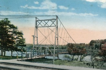 Stuart provided a detailed account of his search for the remains of this bridge: "In your database you have this picture. It shows a footbridge crossing the Merrimack from a train stop to the Vesper Country Club. I was intrigued by this postcard since it evokes a different, and perhaps better time for Lowell. Unfortunately, you don't seem to have much information about the bridge. Moreover, I am unaware of any suspension bridges crossing the Merrimack River anywhere near Lowell.
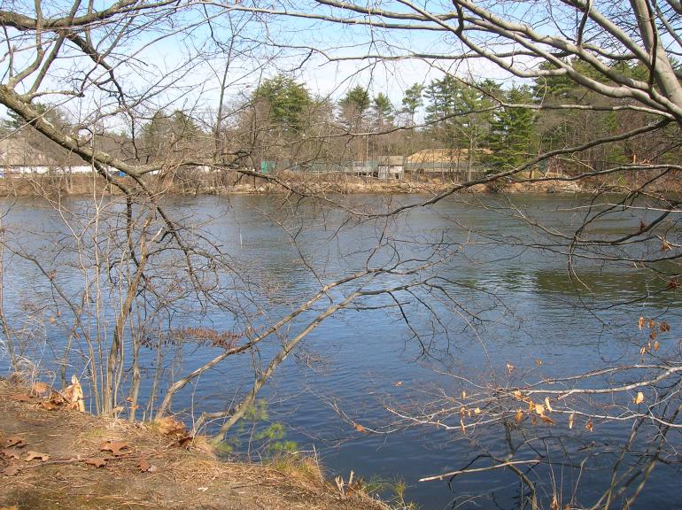
"However, Tyngs Island and the Vesper Country Club still exist. Here's a Google Maps satellite photo of the island: Google Maps: Tyngs Island. You'll notice that there are railroad tracks running along the southern bank of the river opposite Tyngs Island, just as there are in the postcard. It is logical that the Boston and Maine RR would have a whistle stop somewhere along that stretch for wealthy Lowell residents to disembark and walk the bridge over the river to the coutry club.
"...After a nice lunch in Lowell we rode our bikes up Tyngsborough road. Our ride took us beyond Lowell, through Chelmsford, and then just over the town line into Tyngsborough to the area just opposite Tyngs Island.
"We parked our bikes along the tracks in the area where Google Maps shows a large white rectangle between the tracks and the river. I figured that the bridge would have been somewhere in that area. The white rectangle in the satellite image is the main building of a large granite dealer. We tramped around that property but found nothing. There is also a boat service facility at that location. We showed a photocopy of your postcard to a guy who happened to be working there on Sunday. He shook his head and said he had no idea where the bridge might have been.
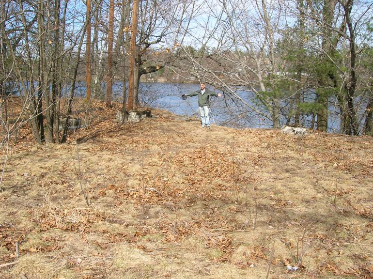
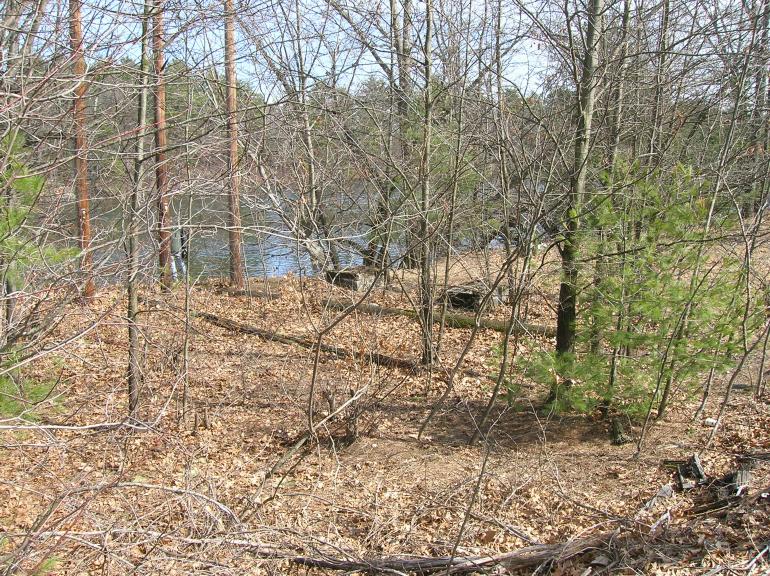
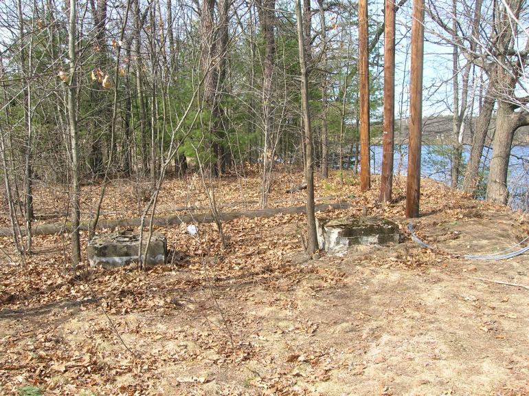
"Undeterred, we ambled up the tracks from there (north and west), and ducked into the woods just beyond the end of the granite dealer's property. We didn't go very far and we came across a site which in all likelihood was the site of the suspension bridge.
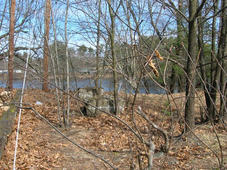
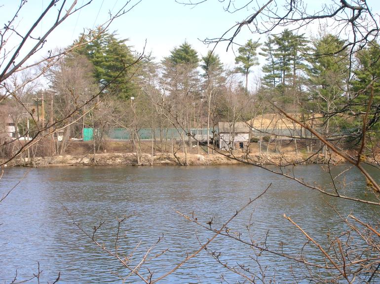
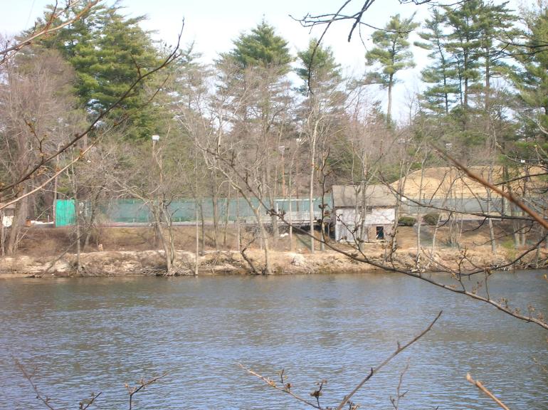
"This site is perhaps 100 feet beyond the fence marking the end of the granite dealer's property, adjacent to a signal light for the railroad. It is fairly wooded now, and is the kind of place where sullen teens and hobos go to smoke cigarettes and drink cheap beer. The site is about 10-15 feet above the water level, which makes sense from the perspective of erecting a suspension bridge. On the other side of the river is a small house-like structure, maybe the same one shown in the photo? Or maybe not. The main buildings of the country club are just upriver (north and west) of this site, which seems to be reflected in your postcard.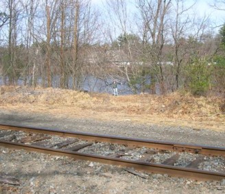 "Here's a close-up of the site from Google Maps: Google Maps: Tyngs Island.
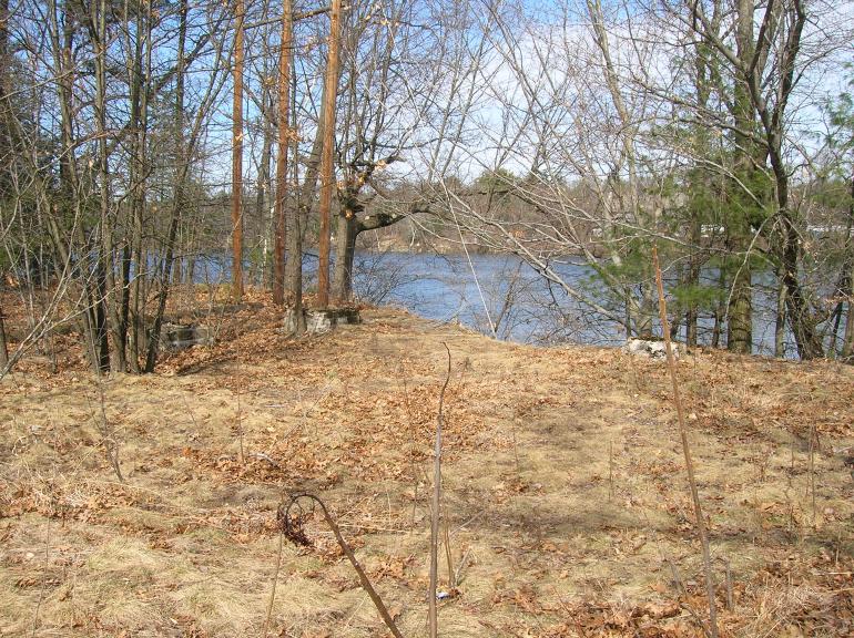
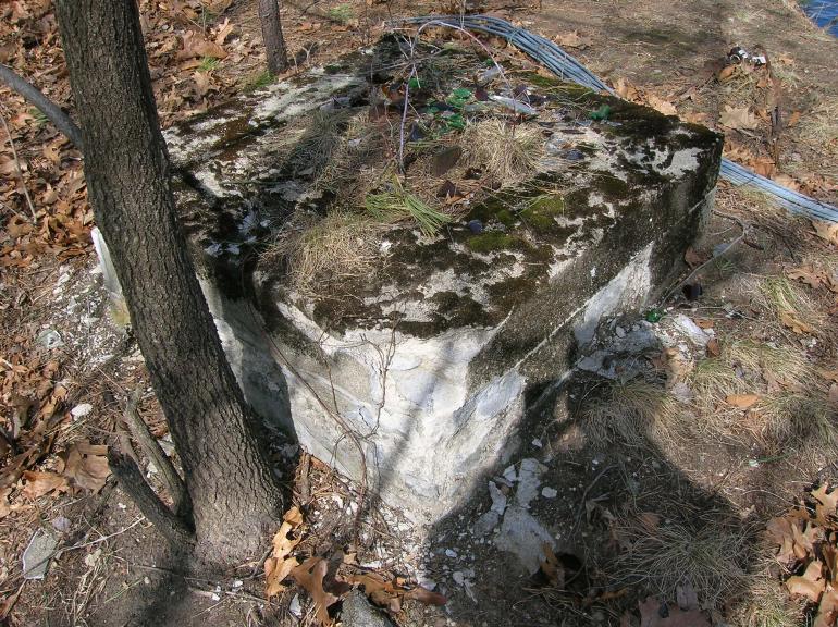
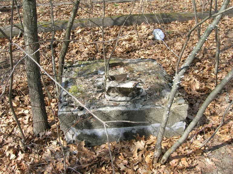
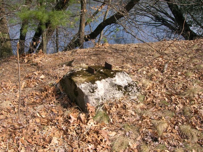
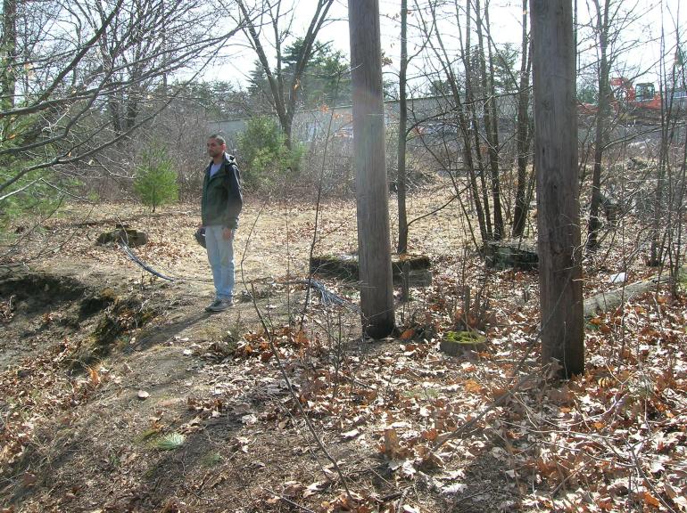
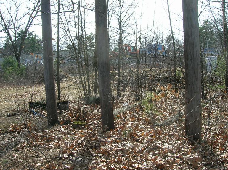
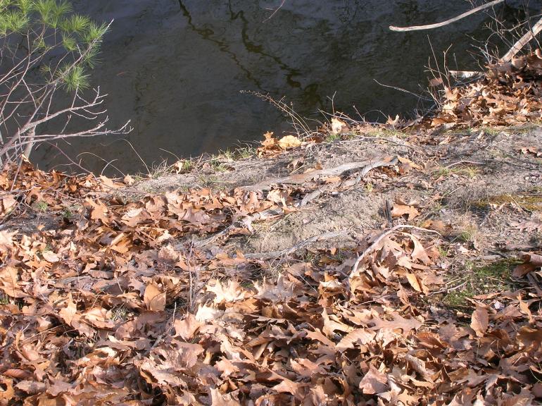
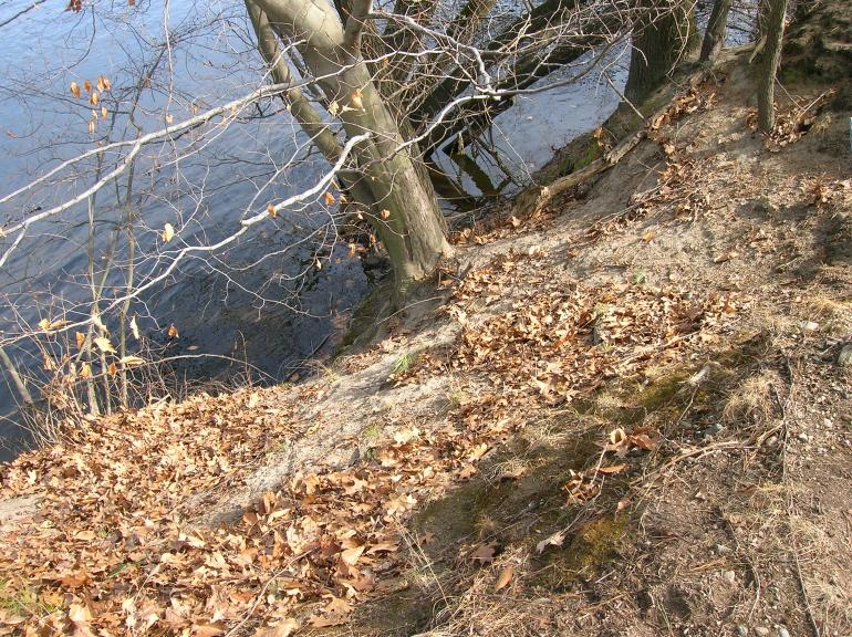
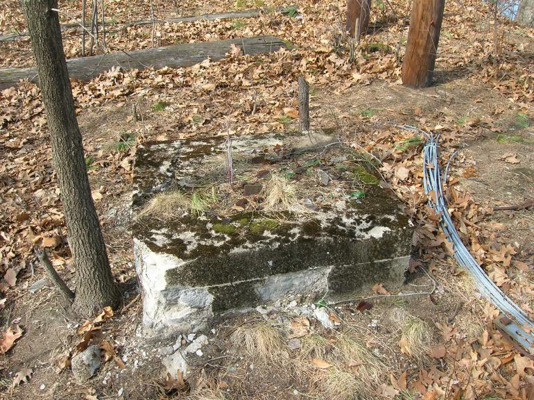
"At this site, we found three old concrete footings with vertically protruding metal I-beams sprouting from them. You can see them in the photo set [below]. The I-beams were cut off about one or two inches above the concrete. I would have expected to find four footings, not three, but three is all we found.
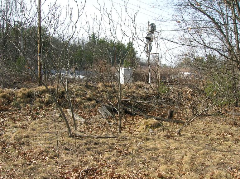
"We also found some old metal cables in amazingly good condition on the slope down towards the river. Maybe the support cables were galvanized? The cables are in the photos which look down towards the river -- you need to look closely, but they are there.
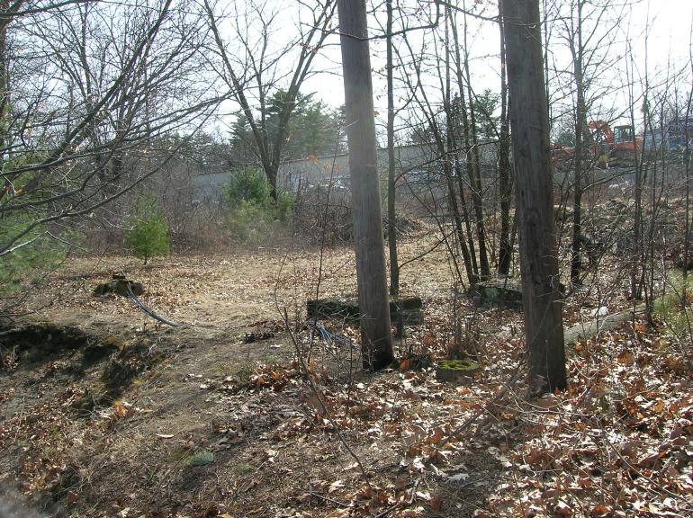
"There is a large dirt mound next to the tracks. I wonder if that is the remains of the station platform? The dirt pile has lots of wooden pieces sticking out of it. Maybe some are ties, but others may be from the platform and gang-plank to the bridge? I don't know. There were also some stone fragments in the dirt pile -- slate and granite -- which looked as if they were shaped by man. However, they didn't have any identifying markings on them, so we don't know what purpose they may have served -- if any.
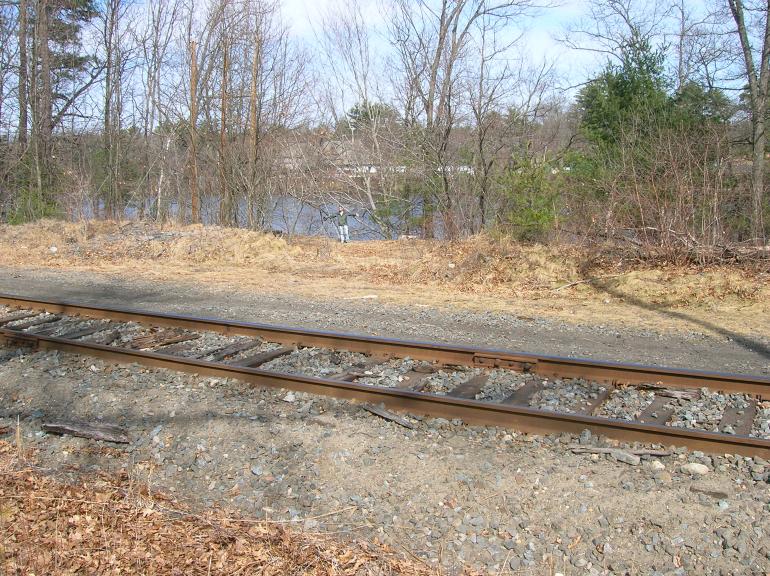
"There is only one track running by the site, but the railroad's right of way is clearly wide enough to hold two tracks. I would imagine that the RR pulled up one of the two tracks some time ago when they were busy shrinking. There are two tracks leaving Lowell in this direction; somewhere between Lowell and this site the two tracks become one.
"Therefore, we believe we have solved the mystery of your suspension bridge over the Merrimack. It did exist once, but is long since gone. However, some traces remain, and they are documented in the photoset."
Mail | Facebook | X (Twitter) | Bluesky