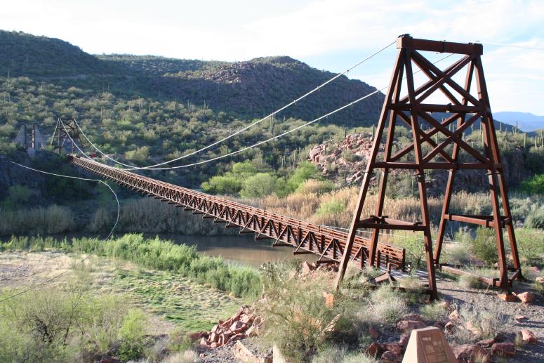
Verde River Sheep Bridge
This is an image set within the Bridgemeister collection.
| Bridge: | Verde River Sheep Bridge |
| Location: | Sheep Crossing (Cave Creek vicinity), Arizona, USA - Verde River |
| Coordinates and Maps: | See related inventory record(s). |
| Image Set Contributor: | Patrick S. O'Donnell |
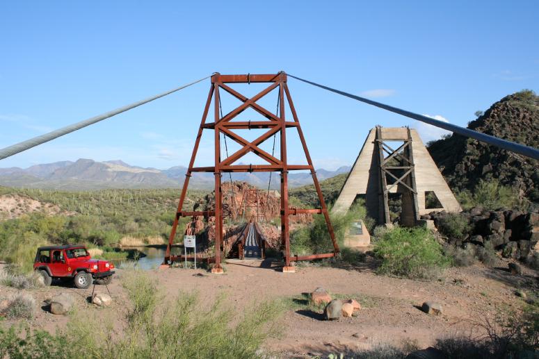
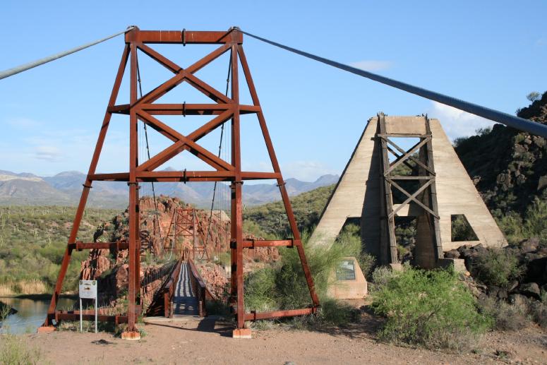
| Related Suspension Bridge Inventory: | 1989 Sheep - Sheep Crossing (Cave Creek vicinity), Arizona, USA |
| Related Image Lists: | All from Patrick S. O'Donnell All in Arizona All in USA All Pedestrian Suspension Bridges |
| Credit: | All photos by Patrick S. O'Donnell. Please do not reuse without permission. |
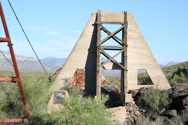
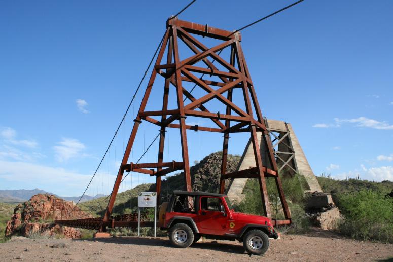
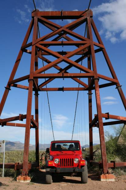
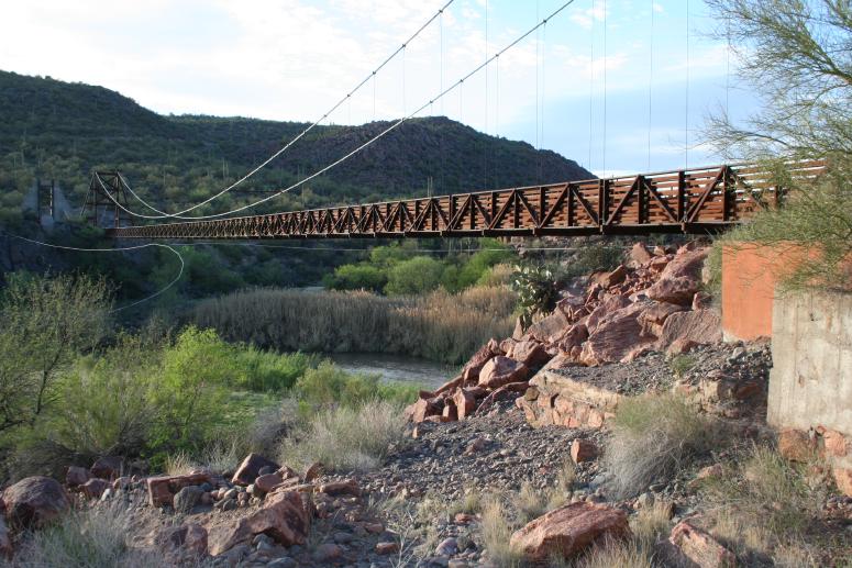
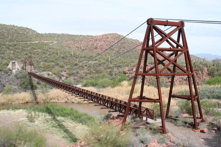
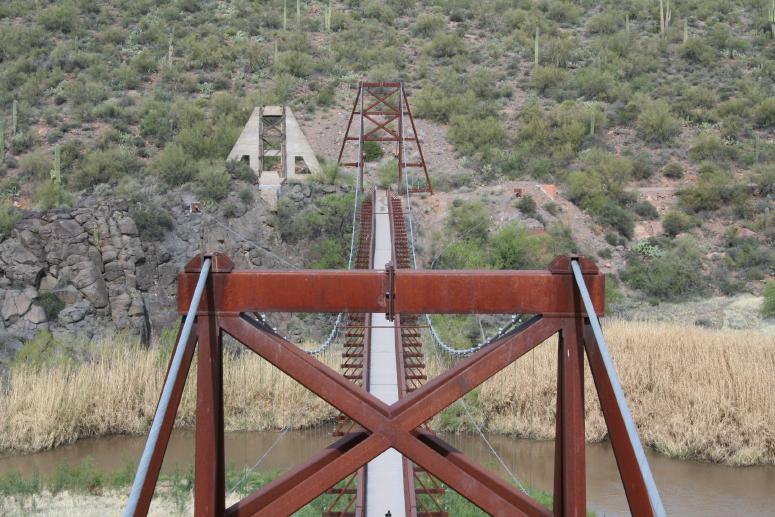
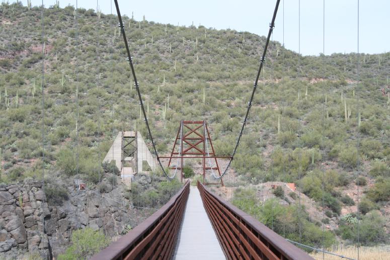
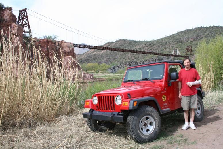
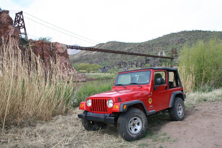
Patrick made an extended visit to the Verde River Sheep bridges in early 2007. This page shows the site focusing on the newer 1989 replacement bridge. Another page of Patrick's photos focuses on the original 1943 bridge. 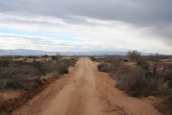 Patrick writes: "Upon first learning of the Sheep Bridge's existence several years ago, it had become the suspension bridge in North America I most wanted to visit. The combination of its design (including length), history, and remoteness has kept it in the forefront of my mind. It's the remoteness that has intimidated me from visiting this bridge any sooner as it's located in the middle of nowhere, in the middle of Arizona. Research had informed me that getting to this bridge would require a vehicle with 'clearance'. With time off from work to nurse a busted up wrist from a bicycle spill, I found a place over the Internet in Sedona, Arizona that rents Jeep Wrangler trail-ready 4X4s. Within a few days I was on my way to see the Sheep Bridge.
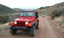 "Well-rested from missing the last three weeks of work due to the fractured wrist and excited to finally be visiting the Sheep Bridge; I had no problem driving straight through to Sedona, Arizona from here in Pennsylvania an hour outside of Philadelphia. I left at 5AM on a Monday driving straight through solo 35 hours 2,326 miles to Sedona, Arizona, arriving at 1PM Tuesday. By 1:30 I was in the Jeep on my way to the Sheep Bridge. Another three hours of driving and 83 miles later I was at the Sheep Bridge. The last 32 of those miles where on at times, rough, unpaved, rock strewn, twisting roads.
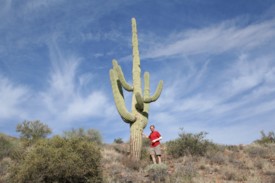 "Exiting I-17 at 'Bloody Basin Road' you'll immediately enter the Agua Fria National Monument where Bloody Basin Road becomes dirt having been paved for only the 1/4 mile from the highway. Agua Fria National Monument eventually becomes Tonto National Forest with little fanfare. About 20 miles in off the interstate, Bloody Basin Road ends at the junctions of Cave Creek Road (goes to the south, right, to Cave Creek) and, Forest Route 269 (straight). Continue on Forest Route 269 for the 12 miles to the Sheep Bridge. It's these last 12 miles where the 'vehicle with clearance' is most appreciated.
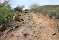 "I spent an hour and a half at the bridge before deciding to head back to take advantage of the remaining daylight for at least the stretch back to the highway. I returned to Sedona to my vehicle to sleep. I had been up for 45 hours and had driven just over 40 of those, covering 2,491 miles. Of the nearly 5 hours not driving - 2.5 hours spent refueling (vehicle and myself), half hour spent divided between a brief bridge visit just before entering Sedona and signing off on the Jeep, hour and a half at the Sheep Bridge, and half hour calling home via a land line on two occasions as I don't own a cell phone yet.
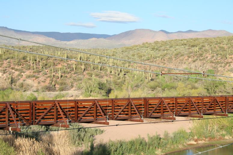
"When I woke up on Wednesday morning 7 hours later, I decided to head back to the Sheep Bridge since I had the Jeep until 1:30 for the 24-hour rental period. I would end up with another two hours at the bridge as well as more time to photograph the scenery along the way into and surrounding the bridge. Large part of the scenery was the Saguaros - my first. I had no idea that on average they're taller than a two story house. Of the 7 hours driving the two round trips on the ~130 miles of dirt roads, I'd encountered only a dozen vehicles - most of those being quad runners. Of the total 3.5 hours between the two visits at the bridge I was the only one to use it - as a crossing. There were several young adults hanging out under the bridge swinging from a rope affixed to the underside of the bridge into the Verde River. I would have joined them if it weren't for my cast and instructions not to get it wet."
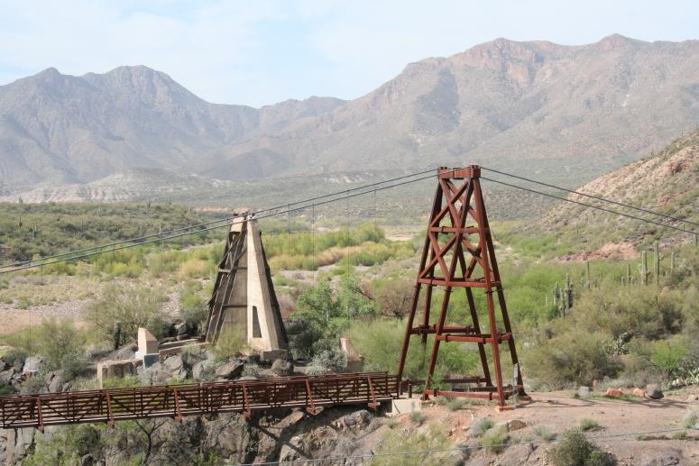
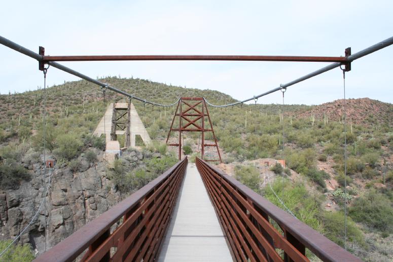
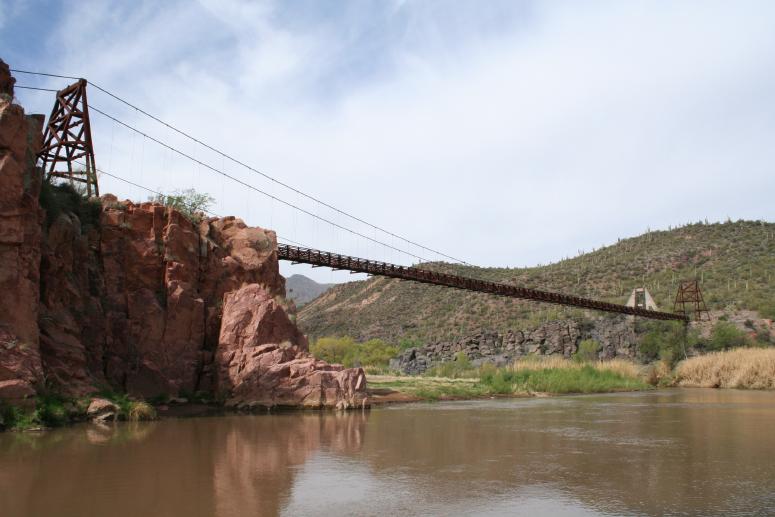
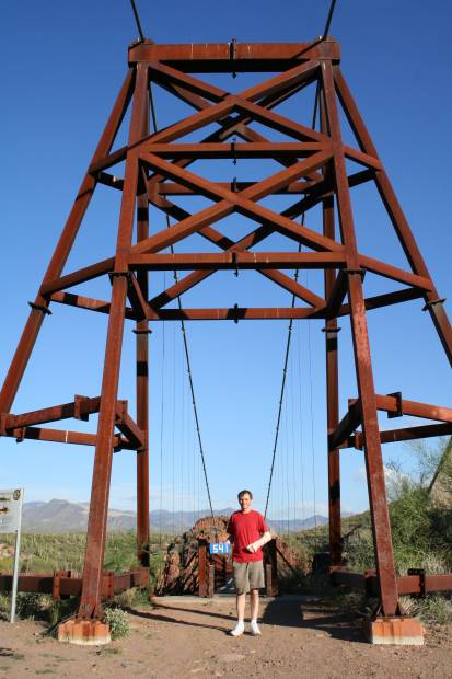
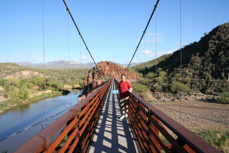
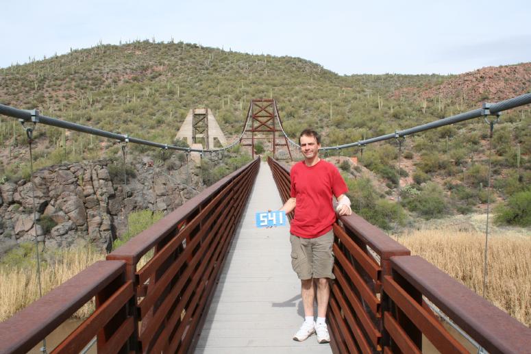
Patrick notes the first 24 photos are: "From the west end of the bridge looking primarily to the east during the first visit... Looking east across the Verde River into the Mazatzal Wilderness and Mazatzal Mountains on the horizon. The mountain with the yellow vegetation is Table Mountain at 5,408 feet; ~2,400 feet above the Verde River at 8 miles distance. The Mazatzal Mountains on the horizon are 14 miles distant with some peaks close to 6,000 feet above the river."
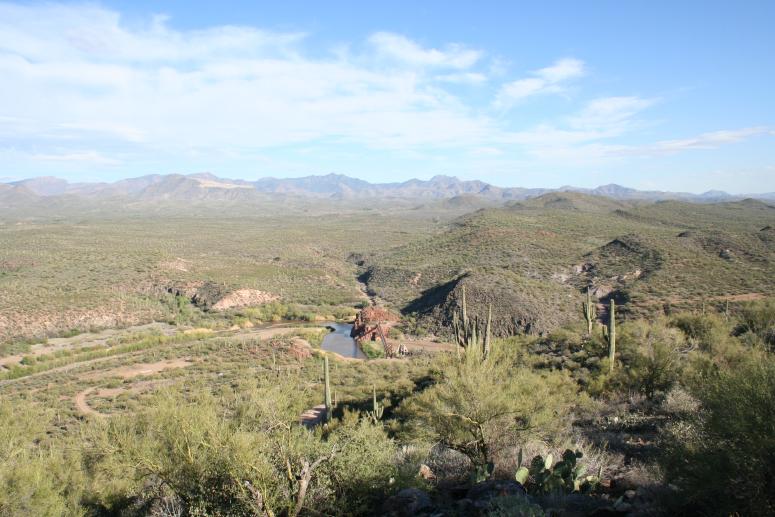
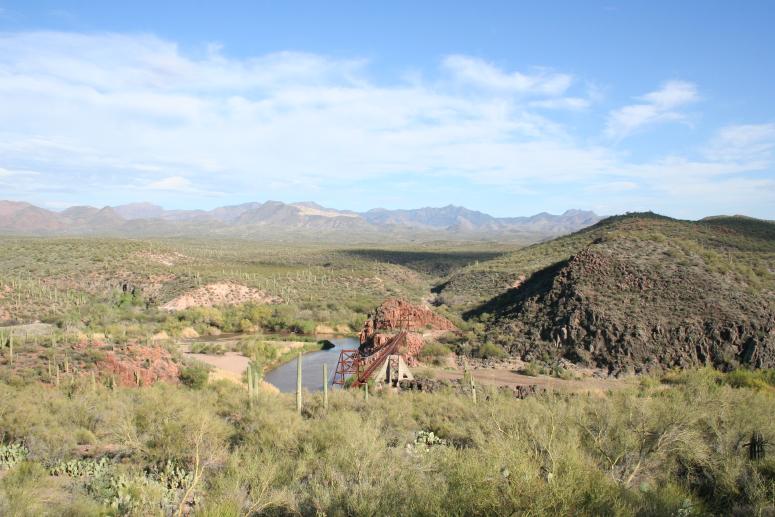
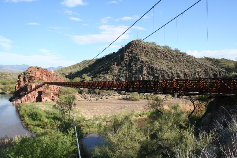
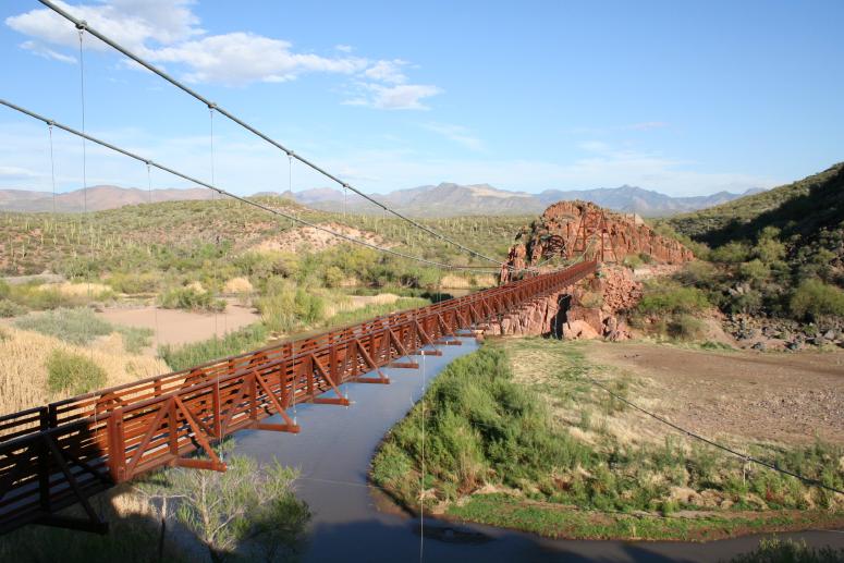
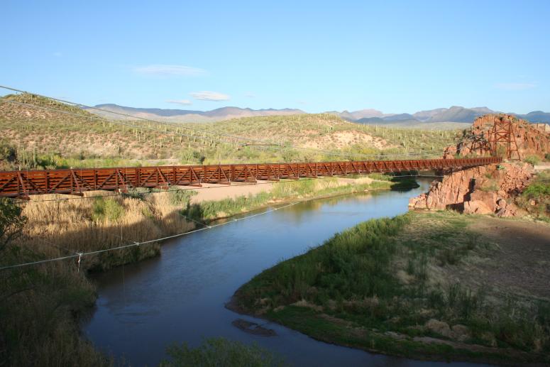
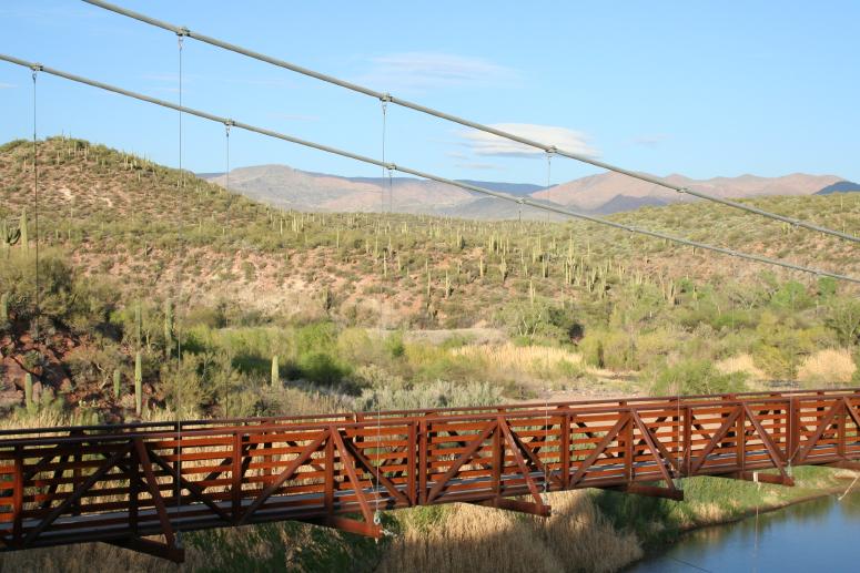
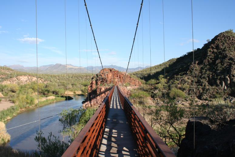
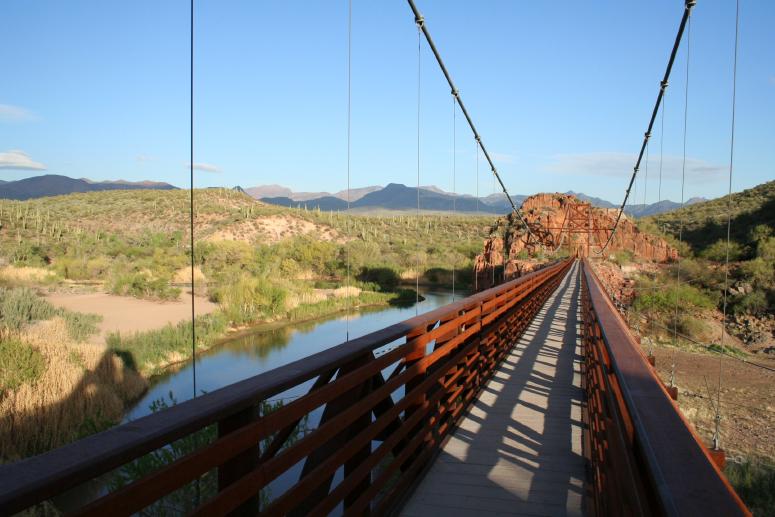
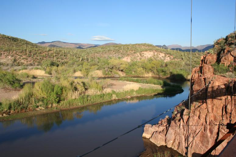
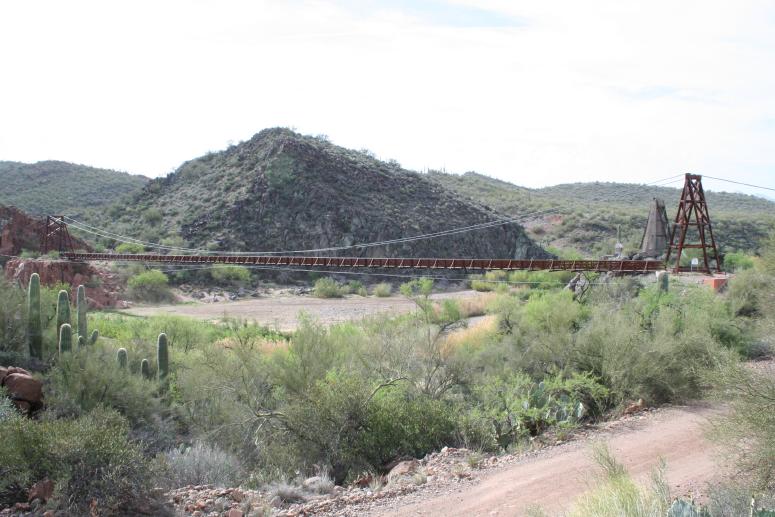
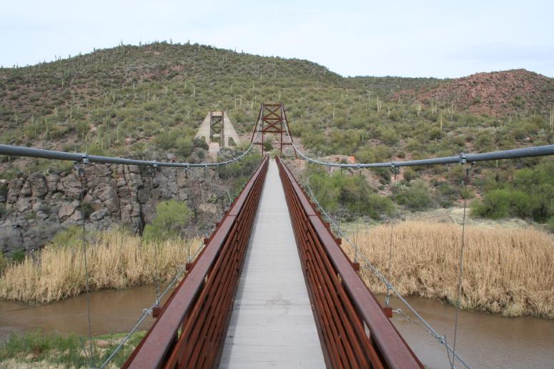
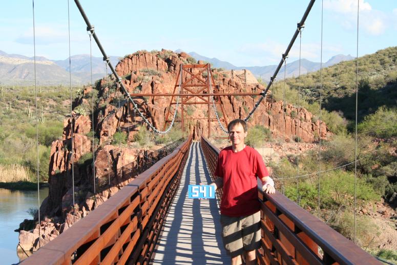
"Looking back west across the Verde River during the first visit."
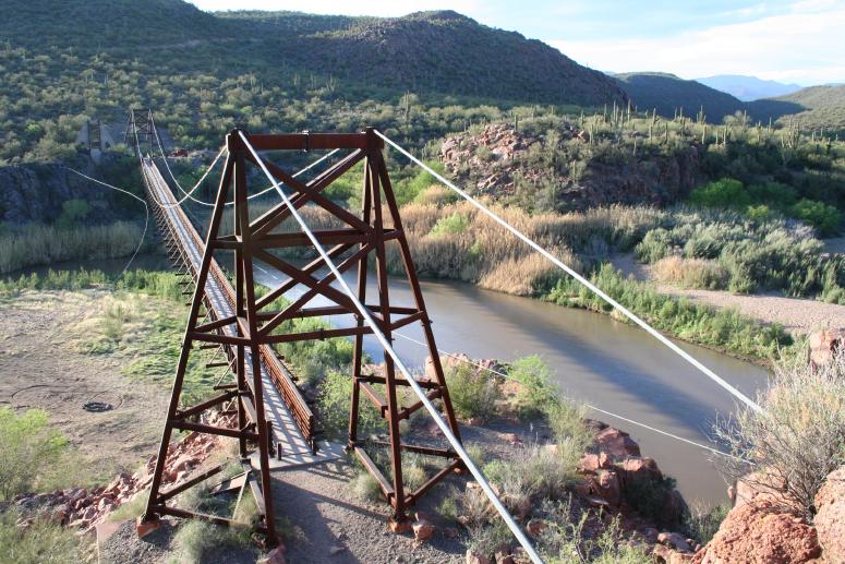
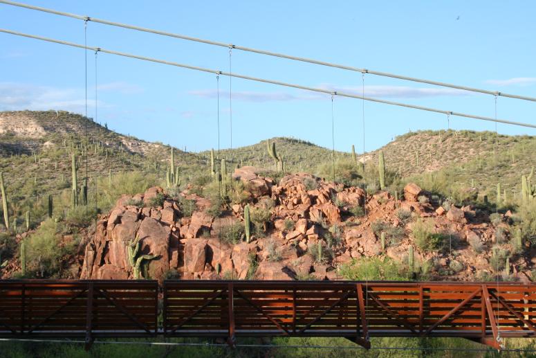
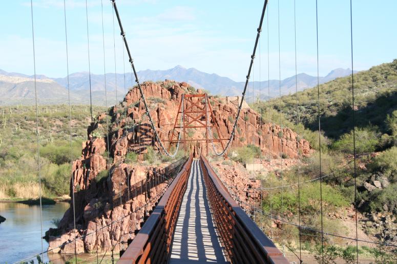
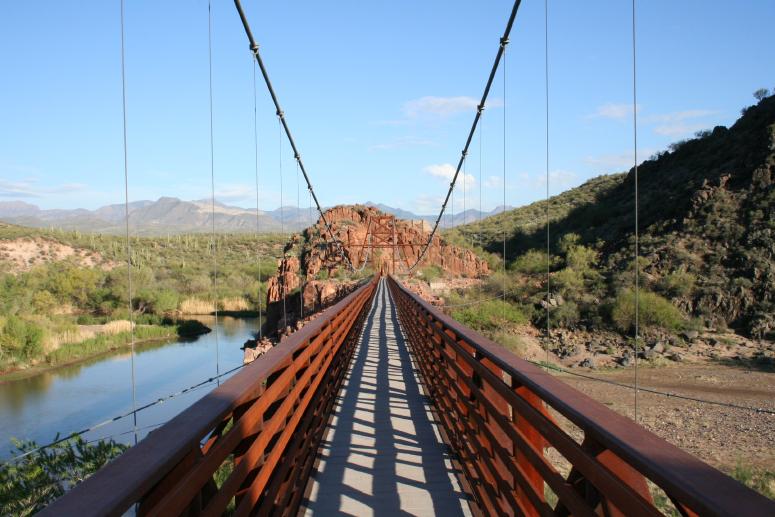
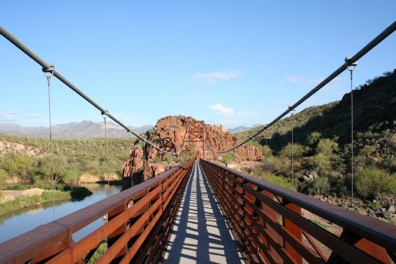
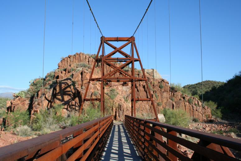
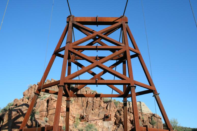
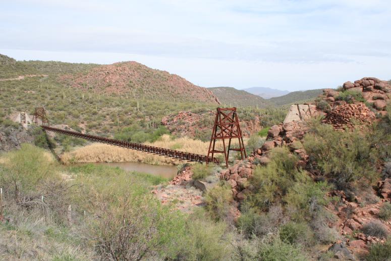
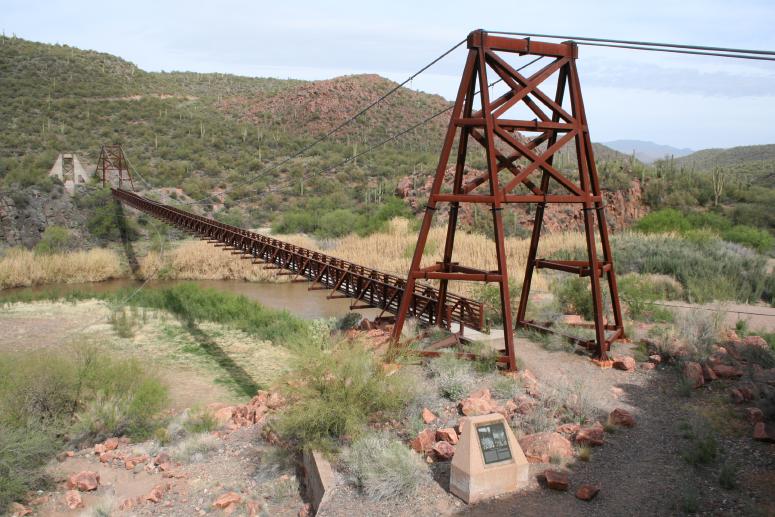
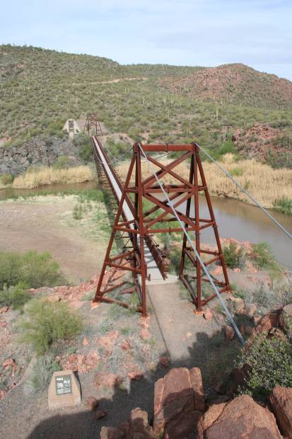
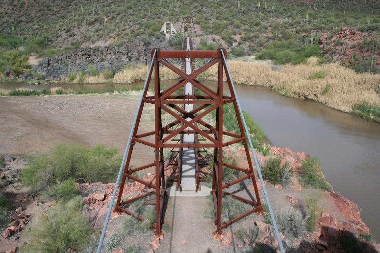
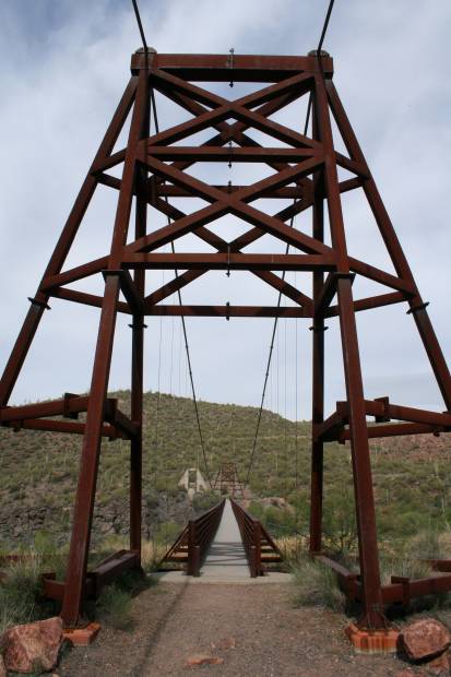
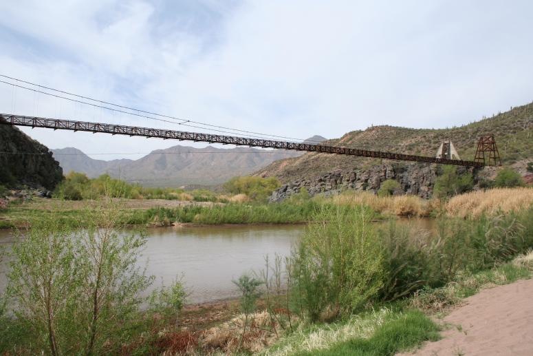
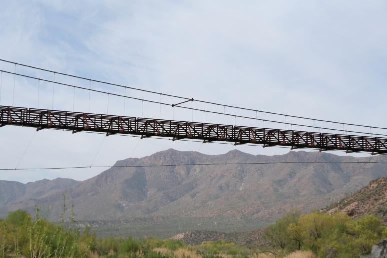
Patrick notes the next 21 photos are from his second visit to the bridge, the next morning.
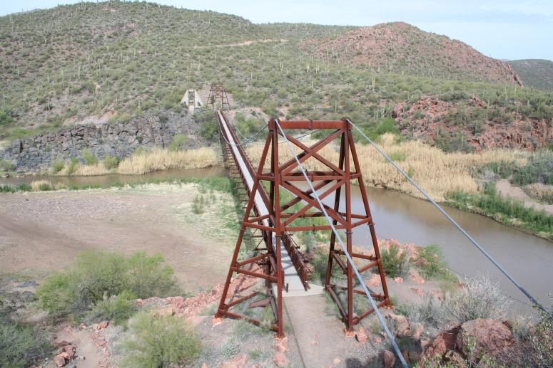
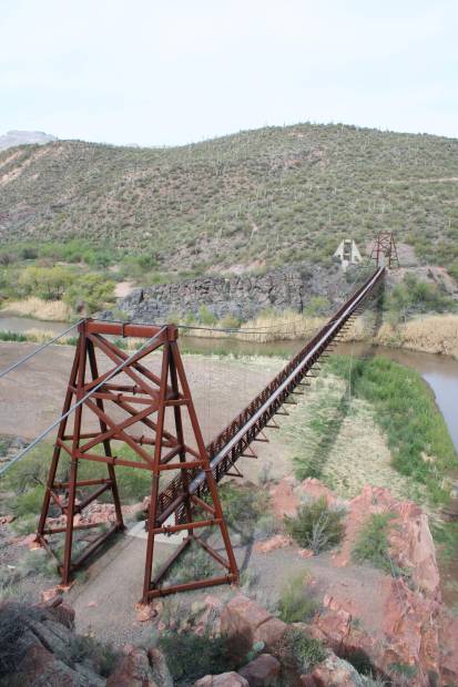
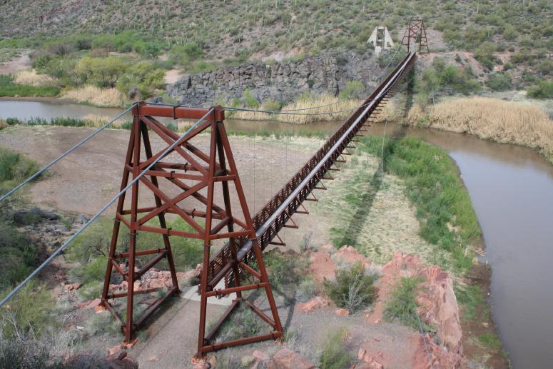
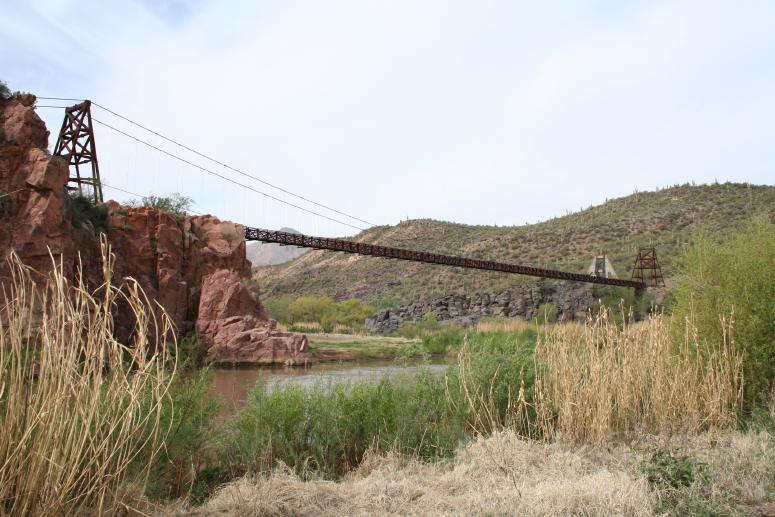
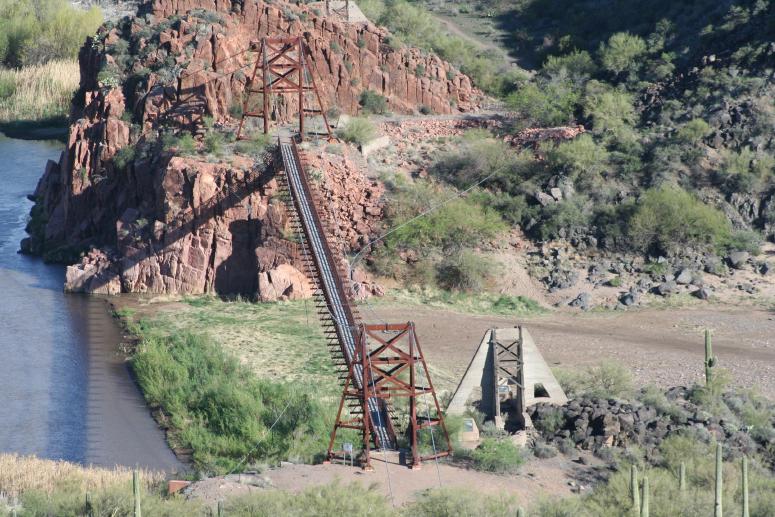
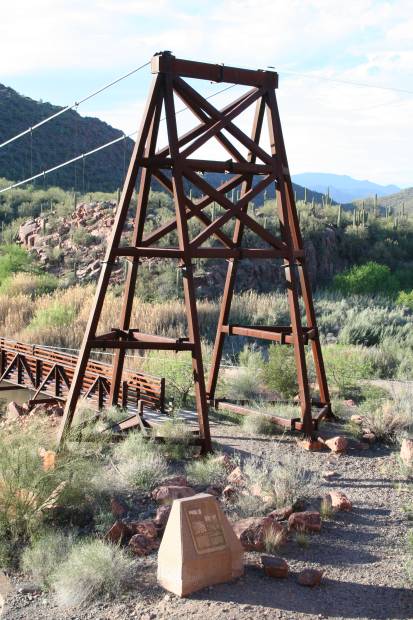
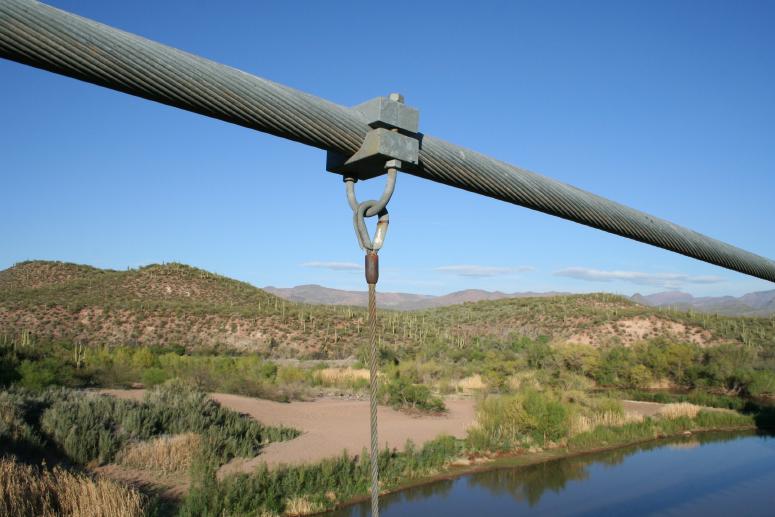
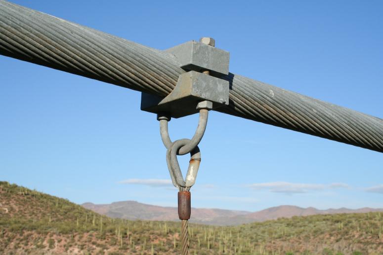
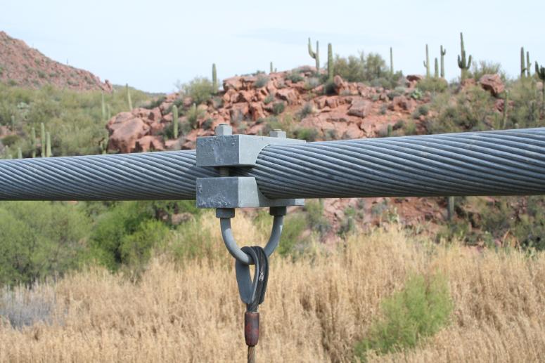
The next two photos show a sway cable anchorage.
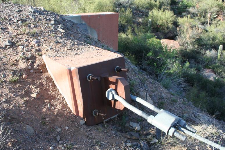
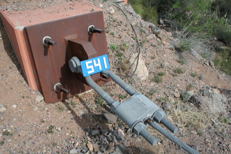
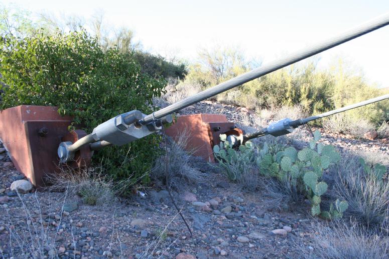
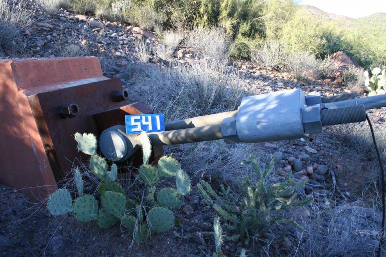
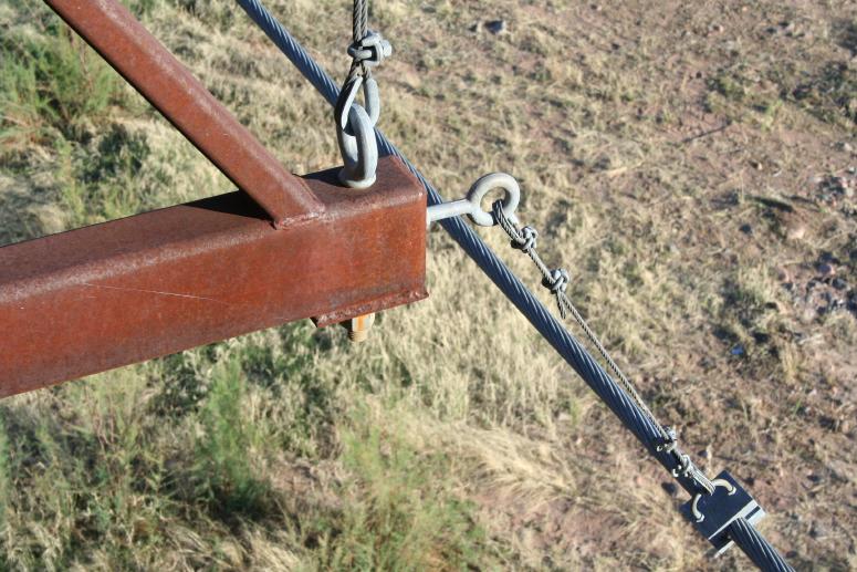
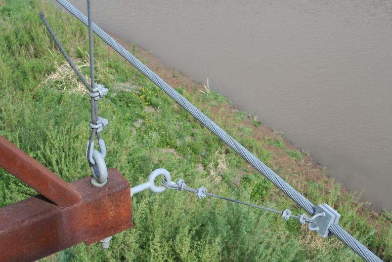
The next three photos show the west anchorage.
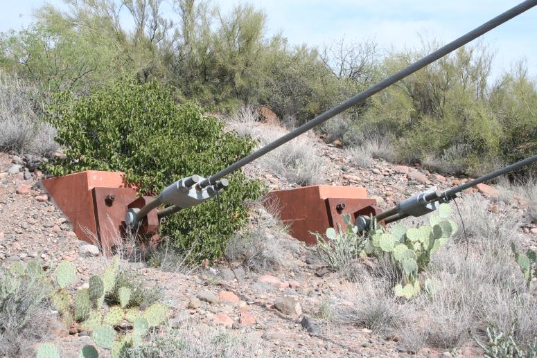
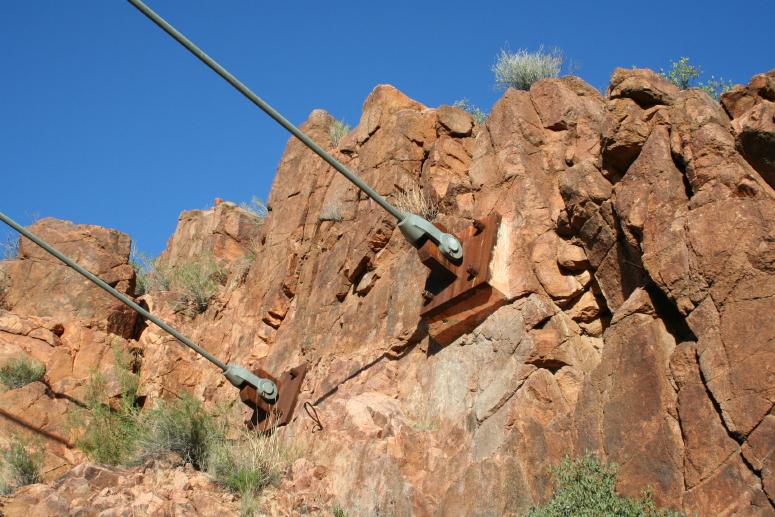
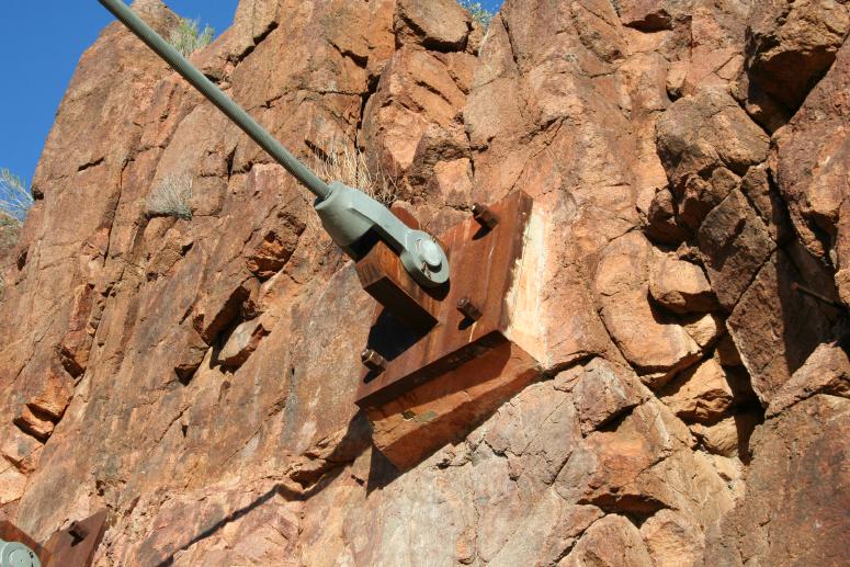
The next two photos show the east anchorage.
Mail | Facebook | X (Twitter) | Bluesky