Inventory Search Results (101-200 of 432)
Results : << < 1-100 101-200 201-300 301-400 401-432 > >> All
432 suspension bridges were found for search criteria: county .
Bridges 101 through 200 (of 432 total) appear below. Click the Bridgemeister ID number to isolate the bridge on its own page.
If you don't see what you were looking for, try an image search with the same criteria: county
Related:
Your search includes criteria for which the Bridgemeister inventory has incomplete data such as
Year Completed, Usage, Status, Span Length, and Number of Suspended Spans. The results below are
based on the information currently available within the inventory. Also, span lengths are sometimes estimated
based on satellite imagery.
Bridgemeister ID: 2550 (added 2012-01-01)Year Completed: 2009 Name: Balinghe Also Known As: 坝陵河特大桥, Ba Lin He Location: Guanling County, Guizhou , China Crossing: Baling River Coordinates: 25.962140 N 105.631658 E Maps: Acme , GeoHack , Google , OpenStreetMap Use: Vehicular Status: In use (last checked: 2019) Main Cables: Wire (steel) Suspended Spans: 1 Main Span: 1 x 1,088 meters (3,569.6 feet)
Bridgemeister ID: 2551 (added 2012-01-01)Year Completed: 2009 Name: Si Du River Also Known As: 四渡河特大桥, Siduhe River, Sidu River Location: Yesanguan vicinity, Badong County, Hubei , China Crossing: Si Du River Coordinates: 30.620540 N 110.395035 E Maps: Acme , GeoHack , Google , OpenStreetMap Use: Vehicular Status: In use (last checked: 2019) Main Cables: Wire (steel) Suspended Spans: 1 Main Span: 1 x 900 meters (2,952.8 feet)
When completed was recognized as the "highest" bridge (of any kind) with roadway 496 meters above the lowest point (the Si Du River) below the bridge. Its height has since been surpassed. Bridgemeister ID: 8140 (added 2024-01-21)Year Completed: 2010 Name: Nezha Location: Xingfu Village (幸福村), Beichuan County (北川县), Mianyang and Qinghecun (清合村), Jiangyou, Mianyang, Sichuan , China Crossing: Tongkou River At or Near Feature: Qianyuan Mountain Scenic Area Coordinates: 31.828611 N 104.581306 E Maps: Acme , GeoHack , Google , OpenStreetMap Use: Vehicular Status: In use (last checked: 2020) Main Cables: Wire (steel) Suspended Spans: 1 Main Span: 1 x 252 meters (826.8 feet)
Bridgemeister ID: 5130 (added 2020-09-06)Year Completed: 2012 Name: Lancangjiang Pipeline Also Known As: 澜沧江油气管线桥 Location: Shanyangxiang vicinity, Yongping County, Yunnan , China Crossing: Lancangjiang Coordinates: 25.290117 N 99.347627 E Maps: Acme , GeoHack , Google , OpenStreetMap Use: Pipeline Status: In use (last checked: 2019) Main Cables: Wire (steel) Suspended Spans: 1 Main Span: 1 x 280 meters (918.6 feet)
Bridgemeister ID: 4696 (added 2020-06-20)Year Completed: 2012 Name: Liujiaxia Also Known As: 刘家峡黄河大桥 Location: Liujiaxiazhen (刘家峡镇), Yongjing County, Gansu , China Coordinates: 35.845405 N 103.266047 E Maps: Acme , GeoHack , Google , OpenStreetMap Use: Vehicular (two-lane, heavy vehicles), with walkway Status: In use (last checked: 2020) Main Cables: Wire (steel) Suspended Spans: 1 Main Span: 1 x 536 meters (1,758.5 feet)
Bridgemeister ID: 4550 (added 2020-05-30)Year Completed: 2012 Name: Point Bonita Lighthouse Location: Golden Gate National Recreation Area, Marin County, California , USA Coordinates: 37.815823 N 122.529254 W Maps: Acme , GeoHack , Google , OpenStreetMap Principals: Flatiron Construction Use: Footbridge Status: In use (last checked: 2020) Main Cables: Wire (steel) Suspended Spans: 1
Bridgemeister ID: 5094 (added 2020-09-05)Year Completed: 2013 Name: Luozhou Location: Luozhouzhen (螺洲镇), Cangshan District (仓山区), Fuzhou (福州市) and Xiangqianzhen (祥谦镇), Minhou County (闽侯县), Fuzhou, Fujian , China Crossing: Wulong River Coordinates: 25.979600 N 119.341546 E Maps: Acme , GeoHack , Google , OpenStreetMap Use: Vehicular Status: In use (last checked: 2020) Main Cables: Wire (steel) Suspended Spans: 4 Main Spans: 2 x 186 meters (610.2 feet) Side Spans: 2 x 85 meters (278.9 feet) Characteristics: Self-anchored
Bridgemeister ID: 4697 (added 2020-06-20)Year Completed: 2013 Name: Taohuayu Also Known As: 桃花峪黄河大桥, Tao Hua Yu Location: Wuzhi County (武陟县), Jiaozuo (焦作市), Henan , China Crossing: Yellow River Coordinates: 34.959280 N 113.481261 E Maps: Acme , GeoHack , Google , OpenStreetMap Use: Vehicular (major highway) Status: In use (last checked: 2020) Main Cables: Wire (steel) Suspended Spans: 3 Main Span: 1 x 406 meters (1,332 feet) Side Spans: 2 x 160 meters (524.9 feet)
Bridgemeister ID: 8363 (added 2024-02-11)Year Completed: 2014 Name: (pipeline bridge) Location: Taipingzhen (太平镇), Shidian County (施甸县), Baoshan (保山市), Yunnan , China Crossing: Nujiang Coordinates: 24.836000 N 98.911806 E Maps: Acme , GeoHack , Google , OpenStreetMap Use: Pipeline Status: Extant (last checked: 2022) Main Span: 1 x 316 meters (1,036.7 feet) estimated
Bridgemeister ID: 4711 (added 2020-06-20)Year Completed: 2014 Name: Wujiang Also Known As: Qian Zhuangfei Location: Houshanxiang (后山镇), Jinsha County (金沙县), Bijie (毕节市) and Liuchangzhen (流长镇), Xifeng County (息烽县), Guiyang (贵阳市), Guizhou , China Crossing: Wujiang Coordinates: 27.277411 N 106.613960 E Maps: Acme , GeoHack , Google , OpenStreetMap Use: Vehicular (two-lane) Status: In use (last checked: 2020) Main Cables: Wire (steel) Suspended Spans: 1 Main Span: 1 x 325 meters (1,066.3 feet)
Bridgemeister ID: 6162 (added 2021-07-07)Year Completed: 2015 Name: Tongmai Also Known As: Tong Mai Location: Tongmai (塘麦), Pome (波密县), Nyingchi (林芝市), Tibet , China Crossing: Yiong Tsangpo Coordinates: 30.098073 N 95.064624 E Maps: Acme , GeoHack , Google , OpenStreetMap Use: Vehicular Status: In use (last checked: 2018) Main Cables: Wire (steel)
Bridgemeister ID: 8181 (added 2024-02-05)Year Completed: 2016 Name: Wuhe Location: Wuhecun (伍合村), Xide County, Liangshan Yi (凉山彝族自治州), Sichuan , China Coordinates: 28.340139 N 102.335694 E Maps: Acme , GeoHack , Google , OpenStreetMap Use: Vehicular (one-lane) Status: Extant (last checked: 2022) Main Cables: Wire (steel) Suspended Spans: 1
Bridgemeister ID: 2755 (added 2019-06-30)Year Completed: 2017 Name: Taiping Also Known As: Tai-Ping Location: Meishan Township, Chiayi County, Taiwan At or Near Feature: Tai-Ping 36 Bends (太平三十六彎) Coordinates: 23.559296 N 120.597514 E Maps: Acme , GeoHack , Google , OpenStreetMap Use: Footbridge Status: In use (last checked: 2023) Main Cables: Wire (steel) Suspended Spans: 1 Main Span: 1 x 281 meters (921.9 feet)
Bridgemeister ID: 4748 (added 2020-06-27)Year Completed: 2018 Name: Qingjiang Shuibuya Location: Shuibuyazhen (水布垭镇), Hubei , China Crossing: Qingjiang Coordinates: 30.434079 N 110.320721 E Maps: Acme , GeoHack , Google , OpenStreetMap Use: Vehicular (two-lane) Main Cables: Wire (steel) Suspended Spans: 1 Main Span: 1 x 420 meters (1,378 feet)
Bridgemeister ID: 8123 (added 2024-01-13)Year Completed: 2018 Name: Rulakes Also Known As: 魯拉克斯吊橋 Location: Taimali Township, Taitung County, Taiwan Coordinates: 22.522944 N 120.923583 E Maps: Acme , GeoHack , Google , OpenStreetMap Use: Footbridge Status: In use (last checked: 2023) Main Cables: Wire (steel) Suspended Spans: 1 Main Span: 1 x 10⁴ meters (341.2 feet) estimated
Bridgemeister ID: 3376 (added 2019-12-21)Year Completed: 2018 Name: Xingkang Also Known As: 大渡河兴康特大桥, Luding Yaye Expressway, Daduhe Location: Luding County, Sichuan , China Crossing: Dadu River Coordinates: 29.965400 N 102.214900 E Maps: Acme , GeoHack , Google , OpenStreetMap Use: Vehicular (major highway) Status: In use (last checked: 2019) Main Cables: Wire (steel) Suspended Spans: 1 Main Span: 1 x 1,100 meters (3,608.9 feet)
Bridgemeister ID: 8346 (added 2024-02-10)Year Completed: 2019 Name: (suspension bridge) Location: Majixiang (马吉乡), Fugong County (福贡县), Nujiang Lisu (怒江傈僳族自治州), Yunnan , China Crossing: Nujiang Coordinates: 27.482944 N 98.829472 E Maps: Acme , GeoHack , Google , OpenStreetMap Status: Extant (last checked: 2021) Main Span: 1 x 129 meters (423.2 feet) estimated
Bridgemeister ID: 8113 (added 2024-01-07)Year Completed: 2019 Name: Guanshan Also Known As: 官山大桥, 岱山县官山大桥 Location: Daishan County (岱山县), Zhoushan (舟山市), Zhejiang , China Crossing: East China Sea Coordinates: 30.224139 N 122.202583 E Maps: Acme , GeoHack , Google , OpenStreetMap Use: Vehicular (major highway) Status: In use (last checked: 2023) Main Cables: Wire (steel) Suspended Spans: 1 Main Span: 1 x 580 meters (1,902.9 feet)
Bridgemeister ID: 5099 (added 2020-09-05)Year Completed: 2019 Name: Jinshajiang Yueliangwan Also Known As: 月亮湾金沙江大桥 Location: Yongshan County, Yunnan and Daxingzhen, Jinyang County, Sichuan , China Crossing: Jinsha River Coordinates: 27.686178 N 103.351369 E Maps: Acme , GeoHack , Google , OpenStreetMap Use: Vehicular Status: In use (last checked: 2019) Main Cables: Wire (steel) Suspended Spans: 1 Main Span: 1 x 465 meters (1,525.6 feet)
Bridgemeister ID: 3379 (added 2019-12-21)Year Completed: 2019 Name: Xiushan Also Known As: 舟山市秀山大桥, 秀山大桥 Location: Daishan County (岱山县), Zhoushan (舟山市), Zhejiang , China Crossing: East China Sea Coordinates: 30.210215 N 122.184018 E Maps: Acme , GeoHack , Google , OpenStreetMap Use: Vehicular Status: In use (last checked: 2023) Main Cables: Wire (steel) Suspended Spans: 3 Main Span: 1 x 926 meters (3,038.1 feet) Side Spans: 2
Bridgemeister ID: 8323 (added 2024-02-09)Year Completed: 2020 Name: (suspension bridge) Location: Pihexiang (匹河怒族乡), Fugong County (福贡县), Nujiang Lisu (怒江傈僳族自治州), Yunnan , China Crossing: Nujiang Coordinates: 26.521639 N 98.900250 E Maps: Acme , GeoHack , Google , OpenStreetMap Status: Extant (last checked: 2021) Main Span: 1 x 126 meters (413.4 feet) estimated
Likely completed in 2020, possibly 2021. Bridgemeister ID: 4930 (added 2020-07-31)Year Completed: 2020 Name: Mountain Moon Also Known As: 山月吊橋, Yamatsuki Location: Xiulin Township, Hualien County, Taiwan Crossing: Liwu River At or Near Feature: Taroko Gorge at Buluowan Terraces Coordinates: 24.173804 N 121.569655 E Maps: Acme , GeoHack , Google , OpenStreetMap Use: Footbridge Status: In use (last checked: 2020) Main Cables: Wire (steel) Suspended Spans: 1 Main Span: 1 x 196 meters (643 feet)
Bridgemeister ID: 8314 (added 2024-02-09)Year Completed: 2021 Name: (suspension bridge) Location: Shangpazhen (上帕镇), Fugong County (福贡县), Nujiang Lisu (怒江傈僳族自治州), Yunnan , China Crossing: Nujiang Coordinates: 26.871500 N 98.869528 E Maps: Acme , GeoHack , Google , OpenStreetMap Status: Extant (last checked: 2021) Main Span: 1 x 111 meters (364.2 feet) estimated
Appears to be a new suspension bridge built in 2021 at the location of, possibly, a prior suspension bridge. Bridgemeister ID: 7436 (added 2022-12-10)Year Completed: 2021 Name: Samuel Hayes Location: Rathdrum, County Wicklow, Ireland Crossing: River Avonmore Coordinates: 52.943589 N 6.232533 W Maps: Acme , GeoHack , Google , OpenStreetMap Use: Footbridge Status: In use (last checked: 2022) Main Cables: Wire (steel) Suspended Spans: 1 Main Span: 1 x 30 meters (98.4 feet) estimated
Bridgemeister ID: 8516 (added 2024-03-24)Year Completed: 2022 Name: Guihua Also Known As: Osmanthus Location: Wushan (巫山县), Chongqing , China Crossing: Daning River Coordinates: 31.126048 N 109.895480 E Maps: Acme , GeoHack , Google , OpenStreetMap Use: Vehicular (four or more lanes) Status: In use (last checked: 2023) Main Cables: Wire (steel) Suspended Spans: 1 Main Span: 1 x 550 meters (1,804.5 feet)
Bridgemeister ID: 5810 (added 2021-04-10)Name: (footbridge) Location: Alishan Township, Chiayi County, Taiwan At or Near Feature: Shipangu Falls - 石盤谷瀑布 Coordinates: 23.599119 N 120.745541 E Maps: Acme , GeoHack , Google , OpenStreetMap Use: Footbridge Status: In use (last checked: 2020) Main Cables: Wire (steel) Main Span: 1
Bridgemeister ID: 5811 (added 2021-04-11)Name: (footbridge) Location: Alishan Township, Chiayi County, Taiwan Coordinates: 23.592602 N 120.746110 E Maps: Acme , GeoHack , Google , OpenStreetMap Use: Footbridge Status: In use (last checked: 2017) Main Cables: Wire (steel) Main Span: 1
Bridgemeister ID: 3027 (added 2019-10-13)Name: (footbridge) Location: Altja, Lääne-Viru County, Estonia At or Near Feature: Lahemaa National Park Coordinates: 59.585815 N 26.117792 E Maps: Acme , GeoHack , Google , OpenStreetMap Use: Footbridge Status: In use (last checked: 2020) Main Cables: Wire (steel) Suspended Spans: 1
Bridgemeister ID: 1875 (added 2005-09-22)Name: (footbridge) Location: Baldwin vicinity, Iowa , USA Crossing: Bear Creek At or Near Feature: Eden Valley County Refuge Coordinates: 42.04455 N 90.86093 W Maps: Acme , GeoHack , Google , OpenStreetMap Use: Footbridge Status: In use (last checked: 2007) Suspended Spans: 1 Main Span: 1 x 27.4 meters (90 feet)
Bridgemeister ID: 2830 (added 2019-07-04)Name: (footbridge) Location: Baoshan, Hsinchu County, Taiwan Crossing: Pao-shan Reservoir Coordinates: 24.747207 N 121.052170 E Maps: Acme , GeoHack , Google , OpenStreetMap Use: Footbridge Status: In use (last checked: 2016) Main Cables: Wire (steel) Suspended Spans: 3 Main Span: 1 Side Spans: 2
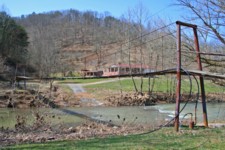
Bridgemeister ID: 2445 (added 2008-04-23)Name: (footbridge) Location: Barwick, Breathitt County, Kentucky , USA Crossing: North Fork Kentucky River Coordinates: 37.37142 N 83.35669 W Maps: Acme , GeoHack , Google , OpenStreetMap Use: Footbridge Status: In use (last checked: 2008) Main Cables: Wire Suspended Spans: 4 Main Spans: 1 x 39.6 meters (130 feet), Side Spans: 1 x 36.6 meters (120 feet),
Bridgemeister ID: 2457 (added 2008-09-20)Name: (footbridge) Location: Beatrice vicinity, Ritchie County, West Virginia , USA Crossing: South Fork Hughes River Use: Footbridge Status: In use (last checked: 2008) Main Cables: Wire Suspended Spans: 1 Main Span: 1
Coordinates and photos of this private bridge have been withheld at the request of the owner. Bridgemeister ID: 292 (added before 2003)Name: (footbridge) Location: Bethel, Marshfield vicinity, Wisconsin , USA Crossing: Dexter Lake At or Near Feature: North Wood County Park Coordinates: 44.5186 N 90.14035 W Maps: Acme , GeoHack , Google , OpenStreetMap Use: Footbridge Status: In use (last checked: 2021) Main Cables: Wire (steel) Suspended Spans: 1 Main Span: 1 x 45.7 meters (150 feet) estimated
Bridgemeister ID: 1260 (added 2004-03-13)Name: (footbridge) Location: Chauga Heights vicinity, South Carolina , USA Crossing: Chauga River At or Near Feature: Chau Ram County Park Coordinates: 34.68241 N 83.1468 W Maps: Acme , GeoHack , Google , OpenStreetMap Use: Footbridge Status: In use (last checked: 2009) Main Cables: Wire (steel) Suspended Spans: 1 Main Span: 1 x 53.3 meters (175 feet)
Douglas E. McClure writes (in 2009): "This bridge span is 175 feet and was constructed a few years ago. The earlier bridge was also a swinging bridge at the same location and type, but was washed out during heavy rains. The new bridge was raised 5 feet." Bridgemeister ID: 2454 (added 2008-09-20)Name: (footbridge) Location: Cisco vicinity, Ritchie County, West Virginia , USA Crossing: North Fork Hughes River Coordinates: 39.15388 N 81.23820 W Maps: Acme , GeoHack , Google , OpenStreetMap Use: Footbridge Status: In use (last checked: 2021) Main Cables: Wire Suspended Spans: 2 Main Span: 1 x 38.1 meters (125 feet) estimated Side Span: 1 x 9.8 meters (32 feet) estimated
Bridgemeister ID: 1894 (added 2005-10-01)Name: (footbridge) Location: Eagle Lake vicinity, Minnesota , USA Crossing: LeSueur River At or Near Feature: Wildwood County Park Coordinates: 44.12445 N 93.864117 W Maps: Acme , GeoHack , Google , OpenStreetMap Use: Footbridge Status: In use (last checked: 2005) Main Cables: Wire (steel) Main Span: 1 x 42.7 meters (140 feet)
Bridgemeister ID: 1262 (added 2004-03-13)Name: (footbridge) Location: Fleish, Mystic vicinity, California , USA Crossing: Truckee River Coordinates: 39.452067 N 120.00555 W Maps: Acme , GeoHack , Google , OpenStreetMap Use: Footbridge Status: Replaced, 2013 Main Cables: Wire (steel) Suspended Spans: 1 Main Span: 1 x 61 meters (200 feet) estimated
Crosses some a spillway just east of I-80 just before I-80 crosses from California to Nevada. North of Mystic in Sierra County. Jan Claire sends observations about the structure the bridge crosses: "The dam is a diverter. Water from the Truckee river is diverted into a canal which runs over to Verdi, Nevada at which point it is pumped up and over a hill and down into another river. Because this dam does not appear on the California Department of Water Resources inventory, I assume it is a long-ago-grandfathered dam operated under treaty with the state of Nevada for irrigation purposes. Satellite photos show this diverter-canal runs through what may still be, or probably was, farmland west of Verdi." Replaced by 2013 Fleish - Fleish, Mystic vicinity, California, USA . Bridgemeister ID: 1632 (added 2005-03-12)Name: (footbridge) Location: Gukeng Township, Yunlin County, Taiwan At or Near Feature: Zhanghu Shell Fossil Zone Use: Footbridge Status: In use (last checked: 2004) Main Cables: Wire (steel) Suspended Spans: 1
Long footbridge crossing above a river and the "ZhangHu Shell Fossil Zone". Bridgemeister ID: 3766 (added 2020-02-29)Name: (footbridge) Location: Jianshi Township, Hsinchu County, Taiwan Coordinates: 24.738471 N 121.254994 E Maps: Acme , GeoHack , Google , OpenStreetMap Use: Footbridge Status: Derelict (last checked: 2013) Main Cables: Wire
Bridgemeister ID: 3767 (added 2020-02-29)Name: (footbridge) Location: Jianshi Township, Hsinchu County, Taiwan Coordinates: 24.704941 N 121.208162 E Maps: Acme , GeoHack , Google , OpenStreetMap Use: Footbridge Status: In use (last checked: 2019) Main Cables: Wire (steel) Suspended Spans: 1
Bridgemeister ID: 1218 (added 2004-02-15)Name: (footbridge) Location: Lagu Wadi, Fugong County, Yunnan , China References: BYU Use: Footbridge Suspended Spans: 1
Bridgemeister ID: 6915 (added 2022-01-21)Name: (footbridge) Location: Lugu Township, Nantou County, Taiwan At or Near Feature: Fenghuanggu Bird and Ecological Park (國立自然科學博物館鳳凰谷鳥園生態園區) Coordinates: 23.730361 N 120.796035 E Maps: Acme , GeoHack , Google , OpenStreetMap Use: Footbridge Status: In use (last checked: 2015) Main Cables: Wire (steel) Suspended Spans: 1
Patrick S. O'Donnell provided a rough main span estimate of 200 feet. Bridgemeister ID: 2941 (added 2019-09-28)Name: (footbridge) Location: Mårdseleforsen Nature Reserve, Västerbotten County, Sweden Crossing: Vindel River Coordinates: 64.681354 N 19.233736 E Maps: Acme , GeoHack , Google , OpenStreetMap Use: Footbridge Status: In use (last checked: 2016) Main Cables: Wire (steel) Suspended Spans: 1
Bridgemeister ID: 1353 (added 2004-05-15)Name: (footbridge) Location: McConnell vicinity, Virginia , USA Crossing: Copper Creek Coordinates: 36.73020 N 82.46878 W Maps: Acme , GeoHack , Google , OpenStreetMap Principals: VDOT Use: Footbridge Status: In use (last checked: 2004) Main Cables: Wire Main Span: 1 x 26.8 meters (88 feet) estimated Side Spans: 1 x 4.3 meters (14 feet) estimated,
Located at the Scott County route 714 low-water vehicular crossing of Copper Creek. Bridgemeister ID: 1360 (added 2004-05-16)Name: (footbridge) Location: McConnell vicinity, Virginia , USA Crossing: Copper Creek Coordinates: 36.73500 N 82.46173 W Maps: Acme , GeoHack , Google , OpenStreetMap Principals: VDOT Use: Footbridge Status: In use Main Cables: Wire Main Span: 1 x 25.9 meters (85 feet) estimated Side Spans: 1 x 9.1 meters (30 feet) estimated,
Located about 1/4-mile walk from the intersection of Scott County routes 670 and 673. Bridgemeister ID: 3768 (added 2020-02-29)Name: (footbridge) Location: Nanzhuang Township, Miaoli County, Taiwan Coordinates: 24.621094 N 121.006046 E Maps: Acme , GeoHack , Google , OpenStreetMap Use: Footbridge Status: In use (last checked: 2019) Main Cables: Wire (steel)
Bridgemeister ID: 3770 (added 2020-02-29)Name: (footbridge) Location: Nanzhuang Township, Miaoli County, Taiwan Coordinates: 24.558400 N 120.979059 E Maps: Acme , GeoHack , Google , OpenStreetMap Use: Footbridge Status: In use (last checked: 2019) Main Cables: Wire (steel) Suspended Spans: 1
Bridgemeister ID: 5214 (added 2020-10-11)Name: (footbridge) Location: Nanzhuang Township, Miaoli County, Taiwan At or Near Feature: 七分醉瀑布 Coordinates: 24.545687 N 121.030435 E Maps: Acme , GeoHack , Google , OpenStreetMap Use: Footbridge Status: In use (last checked: 2020) Main Cables: Wire (steel) Suspended Spans: 1
Bridgemeister ID: 1227 (added 2004-02-15)Name: (footbridge) Location: Ninglang County, Yunnan , China References: BYU Use: Footbridge Main Cables: Wire (steel) Suspended Spans: 1
H-shaped concrete towers. Bridgemeister ID: 2421 (added 2008-02-22)Name: (footbridge) Location: Perry County, Kentucky , USA Crossing: Troublesome Creek Coordinates: 37.38502 N 83.15154 W Maps: Acme , GeoHack , Google , OpenStreetMap Use: Footbridge Status: In use (last checked: 2007) Main Cables: Wire (steel) Suspended Spans: 2 Main Spans: 1 x 30.5 meters (100 feet) estimated,
Bridgemeister ID: 4933 (added 2020-08-04)Name: (footbridge) Location: Pineville vicinity, Kentucky , USA Crossing: Cumberland River Use: Footbridge Status: In use (last checked: 1975) Main Cables: Wire
The January 3, 1975 edition of the Middlesboro Daily News (Middlesboro, Kentucky) ran a front page photo with description: "As this young woman gazes out over the water of the Cumberland River she may be contemplating the first day of sunshine In the new year. The scenic suspension bridge from which she is gazing at the icy water below is located about two miles past Bell High School on the Harlan Road." That appears to place the bridge in Pineville or very nearby based on the present day (2020) locations of Bell County High School and Harlan Road (US119). Likely removed. Bridgemeister ID: 1368 (added 2004-07-03)Name: (footbridge) Location: Poteet Ford, Jonesville vicinity, Virginia , USA Crossing: Powell River Coordinates: 36.66681 N 83.08469 W Maps: Acme , GeoHack , Google , OpenStreetMap Principals: VDOT Use: Footbridge Status: Closed (last checked: 2021) Main Cables: Wire (steel)
Closed at some point between 2004 and 2020. Quon, Kristin. "Future of historic Lee County bridge up in the air." WCYB News 5 , 11 March 2021, wcyb.com/news/local/future-of-historic-lee-county-bridge-up-in-the-air."On Tuesday, March 16th, the Lee County Board of Supervisors will hold a public hearing to talk about the proposed abandonment of 1.1 miles of State Route 739 (Harris Hollow Road and Hunting Club Road) from State Route 783 to .95 miles south of State Route 617... The proposed abandonment also includes the abandonment of the swinging pedestrian bridge, which is currently not in use…"
Arintok, Angelique. "Historic swinging bridge and surrounding road in Lee County won't be under new supervision." WCYB News 5 , 1 May 2021, wcyb.com/news/local/historic-swinging-bridge-and-surrounding-road-wont-be-under-new-supervision.Discussed local controversy regarding the proposed abandonment of the segment of road leading up to the bridge and the abandonment of the bridge. Local citizens were against abandonment citing historical value of the bridge.
Bridgemeister ID: 4624 (added 2020-06-07)Name: (footbridge) Location: Ren'ai Township, Nantou County, Taiwan Coordinates: 24.072052 N 121.194767 E Maps: Acme , GeoHack , Google , OpenStreetMap Use: Footbridge Status: In use (last checked: 2019) Main Cables: Wire (steel) Suspended Spans: 1
Bridgemeister ID: 5805 (added 2021-04-10)Name: (footbridge) Location: Ren’ai Township, Nantou County, Taiwan Coordinates: 24.162643 N 121.179630 E Maps: Acme , GeoHack , Google , OpenStreetMap Use: Footbridge Status: In use (last checked: 2020) Main Cables: Wire (steel) Main Span: 1
Bridgemeister ID: 5655 (added 2021-01-01)Name: (footbridge) Location: Rowdy vicinity, Perry County, Kentucky , USA Crossing: Troublesome Creek Coordinates: 37.419410 N 83.210633 W Maps: Acme , GeoHack , Google , OpenStreetMap Use: Footbridge Status: In use (last checked: 2008) Main Cables: Wire (steel) Suspended Spans: 2 Main Span: 1 Side Span: 1
Bridgemeister ID: 2469 (added 2008-12-19)Name: (footbridge) Location: Schramm Park State Recreation Area, Sarpy County, Nebraska , USA Use: Footbridge Status: In use (last checked: 2023) Main Cables: Wire (steel) Suspended Spans: 1 Main Span: 1 x 28.3 meters (93 feet)
Destroyed by major flood that ravaged the town, June 24, 1950. Bridgemeister ID: 2227 (added 2007-03-18)Name: (footbridge) Location: Sprigg vicinity, West Virginia and Pike County, Kentucky , USA Crossing: Tug Fork River At or Near Feature: Tug Valley Country Club Coordinates: 37.63102 N 82.18641 W Maps: Acme , GeoHack , Google , OpenStreetMap Use: Footbridge Status: In use (last checked: 2007) Main Cables: Wire (steel) Suspended Spans: 1 Main Span: 1 x 97.5 meters (320 feet) estimated
Wide footbridge used by golf carts. Bridgemeister ID: 4777 (added 2020-07-03)Name: (footbridge) Location: Sunchang, Jeollabuk-do, South Korea At or Near Feature: Gangcheonsan County Park Coordinates: 35.395912 N 127.052596 E Maps: Acme , GeoHack , Google , OpenStreetMap Use: Footbridge Status: In use (last checked: 2020) Main Cables: Wire (steel) Suspended Spans: 1
Bridgemeister ID: 3413 (added 2019-12-21)Name: (footbridge) Location: Tai'an Township, Miaoli County, Taiwan Coordinates: 24.468243 N 120.919072 E Maps: Acme , GeoHack , Google , OpenStreetMap Use: Footbridge Status: Extant (last checked: 2019) Main Cables: Wire (steel)
Bridgemeister ID: 558 (added before 2003)Name: (footbridge) Location: Troy vicinity, Gilmer County, West Virginia , USA Crossing: Fink Creek Coordinates: 39.03230 N 80.74106 W Maps: Acme , GeoHack , Google , OpenStreetMap Use: Footbridge Status: In use (last checked: 2007) Main Cables: Wire Suspended Spans: 2 Main Span: 1 x 41.8 meters (137 feet) estimated Side Span: 1
Bridgemeister ID: 2288 (added 2007-04-23)Name: (footbridge) Location: Troy vicinity, Gilmer County, West Virginia , USA Crossing: Fink Creek Coordinates: 39.03254 N 80.73385 W Maps: Acme , GeoHack , Google , OpenStreetMap Use: Footbridge Status: In use (last checked: 2007) Main Cables: Wire Suspended Spans: 4 Main Spans: 2 Side Spans: 2
One of two nearby likely derelict suspension bridges across arms of the Verdigris. May be a third nearby suspension bridge across the arm of the Verdigris into which Strawberry Creek flows. Near (footbridge) - Wagoner County, Oklahoma, USA . One of two nearby likely derelict suspension bridges across arms of the Verdigris. May be a third nearby suspension bridge across the arm of the Verdigris into which Strawberry Creek flows. Near (footbridge) - Wagoner County, Oklahoma, USA . Bridgemeister ID: 2835 (added 2019-07-04)Name: (footbridge) Location: Wanfeng, Ren'ai Township, Nantou County, Taiwan Coordinates: 23.951163 N 121.073658 E Maps: Acme , GeoHack , Google , OpenStreetMap Use: Footbridge Status: In use Main Cables: Wire
Bridgemeister ID: 2510 (added 2009-12-30)Name: (footbridge) Location: Wilmore, McDowell County, West Virginia , USA Crossing: Tug Fork Big Sandy River Coordinates: 37.45758 N 81.75380 W Maps: Acme , GeoHack , Google , OpenStreetMap Use: Footbridge Status: In use (last checked: 2015) Main Cables: Wire (steel) Suspended Spans: 2 Main Span: 1 x 48.8 meters (160 feet) Side Span: 1 x 6.7 meters (22 feet)
Bridgemeister ID: 2746 (added 2019-06-23)Name: (footbridge) Location: Winterset, Iowa , USA Crossing: North River At or Near Feature: Guye Woods County Park Coordinates: 41.416563 N 93.957499 W Maps: Acme , GeoHack , Google , OpenStreetMap Use: Footbridge Status: In use (last checked: 2015) Main Cables: Wire (steel)
Bridgemeister ID: 3416 (added 2019-12-21)Name: (footbridge) Location: Wufeng Township, Hsinchu County, Taiwan At or Near Feature: Qingquan Hot Spring Coordinates: 24.575037 N 121.104774 E Maps: Acme , GeoHack , Google , OpenStreetMap Use: Footbridge Status: In use Main Cables: Wire (steel) Suspended Spans: 3 Main Span: 1 Side Spans: 2
Bridgemeister ID: 3417 (added 2019-12-21)Name: (footbridge) Location: Wufeng Township, Hsinchu County, Taiwan Coordinates: 24.576312 N 121.105155 E Maps: Acme , GeoHack , Google , OpenStreetMap Use: Footbridge Status: Extant (last checked: 2019)
Bridgemeister ID: 3418 (added 2019-12-21)Name: (footbridge) Location: Wufeng Township, Hsinchu County, Taiwan Coordinates: 24.573923 N 121.104867 E Maps: Acme , GeoHack , Google , OpenStreetMap Use: Footbridge Status: In use (last checked: 2019) Main Cables: Wire (steel)
Appears to have been built in the late 2010s. Bridgemeister ID: 3419 (added 2019-12-21)Name: (footbridge) Location: Wufeng Township, Hsinchu County, Taiwan Coordinates: 24.600170 N 121.114436 E Maps: Acme , GeoHack , Google , OpenStreetMap Use: Footbridge Status: Derelict (last checked: 2019)
Bridgemeister ID: 3774 (added 2020-02-29)Name: (footbridge) Location: Xinyi Township, Nantou County, Taiwan Coordinates: 23.577814 N 120.906041 E Maps: Acme , GeoHack , Google , OpenStreetMap Use: Footbridge Status: Derelict (last checked: 2013) Main Cables: Wire
Bridgemeister ID: 3775 (added 2020-02-29)Name: (footbridge) Location: Xinyi Township, Nantou County, Taiwan Coordinates: 23.563607 N 120.917712 E Maps: Acme , GeoHack , Google , OpenStreetMap Use: Footbridge Status: Extant (last checked: 2013) Main Cables: Wire
Bridgemeister ID: 3570 (added 2019-12-26)Name: (footbridge) Location: Xiulin Township, Hualien County, Taiwan At or Near Feature: Wenshan Hot Springs Coordinates: 24.202120 N 121.490514 E Maps: Acme , GeoHack , Google , OpenStreetMap Use: Footbridge Status: In use (last checked: 2019) Main Cables: Wire
Bridgemeister ID: 4730 (added 2020-06-27)Name: (footbridge) Location: Xiulin Township, Hualien County, Taiwan Coordinates: 24.220447 N 121.485438 E Maps: Acme , GeoHack , Google , OpenStreetMap Use: Footbridge Status: In use Main Cables: Wire (steel) Suspended Spans: 1
Bridgemeister ID: 5806 (added 2021-04-10)Name: (footbridge) Location: Zhongliao Township, Nantou County, Taiwan Coordinates: 23.955777 N 120.802912 E Maps: Acme , GeoHack , Google , OpenStreetMap Use: Footbridge Status: In use (last checked: 2014) Main Cables: Wire (steel) Main Span: 1
Bridgemeister ID: 3567 (added 2019-12-26)Name: (footbridge) Location: Zhuqi, Chiayi County, Taiwan Coordinates: 23.496765 N 120.505862 E Maps: Acme , GeoHack , Google , OpenStreetMap Use: Footbridge Status: In use (last checked: 2019) Main Cables: Wire (steel)
Bridgemeister ID: 5809 (added 2021-04-10)Name: (footbridge) Location: Zhushan Township, Nantou County, Taiwan At or Near Feature: Songlong Rock WaterFall - 松瀧岩瀑布 Coordinates: 23.619593 N 120.802472 E Maps: Acme , GeoHack , Google , OpenStreetMap Use: Footbridge Status: In use (last checked: 2018) Main Cables: Wire (steel) Suspended Spans: 1
2014: Deck and cables completely removed. Unclear if bridge was damaged or was just undergoing restoration. Later reopened. Bridgemeister ID: 1820 (added 2005-05-21)Name: (pipeline bridge) Location: Fulton, Arkansas , USA Crossing: Red River Coordinates: 33.60368 N 93.81316 W Maps: Acme , GeoHack , Google , OpenStreetMap Use: Pipeline Status: Extant (last checked: 2007) Main Cables: Wire (steel) Suspended Spans: 3 Main Span: 1 Side Spans: 2
Call numbers ECD0860-1 and ECD0860-2 of the Arkansas History Commission's image archives show this large pipeline bridge. Bridgemeister ID: 2823 (added 2019-07-04)Name: (pipeline bridge) Location: Ren'ai Township, Nantou County, Taiwan Coordinates: 23.917088 N 121.055192 E Maps: Acme , GeoHack , Google , OpenStreetMap Use: Pipeline Status: Extant (last checked: 2016) Main Cables: Wire
Bridgemeister ID: 4655 (added 2020-06-17)Name: (suspension bridge) Location: Alishan Township, Chiayi County, Taiwan Coordinates: 23.448101 N 120.707766 E Maps: Acme , GeoHack , Google , OpenStreetMap Status: Extant (last checked: 2019) Main Cables: Wire Suspended Spans: 1
Appears to be a single-lane vehicular suspension bridge, bypassed in the late 2010s. Bridgemeister ID: 8209 (added 2024-02-05)Name: (suspension bridge) Location: Anningxiang (安宁镇), Jinchuan County, Ngawa (阿坝州), Sichuan , China Crossing: Dijan River Coordinates: 31.303778 N 102.015750 E Maps: Acme , GeoHack , Google , OpenStreetMap Status: Extant (last checked: 2021) Main Span: 1 x 10⁸ meters (354.3 feet) estimated
Mail | Facebook | Twitter
