Inventory Search Results
18 suspension bridges were found for search criteria: dice completed between 1700 and 2005 including undated bridges. All 18 bridges from the search results appear below. Click the Bridgemeister ID number to isolate the bridge on its own page. If you don't see what you were looking for, try an image search with the same criteria: dice. This will find the bridge if it is pictured on the site, but is not a catenary suspension bridge.
Related:
Your search includes criteria for which the Bridgemeister inventory has incomplete data such as
Year Completed, Usage, Status, Span Length, and Number of Suspended Spans. The results below are
based on the information currently available within the inventory. Also, span lengths are sometimes estimated
based on satellite imagery.
1897: Hackberry
Warsaw, Missouri, USA - Osage River
| Bridgemeister ID: | 2538 (added 2011-12-28) |
| Year Completed: | 1897 |
| Name: | Hackberry |
| Also Known As: | Lower |
| Location: | Warsaw, Missouri, USA |
| Crossing: | Osage River |
| Principals: | Joseph A. Dice, Dr. Daniel M. Eddy |
| References: | BOTO |
| Use: | Vehicular |
| Status: | Destroyed, 1926 |
| Main Cables: | Wire |
| Main Span: | 1 x 158.5 meters (520 feet) |
Notes:
- Destroyed by fire, 1926.
1904: Upper
Warsaw, Missouri, USA - Osage River
| Bridgemeister ID: | 2537 (added 2011-12-28) |
| Year Completed: | 1904 |
| Name: | Upper |
| Also Known As: | Swinging |
| Location: | Warsaw, Missouri, USA |
| Crossing: | Osage River |
| Coordinates: | 38.244449 N 93.387608 W |
| Maps: | Acme, GeoHack, Google, OpenStreetMap |
| Principals: | Joseph A. Dice, Dr. Daniel M. Eddy |
| References: | BOTO |
| Use: | Vehicular |
| Status: | Destroyed, 1924 |
| Main Cables: | Wire |
Notes:
- Destroyed by a tornado.
- Replaced by 1927 Upper (Swinging) - Warsaw, Missouri, USA.
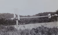
1905: Tuscumbia
Tuscumbia, Missouri, USA - Osage River
| Bridgemeister ID: | 1977 (added 2005-11-27) |
| Year Completed: | 1905 |
| Name: | Tuscumbia |
| Location: | Tuscumbia, Missouri, USA |
| Crossing: | Osage River |
| Coordinates: | 38.23526 N 92.44763 W |
| Maps: | Acme, GeoHack, Google, OpenStreetMap |
| Principals: | Joseph Dice |
| References: | BOTO |
| Use: | Vehicular (one-lane) |
| Status: | Replaced, 1933 |
| Main Cables: | Wire |
| Main Span: | 1 |
| Side Spans: | 2 |
Notes:
- Some remains still visible at site, 2007.
- Near (suspension bridge) - Tuscumbia vicinity, Missouri, USA.
External Links:
1908: Bailey
Warsaw vicinity, Missouri, USA - Osage River
| Bridgemeister ID: | 3516 (added 2019-12-24) |
| Year Completed: | 1908 |
| Name: | Bailey |
| Location: | Warsaw vicinity, Missouri, USA |
| Crossing: | Osage River |
| Principals: | Joseph A. Dice |
| References: | BOTO |
| Use: | Vehicular |
| Status: | Removed |
| Main Cables: | Wire (steel) |
Notes:
- Location inundated by the Harry S. Truman Reservoir.
1908: Heath Ford
Warsaw vicinity, Missouri, USA - Osage River
| Bridgemeister ID: | 3515 (added 2019-12-24) |
| Year Completed: | 1908 |
| Name: | Heath Ford |
| Location: | Warsaw vicinity, Missouri, USA |
| Crossing: | Osage River |
| Principals: | Joseph A. Dice |
| References: | BOTO |
| Use: | Vehicular |
| Status: | Removed |
| Main Cables: | Wire (iron) |
| Main Span: | 1 x 157.6 meters (517 feet) |
Notes:
- Damaged by wind, 1932. Replaced, 1937
- Location inundated by the Harry S. Truman Reservoir.
1912: Branstetter
Warsaw vicinity, Missouri, USA - Osage River
| Bridgemeister ID: | 2042 (added 2006-05-07) |
| Year Completed: | 1912 |
| Name: | Branstetter |
| Also Known As: | Peal Bend |
| Location: | Warsaw vicinity, Missouri, USA |
| Crossing: | Osage River |
| Principals: | Joseph A. Dice |
| References: | BOTO |
| Use: | Vehicular (one-lane) |
| Status: | Removed |
| Main Cables: | Wire (steel) |
| Main Span: | 1 x 182.9 meters (600 feet) |
Notes:
- Heavily damaged by wind, 1924. Rebuilt.
- Location inundated by the Harry S. Truman Reservoir.
External Links:
1912: County Line
Henry County and St. Clair County, Missouri, USA - Osage River
| Bridgemeister ID: | 3518 (added 2019-12-24) |
| Year Completed: | 1912 |
| Name: | County Line |
| Also Known As: | Gilbert-Harris |
| Location: | Henry County and St. Clair County, Missouri, USA |
| Crossing: | Osage River |
| Principals: | Joseph A. Dice |
| References: | BOTO |
| Use: | Vehicular (one-lane) |
| Status: | Removed |
| Main Cables: | Wire (steel) |
Notes:
- Location inundated by the Harry S. Truman Reservoir.
External Links:
- Bridgehunter - County Line Bridge. Robert Hayden (BOTO) describes the County Line bridge briefly as being the first steel-towered Joe Dice bridge but the image at shows large timber towers like other pre-steel towered Dice bridges.
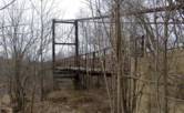
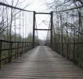
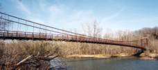
1922: Glaize
Brumley vicinity, Missouri, USA - Grand Glaize Creek
| Bridgemeister ID: | 332 (added before 2003) |
| Year Completed: | 1922 |
| Name: | Glaize |
| Also Known As: | Auglaize, Grand Glaize, Grand Auglaize |
| Location: | Brumley vicinity, Missouri, USA |
| Crossing: | Grand Glaize Creek |
| Coordinates: | 38.077098 N 92.526488 W |
| Maps: | Acme, GeoHack, Google, OpenStreetMap |
| Principals: | Joseph A. Dice |
| References: | BOTO |
| Use: | Vehicular (one-lane) |
| Status: | Closed, January 6, 2021 (last checked: 2021) |
| Main Cables: | Wire (steel) |
| Suspended Spans: | 2 |
| Main Span: | 1 x 126.2 meters (414 feet) estimated |
| Side Span: | 1 |
| Deck width: | 12 feet |
Notes:
- 2020, October 8: Added to National Register of Historic Places.
- 2021, January 6: Closed due to structural issues with the bridge's anchors.
- 2021, February 6: New inspection of the current issue ("loose cables"). Bridge is still closed.
- Near 1925 Mill Creek - Brumley vicinity, Missouri, USA.
External Links:
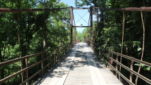
1924: Kemna
St. Elizabeth, Missouri, USA - Tavern Creek
| Bridgemeister ID: | 611 (added 2003-01-14) |
| Year Completed: | 1924 |
| Name: | Kemna |
| Location: | St. Elizabeth, Missouri, USA |
| Crossing: | Tavern Creek |
| Coordinates: | 38.247265 N 92.245431 W |
| Maps: | Acme, GeoHack, Google, OpenStreetMap |
| Principals: | Joseph A. Dice |
| References: | BOTO |
| Use: | Vehicular (one-lane) |
| Status: | In use (last checked: 2019) |
| Main Cables: | Wire (steel) |
| Suspended Spans: | 1 |
| Main Span: | 1 x 50.9 meters (167 feet) |
| Deck width: | 11.1 feet |
Notes:
- Original timber towers replaced, 1978.
- Similar to 1925 Mill Creek - Brumley vicinity, Missouri, USA.
- Near 1925 Kliethermes (Brumley) - St. Anthony vicinity, Missouri, USA.
External Links:
1925: Buechter
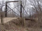
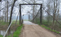
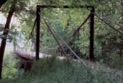
St. Anthony vicinity, Missouri, USA - Tavern Creek
| Bridgemeister ID: | 610 (added 2003-01-14) |
| Year Completed: | 1925 |
| Name: | Buechter |
| Location: | St. Anthony vicinity, Missouri, USA |
| Crossing: | Tavern Creek |
| Coordinates: | 38.141573 N 92.297910 W |
| Maps: | Acme, GeoHack, Google, OpenStreetMap |
| Principals: | Joseph A. Dice |
| References: | BOTO |
| Use: | Vehicular (one-lane) |
| Status: | Demolished, 2011 |
| Main Cables: | Wire (steel) |
| Suspended Spans: | 1 |
| Main Span: | 1 x 42.7 meters (140 feet) |
| Deck width: | 12.1 feet |
Notes:
- Completed circa 1925.
- Sometimes spelled Buetcher. The road the bridge carried is named with the "Buechter" spelling.
- Renovated 1986.
- Similar to 1925 Kliethermes (Brumley) - St. Anthony vicinity, Missouri, USA.
External Links:
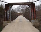
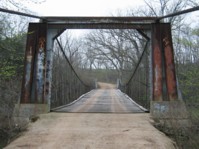
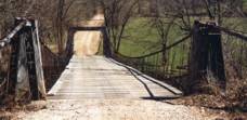
- Historic Bridges of the United States - Buechter Bridge - Miller County, Missouri
- Structurae - Structure ID 20014258
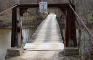
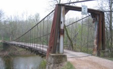
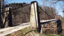
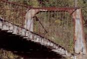
1925: Kliethermes
St. Anthony vicinity, Missouri, USA - Tavern Creek
| Bridgemeister ID: | 609 (added 2003-01-14) |
| Year Completed: | 1925 |
| Name: | Kliethermes |
| Also Known As: | Brumley |
| Location: | St. Anthony vicinity, Missouri, USA |
| Crossing: | Tavern Creek |
| Coordinates: | 38.178223 N 92.322981 W |
| Maps: | Acme, GeoHack, Google, OpenStreetMap |
| Principals: | Joseph A. Dice |
| References: | BOTO |
| Use: | Vehicular (one-lane) |
| Status: | Removed, March, 2008 |
| Main Cables: | Wire (steel) |
| Suspended Spans: | 1 |
| Main Span: | 1 x 65.8 meters (215.8 feet) |
| Deck width: | 10.8 feet |
Notes:
- Renovated, 1988. Closed, Spring 2006. Subsequently demolished in 2008.
- Completed circa 1925.
- Similar to 1925 Buechter - St. Anthony vicinity, Missouri, USA.
External Links:
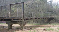
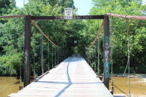
1925: Mill Creek
Brumley vicinity, Missouri, USA - Mill Creek
| Bridgemeister ID: | 342 (added before 2003) |
| Year Completed: | 1925 |
| Name: | Mill Creek |
| Location: | Brumley vicinity, Missouri, USA |
| Crossing: | Mill Creek |
| Coordinates: | 38.078408 N 92.524264 W |
| Maps: | Acme, GeoHack, Google, OpenStreetMap |
| Principals: | Joseph A. Dice |
| References: | BOTO |
| Use: | Vehicular (one-lane) |
| Status: | In use (last checked: 2020) |
| Main Cables: | Wire (steel) |
| Suspended Spans: | 2 |
| Main Span: | 1 x 29.3 meters (96 feet) estimated |
| Side Span: | 1 |
| Deck width: | 11.1 feet |
Notes:
- Original cables now assisted by additional steel cables.
- Similar to 1924 Kemna - St. Elizabeth, Missouri, USA.
- Near 1922 Glaize (Auglaize, Grand Glaize, Grand Auglaize) - Brumley vicinity, Missouri, USA. The bridges are less than half a mile apart.
External Links:

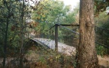
1926: Boeckman
St. Elizabeth, Missouri, USA - Big Tavern Creek
| Bridgemeister ID: | 608 (added 2003-01-14) |
| Year Completed: | 1926 |
| Name: | Boeckman |
| Location: | St. Elizabeth, Missouri, USA |
| Crossing: | Big Tavern Creek |
| Coordinates: | 38.22667 N 92.24 W |
| Maps: | Acme, GeoHack, Google, OpenStreetMap |
| Principals: | Joseph A. Dice |
| References: | BOTO |
| Use: | Vehicular |
| Status: | Replaced, 2003 |
| Main Cables: | Wire (steel) |
| Suspended Spans: | 1 |
| Main Span: | 1 x 48.8 meters (160 feet) |
| Deck width: | 12.4 feet |
Notes:
- Federal Highway Administration year 2000 data listed 1910 as the year of completion.
- Original timber towers replaced with steel towers, 1988.
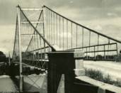
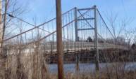
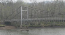
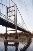
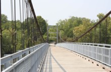
1927: Upper
Warsaw, Missouri, USA - Osage River
| Bridgemeister ID: | 1070 (added 2003-12-27) |
| Year Completed: | 1927 |
| Name: | Upper |
| Also Known As: | Swinging |
| Location: | Warsaw, Missouri, USA |
| Crossing: | Osage River |
| Coordinates: | 38.244110 N 93.388767 W |
| Maps: | Acme, GeoHack, Google, OpenStreetMap |
| Principals: | Joseph A. Dice |
| References: | BOTO |
| Use: | Vehicular (one-lane) |
| Status: | Restricted to foot traffic (last checked: 2020) |
| Main Cables: | Wire (steel) |
| Suspended Spans: | 2 |
| Main Span: | 1 x 152.4 meters (500 feet) estimated |
| Side Span: | 1 x 29 meters (95 feet) estimated |
Notes:
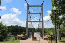
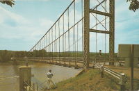
- Joseph Dice supervised the construction of this bridge to replace the 1904 structure destroyed in a tornado in 1924. A postcard of this bridge reads: "built in 1927 by the Benton County Court and by popular subscription of citizens to replace a similar bridge destroyed by a windstorm two years earlier. Structure swings on two wire cables imbedded and anchored in concrete and stone. The towers and floor beams are of steel while the floor is of wood. A state highway crosses this bridge."
- Reopened for pedestrians, 2007, after being closed for several years.
- Replaced 1904 Upper (Swinging) - Warsaw, Missouri, USA.
External Links:
1930: Klenklen
Pilot Grove vicinity, Missouri, USA - Lamine River
| Bridgemeister ID: | 1570 (added 2004-12-05) |
| Year Completed: | 1930 |
| Name: | Klenklen |
| Location: | Pilot Grove vicinity, Missouri, USA |
| Crossing: | Lamine River |
| Coordinates: | 38.828284 N 93.034299 W |
| Maps: | Acme, GeoHack, Google, OpenStreetMap |
| Principals: | Joseph A. Dice |
| References: | HAERMO91 |
| Use: | Vehicular (one-lane) |
| Status: | Removed, c. 1996 |
| Main Cables: | Wire (steel) |
| Suspended Spans: | 2 |
| Main Span: | 1 x 61 meters (200 feet) |
| Side Span: | 1 x 9.1 meters (30 feet) |
Notes:
- Partially collapsed. Closed and replaced 1994, demolished c. 1996.
- Coordinates are approximate, showing location of replacement.
- Sometimes spelled as "Klenken."
- Sometimes cited as having been completed in 1929, HAER MO-91 (reference HAERMO91) states construction began September 1929 and completed in April 1930.
1931: Long Shoal
Warsaw vicinity, Missouri, USA - Osage River
| Bridgemeister ID: | 3517 (added 2019-12-24) |
| Year Completed: | 1931 |
| Name: | Long Shoal |
| Location: | Warsaw vicinity, Missouri, USA |
| Crossing: | Osage River |
| Principals: | Joseph A. Dice |
| References: | BOTO |
| Use: | Vehicular |
| Status: | Collapsed, September 21, 1965 |
| Main Cables: | Wire (steel) |
Notes:
- Collapsed, killing three people, September 1965.
1937: Bryan's Crossing
Warsaw vicinity, Missouri, USA - South Grand River
| Bridgemeister ID: | 1074 (added 2003-12-27) |
| Year Completed: | 1937 |
| Name: | Bryan's Crossing |
| Also Known As: | Downing Bend |
| Location: | Warsaw vicinity, Missouri, USA |
| Crossing: | South Grand River |
| Principals: | Joseph A. Dice? |
| References: | BOTO |
| Use: | Vehicular (one-lane) |
| Status: | Removed |
| Main Cables: | Wire (steel) |
| Suspended Spans: | 1 |
Notes:
- Likely another Joseph A. Dice bridge.
- Location inundated by the Harry S. Truman Reservoir.
External Links:
Vienna Swinging
Vienna, Missouri, USA - Maries River
| Bridgemeister ID: | 2364 (added 2007-09-08) |
| Name: | Vienna Swinging |
| Location: | Vienna, Missouri, USA |
| Crossing: | Maries River |
| Coordinates: | 38.20176 N 91.97756 W |
| Maps: | Acme, GeoHack, Google, OpenStreetMap |
| Principals: | Joseph Dice |
| References: | BOTO |
| Use: | Vehicular (one-lane) |
| Status: | Destroyed, 1998 |
| Main Cables: | Wire |
| Suspended Spans: | 1 |
Notes:
- Destroyed by flood, but some remains still visible at site, 2006.
- BOTO refers to as "Ballpark Rd." bridge for lack of a known name as the bridge was on the route following Ballpark Road out of Vienna.
External Links: