Inventory Search Results (1,201-1,300 of 1,965)
Results : << < ... 801-900 901-1000 1001-1100 1101-1200 1201-1300 1301-1400 1401-1500 1501-1600 ... > >> All
1,965 suspension bridges were found for search criteria: "(footbridge)" .
Bridges 1,201 through 1,300 (of 1,965 total) appear below. Click the Bridgemeister ID number to isolate the bridge on its own page.
If you don't see what you were looking for, try an image search with the same criteria: "(footbridge)"
Related:
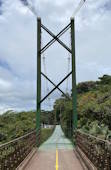
Bridgemeister ID: 7791 (added 2023-08-21)Name: (footbridge) Location: Monteverde, Santa Elena vicinity, Costa Rica At or Near Feature: Sky Adventures Monteverde Park Coordinates: 10.336564 N 84.810611 W Maps: Acme , GeoHack , Google , OpenStreetMap Use: Footbridge Status: In use (last checked: 2023) Main Cables: Wire (steel) Suspended Spans: 1
This bridge is not part of the adjacent Sky Walk but is within the same park connecting the main building to a parking lot. Near (footbridge) - Monteverde, Santa Elena vicinity, Costa Rica . Near Sky Walk 1 - Monteverde, Santa Elena vicinity, Costa Rica . Near Sky Walk 2 - Monteverde, Santa Elena vicinity, Costa Rica . Near Sky Walk 3 - Monteverde, Santa Elena vicinity, Costa Rica . Near Sky Walk 4 - Monteverde, Santa Elena vicinity, Costa Rica . Near Sky Walk 5 - Monteverde, Santa Elena vicinity, Costa Rica . Near Sky Walk 6 - Monteverde, Santa Elena vicinity, Costa Rica . Bridgemeister ID: 7792 (added 2023-08-21)Name: (footbridge) Location: Monteverde, Santa Elena vicinity, Costa Rica At or Near Feature: Sky Adventures Monteverde Park Coordinates: 10.337318 N 84.810960 W Maps: Acme , GeoHack , Google , OpenStreetMap Use: Footbridge Status: In use (last checked: 2023) Main Cables: Wire (steel) Suspended Spans: 1
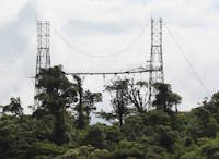
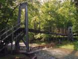
This bridge is not part of the nearby Sky Walk but is within the same park. It is used as the landing zone for the last zip line and has a lower platform for short-distance bungee-rappeling. Near (footbridge) - Monteverde, Santa Elena vicinity, Costa Rica . Near Sky Walk 1 - Monteverde, Santa Elena vicinity, Costa Rica . Near Sky Walk 2 - Monteverde, Santa Elena vicinity, Costa Rica . Near Sky Walk 3 - Monteverde, Santa Elena vicinity, Costa Rica . Near Sky Walk 4 - Monteverde, Santa Elena vicinity, Costa Rica . Near Sky Walk 5 - Monteverde, Santa Elena vicinity, Costa Rica . Near Sky Walk 6 - Monteverde, Santa Elena vicinity, Costa Rica . Bridgemeister ID: 1337 (added 2004-05-01)Name: (footbridge) Location: Montour Falls, New York , USA Crossing: L'Hommedieu Diversion Channel At or Near Feature: Frederick L. Warder Academy of Fire Science Coordinates: 42.34221 N 76.83645 W Maps: Acme , GeoHack , Google , OpenStreetMap Use: Footbridge Status: In use (last checked: 2004) Main Cables: Wire (steel) Suspended Spans: 3 Main Span: 1 Side Spans: 2
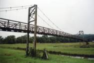
Bridgemeister ID: 1388 (added 2004-07-03)Name: (footbridge) Location: Mooretown, Virginia , USA Crossing: Little Back Creek Coordinates: 38.10547 N 79.90070 W Maps: Acme , GeoHack , Google , OpenStreetMap Principals: VDOT Use: Footbridge Status: In use (last checked: 2004) Main Cables: Wire (steel) Suspended Spans: 1 Main Span: 1 x 24.4 meters (80 feet) estimated
Bridgemeister ID: 817 (added 2003-05-30)Name: (footbridge) Location: Moumoukai vicinity, New Zealand Coordinates: 37.111535 S 175.121705 E Maps: Acme , GeoHack , Google , OpenStreetMap Use: Footbridge Status: In use (last checked: 2017) Main Cables: Wire (steel) Suspended Spans: 1
Bridgemeister ID: 7135 (added 2022-06-19)Name: (footbridge) Location: Mount Aspiring, Otago, New Zealand Crossing: Matukituki River At or Near Feature: East Matukituki Valley Track Coordinates: 44.496310 S 168.785008 E Maps: Acme , GeoHack , Google , OpenStreetMap Use: Footbridge Status: In use (last checked: 2021) Main Cables: Wire (steel) Suspended Spans: 1
Bridgemeister ID: 7136 (added 2022-06-19)Name: (footbridge) Location: Mount Aspiring, Otago, New Zealand Crossing: Matukituki River At or Near Feature: Rob Roy Track Coordinates: 44.505887 S 168.726758 E Maps: Acme , GeoHack , Google , OpenStreetMap Use: Footbridge Status: In use (last checked: 2020) Main Cables: Wire (steel) Suspended Spans: 1
Bridgemeister ID: 1472 (added 2004-08-29)Name: (footbridge) Location: Mount Brydges vicinity, Ontario , Canada At or Near Feature: Longwoods Road Conservation Area Coordinates: 42.88338 N 81.47578 W Maps: Acme , GeoHack , Google , OpenStreetMap Use: Footbridge Status: In use (last checked: 2005) Main Cables: Wire (steel) Suspended Spans: 1
Bridgemeister ID: 1838 (added 2005-07-03)Name: (footbridge) Location: Mount Hermon, California , USA Crossing: Bean Creek At or Near Feature: Mount Hermon Christian Conference Center Coordinates: 37.052667 N 122.06005 W Maps: Acme , GeoHack , Google , OpenStreetMap Use: Footbridge Status: In use (last checked: 2005) Main Cables: Wire Suspended Spans: 1 Main Span: 1 x 25.6 meters (84 feet)
Bridgemeister ID: 1996 (added 2005-12-24)Name: (footbridge) Location: Mount Hermon, California , USA Crossing: Zayante Creek At or Near Feature: Mount Hermon Christian Conference Center Use: Footbridge Status: Replaced (last checked: 2006)
Bridgemeister ID: 2223 (added 2007-03-15)Name: (footbridge) Location: Mount Hermon, California , USA Crossing: Zayante Creek At or Near Feature: Mount Hermon Christian Conference Center Use: Footbridge Status: In use (last checked: 2007) Main Cables: Wire (steel)
Bridgemeister ID: 1745 (added 2005-04-20)Name: (footbridge) Location: Mount Morgan, Queensland , Australia Crossing: Dee River Status: Destroyed, 1928, by flood. Main Cables: Wire
According to a sign at one of the remaining Mount Morgan suspension bridges, "[this bridge] spanned from Tipperary Road to the 'lower yards' of the mine, 100 metres past where the western end of Morgan Street crosses the Dee. It was destroyed in 1928." Bridgemeister ID: 1746 (added 2005-04-20)Name: (footbridge) Location: Mount Morgan, Queensland , Australia Crossing: Dee River Status: Destroyed, 1928, by flood. Main Cables: Wire
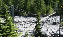
According to a sign at one of the remaining Mount Morgan suspension bridges, "[this bridge] crossed from the mine side of the Dee, west of the gold sheds, to Tipperary Road, opposite where Mountain View and Sunburst Hotels once stood. It too was swept away in 1928." Bridgemeister ID: 262 (added before 2003)Name: (footbridge) Location: Mt. Rainier National Park, Washington , USA Crossing: Carbon River At or Near Feature: Carbon Glacier Trail Coordinates: 46.94956 N 121.79537 W Maps: Acme , GeoHack , Google , OpenStreetMap Use: Footbridge Status: In use (last checked: 2006) Main Cables: Wire (steel) Suspended Spans: 1 Main Span: 1 x 61 meters (200 feet) estimated
Bridgemeister ID: 651 (added 2003-02-22)Name: (footbridge) Location: Mt. Rainier National Park, Washington , USA Crossing: Ohanapecosh River At or Near Feature: Grove of the Patriarchs vicinity Coordinates: 46.76299 N 121.55637 W Maps: Acme , GeoHack , Google , OpenStreetMap Use: Footbridge Status: Closed, November 2021 (last checked: 2021) Main Cables: Wire (steel) Suspended Spans: 1 Main Span: 1 x 34.4 meters (113 feet) estimated
2021, November: Closed due to recent flood damage. Timeline for repair or replacement unclear. Bridgemeister ID: 8281 (added 2024-02-08)Name: (footbridge) Location: Mtskheta (მცხეთა), Georgia Crossing: Kura River Coordinates: 41.839333 N 44.673139 E Maps: Acme , GeoHack , Google , OpenStreetMap Use: Footbridge Status: In use (last checked: 2018) Main Cables: Wire (steel) Main Span: 1
Bridgemeister ID: 6118 (added 2021-07-04)Name: (footbridge) Location: Muadzam Shah vicinity, Pahang, Malaysia Crossing: Rompin River Coordinates: 3.063937 N 103.011845 E Maps: Acme , GeoHack , Google , OpenStreetMap Use: Footbridge Status: In use (last checked: 2017) Main Cables: Wire (steel) Main Span: 1
Bridgemeister ID: 8035 (added 2023-12-23)Name: (footbridge) Location: Muara Botung, Mandailing Natal Regency, North Sumatra , Indonesia Coordinates: 0.644722 N 99.811250 E Maps: Acme , GeoHack , Google , OpenStreetMap Use: Footbridge Status: In use (last checked: 2022) Main Cables: Wire (steel) Main Span: 1
Bridgemeister ID: 8029 (added 2023-12-23)Name: (footbridge) Location: Muara Kumpulan, Mandailing Natal Regency, North Sumatra , Indonesia Coordinates: 0.632583 N 99.840111 E Maps: Acme , GeoHack , Google , OpenStreetMap Use: Footbridge Status: In use (last checked: 2023) Main Cables: Wire (steel) Suspended Spans: 1
Completed at some point in the 2007-2012 time frame. Bridgemeister ID: 6652 (added 2021-09-11)Name: (footbridge) Location: Muaradua, Cikular, Lebak Regency and Jayasari, Cimarga, Lebak Regency, Banten , Indonesia Coordinates: 6.440939 S 106.133143 E Maps: Acme , GeoHack , Google , OpenStreetMap Use: Footbridge Status: Derelict (last checked: 2019) Main Cables: Wire (steel) Main Span: 1
Bridgemeister ID: 5044 (added 2020-08-23)Name: (footbridge) Location: Mueang Sawankhalok, Sawankhalok District, Sukhothai, Thailand Crossing: Yom River Coordinates: 17.322233 N 99.832028 E Maps: Acme , GeoHack , Google , OpenStreetMap Use: Footbridge Status: In use (last checked: 2019) Main Cables: Wire (steel) Suspended Spans: 1 Main Span: 1 x 128.5 meters (421.6 feet) estimated
Bridgemeister ID: 2375 (added 2007-09-29)Name: (footbridge) Location: Munson vicinity, Florida , USA Crossing: Sweetwater Creek At or Near Feature: Sweetwater Trail - Blackwater State Forest Use: Footbridge Status: In use (last checked: 2012) Main Cables: Wire (steel) Suspended Spans: 1 Main Span: 1 x 30.5 meters (100 feet)
Bridgemeister ID: 5334 (added 2020-11-11)Name: (footbridge) Location: Muriwai, New Zealand At or Near Feature: Goldie Bush Walkway Coordinates: 36.847463 S 174.455739 E Maps: Acme , GeoHack , Google , OpenStreetMap Use: Footbridge Status: In use (last checked: 2020) Main Cables: Wire (steel)
YouTube - Nacho Circle . Video showing the tower still standing from the footbridge and the newer adjacent road bridge. Posted October 2019.Bridgemeister ID: 4851 (added 2020-07-12)Name: (footbridge) Location: Nagaizumi, Shizuoka , Japan At or Near Feature: Surugadaira Natural Park Coordinates: 35.172779 N 138.869722 E Maps: Acme , GeoHack , Google , OpenStreetMap Use: Footbridge Status: In use (last checked: 2020) Main Cables: Wire (steel) Suspended Spans: 1
Bridgemeister ID: 4852 (added 2020-07-12)Name: (footbridge) Location: Nagaizumi, Shizuoka , Japan At or Near Feature: Surugadaira Natural Park Coordinates: 35.172951 N 138.870418 E Maps: Acme , GeoHack , Google , OpenStreetMap Use: Footbridge Status: In use (last checked: 2020) Main Cables: Wire (steel) Suspended Spans: 1
Bridgemeister ID: 5165 (added 2020-09-07)Name: (footbridge) Location: Nakatsugawa, Gifu , Japan Coordinates: 35.580153 N 137.538699 E Maps: Acme , GeoHack , Google , OpenStreetMap Use: Footbridge Status: In use (last checked: 2017) Main Cables: Wire (steel) Main Spans: 2
Bridgemeister ID: 3773 (added 2020-02-29)Name: (footbridge) Location: Namaxia District, Kaohsiung City, Taiwan Coordinates: 23.253890 N 120.697223 E Maps: Acme , GeoHack , Google , OpenStreetMap Use: Footbridge Status: In use (last checked: 2014) Main Cables: Wire (steel)
Bridgemeister ID: 4464 (added 2020-04-26)Name: (footbridge) Location: Namsskogan, Trøndelag, Norway Crossing: Namsen Coordinates: 65.058559 N 13.328878 E Maps: Acme , GeoHack , Google , kart.1881.no , OpenStreetMap Use: Footbridge Status: Removed Main Cables: Wire Suspended Spans: 1 Main Span: 1 x 72 meters (236.2 feet) estimated
Built prior to 1938. Patrick S. O'Donnell observes: "Timber A-frame tower with a mono main cable. This explains the angled inward railing posts on the bridge. Their angles increasing inward with the inclination of the suspenders progressing toward midspan. The maximum main cable sag at the midspan would had to have been well above the deck so as to allow sufficient space to walk through between the railing posts there." Bridgemeister ID: 8578 (added 2024-05-11)Name: (footbridge) Location: Namthang (नामथाङ), Namchi and Bagheykhola (बघेय्खोला), Sikkim , India Crossing: Teesta River Coordinates: 27.204503 N 88.484879 E Maps: Acme , GeoHack , Google , OpenStreetMap Use: Footbridge Status: In use (last checked: 2021) Main Cables: Wire (steel) Main Span: 1 x 116.1 meters (381 feet) estimated
Bridgemeister ID: 8579 (added 2024-05-11)Name: (footbridge) Location: Namthang (नामथाङ), Namchi and Bagheykhola (बघेय्खोला), Sikkim , India Crossing: Burul Samardung Khola Coordinates: 27.201703 N 88.481467 E Maps: Acme , GeoHack , Google , OpenStreetMap Use: Footbridge Status: Extant (last checked: 2022) Main Span: 1 x 78.9 meters (259 feet) estimated
Bridgemeister ID: 3768 (added 2020-02-29)Name: (footbridge) Location: Nanzhuang Township, Miaoli County, Taiwan Coordinates: 24.621094 N 121.006046 E Maps: Acme , GeoHack , Google , OpenStreetMap Use: Footbridge Status: In use (last checked: 2019) Main Cables: Wire (steel)
Bridgemeister ID: 3770 (added 2020-02-29)Name: (footbridge) Location: Nanzhuang Township, Miaoli County, Taiwan Coordinates: 24.558400 N 120.979059 E Maps: Acme , GeoHack , Google , OpenStreetMap Use: Footbridge Status: In use (last checked: 2019) Main Cables: Wire (steel) Suspended Spans: 1
Bridgemeister ID: 5214 (added 2020-10-11)Name: (footbridge) Location: Nanzhuang Township, Miaoli County, Taiwan At or Near Feature: 七分醉瀑布 Coordinates: 24.545687 N 121.030435 E Maps: Acme , GeoHack , Google , OpenStreetMap Use: Footbridge Status: In use (last checked: 2020) Main Cables: Wire (steel) Suspended Spans: 1
Bridgemeister ID: 1395 (added 2004-07-04)Name: (footbridge) Location: Nasu, Tochigi , Japan At or Near Feature: Yanome Dam Coordinates: 37.073417 N 140.148333 E Maps: Acme , GeoHack , Google , OpenStreetMap Use: Footbridge Status: In use (last checked: 2004) Main Cables: Wire (steel)
Bridgemeister ID: 6140 (added 2021-07-06)Name: (footbridge) Location: Nathrop, Colorado , USA Crossing: Arkansas River At or Near Feature: Chateau Chaparral Coordinates: 38.743944 N 106.067806 W Maps: Acme , GeoHack , Google , OpenStreetMap Use: Footbridge Status: In use (last checked: 2021) Main Cables: Wire (steel) Suspended Spans: 1 Main Span: 1
Bridgemeister ID: 6506 (added 2021-08-22)Name: (footbridge) Location: Nayagati, Lebak Regency, Banten , Indonesia Coordinates: 6.603625 S 106.247695 E Maps: Acme , GeoHack , Google , OpenStreetMap Use: Footbridge Status: In use (last checked: 2018) Main Cables: Wire (steel) Main Span: 1
Bridgemeister ID: 3068 (added 2019-10-26)Name: (footbridge) Location: Neela Sandh, Rawalpindi vicinity, Punjab, Pakistan Coordinates: 33.661770 N 73.383915 E Maps: Acme , GeoHack , Google , OpenStreetMap Use: Footbridge Status: In use (last checked: 2019) Main Cables: Wire (steel)
Coordinates are approximate. Bridgemeister ID: 3840 (added 2020-03-06)Name: (footbridge) Location: Negata, Shizuoka , Japan Coordinates: 34.849944 N 137.788566 E Maps: Acme , GeoHack , Google , OpenStreetMap Use: Footbridge Status: In use (last checked: 2019) Main Cables: Wire (steel)
Bridgemeister ID: 7346 (added 2022-10-08)Name: (footbridge) Location: Nelayan, Sandakan, Sabah, Malaysia Crossing: Sungai Seguntor Coordinates: 5.921023 N 118.018658 E Maps: Acme , GeoHack , Google , OpenStreetMap Use: Footbridge Status: In use (last checked: 2022) Main Cables: Wire (steel) Main Span: 1 x 75 meters (246.1 feet) estimated
2022, January: Bridge is the subject of viral news reports showing young children using the bridge to get to school despite many missing floorboards. Repairs initiated soon after. Bridgemeister ID: 3868 (added 2020-03-08)Name: (footbridge) Location: Nepalthok, Dumja, Nepal Crossing: Roshi Khola Coordinates: 27.443944 N 85.808249 E Maps: Acme , GeoHack , Google , OpenStreetMap Use: Footbridge Status: In use (last checked: 2020) Main Cables: Wire (steel) Main Span: 1
Bridgemeister ID: 3752 (added 2020-02-28)Name: (footbridge) Location: Nesby, Saltdal, Nordland, Norway Crossing: Luonosjåhkå Coordinates: 67.053910 N 15.39050 E Maps: Acme , GeoHack , Google , kart.1881.no , OpenStreetMap Use: Footbridge Status: In use (last checked: 2010) Main Cables: Wire (steel) Suspended Spans: 1 Main Span: 1 x 90 meters (295.3 feet) estimated
Bridgemeister ID: 4046 (added 2020-03-29)Name: (footbridge) Location: Nesbyen, Nes, Viken, Norway Crossing: Hallingdalselva Coordinates: 60.621550 N 9.05852 E Maps: Acme , GeoHack , Google , kart.1881.no , OpenStreetMap Use: Footbridge Status: In use (last checked: 2018) Main Cables: Wire (steel) Suspended Spans: 1 Main Span: 1 x 76 meters (249.3 feet) estimated
Based on historic aerial images, completed prior to 1962. Bridgemeister ID: 2210 (added 2007-02-11)Name: (footbridge) Location: Neustadt an der Wied, Rheinland-Pfalz, Germany Crossing: Wied River Coordinates: 50.62044 N 7.42420 E Maps: Acme , GeoHack , Google , OpenStreetMap Use: Footbridge Status: In use (last checked: 2006) Main Cables: Wire (steel) Suspended Spans: 1 Main Span: 1 x 25.4 meters (83.3 feet) Deck width: 1.2 meters between side rails, 1.3 meters total
Eckhard Bernstorff notes: "Side spans (not suspended) have separated girders. Cables are anchored at connection point of these separated girders to the ground (at the end of side span girders). Suspended main span girder is free of horizontal forces. Hangers are 'plates' with cross-section 1 x 4 cm." Bridgemeister ID: 6981 (added 2022-04-02)Name: (footbridge) Location: New Luce vicinity, Dumfries and Galloway, Scotland , United Kingdom Crossing: Water of Luce At or Near Feature: Southern Upland Way Coordinates: 54.920573 N 4.852780 W Maps: Acme , GeoHack , Google , OpenStreetMap Use: Footbridge Status: In use (last checked: 2022) Main Cables: Wire (steel) Suspended Spans: 1 Main Span: 1
Bridgemeister ID: 4523 (added 2020-05-17)Name: (footbridge) Location: New Marlborough, Massachusetts , USA Crossing: Whiting River At or Near Feature: Thousand Acre Swamp Coordinates: 42.071662 N 73.201265 W Maps: Acme , GeoHack , Google , OpenStreetMap Use: Footbridge Status: In use (last checked: 2020) Main Cables: Wire (steel) Suspended Spans: 1
Small footbridge around the perimeter of Thousand Acre Swamp reservoir. Bridgemeister ID: 1305 (added 2004-04-09)Name: (footbridge) Location: Newhalem, Washington , USA Crossing: Skagit River Coordinates: 48.67490 N 121.24074 W Maps: Acme , GeoHack , Google , OpenStreetMap Use: Footbridge Status: In use Main Cables: Wire (steel) Suspended Spans: 1 Main Span: 1 x 112.8 meters (370 feet) estimated
Bridgemeister ID: 6857 (added 2022-01-02)Name: (footbridge) Location: Ngadirejo, Trenggalek Regency, East Java , Indonesia Coordinates: 8.126337 S 111.768899 E Maps: Acme , GeoHack , Google , OpenStreetMap Use: Footbridge Status: In use (last checked: 2021) Main Cables: Wire (steel) Suspended Spans: 1
Bridgemeister ID: 5074 (added 2020-08-30)Name: (footbridge) Location: Ngio Rai, Taphan Hin District, Phichit, Thailand Crossing: Nan River Coordinates: 16.298261 N 100.410674 E Maps: Acme , GeoHack , Google , OpenStreetMap Use: Footbridge Status: In use (last checked: 2019) Main Cables: Wire (steel)
Vandalized January, 2021, causing the bridge to collapse. Bridgemeister ID: 2208 (added 2007-02-11)Name: (footbridge) Location: Niederbuchenau, Rheinland-Pfalz, Germany Crossing: Wied River Coordinates: 50.57682 N 7.40954 E Maps: Acme , GeoHack , Google , OpenStreetMap Use: Footbridge Status: In use (last checked: 2006) Main Cables: Wire (steel) Suspended Spans: 1 Main Span: 1 x 27.2 meters (89.2 feet) Deck width: 1.1 meters between side rails, 1.3 meters total
Completed circa 1935. New towers circa 1975. Renovation, 2005. Bridgemeister ID: 3289 (added 2019-11-24)Name: (footbridge) Location: Nikeli, Laajakoski vicinity and Pernoo, Finland Crossing: Kymi River Coordinates: 60.569631 N 26.826901 E Maps: Acme , GeoHack , Google , OpenStreetMap Use: Footbridge Status: In use (last checked: 2022) Main Cables: Wire (steel)
Bridgemeister ID: 8138 (added 2024-01-14)Name: (footbridge) Location: Nimeta (નિમેટા), Vadodara (વડોદરા) vicinity, Gujarat , India Use: Footbridge Status: Removed Main Cables: Wire Suspended Spans: 1
This bridge was likely located on the grounds of the famous gardens at Nimeta. It appears it may have been a Harper bridge. Bridgemeister ID: 1227 (added 2004-02-15)Name: (footbridge) Location: Ninglang County, Yunnan , China References: BYU Use: Footbridge Main Cables: Wire (steel) Suspended Spans: 1
H-shaped concrete towers. Bridgemeister ID: 3006 (added 2019-10-13)Name: (footbridge) Location: Nisargadhama, Karnataka , India Crossing: Kaveri River At or Near Feature: Nisargadhama Reserve Coordinates: 12.445962 N 75.937370 E Maps: Acme , GeoHack , Google , OpenStreetMap Use: Footbridge Status: In use (last checked: 2014) Main Cables: Wire (steel)
Bridgemeister ID: 4101 (added 2020-04-05)Name: (footbridge) Location: Nore og Uvdal vicinity, Viken, Norway Crossing: Heinelvi Coordinates: 60.361570 N 8.130197 E Maps: Acme , GeoHack , Google , kart.1881.no , OpenStreetMap Use: Footbridge Status: In use (last checked: 2019) Main Cables: Wire (steel) Suspended Spans: 1 Main Span: 1 x 27.5 meters (90.2 feet) estimated
Bridgemeister ID: 812 (added 2003-05-29)Name: (footbridge) Location: Norman, Oklahoma , USA Crossing: Duck Pond At or Near Feature: University of Oklahoma Coordinates: 35.207327 N 97.436762 W Maps: Acme , GeoHack , Google , OpenStreetMap Use: Footbridge Status: In use (last checked: 2018) Suspended Spans: 1
Tiny footbridge. Main span likely less than 30 feet. Bridgemeister ID: 6901 (added 2022-01-20)Name: (footbridge) Location: North Ralleanak, Aralle, Mamasa Regency, West Sulawesi , Indonesia Coordinates: 2.898624 S 119.124004 E Maps: Acme , GeoHack , Google , OpenStreetMap Use: Footbridge Status: Extant (last checked: 2020) Main Span: 1 x 21 meters (69 feet) estimated
Facebook . Image with the bridge visible in the background, posted in 2020.Bridgemeister ID: 861 (added 2003-08-09)Name: (footbridge) Location: North Riverside, Illinois , USA Crossing: Des Plaines River At or Near Feature: Riverside Golf Club Coordinates: 41.84336 N 87.82781 W Maps: Acme , GeoHack , Google , OpenStreetMap Use: Footbridge Status: In use Main Cables: Wire Suspended Spans: 1 Main Span: 1 x 45.7 meters (150 feet) estimated
This bridge employs an interesting system of cable stays and inclined suspenders. It accomodates foot and golf cart traffic. Bridgemeister ID: 5916 (added 2021-05-27)Name: (footbridge) Location: Novalukomĺ, Belarus Crossing: Lukomskaye Lake Coordinates: 54.660122 N 29.138697 E Maps: Acme , GeoHack , Google , OpenStreetMap Use: Footbridge Status: In use (last checked: 2021) Main Cables: Wire (steel) Suspended Spans: 1 Main Span: 1 x 69 meters (226.4 feet) estimated
Bridgemeister ID: 5888 (added 2021-05-20)Name: (footbridge) Location: Novolativka, Dnipropetrovsk Oblast, Ukraine Crossing: Inhulets River Coordinates: 47.766028 N 33.238580 E Maps: Acme , GeoHack , Google , OpenStreetMap Use: Footbridge Status: In use (last checked: 2019) Main Cables: Wire (steel) Main Span: 1
Bridgemeister ID: 6761 (added 2021-10-24)Name: (footbridge) Location: Novomikhailovskii (Новомихайловский), Krasnodar Krai, Russia Crossing: Reka Nechepsukho Coordinates: 44.240969 N 38.834299 E Maps: Acme , GeoHack , Google , OpenStreetMap Use: Footbridge Status: In use (last checked: 2021) Main Cables: Wire (steel) Main Span: 1
Bridgemeister ID: 1453 (added 2004-08-08)Name: (footbridge) Location: Nyköping vicinity and Trosa vicinity, Sweden At or Near Feature: Stendörren Nature Reserve Coordinates: 58.747283 N 17.377517 E Maps: Acme , GeoHack , Google , OpenStreetMap Use: Footbridge Status: In use (last checked: 2019) Main Cables: Wire (steel)
Bridgemeister ID: 3362 (added 2019-12-20)Name: (footbridge) Location: Nyköping vicinity and Trosa vicinity, Sweden At or Near Feature: Stendörren Nature Reserve Coordinates: 58.743617 N 17.387682 E Maps: Acme , GeoHack , Google , OpenStreetMap Use: Footbridge Status: In use (last checked: 2019) Main Cables: Wire (steel) Suspended Spans: 1
Bridgemeister ID: 2209 (added 2007-02-11)Name: (footbridge) Location: Oberhoppen, Rheinland-Pfalz, Germany Crossing: Wied River Coordinates: 50.60500 N 7.38721 E Maps: Acme , GeoHack , Google , OpenStreetMap Use: Footbridge Status: In use (last checked: 2006) Main Cables: Wire (steel) Suspended Spans: 1 Main Span: 1 x 29.5 meters (96.8 feet) Deck width: 1.1 meters between side rails, 1.5 meters total
Bridgemeister ID: 6147 (added 2021-07-07)Name: (footbridge) Location: Obninsk, Kaluga Oblast, Russia Coordinates: 55.092625 N 36.594117 E Maps: Acme , GeoHack , Google , OpenStreetMap Use: Footbridge Status: In use (last checked: 2021) Main Cables: Wire (steel) Main Span: 1
Mail | Facebook | Twitter
