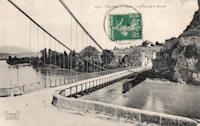
Inventory Search Results (101-200 of 387)
387 suspension bridges were found for search criteria: AAJ. Bridges 101 through 200 (of 387 total) appear below. Click the Bridgemeister ID number to isolate the bridge on its own page. If you don't see what you were looking for, try an image search with the same criteria: AAJ. This will find the bridge if it is pictured on the site, but is not a catenary suspension bridge.
Related:
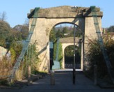
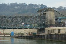
1836: Victoria
Bath, England, United Kingdom - River Avon
| Bridgemeister ID: | 397 (added before 2003) |
| Year Completed: | 1836 |
| Name: | Victoria |
| Location: | Bath, England, United Kingdom |
| Crossing: | River Avon |
| Coordinates: | 51.38350 N 2.37327 W |
| Maps: | Acme, GeoHack, Google, OpenStreetMap |
| Principals: | James Dredge |
| References: | AAJ |
| Use: | Vehicular (one-lane) |
| Status: | Restricted to foot traffic (last checked: 2019) |
| Main Cables: | Eyebar (iron) |
| Suspended Spans: | 1 |
| Main Span: | 1 x 45.7 meters (150 feet) |
| Deck width: | 18 feet |
Notes:
- Dredge patent bridge.
- Closed in 2010 due to safety concerns. Scheduled to be largely rebuilt as a replica, starting April 2013 to be completed April 2014. Temporary truss installed through the bridge to permit traffic during the refurbishment. Reopened January 2015.
External Links:
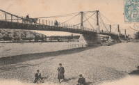
1837: Cavaillon
Cavaillon, Vaucluse and Bouches-du-Rhône, France - Durance River
| Bridgemeister ID: | 1012 (added 2003-11-21) |
| Year Completed: | 1837 |
| Name: | Cavaillon |
| Location: | Cavaillon, Vaucluse and Bouches-du-Rhône, France |
| Crossing: | Durance River |
| Principals: | Jules Seguin |
| References: | AAJ |
| Use: | Vehicular |
| Status: | Replaced |
| Main Cables: | Wire (iron) |
Notes:
- Destroyed by flood 1838, rebuilt 1840, wrecked by wind 1850, rebuilt 1851, damaged by floods 1886, rebuilt 1887, rebuilt 1914.
- Replaced by 1931 Cavaillon - Cavaillon, Vaucluse and Bouches-du-Rhône, France.
External Links:
1837: Constantine
Paris, France - Seine River
| Bridgemeister ID: | 1775 (added 2005-04-22) |
| Year Completed: | 1837 |
| Name: | Constantine |
| Location: | Paris, France |
| Crossing: | Seine River |
| At or Near Feature: | left bank |
| References: | AAJ |
| Use: | Footbridge |
| Status: | Replaced, c. 1860's |
| Main Cables: | Wire (iron) |
| Suspended Spans: | 3 |
| Main Span: | 1 x 101.4 meters (332.69 feet) |
| Side Spans: | 2 x 25.8 meters (84.75 feet) |
Notes:
- Connected l'Ile Saint-Louis and Quai St. Bernard.
- AAJ says replaced in 1863, but the current bridge at this location (Pont Sully) was not completed until 1876.
- Companion to 1837 Damiette - Paris, France.
External Links:
1837: Damiette
Paris, France - Seine River
| Bridgemeister ID: | 1776 (added 2005-04-22) |
| Year Completed: | 1837 |
| Name: | Damiette |
| Location: | Paris, France |
| Crossing: | Seine River |
| At or Near Feature: | right bank |
| References: | AAJ |
| Use: | Footbridge |
| Status: | Destroyed, 1848 |
| Suspended Spans: | 2 |
| Main Spans: | 1 x 58 meters (190.3 feet), 1 x 76.8 meters (251.85 feet) |
Notes:
- AAJ: It connected "the Quai of Célestins with the l'Ile Saint-Louis on one side, and with the I'lle of Louviers on the other."
- Companion to 1837 Constantine - Paris, France.
External Links:
1837: La Balme
La Balme, Savoie and Virignin, Ain, France - Rhône River
1837: Port-Boulet
Port-Boulet, Bourgueil vicinity, Indre-et-Loire, France - Loire River
| Bridgemeister ID: | 1773 (added 2005-04-22) |
| Year Completed: | 1837 |
| Name: | Port-Boulet |
| Location: | Port-Boulet, Bourgueil vicinity, Indre-et-Loire, France |
| Crossing: | Loire River |
| Principals: | Seguin Brothers |
| References: | AAJ |
| Status: | Destroyed, 1871 |
| Main Cables: | Wire (iron) |
External Links:
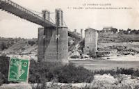
1837: Vallon
Vallon-Pont-D'arc and Salavas, Ardèche, France - Ardèche River
| Bridgemeister ID: | 1766 (added 2005-04-22) |
| Year Completed: | 1837 |
| Name: | Vallon |
| Also Known As: | Salavas |
| Location: | Vallon-Pont-D'arc and Salavas, Ardèche, France |
| Crossing: | Ardèche River |
| Coordinates: | 44.398624 N 4.385082 E |
| Maps: | Acme, GeoHack, Google, OpenStreetMap |
| References: | AAJ |
| Use: | Vehicular |
| Status: | Removed |
| Main Cables: | Wire |
| Main Spans: | 2 |
Notes:
- The current (2022) bridge at this location is built on the piers of the suspension bridge.
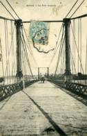
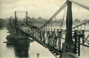
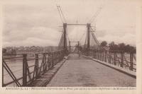
1838: Ancenis
Ancenis, Loire-Atlantique and Le Fourneau, Maine-et-Loire, France - Loire River
| Bridgemeister ID: | 1036 (added 2003-12-03) |
| Year Completed: | 1838 |
| Name: | Ancenis |
| Location: | Ancenis, Loire-Atlantique and Le Fourneau, Maine-et-Loire, France |
| Crossing: | Loire River |
| Principals: | Marc Seguin |
| References: | AAJ |
| Use: | Vehicular |
| Status: | Destroyed, 1944 |
| Main Cables: | Wire (iron) |
Notes:
- Destroyed 1940, temporarily rebuilt, destroyed 1944.
- Replaced by 1953 Ancenis - Ancenis, Loire-Atlantique and Le Fourneau, Maine-et-Loire, France.
External Links:
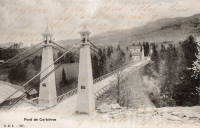
1838: Corbières
Corbières, Switzerland - Sarine River
| Bridgemeister ID: | 1778 (added 2005-04-22) |
| Year Completed: | 1838 |
| Name: | Corbières |
| Location: | Corbières, Switzerland |
| Crossing: | Sarine River |
| References: | AAJ |
| Use: | Vehicular (one-lane) |
| Status: | Replaced, 1931 |
| Main Cables: | Wire (iron) |
| Suspended Spans: | 1 |
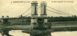
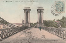
1838: Marmande
Marmande, Lot-et-Garonne, France - Garonne River
| Bridgemeister ID: | 1603 (added 2005-02-06) |
| Year Completed: | 1838 |
| Name: | Marmande |
| Location: | Marmande, Lot-et-Garonne, France |
| Crossing: | Garonne River |
| Coordinates: | 44.499538 N 0.156698 E |
| Maps: | Acme, GeoHack, Google, OpenStreetMap |
| References: | AAJ |
| Use: | Vehicular |
| Status: | Failed, 1930 |
| Main Cables: | Wire (iron) |
| Suspended Spans: | 2 |
| Side Spans: | 2 |
Notes:
- AAJ lists this bridge as completed in 1835.
- Near 1845 Couthures - Couthures-sur-Garonne, Lot-et-Garonne, France.
- Replaced by 1932 Marmande (Renaud Jean) - Marmande, Lot-et-Garonne, France.
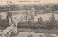
1838: Mas-d'Agenais
Le Mas-d'Agenais, Lot-et-Garonne, France - Garonne River
| Bridgemeister ID: | 1033 (added 2003-11-30) |
| Year Completed: | 1838 |
| Name: | Mas-d'Agenais |
| Location: | Le Mas-d'Agenais, Lot-et-Garonne, France |
| Crossing: | Garonne River |
| Coordinates: | 44.412101 N 0.222131 E |
| Maps: | Acme, GeoHack, Google, OpenStreetMap |
| References: | AAJ |
| Use: | Vehicular |
| Status: | In use (last checked: 2016) |
| Main Cables: | Wire (iron) |
| Suspended Spans: | 3 |
| Main Spans: | 3 |
Notes:
- 1930: The bridge is strengthened. The suspension system is replaced, the deck is stiffened with a plate girder system, and the pairs of end pylons are transformed to (or replaced with) towers with gothic arches.
External Links:
1838: Tournus
Tournus, Saône-et-Loire, France - Saône River
| Bridgemeister ID: | 5660 (added 2021-01-01) |
| Year Completed: | 1838 |
| Name: | Tournus |
| Location: | Tournus, Saône-et-Loire, France |
| Crossing: | Saône River |
| Coordinates: | 46.564107 N 4.912460 E |
| Maps: | Acme, GeoHack, Google, OpenStreetMap |
| References: | AAJ |
| Status: | Removed, 1869 |
| Main Cables: | Wire (iron) |
Notes:
- Later at same location 1950 Tournus - Tournus, Saône-et-Loire, France.
External Links:
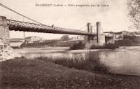
1839: Balbigny
Balbigny, Loire, France - Loire River
| Bridgemeister ID: | 1777 (added 2005-04-22) |
| Year Completed: | 1839 |
| Name: | Balbigny |
| Location: | Balbigny, Loire, France |
| Crossing: | Loire River |
| References: | AAJ |
| Use: | Vehicular |
| Status: | Destroyed, 1940 |
| Suspended Spans: | 2 |
External Links:
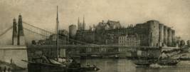
1839: Basse-Chaîne
Angers, Maine-et-Loire, France - Maine River
| Bridgemeister ID: | 993 (added 2003-11-16) |
| Year Completed: | 1839 |
| Name: | Basse-Chaîne |
| Also Known As: | Angers |
| Location: | Angers, Maine-et-Loire, France |
| Crossing: | Maine River |
| Principals: | Joseph Chaley |
| References: | AAJ, GHD, HBE, PTS2 |
| Status: | Collapsed, 1850 |
| Main Cables: | Wire (iron) |
| Suspended Spans: | 1 |
| Main Span: | 1 x 10² meters (334.66 feet) |
| Deck width: | 23.62 feet |
Notes:
- Collapsed under weight of maching troops, April 16, 1850, killing more than 200 soldiers. Collapse precipitated French virtual moratorium on suspension bridge building bringing to a close the prolific era of French wire cable suspension bridges.
External Links:
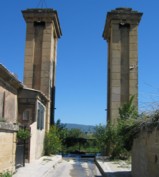
1839: Cadenet
Cadenet, Vaucluse and Bouches-du-Rhône, France - Durance River
| Bridgemeister ID: | 1008 (added 2003-11-21) |
| Year Completed: | 1839 |
| Name: | Cadenet |
| Location: | Cadenet, Vaucluse and Bouches-du-Rhône, France |
| Crossing: | Durance River |
| Coordinates: | 43.712117 N 5.365317 E |
| Maps: | Acme, GeoHack, Google, OpenStreetMap |
| Principals: | Adolphe Boulland |
| References: | AAJ |
| Use: | Vehicular |
| Status: | Only towers remain (last checked: 2005) |
Notes:
- Damaged by flood 1843, closed until 1844, destroyed 1944. Towers still standing, 2005.
External Links:
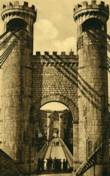
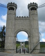
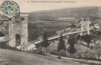
1839: Caille
Allonzier-La-Caille vicinity, Haute-Savoie, France - Usses Torrent
| Bridgemeister ID: | 859 (added 2003-08-09) |
| Year Completed: | 1839 |
| Name: | Caille |
| Also Known As: | Charles-Albert |
| Location: | Allonzier-La-Caille vicinity, Haute-Savoie, France |
| Crossing: | Usses Torrent |
| Coordinates: | 46.0126 N 6.111633 E |
| Maps: | Acme, GeoHack, Google, OpenStreetMap |
| Principals: | E. Belin |
| References: | AAJ, BPF, PTS2 |
| Use: | Vehicular |
| Status: | Restricted to foot traffic (last checked: 2019) |
| Main Cables: | Wire (iron) |
| Suspended Spans: | 1 |
| Main Span: | 1 x 192 meters (629.9 feet) |
External Links:
1839: Hameln
Hameln, Niedersachsen, Germany - Weser River
| Bridgemeister ID: | 2298 (added 2007-04-26) |
| Year Completed: | 1839 |
| Name: | Hameln |
| Location: | Hameln, Niedersachsen, Germany |
| Crossing: | Weser River |
| Coordinates: | 52.101511 N 9.351547 E |
| Maps: | Acme, GeoHack, Google, OpenStreetMap |
| Principals: | Georg Theodor Wendelstadt |
| References: | AAJ, PTS2 |
| Use: | Vehicular |
| Status: | Dismantled, c. 1890s |
| Main Cables: | Chain (iron) |
| Main Spans: | 2 |
Notes:
- Replaced in the 1890s by a (likely) cantilever bridge having the general shape of a suspension bridge.
- AAJ writes: "the first use of triangular bracing between double chain cables" and mentions that it was dismantled and moved to Hessisch Oldendorf 1880-1890 or 1899. Most accounts suggest the bridge was reassembled in the 1898-1899 time frame.
- Moved to 1899 Weserbrücke - Hessisch Oldendorf and Fuhlen, Germany.
External Links:
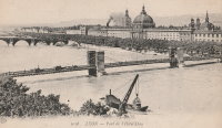
1839: L'Hôtel Dieu
Lyon, Métropole de Lyon, France - Rhône River
| Bridgemeister ID: | 966 (added 2003-11-01) |
| Year Completed: | 1839 |
| Name: | L'Hôtel Dieu |
| Location: | Lyon, Métropole de Lyon, France |
| Crossing: | Rhône River |
| Principals: | Clauzel |
| References: | AAJ, PQL |
| Use: | Vehicular |
| Status: | Demolished, 1912 |
| Main Cables: | Wire (iron) |
Notes:
- Was at location of present-day Pont Wilson.
- Rebuilt, 1850.
- Near 1845 College (Collège) - Lyon, Métropole de Lyon, France.
External Links:
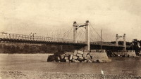
1839: Manosque
Manosque, Alpes-de-Haute-Provence, France - Durance River
| Bridgemeister ID: | 2001 (added 2005-12-26) |
| Year Completed: | 1839 |
| Name: | Manosque |
| Location: | Manosque, Alpes-de-Haute-Provence, France |
| Crossing: | Durance River |
| References: | AAJ |
| Use: | Vehicular |
| Status: | Replaced |
Notes:
- Heavily damaged by flood debris, 1843.
- Later at same location 1939 Manosque - Manosque, Alpes-de-Haute-Provence, France.
External Links:
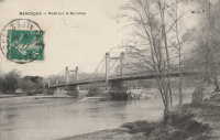
1839: Roche-Bernard
La Roche-Bernard, Morbihan, France - Vilaine River
| Bridgemeister ID: | 1027 (added 2003-11-22) |
| Year Completed: | 1839 |
| Name: | Roche-Bernard |
| Location: | La Roche-Bernard, Morbihan, France |
| Crossing: | Vilaine River |
| Principals: | P. Leblanc |
| References: | AAJ, HBE, PTS2 |
| Use: | Vehicular |
| Status: | Replaced, 1911 |
| Main Cables: | Wire (iron) |
| Suspended Spans: | 1 |
| Main Span: | 1 x 198 meters (649.6 feet) |
Notes:
- Wrecked by wind 1852, rebuilt, damaged 1866, 1869, 1870, and 1871. After the 1871 repairs, it was restricted to foot traffic. It was replaced in 1911 by an arch. Approaches extant (next to the later suspension bridge), 2004.
- Next to 1960 Roche-Bernard - La Roche-Bernard, Morbihan, France.
External Links:
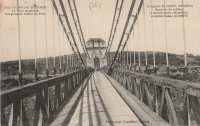
1839: Saint André-de-Cubzac
Saint André-de-Cubzac, Gironde, France - Dordogne River
| Bridgemeister ID: | 550 (added before 2003) |
| Year Completed: | 1839 |
| Name: | Saint André-de-Cubzac |
| Also Known As: | Cubzac |
| Location: | Saint André-de-Cubzac, Gironde, France |
| Crossing: | Dordogne River |
| Coordinates: | 44.962000 N 0.461444 W |
| Maps: | Acme, GeoHack, Google, OpenStreetMap |
| Principals: | Marie Fortuné de Vergès, Emil Martin |
| References: | AAJ, HBE, PTS2 |
| Use: | Vehicular |
| Status: | Destroyed, 1869 |
| Main Cables: | Wire (iron) |
| Suspended Spans: | 5 |
| Main Spans: | 5 x 10⁹ meters (357.6 feet) |
| Deck width: | 23 feet |
Notes:
- This is perhaps one of the most fanciful large suspension bridges ever built.
- Destroyed in a storm, 1869. Its replacement (a truss bridge) was completed in 1883. The approaches and the bottom halves of the suspension bridge towers were strengthened and used for the replacement.
- AAJ citing Engineering News-Record: "Vergès used inclined tie cables running from the top of the tower at one end of a span to a roadway-level connection on the opposite tower."
External Links:
- Structurae - Cubzac Bridge. Photos of the replacement truss structure.
- Structurae - Structure ID 20000898
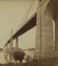

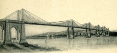
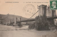
1839: Teil
Le Teil, Ardèche and Montélimar, Drôme, France - Rhône River
| Bridgemeister ID: | 1733 (added 2005-04-06) |
| Year Completed: | 1839 |
| Name: | Teil |
| Location: | Le Teil, Ardèche and Montélimar, Drôme, France |
| Crossing: | Rhône River |
| Coordinates: | 44.552213 N 4.691909 E |
| Maps: | Acme, GeoHack, Google, OpenStreetMap |
| References: | AAJ |
| Status: | Replaced, 1931 |
| Main Cables: | Wire (iron) |
| Suspended Spans: | 4 |
| Main Spans: | 4 |
| Deck width: | 19.68 feet |
Notes:
- Damaged by flood, 1840. Rebuilt and reopened, 1843. Damaged by floods, 1856 and 1881.
- Replaced by 1931 Teil - Le Teil, Ardèche and Montélimar, Drôme, France.
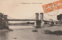
1839: Thoissey
Thoissey, Ain and Dracé, Rhône, France - Saône River
| Bridgemeister ID: | 5643 (added 2020-12-30) |
| Year Completed: | 1839 |
| Name: | Thoissey |
| Location: | Thoissey, Ain and Dracé, Rhône, France |
| Crossing: | Saône River |
| Coordinates: | 46.165206 N 4.789349 E |
| Maps: | Acme, GeoHack, Google, OpenStreetMap |
| References: | AAJ |
| Use: | Vehicular |
| Status: | Removed |
| Main Cables: | Wire (iron) |
| Suspended Spans: | 2 |
| Main Spans: | 2 |
Notes:
- Various sources suggest completed 1837-1839. The bridge may have initially failed upon its completion in 1837 and then opened in 1839.
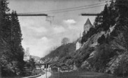
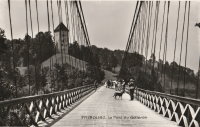
1840: Gotteron
Fribourg, Switzerland - Sarine River
| Bridgemeister ID: | 398 (added before 2003) |
| Year Completed: | 1840 |
| Name: | Gotteron |
| Location: | Fribourg, Switzerland |
| Crossing: | Sarine River |
| Principals: | Joseph Chaley |
| References: | AAJ, GHD, PTS2 |
| Use: | Vehicular |
| Status: | Removed |
| Main Cables: | Wire (iron) |
| Suspended Spans: | 1 |
| Main Span: | 1 x 220 meters (721.8 feet) |
Notes:
- 1919, May 9: An overloaded truck carrying logs causes the failure of several suspenders and collapse of a large section of the deck.
- Near 1834 Zaehringen (Grand Pont Suspendu) - Fribourg, Switzerland.
External Links:
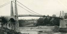
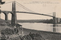
1840: Lézardrieux
Lézardrieux, Côtes-d'Armor, France - Trieux River
| Bridgemeister ID: | 1116 (added 2004-01-05) |
| Year Completed: | 1840 |
| Name: | Lézardrieux |
| Location: | Lézardrieux, Côtes-d'Armor, France |
| Crossing: | Trieux River |
| Coordinates: | 48.780778 N 3.106222 W |
| Maps: | Acme, GeoHack, Google, OpenStreetMap |
| Principals: | Seguin Brothers |
| References: | AAJ, PTS2 |
| Use: | Vehicular (one-lane) |
| Status: | Replaced, 1925 |
| Main Cables: | Wire (iron) |
| Suspended Spans: | 1 |
| Main Span: | 1 x 150 meters (492.1 feet) |
Notes:
- 1925: Replaced by a Gisclard suspension bridge reusing the approach spans and piers of the 1840 suspension bridge.
External Links:
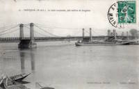
1840: Montjean-sur-Loire
Montjean-sur-Loire, Maine-et-Loire, France - Loire River
| Bridgemeister ID: | 1780 (added 2005-04-23) |
| Year Completed: | 1840 |
| Name: | Montjean-sur-Loire |
| Location: | Montjean-sur-Loire, Maine-et-Loire, France |
| Crossing: | Loire River |
| Coordinates: | 47.394880 N 0.859161 W |
| Maps: | Acme, GeoHack, Google, OpenStreetMap |
| References: | AAJ |
| Use: | Vehicular |
| Status: | Replaced, 1927 |
| Main Cables: | Wire (iron) |
Notes:
1840: Saint-Florent
Saint-Hilaire-Saint-Florent, Maine-et-Loire, France - Thouet River
| Bridgemeister ID: | 1779 (added 2005-04-23) |
| Year Completed: | 1840 |
| Name: | Saint-Florent |
| Location: | Saint-Hilaire-Saint-Florent, Maine-et-Loire, France |
| Crossing: | Thouet River |
| References: | AAJ |
| Suspended Spans: | 1 |
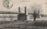
1841: Aiguilly
Roanne vicinity and Vougy vicinity, Loire, France - Loire River
| Bridgemeister ID: | 1566 (added 2004-11-28) |
| Year Completed: | 1841 |
| Name: | Aiguilly |
| Location: | Roanne vicinity and Vougy vicinity, Loire, France |
| Crossing: | Loire River |
| References: | AAJ |
| Status: | Replaced, 1937 |
| Main Cables: | Wire (iron) |
Notes:
External Links:
1841: Balloch Ferry
Balloch, Scotland, United Kingdom - River Leven
| Bridgemeister ID: | 5552 (added 2020-12-16) |
| Year Completed: | 1841 |
| Name: | Balloch Ferry |
| Location: | Balloch, Scotland, United Kingdom |
| Crossing: | River Leven |
| Coordinates: | 56.003420 N 4.581826 W |
| Maps: | Acme, GeoHack, Google, OpenStreetMap |
| Principals: | Sir James Colquhoun |
| References: | AAJ |
| Status: | Removed, c. 1887 |
| Main Cables: | Rod (iron) |
| Suspended Spans: | 3 |
| Main Span: | 1 x 61 meters (200 feet) |
| Side Spans: | 2 x 13.7 meters (45 feet) |
Notes:
- Design based on James Dredge's taper principle patent.
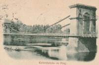
1841: Císaře Františka I
Prague, Czechia - Vltava River
| Bridgemeister ID: | 5941 (added 2021-06-29) |
| Year Completed: | 1841 |
| Name: | Císaře Františka I |
| Also Known As: | Emperor Franz I |
| Location: | Prague, Czechia |
| Crossing: | Vltava River |
| Coordinates: | 50.081354 N 14.410023 E |
| Maps: | Acme, GeoHack, Google, OpenStreetMap |
| Principals: | Friedrich Schnirch |
| References: | AAJ, PTS2 |
| Use: | Vehicular |
| Status: | Removed, c. 1899-1901 |
| Main Cables: | Chain (iron) |
Notes:
- This location is now crossed by the Legion Bridge (Legii Most).
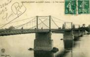
1841: Châteauneuf-sur-Loire
Châteauneuf-sur-Loire, Loiret, France - Loire River
| Bridgemeister ID: | 1016 (added 2003-11-22) |
| Year Completed: | 1841 |
| Name: | Châteauneuf-sur-Loire |
| Location: | Châteauneuf-sur-Loire, Loiret, France |
| Crossing: | Loire River |
| Coordinates: | 47.857889 N 2.223417 E |
| Maps: | Acme, GeoHack, Google, OpenStreetMap |
| Principals: | Seguin Brothers |
| References: | AAJ |
| Use: | Vehicular |
| Status: | Replaced |
| Main Cables: | Wire (iron) |
| Suspended Spans: | 5 |
| Main Spans: | 5 |
Notes:
- 1870: Heavily damaged during Franco-Prussian war.
- 1872: Repairs completed.
- Replaced by 1935 Châteauneuf-sur-Loire - Châteauneuf-sur-Loire, Loiret, France.
External Links:
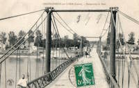
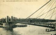
1841: Châtillon-sur-Loire
Châtillon-sur-Loire, Loiret, France - Loire River
| Bridgemeister ID: | 1017 (added 2003-11-22) |
| Year Completed: | 1841 |
| Name: | Châtillon-sur-Loire |
| Location: | Châtillon-sur-Loire, Loiret, France |
| Crossing: | Loire River |
| Principals: | Marc Seguin |
| References: | AAJ |
| Use: | Vehicular |
| Status: | Replaced, 1931 |
| Main Cables: | Wire (iron) |
| Suspended Spans: | 4 |
| Main Spans: | 2 x 92 meters (301.8 feet), 2 x 76 meters (249.3 feet) |
Notes:
- Destroyed by flood 1846, rebuilt 1848, damaged by flood 1856, rebuilt 1857.
- Replaced by 1931 Châtillon-sur-Loire - Châtillon-sur-Loire, Loiret, France. Built on same piers.
External Links:
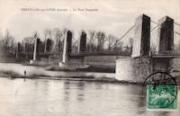
1841: Saintes
Saintes, Charente-Maritime, France - Charente River
| Bridgemeister ID: | 5662 (added 2021-01-01) |
| Year Completed: | 1841 |
| Name: | Saintes |
| Location: | Saintes, Charente-Maritime, France |
| Crossing: | Charente River |
| References: | AAJ |
| Use: | Vehicular |
| Status: | Removed, 1876 |
| Main Cables: | Wire (iron) |
| Suspended Spans: | 1 |
1841: Verdun-sur-Garonne
Verdun-sur-Garonne, Tarn-et-Garonne, France - Garonne River
| Bridgemeister ID: | 2158 (added 2006-12-10) |
| Year Completed: | 1841 |
| Name: | Verdun-sur-Garonne |
| Location: | Verdun-sur-Garonne, Tarn-et-Garonne, France |
| Crossing: | Garonne River |
| References: | AAJ, PTS2 |
| Use: | Vehicular |
| Suspended Spans: | 1 |
| Main Span: | 1 x 151 meters (495.4 feet) |
Notes:
- See 1931 Verdun-sur-Garonne - Verdun-sur-Garonne, Tarn-et-Garonne, France. The relationship between the older and current bridges is unclear.
External Links:
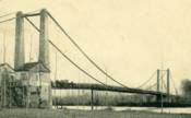
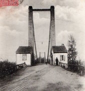
1842: (footbridge)
London, England, United Kingdom - Regent's Canal
| Bridgemeister ID: | 5088 (added 2020-09-04) |
| Year Completed: | 1842 |
| Name: | (footbridge) |
| Location: | London, England, United Kingdom |
| Crossing: | Regent's Canal |
| At or Near Feature: | Regent's Park |
| Principals: | James Dredge |
| References: | AAJ |
| Use: | Footbridge |
| Status: | Removed |
| Main Cables: | Rod (iron) |
| Suspended Spans: | 1 |
| Main Span: | 1 x 22.9 meters (75 feet) |
Notes:
- Built as part of same project as 1842 (footbridge) - London, England, United Kingdom.
- Built as part of same project as 1842 (footbridge) - London, England, United Kingdom.
- Built as part of same project as 1842 (footbridge) - London, England, United Kingdom.
- Built as part of same project as 1842 (footbridge) - London, England, United Kingdom.
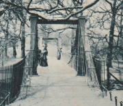
1842: (footbridge)
London, England, United Kingdom - Regent's Canal
| Bridgemeister ID: | 5089 (added 2020-09-04) |
| Year Completed: | 1842 |
| Name: | (footbridge) |
| Location: | London, England, United Kingdom |
| Crossing: | Regent's Canal |
| At or Near Feature: | Regent's Park |
| Principals: | James Dredge |
| References: | AAJ |
| Use: | Footbridge |
| Status: | Removed |
| Main Cables: | Rod (iron) |
| Suspended Spans: | 1 |
| Main Span: | 1 x 22.9 meters (75 feet) |
Notes:
- Built as part of same project as 1842 (footbridge) - London, England, United Kingdom.
- Built as part of same project as 1842 (footbridge) - London, England, United Kingdom.
- Built as part of same project as 1842 (footbridge) - London, England, United Kingdom.
- Built as part of same project as 1842 (footbridge) - London, England, United Kingdom.

1842: (footbridge)
London, England, United Kingdom
| Bridgemeister ID: | 5090 (added 2020-09-04) |
| Year Completed: | 1842 |
| Name: | (footbridge) |
| Location: | London, England, United Kingdom |
| At or Near Feature: | Regent's Park |
| Principals: | James Dredge |
| References: | AAJ |
| Use: | Footbridge |
| Status: | Removed |
| Main Cables: | Rod (iron) |
| Main Span: | 1 x 45.7 meters (150 feet) |
Notes:
- Built as part of same project as 1842 (footbridge) - London, England, United Kingdom.
- Built as part of same project as 1842 (footbridge) - London, England, United Kingdom.
- Built as part of same project as 1842 (footbridge) - London, England, United Kingdom.
- Built as part of same project as 1842 (footbridge) - London, England, United Kingdom.

1842: (footbridge)
London, England, United Kingdom
| Bridgemeister ID: | 5091 (added 2020-09-04) |
| Year Completed: | 1842 |
| Name: | (footbridge) |
| Location: | London, England, United Kingdom |
| At or Near Feature: | Regent's Park |
| Principals: | James Dredge |
| References: | AAJ |
| Use: | Footbridge |
| Status: | Removed |
| Main Cables: | Rod (iron) |
Notes:
- Built as part of same project as 1842 (footbridge) - London, England, United Kingdom.
- Built as part of same project as 1842 (footbridge) - London, England, United Kingdom.
- Built as part of same project as 1842 (footbridge) - London, England, United Kingdom.
- Built as part of same project as 1842 (footbridge) - London, England, United Kingdom.

1842: (footbridge)
London, England, United Kingdom
| Bridgemeister ID: | 5092 (added 2020-09-04) |
| Year Completed: | 1842 |
| Name: | (footbridge) |
| Location: | London, England, United Kingdom |
| At or Near Feature: | Regent's Park |
| Principals: | James Dredge |
| References: | AAJ |
| Use: | Footbridge |
| Status: | Removed |
| Main Cables: | Rod (iron) |
Notes:
- Built as part of same project as 1842 (footbridge) - London, England, United Kingdom.
- Built as part of same project as 1842 (footbridge) - London, England, United Kingdom.
- Built as part of same project as 1842 (footbridge) - London, England, United Kingdom.
- Built as part of same project as 1842 (footbridge) - London, England, United Kingdom.

1842: (suspension bridge)
Frome, England, United Kingdom - River Frome
| Bridgemeister ID: | 4062 (added 2020-03-30) |
| Year Completed: | 1842 |
| Name: | (suspension bridge) |
| Location: | Frome, England, United Kingdom |
| Crossing: | River Frome |
| Principals: | James Dredge |
| References: | AAJ |
| Status: | Removed |
1842: Cité
Île de la Cité and Île St-Louis, Paris, France - Seine River
1842: Les Mées
Les Mées, Alpes-de-Haute-Provence, France - Durance River
| Bridgemeister ID: | 1734 (added 2005-04-19) |
| Year Completed: | 1842 |
| Name: | Les Mées |
| Location: | Les Mées, Alpes-de-Haute-Provence, France |
| Crossing: | Durance River |
| References: | AAJ |
| Use: | Vehicular |
| Status: | Destroyed, 1843 |
| Suspended Spans: | 3 |
Notes:
- Destroyed by flood, 1843.
- Replaced by 1856 Les Mées - Les Mées, Alpes-de-Haute-Provence, France.
External Links:
1842: Pênsil Maria II
Porto, Portugal - Douro River
| Bridgemeister ID: | 2433 (added 2008-04-22) |
| Year Completed: | 1842 |
| Name: | Pênsil Maria II |
| Location: | Porto, Portugal |
| Crossing: | Douro River |
| Coordinates: | 41.14006 N 8.60986 W |
| Maps: | Acme, GeoHack, Google, OpenStreetMap |
| Principals: | Mellet, Stanislas Bigot, Amédée Caruette |
| References: | AAJ |
| Use: | Vehicular |
| Status: | Only towers remain, since 1887 (last checked: 2020) |
| Main Cables: | Wire |
| Suspended Spans: | 1 |
Notes:
- Replaced by the famous bi-level Dom Luís I arch bridge. Towers of the suspension bridge are extant at the foot of the Dom Luís I bridge.
External Links:
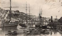
1842: Wraysbury
Wraysbury, England, United Kingdom
| Bridgemeister ID: | 4835 (added 2020-07-10) |
| Year Completed: | 1842 |
| Name: | Wraysbury |
| Location: | Wraysbury, England, United Kingdom |
| Principals: | James Dredge |
| References: | AAJ |
| Use: | Vehicular |
| Status: | Removed |
| Main Cables: | Rod (iron) |
| Main Span: | 1 x 30.5 meters (100 feet) |
1843: Bassou
Bassou and Bonnard, Yonne, France - Yonne River
| Bridgemeister ID: | 2234 (added 2007-03-19) |
| Year Completed: | 1843 |
| Name: | Bassou |
| Location: | Bassou and Bonnard, Yonne, France |
| Crossing: | Yonne River |
| References: | AAJ |
| Use: | Vehicular |
| Status: | Replaced, 1967 |
| Main Cables: | Wire |
| Suspended Spans: | 1 |
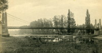
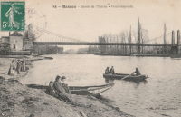
1843: Ingrandes
Ingrandes, Maine-et-Loire, France - Loire River
| Bridgemeister ID: | 1171 (added 2004-01-23) |
| Year Completed: | 1843 |
| Name: | Ingrandes |
| Location: | Ingrandes, Maine-et-Loire, France |
| Crossing: | Loire River |
| Coordinates: | 47.40075 N 0.918683 W |
| Maps: | Acme, GeoHack, Google, OpenStreetMap |
| References: | AAJ |
| Use: | Vehicular |
| Status: | In use (last checked: 2021) |
| Main Cables: | Wire (iron) |
| Suspended Spans: | 8 |
| Main Spans: | 8 |
Notes:
- Structurae has the bridge completed in 1922 (with a 1941 reconstruction) and AAJ suggests the bridge was completed 1924-1927, but older images of the bridge show an older bridge consistent with the 1843 date. The later dates represent reconstructions. The current bridge has steel cables.
External Links:
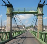
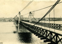
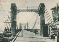
1843: Seraing
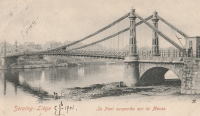
Seraing, Liège vicinity, Belgium - Meuse River
| Bridgemeister ID: | 6550 (added 2021-08-29) |
| Year Completed: | 1843 |
| Name: | Seraing |
| Location: | Seraing, Liège vicinity, Belgium |
| Crossing: | Meuse River |
| Coordinates: | 50.616960 N 5.509567 E |
| Maps: | Acme, GeoHack, Google, OpenStreetMap |
| Principals: | Hubert Brialmont, John Cockerill & Cie |
| References: | AAJ, IBB, PTS2 |
| Use: | Vehicular |
| Status: | Removed, 1905 |
| Main Cables: | Chain (iron) |
| Suspended Spans: | 1 |
| Main Span: | 1 x 10⁵ meters (344.5 feet) |
External Links:
1844: Crevant à Maringues
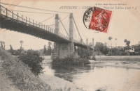
Maringues and Crevant-Laveine, Puy-de-Dôme, France - Allier River
| Bridgemeister ID: | 1941 (added 2005-10-29) |
| Year Completed: | 1844 |
| Name: | Crevant à Maringues |
| Location: | Maringues and Crevant-Laveine, Puy-de-Dôme, France |
| Crossing: | Allier River |
| References: | AAJ |
| Use: | Vehicular |
| Status: | Removed |
| Main Cables: | Wire (iron) |
| Suspended Spans: | 3 |
1844: Mülheimer
Mülheim an der Ruhr, North Rhine-Westphalia, Germany - Ruhr River
| Bridgemeister ID: | 2297 (added 2007-04-26) |
| Year Completed: | 1844 |
| Name: | Mülheimer |
| Location: | Mülheim an der Ruhr, North Rhine-Westphalia, Germany |
| Crossing: | Ruhr River |
| Principals: | Malberg |
| References: | AAJ, PTS2 |
| Status: | Demolished, 1909 |
| Main Cables: | Chain (iron) |
| Suspended Spans: | 3 |
| Main Span: | 1 x 94.14 meters (308.9 feet) |
| Side Spans: | 2 x 28.25 meters (92.7 feet) |
External Links:
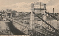
1844: Saint-Claude
Saint-Claude, Jura, France - Tacon River
| Bridgemeister ID: | 1200 (added 2004-01-31) |
| Year Completed: | 1844 |
| Name: | Saint-Claude |
| Location: | Saint-Claude, Jura, France |
| Crossing: | Tacon River |
| References: | AAJ |
| Use: | Vehicular |
| Status: | Replaced, 1939 |
| Main Cables: | Wire (iron) |
| Suspended Spans: | 1 |
Notes:
- Replaced by a concrete arch, 1939.
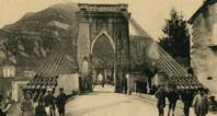

1844: Union
Ottawa, Ontario, Canada - Chaudière Falls
| Bridgemeister ID: | 26 (added before 2003) |
| Year Completed: | 1844 |
| Name: | Union |
| Location: | Ottawa, Ontario, Canada |
| Crossing: | Chaudière Falls |
| Principals: | Samuel Keefer |
| References: | AAJ |
| Use: | Vehicular |
| Status: | Replaced, 1889 |
| Main Cables: | Wire (iron) |
| Suspended Spans: | 1 |
| Main Span: | 1 x 74.2 meters (243.5 feet) |
Notes:
- At time of completion, Ottawa was still known as Bytown.
External Links:

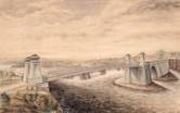
1845: (footbridge)
Caledon, County Tyrone, Northern Ireland, United Kingdom - River Blackwater
| Bridgemeister ID: | 2424 (added 2008-03-12) |
| Year Completed: | 1845 |
| Name: | (footbridge) |
| Location: | Caledon, County Tyrone, Northern Ireland, United Kingdom |
| Crossing: | River Blackwater |
| Coordinates: | 54.34608 N 6.83276 W |
| Maps: | Acme, GeoHack, Google, OpenStreetMap |
| Principals: | James Dredge |
| References: | AAJ |
| Use: | Footbridge |
| Status: | Extant (last checked: 2021) |
| Main Cables: | Rod (iron) |
| Suspended Spans: | 1 |
| Main Span: | 1 x 22.6 meters (74 feet) |
Notes:
- This distinctly Dredge bridge is currently sitting atop modern concrete piers.
External Links:
1845: Castelmoron-sur-Lot
Castelmoron-sur-Lot, Lot-et-Garonne, France - Lot River
| Bridgemeister ID: | 1720 (added 2005-04-05) |
| Year Completed: | 1845 |
| Name: | Castelmoron-sur-Lot |
| Location: | Castelmoron-sur-Lot, Lot-et-Garonne, France |
| Crossing: | Lot River |
| Coordinates: | 44.395673 N 0.494136 E |
| Maps: | Acme, GeoHack, Google, OpenStreetMap |
| References: | AAJ |
| Use: | Vehicular |
| Status: | Replaced, 1933 |
| Main Cables: | Wire (iron) |
| Main Span: | 1 |
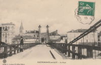
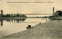
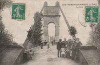
1845: Couthures
Couthures-sur-Garonne, Lot-et-Garonne, France - Garonne River
| Bridgemeister ID: | 1900 (added 2005-10-04) |
| Year Completed: | 1845 |
| Name: | Couthures |
| Location: | Couthures-sur-Garonne, Lot-et-Garonne, France |
| Crossing: | Garonne River |
| Coordinates: | 44.513600 N 0.080580 E |
| Maps: | Acme, GeoHack, Google, OpenStreetMap |
| References: | AAJ |
| Use: | Vehicular |
| Status: | Removed |
| Main Cables: | Wire |
| Suspended Spans: | 1 |
Notes:
1845: Nogent-l'Artaud
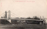
Nogent-l'Artaud, Aisne, France - Marne River
| Bridgemeister ID: | 5554 (added 2020-12-17) |
| Year Completed: | 1845 |
| Name: | Nogent-l'Artaud |
| Location: | Nogent-l'Artaud, Aisne, France |
| Crossing: | Marne River |
| Coordinates: | 48.969762 N 3.320971 E |
| Maps: | Acme, GeoHack, Google, OpenStreetMap |
| References: | AAJ |
| Use: | Vehicular |
| Status: | Removed |
| Main Cables: | Wire (iron) |
| Suspended Spans: | 1 |
Notes:
- Destroyed 1870. Rebuilt 1875.
1845: Volonne
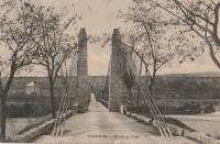
Volonne, Alpes-de-Haute-Provence, France - Durance River
| Bridgemeister ID: | 2002 (added 2005-12-26) |
| Year Completed: | 1845 |
| Name: | Volonne |
| Location: | Volonne, Alpes-de-Haute-Provence, France |
| Crossing: | Durance River |
| References: | AAJ |
| Use: | Vehicular (one-lane) |
| Status: | Replaced |
| Main Cables: | Wire |
Notes:
External Links:
1846: Maison-Rouge
Courcelles-sur-Seine, Eure, France - Seine River
| Bridgemeister ID: | 5642 (added 2020-12-30) |
| Year Completed: | 1846 |
| Name: | Maison-Rouge |
| Location: | Courcelles-sur-Seine, Eure, France |
| Crossing: | Seine River |
| Coordinates: | 49.179082 N 1.353851 E |
| Maps: | Acme, GeoHack, Google, OpenStreetMap |
| Principals: | Escarraguel Brothers |
| References: | AAJ |
| Use: | Vehicular |
| Status: | Destroyed, October 15, 1870 |
| Main Cables: | Wire (iron) |
Notes:
- Coordinates indicate the approximate former location of this bridge.
1846: Saint Clair
Lyon, Métropole de Lyon, France - Rhône River
| Bridgemeister ID: | 551 (added before 2003) |
| Year Completed: | 1846 |
| Name: | Saint Clair |
| Also Known As: | Louis Philippe, Vaïsse |
| Location: | Lyon, Métropole de Lyon, France |
| Crossing: | Rhône River |
| References: | AAJ, PQL |
| Use: | Vehicular |
| Status: | Demolished, 1953 |
| Main Cables: | Wire (iron) |
| Suspended Spans: | 2 |
| Deck width: | 7 meters |
Notes:
- Damaged by drifting boat, 1854. Rebuilt, 1856. Bombed, 1944. Rebuilt, 1946. Demolished, 1953.
- Crossed at present-day location of Pont Maréchal de Lattre de Tassigny.
- Originally constructed with two suspended spans. When it was rebuilt in 1856, towers were added increasing the number of suspended spans to six.
- Near 1845 College (Collège) - Lyon, Métropole de Lyon, France.
External Links:

1847: Donzère
Donzère, Drôme and Viviers, Ardèche, France - Rhône River
| Bridgemeister ID: | 970 (added 2003-11-13) |
| Year Completed: | 1847 |
| Name: | Donzère |
| Also Known As: | Robinet |
| Location: | Donzère, Drôme and Viviers, Ardèche, France |
| Crossing: | Rhône River |
| Coordinates: | 44.452367 N 4.6981 E |
| Maps: | Acme, GeoHack, Google, OpenStreetMap |
| References: | AAJ, BPF |
| Use: | Vehicular (one-lane) |
| Status: | In use (last checked: 2021) |
| Main Cables: | Wire (iron) |
| Suspended Spans: | 3 |
| Main Spans: | 3 x 100 meters (328.1 feet) estimated |
External Links:
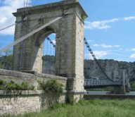
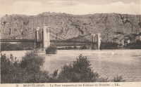
1847: Saint-Symphorien
Tours, Indre-et-Loire, France - Loire River
| Bridgemeister ID: | 1755 (added 2005-04-20) |
| Year Completed: | 1847 |
| Name: | Saint-Symphorien |
| Location: | Tours, Indre-et-Loire, France |
| Crossing: | Loire River |
| At or Near Feature: | l'Île Aucard |
| Coordinates: | 47.398776 N 0.692994 E |
| Maps: | Acme, GeoHack, Google, OpenStreetMap |
| Principals: | Seguin Brothers |
| References: | AAJ |
| Use: | Vehicular (one-lane), with walkway |
| Status: | Replaced |
| Main Cables: | Wire (iron) |
| Suspended Spans: | 3 |
| Main Spans: | 3 |
Notes:
- This was the three-span south section of the Saint-Symphorien bridge.
- 1940-1944: The Saint-Symphorien bridge is destroyed by French troops in June 1940 to slow the German army. Repaired in 1943. Destroyed again in 1944 by the German army. It is unclear whether both the north and south bridges were destroyed during these events.
- Connects to 1847 Saint-Symphorien - Tours, Indre-et-Loire, France.
- Replaced by Saint-Symphorien - Tours, Indre-et-Loire, France.
External Links:
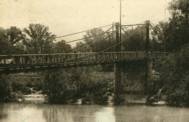
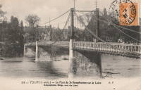
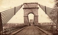
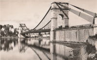
1847: St. Christophe
Lorient, Morbihan, France - Scorff River
| Bridgemeister ID: | 1155 (added 2004-01-18) |
| Year Completed: | 1847 |
| Name: | St. Christophe |
| Also Known As: | Kérentrech, Nemours |
| Location: | Lorient, Morbihan, France |
| Crossing: | Scorff River |
| Principals: | Le Clerc and Noyon |
| References: | AAJ |
| Use: | Vehicular |
| Status: | Removed |
| Main Cables: | Wire (iron) |
| Main Span: | 1 x 180 meters (590.6 feet) |
Notes:
- Large masonry towers. Main span of 180 meters is unusually large for a French bridge of this decade.
External Links:
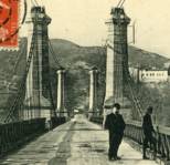
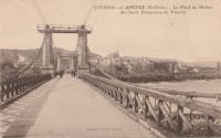
1847: Viviers
Viviers, Ardèche and Drôme, France - Rhône River
| Bridgemeister ID: | 1961 (added 2005-11-05) |
| Year Completed: | 1847 |
| Name: | Viviers |
| Location: | Viviers, Ardèche and Drôme, France |
| Crossing: | Rhône River |
| Coordinates: | 44.481667 N 4.699698 E |
| Maps: | Acme, GeoHack, Google, OpenStreetMap |
| References: | AAJ |
| Use: | Vehicular (one-lane) |
| Status: | Destroyed, 1944 |
| Main Cables: | Wire |
Notes:
- Later at same location 1954 Viviers - Viviers, Ardèche and Châteauneuf-Du-Rhône, Drôme, France.
External Links:
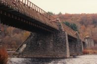
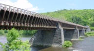
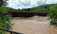
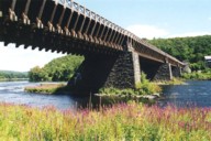
1848: Delaware Aqueduct
Lackawaxen, Pennsylvania and Minisink Ford, New York, USA - Delaware River
| Bridgemeister ID: | 30 (added before 2003) |
| Year Completed: | 1848 |
| Name: | Delaware Aqueduct |
| Also Known As: | Roebling Aqueduct |
| Location: | Lackawaxen, Pennsylvania and Minisink Ford, New York, USA |
| Crossing: | Delaware River |
| Coordinates: | 41.48262 N 74.98461 W |
| Maps: | Acme, GeoHack, Google, OpenStreetMap |
| Principals: | John A. Roebling |
| References: | AAJ, BDR, BOB, BPL, GBD, LAB, LACE, RDH, SJR |
| Use: | Aqueduct and Vehicular (one-lane), with walkway |
| Status: | In use (last checked: 2006) |
| Main Cables: | Wire (iron) |
| Suspended Spans: | 4 |
| Main Spans: | 1 x 43.3 meters (142 feet), 3 x 39.9 meters (131 feet) |
Notes:
- BPL: Completed 1848. RDH/BDR: Completed 1848, not used until 1849.
- Originally constructed to carry the Delaware and Hudson Canal. Converted to a one-lane vehicular bridge soon after the canal closed in 1898. Substantially restored in 1980's and 1990's, but retains original cables.
- Built as part of same project as 1849 Lackawaxen Aqueduct - Lackawaxen, Pennsylvania, USA.
- Built as part of same project as 1851 High Falls Aqueduct - High Falls, New York, USA.
- Built as part of same project as 1851 Neversink Aqueduct - Cuddebackville, New York, USA.
- Near 1849 Lackawaxen Aqueduct - Lackawaxen, Pennsylvania, USA.
External Links:
1848: Shadwell
Shadwell, England, United Kingdom
| Bridgemeister ID: | 5641 (added 2020-12-30) |
| Year Completed: | 1848 |
| Name: | Shadwell |
| Location: | Shadwell, England, United Kingdom |
| At or Near Feature: | Ropery Grounds at Sun Tavern Fields |
| Principals: | William Dredge |
| References: | AAJ |
| Use: | Footbridge |
| Status: | Removed |
| Main Cables: | Rod (iron) |
Notes:
- William Dredge was the son of James Dredge known for his "taper principle" bridge design. Based on the description of the Shadwell bridge (in the sources cited by Jakkula), it is unclear if this Shadwell bridge followed Williams' father's design. 1848 is assumed as the year of completion based on the October 7, 1848 Mechanics' Magazine article cited by Jakkula which starts "A foot-suspension bridge has just been erected..."
1849: Chain
Budapest, Hungary - Danube River
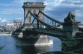
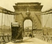
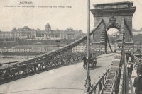
| Bridgemeister ID: | 402 (added before 2003) |
| Year Completed: | 1849 |
| Name: | Chain |
| Also Known As: | Széchenyi Lánchíd |
| Location: | Budapest, Hungary |
| Crossing: | Danube River |
| Coordinates: | 47.49945 N 19.046567 E |
| Maps: | Acme, GeoHack, Google, OpenStreetMap |
| Principals: | William Tierney Clark, Adam Clark |
| References: | AAJ, BC3, BCO, CTW, HBE, ONF |
| Use: | Vehicular |
| Status: | In use (last checked: 2021) |
| Main Cables: | Chain (iron) |
| Suspended Spans: | 3 |
| Main Span: | 1 x 203 meters (666 feet) |
| Side Spans: | 2 x 90.8 meters (298 feet) |
Notes:
- Don Sayenga notes, the bridge was designed by W.T. Clark, but built by Adam Clark (no relation).
- 1945: Destroyed during WWII, rebuilt 1949.
- 2020: Major rehabilitation project expected to start May, 2021.
External Links:

1849: Fourneau
Le Fourneau, Bourbon-Lancy vicinity, Saône-et-Loire and Allier, France - Loire River
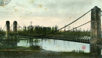
| Bridgemeister ID: | 1772 (added 2005-04-22) |
| Year Completed: | 1849 |
| Name: | Fourneau |
| Location: | Le Fourneau, Bourbon-Lancy vicinity, Saône-et-Loire and Allier, France |
| Crossing: | Loire River |
| References: | AAJ |
| Use: | Vehicular |
| Status: | Replaced, 1932 |
| Main Spans: | 2 x 115 meters (377.32 feet) |
| Deck width: | 16.4 feet |
Notes:
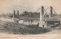
1849: Jaulgonne
Jaulgonne and Varennes, Aisne, France - Marne River
| Bridgemeister ID: | 1940 (added 2005-10-29) |
| Year Completed: | 1849 |
| Name: | Jaulgonne |
| Location: | Jaulgonne and Varennes, Aisne, France |
| Crossing: | Marne River |
| Principals: | Seguin Brothers |
| References: | AAJ |
| Use: | Vehicular |
| Status: | Removed |
| Main Cables: | Wire (iron) |
| Suspended Spans: | 1 |
| Main Span: | 1 x 75 meters (246.07 feet) |
Notes:
- Replaced by Jaulgonne - Jaulgonne and Varennes, Aisne, France.

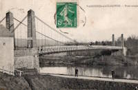
1849: Lackawaxen Aqueduct
Lackawaxen, Pennsylvania, USA - Lackawaxen River
| Bridgemeister ID: | 31 (added before 2003) |
| Year Completed: | 1849 |
| Name: | Lackawaxen Aqueduct |
| Location: | Lackawaxen, Pennsylvania, USA |
| Crossing: | Lackawaxen River |
| Principals: | John A. Roebling |
| References: | AAJ, BOB, BPL, RDH, SJR |
| Use: | Aqueduct |
| Status: | Removed |
| Main Cables: | Wire (iron) |
| Suspended Spans: | 2 |
| Main Spans: | 2 x 34.9 meters (114.37 feet) |
Notes:
- BPL says 1848, RDH says same, but not used until 1849.
- Built as part of same project as 1848 Delaware Aqueduct (Roebling Aqueduct) - Lackawaxen, Pennsylvania and Minisink Ford, New York, USA.
- Built as part of same project as 1851 High Falls Aqueduct - High Falls, New York, USA.
- Built as part of same project as 1851 Neversink Aqueduct - Cuddebackville, New York, USA.
- Near 1848 Delaware Aqueduct (Roebling Aqueduct) - Lackawaxen, Pennsylvania and Minisink Ford, New York, USA.
External Links:
1849: Langeais
Langeais, Indre-et-Loire, France - Loire River
| Bridgemeister ID: | 6718 (added 2021-10-16) |
| Year Completed: | 1849 |
| Name: | Langeais |
| Location: | Langeais, Indre-et-Loire, France |
| Crossing: | Loire River |
| Coordinates: | 47.319030 N 0.404770 E |
| Maps: | Acme, GeoHack, Google, OpenStreetMap |
| References: | AAJ, BPF |
| Use: | Vehicular |
| Status: | Replaced |
| Main Spans: | 3 |
| Side Spans: | 2 |
Notes:
- Damaged by lightning 1859 and repaired. Cables cut during war 1870 and repaired in 1874.
- Replaced by 1937 Langeais - Langeais, Indre-et-Loire, France. However, the 1849 bridge may have been largely before the 1937 bridge.
External Links:
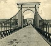
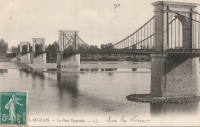
1849: Le Pouzin
Le Pouzin, Ardèche, France - Rhône River
| Bridgemeister ID: | 1153 (added 2004-01-18) |
| Year Completed: | 1849 |
| Name: | Le Pouzin |
| Location: | Le Pouzin, Ardèche, France |
| Crossing: | Rhône River |
| Principals: | Adolphe Boulland |
| References: | AAJ |
| Use: | Vehicular |
| Status: | Destroyed, 1940 |
| Main Cables: | Wire (iron) |
| Suspended Spans: | 3 |
| Main Spans: | 3 x 100 meters (328.1 feet) |
External Links:
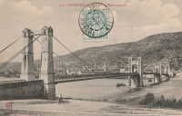
1849: Marc Seguin
Tournon-sur-Rhône, Ardèche and Tain-L'Hermitage, Drôme, France - Rhône River
| Bridgemeister ID: | 975 (added 2003-11-14) |
| Year Completed: | 1849 |
| Name: | Marc Seguin |
| Location: | Tournon-sur-Rhône, Ardèche and Tain-L'Hermitage, Drôme, France |
| Crossing: | Rhône River |
| Coordinates: | 45.068638 N 4.834972 E |
| Maps: | Acme, GeoHack, Google, OpenStreetMap |
| Principals: | Marc Seguin |
| References: | AAJ, BPF |
| Use: | Vehicular |
| Status: | Restricted to foot traffic (last checked: 2021) |
| Main Cables: | Wire (iron) |
| Suspended Spans: | 2 |
| Main Spans: | 2 |
Notes:
- A second bridge at Tournon, by Seguin, approximately 100 meters downstream from his 1825 bridge. Restored 1989.
- Near 1825 Tain-Tournon - Tournon-sur-Rhône, Ardèche and Tain, Drôme, France.
- Near 1958 Gustave Toursier - Tournon-sur-Rhône, Ardèche and Tain-L'Hermitage, Drôme, France.
External Links:
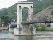
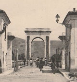
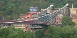
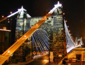
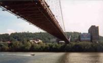
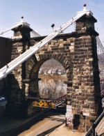
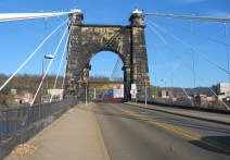
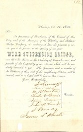
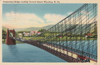
1849: Wheeling
Wheeling, West Virginia, USA - Ohio River
| Bridgemeister ID: | 32 (added before 2003) |
| Year Completed: | 1849 |
| Name: | Wheeling |
| Also Known As: | Wheeling and Belmont |
| Location: | Wheeling, West Virginia, USA |
| Crossing: | Ohio River |
| Coordinates: | 40.07167 N 80.72667 W |
| Maps: | Acme, GeoHack, Google, OpenStreetMap |
| Principals: | Charles Ellet |
| References: | AAJ, BBR, BC3, BOB, BPL, CEJ, COB, GBD, HBE, LAB, LACE, ONF, PTS2, RWS, WCC, WHSB |
| Use: | Vehicular (two-lane, light vehicles only) |
| Status: | Restricted to foot traffic, since September 2019 (last checked: 2020) |
| Main Cables: | Wire (iron) |
| Suspended Spans: | 1 |
| Main Span: | 1 x 307.8 meters (1,010 feet) |
Notes:
- Was still part of Virginia at time of completion.
- 1854: Rebuilt after it was wrecked by a windstorm. Contrary to popular myth, the rebuilding was undertaken by Ellet and his assistant William K. McComas, not by John A. Roebling.
- 1860: Overhauled. Popular myth often attributes this work to the Roeblings. WHSB attributes this work to William K. McComas. After this overhaul, the bridge still does not have the distinctive diagonal cable stays that give it the appearance of a Roebling bridge.
- 1872: Overhauled according to a design by Washington Roebling. John A. Roebling had died in 1869 and was not involved with this work. WHSB notes, "The design essentially Roeblingized the bridge with the diagonal cable stays that are such a prominent feature of the bridge."
- 2019, September: Closed to vehicular traffic indefinitely due to safety concerns after repeated overweight vehicle violations.
- 2020, November: Bids being evaluated for renovation project. Bridge remains closed to vehicular traffic.
- 2021, April: Single bid received was rejected. Bids expected to be resolicited in June. The bridge remains closed to all vehicular traffic.
- 2022, February: $17.9 million renovation project expected to start soon.
- Became longest suspension bridge by eclipsing 1834 Zaehringen (Grand Pont Suspendu) - Fribourg, Switzerland.
- Eclipsed by new longest suspension bridge 1867 John A. Roebling (Cincinnati, Cincinnati and Covington) - Cincinnati, Ohio and Covington, Kentucky, USA.
External Links:
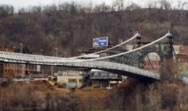
1850: (suspension bridge)
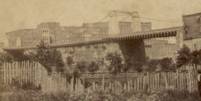
Nashville and Edgefield, Tennessee, USA - Cumberland River
| Bridgemeister ID: | 33 (added before 2003) |
| Year Completed: | 1850 |
| Name: | (suspension bridge) |
| Location: | Nashville and Edgefield, Tennessee, USA |
| Crossing: | Cumberland River |
| Principals: | Adolphus Heiman, Mathew Dickinson Field |
| References: | AAJ |
| Use: | Vehicular |
| Status: | Destroyed, 1862 |
| Main Cables: | Wire (iron) |
| Main Span: | 1 x 164 meters (538 feet) |
Notes:
- Collapsed 1855, rebuilt, destroyed 1862 (possibly 1863). Was at site of present-day Woodland Street Bridge.
- Replaced by 1866 (suspension bridge) - Nashville and Edgefield, Tennessee, USA.
External Links:
1850: Chain
Aarau, Switzerland - Aare River
| Bridgemeister ID: | 4761 (added 2020-06-28) |
| Year Completed: | 1850 |
| Name: | Chain |
| Also Known As: | Aarau Kettenbrücke |
| Location: | Aarau, Switzerland |
| Crossing: | Aare River |
| Coordinates: | 47.395431 N 8.042028 E |
| Maps: | Acme, GeoHack, Google, OpenStreetMap |
| Principals: | Jean Gaspard Dollfuss |
| References: | AAJ, PTS2 |
| Use: | Vehicular (one-lane) |
| Status: | Replaced, 1949 |
| Main Cables: | Eyebar (iron) |
| Suspended Spans: | 1 |
External Links:
- Kettenbrücke (Aarau) - Wikipedia. Notes bridge was opened for traffic December 28, 1850 and officially inaugurated January 6, 1851.
- Structurae - Structure ID 20043577
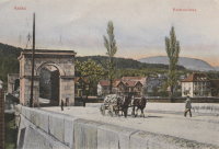
1850: Greffier
Le Mans, Sarthe, France - Sarthe River
| Bridgemeister ID: | 4916 (added 2020-07-19) |
| Year Completed: | 1850 |
| Name: | Greffier |
| Also Known As: | Clerk's, Wire |
| Location: | Le Mans, Sarthe, France |
| Crossing: | Sarthe River |
| Coordinates: | 48.001128 N 0.189991 E |
| Maps: | Acme, GeoHack, Google, OpenStreetMap |
| References: | AAJ |
| Use: | Vehicular |
| Status: | Destroyed |
| Main Cables: | Wire (iron) |
Notes:
- Destroyed, 1871, to slow the advancing Prussian army.
External Links:
1851: High Falls Aqueduct
High Falls, New York, USA - Rondout Creek
| Bridgemeister ID: | 34 (added before 2003) |
| Year Completed: | 1851 |
| Name: | High Falls Aqueduct |
| Location: | High Falls, New York, USA |
| Crossing: | Rondout Creek |
| Principals: | John A. Roebling |
| References: | AAJ, BOB, BPL, RDH, SJR |
| Use: | Aqueduct |
| Status: | Removed, August, 1921 |
| Main Cables: | Wire (iron) |
| Suspended Spans: | 1 |
| Main Span: | 1 x 44.2 meters (145 feet) |
Notes:
- BPL, AAJ say completed 1848, RDH says not used until 1851 canal season.
- Heavy damaged by fire, 1921.
- Built as part of same project as 1848 Delaware Aqueduct (Roebling Aqueduct) - Lackawaxen, Pennsylvania and Minisink Ford, New York, USA.
- Built as part of same project as 1849 Lackawaxen Aqueduct - Lackawaxen, Pennsylvania, USA.
- Built as part of same project as 1851 Neversink Aqueduct - Cuddebackville, New York, USA.
External Links:
1851: Lewiston-Queenston
Lewiston, New York, USA and Queenston, Ontario, Canada - Niagara River
| Bridgemeister ID: | 35 (added before 2003) |
| Year Completed: | 1851 |
| Name: | Lewiston-Queenston |
| Location: | Lewiston, New York, USA and Queenston, Ontario, Canada |
| Crossing: | Niagara River |
| Principals: | Edward Serrell |
| References: | AAJ, BOB, BPL, HBE, PTS2 |
| Use: | Vehicular |
| Status: | Wrecked, 1864 |
| Main Cables: | Wire (iron) |
| Suspended Spans: | 1 |
| Main Span: | 1 x 258.8 meters (849 feet) |
| Deck width: | 21 feet (AAJ: 19.5 feet) |
Notes:
- Wrecked by wind February 1, 1864. Stay cables beneath the bridge had been disconnected to avoid damage from rising ice. Portions of the cables and deck remained, in a derelict state, as late as 1895. Replacement was not started until the late 1890's.
- The February 3, 1864 edition of Niagara Falls Gazette describes the wind event: "Partial Destruction Of The Lewiston Suspension Bridge -- A portion of the flooring and other wood-work of the Lewiston Suspension Bridge was blown down during the gale Monday forenoon. It seems that the long guys had been cut during the late ice jam to prevent injury to the structure and thus its strength to withstand a gale was much weakened. The wind swept through the gorge on Monday with terrific force and swayed the bridge so that some of the cross timbers, near the centre were loosened from their fastenings, and fell, of course carrying the floor with them. A large portion at each end, remains without material injury. The extent of the damage -- financially -- we have not yet learned, but we judge from what we hear that it may be about $10,000. The bridge was built in 1852 and cost not far from $40,000. It will doubtless soon be repaired and in use."
- Later at same location 1899 Lewiston-Queenston - Lewiston, New York, USA and Queenston, Ontario, Canada.
- See 1849 Wheeling (Wheeling and Belmont) - Wheeling, West Virginia, USA. The 1851 Lewiston-Queenston bridge is sometimes claimed to have become the longest in the world with a main span surpassing the length of the Wheeling suspension bridge. However, Don Sayenga notes the length of the suspended span of the Lewiston-Queenston bridge was only 849 feet, not the 1,043 feet sometimes cited. Don writes: "[1,043 feet] was the distance between the towers built high up on the cliffs above the crossing - because there was no space for them below. The roadway suspended from the towers was only 849 feet span over the water from abutment to abutment." Thus, Roebling's Cincinnati bridge should be considered the first to eclipse Wheeling's record main span.
External Links:
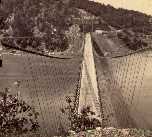
1851: Neversink Aqueduct
Cuddebackville, New York, USA - Neversink River
| Bridgemeister ID: | 36 (added before 2003) |
| Year Completed: | 1851 |
| Name: | Neversink Aqueduct |
| Location: | Cuddebackville, New York, USA |
| Crossing: | Neversink River |
| Principals: | John A. Roebling |
| References: | AAJ, BOB, RDH, SJR |
| Use: | Aqueduct |
| Status: | Removed |
| Main Cables: | Wire (iron) |
| Suspended Spans: | 1 |
| Main Span: | 1 x 51.8 meters (170 feet) |
Notes:
- BPL says 1849, RDH says not used until 1851 canal season.
- Built as part of same project as 1848 Delaware Aqueduct (Roebling Aqueduct) - Lackawaxen, Pennsylvania and Minisink Ford, New York, USA.
- Built as part of same project as 1849 Lackawaxen Aqueduct - Lackawaxen, Pennsylvania, USA.
- Built as part of same project as 1851 High Falls Aqueduct - High Falls, New York, USA.
External Links:
1852: (suspension bridge)
Frankfort, Kentucky, USA - Kentucky River
| Bridgemeister ID: | 1714 (added 2005-04-03) |
| Year Completed: | 1852 |
| Name: | (suspension bridge) |
| Location: | Frankfort, Kentucky, USA |
| Crossing: | Kentucky River |
| Coordinates: | 38.201998 N 84.881934 W |
| Maps: | Acme, GeoHack, Google, OpenStreetMap |
| Principals: | Mathew Dickinson Field |
| References: | AAJ, ENG18570605, HBE, HOF |
| Use: | Rail |
| Status: | Removed |
| Main Cables: | Wire (iron) |
| Suspended Spans: | 2 |
| Main Spans: | 1 x 61 meters (200 feet) estimated, 1 x 91.4 meters (300 feet) estimated |
Notes:
- An early attempt at a railroad suspension bridge, it was significantly reconstructed (because of excessive vibrations and increasing loads) by Julius W. Adams in 1857 to have three spans of 120, 163, and 163 feet. It is unclear whether the new structure was also a suspension bridge.
- HOF describes the location as "between the foot of Broadway and the neck of land near the mouth of Benson Creek." The coordinates provided here are for the later rail crossing at that general location, likely at or very close to the site of the suspension bridge.
1852: Charleston
Charleston, West Virginia, USA - Elk River
| Bridgemeister ID: | 38 (added before 2003) |
| Year Completed: | 1852 |
| Name: | Charleston |
| Also Known As: | Lovell Street |
| Location: | Charleston, West Virginia, USA |
| Crossing: | Elk River |
| Principals: | W. O. Buchanan, William Kuhn, Abraham Wright |
| References: | AAJ, EOV, HBE, PTS2 |
| Use: | Vehicular |
| Status: | Collapsed, December 15, 1904 |
| Main Cables: | Wire (iron) |
| Suspended Spans: | 1 |
| Main Span: | 1 x 145.7 meters (478 feet) |
| Deck width: | 17 feet |
Notes:
- Was still part of Virginia at time of completion.
- Damaged during Civil War. An article in the August 2, 1861 issue of the New York Times mentions: "A junction of our forces having now been effected, the army at once moved on to Elk River, which debouches into the Kanawha at Charleston, where the army encamped for the night. We would have crossed the stream at once, and marched through the town the same evening, but for the fact that the rebels had partially destroyed the beautiful suspension bridge which spans Elk River at this spot, rendering it unsafe for passage. Not content with burning a portion of the flooring, they nearly severed the strands which support the structure, and aid their work, too, in the most bungling manner. A more shameless piece of vandalism I never witnessed. While the army slept, a company of sappers and miners repaired the damage, and yesterday the army, nearly five thousand strong, marched through the streets of Charleston."
- Near 1884 (suspension bridge) - Charleston, West Virginia, USA.
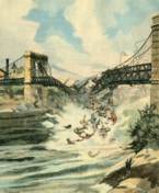
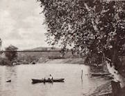
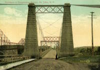
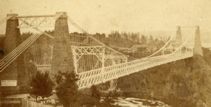
1852: St. John
St. John, New Brunswick, Canada - St. John River
| Bridgemeister ID: | 37 (added before 2003) |
| Year Completed: | 1852 |
| Name: | St. John |
| Location: | St. John, New Brunswick, Canada |
| Crossing: | St. John River |
| Principals: | Edward Serrell |
| References: | AAJ, BPL, HBE, PTS2 |
| Use: | Vehicular (one-lane) |
| Status: | Removed, 1915 |
| Main Cables: | Wire (iron) |
| Suspended Spans: | 1 |
| Main Span: | 1 x 195.1 meters (640 feet) |
Notes:
- Rebuilt 1857.
External Links:
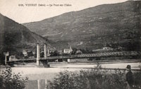
1852: Veurey
Veurey-Voroize, Isère, France - Isère River
| Bridgemeister ID: | 4880 (added 2020-07-18) |
| Year Completed: | 1852 |
| Name: | Veurey |
| Location: | Veurey-Voroize, Isère, France |
| Crossing: | Isère River |
| Coordinates: | 45.271117 N 5.621434 E |
| Maps: | Acme, GeoHack, Google, OpenStreetMap |
| References: | AAJ |
| Use: | Vehicular |
| Status: | Destroyed, 1928 |
| Main Cables: | Wire (iron) |
Notes:
- 1928: Destroyed by flood.
- Replaced by 1933 Veurey - Veurey-Voroize, Isère, France.
1853: Falmouth
Falmouth, Kentucky, USA - Licking River
| Bridgemeister ID: | 42 (added before 2003) |
| Year Completed: | 1853 |
| Name: | Falmouth |
| Location: | Falmouth, Kentucky, USA |
| Crossing: | Licking River |
| Coordinates: | 38.678056 N 84.328222 W |
| Maps: | Acme, GeoHack, Google, OpenStreetMap |
| Principals: | D. Griffith Smith |
| References: | AAJ, EOV |
| Use: | Vehicular |
| Status: | Collapsed, 1868 |
| Main Cables: | Wire (iron) |
| Main Span: | 1 x 98.5 meters (323 feet) |
Notes:
- 1854: A brief article in March 22, 1854 Louisville Daily Courier states the bridge was destroyed ("rendering the whole structure useless… it cannot even be repaired") in the early 1854 flood that destroyed other Licking River bridges. However, other sources indicate the Falmouth bridge survived the flood. Unclear if it was completely destroyed and rebuilt or just damaged and repaired.
- Coordinates provided here indicate the likely location of the bridge over the main branch of the Licking River.
External Links:
- New Licking Bridge Stands On The Foundation of Its Predecessors - Rootsweb.com. Several anecdotes and snippets of history about the bridge. Indicates the bridge survived the January 1854 Licking River flood and survived until 1868.
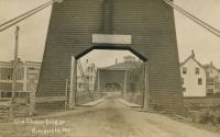
1853: Mill Pond
Kingfield, Maine, USA - Carrabasset River
| Bridgemeister ID: | 45 (added before 2003) |
| Year Completed: | 1853 |
| Name: | Mill Pond |
| Location: | Kingfield, Maine, USA |
| Crossing: | Carrabasset River |
| Principals: | Daniel Beedy |
| References: | AAJ, BPL |
| Use: | Vehicular (one-lane), with walkway |
| Status: | Replaced, 1916 |
| Main Cables: | Chain (iron) |
| Main Span: | 1 x 57.9 meters (190 feet) |
| Deck width: | 15 feet |
Notes:
- Similar to 1856 Strong - Strong, Maine, USA.
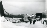
1853: Peney
Peney, Satigny vicinity, Geneva, Switzerland - Rhône River
| Bridgemeister ID: | 1827 (added 2005-05-30) |
| Year Completed: | 1853 |
| Name: | Peney |
| Location: | Peney, Satigny vicinity, Geneva, Switzerland |
| Crossing: | Rhône River |
| Principals: | Hug |
| References: | AAJ, GHD |
| Use: | Vehicular |
| Status: | Collapsed, May 24, 1853 |
| Main Cables: | Wire (iron) |
| Suspended Spans: | 1 |
| Main Span: | 1 x 100 meters (328.1 feet) |
Notes:
- GHD describes how Dufour designed the bridge but was replaced (for political reasons) by a novice engineer, Mr. Hug who produced his own design. The bridge collapsed under test loading.
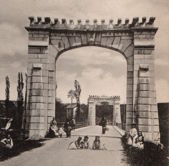
1853: Saint-Florent-le-Vieil
Saint-Florent-le-Vieil, Maine-et-Loire and Varades, Loire-Atlantique, France - Loire River
| Bridgemeister ID: | 1596 (added 2005-02-06) |
| Year Completed: | 1853 |
| Name: | Saint-Florent-le-Vieil |
| Location: | Saint-Florent-le-Vieil, Maine-et-Loire and Varades, Loire-Atlantique, France |
| Crossing: | Loire River |
| References: | AAJ |
| Use: | Vehicular (one-lane) |
| Status: | Removed |
| Main Cables: | Wire |
Notes:
- Multispan 19th-century suspension bridge distinct from the two 1965 cable-stayed and catenary suspension bridges connecting Varades and Saint-Florent-le-Vieil.
- Connects to 1853 Varades - Varades, Loire-Atlantique and Saint-Florent-le-Vieil, Maine-et-Loire, France.
- Later at same location 1954 Varades - Varades, Loire-Atlantique and Saint-Florent-le-Vieil, Maine-et-Loire, France.
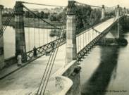
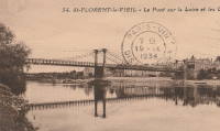
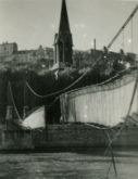
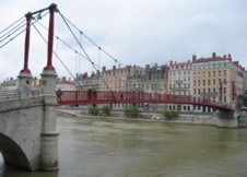
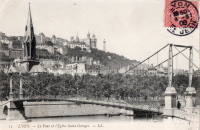
1853: Saint-Georges
Lyon, Métropole de Lyon, France - Saône River
| Bridgemeister ID: | 552 (added before 2003) |
| Year Completed: | 1853 |
| Name: | Saint-Georges |
| Also Known As: | Sala |
| Location: | Lyon, Métropole de Lyon, France |
| Crossing: | Saône River |
| Coordinates: | 45.757117 N 4.82615 E |
| Maps: | Acme, GeoHack, Google, OpenStreetMap |
| References: | AAJ, BPF, PQL |
| Use: | Footbridge |
| Status: | In use (last checked: 2022) |
| Main Cables: | Wire (iron) |
| Suspended Spans: | 1 |
| Main Span: | 1 x 75 meters (246.1 feet) |
Notes:
- Destroyed 1944, rebuilt same year. Reconstructed 1999.
External Links:
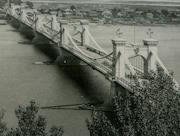
1853: Tsar Nicholas I
Kiev, Ukraine - Dnieper River
| Bridgemeister ID: | 409 (added before 2003) |
| Year Completed: | 1853 |
| Name: | Tsar Nicholas I |
| Location: | Kiev, Ukraine |
| Crossing: | Dnieper River |
| Principals: | Charles Blacker Vignoles |
| References: | AAJ, HBE, IEA, PTS2 |
| Use: | Vehicular |
| Status: | Destroyed, c. 1920 |
| Main Cables: | Chain (iron, flat link) |
| Suspended Spans: | 6 |
| Main Spans: | 4 x 134.1 meters (440 feet) |
| Side Spans: | 2 x 68.6 meters (225 feet) |
External Links:
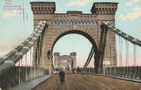
1853: Varades
Varades, Loire-Atlantique and Saint-Florent-le-Vieil, Maine-et-Loire, France - Loire River
| Bridgemeister ID: | 1962 (added 2005-11-06) |
| Year Completed: | 1853 |
| Name: | Varades |
| Location: | Varades, Loire-Atlantique and Saint-Florent-le-Vieil, Maine-et-Loire, France |
| Crossing: | Loire River |
| References: | AAJ |
| Status: | Removed |
Notes:
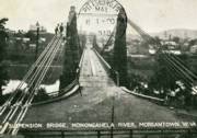
1854: Morgantown
Morgantown, West Virginia, USA - Monongahela River
| Bridgemeister ID: | 49 (added before 2003) |
| Year Completed: | 1854 |
| Name: | Morgantown |
| Location: | Morgantown, West Virginia, USA |
| Crossing: | Monongahela River |
| References: | AAJ, EN19070918, EOV, HBE, PTS2 |
| Use: | Vehicular, with walkway |
| Status: | Removed |
| Main Cables: | Wire (iron) |
| Suspended Spans: | 1 |
| Main Span: | 1 x 185.3 meters (608 feet) |
| Deck width: | 20 feet |
Notes:
- Was still part of Virginia at time of completion.
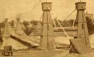
1855: Minneapolis
Minneapolis, Minnesota, USA - Mississippi River
| Bridgemeister ID: | 50 (added before 2003) |
| Year Completed: | 1855 |
| Name: | Minneapolis |
| Also Known As: | St. Anthony's Falls |
| Location: | Minneapolis, Minnesota, USA |
| Crossing: | Mississippi River |
| At or Near Feature: | Nicollet Island |
| Principals: | Thomas M. Griffith |
| References: | AAJ, BPL, HBE, PTS2 |
| Use: | Vehicular |
| Status: | Demolished, 1876 |
| Main Cables: | Wire (iron) |
| Suspended Spans: | 1 |
| Main Span: | 1 x 189 meters (620 feet) |
| Deck width: | 17 feet |
Notes:
- Replaced by 1877 Minneapolis - Minneapolis, Minnesota, USA.
- Later at same location 1990 Hennepin Avenue (Father Louis Hennepin) - Minneapolis, Minnesota, USA.
External Links:
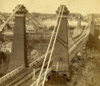
1855: Niagara Suspension
Niagara Falls, New York, USA and Niagara Falls, Ontario, Canada - Niagara River
| Bridgemeister ID: | 51 (added before 2003) |
| Year Completed: | 1855 |
| Name: | Niagara Suspension |
| Location: | Niagara Falls, New York, USA and Niagara Falls, Ontario, Canada |
| Crossing: | Niagara River |
| Principals: | John A. Roebling |
| References: | AAJ, BAAW, BBR, BFL, BMA, BOB, BPL, HBE, LIR, NSB, ONF, PTS2, SA18810716, SJR |
| Use: | Rail (heavy rail) and Vehicular (double-deck), with walkway |
| Status: | Replaced, 1897 |
| Main Cables: | Wire (iron) |
| Suspended Spans: | 1 |
| Main Span: | 1 x 250.3 meters (821.3 feet) |
Notes:
- Cables renovated, 1877. Wooden stiffening trusses replaced, 1880. Towers replaced, c. 1886. Bridge replaced with steel arch, 1897.
- AAJ notes the roadway deck opened in 1854, but the railway deck did not open until 1855.
- Replaced 1848 Niagara Suspension - Niagara Falls, New York, USA and Niagara Falls, Ontario, Canada.
External Links:
1856: Guyandotte
Guyandotte and Huntington, West Virginia, USA - Guyandotte River
| Bridgemeister ID: | 40 (added before 2003) |
| Year Completed: | 1856 |
| Name: | Guyandotte |
| Location: | Guyandotte and Huntington, West Virginia, USA |
| Crossing: | Guyandotte River |
| Coordinates: | 38.430083 N 82.391694 W |
| Maps: | Acme, GeoHack, Google, OpenStreetMap |
| Principals: | George Wilson Mason |
| References: | AAJ, EOV, PTS2 |
| Use: | Vehicular |
| Status: | Removed, 1907 |
| Main Cables: | Wire (iron) |
| Suspended Spans: | 1 |
| Main Span: | 1 x 137.2 meters (450 feet) |
Notes:
- EOV cites a source claiming the bridge was begun in 1853, but not completed until 1858. AAJ says completed in 1848. Other sources claim it was completed in 1852 and 1856.
- Was still part of Virginia at time of completion.
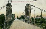
1856: Ollières
Les Ollières-sur-Eyrieux, Ardèche, France - Eyrieux River
| Bridgemeister ID: | 4882 (added 2020-07-18) |
| Year Completed: | 1856 |
| Name: | Ollières |
| Location: | Les Ollières-sur-Eyrieux, Ardèche, France |
| Crossing: | Eyrieux River |
| Coordinates: | 44.804655 N 4.614687 E |
| Maps: | Acme, GeoHack, Google, OpenStreetMap |
| References: | AAJ |
| Use: | Vehicular |
| Status: | Removed |
Notes:
- AAJ assumes completion in 1856 based on an 18-month contract let in August 1854. Appears to have been a quite dramatic bridge, with very large castellated towers, on an alignment adjacent to the current twin-arch bridge.
1857: Black River
Watertown, New York, USA - Black River
| Bridgemeister ID: | 55 (added before 2003) |
| Year Completed: | 1857 |
| Name: | Black River |
| Also Known As: | Bradford, Mill Street |
| Location: | Watertown, New York, USA |
| Crossing: | Black River |
| Principals: | Gilbert Bradford |
| References: | AAJ, HBE, ONC |
| Use: | Vehicular |
| Status: | Removed, 1890's |
| Main Cables: | Wire (iron) |
| Suspended Spans: | 1 |
| Main Span: | 1 x 53 meters (173.9 feet) |
| Deck width: | 18 feet |
Notes:
- Replaced in 1890's (ONC).
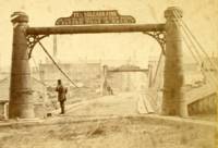
1857: Saint James's Park
London, England, United Kingdom
| Bridgemeister ID: | 6831 (added 2021-12-31) |
| Year Completed: | 1857 |
| Name: | Saint James's Park |
| Location: | London, England, United Kingdom |
| At or Near Feature: | Saint James's Park |
| References: | AAJ |
| Use: | Footbridge |
| Status: | Replaced, 1957 |
| Main Cables: | Eyebar (iron) |
| Suspended Spans: | 1 |
Notes:
- Reviews of this bridge were not favorable. Jakkula (AAJ) sites several contemporary sources (1857) objecting to the bridge obstructing the view of the scenery. One citation is summarized: "Regards the bridge as a hideous structure".
External Links:
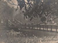
| Bridgemeister ID: | 5665 (added 2021-01-03) |
| Year Completed: | 1858 |
| Name: | Trofa |
| Also Known As: | Barca |
| Location: | Trofa and Ribeirão, Portugal |
| Crossing: | Ave River |
| Coordinates: | 41.345251 N 8.556376 W |
| Maps: | Acme, GeoHack, Google, OpenStreetMap |
| References: | AAJ |
| Use: | Vehicular |
| Status: | Removed, 1935 |
| Main Cables: | Wire (iron) |
| Suspended Spans: | 1 |
| Main Span: | 1 x 82 meters (269 feet) |
Notes:
- Coordinates are for the current Ave River crossing at Trofa. The Ponte Pênsil da Trofa may have been located here or slightly west of here.
External Links:
1859: Doux
St Jean de Muzols and Tournon-sur-Rhône, Ardèche, France - Doux River
| Bridgemeister ID: | 5661 (added 2021-01-01) |
| Year Completed: | 1859 |
| Name: | Doux |
| Location: | St Jean de Muzols and Tournon-sur-Rhône, Ardèche, France |
| Crossing: | Doux River |
| Coordinates: | 45.074919 N 4.816389 E |
| Maps: | Acme, GeoHack, Google, OpenStreetMap |
| References: | AAJ |
| Use: | Vehicular |
| Status: | Removed |
| Main Cables: | Wire |
| Suspended Spans: | 1 |
Notes:
External Links:
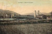
1860: Grand Falls
Grand Falls, New Brunswick, Canada - St. John River
| Bridgemeister ID: | 60 (added before 2003) |
| Year Completed: | 1860 |
| Name: | Grand Falls |
| Location: | Grand Falls, New Brunswick, Canada |
| Crossing: | St. John River |
| Principals: | James Tomlinson |
| References: | AAJ |
| Use: | Vehicular (two-lane) |
| Status: | Replaced, 1915 |
| Main Cables: | Wire (iron) |
| Suspended Spans: | 1 |
| Main Span: | 1 x 63.9 meters (209.75 feet) |
| Deck width: | 16 feet |
Notes:
- Out of use, 1912.
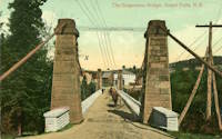
1861: Gauley River
Gauley Bridge, West Virginia, USA - Gauley River
| Bridgemeister ID: | 2123 (added 2006-09-17) |
| Year Completed: | 1861 |
| Name: | Gauley River |
| Location: | Gauley Bridge, West Virginia, USA |
| Crossing: | Gauley River |
| Principals: | John W. Murphy |
| References: | AAJ |
| Use: | Vehicular |
| Status: | Destroyed, 1862 |
| Main Cables: | Wire (iron) |
Notes:
- Don Sayenga writes:
"It was built in great haste out of military necessity utilizing abutments and piers of an earlier wooden bridge that had been burnt by a unit of the Confederate Army commanded by Gen. John B. Floyd. This occurred just after the fight known as the Battle of Carnifex Ferry on September 10, 1861. Later the Confederate Army recaptured the bridge location and burnt the new one also. The designer/builder was John W. Murphy (1828-1874) who was working as an engineer in Alabama when the war began in 1861. He held a Civil Engineer degree from Rensselaer. Murphy's concept involved multiple factory-made wire ropes as main cables combined with wooden bracing. The exact location of the bridge seems to have been called the New River Cliffs but I haven't found this on a map. Photos of the bridge came into the possession of Prof. George Plympton, an associate of Murphy's in the latter part of his career. Plympton presented a paper about bridges in 1894 reported by The Railroad Gazette August 24. The photos were given to the Gazette - one of their artists converted the photos to pen-and-ink drawings for publication in the issue of November 9, 1894, p. 773."
Don transcribed the following:
The Railroad Gazette, August 24, 1894, Page 579."Prof. Plympton then related two reminiscences of bridge building between 1852 and 1861...The other instance was the building of a military suspension bridge over the Gauley River in 1861. The government called for a bridge of sufficient strength to permit the passage of General Rosecrans corps, allowing twenty-four days' time. The abutments and piers of the former bridge remained in good condition. Murphy submitted an original plan, which was accepted. The plans were drawn up by Mr. Murphy on the cars, while he was traveling to Washington to submit his ideas to the United States army en gineers. The plans were accepted and Murphy at once went to work. Four one-inch wire ropes, laid side by side, formed his cables. A pyramidal tower was constructed of heavy timbers, and in place of suspending rods a loosely-formed truss was hung upon the cable without fastening. This truss, connected with the floor of the bridge, was finished on the 22nd day after receiving the order to build."
Proceedings of the Franklin Institute, October 21, 1874, Page 306."It was a suspension bridge 520 feet in length, 10 feet roadway, consisting of three spans, supported by eight cables. There was some doubt in the mind of the commanding officer that it would answer the purpose...To test it ...he asked that a battalion be ordered to make a charge over it, which was done, to the satisfaction of the General in command...it afterwards passed and repassed the whole command as long as they occupied that portion of the country. A change of base put it into the possession of the Confederates who burnt it down."
- An article in the July 15, 1951 edition of The Charleston Daily Mail describes the bridge and its demise:
"After the Confederate forces had retreated and burned the old covered bridge, the Federal engineers constructed a make-shift bridge across the Gauley. There are pictures in existence showing this light, cable bridge erected on the old piers of the original bridge. This structure was cut down Sept. 11, 1862, when the Federals retreated from an attack by Confederate Gen. W. W. Loring, who routed the Unionists from the valley for a brief time."
- Jakkula has an 1862 entry for "Gauley River Bridge" with little information, citing the American Railroad Journal, Vol. 37, No. 1472, July 2, 1864, p.651: "A suspension bridge built over the Gauley River, Virginia, by the Government in 1862." It is unclear if this reference is for the same bridge.
