Inventory Search Results (201-300 of 387)
387 suspension bridges were found for search criteria: AAJ. Bridges 201 through 300 (of 387 total) appear below. Click the Bridgemeister ID number to isolate the bridge on its own page. If you don't see what you were looking for, try an image search with the same criteria: AAJ. This will find the bridge if it is pictured on the site, but is not a catenary suspension bridge.
Related:
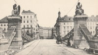
1864: Aspern
Vienna, Austria
| Bridgemeister ID: | 3076 (added 2019-10-26) |
| Year Completed: | 1864 |
| Name: | Aspern |
| Location: | Vienna, Austria |
| Coordinates: | 48.211858 N 16.383001 E |
| Maps: | Acme, GeoHack, Google, OpenStreetMap |
| Principals: | Friedrich Schnirch |
| References: | AAJ, PTS2 |
| Use: | Vehicular |
| Status: | Demolished, 1913 |
| Main Cables: | Eyebar (iron) |
| Suspended Spans: | 1 |
| Main Span: | 1 |
External Links:
1864: Franklin
Franklin, Pennsylvania, USA - Allegheny River
| Bridgemeister ID: | 3186 (added 2019-11-09) |
| Year Completed: | 1864 |
| Name: | Franklin |
| Location: | Franklin, Pennsylvania, USA |
| Crossing: | Allegheny River |
| Principals: | John Murphy |
| References: | AAJ |
| Status: | Destroyed, 1870 |
Notes:
- 1870: Cable ends caught fire precipitating collapse, killing two.
1865: Market Street
Williamsport, Pennsylvania, USA - Susquehanna River
| Bridgemeister ID: | 64 (added before 2003) |
| Year Completed: | 1865 |
| Name: | Market Street |
| Location: | Williamsport, Pennsylvania, USA |
| Crossing: | Susquehanna River |
| Principals: | Alfred P. Boller |
| References: | AAJ, JFI186604 |
| Use: | Vehicular |
| Status: | Destroyed, June 1, 1889 |
| Main Cables: | Wire (iron) |
| Suspended Spans: | 5 |
| Main Spans: | 5 x 61 meters (200 feet) |
Notes:
- JFI186604 (in which Boller mentions about the bridge's "peculiar system of trussing": "This general arrangement for suspension bridges was first practised by John Murphy, Esq., C.E., over the Gauley, in West Virginia, and also at Franklin, Pennsylvania.")
- Destroyed by flood June 1, 1889.
- Near 1878 Maynard Street - Williamsport, Pennsylvania, USA.
- Replaced by 1889 Market Street - Williamsport, Pennsylvania, USA.
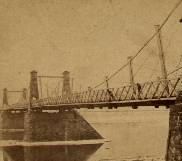
1866: (suspension bridge)
Nashville and Edgefield, Tennessee, USA - Cumberland River
| Bridgemeister ID: | 1965 (added 2005-11-20) |
| Year Completed: | 1866 |
| Name: | (suspension bridge) |
| Location: | Nashville and Edgefield, Tennessee, USA |
| Crossing: | Cumberland River |
| References: | AAJ |
| Use: | Vehicular |
| Status: | Removed, 1884 |
| Main Cables: | Wire |
Notes:
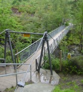
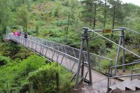
1867: Corrieshalloch
Braemore, Scotland, United Kingdom - Corrieshalloch Gorge
| Bridgemeister ID: | 1308 (added 2004-04-10) |
| Year Completed: | 1867 |
| Name: | Corrieshalloch |
| Location: | Braemore, Scotland, United Kingdom |
| Crossing: | Corrieshalloch Gorge |
| At or Near Feature: | Falls of Measach |
| Coordinates: | 57.755753 N 5.021048 W |
| Maps: | Acme, GeoHack, Google, OpenStreetMap |
| Principals: | John Fowler |
| References: | AAJ, HBR |
| Use: | Footbridge |
| Status: | In use (last checked: 2022) |
| Main Cables: | Wire |
| Suspended Spans: | 1 |
| Main Span: | 1 x 25.1 meters (82.5 feet) |
Notes:
- 2022, May: Closed again for maintenance and inspection, reopened by month's end.
- AAJ lists the bridge at "Corry Halloch" bridge completed in 1875. Other sources mention 1867, and 1874.
- 1977: Anchorages replaced (HBR).
- 2021: Closed September 10 due to safety concerns. Repaired and re-opened in October.
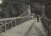
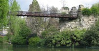
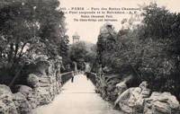
| Bridgemeister ID: | 516 (added before 2003) |
| Year Completed: | 1867 |
| Name: | Parc des Buttes-Chaumont |
| Location: | Paris, France |
| At or Near Feature: | Parc des Buttes-Chaumont |
| Coordinates: | 48.880933 N 2.381533 E |
| Maps: | Acme, GeoHack, Google, OpenStreetMap |
| References: | AAJ |
| Use: | Footbridge |
| Status: | In use (last checked: 2021) |
| Main Cables: | Wire |
| Suspended Spans: | 1 |
| Main Span: | 1 x 61 meters (200 feet) |
External Links:
1868: Eiserner Steg
Frankfurt, Germany - Main River
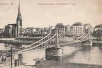
| Bridgemeister ID: | 6429 (added 2021-08-11) |
| Year Completed: | 1868 |
| Name: | Eiserner Steg |
| Also Known As: | Eiserne Steg |
| Location: | Frankfurt, Germany |
| Crossing: | Main River |
| Coordinates: | 50.108108 N 8.682128 E |
| Maps: | Acme, GeoHack, Google, OpenStreetMap |
| Principals: | Peter Schmick |
| References: | AAJ, PTS2 |
| Use: | Footbridge |
| Status: | Replaced, 1912 |
| Suspended Spans: | 3 |
| Main Span: | 1 |
| Side Spans: | 2 |
Notes:
- A "stiffened" braced chain suspension bridge. Like several other similar eastern European bridges constructed in the late 1800s and early 1900s it is somewhat questionable whether this bridge should be included in a list of suspension bridges. It was replaced in 1912 by a cantilever bridge that resembles the shape and lines of the former suspension bridge.
External Links:
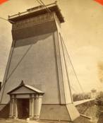
1869: Clifton
Niagara Falls, New York, USA and Niagara Falls, Ontario, Canada - Niagara River
| Bridgemeister ID: | 70 (added before 2003) |
| Year Completed: | 1869 |
| Name: | Clifton |
| Also Known As: | Niagara-Clifton, Falls View, First Falls View |
| Location: | Niagara Falls, New York, USA and Niagara Falls, Ontario, Canada |
| Crossing: | Niagara River |
| Principals: | Samuel Keefer |
| References: | AAJ, BPL, HBE, PTS2 |
| Use: | Vehicular |
| Status: | Replaced, 1889 |
| Main Cables: | Wire (iron) |
| Main Span: | 1 x 386.6 meters (1,268.3 feet) |
| Deck width: | 10 feet |
Notes:
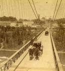
- Opened January 2nd, 1869. Wooden towers replaced with steel towers, 1884. Widened to 17 feet, 1888. Wrecked by wind, January, 1889. Some of the images here may show the replacement bridge.
- Became longest suspension bridge by eclipsing 1867 John A. Roebling (Cincinnati, Cincinnati and Covington) - Cincinnati, Ohio and Covington, Kentucky, USA.
- Eclipsed by new longest suspension bridge 1883 Brooklyn (Great East River) - New York and Brooklyn, New York, USA.
- Replaced by 1889 Second Falls View - Niagara Falls, New York, USA and Niagara Falls, Ontario, Canada.
External Links:
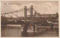
1869: Rudolfova Lávka
Prague, Czechia - Vltava River
| Bridgemeister ID: | 5939 (added 2021-06-29) |
| Year Completed: | 1869 |
| Name: | Rudolfova Lávka |
| Also Known As: | Rudolfsteg, Kettensteg, Železna Lávka |
| Location: | Prague, Czechia |
| Crossing: | Vltava River |
| Coordinates: | 50.090185 N 14.412677 E |
| Maps: | Acme, GeoHack, Google, OpenStreetMap |
| Principals: | Karel Veselý, František Schön, Ruston and Co. |
| References: | AAJ, PTS2 |
| Use: | Footbridge |
| Status: | Removed, c. 1914 |
| Main Cables: | Chain (iron) |
Notes:
- Removed at some point after the adjacent Mánes bridge was opened in 1914.
External Links:
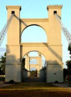
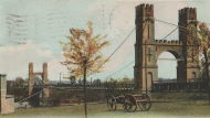
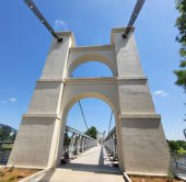
1869: Waco
Waco, Texas, USA - Brazos River
| Bridgemeister ID: | 72 (added before 2003) |
| Year Completed: | 1869 |
| Name: | Waco |
| Location: | Waco, Texas, USA |
| Crossing: | Brazos River |
| Coordinates: | 31.561314 N 97.127063 W |
| Maps: | Acme, GeoHack, Google, OpenStreetMap |
| Principals: | Thomas M. Griffith |
| References: | AAJ, BC3, BPL, BRAZ, GBD, HAERTX98, HBE, PTS2, WSB |
| Use: | Vehicular, with walkway |
| Status: | Restricted to foot traffic (last checked: 2023) |
| Main Cables: | Wire (iron) |
| Suspended Spans: | 1 |
| Main Span: | 1 x 144.8 meters (475 feet) |
| Deck width: | 18 feet |
Notes:
- 1915: Rebuilt.
- 2020, October: Closed for restoration project expecting to last 18-24 months.
- 2021, March: Major restoration project underway, led by Sparks Engineering, Inc.
- 2023, April: The restored bridge is rededicated on April 22. Patrick Sparks of Sparks Engineering reports: . The rededication was held April 22, 2023. "The project involved full rehabilitation including: replacement of the suspension system and anchor rods, strengthening of the anchorages, replacement of the saddle bearings, retrofit strengthening of the east tower, and deck replacement (concrete on the main deck, tropical hardwood on the side walks)."
External Links:
1871: Boatford
Langholm, Borders, Scotland, United Kingdom - River Esk
| Bridgemeister ID: | 1428 (added 2004-07-24) |
| Year Completed: | 1871 |
| Name: | Boatford |
| Location: | Langholm, Borders, Scotland, United Kingdom |
| Crossing: | River Esk |
| References: | AAJ |
| Status: | Collapsed |
Notes:
- Collapsed soon after it was completed under weight of 200 spectators.
- Replaced by 1873 Boatford - Langholm, Borders, Scotland, United Kingdom.
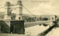
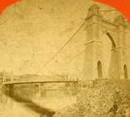
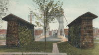
1871: Warren
Warren, Pennsylvania, USA - Allegheny River
| Bridgemeister ID: | 75 (added before 2003) |
| Year Completed: | 1871 |
| Name: | Warren |
| Also Known As: | Hickory Street |
| Location: | Warren, Pennsylvania, USA |
| Crossing: | Allegheny River |
| Principals: | George W. Fishler |
| References: | AAJ, EOV, HAERPA461, HBE, PTS2 |
| Use: | Vehicular, with walkway |
| Status: | Replaced, 1918 |
| Main Cables: | Wire (iron) |
| Suspended Spans: | 1 |
| Main Span: | 1 x 143.3 meters (470 feet) |
| Deck width: | 29 feet |
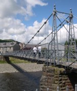
1873: Boatford
Langholm, Borders, Scotland, United Kingdom - River Esk
| Bridgemeister ID: | 534 (added before 2003) |
| Year Completed: | 1873 |
| Name: | Boatford |
| Location: | Langholm, Borders, Scotland, United Kingdom |
| Crossing: | River Esk |
| Coordinates: | 55.15098 N 3.00273 W |
| Maps: | Acme, GeoHack, Google, OpenStreetMap |
| References: | AAJ |
| Use: | Footbridge |
| Status: | In use (last checked: 2004) |
| Main Span: | 1 x 53.3 meters (175 feet) |
Notes:
1874: Châtel-de-Neuvre
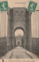
Châtel-de-Neuvre and La Ferté-Hauterive, Allier, France - Allier River
| Bridgemeister ID: | 4905 (added 2020-07-18) |
| Year Completed: | 1874 |
| Name: | Châtel-de-Neuvre |
| Location: | Châtel-de-Neuvre and La Ferté-Hauterive, Allier, France |
| Crossing: | Allier River |
| Coordinates: | 46.402296 N 3.317844 E |
| Maps: | Acme, GeoHack, Google, OpenStreetMap |
| References: | AAJ |
| Use: | Vehicular |
| Status: | Replaced, 1923 |
| Main Cables: | Wire |
| Suspended Spans: | 2 |
| Main Spans: | 2 |
External Links:
1876: Petroleum Street
Oil City, Pennsylvania, USA - Allegheny River
| Bridgemeister ID: | 83 (added before 2003) |
| Year Completed: | 1876 |
| Name: | Petroleum Street |
| Also Known As: | Oil City |
| Location: | Oil City, Pennsylvania, USA |
| Crossing: | Allegheny River |
| Principals: | Charles Roebling |
| References: | AAJ, HAERPA461, HBE, PTS2, TRS |
| Use: | Vehicular |
| Status: | Removed |
| Main Cables: | Wire |
| Suspended Spans: | 3 |
| Main Span: | 1 x 152.4 meters (500 feet) |
| Side Spans: | 2 |
Notes:
- AAJ: Rebuilt, 1884, 1905.
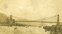
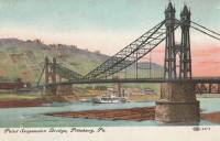
1876: Point
Pittsburgh, Pennsylvania, USA - Monongahela River
| Bridgemeister ID: | 84 (added before 2003) |
| Year Completed: | 1876 |
| Name: | Point |
| Location: | Pittsburgh, Pennsylvania, USA |
| Crossing: | Monongahela River |
| Principals: | Edward Hemberle |
| References: | AAJ, BOP, BPL, HBE, IEA, ONF, PBR, PTS2, SA19000106 |
| Use: | Vehicular and Rail (streetcar) |
| Status: | Demolished, 1927 |
| Main Cables: | Eyebar |
| Suspended Spans: | 1 |
| Main Span: | 1 x 243.8 meters (800 feet) |
| Deck width: | 34 feet |
Notes:
- Partial floor collapse requiring extensive repairs, December 24, 1903. Repaired, 1904. Demolished 1927.
External Links:
1877: Canet
Ventenac-en-Minervois and Canet, Aude, France - Aude River
| Bridgemeister ID: | 5658 (added 2021-01-01) |
| Year Completed: | 1877 |
| Name: | Canet |
| Location: | Ventenac-en-Minervois and Canet, Aude, France |
| Crossing: | Aude River |
| Coordinates: | 43.240039 N 2.855134 E |
| Maps: | Acme, GeoHack, Google, OpenStreetMap |
| References: | AAJ |
| Use: | Vehicular |
| Status: | Removed |
| Main Cables: | Wire |
| Suspended Spans: | 1 |
Notes:
- Piers are still present (in 2020) next to the current Aude River crossing at this location.
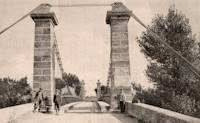
1877: Cottaneva
Cottaneva Creek, Rockport, California, USA - Rockport Bay, Pacific Ocean
| Bridgemeister ID: | 1152 (added 2004-01-18) |
| Year Completed: | 1877 |
| Name: | Cottaneva |
| Location: | Cottaneva Creek, Rockport, California, USA |
| Crossing: | Rockport Bay, Pacific Ocean |
| Coordinates: | 39.736703 N 123.832585 W |
| Maps: | Acme, GeoHack, Google, OpenStreetMap |
| Principals: | Pacific Bridge Co. |
| References: | AAJ |
| Use: | Vehicular (one-lane) |
| Status: | Removed |
| Main Cables: | Wire (iron) |
| Suspended Spans: | 1 |
| Main Span: | 1 x 82.3 meters (270 feet) |
Notes:
- This bridge was part of the Rockport lumber mill (Mendocino County). The bridge stretched over ocean to a large rock in the bay.
- Jakkula cites two sources describing the cables as steel.
- Don Sayenga transcribed one of Jakkula's references, The Iron Age Volume XX , No. 3 (August 2, 1877) Page 1: "A Steel Wire Suspension Bridge In California"
The Pacific Bridge Company are building in Mendocino county, California at Cottoneva, a suspension bridge which is described as follows "The distance from center to center of the saddles on the towers is 270 feet. The deflection or fall of the cable is 23 feet 6 inches. The cables are built in the same manner as those of the Clifton bridge at Niagara. The steel wire is about No. 11 Birmingham gauge, and is protected against rust by immersing in a bath which it a fine coat of zinc. There are eleven wires in each strand, seven strands in each rope, and seven ropes in each cable. The ropes are not twisted together to form the cable but gathered up every six feet by the suspender bands. Each rope is warranted to bear a strain of 60 tons. It is made fast to an independent anchor bar, 1 by 3 inches in diameter, and forming links 18 feet long, until connection is made with the anchors. The anchors are of cast iron, 3-1/2 by 3 feet in surface, weigh 1000 pounds each, and are placed 14 feet below the surface of the rock. Great care was taken in securing the anchors in place by means of cross I beams which run under the rock on either side. The lower part of each pit was enlarged to so as to form a hemispherical chamber, and the rock work, set in Portland cement, which is built upon the anchor, is so constructed that the upward strain is transmitted to the sides. The towers are of red wood. There are four posts 10 x 10 inches and two 10 x 12 inches, giving an effective area of 640 inches to withstand the strain of the cables on the tower. The wooden truss to prevent vertical vibration is 8 feet high and of the Howe truss pattern. The 270 feet of the bridge is divided into 45 pannels. The longest suspenders, 44 in number are of 7/8 inch steel wire, the 42 shorter ones are of 1-1/8 inch solid iron. The estimated dead load of the bridge is 1000 pounds per linear foot; live load, one ton per linear foot; in all, one and one half tons, or one fifth of actual breaking load. The bridge will be completed in about 30 days and promises to be a structure which the builders may well be proud of."
Don writes: "[In] Jakkula's last citation, he is saying that this is factory-made wire rope... The construction of the wire rope (7 by 11) used in the main cables is not common for the USA as of 1877; in fact it is extremely uncommon. The wire ropes used at Clifton/Niagara were made in England -- it wouldn't surprise me if these were made in England too."
1877: Minneapolis
Minneapolis, Minnesota, USA - Mississippi River
| Bridgemeister ID: | 86 (added before 2003) |
| Year Completed: | 1877 |
| Name: | Minneapolis |
| Location: | Minneapolis, Minnesota, USA |
| Crossing: | Mississippi River |
| At or Near Feature: | Nicollet Island |
| Principals: | Thomas M. Griffith |
| References: | AAJ, BPL, HBE, PTS2 |
| Use: | Vehicular, with walkway |
| Status: | Replaced, 1890 |
| Main Cables: | Wire (iron) |
| Suspended Spans: | 1 |
| Main Span: | 1 x 205.8 meters (675.1 feet) |
| Deck width: | 32 feet |
Notes:
- Replaced 1855 Minneapolis (St. Anthony's Falls) - Minneapolis, Minnesota, USA.
- Later at same location 1990 Hennepin Avenue (Father Louis Hennepin) - Minneapolis, Minnesota, USA.
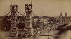
1879: Saint-Ilpize
Saint-Ilpize, Haute-Loire, France - Allier River
| Bridgemeister ID: | 1097 (added 2004-01-02) |
| Year Completed: | 1879 |
| Name: | Saint-Ilpize |
| Location: | Saint-Ilpize, Haute-Loire, France |
| Crossing: | Allier River |
| Coordinates: | 45.198556 N 3.386866 E |
| Maps: | Acme, GeoHack, Google, OpenStreetMap |
| Principals: | Ferdinand Arnodin |
| References: | AAJ, BPF, HBE, PTS2 |
| Use: | Vehicular (one-lane) |
| Status: | In use (last checked: 2020) |
| Main Cables: | Wire |
| Suspended Spans: | 3 |
| Main Span: | 1 x 70.35 meters (230.8 feet) |
| Side Spans: | 2 |
| Deck width: | 18 feet |
Notes:
- The side spans are supported solely by inclined stays, not suspenders from the main cables.
- Closed to all traffic on July 15, 2004 due to damage to the deck, possibly caused by an overloaded truck. Repaired and reopened.
External Links:
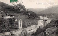
1880: Fitzroy
Rockhampton, Queensland, Australia - Fitzroy River
| Bridgemeister ID: | 416 (added before 2003) |
| Year Completed: | 1880 |
| Name: | Fitzroy |
| Location: | Rockhampton, Queensland, Australia |
| Crossing: | Fitzroy River |
| Principals: | F. J. Byerley, Owen Jones |
| References: | AAJ, STC |
| Use: | Vehicular |
| Status: | Demolished, 1956 |
| Main Cables: | Chain (iron) |
| Suspended Spans: | 6 |
| Main Spans: | 4 x 70.7 meters (232 feet) |
| Side Spans: | 2 x 26.5 meters (86.9 feet) |
| Deck width: | 21 feet |
Notes:
- Damaged during flood, 1890. Repaired, 1891.
External Links:
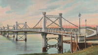
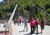
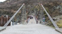
1880: Kawarau Gorge
Kawarau Gorge, Central Otago, New Zealand - Kawarau River Gorge
| Bridgemeister ID: | 667 (added 2003-03-08) |
| Year Completed: | 1880 |
| Name: | Kawarau Gorge |
| Location: | Kawarau Gorge, Central Otago, New Zealand |
| Crossing: | Kawarau River Gorge |
| Coordinates: | 45.008882 S 168.899938 E |
| Maps: | Acme, GeoHack, Google, OpenStreetMap |
| Principals: | H.P. Higginson, A.R.W Fulton, W.C. Edwards |
| References: | AAJ, GAP |
| Use: | Vehicular (one-lane) |
| Status: | Restricted to foot traffic (last checked: 2017) |
| Main Cables: | Wire (iron) |
| Suspended Spans: | 1 |
| Main Span: | 1 x 91.4 meters (300 feet) |
Notes:
- Appears to now be used solely as a bungee-jumping platform.
External Links:
1880: Suspension Pier
Seaview, Isle of Wight, England, United Kingdom
| Bridgemeister ID: | 2409 (added 2007-12-24) |
| Year Completed: | 1880 |
| Name: | Suspension Pier |
| Location: | Seaview, Isle of Wight, England, United Kingdom |
| References: | AAJ |
| Use: | Footbridge |
| Status: | Destroyed, December, 1950 |
| Main Spans: | 3 |
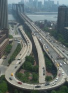
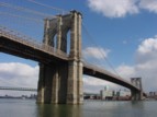
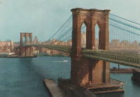
1883: Brooklyn
New York and Brooklyn, New York, USA - East River
| Bridgemeister ID: | 89 (added before 2003) |
| Year Completed: | 1883 |
| Name: | Brooklyn |
| Also Known As: | Great East River |
| Location: | New York and Brooklyn, New York, USA |
| Crossing: | East River |
| Coordinates: | 40.706 N 73.99667 W |
| Maps: | Acme, GeoHack, Google, OpenStreetMap |
| Principals: | John A. Roebling, Washington A. Roebling |
| References: | AAJ, BAAW, BBR, BBTS, BC3, BFL, BLD, BMA, BOB, BOU, BPL, COB, CTW, GB, GBD, HBE, LAB, LACE, NG198305, ONF, PTS2, SJR |
| Use: | Rail (light rail) and Vehicular (major highway), with walkway |
| Status: | In use (last checked: 2022) |
| Main Cables: | Wire (steel) |
| Suspended Spans: | 3 |
| Main Span: | 1 x 486.3 meters (1,595.5 feet) |
| Side Spans: | 2 x 283.5 meters (930 feet) |
| Deck width: | 85 feet |
Notes:
- Became longest suspension bridge by eclipsing 1869 Clifton (Niagara-Clifton, Falls View, First Falls View) - Niagara Falls, New York, USA and Niagara Falls, Ontario, Canada.
- Eclipsed by new longest suspension bridge 1903 Williamsburg - New York and Brooklyn, New York, USA.
- Next to 1909 Manhattan - New York and Brooklyn, New York, USA.
- Near 1903 Williamsburg - New York and Brooklyn, New York, USA.
External Links:

1884: (suspension bridge)
Charleston, West Virginia, USA - Elk River
| Bridgemeister ID: | 1427 (added 2004-07-24) |
| Year Completed: | 1884 |
| Name: | (suspension bridge) |
| Location: | Charleston, West Virginia, USA |
| Crossing: | Elk River |
| References: | AAJ, HBE, PTS2 |
| Use: | Vehicular and Rail (streetcar) |
| Status: | Removed |
| Main Cables: | Wire |
| Main Span: | 1 x 83.2 meters (273 feet) |
Notes:
- AAJ: Repaired by William Hildenbrand a few years after completion.
- Near 1852 Charleston (Lovell Street) - Charleston, West Virginia, USA.
1884: McKeesport-Reynoldton
McKeesport, Pennsylvania, USA - Youghiogheny River
| Bridgemeister ID: | 90 (added before 2003) |
| Year Completed: | 1884 |
| Name: | McKeesport-Reynoldton |
| Also Known As: | Third Avenue |
| Location: | McKeesport, Pennsylvania, USA |
| Crossing: | Youghiogheny River |
| Coordinates: | 40.352359 N 79.870561 W |
| Maps: | Acme, GeoHack, Google, OpenStreetMap |
| Principals: | McKeesport and Reynoldton Bridge Co. |
| References: | AAJ, HAERPA461 |
| Use: | Rail (streetcar) and Vehicular |
| Status: | Dismantled, 1961 |
| Main Cables: | Wire (steel) |
| Suspended Spans: | 3 |
| Main Span: | 1 x 97.5 meters (320 feet) |
| Side Spans: | 2 x 48.8 meters (160 feet) |
Notes:
- 1896: Reconstructed by Hermann Laub
1884: North Side
Pittsburgh, Pennsylvania, USA - Allegheny River
| Bridgemeister ID: | 91 (added before 2003) |
| Year Completed: | 1884 |
| Name: | North Side |
| Also Known As: | Seventh Street |
| Location: | Pittsburgh, Pennsylvania, USA |
| Crossing: | Allegheny River |
| Principals: | Gustav Lindenthal |
| References: | AAJ, BPL, HBE, PBR, PTS2 |
| Use: | Vehicular |
| Status: | Removed, 1924 |
| Main Cables: | Eyebar |
| Suspended Spans: | 4 |
| Main Spans: | 2 x 97.5 meters (320 feet) |
| Side Spans: | 2 x 50.3 meters (165 feet) |
| Deck width: | 42 feet |
Notes:
- Next to 1860 Allegheny River (Sixth Street, St. Clair) - Pittsburgh, Pennsylvania, USA.
- Replaced by 1926 Andy Warhol (Seventh Street) - Pittsburgh, Pennsylvania, USA.
External Links:
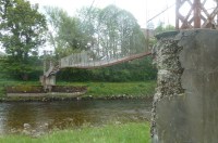
1885: Abergeldie Castle
Balmoral vicinity, Scotland, United Kingdom - River Dee
| Bridgemeister ID: | 1705 (added 2005-03-29) |
| Year Completed: | 1885 |
| Name: | Abergeldie Castle |
| Location: | Balmoral vicinity, Scotland, United Kingdom |
| Crossing: | River Dee |
| Coordinates: | 57.043806 N 3.176197 W |
| Maps: | Acme, GeoHack, Google, OpenStreetMap |
| Principals: | Blaikie Brothers |
| References: | AAJ, HBR |
| Use: | Footbridge |
| Status: | Derelict (last checked: 2016) |
| Main Cables: | Wire |
| Suspended Spans: | 1 |
Notes:
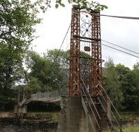
- William Craig describes the bridge, "A wood and angle iron deck supported from two pairs of wire cables and rod suspenders. The railings are of light woven wire. Pylons with ornamental heads are of lattice gider construction on concrete bases five miles west of Ballater, Scotland."
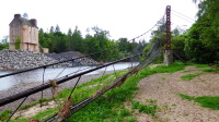
- Was already derelict before December 2015 flooding (Storm Frank) that severely damaged several River Dee bridges. Dave Cooper writes in early 2016: "The bridge's southern tower and its base are gone. The river bank has eroded back to within feet of the grade one listed Abergeldie Castle. Seat of Baron Abergeldie."
External Links:


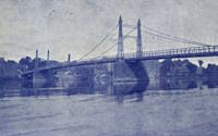
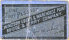
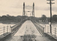
1886: (suspension bridge)
Windsor Locks and Warehouse Point, Connecticut, USA - Connecticut River
| Bridgemeister ID: | 306 (added before 2003) |
| Year Completed: | 1886 |
| Name: | (suspension bridge) |
| Location: | Windsor Locks and Warehouse Point, Connecticut, USA |
| Crossing: | Connecticut River |
| Principals: | James Shipman |
| References: | AAJ, PTS2 |
| Use: | Vehicular |
| Status: | Removed |
| Main Cables: | Wire |
| Suspended Spans: | 3 |
| Main Span: | 1 x 167.6 meters (550 feet) |
| Side Spans: | 2 x 91.4 meters (300 feet) |
External Links:
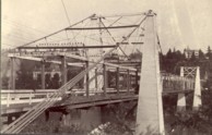
1888: Oregon City
Oregon City and West Linn, Oregon, USA - Willamette River
| Bridgemeister ID: | 295 (added before 2003) |
| Year Completed: | 1888 |
| Name: | Oregon City |
| Location: | Oregon City and West Linn, Oregon, USA |
| Crossing: | Willamette River |
| References: | AAJ |
| Use: | Vehicular |
| Status: | Dismantled, 1922 |
| Main Cables: | Wire |
| Suspended Spans: | 3 |
| Main Span: | 1 |
| Side Spans: | 2 |
Notes:
1888: Tidewater Pipeline
Jim Thorpe, Pennsylvania, USA - Lehigh River
| Bridgemeister ID: | 1527 (added 2004-10-24) |
| Year Completed: | 1888 |
| Name: | Tidewater Pipeline |
| Location: | Jim Thorpe, Pennsylvania, USA |
| Crossing: | Lehigh River |
| Coordinates: | 40.90714 N 75.748544 W |
| Maps: | Acme, GeoHack, Google, OpenStreetMap |
| Principals: | William Hildenbrand |
| References: | AAJ, HBE |
| Use: | Pipeline |
| Status: | Extant (last checked: 2020) |
| Main Cables: | Wire |
| Main Span: | 1 x 109.7 meters (360 feet) |
Notes:
- The town was named "Mauch Chunk" at the time the pipeline was built.
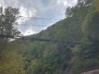
1889: (suspension bridge)
Chesterfield vicinity, New Hampshire and Brattleboro, Vermont, USA - Connecticut River
| Bridgemeister ID: | 95 (added before 2003) |
| Year Completed: | 1889 |
| Name: | (suspension bridge) |
| Location: | Chesterfield vicinity, New Hampshire and Brattleboro, Vermont, USA |
| Crossing: | Connecticut River |
| Principals: | Berlin Iron Bridge Co. |
| References: | AAJ, CCR |
| Use: | Vehicular |
| Status: | Destroyed, March 19, 1936 |
| Main Cables: | Wire |
| Suspended Spans: | 1 |
Notes:
- Destroyed by flood March 19, 1936.
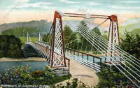
1889: Fiorentini
Rome, Italy - Tiber River
| Bridgemeister ID: | 828 (added 2003-05-31) |
| Year Completed: | 1889 |
| Name: | Fiorentini |
| Also Known As: | Ferro, Soldo, Soldino |
| Location: | Rome, Italy |
| Crossing: | Tiber River |
| Coordinates: | 41.898801 N 12.463689 E |
| Maps: | Acme, GeoHack, Google, OpenStreetMap |
| References: | AAJ, ONF, PTS2 |
| Use: | Vehicular |
| Status: | Demolished, July 15, 1941 |
| Main Cables: | Eyebar |
| Suspended Spans: | 1 |
| Characteristics: | Braced (trussed) chain/cable, Hinged cables |
Notes:
- Jakkula (AAJ) lists this bridge as completed in 1889 based on articles from 1899-1900 discussing braced chain suspension bridges. Various internet sources consistently cite 1863 as the year of completion. The 1889 date is more consistent with several similar braced-chain suspension bridges built in the 1890, but it is unclear which sources are accurate.
- "Braced chain" main cables.
- Similar to 1936 Kindee - Kindee, Ellenborough vicinity, New South Wales, Australia.
- Similar to 1951 Marias River (Pugsley) - Chester vicinity, Montana, USA.
- Similar to (footbridge) - Sarov (Саров), Nizhny Novgorod Oblast, Russia.
- Similar to Allan - Segenhoe, Scone vicinity, New South Wales, Australia.
- Similar to Ininskiy (Ининский) - Inya (Иня), Altai Republic, Russia.
- Similar to Reku Vel' - Solginskiy (Солгинский), Arkhangelsk Oblast, Russia.
External Links:
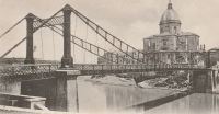
1890: Grand Avenue
St. Louis, Missouri, USA - Mill Creek Valley
| Bridgemeister ID: | 96 (added before 2003) |
| Year Completed: | 1890 |
| Name: | Grand Avenue |
| Also Known As: | Jefferson Avenue |
| Location: | St. Louis, Missouri, USA |
| Crossing: | Mill Creek Valley |
| Principals: | Carl Gayler |
| References: | AAJ, HBE, IEA, ONF, PTS2, SSB |
| Use: | Vehicular, with walkway |
| Status: | Demolished, 1960 |
| Main Cables: | Eyebar |
| Suspended Spans: | 3 |
| Main Span: | 1 x 121.9 meters (400 feet) |
| Side Spans: | 2 x 45.7 meters (150 feet) |
| Deck width: | 60 feet |
| Characteristics: | Braced (trussed) chain/cable |
Notes:
- Braced chain (stiffened-eyebar) design often espoused by Gustav Lindenthal. ONF (an article by Lindenthal) refers to this as the Jefferson Ave. bridge while Fowler's book (IEA) calls it "Grand Avenue". AAJ describes it as "a three-hinged inverted arch with two stiffened chains, one on each side."
External Links:
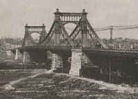
1893: Dorrator
Falkirk, Scotland, United Kingdom - River Carron
| Bridgemeister ID: | 2201 (added 2007-01-28) |
| Year Completed: | 1893 |
| Name: | Dorrator |
| Also Known As: | Falkirk, Carronvale |
| Location: | Falkirk, Scotland, United Kingdom |
| Crossing: | River Carron |
| Coordinates: | 56.011418 N 3.819145 W |
| Maps: | Acme, GeoHack, Google, OpenStreetMap |
| Principals: | Louis Harper |
| References: | AAJ, HARPER |
| Use: | Footbridge |
| Status: | Only towers remain (last checked: 2014) |
| Main Cables: | Wire |
| Suspended Spans: | 1 |
| Main Span: | 1 x 27 meters (88.6 feet) |
Notes:
- Replaced 2014. One tower remains as a monument to the Harper bridge.
External Links:
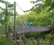
1893: Feugh
Banchory, Scotland, United Kingdom - Water of Feugh
| Bridgemeister ID: | 2196 (added 2007-01-26) |
| Year Completed: | 1893 |
| Name: | Feugh |
| Location: | Banchory, Scotland, United Kingdom |
| Crossing: | Water of Feugh |
| Coordinates: | 57.042679 N 2.493234 W |
| Maps: | Acme, GeoHack, Google, OpenStreetMap |
| Principals: | Louis Harper |
| References: | AAJ, HARPER |
| Use: | Footbridge |
| Status: | In use (last checked: 2014) |
| Main Cables: | Wire |
| Suspended Spans: | 1 |
| Main Span: | 1 x 30 meters (98.4 feet) |
Notes:
- Towers replaced, at some point. Unclear how much of the present-day (2020) bridge is original.
External Links:
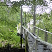
1894: Devil's Dyke Aerial Cableway
Fulking, Brighton vicinity, England, United Kingdom - Devil's Dyke
| Bridgemeister ID: | 4843 (added 2020-07-11) |
| Year Completed: | 1894 |
| Name: | Devil's Dyke Aerial Cableway |
| Location: | Fulking, Brighton vicinity, England, United Kingdom |
| Crossing: | Devil's Dyke |
| References: | AAJ |
| Use: | Tramway |
| Status: | Closed, 1909 |
| Main Cables: | Wire (steel) |
| Suspended Spans: | 3 |
| Main Span: | 1 |
| Side Spans: | 2 |
External Links:
1894: Occidente
Santa Fé de Antioquia, Colombia - Cauca River
| Bridgemeister ID: | 934 (added 2003-10-25) |
| Year Completed: | 1894 |
| Name: | Occidente |
| Also Known As: | Western |
| Location: | Santa Fé de Antioquia, Colombia |
| Crossing: | Cauca River |
| Coordinates: | 6.577965 N 75.798177 W |
| Maps: | Acme, GeoHack, Google, OpenStreetMap |
| Principals: | José María Villa |
| References: | AAJ, HBE, PTS2 |
| Use: | Vehicular (one-lane), with walkway |
| Status: | In use (last checked: 2019) |
| Main Cables: | Wire |
| Main Span: | 1 x 286.5 meters (940 feet) |
External Links:
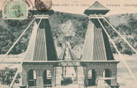
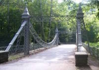
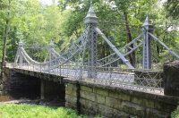
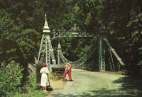
| Bridgemeister ID: | 343 (added before 2003) |
| Year Completed: | 1895 |
| Name: | Mill Creek Park |
| Also Known As: | White, Silver, Old Steel, Cinderella, Fairy Tale |
| Location: | Youngstown vicinity, Ohio, USA |
| At or Near Feature: | Mill Creek Park |
| Coordinates: | 41.07325 N 80.68886 W |
| Maps: | Acme, GeoHack, Google, OpenStreetMap |
| Principals: | Charles Evan Fowler |
| References: | AAJ, HBE, IEA, PTS2 |
| Use: | Vehicular (two-lane) |
| Status: | In use (last checked: 2021) |
| Main Cables: | Eyebar |
| Suspended Spans: | 1 |
| Main Span: | 1 x 27.4 meters (90 feet) |
| Characteristics: | Braced (trussed) chain/cable |
Notes:
- Short stiffened eyebar ("braced chain") of the style that Lindenthal often proposed. A mid-span support was added many years ago.
- Major rehabilitation started, June 2007. Reopened November, 2007.
External Links:
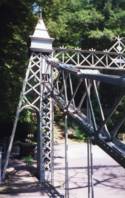
1897: Lincoln Highway
East Liverpool, Ohio and Chester, West Virginia, USA - Ohio River
| Bridgemeister ID: | 105 (added before 2003) |
| Year Completed: | 1897 |
| Name: | Lincoln Highway |
| Also Known As: | Chester |
| Location: | East Liverpool, Ohio and Chester, West Virginia, USA |
| Crossing: | Ohio River |
| Principals: | Hermann Laub, E.S. Fickes |
| References: | AAJ, BPL, HBE, PTS2 |
| Use: | Vehicular, with walkway |
| Status: | Removed, 1970 |
| Main Cables: | Wire (steel) |
| Suspended Spans: | 3 |
| Main Span: | 1 x 214.9 meters (705 feet) |
| Side Spans: | 1 x 109.7 meters (360 feet), 1 x 128 meters (420 feet) |
| Deck width: | 27 feet |
Notes:
- Rebuilt 1939 by David Steinman. Closed and demolished, 1970.
External Links:
1897: Rochester
Rochester and Monaca, Pennsylvania, USA - Ohio River
| Bridgemeister ID: | 104 (added before 2003) |
| Year Completed: | 1897 |
| Name: | Rochester |
| Location: | Rochester and Monaca, Pennsylvania, USA |
| Crossing: | Ohio River |
| Principals: | Edwin Kirtland Morse |
| References: | AAJ, BPL, HBE, PTS2 |
| Use: | Vehicular, with walkway |
| Status: | Removed |
| Main Cables: | Wire (steel) |
| Suspended Spans: | 3 |
| Main Span: | 1 x 243.8 meters (800 feet) |
| Side Spans: | 1 x 121.9 meters (400 feet), 1 x 126.8 meters (416 feet) |
| Deck width: | 28 feet |
External Links:

1898: Hampden
Kangaroo Valley, New South Wales, Australia - Kangaroo River
| Bridgemeister ID: | 423 (added before 2003) |
| Year Completed: | 1898 |
| Name: | Hampden |
| Location: | Kangaroo Valley, New South Wales, Australia |
| Crossing: | Kangaroo River |
| Coordinates: | 34.727454 S 150.520910 E |
| Maps: | Acme, GeoHack, Google, OpenStreetMap |
| Principals: | E.M. de Burgh |
| References: | AAJ, STC |
| Use: | Vehicular (one-lane) |
| Status: | In use (last checked: 2023) |
| Main Cables: | Wire (steel) |
| Suspended Spans: | 1 |
| Main Span: | 1 x 77.1 meters (253 feet) |
External Links:
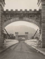
1898: Langenargen
Langenargen and Gohren, Kressbronn am Bodensee, Baden-Württemberg, Germany - Argen River
| Bridgemeister ID: | 929 (added 2003-10-24) |
| Year Completed: | 1898 |
| Name: | Langenargen |
| Location: | Langenargen and Gohren, Kressbronn am Bodensee, Baden-Württemberg, Germany |
| Crossing: | Argen River |
| Coordinates: | 47.59622 N 9.56208 E |
| Maps: | Acme, GeoHack, Google, OpenStreetMap |
| Principals: | Kubler, Leibbrand |
| References: | AAJ, HBE, PTS2 |
| Use: | Vehicular, with walkway |
| Status: | Restricted to foot traffic (last checked: 2022) |
| Main Cables: | Wire |
| Suspended Spans: | 1 |
| Main Span: | 1 x 71.9 meters (236 feet) |
Notes:
- Othmar Ammann worked as an intern on this bridge.
External Links:
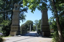
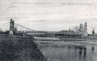
1899: Lewiston-Queenston
Lewiston, New York, USA and Queenston, Ontario, Canada - Niagara River
| Bridgemeister ID: | 108 (added before 2003) |
| Year Completed: | 1899 |
| Name: | Lewiston-Queenston |
| Location: | Lewiston, New York, USA and Queenston, Ontario, Canada |
| Crossing: | Niagara River |
| Principals: | L.L. Buck, R.S. Buck |
| References: | AAJ, BPL, HBE, PTS2 |
| Use: | Vehicular and Rail (streetcar) |
| Status: | Replaced, 1962 |
| Main Cables: | Wire (steel) |
| Suspended Spans: | 1 |
| Main Span: | 1 x 317 meters (1,040 feet) |
| Deck width: | 17 feet |
Notes:
- Reused parts from the recently dismantled Second Falls View Bridge.
- At former location of 1851 Lewiston-Queenston - Lewiston, New York, USA and Queenston, Ontario, Canada.
- See 1889 Second Falls View - Niagara Falls, New York, USA and Niagara Falls, Ontario, Canada.
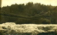
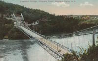
1899: Mühlentor
Lübeck, Germany - Elbe-Lübeck Canal
| Bridgemeister ID: | 4574 (added 2020-06-03) |
| Year Completed: | 1899 |
| Name: | Mühlentor |
| Location: | Lübeck, Germany |
| Crossing: | Elbe-Lübeck Canal |
| Coordinates: | 53.859130 N 10.691012 E |
| Maps: | Acme, GeoHack, Google, OpenStreetMap |
| References: | AAJ |
| Use: | Vehicular |
| Status: | In use (last checked: 2019) |
| Main Cables: | Eyebar (steel) |
| Suspended Spans: | 3 |
| Main Span: | 1 |
| Side Spans: | 2 |
External Links:
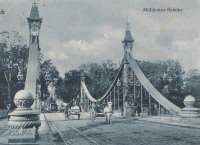
1900: New River
Nuttallburg and South Nuttall, West Virginia, USA - New River
| Bridgemeister ID: | 347 (added before 2003) |
| Year Completed: | 1900 |
| Name: | New River |
| Also Known As: | Swinging |
| Location: | Nuttallburg and South Nuttall, West Virginia, USA |
| Crossing: | New River |
| Coordinates: | 38.047482 N 81.035972 W |
| Maps: | Acme, GeoHack, Google, OpenStreetMap |
| References: | AAJ, HBE |
| Use: | Footbridge |
| Status: | Only towers remain (last checked: 2006) |
| Main Cables: | Wire |
| Suspended Spans: | 1 |
| Main Span: | 1 x 103.6 meters (340 feet) |
| Deck width: | 6 feet |
Notes:
- At least one of the towers is still standing, as of 2006.
- Coordinates are for likely location of the bridge, based on historical maps.
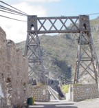
1900: Ojuela
Mapimí, Torreon vicinity, Durango, Mexico
| Bridgemeister ID: | 1043 (added 2003-12-06) |
| Year Completed: | 1900 |
| Name: | Ojuela |
| Also Known As: | Mapimi, Mampimi, Miampimi |
| Location: | Mapimí, Torreon vicinity, Durango, Mexico |
| Coordinates: | 25.791768 N 103.790706 W |
| Maps: | Acme, GeoHack, Google, OpenStreetMap |
| Principals: | Santiago Minguín, William Hildenbrand?, Henry G. Tyrell |
| References: | AAJ, HBE, PTS2 |
| Use: | Vehicular |
| Status: | Restricted to foot traffic (last checked: 2019) |
| Main Cables: | Wire (steel) |
| Suspended Spans: | 1 |
| Main Span: | 1 x 271.5 meters (890.7 feet) estimated |
Notes:
- Misspelled on every long span bridge list I've ever seen, this long narrow footbridge is located at Mapimí, Mexico.
- AAJ notes this bridge as having a 10-foot wide roadway and having been built by William Hildenbrand. The present-day bridge's deck measures only 1.8 meters and is restricted to foot traffic. In HBE, Tyrell takes credit for the design of the bridge and also notes the 10-foot roadway (though, HBE was probably a source for AAJ).
External Links:
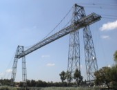
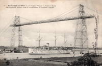
1900: Rochefort-Martrou Transporter
Rochefort, Charente-Maritime, France - Charente River
| Bridgemeister ID: | 949 (added 2003-10-30) |
| Year Completed: | 1900 |
| Name: | Rochefort-Martrou Transporter |
| Also Known As: | Matrou Transporter |
| Location: | Rochefort, Charente-Maritime, France |
| Crossing: | Charente River |
| Coordinates: | 45.91613 N 0.960638 W |
| Maps: | Acme, GeoHack, Google, OpenStreetMap |
| Principals: | Ferdinand Arnodin |
| References: | AAJ, BPF |
| Use: | Transporter |
| Status: | In use (last checked: 2022) |
| Main Cables: | Wire (steel) |
| Suspended Spans: | 1 |
| Main Span: | 1 x 129 meters (423.2 feet) |
Notes:
- Eckhard Bernstorff notes (data from the information table at the machinery building, where the motor to pull the platform is installed): Main Span 129 m (the high truss towers have a wide basis, the length from saddle to saddle is 139.75 m, and the length of the whole "tableau" including side parts is 175.5m), width between rails 8m. The Rochefort Transporter is well in use [2005], in the summer on all days people can use the "ferry" which is attached to the rails under the bridge.
External Links:
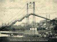
1900: Upper
Easton, Pennsylvania, USA - Lehigh River
| Bridgemeister ID: | 366 (added before 2003) |
| Year Completed: | 1900 |
| Name: | Upper |
| Location: | Easton, Pennsylvania, USA |
| Crossing: | Lehigh River |
| Principals: | Henry G. Tyrell, John McNeal |
| References: | AAJ, DSL20030414, EN19001122, HBE, PTS2, WGE20030513 |
| Use: | Footbridge |
| Status: | Demolished, 1955 |
| Main Cables: | Wire (steel) |
| Suspended Spans: | 3 |
| Main Spans: | 2 x 85 meters (279 feet) |
| Side Span: | 1 x 33.5 meters (110 feet) |
Notes:
- According to Tyrell, "[It] joins Dock Street on the lower side of the river with Glendon Avenue on the upper side, 90 feet above it. To overcome this difference in elevation of the two ends without incurring excessive expense for approach, the bridge floor was made to descend on a grade of 7.2 per cent from the upper bank to meet stairs rising from Dock Street..."
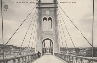
1902: Vernaison
Vernaison, Métropole de Lyon, France - Rhône River
| Bridgemeister ID: | 6431 (added 2021-08-11) |
| Year Completed: | 1902 |
| Name: | Vernaison |
| Location: | Vernaison, Métropole de Lyon, France |
| Crossing: | Rhône River |
| Coordinates: | 45.646369 N 4.815423 E |
| Maps: | Acme, GeoHack, Google, OpenStreetMap |
| Principals: | Ferdinand Arnodin |
| References: | AAJ, PTS2 |
| Use: | Vehicular |
| Status: | Destroyed, June 1940 |
| Main Cables: | Wire (steel) |
Notes:
- Later at same location 1959 Vernaison - Vernaison and Solaize, Métropole de Lyon, France.
External Links:
1903: Caperton
Caperton vicinity, West Virginia, USA - New River
| Bridgemeister ID: | 1422 (added 2004-07-17) |
| Year Completed: | 1903 |
| Name: | Caperton |
| Location: | Caperton vicinity, West Virginia, USA |
| Crossing: | New River |
| Coordinates: | 38.021856 N 81.028479 W |
| Maps: | Acme, GeoHack, Google, OpenStreetMap |
| References: | AAJ, HBE, PTS2 |
| Use: | Footbridge |
| Status: | Removed |
| Main Cables: | Wire |
| Suspended Spans: | 1 |
| Main Span: | 1 x 155.4 meters (510 feet) |
Notes:
- Removed by the 1960s, probably earlier.
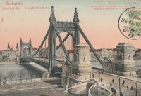
1903: Elisabeth
Budapest, Hungary - Danube River
| Bridgemeister ID: | 426 (added before 2003) |
| Year Completed: | 1903 |
| Name: | Elisabeth |
| Also Known As: | Elizabeth, Erzsébet |
| Location: | Budapest, Hungary |
| Crossing: | Danube River |
| Principals: | Aurel Czekelius, M. Nagy |
| References: | AAJ, BMA, HBE, PTS2, SA19050909 |
| Use: | Vehicular, with walkway |
| Status: | Destroyed, 1945 |
| Main Cables: | Eyebar |
| Suspended Spans: | 3 |
| Main Span: | 1 x 289.9 meters (951 feet) |
| Side Spans: | 2 x 44.2 meters (145 feet) |
Notes:
- Replaced by 1964 Elisabeth (Erzsébet) - Budapest, Hungary.
External Links:
1903: Ticonic
Waterville, Maine, USA - Kennebec River
| Bridgemeister ID: | 110 (added before 2003) |
| Year Completed: | 1903 |
| Name: | Ticonic |
| Also Known As: | Tupenny, Two Cent |
| Location: | Waterville, Maine, USA |
| Crossing: | Kennebec River |
| Coordinates: | 44.55073 N 69.62728 W |
| Maps: | Acme, GeoHack, Google, OpenStreetMap |
| Principals: | Edwin D. Graves |
| References: | AAJ, HBE, PTS2 |
| Use: | Footbridge |
| Status: | In use (last checked: 2009) |
| Main Cables: | Wire |
| Suspended Spans: | 1 |
| Main Span: | 1 x 121.9 meters (400 feet) |
| Deck width: | 6 feet |
External Links:
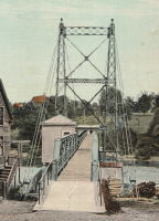
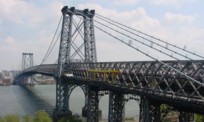
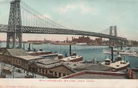
1903: Williamsburg
New York and Brooklyn, New York, USA - East River
| Bridgemeister ID: | 111 (added before 2003) |
| Year Completed: | 1903 |
| Name: | Williamsburg |
| Location: | New York and Brooklyn, New York, USA |
| Crossing: | East River |
| Coordinates: | 40.71355 N 73.97226 W |
| Maps: | Acme, GeoHack, Google, OpenStreetMap |
| Principals: | L.L. Buck |
| References: | AAJ, BAAW, BAR, BBR, BPL, GBD, HBE, PTS2, SJR |
| Use: | Rail (light rail) and Vehicular (major highway), with walkway |
| Status: | In use (last checked: 2022) |
| Main Cables: | Wire (steel) |
| Suspended Spans: | 1 |
| Main Span: | 1 x 487.7 meters (1,600 feet) |
Notes:
- Became longest suspension bridge by eclipsing 1883 Brooklyn (Great East River) - New York and Brooklyn, New York, USA.
- Eclipsed by new longest suspension bridge 1924 Bear Mountain - Anthony's Nose and Bear Mountain, New York, USA.
- Near 1883 Brooklyn (Great East River) - New York and Brooklyn, New York, USA.
- Near 1909 Manhattan - New York and Brooklyn, New York, USA.
External Links:
1904: Bonhomme
Kervignac, Morbihan, France - Blavet River
| Bridgemeister ID: | 1115 (added 2004-01-05) |
| Year Completed: | 1904 |
| Name: | Bonhomme |
| Location: | Kervignac, Morbihan, France |
| Crossing: | Blavet River |
| Coordinates: | 47.764878 N 3.302251 W |
| Maps: | Acme, GeoHack, Google, OpenStreetMap |
| Principals: | Ferdinand Arnodin |
| References: | AAJ, BPF, PTS2 |
| Use: | Vehicular |
| Status: | Only towers remain, since 1980 (last checked: 2019) |
| Main Cables: | Wire |
| Suspended Spans: | 3 |
| Main Span: | 1 x 163.1 meters (535 feet) |
| Side Spans: | 2 x 36.9 meters (121 feet) |
Notes:
- Deck and cables removed, 1980.
External Links:
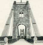
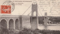
1904: Jons-Niévroz
Jons, Rhône and Niévroz, Ain, France - Rhône River
| Bridgemeister ID: | 2033 (added 2006-04-23) |
| Year Completed: | 1904 |
| Name: | Jons-Niévroz |
| Location: | Jons, Rhône and Niévroz, Ain, France |
| Crossing: | Rhône River |
| References: | AAJ |
| Use: | Vehicular |
| Status: | Destroyed, 1940 |
| Suspended Spans: | 1 |
| Main Span: | 1 x 200 meters (656.2 feet) |
Notes:
- Destroyed, 1940, during WWII.
- Similar to 1912 Groslée - Groslée, Ain and Brangues, Isère, France.
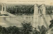
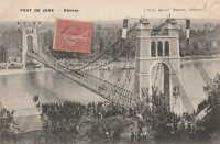
1905: Kelso
Kelso, Washington, USA - Cowlitz River
| Bridgemeister ID: | 1651 (added 2005-03-19) |
| Year Completed: | 1905 |
| Name: | Kelso |
| Location: | Kelso, Washington, USA |
| Crossing: | Cowlitz River |
| References: | AAJ, PTS2 |
| Use: | Vehicular |
| Status: | Collapsed, Jan. 3, 1923 |
| Main Cables: | Wire (steel) |
| Suspended Spans: | 1 |
| Main Span: | 1 x 91.4 meters (300 feet) |
Notes:
- Washed out, 1906. Rebuilt, 1907. Collapsed, 1923, killing "12 to 15 persons" when one of the cables parted with the anchorage.
External Links:
1905: Market Street
Steubenville, Ohio and East Steubenville, West Virginia, USA - Ohio River
| Bridgemeister ID: | 114 (added before 2003) |
| Year Completed: | 1905 |
| Name: | Market Street |
| Location: | Steubenville, Ohio and East Steubenville, West Virginia, USA |
| Crossing: | Ohio River |
| Coordinates: | 40.35833 N 80.61167 W |
| Maps: | Acme, GeoHack, Google, OpenStreetMap |
| Principals: | Hermann Laub |
| References: | AAJ, BPL, PTS2 |
| Use: | Vehicular (two-lane) |
| Status: | Closed, December 2023 |
| Main Cables: | Wire (steel) |
| Suspended Spans: | 3 |
| Main Span: | 1 x 207.3 meters (680 feet) |
| Side Spans: | 2 x 79.2 meters (260 feet) |
Notes:
- 2023, December: Closed by WVDOT because of safety concerns.
- Near 1928 Fort Steuben - Steubenville, Ohio and Weirton, West Virginia, USA.
External Links:
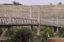
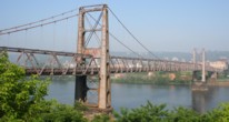
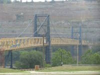
1905: Newell
East Liverpool, Ohio and Newell, West Virginia, USA - Ohio River
| Bridgemeister ID: | 117 (added before 2003) |
| Year Completed: | 1905 |
| Name: | Newell |
| Location: | East Liverpool, Ohio and Newell, West Virginia, USA |
| Crossing: | Ohio River |
| Coordinates: | 40.62167 N 80.595 W |
| Maps: | Acme, GeoHack, Google, OpenStreetMap |
| Principals: | Edwin Kirtland Morse, Dravo Company |
| References: | AAJ, BPL, PTS2 |
| Use: | Vehicular (two-lane), with walkway |
| Status: | In use (last checked: 2022) |
| Main Cables: | Wire (steel) |
| Suspended Spans: | 3 |
| Main Span: | 1 x 228.6 meters (750 feet) |
| Side Spans: | 2 |
Annotated Citations:
- Huba, Stephen. "There’s a new owner for the Newell Bridge." The Weirton Daily Times, 6 May 2022, www.weirtondailytimes.com/news/local-news/2022/05/theres-a-new-owner-for-the-newell-bridge/.
"Frank Six of Six Enterprises in Newell, assumed ownership Wednesday of one of the oldest suspension bridges on the Ohio River for an undisclosed sum from HLC Holdings Inc., parent company of the Fiesta Tableware Co., formerly known as the Homer Laughlin China Co."
- Bobby-Gilbert, Jo-Ann., "Fiesta Tableware Parent Sells Iconic Newell Bridge." The Business Journal, 5 May 2022, businessjournaldaily.com/fiesta-tableware-parent-sells-iconic-newell-bridge/.
"After 116 years of ownership by HLC Holdings Inc., parent company of The Fiesta Tableware Co., the Newell Bridge and Railway Co. changed hands at midnight Wednesday. Officials of Fiesta Tableware, formerly known as Homer Laughlin China Co., announced that the bridge has been purchased by Frank Six, owner of Six Enterprises in Newell."
External Links:

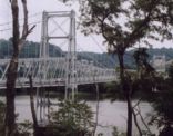
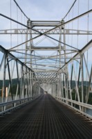
1905: Widnes-Runcorn Transporter
Runcorn, England, United Kingdom - River Mersey, Manchester Ship Canal
| Bridgemeister ID: | 954 (added 2003-10-31) |
| Year Completed: | 1905 |
| Name: | Widnes-Runcorn Transporter |
| Location: | Runcorn, England, United Kingdom |
| Crossing: | River Mersey, Manchester Ship Canal |
| Principals: | J.J. Webster, J.T. Wood, Charles Smith |
| References: | AAJ, BRB, HBE |
| Use: | Transporter |
| Status: | Removed |
| Main Cables: | Wire (steel) |
| Suspended Spans: | 1 |
| Main Span: | 1 x 304.8 meters (1,000 feet) |
External Links:
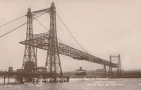
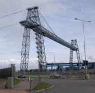
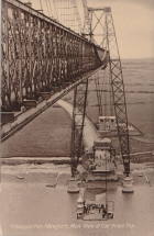
1906: Newport Transporter
Newport, Wales, United Kingdom - River Usk
| Bridgemeister ID: | 939 (added 2003-10-25) |
| Year Completed: | 1906 |
| Name: | Newport Transporter |
| Location: | Newport, Wales, United Kingdom |
| Crossing: | River Usk |
| Coordinates: | 51.570642 N 2.985246 W |
| Maps: | Acme, GeoHack, Google, OpenStreetMap |
| Principals: | Ferdinand Arnodin |
| References: | AAJ, NTB |
| Use: | Transporter |
| Status: | In use (last checked: 2011) |
| Main Cables: | Wire (steel) |
| Suspended Spans: | 1 |
| Main Span: | 1 x 196.6 meters (645 feet) |
External Links:
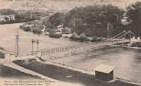
1906: Schönausteg
Berne, Switzerland - Aare River
| Bridgemeister ID: | 1396 (added 2004-07-04) |
| Year Completed: | 1906 |
| Name: | Schönausteg |
| Location: | Berne, Switzerland |
| Crossing: | Aare River |
| Coordinates: | 46.934417 N 7.445883 E |
| Maps: | Acme, GeoHack, Google, OpenStreetMap |
| References: | AAJ |
| Use: | Footbridge |
| Status: | In use (last checked: 2017) |
| Main Cables: | Eyebar (steel) |
| Suspended Spans: | 1 |
| Main Span: | 1 x 53.3 meters (174.88 feet) |
| Deck width: | 8.2 feet |
External Links:
1906: Trellins
Vinay vicinity, Isère, France - Isère River
| Bridgemeister ID: | 1423 (added 2004-07-17) |
| Year Completed: | 1906 |
| Name: | Trellins |
| Location: | Vinay vicinity, Isère, France |
| Crossing: | Isère River |
| Coordinates: | 45.19536 N 5.42482 E |
| Maps: | Acme, GeoHack, Google, OpenStreetMap |
| References: | AAJ |
| Use: | Vehicular |
| Status: | Derelict (last checked: 2009) |
| Main Cables: | Wire |
| Suspended Spans: | 3 |
| Main Span: | 1 x 146.6 meters (481 feet) |
| Side Spans: | 2 x 25.3 meters (83 feet) |
Notes:
- 2022: Still standing, but suspenders and deck have been removed.
External Links:
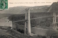
1907: Vulcan
Vulcan, West Virginia and Pike County, Kentucky, USA - Tug Fork Big Sandy River
| Bridgemeister ID: | 2141 (added 2006-11-02) |
| Year Completed: | 1907 |
| Name: | Vulcan |
| Location: | Vulcan, West Virginia and Pike County, Kentucky, USA |
| Crossing: | Tug Fork Big Sandy River |
| References: | AAJ |
| Use: | Footbridge |
| Status: | Removed |
| Main Cables: | Wire |
| Main Span: | 1 x 121.9 meters (400 feet) |
Notes:
- On Page 13 of the December 27, 1967 edition of West Virginia's The Charleston Gazette newspaper, there is a photograph of this footbridge with a Jeep driving across. The caption reads: "Pedestrian bridge at Vulcan... is used by vehicles because it provides a route over the Tug River to Kentucky. A citizen's group has complained that the bridge is not strong enough to support cars." The photograph accompanies an article "Road Reform Call Urged" that says the bridge is "regularly used by Jeeps and small cars." Note the date of the article, December 27, 1967 is 12 days after the Silver Bridge disaster at Point Pleasant, West Virginia.
- Near (footbridge) - Vulcan, West Virginia and Pike County, Kentucky, USA. Although similar in appearance, these appear to have been different bridges.
1908: Tyngs Island
Lowell vicinity, Massachusetts, USA - Merrimack River
| Bridgemeister ID: | 844 (added 2003-06-28) |
| Year Completed: | 1908 |
| Name: | Tyngs Island |
| Location: | Lowell vicinity, Massachusetts, USA |
| Crossing: | Merrimack River |
| At or Near Feature: | Vesper Country Club |
| Coordinates: | 42.65574 N 71.39971 W |
| Maps: | Acme, GeoHack, Google, OpenStreetMap |
| Principals: | Westinghouse, Church, Kerr, and Co., J.R. Worcester |
| References: | AAJ, HBE |
| Use: | Footbridge |
| Status: | Destroyed, 1936 |
| Main Cables: | Wire (steel) |
| Suspended Spans: | 1 |
| Main Span: | 1 x 167.6 meters (550 feet) |
| Deck width: | 4.5 feet |
Notes:
- Destroyed by flood, 1936.
1909: Empire
Empire, Panama Canal Zone - Panama Canal
| Bridgemeister ID: | 525 (added before 2003) |
| Year Completed: | 1909 |
| Name: | Empire |
| Location: | Empire, Panama Canal Zone |
| Crossing: | Panama Canal |
| References: | PTS2 |
| Use: | Vehicular (one-lane) and Pipeline |
| Status: | Removed |
| Main Cables: | Wire (steel) |
| Suspended Spans: | 1 |
| Main Span: | 1 x 182.9 meters (600 feet) |
Notes:
- AAJ: Built to carry water and compressed air pipelines during canal construction, but also had a roadway.
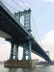
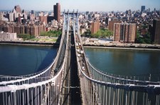
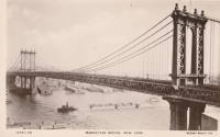
1909: Manhattan
New York and Brooklyn, New York, USA - East River
| Bridgemeister ID: | 123 (added before 2003) |
| Year Completed: | 1909 |
| Name: | Manhattan |
| Location: | New York and Brooklyn, New York, USA |
| Crossing: | East River |
| Coordinates: | 40.70667 N 73.99167 W |
| Maps: | Acme, GeoHack, Google, OpenStreetMap |
| Principals: | O.F. Nichols, Leon Moisseiff |
| References: | AAJ, BAAW, BBR, BC3, BPL, GBD, HBE, LAB, PTS2, SA19050909, SJR |
| Use: | Vehicular (double-deck) |
| Status: | In use (last checked: 2022) |
| Main Cables: | Wire (steel) |
| Suspended Spans: | 3 |
| Main Span: | 1 x 448.1 meters (1,470 feet) |
| Side Spans: | 2 x 221 meters (725 feet) |
Notes:
- Opened December 31, 1909, but not fully completed yet.
- Next to 1883 Brooklyn (Great East River) - New York and Brooklyn, New York, USA.
- Near 1903 Williamsburg - New York and Brooklyn, New York, USA.
External Links:

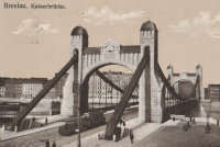
1910: Grunwaldzki
Wroclaw, Poland - Oder River
| Bridgemeister ID: | 431 (added before 2003) |
| Year Completed: | 1910 |
| Name: | Grunwaldzki |
| Also Known As: | Kaiser, Imperial, Kaiserbrücke |
| Location: | Wroclaw, Poland |
| Crossing: | Oder River |
| Coordinates: | 51.109503 N 17.052506 E |
| Maps: | Acme, GeoHack, Google, OpenStreetMap |
| Principals: | R. Weyerauch, M. Mayer |
| References: | AAJ |
| Use: | Vehicular (four-lane), with walkway |
| Status: | In use (last checked: 2019) |
| Main Cables: | Chain (steel) |
| Suspended Spans: | 1 |
| Main Span: | 1 x 126.5 meters (415 feet) |
External Links:
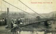
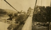
1910: Linn Creek
Linn Creek, Missouri, USA - Osage River
| Bridgemeister ID: | 289 (added before 2003) |
| Year Completed: | 1910 |
| Name: | Linn Creek |
| Location: | Linn Creek, Missouri, USA |
| Crossing: | Osage River |
| Principals: | T.S. Hart |
| References: | AAJ, PTS2 |
| Use: | Vehicular |
| Status: | Removed, 1931 |
| Main Cables: | Wire |
| Suspended Spans: | 1 |
| Main Span: | 1 x 160 meters (525 feet) |
Notes:
- Dismantled 1931 in preparation for inundation that created Lake Of The Ozarks.
External Links:
- www.LakeHistory.info. Michael Gillespie writes: "The supporting cables were cut and the tower was allowed to fall into the Osage River. The entire flood plain was being inundated by the waters of the newly created Lake of the Ozarks. During World War 2, the cables and tower were raised and sold for scrap. The shoreline of today's Lake of the Ozarks is just at the base of the bridge abutment. The toll house, seen in the photo just to the left of the bridge, is long gone, and everything below that has been underwater for 77 years. I have created a map of the road system at that location."
1910: Massena Center
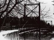
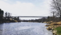
Massena, New York, USA - Grasse River
| Bridgemeister ID: | 124 (added before 2003) |
| Year Completed: | 1910 |
| Name: | Massena Center |
| Location: | Massena, New York, USA |
| Crossing: | Grasse River |
| Coordinates: | 44.959213 N 74.830558 W |
| Maps: | Acme, GeoHack, Google, OpenStreetMap |
| Principals: | Holton D. Robinson |
| References: | AAJ, PTS2 |
| Use: | Vehicular (one-lane) |
| Status: | Closed, 1974 (last checked: 2020) |
| Main Cables: | Wire (steel) |
| Suspended Spans: | 3 |
| Main Span: | 1 x 121.9 meters (400 feet) |
| Side Spans: | 2 x 30.5 meters (100 feet) |
Notes:
- Standing, but closed to all foot and vehicular traffic.
1912: Hagwilget
Hagwilget, British Columbia, Canada - Bulkley River
| Bridgemeister ID: | 1229 (added 2004-02-15) |
| Year Completed: | 1912 |
| Name: | Hagwilget |
| Also Known As: | Bulkley Canyon |
| Location: | Hagwilget, British Columbia, Canada |
| Crossing: | Bulkley River |
| At or Near Feature: | Hagwilget Canyon |
| Coordinates: | 55.257347 N 127.604616 W |
| Maps: | Acme, GeoHack, Google, OpenStreetMap |
| References: | AAJ |
| Use: | Vehicular (one-lane) |
| Status: | Replaced, 1931 |
| Main Cables: | Wire (steel) |
| Suspended Spans: | 1 |
| Main Span: | 1 x 137.5 meters (451 feet) |
| Deck width: | 9 feet |
Notes:
- AAJ: Restricted to foot traffic, 1929.
- Replaced by 1931 Hagwilget (Bulkley Canyon) - Hagwilget, British Columbia, Canada.
- See Walcott - Walcott, British Columbia, Canada. Part or all of the dismantled 1912 Hagwilget bridge may have been reused for this bridge at Walcott.

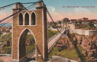
1912: Sidi M'Cid
Constantine, Algeria - Oued Rhumel
| Bridgemeister ID: | 1101 (added 2004-01-02) |
| Year Completed: | 1912 |
| Name: | Sidi M'Cid |
| Location: | Constantine, Algeria |
| Crossing: | Oued Rhumel |
| Coordinates: | 36.372592 N 6.614448 E |
| Maps: | Acme, GeoHack, Google, OpenStreetMap |
| Principals: | Ferdinand Arnodin |
| References: | AAJ |
| Use: | Vehicular (one-lane) |
| Status: | In use (last checked: 2019) |
| Main Cables: | Wire (steel) |
| Suspended Spans: | 1 |
| Main Span: | 1 x 164.6 meters (540 feet) |
| Deck width: | 19.5 feet |
External Links:

1913: Brilliant
Castlegar vicinity, British Columbia, Canada - Kootenay River
| Bridgemeister ID: | 128 (added before 2003) |
| Year Completed: | 1913 |
| Name: | Brilliant |
| Also Known As: | Doukhobor |
| Location: | Castlegar vicinity, British Columbia, Canada |
| Crossing: | Kootenay River |
| Coordinates: | 49.31793 N 117.63023 W |
| Maps: | Acme, GeoHack, Google, OpenStreetMap |
| Principals: | J. R. Grant |
| References: | AAJ, PTS2 |
| Use: | Vehicular (one-lane) |
| Status: | Restricted to foot traffic (last checked: 2010) |
| Main Cables: | Wire (steel) |
| Suspended Spans: | 1 |
| Main Span: | 1 x 100.9 meters (331 feet) |
| Deck width: | 16 feet |
Notes:
- 2010, May: Bridge is reopened for pedestrian traffic after a restoration project. Bridge had been closed and derelict prior.
- Near 1984 Zuckerberg Island Heritage Park - Castlegar, British Columbia, Canada.
External Links:
1913: Whitesville
Whitesville, West Virginia, USA - Coal River
| Bridgemeister ID: | 2142 (added 2006-11-04) |
| Year Completed: | 1913 |
| Name: | Whitesville |
| Location: | Whitesville, West Virginia, USA |
| Crossing: | Coal River |
| References: | AAJ |
| Use: | Footbridge |
| Status: | Collapsed, July 24, 1926 |
| Main Cables: | Wire |
| Main Span: | 1 x 65.2 meters (214 feet) |
| Deck width: | 5 feet |
Notes:
- Collapsed July 24, 1926 while overloaded with people watching a carnival performance. The July 25, 1926 edition of The Charleston Gazette reports the incident in an article with headline "Half Hundred Hurt When Crowded Bridge Collapses at Whitesville, Five Dead, Three More May Die" and sub-headline "Span Fall Under Weight of Hundreds Assembled to Watch Fire Fighting Event on River Bank in Connection with Carnival Celebration; Governor Gore Accompanies Physicians and Nurses on Special Relief Train from Here."
- AAJ cites an Engineering News-Record article from July 29, 1926: "Failure of the bridge was caused by the parting of the turnbuckle on the north end of the east cable. The bridge was built in 1913 and repaired in 1925."
1915: (footbridge)
Chiwaukum vicinity, Washington, USA - Wenatchee River
| Bridgemeister ID: | 1424 (added 2004-07-18) |
| Year Completed: | 1915 |
| Name: | (footbridge) |
| Location: | Chiwaukum vicinity, Washington, USA |
| Crossing: | Wenatchee River |
| Principals: | National Forest Service |
| References: | AAJ, PTS2 |
| Use: | Footbridge |
| Main Cables: | Wire (steel) |
| Suspended Spans: | 1 |
| Main Span: | 1 x 57.9 meters (190 feet) |
1915: Alexandrino de Alencar
Rio de Janeiro, Brazil
1915: Brown's Ford
Brown's Ford and Lowry City vicinity, Missouri, USA - Osage River
| Bridgemeister ID: | 2325 (added 2007-05-06) |
| Year Completed: | 1915 |
| Name: | Brown's Ford |
| Location: | Brown's Ford and Lowry City vicinity, Missouri, USA |
| Crossing: | Osage River |
| References: | AAJ |
| Status: | Removed |
| Main Cables: | Wire |
Notes:
- The June 22, 1940 edition of The Chillicothe Constitution-Tribune (Chillicothe, Missouri) has an article titled "Three Killed in Bridge Collapse, Workmen were repairing the structure near Lowry City, Mo." describing a fatal collapse of the bridge: "Three men were killed, three injured critically and an 8-year old boy believed drowned when cribbing on a wooden suspension bridge across the Osage River six miles east of Lowry City collapsed about 4 o'clock yesterday afternoon. The bridge, on a farm-to-market road in St. Clair County, was being remodeled. Of the ten men working and bystanders on and near the structure when it fell, only one escaped without injury. All those killed or injured lived in St. Clair County. On the west side of the bridge a framework of heavy timbers had been inserted between one of the suspension cables and an old wooden pier, which originally had supported the cable. The workmen were attempting to slide a steel pier under the cable, to replace the wooden pier. The cribbing suddenly gave way, and the pressure from the cable hurled the wood supports in all directions. The bridge floor dropped into the river, except for a small section near the east end."
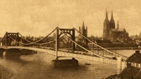
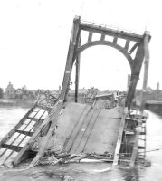
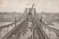
1915: Deutz
Köln (Cologne), Germany - Rhine River
| Bridgemeister ID: | 432 (added before 2003) |
| Year Completed: | 1915 |
| Name: | Deutz |
| Also Known As: | Deutzer, Hindenburg |
| Location: | Köln (Cologne), Germany |
| Crossing: | Rhine River |
| References: | AAJ, BRU |
| Use: | Vehicular |
| Status: | Collapsed, 1945 |
| Main Cables: | Chain (steel) |
| Suspended Spans: | 3 |
| Main Span: | 1 x 184.4 meters (605 feet) |
| Side Spans: | 2 x 92.2 meters (302.5 feet) |
| Deck width: | 59.6 feet |
| Characteristics: | Self-anchored |
Notes:
- First long-span self-anchored suspension bridge.
External Links:
1916: Belpre-Parkersburg
Parkersburg, West Virginia and Belpre, Ohio, USA - Ohio River
| Bridgemeister ID: | 134 (added before 2003) |
| Year Completed: | 1916 |
| Name: | Belpre-Parkersburg |
| Location: | Parkersburg, West Virginia and Belpre, Ohio, USA |
| Crossing: | Ohio River |
| Principals: | Hermann Laub |
| References: | AAJ, BPL, PTS2, SJR |
| Use: | Vehicular, with walkway |
| Status: | Demolished, March 16, 1980 |
| Main Cables: | Wire (steel) |
| Suspended Spans: | 3 |
| Main Span: | 1 x 236.2 meters (775 feet) |
| Side Spans: | 1 x 114.3 meters (375 feet), 1 x 83.8 meters (275 feet) |
| Deck width: | 22 feet |
External Links:
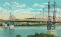
1917: Rio Chiriquí
Panama - Rio Chiriquí
| Bridgemeister ID: | 1425 (added 2004-07-18) |
| Year Completed: | 1917 |
| Name: | Rio Chiriquí |
| Location: | Panama |
| Crossing: | Rio Chiriquí |
| Principals: | A. S. Zinn |
| References: | AAJ, PTS2 |
| Use: | Vehicular |
| Main Cables: | Wire (steel) |
| Suspended Spans: | 1 |
| Main Span: | 1 x 125 meters (410 feet) |
| Deck width: | 7.7 feet |
1918: Opiki Toll
Rangitane, New Zealand - Manawatu River
| Bridgemeister ID: | 698 (added 2003-03-08) |
| Year Completed: | 1918 |
| Name: | Opiki Toll |
| Also Known As: | Akers Toll |
| Location: | Rangitane, New Zealand |
| Crossing: | Manawatu River |
| Coordinates: | 40.431841 S 175.468575 E |
| Maps: | Acme, GeoHack, Google, OpenStreetMap |
| Principals: | Joseph Dawson |
| References: | AAJ, GAP, PTS2 |
| Use: | Vehicular |
| Status: | Derelict (last checked: 2024) |
| Main Cables: | Wire (steel) |
| Main Span: | 1 |
Notes:
- 1969: Bypassed.
- 2023, September: After many years of the main cables and suspenders hanging with no deck, one of the main cables collapsed.
- 2024, March: The collapsed main cable is raised back into position. The bridge, however, is still a just derelict monument with no deck.
External Links:
- ‘Iconic’ Ōpiki Bridge partly collapses in Manawatū River - nzherald.co.nz. Article regarding the September 2023 main cable collapse.
1918: Swinging
Old Hickory, Nashville and Goodlettsville, Nashville, Tennessee, USA - Cumberland River
| Bridgemeister ID: | 587 (added 2003-01-05) |
| Year Completed: | 1918 |
| Name: | Swinging |
| Location: | Old Hickory, Nashville and Goodlettsville, Nashville, Tennessee, USA |
| Crossing: | Cumberland River |
| At or Near Feature: | Hadley Bend |
| Coordinates: | 36.289002 N 86.685355 W |
| Maps: | Acme, GeoHack, Google, OpenStreetMap |
| Principals: | William G. Grove, American Bridge Co. |
| References: | AAJ, PTS2 |
| Use: | Vehicular (one-lane) |
| Status: | Removed |
| Main Cables: | Wire (steel) |
| Suspended Spans: | 1 |
| Main Span: | 1 x 164.6 meters (540 feet) |
| Deck width: | 8 feet |
Notes:
- Coordinates provided are approximate based on current-day (2021) location of Swinging Bridge Road.
External Links:
- Bridgehunter.com | Old Hickory Suspension Bridge
- DuPont High School Alumni Association - The Swinging Bridge. According to the description in this article provided by Old Hickory Branch Library this large bridge had a 540-foot main span and was used for vehicular traffic. "The suspension bridge... Was diverted from its original destination in South America because of the urgency of the war effort. It was built for pedestrian traffic and used only for that purpose at first... Upon determination that the bridge was capable of handling light traffic, a flagman was stationed at each end of the bridge on a 24-hour-a-day basis and cars began using the one-lane span." Kris Brummett adds: "The 540 foot span had no supports to prevent sideways movement and literally swayed back and forth. The bridge was used until 1929."
1919: Beebe
Beebe and Chelan, Washington, USA - Columbia River
| Bridgemeister ID: | 1188 (added 2004-01-24) |
| Year Completed: | 1919 |
| Name: | Beebe |
| Location: | Beebe and Chelan, Washington, USA |
| Crossing: | Columbia River |
| Coordinates: | 47.81308 N 119.97245 W |
| Maps: | Acme, GeoHack, Google, OpenStreetMap |
| Principals: | A. Munster, Wenatchee-Beebe Orchard Co. |
| References: | AAJ, PTS2, SPW |
| Use: | Pipeline and Vehicular |
| Status: | Only towers remain, since 1963 (last checked: 2022) |
| Main Cables: | Wire (steel) |
| Suspended Spans: | 1 |
| Main Span: | 1 x 192.6 meters (632 feet) |
| Deck width: | 12 feet |
Notes:
- The towers are still standing next to the current US97 crossing at Beebe.
- AAJ: Private bridge, built primarily to carry water to the owner's orchard, but also carried a roadway.
External Links:
- The Beebe Bridge | Empire Press | wenatcheeworld.com. Article about the history of the bridge.
- Structurae - Structure ID 20052092
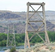
1919: Hansen
Twin Falls vicinity, Idaho, USA - Snake River
| Bridgemeister ID: | 334 (added before 2003) |
| Year Completed: | 1919 |
| Name: | Hansen |
| Location: | Twin Falls vicinity, Idaho, USA |
| Crossing: | Snake River |
| Principals: | Freygang and Trocon |
| References: | AAJ, PTS2 |
| Use: | Vehicular (two-lane) |
| Status: | Replaced, 1966 |
| Main Cables: | Wire (steel) |
| Suspended Spans: | 1 |
| Main Span: | 1 x 185.3 meters (608 feet) |
| Deck width: | 17 feet |
External Links:
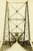
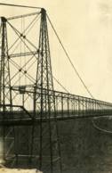
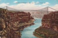
1920: Kaibab Trail
Grand Canyon National Park, Arizona, USA - Colorado River
| Bridgemeister ID: | 2186 (added 2007-01-15) |
| Year Completed: | 1920 |
| Name: | Kaibab Trail |
| Location: | Grand Canyon National Park, Arizona, USA |
| Crossing: | Colorado River |
| Principals: | George C. Goodwin |
| References: | AAJ |
| Use: | Footbridge |
| Status: | Replaced, 1928 |
| Main Cables: | Wire |
| Suspended Spans: | 1 |
Notes:
- Replaced by 1928 Kaibab Trail (Black, South Kaibab) - Bright Angel Campground vicinity, Arizona, USA.
External Links:
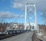
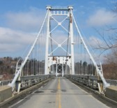
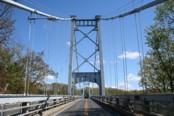
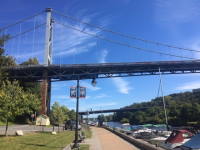
1921: Kingston-Port Ewen
Kingston, New York, USA - Rondout Creek
| Bridgemeister ID: | 138 (added before 2003) |
| Year Completed: | 1921 |
| Name: | Kingston-Port Ewen |
| Also Known As: | Wurts Street, Rondout Creek |
| Location: | Kingston, New York, USA |
| Crossing: | Rondout Creek |
| Coordinates: | 41.916129 N 73.983999 W |
| Maps: | Acme, GeoHack, Google, OpenStreetMap |
| Principals: | Holton D. Robinson, Daniel E. Moran, William Yates |
| References: | AAJ, PTS, PTS2, SJR, SSS |
| Use: | Vehicular (two-lane, heavy vehicles), with walkway |
| Status: | In use, September 2020 (last checked: 2021) |
| Main Cables: | Wire (steel) |
| Suspended Spans: | 3 |
| Main Span: | 1 x 214.9 meters (705 feet) |
| Side Spans: | 2 x 53.7 meters (176.25 feet) |
| Deck width: | 37 feet |
Notes:
- 2008, March: Closed for ten weeks for cable inspection.
- 2018, December: Closed for maintenance. Expected to reopen February, 2019.
- 2019: Major rehabilitation continues to be delayed for several years.
- 2020, September: Closed temporarily. Major renovation project continues to be delayed.
- 2020, December: Closed indefinitely.
- 2021, May: Bids for renovation to be sought in June. Work expected to start in September.
- 2021, October: Groundbreaking ceremony for long-anticipated restoration project. Expected to be completed in 2023 at a cost of US$44.6M
Annotated Citations:
- Kirby, Paul. "Bids for Rondout Creek Bridge overhaul to be sought next month; work expected to start in September." Daily Freeman, 5 May 2021, www.dailyfreeman.com/news/local-news/bids-for-rondout-creek-bridge-overhaul-to-be-sought-next-month-work-expected-to-start/article_612258c4-adce-11eb-8dd6-9f0ac0c85540.html.
"Bids for the planned overhaul of the Rondout Creek Bridge will be sought in June, and the state Department of Transportation expects to award contracts for the work in August, the office of state Assemblyman Kevin Cahill said this week... The rehabilitation of the suspension bridge, which carries Wurts Street over the creek between Kingston and Port Ewen, could cost as much as $37 million, Cahill said previously. The state will pay for the project, which is expected to begin this fall."
External Links:
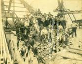
- Dave Longendyke's website. Several photos of the bridge's construction.
- Structurae - Structure ID 20007345
1922: (footbridge)
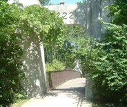
Bexley, Ohio, USA - Alum Creek
| Bridgemeister ID: | 819 (added 2003-05-31) |
| Year Completed: | 1922 |
| Name: | (footbridge) |
| Location: | Bexley, Ohio, USA |
| Crossing: | Alum Creek |
| At or Near Feature: | Wolfe Park |
| Coordinates: | 39.963831 N 82.947491 W |
| Maps: | Acme, GeoHack, Google, OpenStreetMap |
| References: | AAJ, PTS2 |
| Use: | Footbridge |
| Status: | In use (last checked: 2016) |
| Main Cables: | Wire (steel) |
| Suspended Spans: | 1 |
| Deck width: | 6.25 feet |
Notes:
- Closed 2013 for major refurbishment including a new deck. Reopened March. 2014.
- April 2015: Two main cables snap, causing a partial collapse of the bridge deck. Repaired and reopened August 5, 2016. Failure speculated to have been caused by the weight of the new deck installed 2013-2014.
1924: Agness
Agness, Oregon, USA - Rogue River
| Bridgemeister ID: | 273 (added before 2003) |
| Year Completed: | 1924 |
| Name: | Agness |
| Location: | Agness, Oregon, USA |
| Crossing: | Rogue River |
| Principals: | U.S. Forest Service |
| References: | AAJ |
| Status: | Destroyed, 1964 |
| Main Cables: | Wire |
| Main Span: | 1 x 92.7 meters (304 feet) |
| Side Span: | 1 |
Notes:
- A postcard reads, "This historic forestry suspension bridge over the Rogue River was... constructed of steel carried piece by piece up-river from Gold Beach by the mail boats. This bridge was swept away by flood waters 100 feet over flood stage during December 1964."
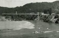
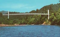
1924: Bear Mountain
Anthony's Nose and Bear Mountain, New York, USA - Hudson River
| Bridgemeister ID: | 141 (added before 2003) |
| Year Completed: | 1924 |
| Name: | Bear Mountain |
| Location: | Anthony's Nose and Bear Mountain, New York, USA |
| Crossing: | Hudson River |
| Coordinates: | 41.32 N 73.985 W |
| Maps: | Acme, GeoHack, Google, OpenStreetMap |
| Principals: | Howard C. Baird |
| References: | AAJ, BAAW, BBR, CPW, PTS2, SJR |
| Use: | Vehicular (two-lane, heavy vehicles), with walkway |
| Status: | In use (last checked: 2022) |
| Main Cables: | Wire (steel) |
| Suspended Spans: | 1 |
| Main Span: | 1 x 497.4 meters (1,632 feet) |
| Deck width: | 48 feet |
Notes:
- Became longest suspension bridge by eclipsing 1903 Williamsburg - New York and Brooklyn, New York, USA.
- Eclipsed by new longest suspension bridge 1926 Benjamin Franklin (Philadelphia-Camden) - Philadelphia, Pennsylvania and Camden, New Jersey, USA.
- Near 2002 Popolopen (William J. Moreau Popolopen) - Fort Montgomery, New York, USA.
External Links:
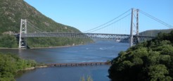
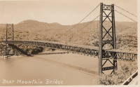
1924: Saint-Leu
Saint-Leu-d'Esserent, Oise, France - Oise River
| Bridgemeister ID: | 1947 (added 2005-11-04) |
| Year Completed: | 1924 |
| Name: | Saint-Leu |
| Location: | Saint-Leu-d'Esserent, Oise, France |
| Crossing: | Oise River |
| Coordinates: | 49.213680 N 2.422861 E |
| Maps: | Acme, GeoHack, Google, OpenStreetMap |
| References: | AAJ |
| Use: | Vehicular (two-lane) |
| Status: | In use (last checked: 2022) |
| Main Cables: | Wire (steel) |
| Suspended Spans: | 1 |
External Links:
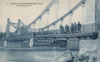
1925: Luzancy
Luzancy, Seine-et-Marne, France - Marne River
| Bridgemeister ID: | 4920 (added 2020-07-26) |
| Year Completed: | 1925 |
| Name: | Luzancy |
| Location: | Luzancy, Seine-et-Marne, France |
| Crossing: | Marne River |
| References: | AAJ, PTS2 |
| Use: | Vehicular |
| Status: | Destroyed |
| Main Cables: | Reinforced Concrete |
| Suspended Spans: | 1 |
Notes:
- Described as a "rigid suspension bridge of reinforced concrete."
- Replaced 1831 Luzancy - Luzancy, Seine-et-Marne, France.
- Similar to 1926 Laon - Laon, Aisne, France.
- Similar to Pommiers - Pommiers, Aisne, France.
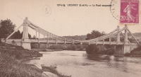
1925: Powhatan
Powhatan, Arkansas, USA - Black River
1926: Andy Warhol
Pittsburgh, Pennsylvania, USA - Allegheny River
| Bridgemeister ID: | 148 (added before 2003) |
| Year Completed: | 1926 |
| Name: | Andy Warhol |
| Also Known As: | Seventh Street |
| Location: | Pittsburgh, Pennsylvania, USA |
| Crossing: | Allegheny River |
| Coordinates: | 40.44626 N 80.00145 W |
| Maps: | Acme, GeoHack, Google, OpenStreetMap |
| Principals: | Vernon R. Covell, T.J. Wilkerson, A.D. Nutter, H.E. Dodge, Stanley L. Roush |
| References: | AAJ, BOP, BPL, PBR, PTS2, USS |
| Use: | Vehicular (four-lane), with walkway |
| Status: | In use (last checked: 2014) |
| Main Cables: | Eyebar (steel) |
| Suspended Spans: | 3 |
| Main Span: | 1 x 134.7 meters (442 feet) |
| Side Spans: | 2 x 67.4 meters (221 feet) |
| Deck width: | 62 feet |
| Characteristics: | Self-anchored |
Notes:
- Self-anchored.
- Replaced 1884 North Side (Seventh Street) - Pittsburgh, Pennsylvania, USA.
- Next to 1927 Rachel Carson (Ninth Street) - Pittsburgh, Pennsylvania, USA.
- Next to 1928 Roberto Clemente (Sixth Street) - Pittsburgh, Pennsylvania, USA.
External Links:
1926: Benjamin Franklin
Philadelphia, Pennsylvania and Camden, New Jersey, USA - Delaware River
| Bridgemeister ID: | 145 (added before 2003) |
| Year Completed: | 1926 |
| Name: | Benjamin Franklin |
| Also Known As: | Philadelphia-Camden |
| Location: | Philadelphia, Pennsylvania and Camden, New Jersey, USA |
| Crossing: | Delaware River |
| Coordinates: | 39.95333 N 75.135 W |
| Maps: | Acme, GeoHack, Google, OpenStreetMap |
| Principals: | Modjeski, Webster, Ball, Moiseff |
| References: | AAJ, BBR, BFL, BONJ, BPL, DRB, GBD, PTL, PTS2, USS |
| Use: | Vehicular (major highway) and Rail (subway), with walkway |
| Status: | In use (last checked: 2007) |
| Main Cables: | Wire (steel) |
| Suspended Spans: | 3 |
| Main Span: | 1 x 533.4 meters (1,750 feet) |
| Side Spans: | 2 x 219.3 meters (719.5 feet) |
| Deck width: | 125.5 feet |
Notes:
- Became longest suspension bridge by eclipsing 1924 Bear Mountain - Anthony's Nose and Bear Mountain, New York, USA.
- Eclipsed by new longest suspension bridge 1929 Ambassador - Detroit, Michigan, USA and Windsor, Ontario, Canada.
- Near 1957 Walt Whitman - Philadelphia, Pennsylvania and Camden, New Jersey, USA.
External Links:
1926: Hercilio Luz
Florianopolis, Santa Catarina, Brazil
| Bridgemeister ID: | 437 (added before 2003) |
| Year Completed: | 1926 |
| Name: | Hercilio Luz |
| Also Known As: | Florianopolis |
| Location: | Florianopolis, Santa Catarina, Brazil |
| Coordinates: | 27.59393 S 48.56619 W |
| Maps: | Acme, GeoHack, Google, OpenStreetMap |
| Principals: | David B. Steinman, Holton D. Robinson |
| References: | AAJ, ADDS, BBR, PTS2, USS |
| Use: | Vehicular (two-lane, heavy vehicles), with walkway |
| Status: | In use (last checked: 2011) |
| Main Cables: | Eyebar (steel) |
| Suspended Spans: | 1 |
| Main Span: | 1 x 339.5 meters (1,113.75 feet) |
| Deck width: | 37 feet |
External Links:
1926: Hidalgo-Reynosa International
Hidalgo, Texas, USA and Reynosa, Tamaulipas, Mexico - Rio Grande
| Bridgemeister ID: | 146 (added before 2003) |
| Year Completed: | 1926 |
| Name: | Hidalgo-Reynosa International |
| Location: | Hidalgo, Texas, USA and Reynosa, Tamaulipas, Mexico |
| Crossing: | Rio Grande |
| Principals: | Austin Bridge Co. |
| References: | AAJ, AUB, HAERTX98, PTS2 |
| Use: | Vehicular |
| Status: | Demolished, 1960's |
| Main Cables: | Wire (steel) |
| Suspended Spans: | 1 |
| Main Span: | 1 x 137.2 meters (450 feet) |
Notes:
- Damaged by flood, 1933. Rebuilt, 1934. Cables failed, 1939. Rebuilt.
1926: Nassau
Nassau, Rheinland-Pfalz, Germany - Lahn River
| Bridgemeister ID: | 1133 (added 2004-01-16) |
| Year Completed: | 1926 |
| Name: | Nassau |
| Location: | Nassau, Rheinland-Pfalz, Germany |
| Crossing: | Lahn River |
| Coordinates: | 50.311299 N 7.795710 E |
| Maps: | Acme, GeoHack, Google, OpenStreetMap |
| References: | AAJ |
| Use: | Vehicular (two-lane) |
| Status: | Removed (last checked: 2004) |
| Main Cables: | Riveted plate |
| Main Span: | 1 x 74.9 meters (245.75 feet) |
Notes:
- The "cables" of this bridge appear to have been steel plates riveted together. The deck is plate girder. Not surprisingly, recent photos of the bridge show it resting on two intermediate piers. AAJ describes the cables: "'laminated chains' made of flat iron plates, there being two such chains to a side, each of five plates riveted together."
- Replaced 1830 (suspension bridge) - Nassau, Germany.
- Replaced by 2005 Nassau - Nassau, Rheinland-Pfalz, Germany.
External Links:
1927: (footbridge)
Forst, Germany - Lusatian Neisse River
| Bridgemeister ID: | 5562 (added 2020-12-19) |
| Year Completed: | 1927 |
| Name: | (footbridge) |
| Location: | Forst, Germany |
| Crossing: | Lusatian Neisse River |
| Coordinates: | 51.748356 N 14.659815 E |
| Maps: | Acme, GeoHack, Google, OpenStreetMap |
| References: | AAJ |
| Use: | Footbridge |
| Status: | Removed |
| Main Cables: | Eyebar (steel) |
| Suspended Spans: | 3 |
| Main Span: | 1 x 39.6 meters (129.89 feet) |
| Side Spans: | 2 x 19.8 meters (64.94 feet) |
Notes:
- Coordinates are for likely alignment of this former bridge, with at least one pier remaining (as of 2020).
