Inventory Search Results
9 suspension bridges were found for search criteria: ASB. All 9 bridges from the search results appear below. Click the Bridgemeister ID number to isolate the bridge on its own page. If you don't see what you were looking for, try an image search with the same criteria: ASB. This will find the bridge if it is pictured on the site, but is not a catenary suspension bridge.
Related:
1801: Jacob's Creek
Iron Bridge, Mount Pleasant vicinity, Pennsylvania, USA - Jacob's Creek
| Bridgemeister ID: | 3 (added before 2003) |
| Year Completed: | 1801 |
| Name: | Jacob's Creek |
| Also Known As: | Iron Bridge, Chain Bridge |
| Location: | Iron Bridge, Mount Pleasant vicinity, Pennsylvania, USA |
| Crossing: | Jacob's Creek |
| Coordinates: | 40.112598 N 79.553186 W |
| Maps: | Acme, GeoHack, Google, OpenStreetMap |
| Principals: | Judge James Finley |
| References: | AAJ, ASB, BBR, BOB, BPL, CAB, DSE20000116, HBE, LAB, PTS2 |
| Use: | Vehicular |
| Status: | Removed, 1833 |
| Main Cables: | Chain (iron) |
| Suspended Spans: | 3 |
| Main Span: | 1 x 21.3 meters (70 feet) |
| Deck width: | 12.5 feet |
Notes:
- In an email dated January 16, 2000, Don Sayenga provided information about the location of this bridge. Generally attributed to Uniontown (the seat of Fayette County, PA), Mr. Sayenga offers some clues about the bridge's true location. "[James Finley] stated that he built it near the home of his friend Meason which implies a connection for the iron as Meason was making iron. Meason's home has survived by the way, a beautiful place. Finley stated it was a combination contract with the cost split between two counties, and he stated it was built over Jacob's Creek which is the county boundary. He also makes it clear it was on the road to Greensburg. The only place the old road crossed Jacob's Creek is just south of Mount Pleasant, Pennsylvania. On the geodetic survey maps this spot is marked "Iron Bridge" but there is no town there. The last time I was there I saw a sign that said 'Iron Bridge' on an automobile scrap yard. I found absolutely no trace of the bridge, but it was not very big, so there was no need for a huge abutment."
- First suspension bridge with a rigid level deck, often considered the world's first modern suspension bridge.
- Coordinates are for the likely location of the bridge, where present-day (2020) Pennsylvania route 3105 crosses Jacob's Creek.
External Links:
1823: (suspension bridge)
Réunion, France - Sainte-Suzanne River
| Bridgemeister ID: | 1541 (added 2004-11-03) |
| Year Completed: | 1823 |
| Name: | (suspension bridge) |
| Location: | Réunion, France |
| Crossing: | Sainte-Suzanne River |
| Principals: | Marc Brunel |
| References: | AAJ, ASB, CAB |
| Use: | Vehicular (two-lane) |
| Main Cables: | Chain (iron) |
| Suspended Spans: | 2 |
| Main Spans: | 2 x 40.2 meters (131.75 feet) |
Notes:
- Réunion was known as "Isle of Bourbon" at this time.
- Built as part of same project as 1823 (suspension bridge) - Réunion, France.
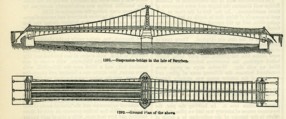
| Bridgemeister ID: | 1542 (added 2004-11-03) |
| Year Completed: | 1823 |
| Name: | (suspension bridge) |
| Location: | Réunion, France |
| Crossing: | Mat River |
| Principals: | Marc Brunel |
| References: | AAJ, ASB, CAB, MOS |
| Use: | Vehicular (two-lane) |
| Main Cables: | Chain (iron) |
| Suspended Spans: | 1 |
| Main Span: | 1 x 40.2 meters (131.75 feet) |
Notes:
- Réunion was known as "Isle of Bourbon" at this time.
- MOS: "These bridges were designed by Mr. Brunel, and executed in England, near Sheffield, where they were put together in January, 1823, before being sent out to the Isle de Bourbon."
- Built as part of same project as 1823 (suspension bridge) - Réunion, France.
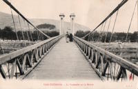
1825: Tain-Tournon
Tournon-sur-Rhône, Ardèche and Tain, Drôme, France - Rhône River
| Bridgemeister ID: | 378 (added before 2003) |
| Year Completed: | 1825 |
| Name: | Tain-Tournon |
| Location: | Tournon-sur-Rhône, Ardèche and Tain, Drôme, France |
| Crossing: | Rhône River |
| Principals: | Marc Seguin |
| References: | AAJ, ASB, BBR, BPF, GHD, LAB, MOS, PTS2, TTSB |
| Use: | Vehicular |
| Status: | Removed, 1965 |
| Main Cables: | Wire (iron) |
| Suspended Spans: | 2 |
| Main Spans: | 2 x 85 meters (278.88 feet) |
| Deck width: | 13.75 feet |
Notes:
- Often credited as being the first large wire suspension bridge in France (and elsewhere). Rebuilt 1847 as a footbridge. Removed 1965.
- Near 1849 Marc Seguin - Tournon-sur-Rhône, Ardèche and Tain-L'Hermitage, Drôme, France.
- Near 1958 Gustave Toursier - Tournon-sur-Rhône, Ardèche and Tain-L'Hermitage, Drôme, France.
External Links:
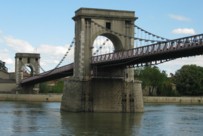
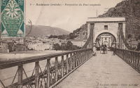
1827: Andance
Andance, Ardèche and Andancette, Drôme, France - Rhône River
| Bridgemeister ID: | 976 (added 2003-11-14) |
| Year Completed: | 1827 |
| Name: | Andance |
| Location: | Andance, Ardèche and Andancette, Drôme, France |
| Crossing: | Rhône River |
| Coordinates: | 45.242194 N 4.801638 E |
| Maps: | Acme, GeoHack, Google, OpenStreetMap |
| Principals: | Marc Seguin |
| References: | AAJ, ASB |
| Use: | Vehicular (one-lane) |
| Status: | In use (last checked: 2009) |
| Main Cables: | Wire (iron) |
| Suspended Spans: | 2 |
| Main Spans: | 2 |
Notes:
- Destroyed August 30, 1944. Rebuilt 1946.
External Links:
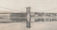
1828: Sablons
Sablons, Isère and Serrières, Ardèche, France - Rhône River
| Bridgemeister ID: | 890 (added 2003-09-06) |
| Year Completed: | 1828 |
| Name: | Sablons |
| Location: | Sablons, Isère and Serrières, Ardèche, France |
| Crossing: | Rhône River |
| Principals: | Marc Seguin |
| References: | AAJ, ASB |
| Use: | Vehicular |
| Status: | Replaced, 1933 |
| Main Cables: | Wire (iron) |
| Main Spans: | 2 x 101 meters (331.38 feet) |
| Deck width: | 13.12 feet |
Notes:
External Links:
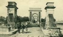
1829: Beaucaire
Beaucaire, Gard and Tarascon, Bouches-du-Rhône, France - Rhône River
| Bridgemeister ID: | 626 (added 2003-01-20) |
| Year Completed: | 1829 |
| Name: | Beaucaire |
| Location: | Beaucaire, Gard and Tarascon, Bouches-du-Rhône, France |
| Crossing: | Rhône River |
| Principals: | Jules Seguin, Joseph Chaley |
| References: | AAJ, ASB, GHD, PTS2 |
| Use: | Vehicular |
| Status: | Destroyed, August 6, 1944 |
| Main Cables: | Wire (iron) |
| Suspended Spans: | 4 |
| Main Spans: | 2 x 120 meters (393.72 feet) |
| Side Spans: | 2 x 93.6 meters (307.1 feet) |
Notes:
- 1887: Flooring failed.
- 1944: Bombed by Allied Forces, August 6.
External Links:
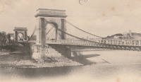
1829: Vienne
Vienne, Isère and Sainte-Colombe, Rhône, France - Rhône River
| Bridgemeister ID: | 977 (added 2003-11-15) |
| Year Completed: | 1829 |
| Name: | Vienne |
| Location: | Vienne, Isère and Sainte-Colombe, Rhône, France |
| Crossing: | Rhône River |
| Coordinates: | 45.524867 N 4.87035 E |
| Maps: | Acme, GeoHack, Google, OpenStreetMap |
| Principals: | Marc Seguin |
| References: | AAJ, ASB |
| Use: | Vehicular (one-lane) |
| Status: | Restricted to foot traffic (last checked: 2005) |
| Main Cables: | Wire (iron) |
| Suspended Spans: | 2 |
| Main Spans: | 2 |
Notes:
- Damaged by flood in 1840. Rebuilt.
External Links:
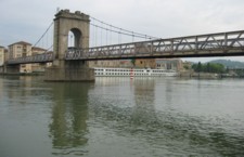
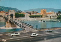
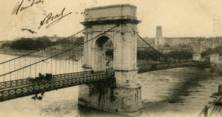
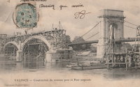
1830: Valence
Valence, Drôme and Guilherand-Granges, Ardèche, France - Rhône River
| Bridgemeister ID: | 631 (added 2003-01-20) |
| Year Completed: | 1830 |
| Name: | Valence |
| Location: | Valence, Drôme and Guilherand-Granges, Ardèche, France |
| Crossing: | Rhône River |
| Coordinates: | 44.932022 N 4.882951 E |
| Maps: | Acme, GeoHack, Google, OpenStreetMap |
| Principals: | Marc Seguin |
| References: | ASB, PTS2 |
| Use: | Vehicular |
| Status: | Removed |
| Main Cables: | Wire (iron) |
| Suspended Spans: | 2 |
| Main Spans: | 2 x 110 meters (360.9 feet) |
| Deck width: | 7 meters |
Notes:
- Two side spans meeting at a single midstream tower.
- Later at same location 1949 (footbridge) - Valence, Drôme and Guilherand-Granges, Ardèche, France.
External Links:
