Inventory Search Results
22 suspension bridges were found for search criteria: AUB. All 22 bridges from the search results appear below. Click the Bridgemeister ID number to isolate the bridge on its own page. If you don't see what you were looking for, try an image search with the same criteria: AUB. This will find the bridge if it is pictured on the site, but is not a catenary suspension bridge.
Related:
1909: Pease River
Vernon, Texas, USA - Pease River
| Bridgemeister ID: | 597 (added 2003-01-11) |
| Year Completed: | 1909 |
| Name: | Pease River |
| Location: | Vernon, Texas, USA |
| Crossing: | Pease River |
| Coordinates: | 34.179636 N 99.324038 W |
| Maps: | Acme, GeoHack, Google, OpenStreetMap |
| Principals: | Mitchell & Pigg |
| References: | AUB |
| Use: | Vehicular |
| Status: | Only towers remain |
| Main Cables: | Wire |
| Suspended Spans: | 4 |
| Main Spans: | 2 |
| Side Spans: | 2 |
Notes:
- In September 2006, Howard Laker writes: "The bridge is no longer there, but one tower is still standing. It is located adjacent to US 287 and can be easily seen."
- 1927: Collapsed under weight of convoy of trucks.
- Replaced 1897 Pease River - Vernon, Texas, USA.
| Bridgemeister ID: | 600 (added 2003-01-11) |
| Year Completed: | 1914 |
| Name: | 98th Meridian |
| Also Known As: | Byers |
| Location: | Byers, Texas and Temple, Oklahoma, USA |
| Crossing: | Red River |
| Coordinates: | 34.124507 N 98.214251 W |
| Maps: | Acme, GeoHack, Google, OpenStreetMap |
| Principals: | Mitchell & Pigg |
| References: | AUB, HAERTX98, PTS2 |
| Use: | Vehicular |
| Status: | Destroyed, 1923 |
| Main Cables: | Wire (steel) |
| Suspended Spans: | 4 |
| Main Spans: | 3 x 172.8 meters (567 feet) |
| Side Span: | 1 x 32.6 meters (107 feet) |
Notes:
- Destroyed by tornado, 1923.
- Coordinates are the exact location of one of the remaining (as of 2020) piers of either this bridge or its replacement suspension bridge. Additional piers, south of that location, are also visible in satellite images.
- Replaced by 1923 98th Meridian (Byers) - Byers vicinity, Texas and Temple, Oklahoma, USA.
- See (suspension bridge) - Texas, USA. The 98th Meridian bridge may match this unknown "Red River" bridge photo. AUB describes the Byers bridge, "This bridge, three spans of 567' each, one side span of 107', and a 16' roadway, had originally been built in 1914."
| Bridgemeister ID: | 595 (added 2003-01-11) |
| Year Completed: | 1917 |
| Name: | Terral-Ringgold |
| Location: | Ringgold, Texas and Terral, Oklahoma, USA |
| Crossing: | Red River |
| Coordinates: | 33.878143 N 97.934776 W |
| Maps: | Acme, GeoHack, Google, OpenStreetMap |
| References: | AUB, PTS2 |
| Use: | Vehicular |
| Status: | Removed |
| Main Cables: | Wire |
| Suspended Spans: | 5 |
| Main Spans: | 3 x 137.2 meters (450 feet) |
| Side Spans: | 2 |
Notes:
- 1931: Replacement opened.
| Bridgemeister ID: | 5589 (added 2020-12-22) |
| Year Completed: | 1923 |
| Name: | 98th Meridian |
| Also Known As: | Byers |
| Location: | Byers vicinity, Texas and Temple, Oklahoma, USA |
| Crossing: | Red River |
| Coordinates: | 34.127249 N 98.214114 W |
| Maps: | Acme, GeoHack, Google, OpenStreetMap |
| Principals: | Austin Bridge Co. |
| References: | AUB |
| Use: | Vehicular |
| Status: | Destroyed, 1938 |
| Main Cables: | Wire (steel) |
Notes:
- AUB describes the Byers bridge: "This bridge, three spans of 567' each, one side span of 107', and a 16' roadway, had originally been built in 1914."
- 1935: Damaged by flood.
- 1938: Destroyed by flood.
- Replaced 1914 98th Meridian (Byers) - Byers, Texas and Temple, Oklahoma, USA.
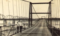
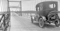
| Bridgemeister ID: | 140 (added before 2003) |
| Year Completed: | 1924 |
| Name: | Nocona |
| Also Known As: | Bluff, Ketchum Bluff, Ketchum's Bluff |
| Location: | Nocona vicinity, Texas and Jefferson County, Oklahoma, USA |
| Crossing: | Red River |
| At or Near Feature: | Ketchum Bluff |
| Coordinates: | 33.93579 N 97.75869 W |
| Maps: | Acme, GeoHack, Google, OpenStreetMap |
| Principals: | Austin Bridge Co. |
| References: | AUB, HAERTX98, PTS2 |
| Use: | Vehicular |
| Status: | Only towers remain (last checked: 2007) |
| Main Cables: | Wire (steel) |
| Main Span: | 1 x 213.4 meters (700 feet) |
Notes:
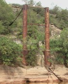
- Legend has it the bridge was burned during a dispute. This likely occurred before 1955. Some sources suggest it occurred before or during 1950. The road that leads to the Texas side of the former crossing is "Burned Out Bridge Road." Follow the image of the derelict tower to see the remains of the bridge.
- AUB mentions: "In January 1924, a contract was entered into with Nocona Bridge Company for a bridge across Red River, nine miles north of Nocona, connecting Texas and Oklahoma. The plans called for a 700' span, 16' roadway, and the main cables to contain 1,000 No. 9 galvanized wires each. The building of this, [the Austin Bridge Company's] first complete cable bridge, and the experience gained therefrom helped to launch Austin Bridge Company into an interesting and profitable line of work."
External Links:
- Nocona Suspension Bridge at Ketchum Bluff, Texas. University of Texas Arlington Libraries Digital Gallery
1925: Powhatan
Powhatan, Arkansas, USA - Black River
1926: Hidalgo-Reynosa International
Hidalgo, Texas, USA and Reynosa, Tamaulipas, Mexico - Rio Grande
| Bridgemeister ID: | 146 (added before 2003) |
| Year Completed: | 1926 |
| Name: | Hidalgo-Reynosa International |
| Location: | Hidalgo, Texas, USA and Reynosa, Tamaulipas, Mexico |
| Crossing: | Rio Grande |
| Principals: | Austin Bridge Co. |
| References: | AAJ, AUB, HAERTX98, PTS2 |
| Use: | Vehicular |
| Status: | Demolished, 1960's |
| Main Cables: | Wire (steel) |
| Suspended Spans: | 1 |
| Main Span: | 1 x 137.2 meters (450 feet) |
Notes:
- Damaged by flood, 1933. Rebuilt, 1934. Cables failed, 1939. Rebuilt.
1927: Bryan-Fannin
Telephone, Bonham vicinity, Fannin County, Texas and Bryan County, Oklahoma, USA - Red River
| Bridgemeister ID: | 602 (added 2003-01-11) |
| Year Completed: | 1927 |
| Name: | Bryan-Fannin |
| Also Known As: | Telephone, Snow's Ferry, Bryant-Fannin |
| Location: | Telephone, Bonham vicinity, Fannin County, Texas and Bryan County, Oklahoma, USA |
| Crossing: | Red River |
| Coordinates: | 33.844484 N 96.011125 W |
| Maps: | Acme, GeoHack, Google, OpenStreetMap |
| Principals: | Austin Bridge Co. |
| References: | AUB, PTS2 |
| Use: | Vehicular |
| Status: | Collapsed, December, 1940 |
| Main Cables: | Wire (steel) |
| Suspended Spans: | 3 |
| Main Span: | 1 |
| Side Spans: | 2 |
Notes:
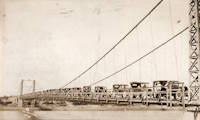
- Sometimes referenced as "Bryant-Fannin". The bridge unquestionably connected Fannin County to Bryan County, Oklahoma, but according to a www.rootsweb.com article (Fannin County TXGenWeb - Ferry's in Fannin County, from Pat Pryor, by Kathy J. Ellis) it was erected at a site known as "Bryant's Crossing" named for a local, Dave Bryant. The Steinman inventory lists it as "Bryan-Fannin". AUB mentions it as "Bryant-Fannin". The Rootsweb article also mentions it collapsed in 1940 under weight of a truck.
- An article in the December 6, 1940 issue of The Port Arthur News (Texas) titled: "Suspension Bridge Plunges Into Red River" describes the collapse: "Owners of a $75,000 tollbridge which plunged into the Red River Wednesday when a suspension cable anchor pulled loose were undecided today whether it would be rebuilt. The bridge, owned by the Austin Bridge company of Dallas, was near Telephone, Tex., 12 miles north of here, and was several miles from a principal highway. Most of the traffic from the Bonham area toward Oklahoma is across a structure built recently to replace a toll bridge at nearby Sowell's bluff that collapsed in 1930. Mrs. Jim Freeman, toll keeper, said she heard a 'rumble' and looked up to see the 'deadman anchor' pull loose, throwing the entire weight of the 1,300 foot span on the other cable. It snapped, and the flooring and steel framework of the bridge sagged into the water. No one was on the structure when it fell."
- Remains of three piers are still visible, 2019.
1927: Durant-Bonham
Bonham vicinity, Fannin County, Texas and Yuba/Durant vicinity, Oklahoma, USA - Red River
| Bridgemeister ID: | 603 (added 2003-01-11) |
| Year Completed: | 1927 |
| Name: | Durant-Bonham |
| Also Known As: | Sowell's Bluff |
| Location: | Bonham vicinity, Fannin County, Texas and Yuba/Durant vicinity, Oklahoma, USA |
| Crossing: | Red River |
| Principals: | Austin Bridge Co. |
| References: | AUB, PTS2 |
| Use: | Vehicular |
| Status: | Collapsed, 1934 |
| Main Cables: | Wire (steel) |
Notes:
- According to a rootsweb article (Fannin County TXGenWeb - Ferry's in Fannin County, from Pat Pryor, by Kathy J. Ellis), "when in 1932 this bridge fell, many people said that acid had been put on the cables to break them so that people from Oklahoma could not cross to Bonham." However, the true date of collapse may have been in 1934. The February 2, 1934 issue of The Daily Oklahoman has a front-page article with a photo of the bridge with collapsed deck. The photo is captioned: "The Red River Bridge on Highway 22 Near Durant After the Midnight Crash," and the article reads: "Here Is the debris of a $60,000 investment made by the states of Oklahoma and Texas eight months ago when they purchased the Bonham-Durant bridge across the Red river on highway 22. Three of the five spans of the 1,500-foot suspension bridge turned upside down and dropped into the river bed when a four-Inch wire cable rusted and broke in two about 15 feet from the ground on the Texas side. A lull in the usual heavy traffic across the bridge prevented accidents. The crash came at midnight, and one motorist had barely reached the Texas side when the cable gave away. Other motorists stopped their cars just in time to witness the spans of the bridge crash 40 feet into the stream. The bridge was built in 1926 and was operated as a toll bridge until 1933 when the two states bought it and made it a free crossing."
- In the October 1989 edition of the Oklahoma Water News an article (excerpted from an article in The Chronicles of Oklahoma by Dr. Bernice N. Crockett) states: "On January 15, 1934, a norther of terrific force came up which cause the Sowell's Bluff Bridge to fall. At 1 a.m. the wire cables on the Fannin side of the river became twisted, then snapped, broken in half, and the entire massive structure fell into the river below -- a complete wreck."
1927: Saint Jo
Illinois Bend, Saint Jo vicinity, Texas and Wilson vicinity, Oklahoma, USA - Red River
| Bridgemeister ID: | 601 (added 2003-01-11) |
| Year Completed: | 1927 |
| Name: | Saint Jo |
| Also Known As: | Airline, Air-Line |
| Location: | Illinois Bend, Saint Jo vicinity, Texas and Wilson vicinity, Oklahoma, USA |
| Crossing: | Red River |
| Coordinates: | 33.917051 N 97.486010 W |
| Maps: | Acme, GeoHack, Google, OpenStreetMap |
| Principals: | Austin Bridge Co. |
| References: | AUB, PTS2 |
| Use: | Vehicular (one-lane) |
| Status: | Removed |
| Main Cables: | Wire (steel) |
| Suspended Spans: | 1 |
| Main Span: | 1 x 213.4 meters (700 feet) |
External Links:
- St Jo "Airline" Suspension Bridge over the Red River Texas - Facebook. Coordinates provided here are based on the research presented in this Bridgehunting Texas Facebook group post.
1928: Des Arc
Des Arc, Arkansas, USA - White River
| Bridgemeister ID: | 152 (added before 2003) |
| Year Completed: | 1928 |
| Name: | Des Arc |
| Also Known As: | Swinging |
| Location: | Des Arc, Arkansas, USA |
| Crossing: | White River |
| Coordinates: | 34.974811 N 91.487684 W |
| Maps: | Acme, GeoHack, Google, OpenStreetMap |
| Principals: | Austin Bridge Co |
| References: | AUB, PTS2 |
| Use: | Vehicular |
| Status: | Demolished, August 1970 |
| Main Cables: | Wire (steel) |
| Suspended Spans: | 3 |
| Main Span: | 1 x 198.1 meters (650 feet) |
| Side Spans: | 2 x 97.5 meters (320 feet) |
Notes:
- The coordinates provided here indicate the approximate alignment of the bridge, about 0.5 miles southeast of the current (2020s) Des Arc White River crossing. The bridge delivered traffic near the east end of East Chester Street in Des Arc.
External Links:
| Bridgemeister ID: | 2378 (added 2007-10-21) |
| Year Completed: | 1929 |
| Name: | Idabel-Clarksville |
| Location: | Idabel vicinity, Oklahoma and Clarksville vicinity, Texas, USA |
| Crossing: | Red River |
| Principals: | Austin Bridge Co. |
| References: | AUB |
| Use: | Vehicular |
| Status: | Destroyed, 1933 |
| Main Cables: | Wire (steel) |
| Suspended Spans: | 3 |
| Main Span: | 1 x 213.4 meters (700 feet) |
| Side Spans: | 2 x 76.2 meters (250 feet) |
| Deck width: | 16 feet |
Notes:
- The November 1933 issue of The Wisconsin Engineer (a publication of the University of Wisconsin) has an article by C.W.P. Walter about research that was being performed by the University of Wisconsin's Engineering Department: "The particular hardware laden contrivance [in the Engineering Building] is a half-model of the Red River Bridge which carried light highway traffic between Clarksville, Texas, and Idabel, Oklahoma. In the early part of this year movement of the Red River as a result of flood waters washed away one of the intermediate piers supporting the end spans, and cause the cable to drop and be subjected to impact loading. It was contended by the company owning the bridge that the cable was overstressed and injured to such an extent that it would be necessary for the insurance company to replace the cable as well as the pier. A committee... was appointed to investigate the questions involved. While the investigation proceeded the Red River continued to scour away the foundation of the existing piers, ultimately causing the bridge to collapse completely."
- AUB mentions this bridge very briefly: "In 1928, [Jim Diamond] was employed by Austin Bridge Company as a consultant on the super-structure and cable work for the White River bridge at Des Arc. Later in the same year, he represented the owners as job engineer on the bridge built by the Company across Red River above Clarksville, Texas."
- Apparently this bridge was damaged by flood the same week it was supposed to open. In the October 1989 edition of the Oklahoma Water News an article (excerpted from an article in The Chronicles of Oklahoma by Dr. Bernice N. Crockett) writes: "The Austin Bridge Company completed the bridge May 19, 1929, but on May 23, when more than 400 people went to see the new bridge opened, an estimated 40 feet of the Red River bank had caved in near the bridge. Heavy rains continued to hinder road construction. A resident near the bridge recalled the night of May 19, 1929, as the night the river changed its course, and by morning had moved the entire structure into Oklahoma." The bridge eventually opened on June 20.
- The Friday December 30, 1932 edition of The Port Arthur News ran an article "Red River Bridge Damaged By Water". Texarkana, Dec. 30 (1932).: "High stages in Red River, that earlier this week demolished the Texas side approach to the privately owned suspension bridge [?] miles north of Clarksville on highway 37 to Idabel have been in recession since Wednesday but indicated continued heavy rains such as last night are expected to bring additional high water with probably further damage to the bridge. More than 50 feet of the approach is gone and the ground piers have crumpled, leaving the anchor cables alone holding the bridge in place."
- It appears the final end to this short-lived bridge didn't come until late May, 1933 when it was completely destroyed by flood.
External Links:
- Historic Suspension Bridges: Advent of the State Highway Department. This Texas Department of Transportation page mentions: "Five of the eleven suspension bridges built by [Austin Bridge Company] were toll bridges over the Red River. The Red River is notorious for its volatile, melting, red clay banks. The bridge between Clarksville, Texas, and Idabel, Oklahoma, was built by ABC in 1928, and washed out during flooding in 1932."
1932: Prairie du Chien
Praire du Chien, Wisconsin and Marquette, Iowa, USA - Mississippi River
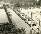
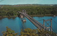
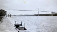
| Bridgemeister ID: | 177 (added before 2003) |
| Year Completed: | 1932 |
| Name: | Prairie du Chien |
| Location: | Praire du Chien, Wisconsin and Marquette, Iowa, USA |
| Crossing: | Mississippi River |
| Coordinates: | 43.046 N 91.17 W |
| Maps: | Acme, GeoHack, Google, OpenStreetMap |
| Principals: | Austin Bridge Co. |
| References: | AAJ, AUB, BPL |
| Use: | Vehicular (two-lane) |
| Status: | Removed, 1974 |
| Main Cables: | Wire (steel) |
| Main Span: | 1 x 144.2 meters (473 feet) |
Notes:
- There were two back-to-back suspension bridges at this location.
- Connects to 1932 Prairie du Chien - Praire du Chien, Wisconsin and Marquette, Iowa, USA.
External Links:
1932: Prairie du Chien
Praire du Chien, Wisconsin and Marquette, Iowa, USA - Mississippi River
| Bridgemeister ID: | 1256 (added before 2003) |
| Year Completed: | 1932 |
| Name: | Prairie du Chien |
| Location: | Praire du Chien, Wisconsin and Marquette, Iowa, USA |
| Crossing: | Mississippi River |
| Coordinates: | 43.05 N 91.162 W |
| Maps: | Acme, GeoHack, Google, OpenStreetMap |
| Principals: | Austin Bridge Co. |
| References: | AAJ, AUB, BPL |
| Use: | Vehicular (two-lane) |
| Status: | Removed, 1974 |
| Main Cables: | Wire (steel) |
| Main Span: | 1 x 144.2 meters (473 feet) |
Notes:
- There were two back-to-back suspension bridges at this location.
- Connects to 1932 Prairie du Chien - Praire du Chien, Wisconsin and Marquette, Iowa, USA.
External Links:


1939: (suspension bridge)
Bend, Texas, USA - Colorado River
| Bridgemeister ID: | 1616 (added 2005-02-26) |
| Year Completed: | 1939 |
| Name: | (suspension bridge) |
| Location: | Bend, Texas, USA |
| Crossing: | Colorado River |
| Principals: | Austin Bridge Co. |
| References: | AUB |
| Use: | Vehicular |
| Status: | Removed |
| Main Cables: | Wire (steel) |
| Suspended Spans: | 3 |
| Main Span: | 1 |
| Side Spans: | 2 |
Notes:
- Similar to 1939 Regency - Regency, Texas, USA. The Bend bridge is pictured in AUB. At first, I thought it was the nearby Regency bridge, but upon closer inspection, the Bend bridge had suspended approach spans. Regency did not. Otherwise, they are very similar in appearance, both having been built in the same year by the same company.
1939: Regency
Regency, Texas, USA - Colorado River
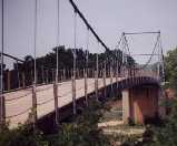
| Bridgemeister ID: | 195 (added before 2003) |
| Year Completed: | 1939 |
| Name: | Regency |
| Location: | Regency, Texas, USA |
| Crossing: | Colorado River |
| Coordinates: | 31.41167 N 98.84667 W |
| Maps: | Acme, GeoHack, Google, OpenStreetMap |
| Principals: | Austin Bridge Co. |
| References: | AUB |
| Use: | Vehicular (one-lane) |
| Status: | In use (last checked: 2008) |
| Main Cables: | Wire (steel) |
| Suspended Spans: | 1 |
| Main Span: | 1 x 103.6 meters (340 feet) |
Notes:
- Similar to 1939 (suspension bridge) - Bend, Texas, USA.
External Links:
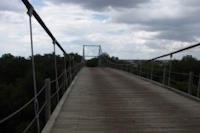
1949: (pipeline bridge)
Purcell vicinity, Oklahoma, USA - Canadian River
| Bridgemeister ID: | 1447 (added 2004-07-31) |
| Year Completed: | 1949 |
| Name: | (pipeline bridge) |
| Location: | Purcell vicinity, Oklahoma, USA |
| Crossing: | Canadian River |
| Principals: | Austin Bridge Co. |
| References: | AUB |
| Use: | Pipeline |
| Main Cables: | Wire (steel) |
Notes:
- Unusual for a pipeline suspension bridge, this bridge has at least two main spans.
1950: (pipeline bridge)
Clanton vicinity, Alabama, USA - Coosa River
| Bridgemeister ID: | 1446 (added 2004-07-31) |
| Year Completed: | 1950 |
| Name: | (pipeline bridge) |
| Location: | Clanton vicinity, Alabama, USA |
| Crossing: | Coosa River |
| Coordinates: | 32.794583 N 86.429267 W |
| Maps: | Acme, GeoHack, Google, OpenStreetMap |
| Principals: | Austin Bridge Co. |
| References: | AUB |
| Use: | Pipeline |
| Status: | Extant (last checked: 2005) |
| Main Cables: | Wire (steel) |
| Suspended Spans: | 1 |
| Main Span: | 1 x 213.4 meters (700 feet) |
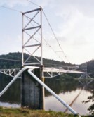
(suspension bridge)
Bazette Crossing and Trinidad, Texas, USA - Trinity River
| Bridgemeister ID: | 598 (added 2003-01-11) |
| Name: | (suspension bridge) |
| Location: | Bazette Crossing and Trinidad, Texas, USA |
| Crossing: | Trinity River |
| References: | AUB |
| Main Cables: | Wire |
Notes:
- Repaired by Austin Bridge Company, 1922.
(suspension bridge)
Decatur vicinity, Wise County, Texas, USA - Trinity River
| Bridgemeister ID: | 599 (added 2003-01-11) |
| Name: | (suspension bridge) |
| Location: | Decatur vicinity, Wise County, Texas, USA |
| Crossing: | Trinity River |
| References: | AUB |
Notes:
- Repaired by Austin Bridge Company, 1923.
(suspension bridge)
Mineral Wells and Palo Pinto, Texas, USA - Brazos River
| Bridgemeister ID: | 596 (added 2003-01-11) |
| Name: | (suspension bridge) |
| Location: | Mineral Wells and Palo Pinto, Texas, USA |
| Crossing: | Brazos River |
| References: | AUB |
| Main Cables: | Wire |