Inventory Search Results
28 suspension bridges were found for search criteria: BAAW. All 28 bridges from the search results appear below. Click the Bridgemeister ID number to isolate the bridge on its own page. If you don't see what you were looking for, try an image search with the same criteria: BAAW. This will find the bridge if it is pictured on the site, but is not a catenary suspension bridge.
Related:
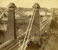
1855: Niagara Suspension
Niagara Falls, New York, USA and Niagara Falls, Ontario, Canada - Niagara River
| Bridgemeister ID: | 51 (added before 2003) |
| Year Completed: | 1855 |
| Name: | Niagara Suspension |
| Location: | Niagara Falls, New York, USA and Niagara Falls, Ontario, Canada |
| Crossing: | Niagara River |
| Principals: | John A. Roebling |
| References: | AAJ, BAAW, BBR, BFL, BMA, BOB, BPL, HBE, LIR, NSB, ONF, PTS2, SA18810716, SJR |
| Use: | Rail (heavy rail) and Vehicular (double-deck), with walkway |
| Status: | Replaced, 1897 |
| Main Cables: | Wire (iron) |
| Suspended Spans: | 1 |
| Main Span: | 1 x 250.3 meters (821.3 feet) |
Notes:
- Cables renovated, 1877. Wooden stiffening trusses replaced, 1880. Towers replaced, c. 1886. Bridge replaced with steel arch, 1897.
- AAJ notes the roadway deck opened in 1854, but the railway deck did not open until 1855.
- Replaced 1848 Niagara Suspension - Niagara Falls, New York, USA and Niagara Falls, Ontario, Canada.
External Links:
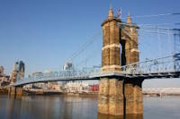
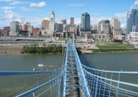
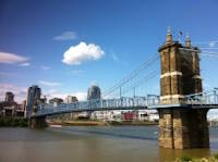
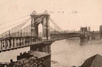
1867: John A. Roebling
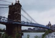
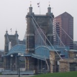
Cincinnati, Ohio and Covington, Kentucky, USA - Ohio River
| Bridgemeister ID: | 65 (added before 2003) |
| Year Completed: | 1867 |
| Name: | John A. Roebling |
| Also Known As: | Cincinnati, Cincinnati and Covington |
| Location: | Cincinnati, Ohio and Covington, Kentucky, USA |
| Crossing: | Ohio River |
| Coordinates: | 39.09167 N 84.50833 W |
| Maps: | Acme, GeoHack, Google, OpenStreetMap |
| Principals: | John A. Roebling |
| References: | BAAW, BC3, BOB, BPL, COB, EOV, HBE, LAB, LACE, ONF, PTS2, SJR, TOB |
| Use: | Vehicular (two-lane), with walkway |
| Status: | Closed, February, 2021 (last checked: 2021) |
| Main Cables: | Wire (iron) |
| Suspended Spans: | 3 |
| Main Span: | 1 x 322.2 meters (1,057 feet) |
| Side Spans: | 2 |
Notes:
- 1892: Cable ends restored.
- 1899: Steel cables added to assist original cables.
- 2021, February: Closed to all vehicular traffic for a nine-month restoration project.
- Became longest suspension bridge by eclipsing 1849 Wheeling (Wheeling and Belmont) - Wheeling, West Virginia, USA.
- Eclipsed by new longest suspension bridge 1869 Clifton (Niagara-Clifton, Falls View, First Falls View) - Niagara Falls, New York, USA and Niagara Falls, Ontario, Canada.
External Links:
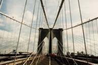
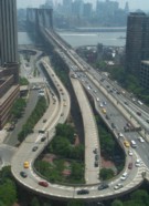
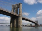
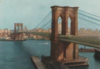
1883: Brooklyn
New York and Brooklyn, New York, USA - East River
| Bridgemeister ID: | 89 (added before 2003) |
| Year Completed: | 1883 |
| Name: | Brooklyn |
| Also Known As: | Great East River |
| Location: | New York and Brooklyn, New York, USA |
| Crossing: | East River |
| Coordinates: | 40.706 N 73.99667 W |
| Maps: | Acme, GeoHack, Google, OpenStreetMap |
| Principals: | John A. Roebling, Washington A. Roebling |
| References: | AAJ, BAAW, BBR, BBTS, BC3, BFL, BLD, BMA, BOB, BOU, BPL, COB, CTW, GB, GBD, HBE, LAB, LACE, NG198305, ONF, PTS2, SJR |
| Use: | Rail (light rail) and Vehicular (major highway), with walkway |
| Status: | In use (last checked: 2022) |
| Main Cables: | Wire (steel) |
| Suspended Spans: | 3 |
| Main Span: | 1 x 486.3 meters (1,595.5 feet) |
| Side Spans: | 2 x 283.5 meters (930 feet) |
| Deck width: | 85 feet |
Notes:
- Became longest suspension bridge by eclipsing 1869 Clifton (Niagara-Clifton, Falls View, First Falls View) - Niagara Falls, New York, USA and Niagara Falls, Ontario, Canada.
- Eclipsed by new longest suspension bridge 1903 Williamsburg - New York and Brooklyn, New York, USA.
- Next to 1909 Manhattan - New York and Brooklyn, New York, USA.
- Near 1903 Williamsburg - New York and Brooklyn, New York, USA.
External Links:
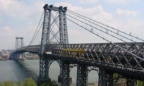
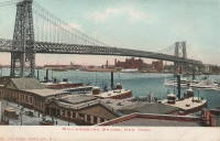
1903: Williamsburg
New York and Brooklyn, New York, USA - East River
| Bridgemeister ID: | 111 (added before 2003) |
| Year Completed: | 1903 |
| Name: | Williamsburg |
| Location: | New York and Brooklyn, New York, USA |
| Crossing: | East River |
| Coordinates: | 40.71355 N 73.97226 W |
| Maps: | Acme, GeoHack, Google, OpenStreetMap |
| Principals: | L.L. Buck |
| References: | AAJ, BAAW, BAR, BBR, BPL, GBD, HBE, PTS2, SJR |
| Use: | Rail (light rail) and Vehicular (major highway), with walkway |
| Status: | In use (last checked: 2022) |
| Main Cables: | Wire (steel) |
| Suspended Spans: | 1 |
| Main Span: | 1 x 487.7 meters (1,600 feet) |
Notes:
- Became longest suspension bridge by eclipsing 1883 Brooklyn (Great East River) - New York and Brooklyn, New York, USA.
- Eclipsed by new longest suspension bridge 1924 Bear Mountain - Anthony's Nose and Bear Mountain, New York, USA.
- Near 1883 Brooklyn (Great East River) - New York and Brooklyn, New York, USA.
- Near 1909 Manhattan - New York and Brooklyn, New York, USA.
External Links:
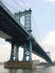
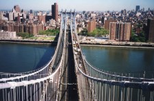
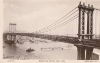
1909: Manhattan
New York and Brooklyn, New York, USA - East River
| Bridgemeister ID: | 123 (added before 2003) |
| Year Completed: | 1909 |
| Name: | Manhattan |
| Location: | New York and Brooklyn, New York, USA |
| Crossing: | East River |
| Coordinates: | 40.70667 N 73.99167 W |
| Maps: | Acme, GeoHack, Google, OpenStreetMap |
| Principals: | O.F. Nichols, Leon Moisseiff |
| References: | AAJ, BAAW, BBR, BC3, BPL, GBD, HBE, LAB, PTS2, SA19050909, SJR |
| Use: | Vehicular (double-deck) |
| Status: | In use (last checked: 2022) |
| Main Cables: | Wire (steel) |
| Suspended Spans: | 3 |
| Main Span: | 1 x 448.1 meters (1,470 feet) |
| Side Spans: | 2 x 221 meters (725 feet) |
Notes:
- Opened December 31, 1909, but not fully completed yet.
- Next to 1883 Brooklyn (Great East River) - New York and Brooklyn, New York, USA.
- Near 1903 Williamsburg - New York and Brooklyn, New York, USA.
External Links:

1916: Katsuyama
Japan
1921: Niyodo
Japan
1922: Kawamoto
Japan
1923: Kaneyama
Japan
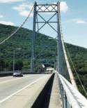
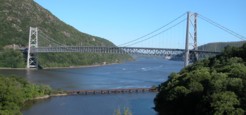
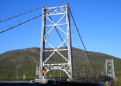
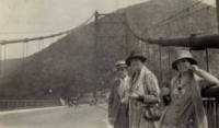
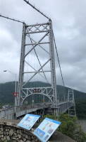
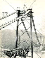
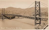
1924: Bear Mountain
Anthony's Nose and Bear Mountain, New York, USA - Hudson River
| Bridgemeister ID: | 141 (added before 2003) |
| Year Completed: | 1924 |
| Name: | Bear Mountain |
| Location: | Anthony's Nose and Bear Mountain, New York, USA |
| Crossing: | Hudson River |
| Coordinates: | 41.32 N 73.985 W |
| Maps: | Acme, GeoHack, Google, OpenStreetMap |
| Principals: | Howard C. Baird |
| References: | AAJ, BAAW, BBR, CPW, PTS2, SJR |
| Use: | Vehicular (two-lane, heavy vehicles), with walkway |
| Status: | In use (last checked: 2022) |
| Main Cables: | Wire (steel) |
| Suspended Spans: | 1 |
| Main Span: | 1 x 497.4 meters (1,632 feet) |
| Deck width: | 48 feet |
Notes:
- Became longest suspension bridge by eclipsing 1903 Williamsburg - New York and Brooklyn, New York, USA.
- Eclipsed by new longest suspension bridge 1926 Benjamin Franklin (Philadelphia-Camden) - Philadelphia, Pennsylvania and Camden, New Jersey, USA.
- Near 2002 Popolopen (William J. Moreau Popolopen) - Fort Montgomery, New York, USA.
External Links:
1924: Shoki
Japan
1927: Miyoshi
Tokushima, Tokushima, Japan - Yoshino River
| Bridgemeister ID: | 1145 (added 2004-01-17) |
| Year Completed: | 1927 |
| Name: | Miyoshi |
| Location: | Tokushima, Tokushima, Japan |
| Crossing: | Yoshino River |
| References: | BAAW |
| Status: | Removed |
| Main Cables: | Wire |
| Main Span: | 1 x 139.9 meters (459 feet) |
Notes:
- BAAW: suspension cables removed, 1989, replaced by arches. However, the modified structure (pictured in BAAW) appears to be more of a continuous truss than an arch-based structure. The bridge appears to have been subsequently removed entirely as there are no current (as of 2020) Yoshino River bridges near Myoshi resembling the bridge.
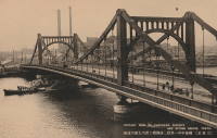
1928: Kiyosu
Chuo City, Tokyo, Japan - Sumida River
| Bridgemeister ID: | 440 (added before 2003) |
| Year Completed: | 1928 |
| Name: | Kiyosu |
| Also Known As: | 清洲橋 |
| Location: | Chuo City, Tokyo, Japan |
| Crossing: | Sumida River |
| Coordinates: | 35.682395 N 139.792022 E |
| Maps: | Acme, GeoHack, Google, OpenStreetMap |
| Principals: | Yutaka Tanaka |
| References: | AAJ, BAAW, PTS2, SSS |
| Use: | Vehicular (four-lane), with walkway |
| Status: | In use (last checked: 2022) |
| Main Cables: | Eyebar (steel) |
| Suspended Spans: | 3 |
| Main Span: | 1 x 91.4 meters (299.9 feet) |
| Side Spans: | 2 |
| Deck width: | 85 feet |
| Characteristics: | Self-anchored |
Notes:
- Self-anchored.
- 2019: Major rehabilitation in progress.
External Links:
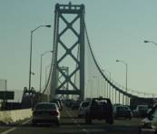
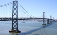
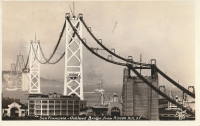
1936: San Francisco-Oakland Bay
Oakland and San Francisco, California, USA - San Francisco Bay
| Bridgemeister ID: | 184 (added before 2003) |
| Year Completed: | 1936 |
| Name: | San Francisco-Oakland Bay |
| Location: | Oakland and San Francisco, California, USA |
| Crossing: | San Francisco Bay |
| Coordinates: | 37.78667 N 122.39 W |
| Maps: | Acme, GeoHack, Google, OpenStreetMap |
| Principals: | C.H. Purcell, Glenn B. Woodruff |
| References: | AAJ, AZB, BAAW, BC3, BPL, GBD, LAB, OBB1, SFOM, USS |
| Use: | Vehicular (double-deck) |
| Status: | In use (last checked: 2022) |
| Main Cables: | Wire (steel) |
| Suspended Spans: | 6 |
| Main Spans: | 1 x 678 meters (2,224.4 feet), 1 x 673.6 meters (2,210 feet) |
| Side Spans: | 4 |
| Deck width: | 66 feet (58 feet roadway) |
Notes:
External Links:

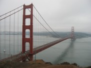
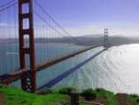
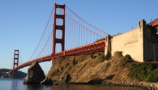
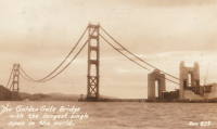
1937: Golden Gate
San Francisco and Marin County, California, USA - San Francisco Bay
| Bridgemeister ID: | 188 (added before 2003) |
| Year Completed: | 1937 |
| Name: | Golden Gate |
| Location: | San Francisco and Marin County, California, USA |
| Crossing: | San Francisco Bay |
| Coordinates: | 37.82 N 122.47667 W |
| Maps: | Acme, GeoHack, Google, OpenStreetMap |
| Principals: | Joseph B. Strauss, Leon Moisseiff, Charles A. Ellis, Irving F. Morrow |
| References: | AAJ, AZB, BAAW, BBR, BC3, BFL, BLD, BMA, BOU, BPL, BRU, COB, CTW, GAT, GBD, GGB, LAB, SPG |
| Use: | Vehicular (major highway), with walkway |
| Status: | In use (last checked: 2022) |
| Main Cables: | Wire (steel) |
| Suspended Spans: | 3 |
| Main Span: | 1 x 1,280.2 meters (4,200 feet) |
| Side Spans: | 2 x 343 meters (1,125.41 feet) |
| Deck width: | 80 feet |
Notes:
- Became longest suspension bridge by eclipsing 1931 George Washington (GWB) - New York, New York and Fort Lee, New Jersey, USA.
- Eclipsed by new longest suspension bridge 1964 Verrazzano Narrows (Verrazano Narrows) - Brooklyn and Staten Island, New York, USA.
External Links:

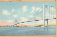
1939: Bronx-Whitestone
The Bronx and Queens, New York, USA - East River
| Bridgemeister ID: | 191 (added before 2003) |
| Year Completed: | 1939 |
| Name: | Bronx-Whitestone |
| Location: | The Bronx and Queens, New York, USA |
| Crossing: | East River |
| Coordinates: | 40.80167 N 73.83 W |
| Maps: | Acme, GeoHack, Google, OpenStreetMap |
| Principals: | O. H. Ammann, Allston Dana |
| References: | AAJ, ARF, BAAW, BBR, BFL, BPL, GBD, SIX |
| Use: | Vehicular (major highway) |
| Status: | In use (last checked: 2022) |
| Main Cables: | Wire (steel) |
| Suspended Spans: | 3 |
| Main Span: | 1 x 701 meters (2,300 feet) |
| Side Spans: | 2 x 224 meters (735 feet) |
Notes:
External Links:

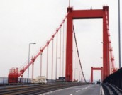
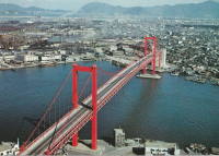
| Bridgemeister ID: | 462 (added before 2003) |
| Year Completed: | 1962 |
| Name: | Wakato |
| Also Known As: | 若戸大橋 |
| Location: | Kita-Kyusyu, Fukuoka, Japan |
| Crossing: | Dokai Bay |
| Coordinates: | 33.902895 N 130.816602 E |
| Maps: | Acme, GeoHack, Google, OpenStreetMap |
| Use: | Vehicular (major highway) |
| Status: | In use (last checked: 2019) |
| Main Cables: | Wire (steel) |
| Suspended Spans: | 3 |
| Main Span: | 1 |
| Side Spans: | 2 |
Notes:
- BAAW: First suspension bridge in Japan with main span exceeding 300 meters.
External Links:
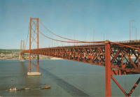
1966: 25 de Abril
Lisbon, Portugal - Tagus River
| Bridgemeister ID: | 464 (added before 2003) |
| Year Completed: | 1966 |
| Name: | 25 de Abril |
| Also Known As: | Tagus, Salazar, April 25th |
| Location: | Lisbon, Portugal |
| Crossing: | Tagus River |
| Coordinates: | 38.6968 N 9.179 W |
| Maps: | Acme, GeoHack, Google, OpenStreetMap |
| Principals: | David B. Steinman, Ray M. Boynton, et. al. |
| References: | BAAW, BAR, BBR, BC3, BDU, BFL, BMA, CTW |
| Use: | Rail and Vehicular (major highway) |
| Status: | In use (last checked: 2019) |
| Main Cables: | Wire (steel) |
| Suspended Spans: | 3 |
| Main Span: | 1 x 1,012.9 meters (3,323 feet) |
| Side Spans: | 2 x 483.4 meters (1,586 feet) |
Notes:
- Major retrofit completed in 1999 to add rail deck and extra vehicle lane.
External Links:
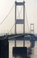
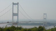
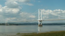
1966: Severn
Aust and Beachley, England, United Kingdom - River Severn
| Bridgemeister ID: | 465 (added before 2003) |
| Year Completed: | 1966 |
| Name: | Severn |
| Also Known As: | First Severn Crossing |
| Location: | Aust and Beachley, England, United Kingdom |
| Crossing: | River Severn |
| Coordinates: | 51.610422 N 2.641658 W |
| Maps: | Acme, GeoHack, Google, OpenStreetMap |
| References: | AOB, BAAW, BBR, BDU, BFL, COB, NTB, SEV |
| Use: | Vehicular (major highway) |
| Status: | In use (last checked: 2021) |
| Main Cables: | Wire (steel) |
| Suspended Spans: | 3 |
| Main Span: | 1 x 987.6 meters (3,240 feet) |
| Side Spans: | 2 x 304.8 meters (1,000 feet) |
External Links:
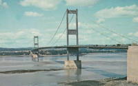
1973: Kanmon
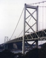
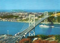
Shimonoseki (下関市), Yamaguchi and Moji Ward, Kitakyushu City ( 北九州市), Fukuoka, Japan - Kanmon Straits
| Bridgemeister ID: | 468 (added before 2003) |
| Year Completed: | 1973 |
| Name: | Kanmon |
| Also Known As: | 関門橋, Kanmonkyō |
| Location: | Shimonoseki (下関市), Yamaguchi and Moji Ward, Kitakyushu City ( 北九州市), Fukuoka, Japan |
| Crossing: | Kanmon Straits |
| Coordinates: | 33.961829 N 130.958562 E |
| Maps: | Acme, GeoHack, Google, OpenStreetMap |
| References: | BAAW |
| Use: | Vehicular (major highway) |
| Status: | In use (last checked: 2019) |
| Main Cables: | Wire (steel) |
| Suspended Spans: | 3 |
| Main Span: | 1 x 712 meters (2,336 feet) |
| Side Spans: | 2 |
External Links:
1977: Hirado
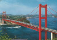
Hirado, Nagasaki and Japan - Hiradoseto Strait
| Bridgemeister ID: | 474 (added before 2003) |
| Year Completed: | 1977 |
| Name: | Hirado |
| Also Known As: | 平戸大橋 |
| Location: | Hirado, Nagasaki and Japan |
| Crossing: | Hiradoseto Strait |
| Coordinates: | 33.356794 N 129.572374 E |
| Maps: | Acme, GeoHack, Google, OpenStreetMap |
| References: | BAAW |
| Use: | Vehicular (two-lane, heavy vehicles), with walkway |
| Status: | In use (last checked: 2019) |
| Main Cables: | Wire (steel) |
| Suspended Spans: | 1 |
| Main Span: | 1 x 465.5 meters (1,527.2 feet) |
External Links:
1983: Innoshima
Onomichi, Hiroshima, Japan - Mekariseto Strait
| Bridgemeister ID: | 476 (added before 2003) |
| Year Completed: | 1983 |
| Name: | Innoshima |
| Also Known As: | 因島大橋 |
| Location: | Onomichi, Hiroshima, Japan |
| Crossing: | Mekariseto Strait |
| Coordinates: | 34.357320 N 133.180017 E |
| Maps: | Acme, GeoHack, Google, OpenStreetMap |
| Principals: | Honshu-Shikoku Bridge Authority |
| References: | BAAW, BDU |
| Use: | Vehicular (major highway), with walkway |
| Status: | In use (last checked: 2019) |
| Main Cables: | Wire (steel) |
| Suspended Spans: | 3 |
| Main Span: | 1 x 770 meters (2,526.2 feet) |
| Side Spans: | 2 x 250 meters (820.2 feet) |
External Links:

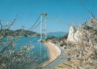
1983: Matadi
Matadi, Dem. Rep. of the Congo (Zaire) - Congo River
| Bridgemeister ID: | 477 (added before 2003) |
| Year Completed: | 1983 |
| Name: | Matadi |
| Location: | Matadi, Dem. Rep. of the Congo (Zaire) |
| Crossing: | Congo River |
| Coordinates: | 5.825215 S 13.434341 E |
| Maps: | Acme, GeoHack, Google, OpenStreetMap |
| References: | BAAW |
| Use: | Vehicular (two-lane, heavy vehicles) |
| Status: | In use (last checked: 2019) |
| Main Cables: | Wire (steel) |
| Suspended Spans: | 1 |
| Main Span: | 1 x 520 meters (1,706 feet) |
Notes:
- Longest suspension bridge in Africa when completed.
- Designed to carry a railway on deck below the roadway, but it does not appear the railway was ever operational. From photos of the site, it doesn't appear rail approaches could have been accomodated unless there are tunnels on both sides of the bridge.
External Links:
1984: Ohnaruto
Awajishima, Hyogo and Naruto, Tokushima, Japan - Naruto Strait
| Bridgemeister ID: | 480 (added before 2003) |
| Year Completed: | 1984 |
| Name: | Ohnaruto |
| Also Known As: | Onaruto |
| Location: | Awajishima, Hyogo and Naruto, Tokushima, Japan |
| Crossing: | Naruto Strait |
| Coordinates: | 34.238877 N 134.651243 E |
| Maps: | Acme, GeoHack, Google, OpenStreetMap |
| Principals: | Honshu-Shikoku Bridge Authority |
| References: | BAAW, BAR, BBR, BDU |
| Use: | Vehicular (major highway) |
| Status: | In use (last checked: 2019) |
| Main Cables: | Wire (steel) |
| Suspended Spans: | 3 |
| Main Span: | 1 x 876 meters (2,874 feet) |
| Side Spans: | 2 x 330 meters (1,082.7 feet) |
| Deck width: | 34 meters |
External Links:
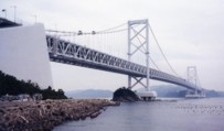
1987: Kita Bisan-Seto
Yoshima Island and Sakaide, Kagawa, Japan - Seto Inland Sea
| Bridgemeister ID: | 481 (added before 2003) |
| Year Completed: | 1987 |
| Name: | Kita Bisan-Seto |
| Also Known As: | 北備讃瀬戸大橋 |
| Location: | Yoshima Island and Sakaide, Kagawa, Japan |
| Crossing: | Seto Inland Sea |
| Coordinates: | 34.379065 N 133.820065 E |
| Maps: | Acme, GeoHack, Google, OpenStreetMap |
| Principals: | Honshu-Shikoku Bridge Authority |
| References: | BAAW, BAR, BBR, BDU |
| Use: | Vehicular (major highway) and Rail |
| Status: | In use (last checked: 2019) |
| Main Cables: | Wire (steel) |
| Suspended Spans: | 3 |
| Main Span: | 1 x 990 meters (3,248 feet) |
| Side Spans: | 2 x 274 meters (899 feet) |
| Deck width: | 35 meters upper deck, 30 meters lower deck |
Notes:
- Connects to 1988 Minami Bisan-Seto (南備讃瀬戸大橋) - Yoshima Island (与島) and Sakaide (坂出市), Kagawa, Japan.
- Near 1988 Shimotsui-Seto (下津井瀬戸大橋) - Kojima, Okayama and Hitsuishijima (櫃石島), Kagawa, Japan.
External Links:
1988: Minami Bisan-Seto
Yoshima Island (与島) and Sakaide (坂出市), Kagawa, Japan - Seto Inland Sea
| Bridgemeister ID: | 485 (added before 2003) |
| Year Completed: | 1988 |
| Name: | Minami Bisan-Seto |
| Also Known As: | 南備讃瀬戸大橋 |
| Location: | Yoshima Island (与島) and Sakaide (坂出市), Kagawa, Japan |
| Crossing: | Seto Inland Sea |
| Coordinates: | 34.364167 N 133.825278 E |
| Maps: | Acme, GeoHack, Google, OpenStreetMap |
| Principals: | Honshu-Shikoku Bridge Authority |
| References: | BAAW, BAR, BBR, BDU |
| Use: | Vehicular (major highway) and Rail |
| Status: | In use (last checked: 2019) |
| Main Cables: | Wire (steel) |
| Suspended Spans: | 3 |
| Main Span: | 1 x 1,100 meters (3,608.9 feet) |
| Side Spans: | 2 x 274 meters (899 feet) |
| Deck width: | 35 meters upper deck, 30 meters lower deck |
Notes:
- Connects to 1987 Kita Bisan-Seto (北備讃瀬戸大橋) - Yoshima Island and Sakaide, Kagawa, Japan.
- Near 1988 Shimotsui-Seto (下津井瀬戸大橋) - Kojima, Okayama and Hitsuishijima (櫃石島), Kagawa, Japan.
External Links:

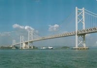
| Bridgemeister ID: | 484 (added before 2003) |
| Year Completed: | 1988 |
| Name: | Ohshima |
| Also Known As: | 伯方・大島大橋 |
| Location: | Hakata Island, Imabari and Imabari (今治市), Ehime, Japan |
| Coordinates: | 34.192724 N 133.072966 E |
| Maps: | Acme, GeoHack, Google, OpenStreetMap |
| Principals: | Honshu-Shikoku Bridge Authority |
| References: | BAAW, BAR |
| Use: | Vehicular (major highway) |
| Status: | In use (last checked: 2019) |
| Main Cables: | Wire (steel) |
| Suspended Spans: | 1 |
| Main Span: | 1 x 560 meters (1,837.3 feet) |
| Deck width: | 23.7 meters |
External Links:
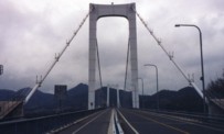
1988: Shimotsui-Seto
Kojima, Okayama and Hitsuishijima (櫃石島), Kagawa, Japan - Seto Inland Sea
| Bridgemeister ID: | 486 (added before 2003) |
| Year Completed: | 1988 |
| Name: | Shimotsui-Seto |
| Also Known As: | 下津井瀬戸大橋 |
| Location: | Kojima, Okayama and Hitsuishijima (櫃石島), Kagawa, Japan |
| Crossing: | Seto Inland Sea |
| Coordinates: | 34.431483 N 133.807833 E |
| Maps: | Acme, GeoHack, Google, OpenStreetMap |
| Principals: | Honshu-Shikoku Bridge Authority |
| References: | AOB, BAAW, BAR, BBR, BDU |
| Use: | Vehicular (major highway) |
| Status: | In use (last checked: 2019) |
| Main Cables: | Wire (steel) |
| Suspended Spans: | 1 |
| Main Span: | 1 x 940 meters (3,084 feet) |
Notes:
- Near 1987 Kita Bisan-Seto (北備讃瀬戸大橋) - Yoshima Island and Sakaide, Kagawa, Japan.
- Near 1988 Minami Bisan-Seto (南備讃瀬戸大橋) - Yoshima Island (与島) and Sakaide (坂出市), Kagawa, Japan.
External Links:
