Inventory Search Results
4 suspension bridges were found for search criteria: BC2. All 4 bridges from the search results appear below. Click the Bridgemeister ID number to isolate the bridge on its own page. If you don't see what you were looking for, try an image search with the same criteria: BC2. This will find the bridge if it is pictured on the site, but is not a catenary suspension bridge.
Related:
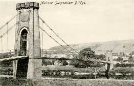
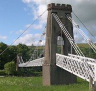
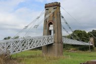
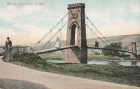
1826: Gattonside
Melrose, Scotland, United Kingdom - River Tweed
| Bridgemeister ID: | 381 (added before 2003) |
| Year Completed: | 1826 |
| Name: | Gattonside |
| Also Known As: | Melrose |
| Location: | Melrose, Scotland, United Kingdom |
| Crossing: | River Tweed |
| Coordinates: | 55.602830 N 2.723349 W |
| Maps: | Acme, GeoHack, Google, OpenStreetMap |
| Principals: | Redpath and Brown |
| References: | BC2, BSI, NTB |
| Use: | Footbridge |
| Status: | In use (last checked: 2014) |
| Main Cables: | Chain (iron) |
| Suspended Spans: | 3 |
| Main Span: | 1 x 91.4 meters (300 feet) |
| Side Spans: | 2 |
| Deck width: | 4 feet 4 inches |
Notes:
- Steel cables added, 1992.
External Links:
1860: Ponte delle Catene
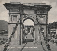
Fornoli, Bagni di Lucca and Chifenti, Italy - Lima River
| Bridgemeister ID: | 411 (added before 2003) |
| Year Completed: | 1860 |
| Name: | Ponte delle Catene |
| Also Known As: | Catena, Bridge of Chains |
| Location: | Fornoli, Bagni di Lucca and Chifenti, Italy |
| Crossing: | Lima River |
| Coordinates: | 44.006048 N 10.562356 E |
| Maps: | Acme, GeoHack, Google, OpenStreetMap |
| Principals: | Lorenzo Nottolini, Bettino Ricasoli |
| References: | BC2, BC3 |
| Use: | Vehicular |
| Status: | Restricted to foot traffic (last checked: 2019) |
| Main Cables: | Chain (iron) |
| Suspended Spans: | 1 |
Notes:
- Damaged during WWII, rebuilt 1953.
External Links:
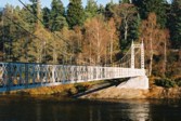
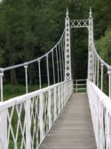
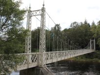
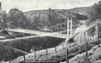
1905: Cambus O'May
Ballater, Scotland, United Kingdom - River Dee
| Bridgemeister ID: | 429 (added before 2003) |
| Year Completed: | 1905 |
| Name: | Cambus O'May |
| Also Known As: | Gordon |
| Location: | Ballater, Scotland, United Kingdom |
| Crossing: | River Dee |
| Coordinates: | 57.065803 N 2.956825 W |
| Maps: | Acme, GeoHack, Google, OpenStreetMap |
| Principals: | James Abernethy & Co. |
| References: | BC2, BC3, BEM, HARPER, HBR, NTB |
| Use: | Footbridge |
| Status: | In use (last checked: April, 2021) |
| Main Cables: | Wire (steel) |
| Suspended Spans: | 1 |
| Main Span: | 1 x 51.8 meters (170 feet) |
Notes:
- 1988: Refurbished (HBR)
- 2015, December: Damaged by the River Dee flood caused by Storm Frank. Closed indefinitely. Repairs expected to start in 2020.
- 2020, August 31: Repairs underway, expected to be completed in approximately 16 weeks.
- 2020, December: Storm Frank repairs now expected to be completed in January 2021.
- 2021, January: Completion of repairs delayed due to COVID-19 pandemic "stay at home" recommendations.
- 2021, April 1: Repairs completed, bridge reopened.
External Links:
- Cambus O' May | Harper Bridges
- The Happy Pontist: Scottish Bridges: 20. Cambus O'May Footbridge
- The Happy Pontist: Scottish Bridges: 43. Cambus O' May Bridge (revisited)
- The Happy Pontist: Scottish Bridges: 55. Cambus O'May Bridge (after the flood)
- Structurae - Structure ID 20019638

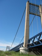
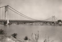
1950: Rognonas
Rognonas, Bouches-du-Rhône and Avignon, Vaucluse, France - Durance River
| Bridgemeister ID: | 549 (added before 2003) |
| Year Completed: | 1950 |
| Name: | Rognonas |
| Location: | Rognonas, Bouches-du-Rhône and Avignon, Vaucluse, France |
| Crossing: | Durance River |
| Coordinates: | 43.914624 N 4.808279 E |
| Maps: | Acme, GeoHack, Google, OpenStreetMap |
| References: | BC2, BPF |
| Use: | Vehicular (two-lane, heavy vehicles), with walkway |
| Status: | In use (last checked: 2019) |
| Main Cables: | Wire (steel) |
| Suspended Spans: | 3 |
| Main Span: | 1 x 255 meters (836.6 feet) |
| Side Spans: | 2 |
External Links:
