Inventory Search Results
35 suspension bridges were found for search criteria: BC3. All 35 bridges from the search results appear below. Click the Bridgemeister ID number to isolate the bridge on its own page. If you don't see what you were looking for, try an image search with the same criteria: BC3. This will find the bridge if it is pictured on the site, but is not a catenary suspension bridge.
Related:
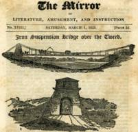
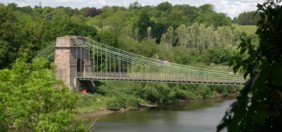
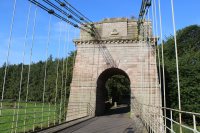
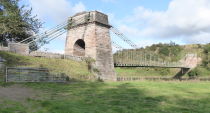
1820: Union
Horncliffe, Berwick-upon-Tweed vicinity, England and Fishwick, Scotland, United Kingdom - River Tweed
| Bridgemeister ID: | 373 (added before 2003) |
| Year Completed: | 1820 |
| Name: | Union |
| Location: | Horncliffe, Berwick-upon-Tweed vicinity, England and Fishwick, Scotland, United Kingdom |
| Crossing: | River Tweed |
| Coordinates: | 55.75256 N 2.10677 W |
| Maps: | Acme, GeoHack, Google, OpenStreetMap |
| Principals: | Sir Samuel Brown |
| References: | AAJ, BBR, BC3, BEM, BOB, HBE, MOS, NTB, PTS2, SBR |
| Use: | Vehicular (one-lane) |
| Status: | In use (last checked: 2023) |
| Main Cables: | Chain (iron) |
| Suspended Spans: | 1 |
| Main Span: | 1 x 136.9 meters (449 feet) |
| Deck width: | 18 feet |
Notes:
- 2007, March: Closed after a hanger snapped in high winds. Repaired and reopened August, 2007.
- 2020, October: Closed for major renovation and conservation project.
- 2023, April: The bridge is reopened.
- Eclipsed by new longest suspension bridge 1826 Menai Strait - Menai Bridge and Bangor vicinity, Wales, United Kingdom.
External Links:
- Conservation - Union Chain Bridge - unionchainbridge.org. Site devoted to the 2020-2023 renovation project. This page lists the highlights of the project.
- Structurae - Structure ID 20000162
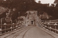
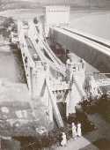
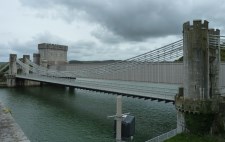
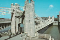
1826: Conwy
Conwy, Wales, United Kingdom - River Conwy
| Bridgemeister ID: | 380 (added before 2003) |
| Year Completed: | 1826 |
| Name: | Conwy |
| Also Known As: | Conway |
| Location: | Conwy, Wales, United Kingdom |
| Crossing: | River Conwy |
| Coordinates: | 53.280476 N 3.823742 W |
| Maps: | Acme, GeoHack, Google, OpenStreetMap |
| Principals: | Thomas Telford |
| References: | AAJ, BBR, BC3, BCO, BEM, HBE, MOS, NTB, PTS2 |
| Use: | Vehicular |
| Status: | Restricted to foot traffic (last checked: 2021) |
| Main Cables: | Chain (iron) |
| Suspended Spans: | 1 |
| Main Span: | 1 x 99.7 meters (327 feet) |
Notes:
- 1904: Major reinforcement and strengthening project.
- 2008, February: Major refurbishment project completed.
- Next to 1904 (footbridge) - Conwy, Wales, United Kingdom.
Annotated Citations:
- "Conway Suspension Bridge." The Engineer, 20 May 1904.
Details regarding the 1904 reinforcement project: "...It was therefore decided to renew all the suspension rods, and pins, and to fix steel cables above the suspension links, to supplement them so that the maximum stress in the links due to any possible travelling load should not exceed 5 tons per square inch. It was also decided to build a stiffening girder coupled to the suspension rod on each side of the bridge, and at the same time to widen the bridge by building a footway 6ft. wide outside the suspenders on the north side of the bridge."
External Links:
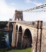
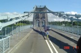
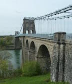
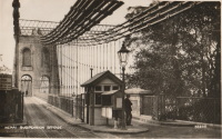
1826: Menai Strait
Menai Bridge and Bangor vicinity, Wales, United Kingdom - Menai Strait
| Bridgemeister ID: | 382 (added before 2003) |
| Year Completed: | 1826 |
| Name: | Menai Strait |
| Location: | Menai Bridge and Bangor vicinity, Wales, United Kingdom |
| Crossing: | Menai Strait |
| Coordinates: | 53.221367 N 4.1646 W |
| Maps: | Acme, GeoHack, Google, OpenStreetMap |
| Principals: | Thomas Telford |
| References: | AAJ, BBR, BC3, BCO, BDU, BEM, BOU, HBE, MOS, NTB, PTS2 |
| Use: | Vehicular (two-lane), with walkway |
| Status: | In use (last checked: 2022) |
| Main Cables: | Chain (iron) |
| Suspended Spans: | 1 |
| Main Span: | 1 x 176.5 meters (579 feet) |
Notes:
- 1839 (or 1840): Restored. Deck strengthened.
- 1893: Original wood deck replaced with a steel deck.
- 1938-1940: Original wrought-iron chains replaced with steel eyebars, deck strengthened.
- 1999: Deck resurfaced and other improvements to strengthen bridge.
- 2020: Major maintenance project planned to start January, 2021.
- 2022, October: Closed due to serious structural concerns. Expected to reopen January 2023 with a weight restriction.
- Became longest suspension bridge by eclipsing 1820 Union - Horncliffe, Berwick-upon-Tweed vicinity, England and Fishwick, Scotland, United Kingdom.
- Eclipsed by new longest suspension bridge 1834 Zaehringen (Grand Pont Suspendu) - Fribourg, Switzerland.
External Links:

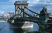
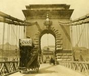
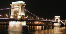
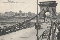
1849: Chain
Budapest, Hungary - Danube River
| Bridgemeister ID: | 402 (added before 2003) |
| Year Completed: | 1849 |
| Name: | Chain |
| Also Known As: | Széchenyi Lánchíd |
| Location: | Budapest, Hungary |
| Crossing: | Danube River |
| Coordinates: | 47.49945 N 19.046567 E |
| Maps: | Acme, GeoHack, Google, OpenStreetMap |
| Principals: | William Tierney Clark, Adam Clark |
| References: | AAJ, BC3, BCO, CTW, HBE, ONF |
| Use: | Vehicular |
| Status: | In use (last checked: 2021) |
| Main Cables: | Chain (iron) |
| Suspended Spans: | 3 |
| Main Span: | 1 x 203 meters (666 feet) |
| Side Spans: | 2 x 90.8 meters (298 feet) |
Notes:
- Don Sayenga notes, the bridge was designed by W.T. Clark, but built by Adam Clark (no relation).
- 1945: Destroyed during WWII, rebuilt 1949.
- 2020: Major rehabilitation project expected to start May, 2021.
External Links:
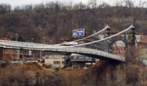
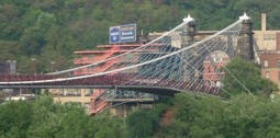
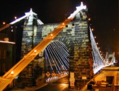
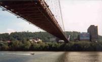
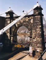
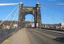
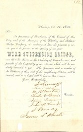
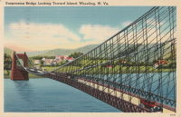
1849: Wheeling
Wheeling, West Virginia, USA - Ohio River
| Bridgemeister ID: | 32 (added before 2003) |
| Year Completed: | 1849 |
| Name: | Wheeling |
| Also Known As: | Wheeling and Belmont |
| Location: | Wheeling, West Virginia, USA |
| Crossing: | Ohio River |
| Coordinates: | 40.07167 N 80.72667 W |
| Maps: | Acme, GeoHack, Google, OpenStreetMap |
| Principals: | Charles Ellet |
| References: | AAJ, BBR, BC3, BOB, BPL, CEJ, COB, GBD, HBE, LAB, LACE, ONF, PTS2, RWS, WCC, WHSB |
| Use: | Vehicular (two-lane, light vehicles only) |
| Status: | Restricted to foot traffic, since September 2019 (last checked: 2020) |
| Main Cables: | Wire (iron) |
| Suspended Spans: | 1 |
| Main Span: | 1 x 307.8 meters (1,010 feet) |
Notes:
- Was still part of Virginia at time of completion.
- 1854: Rebuilt after it was wrecked by a windstorm. Contrary to popular myth, the rebuilding was undertaken by Ellet and his assistant William K. McComas, not by John A. Roebling.
- 1860: Overhauled. Popular myth often attributes this work to the Roeblings. WHSB attributes this work to William K. McComas. After this overhaul, the bridge still does not have the distinctive diagonal cable stays that give it the appearance of a Roebling bridge.
- 1872: Overhauled according to a design by Washington Roebling. John A. Roebling had died in 1869 and was not involved with this work. WHSB notes, "The design essentially Roeblingized the bridge with the diagonal cable stays that are such a prominent feature of the bridge."
- 2019, September: Closed to vehicular traffic indefinitely due to safety concerns after repeated overweight vehicle violations.
- 2020, November: Bids being evaluated for renovation project. Bridge remains closed to vehicular traffic.
- 2021, April: Single bid received was rejected. Bids expected to be resolicited in June. The bridge remains closed to all vehicular traffic.
- 2022, February: $17.9 million renovation project expected to start soon.
- Became longest suspension bridge by eclipsing 1834 Zaehringen (Grand Pont Suspendu) - Fribourg, Switzerland.
- Eclipsed by new longest suspension bridge 1867 John A. Roebling (Cincinnati, Cincinnati and Covington) - Cincinnati, Ohio and Covington, Kentucky, USA.
External Links:
1850: (footbridge)
Brahesborg Estate, Assens, Denmark
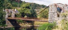
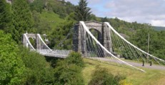
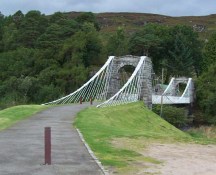
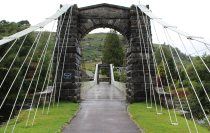
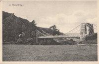
1854: Oich
Invergarry vicinity, Scotland, United Kingdom - River Oich
| Bridgemeister ID: | 403 (added before 2003) |
| Year Completed: | 1854 |
| Name: | Oich |
| Also Known As: | Aberchalder |
| Location: | Invergarry vicinity, Scotland, United Kingdom |
| Crossing: | River Oich |
| Coordinates: | 57.093377 N 4.745271 W |
| Maps: | Acme, GeoHack, Google, OpenStreetMap |
| Principals: | James Dredge |
| References: | BC3, HBR |
| Use: | Vehicular (one-lane) |
| Status: | Restricted to foot traffic (last checked: 2014) |
| Main Cables: | Rod (iron) |
| Suspended Spans: | 1 |
Notes:
- Restored and re-opened, late 1990's.
External Links:
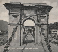
1860: Ponte delle Catene
Fornoli, Bagni di Lucca and Chifenti, Italy - Lima River
| Bridgemeister ID: | 411 (added before 2003) |
| Year Completed: | 1860 |
| Name: | Ponte delle Catene |
| Also Known As: | Catena, Bridge of Chains |
| Location: | Fornoli, Bagni di Lucca and Chifenti, Italy |
| Crossing: | Lima River |
| Coordinates: | 44.006048 N 10.562356 E |
| Maps: | Acme, GeoHack, Google, OpenStreetMap |
| Principals: | Lorenzo Nottolini, Bettino Ricasoli |
| References: | BC2, BC3 |
| Use: | Vehicular |
| Status: | Restricted to foot traffic (last checked: 2019) |
| Main Cables: | Chain (iron) |
| Suspended Spans: | 1 |
Notes:
- Damaged during WWII, rebuilt 1953.
External Links:
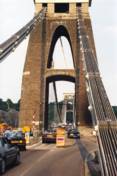
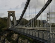
1864: Clifton
Bristol, England, United Kingdom - River Avon
| Bridgemeister ID: | 413 (added before 2003) |
| Year Completed: | 1864 |
| Name: | Clifton |
| Location: | Bristol, England, United Kingdom |
| Crossing: | River Avon |
| Coordinates: | 51.45496 N 2.62781 W |
| Maps: | Acme, GeoHack, Google, OpenStreetMap |
| Principals: | Isambard K. Brunel, P.W. Barlow, Hawkshaw |
| References: | AOB, BBR, BC3, BEM, BMA, BOU, BRB, CTW, HBE, NTB, ONF, PTS2 |
| Use: | Vehicular, with walkway |
| Status: | In use (last checked: 2021) |
| Main Cables: | Eyebar (iron) |
| Suspended Spans: | 1 |
| Main Span: | 1 x 214 meters (702 feet) |
Notes:
- Built with chain cables reused from the Hungerford bridge.
- See 1845 Hungerford - London, England, United Kingdom.
External Links:

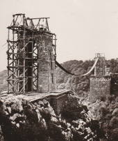
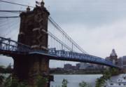
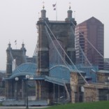
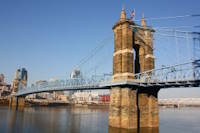
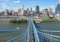
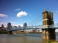
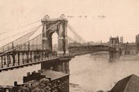
1867: John A. Roebling
Cincinnati, Ohio and Covington, Kentucky, USA - Ohio River
| Bridgemeister ID: | 65 (added before 2003) |
| Year Completed: | 1867 |
| Name: | John A. Roebling |
| Also Known As: | Cincinnati, Cincinnati and Covington |
| Location: | Cincinnati, Ohio and Covington, Kentucky, USA |
| Crossing: | Ohio River |
| Coordinates: | 39.09167 N 84.50833 W |
| Maps: | Acme, GeoHack, Google, OpenStreetMap |
| Principals: | John A. Roebling |
| References: | BAAW, BC3, BOB, BPL, COB, EOV, HBE, LAB, LACE, ONF, PTS2, SJR, TOB |
| Use: | Vehicular (two-lane), with walkway |
| Status: | Closed, February, 2021 (last checked: 2021) |
| Main Cables: | Wire (iron) |
| Suspended Spans: | 3 |
| Main Span: | 1 x 322.2 meters (1,057 feet) |
| Side Spans: | 2 |
Notes:
- 1892: Cable ends restored.
- 1899: Steel cables added to assist original cables.
- 2021, February: Closed to all vehicular traffic for a nine-month restoration project.
- Became longest suspension bridge by eclipsing 1849 Wheeling (Wheeling and Belmont) - Wheeling, West Virginia, USA.
- Eclipsed by new longest suspension bridge 1869 Clifton (Niagara-Clifton, Falls View, First Falls View) - Niagara Falls, New York, USA and Niagara Falls, Ontario, Canada.
External Links:
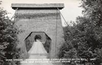
1868: Wire
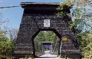
New Portland, Maine, USA - Carrabasset River
| Bridgemeister ID: | 69 (added before 2003) |
| Year Completed: | 1868 |
| Name: | Wire |
| Location: | New Portland, Maine, USA |
| Crossing: | Carrabasset River |
| Coordinates: | 44.890783 N 70.0925 W |
| Maps: | Acme, GeoHack, Google, OpenStreetMap |
| References: | BC3, BPL, GBD, LAB, RDH |
| Use: | Vehicular (one-lane) |
| Status: | In use (last checked: 2023) |
| Main Cables: | Wire (iron) |
| Suspended Spans: | 1 |
| Main Span: | 1 x 60.5 meters (198.4 feet) |
Notes:
- BPL says c. 1866. Historic landmark plaque at bridge also says 1866.
- Extensive repairs, 1960.
External Links:
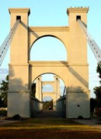
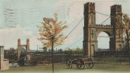
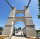
1869: Waco
Waco, Texas, USA - Brazos River
| Bridgemeister ID: | 72 (added before 2003) |
| Year Completed: | 1869 |
| Name: | Waco |
| Location: | Waco, Texas, USA |
| Crossing: | Brazos River |
| Coordinates: | 31.561314 N 97.127063 W |
| Maps: | Acme, GeoHack, Google, OpenStreetMap |
| Principals: | Thomas M. Griffith |
| References: | AAJ, BC3, BPL, BRAZ, GBD, HAERTX98, HBE, PTS2, WSB |
| Use: | Vehicular, with walkway |
| Status: | Restricted to foot traffic (last checked: 2023) |
| Main Cables: | Wire (iron) |
| Suspended Spans: | 1 |
| Main Span: | 1 x 144.8 meters (475 feet) |
| Deck width: | 18 feet |
Notes:
- 1915: Rebuilt.
- 2020, October: Closed for restoration project expecting to last 18-24 months.
- 2021, March: Major restoration project underway, led by Sparks Engineering, Inc.
- 2023, April: The restored bridge is rededicated on April 22. Patrick Sparks of Sparks Engineering reports: . The rededication was held April 22, 2023. "The project involved full rehabilitation including: replacement of the suspension system and anchor rods, strengthening of the anchorages, replacement of the saddle bearings, retrofit strengthening of the east tower, and deck replacement (concrete on the main deck, tropical hardwood on the side walks)."
External Links:
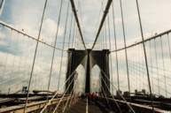
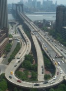
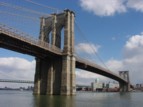
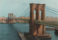
1883: Brooklyn
New York and Brooklyn, New York, USA - East River
| Bridgemeister ID: | 89 (added before 2003) |
| Year Completed: | 1883 |
| Name: | Brooklyn |
| Also Known As: | Great East River |
| Location: | New York and Brooklyn, New York, USA |
| Crossing: | East River |
| Coordinates: | 40.706 N 73.99667 W |
| Maps: | Acme, GeoHack, Google, OpenStreetMap |
| Principals: | John A. Roebling, Washington A. Roebling |
| References: | AAJ, BAAW, BBR, BBTS, BC3, BFL, BLD, BMA, BOB, BOU, BPL, COB, CTW, GB, GBD, HBE, LAB, LACE, NG198305, ONF, PTS2, SJR |
| Use: | Rail (light rail) and Vehicular (major highway), with walkway |
| Status: | In use (last checked: 2022) |
| Main Cables: | Wire (steel) |
| Suspended Spans: | 3 |
| Main Span: | 1 x 486.3 meters (1,595.5 feet) |
| Side Spans: | 2 x 283.5 meters (930 feet) |
| Deck width: | 85 feet |
Notes:
- Became longest suspension bridge by eclipsing 1869 Clifton (Niagara-Clifton, Falls View, First Falls View) - Niagara Falls, New York, USA and Niagara Falls, Ontario, Canada.
- Eclipsed by new longest suspension bridge 1903 Williamsburg - New York and Brooklyn, New York, USA.
- Next to 1909 Manhattan - New York and Brooklyn, New York, USA.
- Near 1903 Williamsburg - New York and Brooklyn, New York, USA.
External Links:
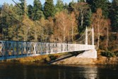
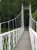
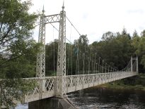
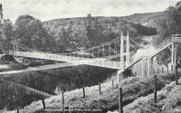
1905: Cambus O'May
Ballater, Scotland, United Kingdom - River Dee
| Bridgemeister ID: | 429 (added before 2003) |
| Year Completed: | 1905 |
| Name: | Cambus O'May |
| Also Known As: | Gordon |
| Location: | Ballater, Scotland, United Kingdom |
| Crossing: | River Dee |
| Coordinates: | 57.065803 N 2.956825 W |
| Maps: | Acme, GeoHack, Google, OpenStreetMap |
| Principals: | James Abernethy & Co. |
| References: | BC2, BC3, BEM, HARPER, HBR, NTB |
| Use: | Footbridge |
| Status: | In use (last checked: April, 2021) |
| Main Cables: | Wire (steel) |
| Suspended Spans: | 1 |
| Main Span: | 1 x 51.8 meters (170 feet) |
Notes:
- 1988: Refurbished (HBR)
- 2015, December: Damaged by the River Dee flood caused by Storm Frank. Closed indefinitely. Repairs expected to start in 2020.
- 2020, August 31: Repairs underway, expected to be completed in approximately 16 weeks.
- 2020, December: Storm Frank repairs now expected to be completed in January 2021.
- 2021, January: Completion of repairs delayed due to COVID-19 pandemic "stay at home" recommendations.
- 2021, April 1: Repairs completed, bridge reopened.
External Links:
- Cambus O' May | Harper Bridges
- The Happy Pontist: Scottish Bridges: 20. Cambus O'May Footbridge
- The Happy Pontist: Scottish Bridges: 43. Cambus O' May Bridge (revisited)
- The Happy Pontist: Scottish Bridges: 55. Cambus O'May Bridge (after the flood)
- Structurae - Structure ID 20019638

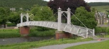
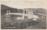
1905: Priorsford
Peebles, Scotland, United Kingdom - River Tweed
| Bridgemeister ID: | 1441 (added 2004-07-31) |
| Year Completed: | 1905 |
| Name: | Priorsford |
| Location: | Peebles, Scotland, United Kingdom |
| Crossing: | River Tweed |
| Coordinates: | 55.649532 N 3.187578 W |
| Maps: | Acme, GeoHack, Google, OpenStreetMap |
| Principals: | Robert Inglis |
| References: | BC3 |
| Use: | Footbridge |
| Status: | In use (last checked: 2014) |
| Main Cables: | Wire (steel) |
| Main Span: | 1 x 29.6 meters (97 feet) |
External Links:

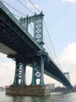
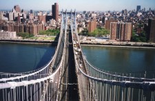
1909: Manhattan
New York and Brooklyn, New York, USA - East River
| Bridgemeister ID: | 123 (added before 2003) |
| Year Completed: | 1909 |
| Name: | Manhattan |
| Location: | New York and Brooklyn, New York, USA |
| Crossing: | East River |
| Coordinates: | 40.70667 N 73.99167 W |
| Maps: | Acme, GeoHack, Google, OpenStreetMap |
| Principals: | O.F. Nichols, Leon Moisseiff |
| References: | AAJ, BAAW, BBR, BC3, BPL, GBD, HBE, LAB, PTS2, SA19050909, SJR |
| Use: | Vehicular (double-deck) |
| Status: | In use (last checked: 2022) |
| Main Cables: | Wire (steel) |
| Suspended Spans: | 3 |
| Main Span: | 1 x 448.1 meters (1,470 feet) |
| Side Spans: | 2 x 221 meters (725 feet) |
Notes:
- Opened December 31, 1909, but not fully completed yet.
- Next to 1883 Brooklyn (Great East River) - New York and Brooklyn, New York, USA.
- Near 1903 Williamsburg - New York and Brooklyn, New York, USA.
External Links:

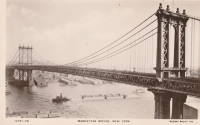
1917: (suspension bridge)
Skhirat, Rabat vicinity, Morocco - Oued Cherrat
| Bridgemeister ID: | 529 (added before 2003) |
| Year Completed: | 1917 |
| Name: | (suspension bridge) |
| Location: | Skhirat, Rabat vicinity, Morocco |
| Crossing: | Oued Cherrat |
| Coordinates: | 33.814930 N 7.110061 W |
| Maps: | Acme, GeoHack, Google, OpenStreetMap |
| References: | BC3 |
| Use: | Vehicular |
| Status: | In use (last checked: 2019) |
| Main Cables: | Wire |
| Suspended Spans: | 1 |
| Main Span: | 1 x 102.4 meters (336 feet) |
External Links:
1927: Port à l'Anglais
Alfortville and Vitry-sur-Seine, Val-de-Marne, France - Seine River
| Bridgemeister ID: | 1114 (added 2004-01-05) |
| Year Completed: | 1927 |
| Name: | Port à l'Anglais |
| Location: | Alfortville and Vitry-sur-Seine, Val-de-Marne, France |
| Crossing: | Seine River |
| Coordinates: | 48.797333 N 2.41875 E |
| Maps: | Acme, GeoHack, Google, OpenStreetMap |
| References: | AAJ, BC3, BPF, PTS2 |
| Use: | Vehicular (three-lane), with walkway |
| Status: | In use (last checked: 2021) |
| Main Cables: | Wire |
| Suspended Spans: | 3 |
| Main Span: | 1 x 124 meters (406.8 feet) |
| Side Spans: | 1 x 54 meters (177.2 feet), 1 x 52 meters (170.6 feet) |
| Deck width: | 40 feet |
Notes:
- This bridge was originally built with the Gisclard suspension system. Such bridges are not included in the Bridgemeister suspension bridge inventory. However, at some point the suspension system was modified to be more similar to a standard suspension bridge. It isn't clear when this modification occurred.
- Near Créteil (Saint-Maur) - Créteil-sur-Marne and Saint-Maur-des-Fossés, Val-de-Marne, France.
External Links:
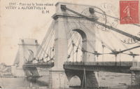
| Bridgemeister ID: | 1449 (added 2004-07-31) |
| Year Completed: | 1928 |
| Name: | Tarassac |
| Location: | St. Martin-de-l'Arcon vicinity, Hérault, France |
| Crossing: | Orb River |
| Coordinates: | 43.564766 N 2.974529 E |
| Maps: | Acme, GeoHack, Google, OpenStreetMap |
| References: | BC3 |
| Use: | Vehicular (one-lane) |
| Status: | In use (last checked: 2019) |
| Main Cables: | Wire (steel) |
| Suspended Spans: | 1 |
| Main Span: | 1 x 104.2 meters (342 feet) |
Notes:
External Links:
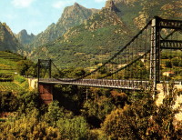
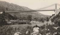
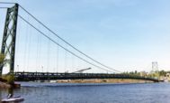
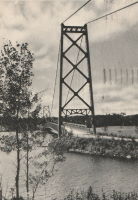
1929: Grand Mère
Grand-Mère, Quebec, Canada - St. Maurice River
| Bridgemeister ID: | 162 (added before 2003) |
| Year Completed: | 1929 |
| Name: | Grand Mère |
| Location: | Grand-Mère, Quebec, Canada |
| Crossing: | St. Maurice River |
| Coordinates: | 46.620117 N 72.6794 W |
| Maps: | Acme, GeoHack, Google, OpenStreetMap |
| Principals: | Robinson and Steinman |
| References: | AAJ, BC3, BPL, PTS2, SJR |
| Use: | Vehicular (two-lane, heavy vehicles), with walkway |
| Status: | In use (last checked: 2019) |
| Main Cables: | Wire (steel) |
| Suspended Spans: | 1 |
| Main Span: | 1 x 289.2 meters (948.8 feet) |
| Deck width: | 26 feet |
External Links:
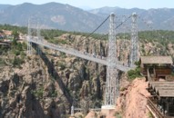
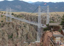
1929: Royal Gorge
Canon City, Colorado, USA - Arkansas River
| Bridgemeister ID: | 164 (added before 2003) |
| Year Completed: | 1929 |
| Name: | Royal Gorge |
| Location: | Canon City, Colorado, USA |
| Crossing: | Arkansas River |
| Coordinates: | 38.46129 N 105.32541 W |
| Maps: | Acme, GeoHack, Google, OpenStreetMap |
| Principals: | George F. Cole, O.K. Peck |
| References: | AAJ, BC3, BMA, GBD |
| Use: | Vehicular (two-lane) |
| Status: | In use (last checked: 2020) |
| Main Cables: | Wire (steel) |
| Suspended Spans: | 3 |
| Main Span: | 1 x 268.2 meters (880 feet) |
| Side Spans: | 2 |
| Deck width: | 18 feet |
Notes:
- This bridge was built solely as a tourist attraction.
External Links:
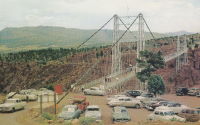
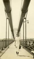
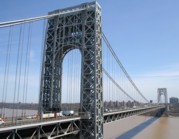
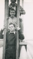
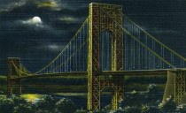
1931: George Washington
New York, New York and Fort Lee, New Jersey, USA - Hudson River
| Bridgemeister ID: | 169 (added before 2003) |
| Year Completed: | 1931 |
| Name: | George Washington |
| Also Known As: | GWB |
| Location: | New York, New York and Fort Lee, New Jersey, USA |
| Crossing: | Hudson River |
| Coordinates: | 40.85333 N 73.955 W |
| Maps: | Acme, GeoHack, Google, OpenStreetMap |
| Principals: | O.H. Ammann, Leon Moisseiff, Dana, Gilbert |
| References: | AAJ, AOB, ARF, BBR, BC3, BFL, BMA, BONJ, BOU, BPL, BRU, COB, CTW, ENR19270811a, ENR19270811b, ENR19290411c, GBD, LAB, LACE, PTS2, SIX, SJR |
| Use: | Vehicular (double-deck), with walkway |
| Status: | In use (last checked: 2022) |
| Main Cables: | Wire (steel) |
| Suspended Spans: | 3 |
| Main Span: | 1 x 1,066.8 meters (3,500 feet) |
| Side Spans: | 2 x 198.1 meters (650 feet) |
| Deck width: | 120 feet |
Notes:
- Became longest suspension bridge by eclipsing 1929 Ambassador - Detroit, Michigan, USA and Windsor, Ontario, Canada.
- Eclipsed by new longest suspension bridge 1937 Golden Gate - San Francisco and Marin County, California, USA.
External Links:
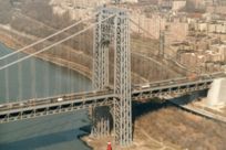
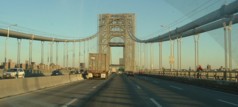
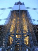
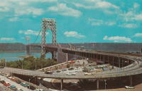
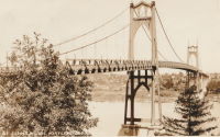
1931: St. Johns
Portland, Oregon, USA - Willamette River
| Bridgemeister ID: | 174 (added before 2003) |
| Year Completed: | 1931 |
| Name: | St. Johns |
| Location: | Portland, Oregon, USA |
| Crossing: | Willamette River |
| Coordinates: | 45.585 N 122.76333 W |
| Maps: | Acme, GeoHack, Google, OpenStreetMap |
| Principals: | Robinson and Steinman |
| References: | AAJ, ADDS, BC3, BCO, BFL, BPL, GBD, LAB, SJR |
| Use: | Vehicular (four-lane), with walkway |
| Status: | In use (last checked: 2022) |
| Main Cables: | Wire (steel) |
| Suspended Spans: | 3 |
| Main Span: | 1 x 367.9 meters (1,207 feet) |
| Side Spans: | 2 x 131.1 meters (430.25 feet) |
| Deck width: | 52 feet |
Notes:
- Substantially rehabilitated, 2003-2005.
External Links:
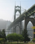
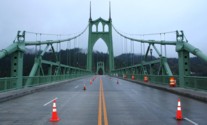
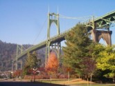
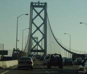
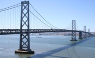
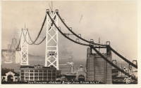
1936: San Francisco-Oakland Bay
Oakland and San Francisco, California, USA - San Francisco Bay
| Bridgemeister ID: | 184 (added before 2003) |
| Year Completed: | 1936 |
| Name: | San Francisco-Oakland Bay |
| Location: | Oakland and San Francisco, California, USA |
| Crossing: | San Francisco Bay |
| Coordinates: | 37.78667 N 122.39 W |
| Maps: | Acme, GeoHack, Google, OpenStreetMap |
| Principals: | C.H. Purcell, Glenn B. Woodruff |
| References: | AAJ, AZB, BAAW, BC3, BPL, GBD, LAB, OBB1, SFOM, USS |
| Use: | Vehicular (double-deck) |
| Status: | In use (last checked: 2022) |
| Main Cables: | Wire (steel) |
| Suspended Spans: | 6 |
| Main Spans: | 1 x 678 meters (2,224.4 feet), 1 x 673.6 meters (2,210 feet) |
| Side Spans: | 4 |
| Deck width: | 66 feet (58 feet roadway) |
Notes:
External Links:

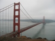
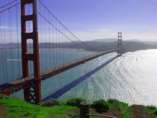
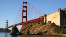
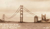
1937: Golden Gate
San Francisco and Marin County, California, USA - San Francisco Bay
| Bridgemeister ID: | 188 (added before 2003) |
| Year Completed: | 1937 |
| Name: | Golden Gate |
| Location: | San Francisco and Marin County, California, USA |
| Crossing: | San Francisco Bay |
| Coordinates: | 37.82 N 122.47667 W |
| Maps: | Acme, GeoHack, Google, OpenStreetMap |
| Principals: | Joseph B. Strauss, Leon Moisseiff, Charles A. Ellis, Irving F. Morrow |
| References: | AAJ, AZB, BAAW, BBR, BC3, BFL, BLD, BMA, BOU, BPL, BRU, COB, CTW, GAT, GBD, GGB, LAB, SPG |
| Use: | Vehicular (major highway), with walkway |
| Status: | In use (last checked: 2022) |
| Main Cables: | Wire (steel) |
| Suspended Spans: | 3 |
| Main Span: | 1 x 1,280.2 meters (4,200 feet) |
| Side Spans: | 2 x 343 meters (1,125.41 feet) |
| Deck width: | 80 feet |
Notes:
- Became longest suspension bridge by eclipsing 1931 George Washington (GWB) - New York, New York and Fort Lee, New Jersey, USA.
- Eclipsed by new longest suspension bridge 1964 Verrazzano Narrows (Verrazano Narrows) - Brooklyn and Staten Island, New York, USA.
External Links:

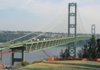
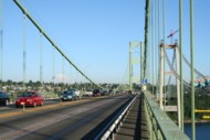
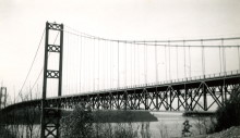
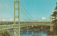
1950: Tacoma Narrows
Tacoma and Gig Harbor, Washington, USA - Puget Sound
| Bridgemeister ID: | 206 (added before 2003) |
| Year Completed: | 1950 |
| Name: | Tacoma Narrows |
| Also Known As: | Sturdy Gertie, Second Tacoma Narrows |
| Location: | Tacoma and Gig Harbor, Washington, USA |
| Crossing: | Puget Sound |
| Coordinates: | 47.270540 N 122.552895 W |
| Maps: | Acme, GeoHack, Google, OpenStreetMap |
| Principals: | Dexter R. Smith |
| References: | BBR, BC3, BCO, BFL, COB, CTT, SPW |
| Use: | Vehicular (major highway), with walkway |
| Status: | In use (last checked: 2022) |
| Main Cables: | Wire (steel) |
| Suspended Spans: | 3 |
| Main Span: | 1 x 853.4 meters (2,800 feet) |
| Side Spans: | 2 x 335.3 meters (1,100 feet) |
| Deck width: | 46f 8in |
Notes:
- Retrofit scheduled for completion, spring 2008.
- Replaced 1940 Tacoma Narrows (Galloping Gertie) - Tacoma and Gig Harbor, Washington, USA.
- Next to 2007 Third Tacoma Narrows - Tacoma and Gig Harbor, Washington, USA.
External Links:

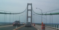
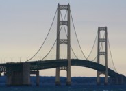
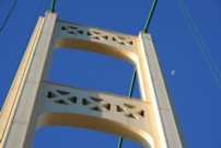
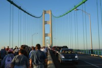
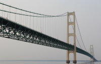
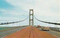
1957: Mackinac
St. Ignace and Mackinaw City, Michigan, USA - Straits of Mackinac
| Bridgemeister ID: | 210 (added before 2003) |
| Year Completed: | 1957 |
| Name: | Mackinac |
| Also Known As: | Mighty Mac |
| Location: | St. Ignace and Mackinaw City, Michigan, USA |
| Crossing: | Straits of Mackinac |
| Coordinates: | 45.820533 N 84.727667 W |
| Maps: | Acme, GeoHack, Google, OpenStreetMap |
| Principals: | David B. Steinman |
| References: | ADDS, BBR, BC3, BFL, BLD, BMA, COB, GBD, LAB, MACB, MM, WOT |
| Use: | Vehicular (four-lane) |
| Status: | In use (last checked: 2022) |
| Main Cables: | Wire (steel) |
| Suspended Spans: | 3 |
| Main Span: | 1 x 1,158.2 meters (3,800 feet) |
| Side Spans: | 2 x 548.6 meters (1,800 feet) |
External Links:

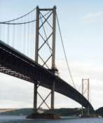
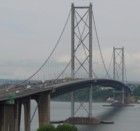
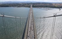
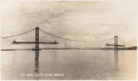
1964: Forth Road
Queensferry, Scotland, United Kingdom - Firth of Forth
| Bridgemeister ID: | 463 (added before 2003) |
| Year Completed: | 1964 |
| Name: | Forth Road |
| Location: | Queensferry, Scotland, United Kingdom |
| Crossing: | Firth of Forth |
| Coordinates: | 56.004020 N 3.404095 W |
| Maps: | Acme, GeoHack, Google, OpenStreetMap |
| References: | BBR, BC3, BDU, BFL, FRB, NTB, WOT |
| Use: | Vehicular (major highway), with walkway |
| Status: | In use (last checked: 2021) |
| Main Cables: | Wire (steel) |
| Suspended Spans: | 3 |
| Main Span: | 1 x 1,006 meters (3,300.5 feet) |
| Side Spans: | 2 x 408 meters (1,338.6 feet) |
Notes:
- December 4, 2015: Closed to all traffic because of structural issues. Reopened for lighter traffic, December 23, 2015. Fully reopened February 20, 2016.
- September 5, 2017: All traffic diverted to newly-opened nearby Queensferry Crossing. Closed completely for repairs. Reopened February 1, 2018 but restricted to public transportation (buses and taxis), pedestrians, and cyclists.
External Links:

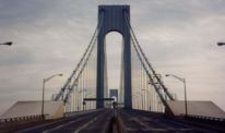
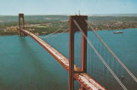
1964: Verrazzano Narrows
Brooklyn and Staten Island, New York, USA - Verrazano Narrows
| Bridgemeister ID: | 219 (added before 2003) |
| Year Completed: | 1964 |
| Name: | Verrazzano Narrows |
| Also Known As: | Verrazano Narrows |
| Location: | Brooklyn and Staten Island, New York, USA |
| Crossing: | Verrazano Narrows |
| Coordinates: | 40.60667 N 74.045 W |
| Maps: | Acme, GeoHack, Google, OpenStreetMap |
| Principals: | Othmar H. Ammann, Whitney |
| References: | BBR, BC3, BFL, BOU, COB, CTW, GBD, LAB, SIX, VNB |
| Use: | Vehicular (double-deck) |
| Status: | In use (last checked: 2022) |
| Main Cables: | Wire (steel) |
| Suspended Spans: | 3 |
| Main Span: | 1 x 1,298.4 meters (4,260 feet) |
| Side Spans: | 2 |
Notes:
- 2017: Long known as the "Verrazano" bridge, efforts to fix the spelling of the bridge's name to "Verrazzano" (such as Giovanni da Verrazzano) pick up momentum with New York state legislature and senate.
- Became longest suspension bridge by eclipsing 1937 Golden Gate - San Francisco and Marin County, California, USA.
- Eclipsed by new longest suspension bridge 1981 Humber - Hull, Humberside, England, United Kingdom.
External Links:

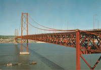
1966: 25 de Abril
Lisbon, Portugal - Tagus River
| Bridgemeister ID: | 464 (added before 2003) |
| Year Completed: | 1966 |
| Name: | 25 de Abril |
| Also Known As: | Tagus, Salazar, April 25th |
| Location: | Lisbon, Portugal |
| Crossing: | Tagus River |
| Coordinates: | 38.6968 N 9.179 W |
| Maps: | Acme, GeoHack, Google, OpenStreetMap |
| Principals: | David B. Steinman, Ray M. Boynton, et. al. |
| References: | BAAW, BAR, BBR, BC3, BDU, BFL, BMA, CTW |
| Use: | Rail and Vehicular (major highway) |
| Status: | In use (last checked: 2019) |
| Main Cables: | Wire (steel) |
| Suspended Spans: | 3 |
| Main Span: | 1 x 1,012.9 meters (3,323 feet) |
| Side Spans: | 2 x 483.4 meters (1,586 feet) |
Notes:
- Major retrofit completed in 1999 to add rail deck and extra vehicle lane.
External Links:
1981: Humber
Hull, Humberside, England, United Kingdom - Humber River
| Bridgemeister ID: | 475 (added before 2003) |
| Year Completed: | 1981 |
| Name: | Humber |
| Location: | Hull, Humberside, England, United Kingdom |
| Crossing: | Humber River |
| Coordinates: | 53.70654 N 0.44997 W |
| Maps: | Acme, GeoHack, Google, OpenStreetMap |
| Principals: | Gilbert Roberts, Bill Harvey, Freeman Fox & Partners |
| References: | AOB, BAR, BC3, BDU, BFL |
| Use: | Vehicular (four-lane), with walkway |
| Status: | In use (last checked: 2021) |
| Main Cables: | Wire (steel) |
| Suspended Spans: | 3 |
| Main Span: | 1 x 1,410 meters (4,626 feet) |
| Side Spans: | 1 x 280 meters (918.6 feet), 1 x 530 meters (1,738.8 feet) |
| Deck width: | 28.5 meters |
Notes:
- Became longest suspension bridge by eclipsing 1964 Verrazzano Narrows (Verrazano Narrows) - Brooklyn and Staten Island, New York, USA.
- Eclipsed by new longest suspension bridge 1998 Akashi Kaikyo (明石海峡大橋) - Maiko, Tarumi-ward, Kobe and Matsuho, Awaji Island, Hyogo, Japan.
External Links:
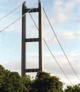
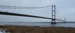
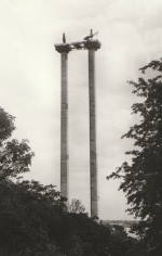
| Bridgemeister ID: | 489 (added before 2003) |
| Year Completed: | 1992 |
| Name: | Askøy |
| Location: | Askøy, Vestland and Olsvik, Bergen, Hordaland, Norway |
| Crossing: | Byfjorden |
| Coordinates: | 60.396143 N 5.214690 E |
| Maps: | Acme, GeoHack, Google, kart.1881.no, OpenStreetMap |
| References: | BAR, BC3 |
| Use: | Vehicular (two-lane, heavy vehicles), with walkway |
| Status: | In use (last checked: 2019) |
| Main Cables: | Wire (steel) |
| Suspended Spans: | 1 |
| Main Span: | 1 x 850 meters (2,788.7 feet) |
External Links:
1997: Höga Kusten
Veda, Sweden - Ångermanälven River
| Bridgemeister ID: | 496 (added before 2003) |
| Year Completed: | 1997 |
| Name: | Höga Kusten |
| Also Known As: | High Coast |
| Location: | Veda, Sweden |
| Crossing: | Ångermanälven River |
| Coordinates: | 62.7984 N 17.93915 E |
| Maps: | Acme, GeoHack, Google, OpenStreetMap |
| References: | BC3, BDU |
| Use: | Vehicular |
| Status: | In use (last checked: 2023) |
| Main Cables: | Wire (steel) |
| Suspended Spans: | 3 |
| Main Span: | 1 x 1,210 meters (3,969.8 feet) |
| Side Spans: | 2 |
| Deck width: | 17.8 meters |
External Links:
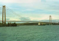
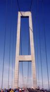
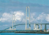
1998: Great Belt
Korsør and Nyborg, Denmark - Great Belt
| Bridgemeister ID: | 502 (added before 2003) |
| Year Completed: | 1998 |
| Name: | Great Belt |
| Also Known As: | Great Belt Fixed Link, Storebaelt, East, Storebælt, East Belt |
| Location: | Korsør and Nyborg, Denmark |
| Crossing: | Great Belt |
| At or Near Feature: | Storebaelt |
| Coordinates: | 55.342087 N 11.036430 E |
| Maps: | Acme, GeoHack, Google, OpenStreetMap |
| Principals: | COINFRA |
| References: | BAR, BBR, BC3, BDU, COB, CTW |
| Use: | Vehicular (major highway) |
| Status: | In use (last checked: 2023) |
| Main Cables: | Wire (steel) |
| Suspended Spans: | 3 |
| Main Span: | 1 x 1,624 meters (5,328.1 feet) |
| Side Spans: | 2 x 535 meters (1,755.2 feet) |
External Links:
1999: Jiangyin
Jiangyin (江阴市), Wuxi (无锡市) and Jingjiang (靖江市), Taizhou (泰州市), Jiangsu, China - Yangtze River
| Bridgemeister ID: | 498 (added before 2003) |
| Year Completed: | 1999 |
| Name: | Jiangyin |
| Location: | Jiangyin (江阴市), Wuxi (无锡市) and Jingjiang (靖江市), Taizhou (泰州市), Jiangsu, China |
| Crossing: | Yangtze River |
| Coordinates: | 31.943965 N 120.273911 E |
| Maps: | Acme, GeoHack, Google, OpenStreetMap |
| References: | BC3, BCG, BDU |
| Use: | Vehicular (major highway) |
| Status: | In use (last checked: 2023) |
| Main Cables: | Wire (steel) |
| Suspended Spans: | 1 |
| Main Span: | 1 x 1,385 meters (4,544 feet) |
External Links: