Inventory Search Results
16 suspension bridges were found for search criteria: BDU. All 16 bridges from the search results appear below. Click the Bridgemeister ID number to isolate the bridge on its own page. If you don't see what you were looking for, try an image search with the same criteria: BDU. This will find the bridge if it is pictured on the site, but is not a catenary suspension bridge.
Related:
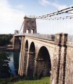
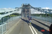
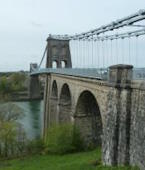
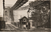
1826: Menai Strait
Menai Bridge and Bangor vicinity, Wales, United Kingdom - Menai Strait
| Bridgemeister ID: | 382 (added before 2003) |
| Year Completed: | 1826 |
| Name: | Menai Strait |
| Location: | Menai Bridge and Bangor vicinity, Wales, United Kingdom |
| Crossing: | Menai Strait |
| Coordinates: | 53.221367 N 4.1646 W |
| Maps: | Acme, GeoHack, Google, OpenStreetMap |
| Principals: | Thomas Telford |
| References: | AAJ, BBR, BC3, BCO, BDU, BEM, BOU, HBE, MOS, NTB, PTS2 |
| Use: | Vehicular (two-lane), with walkway |
| Status: | In use (last checked: 2022) |
| Main Cables: | Chain (iron) |
| Suspended Spans: | 1 |
| Main Span: | 1 x 176.5 meters (579 feet) |
Notes:
- 1839 (or 1840): Restored. Deck strengthened.
- 1893: Original wood deck replaced with a steel deck.
- 1938-1940: Original wrought-iron chains replaced with steel eyebars, deck strengthened.
- 1999: Deck resurfaced and other improvements to strengthen bridge.
- 2020: Major maintenance project planned to start January, 2021.
- 2022, October: Closed due to serious structural concerns. Expected to reopen January 2023 with a weight restriction.
- Became longest suspension bridge by eclipsing 1820 Union - Horncliffe, Berwick-upon-Tweed vicinity, England and Fishwick, Scotland, United Kingdom.
- Eclipsed by new longest suspension bridge 1834 Zaehringen (Grand Pont Suspendu) - Fribourg, Switzerland.
External Links:

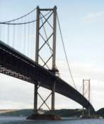
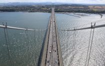
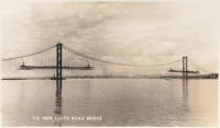
1964: Forth Road
Queensferry, Scotland, United Kingdom - Firth of Forth
| Bridgemeister ID: | 463 (added before 2003) |
| Year Completed: | 1964 |
| Name: | Forth Road |
| Location: | Queensferry, Scotland, United Kingdom |
| Crossing: | Firth of Forth |
| Coordinates: | 56.004020 N 3.404095 W |
| Maps: | Acme, GeoHack, Google, OpenStreetMap |
| References: | BBR, BC3, BDU, BFL, FRB, NTB, WOT |
| Use: | Vehicular (major highway), with walkway |
| Status: | In use (last checked: 2021) |
| Main Cables: | Wire (steel) |
| Suspended Spans: | 3 |
| Main Span: | 1 x 1,006 meters (3,300.5 feet) |
| Side Spans: | 2 x 408 meters (1,338.6 feet) |
Notes:
- December 4, 2015: Closed to all traffic because of structural issues. Reopened for lighter traffic, December 23, 2015. Fully reopened February 20, 2016.
- September 5, 2017: All traffic diverted to newly-opened nearby Queensferry Crossing. Closed completely for repairs. Reopened February 1, 2018 but restricted to public transportation (buses and taxis), pedestrians, and cyclists.
External Links:

1966: 25 de Abril
Lisbon, Portugal - Tagus River
| Bridgemeister ID: | 464 (added before 2003) |
| Year Completed: | 1966 |
| Name: | 25 de Abril |
| Also Known As: | Tagus, Salazar, April 25th |
| Location: | Lisbon, Portugal |
| Crossing: | Tagus River |
| Coordinates: | 38.6968 N 9.179 W |
| Maps: | Acme, GeoHack, Google, OpenStreetMap |
| Principals: | David B. Steinman, Ray M. Boynton, et. al. |
| References: | BAAW, BAR, BBR, BC3, BDU, BFL, BMA, CTW |
| Use: | Rail and Vehicular (major highway) |
| Status: | In use (last checked: 2019) |
| Main Cables: | Wire (steel) |
| Suspended Spans: | 3 |
| Main Span: | 1 x 1,012.9 meters (3,323 feet) |
| Side Spans: | 2 x 483.4 meters (1,586 feet) |
Notes:
- Major retrofit completed in 1999 to add rail deck and extra vehicle lane.
External Links:
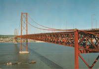
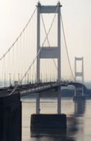
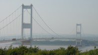
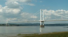
1966: Severn
Aust and Beachley, England, United Kingdom - River Severn
| Bridgemeister ID: | 465 (added before 2003) |
| Year Completed: | 1966 |
| Name: | Severn |
| Also Known As: | First Severn Crossing |
| Location: | Aust and Beachley, England, United Kingdom |
| Crossing: | River Severn |
| Coordinates: | 51.610422 N 2.641658 W |
| Maps: | Acme, GeoHack, Google, OpenStreetMap |
| References: | AOB, BAAW, BBR, BDU, BFL, COB, NTB, SEV |
| Use: | Vehicular (major highway) |
| Status: | In use (last checked: 2021) |
| Main Cables: | Wire (steel) |
| Suspended Spans: | 3 |
| Main Span: | 1 x 987.6 meters (3,240 feet) |
| Side Spans: | 2 x 304.8 meters (1,000 feet) |
External Links:
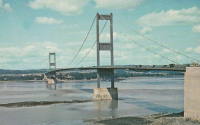
1973: Bosporus
Istanbul, Türkiye - Bosporus Strait
| Bridgemeister ID: | 472 (added before 2003) |
| Year Completed: | 1973 |
| Name: | Bosporus |
| Also Known As: | Bogaziçi, 15 July Martyrs, First, Bosphorus |
| Location: | Istanbul, Türkiye |
| Crossing: | Bosporus Strait |
| Coordinates: | 41.046655 N 29.033788 E |
| Maps: | Acme, GeoHack, Google, OpenStreetMap |
| References: | BAR, BDU, BFL, BMA, CTW |
| Use: | Vehicular (major highway) |
| Status: | In use (last checked: 2019) |
| Main Cables: | Wire (steel) |
| Suspended Spans: | 1 |
| Main Span: | 1 x 1,073.8 meters (3,523 feet) |
External Links:
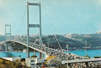
1981: Humber
Hull, Humberside, England, United Kingdom - Humber River
| Bridgemeister ID: | 475 (added before 2003) |
| Year Completed: | 1981 |
| Name: | Humber |
| Location: | Hull, Humberside, England, United Kingdom |
| Crossing: | Humber River |
| Coordinates: | 53.70654 N 0.44997 W |
| Maps: | Acme, GeoHack, Google, OpenStreetMap |
| Principals: | Gilbert Roberts, Bill Harvey, Freeman Fox & Partners |
| References: | AOB, BAR, BC3, BDU, BFL |
| Use: | Vehicular (four-lane), with walkway |
| Status: | In use (last checked: 2021) |
| Main Cables: | Wire (steel) |
| Suspended Spans: | 3 |
| Main Span: | 1 x 1,410 meters (4,626 feet) |
| Side Spans: | 1 x 280 meters (918.6 feet), 1 x 530 meters (1,738.8 feet) |
| Deck width: | 28.5 meters |
Notes:
- Became longest suspension bridge by eclipsing 1964 Verrazzano Narrows (Verrazano Narrows) - Brooklyn and Staten Island, New York, USA.
- Eclipsed by new longest suspension bridge 1998 Akashi Kaikyo (明石海峡大橋) - Maiko, Tarumi-ward, Kobe and Matsuho, Awaji Island, Hyogo, Japan.
External Links:
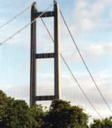
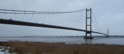
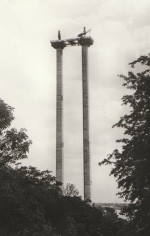
1983: Innoshima
Onomichi, Hiroshima, Japan - Mekariseto Strait
| Bridgemeister ID: | 476 (added before 2003) |
| Year Completed: | 1983 |
| Name: | Innoshima |
| Also Known As: | 因島大橋 |
| Location: | Onomichi, Hiroshima, Japan |
| Crossing: | Mekariseto Strait |
| Coordinates: | 34.357320 N 133.180017 E |
| Maps: | Acme, GeoHack, Google, OpenStreetMap |
| Principals: | Honshu-Shikoku Bridge Authority |
| References: | BAAW, BDU |
| Use: | Vehicular (major highway), with walkway |
| Status: | In use (last checked: 2019) |
| Main Cables: | Wire (steel) |
| Suspended Spans: | 3 |
| Main Span: | 1 x 770 meters (2,526.2 feet) |
| Side Spans: | 2 x 250 meters (820.2 feet) |
External Links:

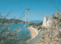
1984: Ohnaruto
Awajishima, Hyogo and Naruto, Tokushima, Japan - Naruto Strait
| Bridgemeister ID: | 480 (added before 2003) |
| Year Completed: | 1984 |
| Name: | Ohnaruto |
| Also Known As: | Onaruto |
| Location: | Awajishima, Hyogo and Naruto, Tokushima, Japan |
| Crossing: | Naruto Strait |
| Coordinates: | 34.238877 N 134.651243 E |
| Maps: | Acme, GeoHack, Google, OpenStreetMap |
| Principals: | Honshu-Shikoku Bridge Authority |
| References: | BAAW, BAR, BBR, BDU |
| Use: | Vehicular (major highway) |
| Status: | In use (last checked: 2019) |
| Main Cables: | Wire (steel) |
| Suspended Spans: | 3 |
| Main Span: | 1 x 876 meters (2,874 feet) |
| Side Spans: | 2 x 330 meters (1,082.7 feet) |
| Deck width: | 34 meters |
External Links:
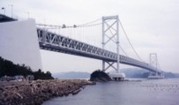
1987: Kita Bisan-Seto
Yoshima Island and Sakaide, Kagawa, Japan - Seto Inland Sea
| Bridgemeister ID: | 481 (added before 2003) |
| Year Completed: | 1987 |
| Name: | Kita Bisan-Seto |
| Also Known As: | 北備讃瀬戸大橋 |
| Location: | Yoshima Island and Sakaide, Kagawa, Japan |
| Crossing: | Seto Inland Sea |
| Coordinates: | 34.379065 N 133.820065 E |
| Maps: | Acme, GeoHack, Google, OpenStreetMap |
| Principals: | Honshu-Shikoku Bridge Authority |
| References: | BAAW, BAR, BBR, BDU |
| Use: | Vehicular (major highway) and Rail |
| Status: | In use (last checked: 2019) |
| Main Cables: | Wire (steel) |
| Suspended Spans: | 3 |
| Main Span: | 1 x 990 meters (3,248 feet) |
| Side Spans: | 2 x 274 meters (899 feet) |
| Deck width: | 35 meters upper deck, 30 meters lower deck |
Notes:
- Connects to 1988 Minami Bisan-Seto (南備讃瀬戸大橋) - Yoshima Island (与島) and Sakaide (坂出市), Kagawa, Japan.
- Near 1988 Shimotsui-Seto (下津井瀬戸大橋) - Kojima, Okayama and Hitsuishijima (櫃石島), Kagawa, Japan.
External Links:
1988: Fatih Sultan Mehmet
Istanbul, Türkiye - Bosporus Strait
| Bridgemeister ID: | 483 (added before 2003) |
| Year Completed: | 1988 |
| Name: | Fatih Sultan Mehmet |
| Also Known As: | Bosporus II |
| Location: | Istanbul, Türkiye |
| Crossing: | Bosporus Strait |
| Coordinates: | 41.091363 N 29.061628 E |
| Maps: | Acme, GeoHack, Google, OpenStreetMap |
| References: | BBR, BDU |
| Use: | Vehicular (major highway) |
| Status: | In use (last checked: 2023) |
| Main Cables: | Wire (steel) |
| Suspended Spans: | 1 |
| Main Span: | 1 x 1,091.2 meters (3,580 feet) |
External Links:
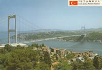
1988: Minami Bisan-Seto
Yoshima Island (与島) and Sakaide (坂出市), Kagawa, Japan - Seto Inland Sea
| Bridgemeister ID: | 485 (added before 2003) |
| Year Completed: | 1988 |
| Name: | Minami Bisan-Seto |
| Also Known As: | 南備讃瀬戸大橋 |
| Location: | Yoshima Island (与島) and Sakaide (坂出市), Kagawa, Japan |
| Crossing: | Seto Inland Sea |
| Coordinates: | 34.364167 N 133.825278 E |
| Maps: | Acme, GeoHack, Google, OpenStreetMap |
| Principals: | Honshu-Shikoku Bridge Authority |
| References: | BAAW, BAR, BBR, BDU |
| Use: | Vehicular (major highway) and Rail |
| Status: | In use (last checked: 2019) |
| Main Cables: | Wire (steel) |
| Suspended Spans: | 3 |
| Main Span: | 1 x 1,100 meters (3,608.9 feet) |
| Side Spans: | 2 x 274 meters (899 feet) |
| Deck width: | 35 meters upper deck, 30 meters lower deck |
Notes:
- Connects to 1987 Kita Bisan-Seto (北備讃瀬戸大橋) - Yoshima Island and Sakaide, Kagawa, Japan.
- Near 1988 Shimotsui-Seto (下津井瀬戸大橋) - Kojima, Okayama and Hitsuishijima (櫃石島), Kagawa, Japan.
External Links:

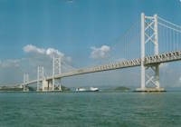
1988: Shimotsui-Seto
Kojima, Okayama and Hitsuishijima (櫃石島), Kagawa, Japan - Seto Inland Sea
| Bridgemeister ID: | 486 (added before 2003) |
| Year Completed: | 1988 |
| Name: | Shimotsui-Seto |
| Also Known As: | 下津井瀬戸大橋 |
| Location: | Kojima, Okayama and Hitsuishijima (櫃石島), Kagawa, Japan |
| Crossing: | Seto Inland Sea |
| Coordinates: | 34.431483 N 133.807833 E |
| Maps: | Acme, GeoHack, Google, OpenStreetMap |
| Principals: | Honshu-Shikoku Bridge Authority |
| References: | AOB, BAAW, BAR, BBR, BDU |
| Use: | Vehicular (major highway) |
| Status: | In use (last checked: 2019) |
| Main Cables: | Wire (steel) |
| Suspended Spans: | 1 |
| Main Span: | 1 x 940 meters (3,084 feet) |
Notes:
- Near 1987 Kita Bisan-Seto (北備讃瀬戸大橋) - Yoshima Island and Sakaide, Kagawa, Japan.
- Near 1988 Minami Bisan-Seto (南備讃瀬戸大橋) - Yoshima Island (与島) and Sakaide (坂出市), Kagawa, Japan.
External Links:
1997: Höga Kusten
Veda, Sweden - Ångermanälven River
| Bridgemeister ID: | 496 (added before 2003) |
| Year Completed: | 1997 |
| Name: | Höga Kusten |
| Also Known As: | High Coast |
| Location: | Veda, Sweden |
| Crossing: | Ångermanälven River |
| Coordinates: | 62.7984 N 17.93915 E |
| Maps: | Acme, GeoHack, Google, OpenStreetMap |
| References: | BC3, BDU |
| Use: | Vehicular |
| Status: | In use (last checked: 2023) |
| Main Cables: | Wire (steel) |
| Suspended Spans: | 3 |
| Main Span: | 1 x 1,210 meters (3,969.8 feet) |
| Side Spans: | 2 |
| Deck width: | 17.8 meters |
External Links:
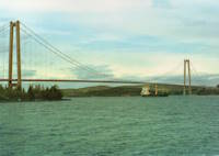
1998: Akashi Kaikyo
Maiko, Tarumi-ward, Kobe and Matsuho, Awaji Island, Hyogo, Japan - Akashi Strait
| Bridgemeister ID: | 501 (added before 2003) |
| Year Completed: | 1998 |
| Name: | Akashi Kaikyo |
| Also Known As: | 明石海峡大橋 |
| Location: | Maiko, Tarumi-ward, Kobe and Matsuho, Awaji Island, Hyogo, Japan |
| Crossing: | Akashi Strait |
| Coordinates: | 34.630617 N 135.0327 E |
| Maps: | Acme, GeoHack, Google, OpenStreetMap |
| Principals: | Honshu-Shikoku Bridge Authority |
| References: | BAR, BBR, BDU, CTW, PS199803, SA199712b |
| Use: | Vehicular (major highway) |
| Status: | In use (last checked: 2020) |
| Main Cables: | Wire (steel) |
| Suspended Spans: | 3 |
| Main Span: | 1 x 1,991 meters (6,532.2 feet) |
| Side Spans: | 2 x 960 meters (3,149.6 feet) |
| Deck width: | 35.5 meters |
Notes:
- Became longest suspension bridge by eclipsing 1981 Humber - Hull, Humberside, England, United Kingdom.
- Eclipsed by new longest suspension bridge 2022 Çanakkale 1915 - Sütlüce, Gelibolu and Lapseki, Çanakkale, Türkiye.
External Links:
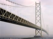
1998: Great Belt
Korsør and Nyborg, Denmark - Great Belt
| Bridgemeister ID: | 502 (added before 2003) |
| Year Completed: | 1998 |
| Name: | Great Belt |
| Also Known As: | Great Belt Fixed Link, Storebaelt, East, Storebælt, East Belt |
| Location: | Korsør and Nyborg, Denmark |
| Crossing: | Great Belt |
| At or Near Feature: | Storebaelt |
| Coordinates: | 55.342087 N 11.036430 E |
| Maps: | Acme, GeoHack, Google, OpenStreetMap |
| Principals: | COINFRA |
| References: | BAR, BBR, BC3, BDU, COB, CTW |
| Use: | Vehicular (major highway) |
| Status: | In use (last checked: 2023) |
| Main Cables: | Wire (steel) |
| Suspended Spans: | 3 |
| Main Span: | 1 x 1,624 meters (5,328.1 feet) |
| Side Spans: | 2 x 535 meters (1,755.2 feet) |
External Links:
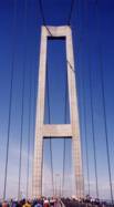
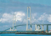
1999: Jiangyin
Jiangyin (江阴市), Wuxi (无锡市) and Jingjiang (靖江市), Taizhou (泰州市), Jiangsu, China - Yangtze River
| Bridgemeister ID: | 498 (added before 2003) |
| Year Completed: | 1999 |
| Name: | Jiangyin |
| Location: | Jiangyin (江阴市), Wuxi (无锡市) and Jingjiang (靖江市), Taizhou (泰州市), Jiangsu, China |
| Crossing: | Yangtze River |
| Coordinates: | 31.943965 N 120.273911 E |
| Maps: | Acme, GeoHack, Google, OpenStreetMap |
| References: | BC3, BCG, BDU |
| Use: | Vehicular (major highway) |
| Status: | In use (last checked: 2023) |
| Main Cables: | Wire (steel) |
| Suspended Spans: | 1 |
| Main Span: | 1 x 1,385 meters (4,544 feet) |
External Links: