Inventory Search Results
33 suspension bridges were found for search criteria: BOB. All 33 bridges from the search results appear below. Click the Bridgemeister ID number to isolate the bridge on its own page. If you don't see what you were looking for, try an image search with the same criteria: BOB. This will find the bridge if it is pictured on the site, but is not a catenary suspension bridge.
Related:
1801: Jacob's Creek
Iron Bridge, Mount Pleasant vicinity, Pennsylvania, USA - Jacob's Creek
| Bridgemeister ID: | 3 (added before 2003) |
| Year Completed: | 1801 |
| Name: | Jacob's Creek |
| Also Known As: | Iron Bridge, Chain Bridge |
| Location: | Iron Bridge, Mount Pleasant vicinity, Pennsylvania, USA |
| Crossing: | Jacob's Creek |
| Coordinates: | 40.112598 N 79.553186 W |
| Maps: | Acme, GeoHack, Google, OpenStreetMap |
| Principals: | Judge James Finley |
| References: | AAJ, ASB, BBR, BOB, BPL, CAB, DSE20000116, HBE, LAB, PTS2 |
| Use: | Vehicular |
| Status: | Removed, 1833 |
| Main Cables: | Chain (iron) |
| Suspended Spans: | 3 |
| Main Span: | 1 x 21.3 meters (70 feet) |
| Deck width: | 12.5 feet |
Notes:
- In an email dated January 16, 2000, Don Sayenga provided information about the location of this bridge. Generally attributed to Uniontown (the seat of Fayette County, PA), Mr. Sayenga offers some clues about the bridge's true location. "[James Finley] stated that he built it near the home of his friend Meason which implies a connection for the iron as Meason was making iron. Meason's home has survived by the way, a beautiful place. Finley stated it was a combination contract with the cost split between two counties, and he stated it was built over Jacob's Creek which is the county boundary. He also makes it clear it was on the road to Greensburg. The only place the old road crossed Jacob's Creek is just south of Mount Pleasant, Pennsylvania. On the geodetic survey maps this spot is marked "Iron Bridge" but there is no town there. The last time I was there I saw a sign that said 'Iron Bridge' on an automobile scrap yard. I found absolutely no trace of the bridge, but it was not very big, so there was no need for a huge abutment."
- First suspension bridge with a rigid level deck, often considered the world's first modern suspension bridge.
- Coordinates are for the likely location of the bridge, where present-day (2020) Pennsylvania route 3105 crosses Jacob's Creek.
External Links:
1816: Spider
Philadelphia, Pennsylvania, USA - Schuylkill River
| Bridgemeister ID: | 20 (added before 2003) |
| Year Completed: | 1816 |
| Name: | Spider |
| Location: | Philadelphia, Pennsylvania, USA |
| Crossing: | Schuylkill River |
| Principals: | Josiah White, Erskine Hazard |
| References: | AAJ, BOB, BPL, GHD, HBE, LAB, PTS2 |
| Use: | Footbridge |
| Status: | Removed |
| Main Cables: | Wire (iron) |
| Main Span: | 1 x 120 meters (393.75 feet) |
Notes:
- Narrow footbridge. First wire bridge in North America. HBE notes "first wire suspension bridge in any country."
- Often described as having collapsed under the weight of ice and snow, Don Sayenga notes that no contemporary sources confirm this demise. Since the nearby chain bridge did fail under weight of ice and snow, he believes this fate has been misattributed to the White and Hazard footbridge. Don believes the bridge was just dismantled at some point after June, 1816.
- Al Zagofsky also wrote to explain there was no evidence of this bridge collapsing under weight of ice and snow. Al writes: "According to an original source Captain Joshua Rowley Watson, who inspected the bridge on June 15, 1816: '...There was a bridge, but which by the weight of ice and snow, has been carried away.' This refers to the previous bridge that the cable bridge was temporarily replacing. I did not see any cause for failure of the wire rope bridge. My guess is that it was removed when the regular bridge was repaired. The same article shows a sketch that he made, showing the main span to be 407 feet. I am looking at the Canal History and Technology Proceedings Vol 5, March 22, 1986."
1820: Union
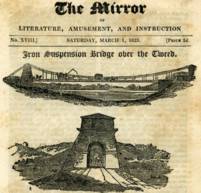
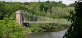
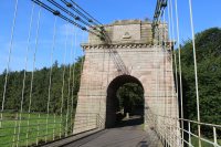
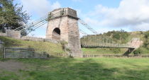
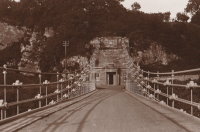
Horncliffe, Berwick-upon-Tweed vicinity, England and Fishwick, Scotland, United Kingdom - River Tweed
| Bridgemeister ID: | 373 (added before 2003) |
| Year Completed: | 1820 |
| Name: | Union |
| Location: | Horncliffe, Berwick-upon-Tweed vicinity, England and Fishwick, Scotland, United Kingdom |
| Crossing: | River Tweed |
| Coordinates: | 55.75256 N 2.10677 W |
| Maps: | Acme, GeoHack, Google, OpenStreetMap |
| Principals: | Sir Samuel Brown |
| References: | AAJ, BBR, BC3, BEM, BOB, HBE, MOS, NTB, PTS2, SBR |
| Use: | Vehicular (one-lane) |
| Status: | In use (last checked: 2023) |
| Main Cables: | Chain (iron) |
| Suspended Spans: | 1 |
| Main Span: | 1 x 136.9 meters (449 feet) |
| Deck width: | 18 feet |
Notes:
- 2007, March: Closed after a hanger snapped in high winds. Repaired and reopened August, 2007.
- 2020, October: Closed for major renovation and conservation project.
- 2023, April: The bridge is reopened.
- Eclipsed by new longest suspension bridge 1826 Menai Strait - Menai Bridge and Bangor vicinity, Wales, United Kingdom.
External Links:
- Conservation - Union Chain Bridge - unionchainbridge.org. Site devoted to the 2020-2023 renovation project. This page lists the highlights of the project.
- Structurae - Structure ID 20000162
1823: Brighton Pier
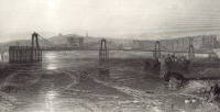
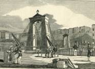
Brighton, East Sussex, England, United Kingdom
| Bridgemeister ID: | 376 (added before 2003) |
| Year Completed: | 1823 |
| Name: | Brighton Pier |
| Location: | Brighton, East Sussex, England, United Kingdom |
| Principals: | Sir Samuel Brown |
| References: | AAJ, BEM, BOB, HBE, MOS, SBR |
| Use: | Footbridge |
| Status: | Destroyed, 1896 |
| Main Cables: | Chain (iron) |
| Suspended Spans: | 4 |
| Main Spans: | 4 x 77.7 meters (255 feet) |
Notes:
- SBR: Severely damaged 1833, 1836. Destroyed by storm 1896.
External Links:
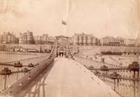
1826: Broughton
Lancashire, England, United Kingdom - River Irwell
| Bridgemeister ID: | 379 (added before 2003) |
| Year Completed: | 1826 |
| Name: | Broughton |
| Also Known As: | Gerald Road |
| Location: | Lancashire, England, United Kingdom |
| Crossing: | River Irwell |
| References: | AAJ, BOB, HBE, MOS, SBR |
| Use: | Vehicular |
| Status: | Replaced, 1914 |
| Main Cables: | Chain (iron) |
| Main Span: | 1 x 44.3 meters (145.5 feet) |
| Deck width: | 18.25 feet |
Notes:
- Famously collapsed under weight of marching troops April 12, 1831. Was rebuilt and strengthened and eventually replaced in 1914.
1829: Montrose
Montrose, Scotland, United Kingdom - South Esk River
| Bridgemeister ID: | 388 (added before 2003) |
| Year Completed: | 1829 |
| Name: | Montrose |
| Location: | Montrose, Scotland, United Kingdom |
| Crossing: | South Esk River |
| Coordinates: | 56.705802 N 2.475390 W |
| Maps: | Acme, GeoHack, Google, OpenStreetMap |
| Principals: | Sir Samuel Brown |
| References: | AAJ, BEM, BOB, HBE, PTS2, SBR |
| Use: | Vehicular |
| Status: | Demolished, 1929 |
| Main Cables: | Chain (iron) |
| Suspended Spans: | 1 |
Notes:
- SBR: March 19, 1830, with a "crowd of people, estimated at 700, ... watching a boat race," a chain broke "plunging most of the people into the river." Repaired.
- 1838: Wrecked by storm. Repaired.
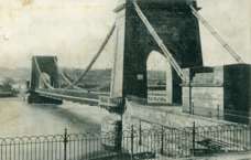

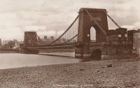
1842: Fairmount
Philadelphia, Pennsylvania, USA - Schuylkill River
| Bridgemeister ID: | 24 (added before 2003) |
| Year Completed: | 1842 |
| Name: | Fairmount |
| Also Known As: | Callowhill Street, Upper Ferry |
| Location: | Philadelphia, Pennsylvania, USA |
| Crossing: | Schuylkill River |
| Principals: | Charles Ellet |
| References: | BBR, BOB, BPL, HBE, LAB, PTS2, WHSB |
| Use: | Vehicular |
| Status: | Replaced, 1875 |
| Main Cables: | Wire (iron) |
| Suspended Spans: | 1 |
| Main Span: | 1 x 104.2 meters (342 feet) |
Notes:
- BBR and BOB say 1841.
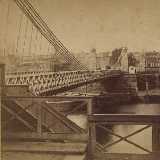
1843: (suspension bridge)
Cincinnati, Ohio, USA - Miami Canal
| Bridgemeister ID: | 25 (added before 2003) |
| Year Completed: | 1843 |
| Name: | (suspension bridge) |
| Location: | Cincinnati, Ohio, USA |
| Crossing: | Miami Canal |
| References: | BOB |
| Status: | Removed |
| Suspended Spans: | 3 |
1845: Pittsburgh Aqueduct
Pittsburgh, Pennsylvania, USA - Allegheny River
| Bridgemeister ID: | 27 (added before 2003) |
| Year Completed: | 1845 |
| Name: | Pittsburgh Aqueduct |
| Location: | Pittsburgh, Pennsylvania, USA |
| Crossing: | Allegheny River |
| Principals: | John A. Roebling |
| References: | BOB, BOP, BPL, HBE, ONF, PTS2, RDH, SJR |
| Use: | Aqueduct |
| Status: | Removed, 1861 |
| Main Cables: | Wire (iron) |
| Suspended Spans: | 7 |
| Main Spans: | 7 x 49.4 meters (162 feet) |
Notes:
- In use until 1860.
External Links:
1846: Monongahela
Pittsburgh, Pennsylvania, USA - Monongahela River
| Bridgemeister ID: | 28 (added before 2003) |
| Year Completed: | 1846 |
| Name: | Monongahela |
| Also Known As: | Smithfield Street |
| Location: | Pittsburgh, Pennsylvania, USA |
| Crossing: | Monongahela River |
| Principals: | John A. Roebling |
| References: | BOB, BOP, BPL, HBE, ONF, PBR, PTS2 |
| Use: | Vehicular |
| Status: | Removed, 1882 |
| Main Cables: | Wire (iron) |
| Suspended Spans: | 8 |
| Main Spans: | 8 x 57.3 meters (188 feet) |
| Deck width: | 20 feet |
External Links:
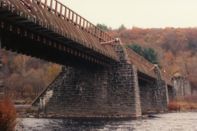
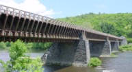
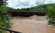
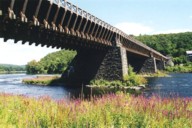
1848: Delaware Aqueduct
Lackawaxen, Pennsylvania and Minisink Ford, New York, USA - Delaware River
| Bridgemeister ID: | 30 (added before 2003) |
| Year Completed: | 1848 |
| Name: | Delaware Aqueduct |
| Also Known As: | Roebling Aqueduct |
| Location: | Lackawaxen, Pennsylvania and Minisink Ford, New York, USA |
| Crossing: | Delaware River |
| Coordinates: | 41.48262 N 74.98461 W |
| Maps: | Acme, GeoHack, Google, OpenStreetMap |
| Principals: | John A. Roebling |
| References: | AAJ, BDR, BOB, BPL, GBD, LAB, LACE, RDH, SJR |
| Use: | Aqueduct and Vehicular (one-lane), with walkway |
| Status: | In use (last checked: 2006) |
| Main Cables: | Wire (iron) |
| Suspended Spans: | 4 |
| Main Spans: | 1 x 43.3 meters (142 feet), 3 x 39.9 meters (131 feet) |
Notes:
- BPL: Completed 1848. RDH/BDR: Completed 1848, not used until 1849.
- Originally constructed to carry the Delaware and Hudson Canal. Converted to a one-lane vehicular bridge soon after the canal closed in 1898. Substantially restored in 1980's and 1990's, but retains original cables.
- Built as part of same project as 1849 Lackawaxen Aqueduct - Lackawaxen, Pennsylvania, USA.
- Built as part of same project as 1851 High Falls Aqueduct - High Falls, New York, USA.
- Built as part of same project as 1851 Neversink Aqueduct - Cuddebackville, New York, USA.
- Near 1849 Lackawaxen Aqueduct - Lackawaxen, Pennsylvania, USA.
External Links:
1848: Niagara Suspension
Niagara Falls, New York, USA and Niagara Falls, Ontario, Canada - Niagara River
| Bridgemeister ID: | 29 (added before 2003) |
| Year Completed: | 1848 |
| Name: | Niagara Suspension |
| Location: | Niagara Falls, New York, USA and Niagara Falls, Ontario, Canada |
| Crossing: | Niagara River |
| Principals: | Charles Ellet |
| References: | BOB, BPL, HBE, ONF, PTS2 |
| Use: | Vehicular (one-lane) |
| Status: | Removed |
| Main Cables: | Wire (iron) |
| Suspended Spans: | 1 |
| Main Span: | 1 x 234.7 meters (770 feet) |
| Deck width: | 7.5 feet |
Notes:
1849: Lackawaxen Aqueduct
Lackawaxen, Pennsylvania, USA - Lackawaxen River
| Bridgemeister ID: | 31 (added before 2003) |
| Year Completed: | 1849 |
| Name: | Lackawaxen Aqueduct |
| Location: | Lackawaxen, Pennsylvania, USA |
| Crossing: | Lackawaxen River |
| Principals: | John A. Roebling |
| References: | AAJ, BOB, BPL, RDH, SJR |
| Use: | Aqueduct |
| Status: | Removed |
| Main Cables: | Wire (iron) |
| Suspended Spans: | 2 |
| Main Spans: | 2 x 34.9 meters (114.37 feet) |
Notes:
- BPL says 1848, RDH says same, but not used until 1849.
- Built as part of same project as 1848 Delaware Aqueduct (Roebling Aqueduct) - Lackawaxen, Pennsylvania and Minisink Ford, New York, USA.
- Built as part of same project as 1851 High Falls Aqueduct - High Falls, New York, USA.
- Built as part of same project as 1851 Neversink Aqueduct - Cuddebackville, New York, USA.
- Near 1848 Delaware Aqueduct (Roebling Aqueduct) - Lackawaxen, Pennsylvania and Minisink Ford, New York, USA.
External Links:
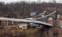
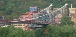
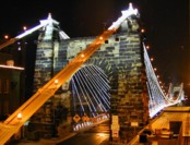
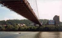
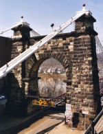
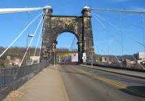
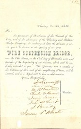
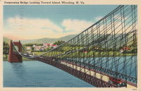
1849: Wheeling
Wheeling, West Virginia, USA - Ohio River
| Bridgemeister ID: | 32 (added before 2003) |
| Year Completed: | 1849 |
| Name: | Wheeling |
| Also Known As: | Wheeling and Belmont |
| Location: | Wheeling, West Virginia, USA |
| Crossing: | Ohio River |
| Coordinates: | 40.07167 N 80.72667 W |
| Maps: | Acme, GeoHack, Google, OpenStreetMap |
| Principals: | Charles Ellet |
| References: | AAJ, BBR, BC3, BOB, BPL, CEJ, COB, GBD, HBE, LAB, LACE, ONF, PTS2, RWS, WCC, WHSB |
| Use: | Vehicular (two-lane, light vehicles only) |
| Status: | Restricted to foot traffic, since September 2019 (last checked: 2020) |
| Main Cables: | Wire (iron) |
| Suspended Spans: | 1 |
| Main Span: | 1 x 307.8 meters (1,010 feet) |
Notes:
- Was still part of Virginia at time of completion.
- 1854: Rebuilt after it was wrecked by a windstorm. Contrary to popular myth, the rebuilding was undertaken by Ellet and his assistant William K. McComas, not by John A. Roebling.
- 1860: Overhauled. Popular myth often attributes this work to the Roeblings. WHSB attributes this work to William K. McComas. After this overhaul, the bridge still does not have the distinctive diagonal cable stays that give it the appearance of a Roebling bridge.
- 1872: Overhauled according to a design by Washington Roebling. John A. Roebling had died in 1869 and was not involved with this work. WHSB notes, "The design essentially Roeblingized the bridge with the diagonal cable stays that are such a prominent feature of the bridge."
- 2019, September: Closed to vehicular traffic indefinitely due to safety concerns after repeated overweight vehicle violations.
- 2020, November: Bids being evaluated for renovation project. Bridge remains closed to vehicular traffic.
- 2021, April: Single bid received was rejected. Bids expected to be resolicited in June. The bridge remains closed to all vehicular traffic.
- 2022, February: $17.9 million renovation project expected to start soon.
- Became longest suspension bridge by eclipsing 1834 Zaehringen (Grand Pont Suspendu) - Fribourg, Switzerland.
- Eclipsed by new longest suspension bridge 1867 John A. Roebling (Cincinnati, Cincinnati and Covington) - Cincinnati, Ohio and Covington, Kentucky, USA.
External Links:
1851: High Falls Aqueduct
High Falls, New York, USA - Rondout Creek
| Bridgemeister ID: | 34 (added before 2003) |
| Year Completed: | 1851 |
| Name: | High Falls Aqueduct |
| Location: | High Falls, New York, USA |
| Crossing: | Rondout Creek |
| Principals: | John A. Roebling |
| References: | AAJ, BOB, BPL, RDH, SJR |
| Use: | Aqueduct |
| Status: | Removed, August, 1921 |
| Main Cables: | Wire (iron) |
| Suspended Spans: | 1 |
| Main Span: | 1 x 44.2 meters (145 feet) |
Notes:
- BPL, AAJ say completed 1848, RDH says not used until 1851 canal season.
- Heavy damaged by fire, 1921.
- Built as part of same project as 1848 Delaware Aqueduct (Roebling Aqueduct) - Lackawaxen, Pennsylvania and Minisink Ford, New York, USA.
- Built as part of same project as 1849 Lackawaxen Aqueduct - Lackawaxen, Pennsylvania, USA.
- Built as part of same project as 1851 Neversink Aqueduct - Cuddebackville, New York, USA.
External Links:
1851: Lewiston-Queenston
Lewiston, New York, USA and Queenston, Ontario, Canada - Niagara River
| Bridgemeister ID: | 35 (added before 2003) |
| Year Completed: | 1851 |
| Name: | Lewiston-Queenston |
| Location: | Lewiston, New York, USA and Queenston, Ontario, Canada |
| Crossing: | Niagara River |
| Principals: | Edward Serrell |
| References: | AAJ, BOB, BPL, HBE, PTS2 |
| Use: | Vehicular |
| Status: | Wrecked, 1864 |
| Main Cables: | Wire (iron) |
| Suspended Spans: | 1 |
| Main Span: | 1 x 258.8 meters (849 feet) |
| Deck width: | 21 feet (AAJ: 19.5 feet) |
Notes:
- Wrecked by wind February 1, 1864. Stay cables beneath the bridge had been disconnected to avoid damage from rising ice. Portions of the cables and deck remained, in a derelict state, as late as 1895. Replacement was not started until the late 1890's.
- The February 3, 1864 edition of Niagara Falls Gazette describes the wind event: "Partial Destruction Of The Lewiston Suspension Bridge -- A portion of the flooring and other wood-work of the Lewiston Suspension Bridge was blown down during the gale Monday forenoon. It seems that the long guys had been cut during the late ice jam to prevent injury to the structure and thus its strength to withstand a gale was much weakened. The wind swept through the gorge on Monday with terrific force and swayed the bridge so that some of the cross timbers, near the centre were loosened from their fastenings, and fell, of course carrying the floor with them. A large portion at each end, remains without material injury. The extent of the damage -- financially -- we have not yet learned, but we judge from what we hear that it may be about $10,000. The bridge was built in 1852 and cost not far from $40,000. It will doubtless soon be repaired and in use."
- Later at same location 1899 Lewiston-Queenston - Lewiston, New York, USA and Queenston, Ontario, Canada.
- See 1849 Wheeling (Wheeling and Belmont) - Wheeling, West Virginia, USA. The 1851 Lewiston-Queenston bridge is sometimes claimed to have become the longest in the world with a main span surpassing the length of the Wheeling suspension bridge. However, Don Sayenga notes the length of the suspended span of the Lewiston-Queenston bridge was only 849 feet, not the 1,043 feet sometimes cited. Don writes: "[1,043 feet] was the distance between the towers built high up on the cliffs above the crossing - because there was no space for them below. The roadway suspended from the towers was only 849 feet span over the water from abutment to abutment." Thus, Roebling's Cincinnati bridge should be considered the first to eclipse Wheeling's record main span.
External Links:
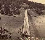
1851: Neversink Aqueduct
Cuddebackville, New York, USA - Neversink River
| Bridgemeister ID: | 36 (added before 2003) |
| Year Completed: | 1851 |
| Name: | Neversink Aqueduct |
| Location: | Cuddebackville, New York, USA |
| Crossing: | Neversink River |
| Principals: | John A. Roebling |
| References: | AAJ, BOB, RDH, SJR |
| Use: | Aqueduct |
| Status: | Removed |
| Main Cables: | Wire (iron) |
| Suspended Spans: | 1 |
| Main Span: | 1 x 51.8 meters (170 feet) |
Notes:
- BPL says 1849, RDH says not used until 1851 canal season.
- Built as part of same project as 1848 Delaware Aqueduct (Roebling Aqueduct) - Lackawaxen, Pennsylvania and Minisink Ford, New York, USA.
- Built as part of same project as 1849 Lackawaxen Aqueduct - Lackawaxen, Pennsylvania, USA.
- Built as part of same project as 1851 High Falls Aqueduct - High Falls, New York, USA.
External Links:
1854: Licking River I
Covington and Newport, Kentucky, USA - Licking River
| Bridgemeister ID: | 47 (added before 2003) |
| Year Completed: | 1854 |
| Name: | Licking River I |
| Location: | Covington and Newport, Kentucky, USA |
| Crossing: | Licking River |
| Principals: | John Gray, George C. Tarvin |
| References: | BOB, BPL, EOV |
| Status: | Collapsed, 1854 |
Notes:
- BPL: Collapsed under weight of cattle 1853. BOB: Indicates year of completion and collapse as 1854. EOV: Appears more authoritative on the matter, "Although the bridge was not quite finished, Tarvin and the mayor of Covington rode the first vehicle across it on December 28, 1853. Less than two weeks later... the bridge collapsed."
- The January 18, 1854 edition of The New York Times has a small article with a January 16, 1854 byline reporting the collapse of the bridge: "The... bridge... gave way this evening, while two men and eighteen cattle were crossing it... The keys which held the wire cable to the anchors gave way."
- Replaced by 1854 Licking River II - Covington and Newport, Kentucky, USA.
1855: Niagara Suspension
Niagara Falls, New York, USA and Niagara Falls, Ontario, Canada - Niagara River
| Bridgemeister ID: | 51 (added before 2003) |
| Year Completed: | 1855 |
| Name: | Niagara Suspension |
| Location: | Niagara Falls, New York, USA and Niagara Falls, Ontario, Canada |
| Crossing: | Niagara River |
| Principals: | John A. Roebling |
| References: | AAJ, BAAW, BBR, BFL, BMA, BOB, BPL, HBE, LIR, NSB, ONF, PTS2, SA18810716, SJR |
| Use: | Rail (heavy rail) and Vehicular (double-deck), with walkway |
| Status: | Replaced, 1897 |
| Main Cables: | Wire (iron) |
| Suspended Spans: | 1 |
| Main Span: | 1 x 250.3 meters (821.3 feet) |
Notes:
- Cables renovated, 1877. Wooden stiffening trusses replaced, 1880. Towers replaced, c. 1886. Bridge replaced with steel arch, 1897.
- AAJ notes the roadway deck opened in 1854, but the railway deck did not open until 1855.
- Replaced 1848 Niagara Suspension - Niagara Falls, New York, USA and Niagara Falls, Ontario, Canada.
External Links:
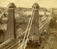
1860: Allegheny River
Pittsburgh, Pennsylvania, USA - Allegheny River
| Bridgemeister ID: | 59 (added before 2003) |
| Year Completed: | 1860 |
| Name: | Allegheny River |
| Also Known As: | Sixth Street, St. Clair |
| Location: | Pittsburgh, Pennsylvania, USA |
| Crossing: | Allegheny River |
| Principals: | John A. Roebling |
| References: | BOB, BOP, BPL, HBE, PBR, PTS2, SJR |
| Use: | Vehicular, with walkway |
| Status: | Replaced, 1892 |
| Main Cables: | Wire (iron) |
| Suspended Spans: | 4 |
| Main Spans: | 2 x 104.9 meters (344 feet) |
| Side Spans: | 2 x 52.1 meters (171 feet) |
| Deck width: | 40 feet |
Notes:
- BPL cites this bridge as the first suspension bridge with metal towers. However, at least two earlier suspension bridges (1857 Watertown, New York and 1856 Bidwell Bar, California) are known to have metal towers and even Roebling's 1846 Smithfield Street Bridge in Pittsburgh had cast iron towers.
- Next to 1884 North Side (Seventh Street) - Pittsburgh, Pennsylvania, USA.
External Links:
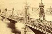
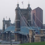
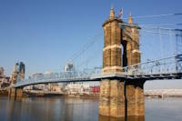
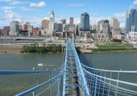
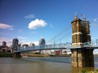
1867: John A. Roebling
Cincinnati, Ohio and Covington, Kentucky, USA - Ohio River
| Bridgemeister ID: | 65 (added before 2003) |
| Year Completed: | 1867 |
| Name: | John A. Roebling |
| Also Known As: | Cincinnati, Cincinnati and Covington |
| Location: | Cincinnati, Ohio and Covington, Kentucky, USA |
| Crossing: | Ohio River |
| Coordinates: | 39.09167 N 84.50833 W |
| Maps: | Acme, GeoHack, Google, OpenStreetMap |
| Principals: | John A. Roebling |
| References: | BAAW, BC3, BOB, BPL, COB, EOV, HBE, LAB, LACE, ONF, PTS2, SJR, TOB |
| Use: | Vehicular (two-lane), with walkway |
| Status: | Closed, February, 2021 (last checked: 2021) |
| Main Cables: | Wire (iron) |
| Suspended Spans: | 3 |
| Main Span: | 1 x 322.2 meters (1,057 feet) |
| Side Spans: | 2 |
Notes:
- 1892: Cable ends restored.
- 1899: Steel cables added to assist original cables.
- 2021, February: Closed to all vehicular traffic for a nine-month restoration project.
- Became longest suspension bridge by eclipsing 1849 Wheeling (Wheeling and Belmont) - Wheeling, West Virginia, USA.
- Eclipsed by new longest suspension bridge 1869 Clifton (Niagara-Clifton, Falls View, First Falls View) - Niagara Falls, New York, USA and Niagara Falls, Ontario, Canada.
External Links:
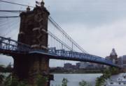
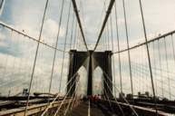
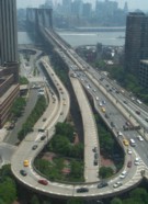
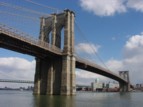
1883: Brooklyn
New York and Brooklyn, New York, USA - East River
| Bridgemeister ID: | 89 (added before 2003) |
| Year Completed: | 1883 |
| Name: | Brooklyn |
| Also Known As: | Great East River |
| Location: | New York and Brooklyn, New York, USA |
| Crossing: | East River |
| Coordinates: | 40.706 N 73.99667 W |
| Maps: | Acme, GeoHack, Google, OpenStreetMap |
| Principals: | John A. Roebling, Washington A. Roebling |
| References: | AAJ, BAAW, BBR, BBTS, BC3, BFL, BLD, BMA, BOB, BOU, BPL, COB, CTW, GB, GBD, HBE, LAB, LACE, NG198305, ONF, PTS2, SJR |
| Use: | Rail (light rail) and Vehicular (major highway), with walkway |
| Status: | In use (last checked: 2022) |
| Main Cables: | Wire (steel) |
| Suspended Spans: | 3 |
| Main Span: | 1 x 486.3 meters (1,595.5 feet) |
| Side Spans: | 2 x 283.5 meters (930 feet) |
| Deck width: | 85 feet |
Notes:
- Became longest suspension bridge by eclipsing 1869 Clifton (Niagara-Clifton, Falls View, First Falls View) - Niagara Falls, New York, USA and Niagara Falls, Ontario, Canada.
- Eclipsed by new longest suspension bridge 1903 Williamsburg - New York and Brooklyn, New York, USA.
- Next to 1909 Manhattan - New York and Brooklyn, New York, USA.
- Near 1903 Williamsburg - New York and Brooklyn, New York, USA.
External Links:
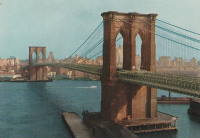
1940: H. Wallace Caldwell Memorial
Riverside, Illinois, USA - Des Plaines River
| Bridgemeister ID: | 775 (added 2003-03-14) |
| Year Completed: | 1940 |
| Name: | H. Wallace Caldwell Memorial |
| Also Known As: | Swinging |
| Location: | Riverside, Illinois, USA |
| Crossing: | Des Plaines River |
| Coordinates: | 41.826083 N 87.8176 W |
| Maps: | Acme, GeoHack, Google, OpenStreetMap |
| Use: | Footbridge |
| Status: | In use (last checked: 2021) |
| Main Cables: | Wire (steel) |
| Suspended Spans: | 1 |
| Main Span: | 1 x 64 meters (210 feet) estimated |
Notes:
- 2002, August 26-27: Deck replaced.
- 2023, March: Project to repaint the bridge expected to start, correcting issues with prior repainting efforts.
- Replaced 1905 Swinging - Riverside, Illinois, USA.
Annotated Citations:
- Uphues, Bob. "Riverside Township confounded in effort to repaint bridge." Riverside-Brookfield Landmark, 19 October 2021, https://www.rblandmark.com/2021/10/19/riverside-township-confounded-in-effort-to-repaint-bridge/
"What was thought to be a pretty straightforward project to refurbish the 210-foot long H. Wallace Caldwell Memorial Bridge – known to local residents as the Swinging Bridge – has turned into something of a nightmare for the Riverside Township Board of Trustees… It turns out that not only was the $75,000 earmarked in the 2021-22 budget far below what it’s going to take to do the job, the township board has had trouble getting companies to even submit bids."
- Uphues, Bob. "Riverside Township confounded in effort to repaint bridge." Riverside-Brookfield Landmark, 21 March 2023, https://www.rblandmark.com/2023/03/21/swinging-bridge-overhaul-set-to-start-in-late-march/
"A long-awaited project to overhaul the painted surfaces of the Swinging Bridge will start March 27 after Riverside Township trustees voted 4-0 on March 14 to approve an ordinance announcing their intention to issue up to $500,000 in alternate revenue bonds to fund the work…"

1964: Gates Park Pack
Augusta vicinity, Montana, USA - North Fork of the Sun River
| Bridgemeister ID: | 6349 (added 2021-07-25) |
| Year Completed: | 1964 |
| Name: | Gates Park Pack |
| Location: | Augusta vicinity, Montana, USA |
| Crossing: | North Fork of the Sun River |
| At or Near Feature: | Bob Marshall Wilderness |
| Coordinates: | 47.553636 N 112.944389 W |
| Maps: | Acme, GeoHack, Google, OpenStreetMap |
| Use: | Pack and Footbridge |
| Status: | Replaced, 2011 |
| Main Cables: | Wire (steel) |
| Suspended Spans: | 1 |
| Main Span: | 1 x 39 meters (128 feet) |
Notes:
- May have replaced another suspension bridge dating to 1948.
- Replaced by 2011 Gates Park Pack - Augusta vicinity, Montana, USA.
External Links:
1964: Medicine Springs Pack
Augusta vicinity, Montana, USA - North Fork Sun River
| Bridgemeister ID: | 6347 (added 2021-07-25) |
| Year Completed: | 1964 |
| Name: | Medicine Springs Pack |
| Location: | Augusta vicinity, Montana, USA |
| Crossing: | North Fork Sun River |
| At or Near Feature: | Bob Marshall Wilderness |
| Coordinates: | 47.632222 N 112.857444 W |
| Maps: | Acme, GeoHack, Google, OpenStreetMap |
| Use: | Pack and Footbridge |
| Status: | Replaced, 2016 |
| Main Cables: | Wire (steel) |
| Suspended Spans: | 1 |
| Main Span: | 1 x 35.1 meters (115 feet) estimated |
Notes:
- May have replaced another suspension bridge.
- Replaced by 2016 Medicine Springs Pack - Augusta vicinity, Montana, USA.
External Links:
- Remote pack bridge near Bob gets a face-lift; materials flown in. "A 52-year-old pack bridge leading into the Bob Marshall Wilderness is being replaced, with tons of material needed in the replacement flown in by helicopter."
| Bridgemeister ID: | 2697 (added 2019-05-27) |
| Year Completed: | 2003 |
| Name: | Bob Mac's Crossing |
| Location: | Athens, Texas, USA |
| At or Near Feature: | East Texas Arboretum |
| Coordinates: | 32.207487 N 95.878114 W |
| Maps: | Acme, GeoHack, Google, OpenStreetMap |
| Principals: | Bob McDonald, San Jacinto Engineering |
| Use: | Footbridge |
| Status: | In use (last checked: 2019) |
| Main Cables: | Wire (steel) |
2011: Gates Park Pack
Augusta vicinity, Montana, USA - North Fork of the Sun River
| Bridgemeister ID: | 6350 (added 2021-07-25) |
| Year Completed: | 2011 |
| Name: | Gates Park Pack |
| Location: | Augusta vicinity, Montana, USA |
| Crossing: | North Fork of the Sun River |
| At or Near Feature: | Continental Divide Trail, Bob Marshall Wilderness |
| Coordinates: | 47.553624 N 112.944214 W |
| Maps: | Acme, GeoHack, Google, OpenStreetMap |
| Use: | Pack and Footbridge |
| Status: | In use (last checked: 2011) |
| Main Cables: | Wire (steel) |
| Suspended Spans: | 1 |
| Main Span: | 1 x 39 meters (128 feet) |
Notes:
2016: Medicine Springs Pack
Augusta vicinity, Montana, USA - North Fork Sun River
| Bridgemeister ID: | 6348 (added 2021-07-25) |
| Year Completed: | 2016 |
| Name: | Medicine Springs Pack |
| Location: | Augusta vicinity, Montana, USA |
| Crossing: | North Fork Sun River |
| At or Near Feature: | Bob Marshall Wilderness |
| Coordinates: | 47.632292 N 112.857250 W |
| Maps: | Acme, GeoHack, Google, OpenStreetMap |
| Use: | Pack and Footbridge |
| Status: | In use (last checked: 2016) |
| Main Cables: | Wire (steel) |
| Suspended Spans: | 1 |
| Main Span: | 1 x 35.1 meters (115 feet) estimated |
Notes:
External Links:
- Remote pack bridge near Bob gets a face-lift; materials flown in. "A 52-year-old pack bridge leading into the Bob Marshall Wilderness is being replaced, with tons of material needed in the replacement flown in by helicopter."
(footbridge)
Burnt Ranch vicinity, California, USA - Trinity River
| Bridgemeister ID: | 2408 (added 2007-12-24) |
| Name: | (footbridge) |
| Location: | Burnt Ranch vicinity, California, USA |
| Crossing: | Trinity River |
| At or Near Feature: | Six Rivers National Forest |
| Use: | Footbridge |
| Status: | Removed |
| Main Cables: | Wire |
| Suspended Spans: | 1 |
Notes:
- Completed 1915-1917, likely removed, 1970s.
- An article in the October 29, 1971 edition of The Times-Standard (Eureka, California) describes this bridge as being located over the Trinity River at New River. USGS topographical maps show a footbridge a few hundred yards north of the intersection of the two rivers at Gray Falls. The article has a photograph of the bridge and describes its possible replacement. The bridge was already closed at the time of the article: "A 50 year-old picturesque footbridge across the Trinity River at New River will be replaced if special funds can be obtained by the Six Rivers Nalional Forest, the federal agency has decided. 'Strong supportive response from people throughout the area to the continued need for a bridge' was reported by Forest Supervisor Bob Allison. The responses came after the Forest Service solicited comments in August on the replacement need for the span. The new bridge would be nearly as possible a replica of the present bridge constructed sometime between 1915 - 1917 by Jim and John Larson. It served as the main link between Denny and the outside world."
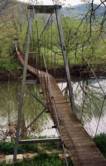
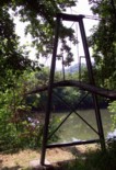
(footbridge)
Wood vicinity, Virginia, USA - Clinch River
| Bridgemeister ID: | 1371 (added 2004-07-03) |
| Name: | (footbridge) |
| Location: | Wood vicinity, Virginia, USA |
| Crossing: | Clinch River |
| Coordinates: | 36.78314 N 82.56162 W |
| Maps: | Acme, GeoHack, Google, OpenStreetMap |
| Principals: | VDOT |
| Use: | Footbridge |
| Status: | In use (last checked: 2007) |
| Main Cables: | Wire (steel) |
| Suspended Spans: | 3 |
| Main Span: | 1 x 68.6 meters (225 feet) estimated |
| Side Spans: | 1 x 11.6 meters (38 feet) estimated, 1 x 14 meters (46 feet) estimated |
(suspension bridge)
Durham, England, United Kingdom
| Bridgemeister ID: | 510 (added before 2003) |
| Name: | (suspension bridge) |
| Location: | Durham, England, United Kingdom |
| Principals: | Sir Samuel Brown |
| References: | BOB |
| Main Cables: | Chain (iron) |
Notes:
- This may be the same as the 1831 Whorlton bridge.
Benchmark Pack
Augusta vicinity, Montana, USA - South Fork Sun River
| Bridgemeister ID: | 6351 (added 2021-07-25) |
| Name: | Benchmark Pack |
| Location: | Augusta vicinity, Montana, USA |
| Crossing: | South Fork Sun River |
| At or Near Feature: | Continental Divide Trail, Bob Marshall Wilderness |
| Coordinates: | 47.506399 N 112.890707 W |
| Maps: | Acme, GeoHack, Google, OpenStreetMap |
| Use: | Pack and Footbridge |
| Status: | In use (last checked: 2018) |
| Main Cables: | Wire (steel) |
| Suspended Spans: | 1 |
| Main Span: | 1 x 27.4 meters (90 feet) estimated |
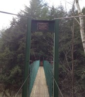
Clarendon Gorge
Rutland vicinity, Vermont, USA - Mill River
| Bridgemeister ID: | 323 (added before 2003) |
| Name: | Clarendon Gorge |
| Also Known As: | Robert Brugmann Memorial |
| Location: | Rutland vicinity, Vermont, USA |
| Crossing: | Mill River |
| At or Near Feature: | Appalachian Trail |
| Coordinates: | 43.520240 N 72.925480 W |
| Maps: | Acme, GeoHack, Google, OpenStreetMap |
| References: | PQU |
| Use: | Footbridge |
| Status: | In use (last checked: 2021) |
| Main Cables: | Wire (steel) |
| Main Span: | 1 |
Notes:
- Destroyed by flood 1973, rebuilt.
- Welles Lobb writes: "Bob Brugmann, my best friend from high school, was attempting to cross an older damaged version of the bridge on July 4, 1973 during a flood when he was swept to death in the raging waters. Bob was 17, a brilliant budding environmentalist, and was attempting a southbound thru-hike of the Appalachian Trail the time of his accident. Later, the Green Mountain Club (a hiking organization) rebuilt the bridge and dedicated it to my late friend."
