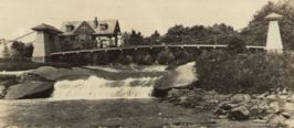
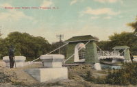
Inventory Search Results
9 suspension bridges were found for search criteria: BONJ. All 9 bridges from the search results appear below. Click the Bridgemeister ID number to isolate the bridge on its own page. If you don't see what you were looking for, try an image search with the same criteria: BONJ. This will find the bridge if it is pictured on the site, but is not a catenary suspension bridge.
Related:
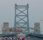
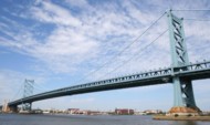
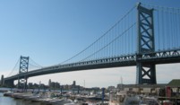
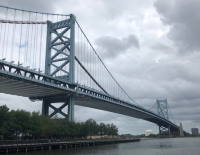
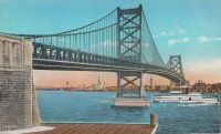
1926: Benjamin Franklin
Philadelphia, Pennsylvania and Camden, New Jersey, USA - Delaware River
| Bridgemeister ID: | 145 (added before 2003) |
| Year Completed: | 1926 |
| Name: | Benjamin Franklin |
| Also Known As: | Philadelphia-Camden |
| Location: | Philadelphia, Pennsylvania and Camden, New Jersey, USA |
| Crossing: | Delaware River |
| Coordinates: | 39.95333 N 75.135 W |
| Maps: | Acme, GeoHack, Google, OpenStreetMap |
| Principals: | Modjeski, Webster, Ball, Moiseff |
| References: | AAJ, BBR, BFL, BONJ, BPL, DRB, GBD, PTL, PTS2, USS |
| Use: | Vehicular (major highway) and Rail (subway), with walkway |
| Status: | In use (last checked: 2007) |
| Main Cables: | Wire (steel) |
| Suspended Spans: | 3 |
| Main Span: | 1 x 533.4 meters (1,750 feet) |
| Side Spans: | 2 x 219.3 meters (719.5 feet) |
| Deck width: | 125.5 feet |
Notes:
- Became longest suspension bridge by eclipsing 1924 Bear Mountain - Anthony's Nose and Bear Mountain, New York, USA.
- Eclipsed by new longest suspension bridge 1929 Ambassador - Detroit, Michigan, USA and Windsor, Ontario, Canada.
- Near 1957 Walt Whitman - Philadelphia, Pennsylvania and Camden, New Jersey, USA.
External Links:
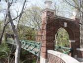
1927: Ravine
Douglass College Campus, New Brunswick, New Jersey, USA
| Bridgemeister ID: | 877 (added 2003-08-31) |
| Year Completed: | 1927 |
| Name: | Ravine |
| Also Known As: | Old Bouncer, Kissing |
| Location: | Douglass College Campus, New Brunswick, New Jersey, USA |
| Coordinates: | 40.485867 N 74.43495 W |
| Maps: | Acme, GeoHack, Google, OpenStreetMap |
| References: | BONJ |
| Use: | Footbridge |
| Status: | In use (last checked: 2020) |
| Main Cables: | Wire (steel) |
| Suspended Spans: | 1 |
| Main Span: | 1 x 30.8 meters (101 feet) estimated |
External Links:
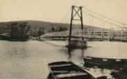
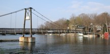
1930: Cranberry Lake
Cranberry Lake, Byram, New Jersey, USA - Cranberry Lake
| Bridgemeister ID: | 153 (added before 2003) |
| Year Completed: | 1930 |
| Name: | Cranberry Lake |
| Location: | Cranberry Lake, Byram, New Jersey, USA |
| Crossing: | Cranberry Lake |
| Coordinates: | 40.95401 N 74.73714 W |
| Maps: | Acme, GeoHack, Google, OpenStreetMap |
| References: | BONJ, PQU |
| Use: | Footbridge |
| Status: | Closed, 2019 (last checked: 2020) |
| Main Cables: | Wire (steel) |
| Suspended Spans: | 3 |
| Main Span: | 1 x 61.5 meters (201.7 feet) estimated |
| Side Spans: | 2 x 21.8 meters (71.5 feet) estimated |
Notes:
- 1928 and 1931 also sometimes cited as years of completion. Construction appears to have completed in December 1930, possibly opening in early 1931.
- 2019: Closed pending repairs and rehabilitation.
External Links:
- Save Our Bridge. "Dedicated to restoring and preserving the historic Cranberry Lake footbridge - one of the oldest pedestrian footbridges in the state of New Jersey."
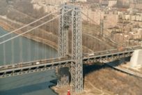
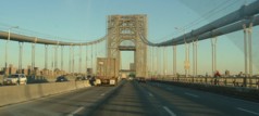
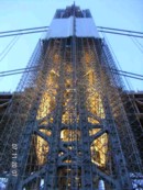
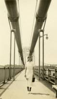
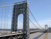
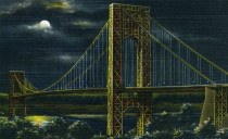
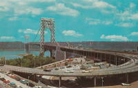
1931: George Washington
New York, New York and Fort Lee, New Jersey, USA - Hudson River
| Bridgemeister ID: | 169 (added before 2003) |
| Year Completed: | 1931 |
| Name: | George Washington |
| Also Known As: | GWB |
| Location: | New York, New York and Fort Lee, New Jersey, USA |
| Crossing: | Hudson River |
| Coordinates: | 40.85333 N 73.955 W |
| Maps: | Acme, GeoHack, Google, OpenStreetMap |
| Principals: | O.H. Ammann, Leon Moisseiff, Dana, Gilbert |
| References: | AAJ, AOB, ARF, BBR, BC3, BFL, BMA, BONJ, BOU, BPL, BRU, COB, CTW, ENR19270811a, ENR19270811b, ENR19290411c, GBD, LAB, LACE, PTS2, SIX, SJR |
| Use: | Vehicular (double-deck), with walkway |
| Status: | In use (last checked: 2022) |
| Main Cables: | Wire (steel) |
| Suspended Spans: | 3 |
| Main Span: | 1 x 1,066.8 meters (3,500 feet) |
| Side Spans: | 2 x 198.1 meters (650 feet) |
| Deck width: | 120 feet |
Notes:
- Became longest suspension bridge by eclipsing 1929 Ambassador - Detroit, Michigan, USA and Windsor, Ontario, Canada.
- Eclipsed by new longest suspension bridge 1937 Golden Gate - San Francisco and Marin County, California, USA.
External Links:
1947: Lumberville-Raven Rock
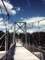
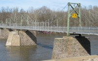
Lumberville, Pennsylvania and Bulls Island State Park, New Jersey, USA - Delaware River
| Bridgemeister ID: | 204 (added before 2003) |
| Year Completed: | 1947 |
| Name: | Lumberville-Raven Rock |
| Also Known As: | Bulls Island |
| Location: | Lumberville, Pennsylvania and Bulls Island State Park, New Jersey, USA |
| Crossing: | Delaware River |
| Coordinates: | 40.407017 N 75.038183 W |
| Maps: | Acme, GeoHack, Google, OpenStreetMap |
| Principals: | John A. Roebling's Sons Co. |
| References: | BDR, BONJ, SSB |
| Use: | Footbridge |
| Status: | In use (last checked: 2007) |
| Main Cables: | Wire (steel) |
| Suspended Spans: | 5 |
| Main Spans: | 5 |
| Characteristics: | Braced (trussed) chain/cable, Hinged cables |
Notes:
- SSB has an old picture of the bridge from a "Roebling publication". The original caption inside the picture says: "Practical application of Roebling Bridge research is the Lumberville footbridge which spans the Delaware River about twenty miles above Trenton. Pictured below, it utilizes four slabs of Roebling prestressed concrete and the Roebling-developed cable stiffening principle for the first time in the Western Hemisphere." and the authors of SSB go on to describe it asa "two-hinged braced cable suspension footbridge."
External Links:
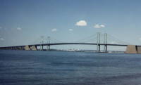
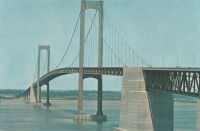
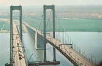
1951: Delaware Memorial I
New Castle, Delaware and Pennsville, New Jersey, USA - Delaware River
| Bridgemeister ID: | 207 (added before 2003) |
| Year Completed: | 1951 |
| Name: | Delaware Memorial I |
| Location: | New Castle, Delaware and Pennsville, New Jersey, USA |
| Crossing: | Delaware River |
| Coordinates: | 39.689227 N 75.520800 W |
| Maps: | Acme, GeoHack, Google, OpenStreetMap |
| Principals: | Homer R. Seely, Enoch R. Needles, Othmar Ammann, et. al. |
| References: | BONJ, BPL, CTD, GBD |
| Use: | Vehicular (major highway) |
| Status: | In use (last checked: 2022) |
| Main Cables: | Wire (steel) |
| Suspended Spans: | 3 |
| Main Span: | 1 x 655.3 meters (2,150 feet) |
| Side Spans: | 2 x 228.6 meters (750 feet) |
| Deck width: | 59.1 feet |
Notes:
External Links:
1968: Delaware Memorial II
New Castle, Delaware and Pennsville, New Jersey, USA - Delaware River
| Bridgemeister ID: | 224 (added before 2003) |
| Year Completed: | 1968 |
| Name: | Delaware Memorial II |
| Location: | New Castle, Delaware and Pennsville, New Jersey, USA |
| Crossing: | Delaware River |
| Coordinates: | 39.688633 N 75.516272 W |
| Maps: | Acme, GeoHack, Google, OpenStreetMap |
| References: | BONJ, CTD, GBD |
| Use: | Vehicular (major highway) |
| Status: | In use (last checked: 2022) |
| Main Cables: | Wire (steel) |
| Suspended Spans: | 3 |
| Main Span: | 1 x 655.3 meters (2,150 feet) |
| Side Spans: | 2 x 228.6 meters (750 feet) |
| Deck width: | 58.7 feet |
Notes:
External Links:


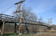
1996: Pochuck Quagmire
Vernon Valley, New Jersey, USA - Pochuck Creek
| Bridgemeister ID: | 239 (added before 2003) |
| Year Completed: | 1996 |
| Name: | Pochuck Quagmire |
| Location: | Vernon Valley, New Jersey, USA |
| Crossing: | Pochuck Creek |
| At or Near Feature: | Appalachian Trail |
| Coordinates: | 41.2353 N 74.472083 W |
| Maps: | Acme, GeoHack, Google, OpenStreetMap |
| Principals: | Tibor Latincsics |
| References: | BONJ, PQU |
| Use: | Footbridge |
| Status: | In use (last checked: 2008) |
| Main Cables: | Wire (steel) |
| Main Span: | 1 x 33.5 meters (110 feet) |
Waste Weir
Trenton, New Jersey, USA - Waste Weir of the Delaware & Raritan Canal
| Bridgemeister ID: | 303 (added before 2003) |
| Name: | Waste Weir |
| Also Known As: | Shaky |
| Location: | Trenton, New Jersey, USA |
| Crossing: | Waste Weir of the Delaware & Raritan Canal |
| At or Near Feature: | Stacy Park |
| Coordinates: | 40.22314 N 74.77998 W |
| Maps: | Acme, GeoHack, Google, OpenStreetMap |
| References: | BONJ |
| Use: | Footbridge |
| Status: | In use (last checked: 2020) |
| Main Cables: | Wire |
| Suspended Spans: | 1 |
External Links:
