Inventory Search Results
10 suspension bridges were found for search criteria: DSL200106. All 10 bridges from the search results appear below. Click the Bridgemeister ID number to isolate the bridge on its own page. If you don't see what you were looking for, try an image search with the same criteria: DSL200106. This will find the bridge if it is pictured on the site, but is not a catenary suspension bridge.
Related:
1852: Wilson's
Cosumne, California, USA - Cosumnes River
| Bridgemeister ID: | 2116 (added 2006-09-10) |
| Year Completed: | 1852 |
| Name: | Wilson's |
| Location: | Cosumne, California, USA |
| Crossing: | Cosumnes River |
| Coordinates: | 38.49229 N 121.17183 W |
| Maps: | Acme, GeoHack, Google, OpenStreetMap |
| Principals: | W. D. Wilson |
| References: | DSL200106 |
| Use: | Vehicular |
| Status: | Removed |
| Main Cables: | Wire |
| Main Span: | 1 x 45.7 meters (150 feet) |
| Deck width: | 12 feet |
Notes:
- The location of this bridge was near the present day location of Cosumne in Sacramento County, just east of Sloughhouse. The location coordinates provided here are only to show the approximate location of present-day Cosumne and should not be considered the exact location of the bridge. Don Sayenga writes: "The exact location was at the intersection of [present-day] Dillard Road and State Route 16 a very short distance east of Sloughhouse, Sacramento County, California... The whole area at that time was known as Daylor's Ranch."
- Don Sayenga notes an F.W. Panhorst (of the California Highway Department) citation:
"Alta California July 27, 1852 reprinting an article from Sacramento Union mentions a wire suspension bridge built in Sacramento County across the Cosumnes. The span is described as 150 feet with a roadway width of 12 feet. One W.D. Wilson is mentioned as owner and designer. This structure, according to our best information, was the first suspension bridge in California."
- A January 14, 1862 Sacramento Bee article notes:
"The quartz mill and house of the brothers Wiley, just beyond Butte City, were carried away by the torrent. At Ione City, William's brick stable had fallen, and several other houses had met with a like fate. On Sutter creek, the loss and damage had been terrific - bridges and houses being carried off like chaff. Mr. Haywood, proprietor of a quartz mill on Sutter creek, had been a loser to the amount of at least $75,000. We have it from good authority that in the counties of Calaveras and Amador not a bridge is left standing. Below Ione City, it is thought that there has been loss of life."
which seems to imply a relationship between the Ione Valley, the Cosumnes River, and the bridge at Wilson's Exchange, but this may have just been coincidental that both "Ione Valley" and Wilson's Exchange were mentioned in the same paragraph; they are nearby. Present-day Ione is in Amador County a few miles east of Sacramento County. The Cosumnes River forms the northern border of Amador County several miles to the north of present-day Ione. Barry Parr notes that the Cosumnes River does not flow through the "Ione Valley," but Barry writes: "Recalling Daylor’s name in Historic Spots of California: 'Daylor established himself as a trader and hotel-keeper on the Cosumnes River about a mile east of Slough House. This place, which was at first known as Daylor’s Ranch, later became the Cosumnes post office.' (p. 290) The site of Cosumnes post office is about five miles downstream from Bridge House, and both are on the Sacramento-Ione Road.
"Last Saturday night, the reports of minute guns were heard, as if signals of distress, coming from the direction of a house where lived Mr. Martin and his family. The whole of Ione Valley was many feet under water. No boats were to be had, so that assistance might be rendered those in danger and distress. In a short time a heavy crash was heard, the signals of distress ceased, and our informant tells us that when he left the general impression was that Martin and his family had lost their lives. The wire suspension bridge over the Cosumnes river had disappeared - the house known as Wilson’s Exchange has also been washed away, and Daylor’s adobe house is flat with the ground. These facts go to show that throughout the mountain districts, as well as in the valleys, the destruction of property and loss of human life exceed the worst that was anticipated, and we shall hear repetitions of such tales of distress as the avenues for communication are gradually opened to us." - See 1852 Huse - Yeomet, California, USA.
- See 1863 Lamb's - Latrobe vicinity and Plymouth vicinity, California, USA.
External Links:
- Oliver Plummer. Transcription by Debbie Walke Gramlick of passage from An Illustrated History of Sacramento County, California. (by Hon. Win. J. Davis, Lewis Publishing Company, 1890, Pages 435-436) which sheds more light on W.D. Wilson.
"Mr. Wilson and part of the company concluded to seek the land of gold, while others kept to the original design of going to Oregon. On his arrival Mr. Wilson mined for a short time on Mormon Island and then moved to Hangtown, now Placerville, where in the winter of 1848-49 he built the first house erected in that place. The family then comprised six children; five more were born in California; nine grew to maturity and seven are living in 1889. In the spring of 1850 he moved down on the Cosumnes and purchased 6,000 acres of the Hartnell Grant, and built a tavern, long known as Wilson’s Exchange, across the river from what is now the Cosumnes post office. He was postmaster from the establishment of that office until 1868. He was by trade a millwright and built the first suspension bridge on the Cosumnes."
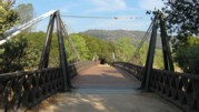
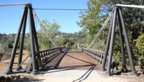
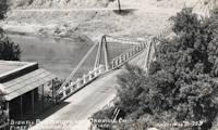
1856: Bidwell Bar
Oroville, California, USA - Feather River
| Bridgemeister ID: | 52 (added before 2003) |
| Year Completed: | 1856 |
| Name: | Bidwell Bar |
| Location: | Oroville, California, USA |
| Crossing: | Feather River |
| Coordinates: | 39.537483 N 121.45415 W |
| Maps: | Acme, GeoHack, Google, OpenStreetMap |
| Principals: | Bidwell Bridge Co. |
| References: | BPL, DSL200106, LACE |
| Use: | Vehicular (one-lane) |
| Status: | Restricted to foot traffic (last checked: 2020) |
| Main Cables: | Wire (iron) |
| Suspended Spans: | 1 |
| Main Span: | 1 x 67.1 meters (220 feet) estimated |
Notes:
- Dismantled before completion of Oroville Dam and replaced by the 1965 high-level Bidwell Bar suspension bridge. The 1856 structure was later reassembled about 1.5 miles south of the new Bidwell Bar bridge. Coordinates provided here are for the current location of the bridge at Kelly Ridge.
- Replaced by 1965 Bidwell Bar - Oroville, California, USA.
External Links:
1856: Westmoreland's
Lancha Plana, California, USA - Mokelumne River
| Bridgemeister ID: | 1089 (added 2004-01-01) |
| Year Completed: | 1856 |
| Name: | Westmoreland's |
| Location: | Lancha Plana, California, USA |
| Crossing: | Mokelumne River |
| References: | DSL200106 |
| Status: | Inundated |
| Main Cables: | Wire (iron) |
Notes:
- Towers and cables were still standing in the 1940s. The location, including the entire former settlement of Lancha Plana, was inundated by the creation of the Camanche Reservoir in 1963. Unclear if remnants are still present (as is the case for some other inundated 19th-century California suspension bridges).
1861: Weitchpec
Weitchpec, California, USA - Klamath River
| Bridgemeister ID: | 1090 (added 2004-01-01) |
| Year Completed: | 1861 |
| Name: | Weitchpec |
| Location: | Weitchpec, California, USA |
| Crossing: | Klamath River |
| Principals: | Andrew S. Hallidie |
| References: | DSL200106 |
| Use: | Vehicular |
| Status: | Removed |
| Main Cables: | Wire (iron) |
| Suspended Spans: | 1 |
Notes:
1862: (suspension bridge)
California, USA - Trinity River
| Bridgemeister ID: | 1093 (added 2004-01-01) |
| Year Completed: | 1862 |
| Name: | (suspension bridge) |
| Location: | California, USA |
| Crossing: | Trinity River |
| Principals: | Andrew S. Hallidie |
| References: | DSL200106 |
| Status: | Removed |
| Main Cables: | Wire (iron) |
1862: (suspension bridge)
California, USA - Stanislaus River
| Bridgemeister ID: | 1094 (added 2004-01-01) |
| Year Completed: | 1862 |
| Name: | (suspension bridge) |
| Location: | California, USA |
| Crossing: | Stanislaus River |
| Principals: | Andrew S. Hallidie |
| References: | DSL200106 |
| Status: | Removed |
| Main Cables: | Wire (iron) |
1862: (suspension bridge)
California, USA - Tuolumne River
| Bridgemeister ID: | 1095 (added 2004-01-01) |
| Year Completed: | 1862 |
| Name: | (suspension bridge) |
| Location: | California, USA |
| Crossing: | Tuolumne River |
| Principals: | Andrew S. Hallidie |
| References: | DSL200106 |
| Status: | Removed |
| Main Cables: | Wire |
1862: (suspension bridge)
McCourtney's Crossing, California, USA - Bear River
| Bridgemeister ID: | 1092 (added 2004-01-01) |
| Year Completed: | 1862 |
| Name: | (suspension bridge) |
| Location: | McCourtney's Crossing, California, USA |
| Crossing: | Bear River |
| Principals: | Andrew S. Hallidie |
| References: | DSL200106 |
| Status: | Removed |
| Main Cables: | Wire (iron) |
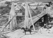
1862: Pine Street
Nevada City, California, USA - Deer Creek
| Bridgemeister ID: | 62 (added before 2003) |
| Year Completed: | 1862 |
| Name: | Pine Street |
| Location: | Nevada City, California, USA |
| Crossing: | Deer Creek |
| Principals: | Andrew S. Hallidie |
| References: | DSL200106 |
| Use: | Vehicular (one-lane) |
| Status: | Removed |
| Main Cables: | Wire (iron) |
| Suspended Spans: | 1 |
1862: Rattlesnake Bar
Folsom vicinity, California, USA - American River
| Bridgemeister ID: | 1091 (added 2004-01-01) |
| Year Completed: | 1862 |
| Name: | Rattlesnake Bar |
| Location: | Folsom vicinity, California, USA |
| Crossing: | American River |
| At or Near Feature: | Rattlesnake Bar |
| Coordinates: | 38.814397 N 121.091726 W |
| Maps: | Acme, GeoHack, Google, OpenStreetMap |
| Principals: | Andrew S. Hallidie |
| References: | DSL200106 |
| Use: | Vehicular (one-lane) |
| Status: | Collapsed, December 21, 1954 |
| Main Cables: | Wire (iron) |
| Suspended Spans: | 1 |
Notes:
- The location of Rattlesnake Bar is closer to present-day Auburn than Folsom, near the location of Goose Flat marked on modern topographical maps of the region. The area was inundated during the creation of Folsom Lake, but the piers and abutments of the Rattlesnake Bar bridge are visible when the water level is low.
- Rodi Lee writes: "[The bridge] collapsed in 1954 when an overweight truck filled with manure crossed it. The driver was unhurt. There are newspaper articles about the incident (Auburn Journal, Auburn). There are some photos in the article as well. The bridge abutments show when the the lake water is low. The bridge was upstream of Wild Goose Flats."
- See 1855 Whiskey Bar (Pioneer, Whisky) - El Dorado County, California, USA. The cables of the Rattlesnake Bar bridge were reportedly reused from the damaged Whiskey Bar bridge.
External Links:
- 1057. The Suspension Bridge over the American River at Rattlesnake Bar, Placer County - Calisphere.org
- Rattlesnake Bridge - Christine's Blog. Several images of the remnants of the bridge.
