Inventory Search Results
79 suspension bridges were found for search criteria: HBE. All 79 bridges from the search results appear below. Click the Bridgemeister ID number to isolate the bridge on its own page. If you don't see what you were looking for, try an image search with the same criteria: HBE. This will find the bridge if it is pictured on the site, but is not a catenary suspension bridge.
Related:
1741: Winch
Middleton-in-Teesdale, England, United Kingdom - River Tees
| Bridgemeister ID: | 372 (added before 2003) |
| Year Completed: | 1741 |
| Name: | Winch |
| Also Known As: | Wynch |
| Location: | Middleton-in-Teesdale, England, United Kingdom |
| Crossing: | River Tees |
| At or Near Feature: | Low Force |
| References: | AAJ, BEM, BPL, HBE, PTS2 |
| Use: | Footbridge |
| Main Cables: | Chain (iron) |
| Suspended Spans: | 1 |
| Main Span: | 1 x 21.3 meters (70 feet) |
Notes:
- Varying histories of this catwalk-style bridge exist. Some claim it was built 1704, a cable snapped in 1802 killing three people, and it was then rebuilt in 1830 (the present bridge). Others attribute the bridge to 1741 and have the 1802 incident killing "one or two people".
- Replaced by 1830 Wynch (Winch) - Middleton-in-Teesdale, England, United Kingdom.
External Links:
1801: Jacob's Creek
Iron Bridge, Mount Pleasant vicinity, Pennsylvania, USA - Jacob's Creek
| Bridgemeister ID: | 3 (added before 2003) |
| Year Completed: | 1801 |
| Name: | Jacob's Creek |
| Also Known As: | Iron Bridge, Chain Bridge |
| Location: | Iron Bridge, Mount Pleasant vicinity, Pennsylvania, USA |
| Crossing: | Jacob's Creek |
| Coordinates: | 40.112598 N 79.553186 W |
| Maps: | Acme, GeoHack, Google, OpenStreetMap |
| Principals: | Judge James Finley |
| References: | AAJ, ASB, BBR, BOB, BPL, CAB, DSE20000116, HBE, LAB, PTS2 |
| Use: | Vehicular |
| Status: | Removed, 1833 |
| Main Cables: | Chain (iron) |
| Suspended Spans: | 3 |
| Main Span: | 1 x 21.3 meters (70 feet) |
| Deck width: | 12.5 feet |
Notes:
- In an email dated January 16, 2000, Don Sayenga provided information about the location of this bridge. Generally attributed to Uniontown (the seat of Fayette County, PA), Mr. Sayenga offers some clues about the bridge's true location. "[James Finley] stated that he built it near the home of his friend Meason which implies a connection for the iron as Meason was making iron. Meason's home has survived by the way, a beautiful place. Finley stated it was a combination contract with the cost split between two counties, and he stated it was built over Jacob's Creek which is the county boundary. He also makes it clear it was on the road to Greensburg. The only place the old road crossed Jacob's Creek is just south of Mount Pleasant, Pennsylvania. On the geodetic survey maps this spot is marked "Iron Bridge" but there is no town there. The last time I was there I saw a sign that said 'Iron Bridge' on an automobile scrap yard. I found absolutely no trace of the bridge, but it was not very big, so there was no need for a huge abutment."
- First suspension bridge with a rigid level deck, often considered the world's first modern suspension bridge.
- Coordinates are for the likely location of the bridge, where present-day (2020) Pennsylvania route 3105 crosses Jacob's Creek.
External Links:
1807: Chain
Georgetown, District of Columbia and Virginia, USA - Potomac River
| Bridgemeister ID: | 4 (added before 2003) |
| Year Completed: | 1807 |
| Name: | Chain |
| Location: | Georgetown, District of Columbia and Virginia, USA |
| Crossing: | Potomac River |
| Coordinates: | 38.92959 N 77.11627 W |
| Maps: | Acme, GeoHack, Google, OpenStreetMap |
| Principals: | John Templeman |
| References: | AAJ, BBR, BCW, CAB, DSE20000118, HBE, PTS2 |
| Use: | Vehicular |
| Status: | Destroyed, 1812 |
| Main Cables: | Chain (iron) |
| Suspended Spans: | 1 |
| Main Span: | 1 x 39.2 meters (128.5 feet) |
Notes:
- BCW gives completion date of 1810 and says bridge was destroyed by flood two years later.
- Coordinates given are for the current crossing (VA SR123, still known locally as "Chain Bridge Road") which is on (or very close) to the alignment of Chain Bridge. Chain Bridge was the third bridge at this site. The current structure is the eighth and was completed in 1940.
External Links:
1807: Wills Creek
Cumberland, Maryland, USA - Wills Creek
| Bridgemeister ID: | 5 (added before 2003) |
| Year Completed: | 1807 |
| Name: | Wills Creek |
| Location: | Cumberland, Maryland, USA |
| Crossing: | Wills Creek |
| Principals: | John Templeman |
| References: | AAJ, BCW, CAB, DSE20000203, HBE |
| Status: | Destroyed, 1810 |
| Main Cables: | Chain (iron) |
| Main Span: | 1 x 42.4 meters (139 feet) |
Notes:
- Destroyed by flood, 1810.
- Later at same location 1820 Wills Creek - Cumberland, Maryland, USA.
1809: (suspension bridge)
Brownsville vicinity, Pennsylvania, USA
| Bridgemeister ID: | 8 (added before 2003) |
| Year Completed: | 1809 |
| Name: | (suspension bridge) |
| Location: | Brownsville vicinity, Pennsylvania, USA |
| References: | AAJ, CAB, DSE20000203, HBE |
| Status: | Removed |
| Main Cables: | Chain (iron) |
1809: (suspension bridge)
Brownsville, Pennsylvania, USA - Dunlap's Creek
| Bridgemeister ID: | 7 (added before 2003) |
| Year Completed: | 1809 |
| Name: | (suspension bridge) |
| Location: | Brownsville, Pennsylvania, USA |
| Crossing: | Dunlap's Creek |
| Principals: | John Templeman |
| References: | AAJ, BCW, CAB, DSE20000118, DSE20000203, HBE |
| Use: | Vehicular |
| Status: | Removed |
| Main Cables: | Chain (iron) |
External Links:
- Dunlap's Creek Bridge (link reported not working). "The first recorded bridge across Dunlap's Creek was a wooden structure constructed prior to 1774. It was repaired in 1801, but was destroyed during a spring storm in 1808. A chain-link suspension bridge was built on the site in 1809; it collapsed under the weight of snow and a heavily laden wagon in 1820. A third bridge, another wooden structure, built in 1821 also failed. The present bridge is thus the fourth bridge at the site."
- Structurae - Structure ID 20008055
1809: Schuylkill Falls
Philadelphia, Pennsylvania, USA - Schuylkill River
| Bridgemeister ID: | 9 (added before 2003) |
| Year Completed: | 1809 |
| Name: | Schuylkill Falls |
| Location: | Philadelphia, Pennsylvania, USA |
| Crossing: | Schuylkill River |
| Principals: | John Templeman |
| References: | AAJ, BBR, BPL, CAB, DSE20000118, HBE, PTS2 |
| Status: | Removed |
| Main Cables: | Chain (iron) |
| Suspended Spans: | 2 |
| Main Spans: | 2 x 46.6 meters (153 feet) |
| Deck width: | 18 feet |
Notes:
- Failed 1811, 1816. HBE notes the 1811 was due to weight of cattle. The 1816 failure was due to weight of ice and snow.
External Links:
1810: (suspension bridge)
Wilmington, Delaware, USA - Brandywine Creek
| Bridgemeister ID: | 6 (added before 2003) |
| Year Completed: | 1810 |
| Name: | (suspension bridge) |
| Location: | Wilmington, Delaware, USA |
| Crossing: | Brandywine Creek |
| References: | AAJ, BCW, CAB, DSE20000203, HBE |
| Status: | Destroyed, 1822 |
| Main Cables: | Chain (iron) |
| Suspended Spans: | 1 |
| Main Span: | 1 x 44.2 meters (145 feet) |
| Deck width: | 30 feet |
Notes:
- Destroyed by flood, 1822.
External Links:
1810: Chain
Newburyport, Massachusetts, USA - Merrimack River
| Bridgemeister ID: | 14 (added before 2003) |
| Year Completed: | 1810 |
| Name: | Chain |
| Also Known As: | Essex-Merrimack |
| Location: | Newburyport, Massachusetts, USA |
| Crossing: | Merrimack River |
| At or Near Feature: | Deer Island |
| Coordinates: | 42.833947 N 70.906811 W |
| Maps: | Acme, GeoHack, Google, OpenStreetMap |
| Principals: | John Templeman |
| References: | AAJ, BBR, CAB, GBD, HBE, POPE, PTS2, RDH |
| Use: | Vehicular (two-lane, light vehicles only) |
| Status: | Replaced, 1909 |
| Main Cables: | Chain (iron) |
| Suspended Spans: | 1 |
| Main Span: | 1 x 74.1 meters (243 feet) |
| Deck width: | 30 feet (2 roadways of 15 feet) |
Notes:
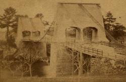
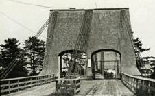
- John Templeman built several bridges (like this one) using James Finley's design.
- Repaired in 1827 after 5 of 10 chains snapped under weight of a team of oxen.
- The complete description from Thomas Pope's 1811 Treatise (POPE):
"The chain Bridge lately thrown over the Merrimack, three miles above Newburyport, in the state of Massachusetts, is now in constant use. This Bridge consists of a single arc, two hundred and forty-four feet span. The abutments are of stone, forty-seven feet long, and thirty-seven high; the uprights, or framed work, which stand on the abutments, are thirty-five feet high, over which are suspended ten distinct chains, the ends of which on both sides of the river are buried deep in pits and secured by large stones: each chain is five hundred and sixteen feet long; and, where they pass over the uprights, they are treble, and made in short links, which is said to be more secure than saddles made of plates of iron. The four middle joists rest on the chains; all the rest are suspended to the main chains to equalize the floor. This Bridge has two passage-ways of fifteen feet in width each, and the floor is so solid as to admit of horses, carriages, etc. to travel at any speed, with very little perceptible motion of the floors. The railing is stout and strong, which adds much firmness to the floor. There are three chains in each range on each side, and four in the middle range: they are calculated to support nearly five hundred tons. From the surface of the water to the middle of the floor is forty feet; and from the top of the abutments to the top of the uprights is thirty-five feet high, making seventy-two feet. The magnitude and power of the abutments, the width and length of the floors, the elevation of the work, the evident powers of the chains, etc. all conspire to make it a wonderful work. Every expense attending it did not amount to twenty-five thousand dollars. The abutment being of stone, the uprights covered, and the chains painted to prevent rust, leaves nothing but the flooring to decay. This Bridge was constructed by John Templeman, Esq. of the district of Columbia, whose talents for the productions of such work, and the various improvements suggested and used by him, have been highly beneficial, and do him great credit."
- Gregory W. Buff sent a transcription of an article describing the 1827 failure. The article was in the Saturday, February 24, 1827 issue (Volume IV, Number 31) of the Canadian Spectator (Montreal, Quebec) newspaper:
"Newburyport, Feb 9. Disastrious [sic] Accident. - On Tuesday morning last, the Essex Merrimack Bridge gave way in the centre, from the parting of the chains that support it. On the Bridge, at the moment, was a loaded team, drawn by six oxen and two horses, driven by two men, Messrs. Garlton [sic] and Jackman, all of whom were precipitated, forty feet, into the river beneath. The teamsters preserved themselves by means of swimming, and the support of fragments of the bridge; the team were all of them except one of the horses, swept beneath the ice a few rods below, and drowned. Five of the ten chains which supported the Bridge, were snapped in different places, and now remain upholding the broken and shattered timber altogether as sad a wreck as we ever witnessed. At the moment of the crash, the light evolved from the friction of the chains resembled the the vivid streaming of a meteor. Various excuses are assigned for the accident, and none, with more probability, than the united effect of the incumbent pressure of the immense body of snow lying upon the bridge, and the frost which had contracted the particles of iron. These produced a tenseness in the chains, which was incapable of resisting the additional pressure of the loaded team, and the whole gave way. The estimated expense of repairing the breach is about 4000 dollars; and the Directors, as we understand, plan to set about it immediately. It will be built up as before. To those who have been losers by this accident the corporation intend to make generous inumeration. The traveling will be uninterrupted, as the solidity of the ice above the bridge forms a safe passage way - and for the conveyance of carriages and heavy baggage the proprietors have promptly provided suitable boats. If any aversion to chain bridges has been produced by this accident, we should be sorry, for ourselves we feel yet unshaken faith in their superior security. The misfortune in this case was no doubt owing to the causes above stated, and not to any defect in the construction of the bridge. Probably hundreds of individuals, including each sex and all ages, have visited the ruins of the bridge. They present a sad and melancholy appearance - crushed and broken timbers suspended by the massy chains, which hang lazily from the pyramidical abutments, while the beholder instinctly shrinks back in terror at the reflection of the situation of the two human beings who were precipitated into the abyss beneath. The preservation of these two men is almost miraculous. Although hurled down 40 feet amid crashing and falling timber, entangled with their cattle, they fell without receiving the least injury, and attained the shore, after being for nearly half an hour, immerse in water chilled to the freezing point. Mr. Jackman is far advanced in years - and suffered somewhat from the exposure to the cold. Mr. Carlton [sic], escaped unhurt. The Chain Bridge has been built for about fifteen years, the span is 220 feet. We believe this was the second or third Chain Bridge built in the United States; and this is probably the first that has met with a similar accident. We understand the proprieters of the Rooks Bridge intend to rebuild theirs as a Chain Bridge."
- Replaced by 1909 Chain - Newburyport, Massachusetts, USA. The 1909 structure was almost entirely new (except for portions of the piers and abutments).
External Links:
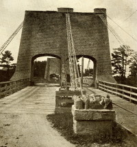
1816: Galashiels
Galashiels, Scotland, United Kingdom - Gala Water
| Bridgemeister ID: | 584 (added 2003-01-01) |
| Year Completed: | 1816 |
| Name: | Galashiels |
| Location: | Galashiels, Scotland, United Kingdom |
| Crossing: | Gala Water |
| Principals: | Richard Lees |
| References: | AAJ, BSI, HBE, PTS2 |
| Use: | Footbridge |
| Status: | Destroyed, 1839 |
| Main Cables: | Wire (iron) |
| Suspended Spans: | 1 |
| Main Span: | 1 x 33.8 meters (111 feet) |
| Deck width: | 3 feet |
Notes:
- BSI: Originally erected in the form of a traditional suspension bridge, but soon reinforced with wire stays from much larger towers to reduce unwanted motion. Destroyed by flood, 1839.
1816: Spider
Philadelphia, Pennsylvania, USA - Schuylkill River
| Bridgemeister ID: | 20 (added before 2003) |
| Year Completed: | 1816 |
| Name: | Spider |
| Location: | Philadelphia, Pennsylvania, USA |
| Crossing: | Schuylkill River |
| Principals: | Josiah White, Erskine Hazard |
| References: | AAJ, BOB, BPL, GHD, HBE, LAB, PTS2 |
| Use: | Footbridge |
| Status: | Removed |
| Main Cables: | Wire (iron) |
| Main Span: | 1 x 120 meters (393.75 feet) |
Notes:
- Narrow footbridge. First wire bridge in North America. HBE notes "first wire suspension bridge in any country."
- Often described as having collapsed under the weight of ice and snow, Don Sayenga notes that no contemporary sources confirm this demise. Since the nearby chain bridge did fail under weight of ice and snow, he believes this fate has been misattributed to the White and Hazard footbridge. Don believes the bridge was just dismantled at some point after June, 1816.
- Al Zagofsky also wrote to explain there was no evidence of this bridge collapsing under weight of ice and snow. Al writes: "According to an original source Captain Joshua Rowley Watson, who inspected the bridge on June 15, 1816: '...There was a bridge, but which by the weight of ice and snow, has been carried away.' This refers to the previous bridge that the cable bridge was temporarily replacing. I did not see any cause for failure of the wire rope bridge. My guess is that it was removed when the regular bridge was repaired. The same article shows a sketch that he made, showing the main span to be 407 feet. I am looking at the Canal History and Technology Proceedings Vol 5, March 22, 1986."
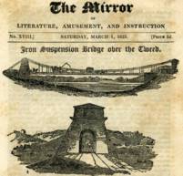
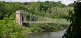
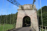
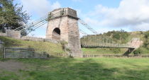
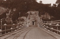
1820: Union
Horncliffe, Berwick-upon-Tweed vicinity, England and Fishwick, Scotland, United Kingdom - River Tweed
| Bridgemeister ID: | 373 (added before 2003) |
| Year Completed: | 1820 |
| Name: | Union |
| Location: | Horncliffe, Berwick-upon-Tweed vicinity, England and Fishwick, Scotland, United Kingdom |
| Crossing: | River Tweed |
| Coordinates: | 55.75256 N 2.10677 W |
| Maps: | Acme, GeoHack, Google, OpenStreetMap |
| Principals: | Sir Samuel Brown |
| References: | AAJ, BBR, BC3, BEM, BOB, HBE, MOS, NTB, PTS2, SBR |
| Use: | Vehicular (one-lane) |
| Status: | In use (last checked: 2023) |
| Main Cables: | Chain (iron) |
| Suspended Spans: | 1 |
| Main Span: | 1 x 136.9 meters (449 feet) |
| Deck width: | 18 feet |
Notes:
- 2007, March: Closed after a hanger snapped in high winds. Repaired and reopened August, 2007.
- 2020, October: Closed for major renovation and conservation project.
- 2023, April: The bridge is reopened.
- Eclipsed by new longest suspension bridge 1826 Menai Strait - Menai Bridge and Bangor vicinity, Wales, United Kingdom.
External Links:
- Conservation - Union Chain Bridge - unionchainbridge.org. Site devoted to the 2020-2023 renovation project. This page lists the highlights of the project.
- Structurae - Structure ID 20000162
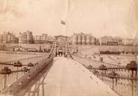
1823: Brighton Pier
Brighton, East Sussex, England, United Kingdom
| Bridgemeister ID: | 376 (added before 2003) |
| Year Completed: | 1823 |
| Name: | Brighton Pier |
| Location: | Brighton, East Sussex, England, United Kingdom |
| Principals: | Sir Samuel Brown |
| References: | AAJ, BEM, BOB, HBE, MOS, SBR |
| Use: | Footbridge |
| Status: | Destroyed, 1896 |
| Main Cables: | Chain (iron) |
| Suspended Spans: | 4 |
| Main Spans: | 4 x 77.7 meters (255 feet) |
Notes:
- SBR: Severely damaged 1833, 1836. Destroyed by storm 1896.
External Links:
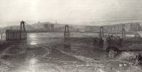
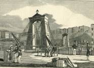
1823: Saint Antoine
Geneva, Switzerland
| Bridgemeister ID: | 377 (added before 2003) |
| Year Completed: | 1823 |
| Name: | Saint Antoine |
| Location: | Geneva, Switzerland |
| Principals: | Guillame Henri Dufour, Marc Seguin, Marc-Auguste Pictet |
| References: | AAJ, GHD, HBE, LAB, MOS, PTS2 |
| Status: | Removed, c.1864 |
| Main Cables: | Wire (iron) |
| Suspended Spans: | 2 |
| Main Spans: | 2 x 40 meters (131.2 feet) |
| Deck width: | 7.5 feet |
External Links:
1826: Broughton
Lancashire, England, United Kingdom - River Irwell
| Bridgemeister ID: | 379 (added before 2003) |
| Year Completed: | 1826 |
| Name: | Broughton |
| Also Known As: | Gerald Road |
| Location: | Lancashire, England, United Kingdom |
| Crossing: | River Irwell |
| References: | AAJ, BOB, HBE, MOS, SBR |
| Use: | Vehicular |
| Status: | Replaced, 1914 |
| Main Cables: | Chain (iron) |
| Main Span: | 1 x 44.3 meters (145.5 feet) |
| Deck width: | 18.25 feet |
Notes:
- Famously collapsed under weight of marching troops April 12, 1831. Was rebuilt and strengthened and eventually replaced in 1914.
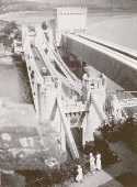
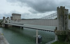
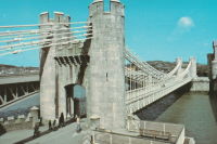
1826: Conwy
Conwy, Wales, United Kingdom - River Conwy
| Bridgemeister ID: | 380 (added before 2003) |
| Year Completed: | 1826 |
| Name: | Conwy |
| Also Known As: | Conway |
| Location: | Conwy, Wales, United Kingdom |
| Crossing: | River Conwy |
| Coordinates: | 53.280476 N 3.823742 W |
| Maps: | Acme, GeoHack, Google, OpenStreetMap |
| Principals: | Thomas Telford |
| References: | AAJ, BBR, BC3, BCO, BEM, HBE, MOS, NTB, PTS2 |
| Use: | Vehicular |
| Status: | Restricted to foot traffic (last checked: 2021) |
| Main Cables: | Chain (iron) |
| Suspended Spans: | 1 |
| Main Span: | 1 x 99.7 meters (327 feet) |
Notes:
- 1904: Major reinforcement and strengthening project.
- 2008, February: Major refurbishment project completed.
- Next to 1904 (footbridge) - Conwy, Wales, United Kingdom.
Annotated Citations:
- "Conway Suspension Bridge." The Engineer, 20 May 1904.
Details regarding the 1904 reinforcement project: "...It was therefore decided to renew all the suspension rods, and pins, and to fix steel cables above the suspension links, to supplement them so that the maximum stress in the links due to any possible travelling load should not exceed 5 tons per square inch. It was also decided to build a stiffening girder coupled to the suspension rod on each side of the bridge, and at the same time to widen the bridge by building a footway 6ft. wide outside the suspenders on the north side of the bridge."
External Links:
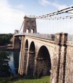
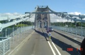
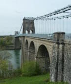
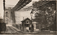
1826: Menai Strait
Menai Bridge and Bangor vicinity, Wales, United Kingdom - Menai Strait
| Bridgemeister ID: | 382 (added before 2003) |
| Year Completed: | 1826 |
| Name: | Menai Strait |
| Location: | Menai Bridge and Bangor vicinity, Wales, United Kingdom |
| Crossing: | Menai Strait |
| Coordinates: | 53.221367 N 4.1646 W |
| Maps: | Acme, GeoHack, Google, OpenStreetMap |
| Principals: | Thomas Telford |
| References: | AAJ, BBR, BC3, BCO, BDU, BEM, BOU, HBE, MOS, NTB, PTS2 |
| Use: | Vehicular (two-lane), with walkway |
| Status: | In use (last checked: 2022) |
| Main Cables: | Chain (iron) |
| Suspended Spans: | 1 |
| Main Span: | 1 x 176.5 meters (579 feet) |
Notes:
- 1839 (or 1840): Restored. Deck strengthened.
- 1893: Original wood deck replaced with a steel deck.
- 1938-1940: Original wrought-iron chains replaced with steel eyebars, deck strengthened.
- 1999: Deck resurfaced and other improvements to strengthen bridge.
- 2020: Major maintenance project planned to start January, 2021.
- 2022, October: Closed due to serious structural concerns. Expected to reopen January 2023 with a weight restriction.
- Became longest suspension bridge by eclipsing 1820 Union - Horncliffe, Berwick-upon-Tweed vicinity, England and Fishwick, Scotland, United Kingdom.
- Eclipsed by new longest suspension bridge 1834 Zaehringen (Grand Pont Suspendu) - Fribourg, Switzerland.
External Links:

1827: (suspension bridge)
Newburyport, Massachusetts, USA - Merrimack River
| Bridgemeister ID: | 23 (added before 2003) |
| Year Completed: | 1827 |
| Name: | (suspension bridge) |
| Location: | Newburyport, Massachusetts, USA |
| Crossing: | Merrimack River |
| Principals: | Thomas Haven |
| References: | AAJ, BPL, HBE, PTS2 |
| Status: | Replaced, 1840 |
| Main Cables: | Chain (iron) |
| Suspended Spans: | 5 |
| Main Spans: | 3 |
| Side Spans: | 2 |
Notes:
- Multi-span structure distinct from Templeman's 1810 Chain Bridge. Sometimes misidentified as an 1827 replacement to the 1810 Templeman Chain Bridge because of the significant damage to the Templeman bridge in 1827.
External Links:

1827: Hammersmith
London, England, United Kingdom - River Thames
| Bridgemeister ID: | 386 (added before 2003) |
| Year Completed: | 1827 |
| Name: | Hammersmith |
| Location: | London, England, United Kingdom |
| Crossing: | River Thames |
| Principals: | William Tierney Clark |
| References: | AAJ, BEM, BTH, HBE, MOS, NTB, ONF, PTS2 |
| Use: | Vehicular, with walkway |
| Status: | Replaced |
| Main Cables: | Chain |
| Suspended Spans: | 3 |
| Main Span: | 1 x 121.9 meters (400 feet) |
| Side Spans: | 2 x 44.8 meters (147 feet) |
Notes:
- Replaced by 1887 Hammersmith - London, England, United Kingdom.
External Links:
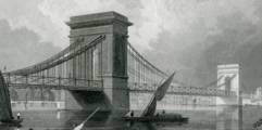
1829: Montrose
Montrose, Scotland, United Kingdom - South Esk River
| Bridgemeister ID: | 388 (added before 2003) |
| Year Completed: | 1829 |
| Name: | Montrose |
| Location: | Montrose, Scotland, United Kingdom |
| Crossing: | South Esk River |
| Coordinates: | 56.705802 N 2.475390 W |
| Maps: | Acme, GeoHack, Google, OpenStreetMap |
| Principals: | Sir Samuel Brown |
| References: | AAJ, BEM, BOB, HBE, PTS2, SBR |
| Use: | Vehicular |
| Status: | Demolished, 1929 |
| Main Cables: | Chain (iron) |
| Suspended Spans: | 1 |
Notes:
- SBR: March 19, 1830, with a "crowd of people, estimated at 700, ... watching a boat race," a chain broke "plunging most of the people into the river." Repaired.
- 1838: Wrecked by storm. Repaired.
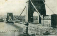

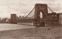
1830: Stockton Railway
Stockton on Tees, England, United Kingdom - River Tees
| Bridgemeister ID: | 390 (added before 2003) |
| Year Completed: | 1830 |
| Name: | Stockton Railway |
| Location: | Stockton on Tees, England, United Kingdom |
| Crossing: | River Tees |
| Principals: | Sir Samuel Brown |
| References: | AAJ, BEM, HBE, SBR |
| Use: | Rail |
| Status: | Replaced, 1842 |
| Main Cables: | Chain (iron) |
| Suspended Spans: | 1 |
| Main Span: | 1 x 85.6 meters (281 feet) |
Notes:
- First railway suspension bridge.
External Links:
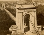
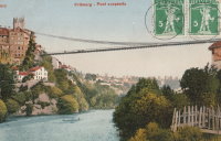
1834: Zaehringen
Fribourg, Switzerland - Sarine River
| Bridgemeister ID: | 395 (added before 2003) |
| Year Completed: | 1834 |
| Name: | Zaehringen |
| Also Known As: | Grand Pont Suspendu |
| Location: | Fribourg, Switzerland |
| Crossing: | Sarine River |
| Principals: | Joseph Chaley |
| References: | AAJ, BBR, BFL, HBE, LAB |
| Use: | Vehicular |
| Status: | Removed, 1920's |
| Main Cables: | Wire (iron) |
| Suspended Spans: | 1 |
| Main Span: | 1 x 273.1 meters (896 feet) |
Notes:
- Became longest suspension bridge by eclipsing 1826 Menai Strait - Menai Bridge and Bangor vicinity, Wales, United Kingdom.
- Eclipsed by new longest suspension bridge 1849 Wheeling (Wheeling and Belmont) - Wheeling, West Virginia, USA.
- Near 1840 Gotteron - Fribourg, Switzerland.
External Links:
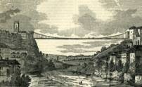
1839: Basse-Chaîne
Angers, Maine-et-Loire, France - Maine River
| Bridgemeister ID: | 993 (added 2003-11-16) |
| Year Completed: | 1839 |
| Name: | Basse-Chaîne |
| Also Known As: | Angers |
| Location: | Angers, Maine-et-Loire, France |
| Crossing: | Maine River |
| Principals: | Joseph Chaley |
| References: | AAJ, GHD, HBE, PTS2 |
| Status: | Collapsed, 1850 |
| Main Cables: | Wire (iron) |
| Suspended Spans: | 1 |
| Main Span: | 1 x 10² meters (334.66 feet) |
| Deck width: | 23.62 feet |
Notes:
- Collapsed under weight of maching troops, April 16, 1850, killing more than 200 soldiers. Collapse precipitated French virtual moratorium on suspension bridge building bringing to a close the prolific era of French wire cable suspension bridges.
External Links:
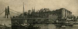
1839: Roche-Bernard
La Roche-Bernard, Morbihan, France - Vilaine River
| Bridgemeister ID: | 1027 (added 2003-11-22) |
| Year Completed: | 1839 |
| Name: | Roche-Bernard |
| Location: | La Roche-Bernard, Morbihan, France |
| Crossing: | Vilaine River |
| Principals: | P. Leblanc |
| References: | AAJ, HBE, PTS2 |
| Use: | Vehicular |
| Status: | Replaced, 1911 |
| Main Cables: | Wire (iron) |
| Suspended Spans: | 1 |
| Main Span: | 1 x 198 meters (649.6 feet) |
Notes:
- Wrecked by wind 1852, rebuilt, damaged 1866, 1869, 1870, and 1871. After the 1871 repairs, it was restricted to foot traffic. It was replaced in 1911 by an arch. Approaches extant (next to the later suspension bridge), 2004.
- Next to 1960 Roche-Bernard - La Roche-Bernard, Morbihan, France.
External Links:
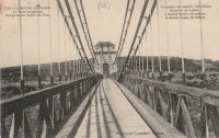
1839: Saint André-de-Cubzac
Saint André-de-Cubzac, Gironde, France - Dordogne River
| Bridgemeister ID: | 550 (added before 2003) |
| Year Completed: | 1839 |
| Name: | Saint André-de-Cubzac |
| Also Known As: | Cubzac |
| Location: | Saint André-de-Cubzac, Gironde, France |
| Crossing: | Dordogne River |
| Coordinates: | 44.962000 N 0.461444 W |
| Maps: | Acme, GeoHack, Google, OpenStreetMap |
| Principals: | Marie Fortuné de Vergès, Emil Martin |
| References: | AAJ, HBE, PTS2 |
| Use: | Vehicular |
| Status: | Destroyed, 1869 |
| Main Cables: | Wire (iron) |
| Suspended Spans: | 5 |
| Main Spans: | 5 x 10⁹ meters (357.6 feet) |
| Deck width: | 23 feet |
Notes:
- This is perhaps one of the most fanciful large suspension bridges ever built.
- Destroyed in a storm, 1869. Its replacement (a truss bridge) was completed in 1883. The approaches and the bottom halves of the suspension bridge towers were strengthened and used for the replacement.
- AAJ citing Engineering News-Record: "Vergès used inclined tie cables running from the top of the tower at one end of a span to a roadway-level connection on the opposite tower."
External Links:
- Structurae - Cubzac Bridge. Photos of the replacement truss structure.
- Structurae - Structure ID 20000898
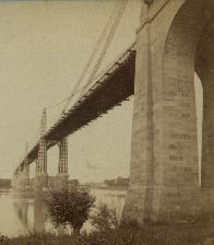

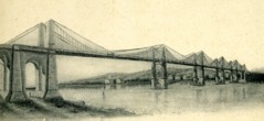
1842: Fairmount
Philadelphia, Pennsylvania, USA - Schuylkill River
| Bridgemeister ID: | 24 (added before 2003) |
| Year Completed: | 1842 |
| Name: | Fairmount |
| Also Known As: | Callowhill Street, Upper Ferry |
| Location: | Philadelphia, Pennsylvania, USA |
| Crossing: | Schuylkill River |
| Principals: | Charles Ellet |
| References: | BBR, BOB, BPL, HBE, LAB, PTS2, WHSB |
| Use: | Vehicular |
| Status: | Replaced, 1875 |
| Main Cables: | Wire (iron) |
| Suspended Spans: | 1 |
| Main Span: | 1 x 104.2 meters (342 feet) |
Notes:
- BBR and BOB say 1841.
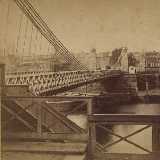
1845: Hungerford
London, England, United Kingdom - River Thames
| Bridgemeister ID: | 400 (added before 2003) |
| Year Completed: | 1845 |
| Name: | Hungerford |
| Location: | London, England, United Kingdom |
| Crossing: | River Thames |
| Principals: | Isambard K. Brunel |
| References: | BBR, BEM, BTH, HBE, PTS2 |
| Use: | Footbridge |
| Status: | Removed |
| Main Cables: | Chain (iron) |
| Suspended Spans: | 3 |
| Main Span: | 1 x 206 meters (676 feet) |
| Side Spans: | 2 x 100.3 meters (329 feet) |
Notes:
- BEM mentions three different years of completion: 1826, 1862, and 1843, all of which are likely incorrect. The bridge was out of service by 1864 as the chain cables were reused for the Clifton Bridge at Bristol, England.
- See 1864 Clifton - Bristol, England, United Kingdom.
External Links:
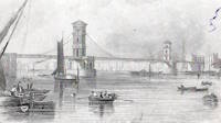
1845: Pittsburgh Aqueduct
Pittsburgh, Pennsylvania, USA - Allegheny River
| Bridgemeister ID: | 27 (added before 2003) |
| Year Completed: | 1845 |
| Name: | Pittsburgh Aqueduct |
| Location: | Pittsburgh, Pennsylvania, USA |
| Crossing: | Allegheny River |
| Principals: | John A. Roebling |
| References: | BOB, BOP, BPL, HBE, ONF, PTS2, RDH, SJR |
| Use: | Aqueduct |
| Status: | Removed, 1861 |
| Main Cables: | Wire (iron) |
| Suspended Spans: | 7 |
| Main Spans: | 7 x 49.4 meters (162 feet) |
Notes:
- In use until 1860.
External Links:
1846: Monongahela
Pittsburgh, Pennsylvania, USA - Monongahela River
| Bridgemeister ID: | 28 (added before 2003) |
| Year Completed: | 1846 |
| Name: | Monongahela |
| Also Known As: | Smithfield Street |
| Location: | Pittsburgh, Pennsylvania, USA |
| Crossing: | Monongahela River |
| Principals: | John A. Roebling |
| References: | BOB, BOP, BPL, HBE, ONF, PBR, PTS2 |
| Use: | Vehicular |
| Status: | Removed, 1882 |
| Main Cables: | Wire (iron) |
| Suspended Spans: | 8 |
| Main Spans: | 8 x 57.3 meters (188 feet) |
| Deck width: | 20 feet |
External Links:
1848: Niagara Suspension
Niagara Falls, New York, USA and Niagara Falls, Ontario, Canada - Niagara River
| Bridgemeister ID: | 29 (added before 2003) |
| Year Completed: | 1848 |
| Name: | Niagara Suspension |
| Location: | Niagara Falls, New York, USA and Niagara Falls, Ontario, Canada |
| Crossing: | Niagara River |
| Principals: | Charles Ellet |
| References: | BOB, BPL, HBE, ONF, PTS2 |
| Use: | Vehicular (one-lane) |
| Status: | Removed |
| Main Cables: | Wire (iron) |
| Suspended Spans: | 1 |
| Main Span: | 1 x 234.7 meters (770 feet) |
| Deck width: | 7.5 feet |
Notes:
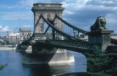
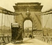
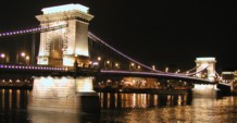
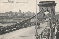
1849: Chain
Budapest, Hungary - Danube River
| Bridgemeister ID: | 402 (added before 2003) |
| Year Completed: | 1849 |
| Name: | Chain |
| Also Known As: | Széchenyi Lánchíd |
| Location: | Budapest, Hungary |
| Crossing: | Danube River |
| Coordinates: | 47.49945 N 19.046567 E |
| Maps: | Acme, GeoHack, Google, OpenStreetMap |
| Principals: | William Tierney Clark, Adam Clark |
| References: | AAJ, BC3, BCO, CTW, HBE, ONF |
| Use: | Vehicular |
| Status: | In use (last checked: 2021) |
| Main Cables: | Chain (iron) |
| Suspended Spans: | 3 |
| Main Span: | 1 x 203 meters (666 feet) |
| Side Spans: | 2 x 90.8 meters (298 feet) |
Notes:
- Don Sayenga notes, the bridge was designed by W.T. Clark, but built by Adam Clark (no relation).
- 1945: Destroyed during WWII, rebuilt 1949.
- 2020: Major rehabilitation project expected to start May, 2021.
External Links:
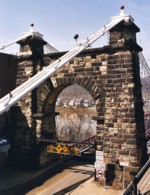
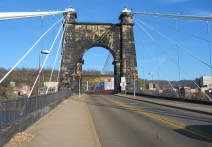
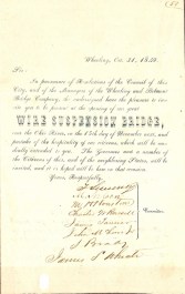
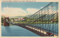
1849: Wheeling
Wheeling, West Virginia, USA - Ohio River
| Bridgemeister ID: | 32 (added before 2003) |
| Year Completed: | 1849 |
| Name: | Wheeling |
| Also Known As: | Wheeling and Belmont |
| Location: | Wheeling, West Virginia, USA |
| Crossing: | Ohio River |
| Coordinates: | 40.07167 N 80.72667 W |
| Maps: | Acme, GeoHack, Google, OpenStreetMap |
| Principals: | Charles Ellet |
| References: | AAJ, BBR, BC3, BOB, BPL, CEJ, COB, GBD, HBE, LAB, LACE, ONF, PTS2, RWS, WCC, WHSB |
| Use: | Vehicular (two-lane, light vehicles only) |
| Status: | Restricted to foot traffic, since September 2019 (last checked: 2020) |
| Main Cables: | Wire (iron) |
| Suspended Spans: | 1 |
| Main Span: | 1 x 307.8 meters (1,010 feet) |
Notes:
- Was still part of Virginia at time of completion.
- 1854: Rebuilt after it was wrecked by a windstorm. Contrary to popular myth, the rebuilding was undertaken by Ellet and his assistant William K. McComas, not by John A. Roebling.
- 1860: Overhauled. Popular myth often attributes this work to the Roeblings. WHSB attributes this work to William K. McComas. After this overhaul, the bridge still does not have the distinctive diagonal cable stays that give it the appearance of a Roebling bridge.
- 1872: Overhauled according to a design by Washington Roebling. John A. Roebling had died in 1869 and was not involved with this work. WHSB notes, "The design essentially Roeblingized the bridge with the diagonal cable stays that are such a prominent feature of the bridge."
- 2019, September: Closed to vehicular traffic indefinitely due to safety concerns after repeated overweight vehicle violations.
- 2020, November: Bids being evaluated for renovation project. Bridge remains closed to vehicular traffic.
- 2021, April: Single bid received was rejected. Bids expected to be resolicited in June. The bridge remains closed to all vehicular traffic.
- 2022, February: $17.9 million renovation project expected to start soon.
- Became longest suspension bridge by eclipsing 1834 Zaehringen (Grand Pont Suspendu) - Fribourg, Switzerland.
- Eclipsed by new longest suspension bridge 1867 John A. Roebling (Cincinnati, Cincinnati and Covington) - Cincinnati, Ohio and Covington, Kentucky, USA.
External Links:
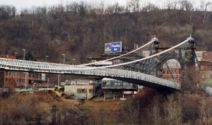
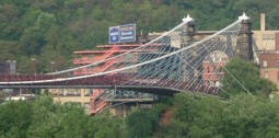
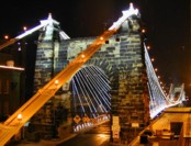
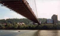
1851: Lewiston-Queenston
Lewiston, New York, USA and Queenston, Ontario, Canada - Niagara River
| Bridgemeister ID: | 35 (added before 2003) |
| Year Completed: | 1851 |
| Name: | Lewiston-Queenston |
| Location: | Lewiston, New York, USA and Queenston, Ontario, Canada |
| Crossing: | Niagara River |
| Principals: | Edward Serrell |
| References: | AAJ, BOB, BPL, HBE, PTS2 |
| Use: | Vehicular |
| Status: | Wrecked, 1864 |
| Main Cables: | Wire (iron) |
| Suspended Spans: | 1 |
| Main Span: | 1 x 258.8 meters (849 feet) |
| Deck width: | 21 feet (AAJ: 19.5 feet) |
Notes:
- Wrecked by wind February 1, 1864. Stay cables beneath the bridge had been disconnected to avoid damage from rising ice. Portions of the cables and deck remained, in a derelict state, as late as 1895. Replacement was not started until the late 1890's.
- The February 3, 1864 edition of Niagara Falls Gazette describes the wind event: "Partial Destruction Of The Lewiston Suspension Bridge -- A portion of the flooring and other wood-work of the Lewiston Suspension Bridge was blown down during the gale Monday forenoon. It seems that the long guys had been cut during the late ice jam to prevent injury to the structure and thus its strength to withstand a gale was much weakened. The wind swept through the gorge on Monday with terrific force and swayed the bridge so that some of the cross timbers, near the centre were loosened from their fastenings, and fell, of course carrying the floor with them. A large portion at each end, remains without material injury. The extent of the damage -- financially -- we have not yet learned, but we judge from what we hear that it may be about $10,000. The bridge was built in 1852 and cost not far from $40,000. It will doubtless soon be repaired and in use."
- Later at same location 1899 Lewiston-Queenston - Lewiston, New York, USA and Queenston, Ontario, Canada.
- See 1849 Wheeling (Wheeling and Belmont) - Wheeling, West Virginia, USA. The 1851 Lewiston-Queenston bridge is sometimes claimed to have become the longest in the world with a main span surpassing the length of the Wheeling suspension bridge. However, Don Sayenga notes the length of the suspended span of the Lewiston-Queenston bridge was only 849 feet, not the 1,043 feet sometimes cited. Don writes: "[1,043 feet] was the distance between the towers built high up on the cliffs above the crossing - because there was no space for them below. The roadway suspended from the towers was only 849 feet span over the water from abutment to abutment." Thus, Roebling's Cincinnati bridge should be considered the first to eclipse Wheeling's record main span.
External Links:
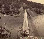
1852: (suspension bridge)
Frankfort, Kentucky, USA - Kentucky River
| Bridgemeister ID: | 1714 (added 2005-04-03) |
| Year Completed: | 1852 |
| Name: | (suspension bridge) |
| Location: | Frankfort, Kentucky, USA |
| Crossing: | Kentucky River |
| Coordinates: | 38.201998 N 84.881934 W |
| Maps: | Acme, GeoHack, Google, OpenStreetMap |
| Principals: | Mathew Dickinson Field |
| References: | AAJ, ENG18570605, HBE, HOF |
| Use: | Rail |
| Status: | Removed |
| Main Cables: | Wire (iron) |
| Suspended Spans: | 2 |
| Main Spans: | 1 x 61 meters (200 feet) estimated, 1 x 91.4 meters (300 feet) estimated |
Notes:
- An early attempt at a railroad suspension bridge, it was significantly reconstructed (because of excessive vibrations and increasing loads) by Julius W. Adams in 1857 to have three spans of 120, 163, and 163 feet. It is unclear whether the new structure was also a suspension bridge.
- HOF describes the location as "between the foot of Broadway and the neck of land near the mouth of Benson Creek." The coordinates provided here are for the later rail crossing at that general location, likely at or very close to the site of the suspension bridge.
1852: Charleston
Charleston, West Virginia, USA - Elk River
| Bridgemeister ID: | 38 (added before 2003) |
| Year Completed: | 1852 |
| Name: | Charleston |
| Also Known As: | Lovell Street |
| Location: | Charleston, West Virginia, USA |
| Crossing: | Elk River |
| Principals: | W. O. Buchanan, William Kuhn, Abraham Wright |
| References: | AAJ, EOV, HBE, PTS2 |
| Use: | Vehicular |
| Status: | Collapsed, December 15, 1904 |
| Main Cables: | Wire (iron) |
| Suspended Spans: | 1 |
| Main Span: | 1 x 145.7 meters (478 feet) |
| Deck width: | 17 feet |
Notes:
- Was still part of Virginia at time of completion.
- Damaged during Civil War. An article in the August 2, 1861 issue of the New York Times mentions: "A junction of our forces having now been effected, the army at once moved on to Elk River, which debouches into the Kanawha at Charleston, where the army encamped for the night. We would have crossed the stream at once, and marched through the town the same evening, but for the fact that the rebels had partially destroyed the beautiful suspension bridge which spans Elk River at this spot, rendering it unsafe for passage. Not content with burning a portion of the flooring, they nearly severed the strands which support the structure, and aid their work, too, in the most bungling manner. A more shameless piece of vandalism I never witnessed. While the army slept, a company of sappers and miners repaired the damage, and yesterday the army, nearly five thousand strong, marched through the streets of Charleston."
- Near 1884 (suspension bridge) - Charleston, West Virginia, USA.
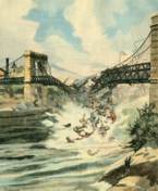
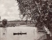
1852: St. John
St. John, New Brunswick, Canada - St. John River
| Bridgemeister ID: | 37 (added before 2003) |
| Year Completed: | 1852 |
| Name: | St. John |
| Location: | St. John, New Brunswick, Canada |
| Crossing: | St. John River |
| Principals: | Edward Serrell |
| References: | AAJ, BPL, HBE, PTS2 |
| Use: | Vehicular (one-lane) |
| Status: | Removed, 1915 |
| Main Cables: | Wire (iron) |
| Suspended Spans: | 1 |
| Main Span: | 1 x 195.1 meters (640 feet) |
Notes:
- Rebuilt 1857.
External Links:
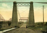
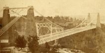
1853: Tsar Nicholas I
Kiev, Ukraine - Dnieper River
| Bridgemeister ID: | 409 (added before 2003) |
| Year Completed: | 1853 |
| Name: | Tsar Nicholas I |
| Location: | Kiev, Ukraine |
| Crossing: | Dnieper River |
| Principals: | Charles Blacker Vignoles |
| References: | AAJ, HBE, IEA, PTS2 |
| Use: | Vehicular |
| Status: | Destroyed, c. 1920 |
| Main Cables: | Chain (iron, flat link) |
| Suspended Spans: | 6 |
| Main Spans: | 4 x 134.1 meters (440 feet) |
| Side Spans: | 2 x 68.6 meters (225 feet) |
External Links:
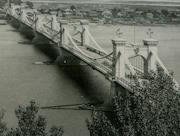
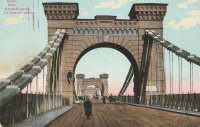
1854: Morgantown
Morgantown, West Virginia, USA - Monongahela River
| Bridgemeister ID: | 49 (added before 2003) |
| Year Completed: | 1854 |
| Name: | Morgantown |
| Location: | Morgantown, West Virginia, USA |
| Crossing: | Monongahela River |
| References: | AAJ, EN19070918, EOV, HBE, PTS2 |
| Use: | Vehicular, with walkway |
| Status: | Removed |
| Main Cables: | Wire (iron) |
| Suspended Spans: | 1 |
| Main Span: | 1 x 185.3 meters (608 feet) |
| Deck width: | 20 feet |
Notes:
- Was still part of Virginia at time of completion.
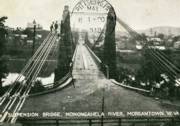
1855: Minneapolis
Minneapolis, Minnesota, USA - Mississippi River
| Bridgemeister ID: | 50 (added before 2003) |
| Year Completed: | 1855 |
| Name: | Minneapolis |
| Also Known As: | St. Anthony's Falls |
| Location: | Minneapolis, Minnesota, USA |
| Crossing: | Mississippi River |
| At or Near Feature: | Nicollet Island |
| Principals: | Thomas M. Griffith |
| References: | AAJ, BPL, HBE, PTS2 |
| Use: | Vehicular |
| Status: | Demolished, 1876 |
| Main Cables: | Wire (iron) |
| Suspended Spans: | 1 |
| Main Span: | 1 x 189 meters (620 feet) |
| Deck width: | 17 feet |
Notes:
- Replaced by 1877 Minneapolis - Minneapolis, Minnesota, USA.
- Later at same location 1990 Hennepin Avenue (Father Louis Hennepin) - Minneapolis, Minnesota, USA.
External Links:
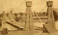
1855: Niagara Suspension
Niagara Falls, New York, USA and Niagara Falls, Ontario, Canada - Niagara River
| Bridgemeister ID: | 51 (added before 2003) |
| Year Completed: | 1855 |
| Name: | Niagara Suspension |
| Location: | Niagara Falls, New York, USA and Niagara Falls, Ontario, Canada |
| Crossing: | Niagara River |
| Principals: | John A. Roebling |
| References: | AAJ, BAAW, BBR, BFL, BMA, BOB, BPL, HBE, LIR, NSB, ONF, PTS2, SA18810716, SJR |
| Use: | Rail (heavy rail) and Vehicular (double-deck), with walkway |
| Status: | Replaced, 1897 |
| Main Cables: | Wire (iron) |
| Suspended Spans: | 1 |
| Main Span: | 1 x 250.3 meters (821.3 feet) |
Notes:
- Cables renovated, 1877. Wooden stiffening trusses replaced, 1880. Towers replaced, c. 1886. Bridge replaced with steel arch, 1897.
- AAJ notes the roadway deck opened in 1854, but the railway deck did not open until 1855.
- Replaced 1848 Niagara Suspension - Niagara Falls, New York, USA and Niagara Falls, Ontario, Canada.
External Links:
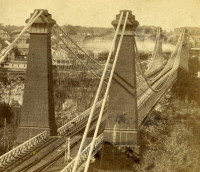
1857: Black River
Watertown, New York, USA - Black River
| Bridgemeister ID: | 55 (added before 2003) |
| Year Completed: | 1857 |
| Name: | Black River |
| Also Known As: | Bradford, Mill Street |
| Location: | Watertown, New York, USA |
| Crossing: | Black River |
| Principals: | Gilbert Bradford |
| References: | AAJ, HBE, ONC |
| Use: | Vehicular |
| Status: | Removed, 1890's |
| Main Cables: | Wire (iron) |
| Suspended Spans: | 1 |
| Main Span: | 1 x 53 meters (173.9 feet) |
| Deck width: | 18 feet |
Notes:
- Replaced in 1890's (ONC).
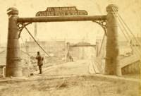
1858: Chelsea
London, England, United Kingdom - River Thames
| Bridgemeister ID: | 410 (added before 2003) |
| Year Completed: | 1858 |
| Name: | Chelsea |
| Also Known As: | Victoria |
| Location: | London, England, United Kingdom |
| Crossing: | River Thames |
| At or Near Feature: | Battersea Park |
| Coordinates: | 51.485061 N 0.149897 W |
| Maps: | Acme, GeoHack, Google, OpenStreetMap |
| Principals: | Thomas Page |
| References: | BTH, HBE, PTS2 |
| Use: | Vehicular |
| Status: | Replaced |
| Main Cables: | Eyebar (iron) |
| Suspended Spans: | 3 |
| Main Span: | 1 x 106.1 meters (348 feet) |
| Side Spans: | 1 x 116.7 meters (383 feet), 1 x 55.8 meters (183 feet) |
Notes:
- Replaced by 1937 Chelsea - London, England, United Kingdom.
External Links:
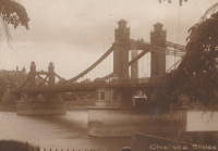
1860: Allegheny River
Pittsburgh, Pennsylvania, USA - Allegheny River
| Bridgemeister ID: | 59 (added before 2003) |
| Year Completed: | 1860 |
| Name: | Allegheny River |
| Also Known As: | Sixth Street, St. Clair |
| Location: | Pittsburgh, Pennsylvania, USA |
| Crossing: | Allegheny River |
| Principals: | John A. Roebling |
| References: | BOB, BOP, BPL, HBE, PBR, PTS2, SJR |
| Use: | Vehicular, with walkway |
| Status: | Replaced, 1892 |
| Main Cables: | Wire (iron) |
| Suspended Spans: | 4 |
| Main Spans: | 2 x 104.9 meters (344 feet) |
| Side Spans: | 2 x 52.1 meters (171 feet) |
| Deck width: | 40 feet |
Notes:
- BPL cites this bridge as the first suspension bridge with metal towers. However, at least two earlier suspension bridges (1857 Watertown, New York and 1856 Bidwell Bar, California) are known to have metal towers and even Roebling's 1846 Smithfield Street Bridge in Pittsburgh had cast iron towers.
- Next to 1884 North Side (Seventh Street) - Pittsburgh, Pennsylvania, USA.
External Links:
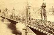
1862: Lambeth
London, England, United Kingdom - River Thames
| Bridgemeister ID: | 829 (added 2003-05-31) |
| Year Completed: | 1862 |
| Name: | Lambeth |
| Location: | London, England, United Kingdom |
| Crossing: | River Thames |
| Principals: | P. W. Barlow |
| References: | BRB, HBE, ONF, PTS2 |
| Use: | Vehicular, with walkway |
| Status: | Replaced, 1932 |
| Suspended Spans: | 3 |
| Main Spans: | 3 x 81.7 meters (268 feet) |
External Links:
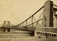
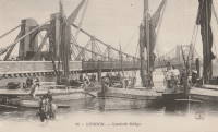
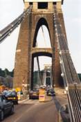
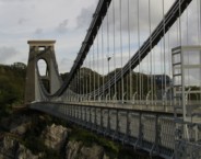
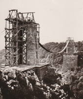
1864: Clifton
Bristol, England, United Kingdom - River Avon
| Bridgemeister ID: | 413 (added before 2003) |
| Year Completed: | 1864 |
| Name: | Clifton |
| Location: | Bristol, England, United Kingdom |
| Crossing: | River Avon |
| Coordinates: | 51.45496 N 2.62781 W |
| Maps: | Acme, GeoHack, Google, OpenStreetMap |
| Principals: | Isambard K. Brunel, P.W. Barlow, Hawkshaw |
| References: | AOB, BBR, BC3, BEM, BMA, BOU, BRB, CTW, HBE, NTB, ONF, PTS2 |
| Use: | Vehicular, with walkway |
| Status: | In use (last checked: 2021) |
| Main Cables: | Eyebar (iron) |
| Suspended Spans: | 1 |
| Main Span: | 1 x 214 meters (702 feet) |
Notes:
- Built with chain cables reused from the Hungerford bridge.
- See 1845 Hungerford - London, England, United Kingdom.
External Links:

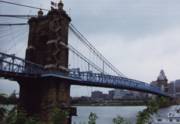
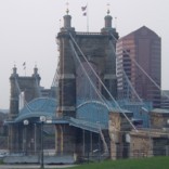
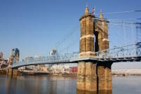
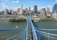
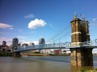
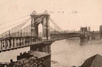
1867: John A. Roebling
Cincinnati, Ohio and Covington, Kentucky, USA - Ohio River
| Bridgemeister ID: | 65 (added before 2003) |
| Year Completed: | 1867 |
| Name: | John A. Roebling |
| Also Known As: | Cincinnati, Cincinnati and Covington |
| Location: | Cincinnati, Ohio and Covington, Kentucky, USA |
| Crossing: | Ohio River |
| Coordinates: | 39.09167 N 84.50833 W |
| Maps: | Acme, GeoHack, Google, OpenStreetMap |
| Principals: | John A. Roebling |
| References: | BAAW, BC3, BOB, BPL, COB, EOV, HBE, LAB, LACE, ONF, PTS2, SJR, TOB |
| Use: | Vehicular (two-lane), with walkway |
| Status: | Closed, February, 2021 (last checked: 2021) |
| Main Cables: | Wire (iron) |
| Suspended Spans: | 3 |
| Main Span: | 1 x 322.2 meters (1,057 feet) |
| Side Spans: | 2 |
Notes:
- 1892: Cable ends restored.
- 1899: Steel cables added to assist original cables.
- 2021, February: Closed to all vehicular traffic for a nine-month restoration project.
- Became longest suspension bridge by eclipsing 1849 Wheeling (Wheeling and Belmont) - Wheeling, West Virginia, USA.
- Eclipsed by new longest suspension bridge 1869 Clifton (Niagara-Clifton, Falls View, First Falls View) - Niagara Falls, New York, USA and Niagara Falls, Ontario, Canada.
External Links:
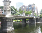
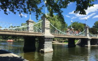
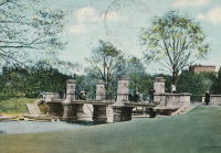
1867: Public Garden
Boston, Massachusetts, USA - Public Garden lagoon
| Bridgemeister ID: | 245 (added before 2003) |
| Year Completed: | 1867 |
| Name: | Public Garden |
| Location: | Boston, Massachusetts, USA |
| Crossing: | Public Garden lagoon |
| Coordinates: | 42.354119 N 71.069920 W |
| Maps: | Acme, GeoHack, Google, OpenStreetMap |
| Principals: | William Gibbons Preston, Clemens Herschel |
| References: | HBE |
| Use: | Footbridge |
| Status: | In use (last checked: 2019) |
| Main Cables: | Eyebar (iron) |
| Suspended Spans: | 3 |
| Main Span: | 1 |
| Side Spans: | 2 |
External Links:

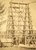
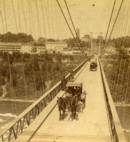
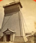
1869: Clifton
Niagara Falls, New York, USA and Niagara Falls, Ontario, Canada - Niagara River
| Bridgemeister ID: | 70 (added before 2003) |
| Year Completed: | 1869 |
| Name: | Clifton |
| Also Known As: | Niagara-Clifton, Falls View, First Falls View |
| Location: | Niagara Falls, New York, USA and Niagara Falls, Ontario, Canada |
| Crossing: | Niagara River |
| Principals: | Samuel Keefer |
| References: | AAJ, BPL, HBE, PTS2 |
| Use: | Vehicular |
| Status: | Replaced, 1889 |
| Main Cables: | Wire (iron) |
| Main Span: | 1 x 386.6 meters (1,268.3 feet) |
| Deck width: | 10 feet |
Notes:
- Opened January 2nd, 1869. Wooden towers replaced with steel towers, 1884. Widened to 17 feet, 1888. Wrecked by wind, January, 1889. Some of the images here may show the replacement bridge.
- Became longest suspension bridge by eclipsing 1867 John A. Roebling (Cincinnati, Cincinnati and Covington) - Cincinnati, Ohio and Covington, Kentucky, USA.
- Eclipsed by new longest suspension bridge 1883 Brooklyn (Great East River) - New York and Brooklyn, New York, USA.
- Replaced by 1889 Second Falls View - Niagara Falls, New York, USA and Niagara Falls, Ontario, Canada.
External Links:
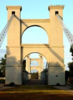
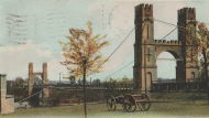
1869: Waco
Waco, Texas, USA - Brazos River
| Bridgemeister ID: | 72 (added before 2003) |
| Year Completed: | 1869 |
| Name: | Waco |
| Location: | Waco, Texas, USA |
| Crossing: | Brazos River |
| Coordinates: | 31.561314 N 97.127063 W |
| Maps: | Acme, GeoHack, Google, OpenStreetMap |
| Principals: | Thomas M. Griffith |
| References: | AAJ, BC3, BPL, BRAZ, GBD, HAERTX98, HBE, PTS2, WSB |
| Use: | Vehicular, with walkway |
| Status: | Restricted to foot traffic (last checked: 2023) |
| Main Cables: | Wire (iron) |
| Suspended Spans: | 1 |
| Main Span: | 1 x 144.8 meters (475 feet) |
| Deck width: | 18 feet |
Notes:
- 1915: Rebuilt.
- 2020, October: Closed for restoration project expecting to last 18-24 months.
- 2021, March: Major restoration project underway, led by Sparks Engineering, Inc.
- 2023, April: The restored bridge is rededicated on April 22. Patrick Sparks of Sparks Engineering reports: . The rededication was held April 22, 2023. "The project involved full rehabilitation including: replacement of the suspension system and anchor rods, strengthening of the anchorages, replacement of the saddle bearings, retrofit strengthening of the east tower, and deck replacement (concrete on the main deck, tropical hardwood on the side walks)."
External Links:
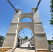
1871: Warren
Warren, Pennsylvania, USA - Allegheny River
| Bridgemeister ID: | 75 (added before 2003) |
| Year Completed: | 1871 |
| Name: | Warren |
| Also Known As: | Hickory Street |
| Location: | Warren, Pennsylvania, USA |
| Crossing: | Allegheny River |
| Principals: | George W. Fishler |
| References: | AAJ, EOV, HAERPA461, HBE, PTS2 |
| Use: | Vehicular, with walkway |
| Status: | Replaced, 1918 |
| Main Cables: | Wire (iron) |
| Suspended Spans: | 1 |
| Main Span: | 1 x 143.3 meters (470 feet) |
| Deck width: | 29 feet |
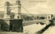
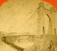
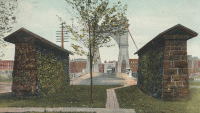
1876: Petroleum Street
Oil City, Pennsylvania, USA - Allegheny River
| Bridgemeister ID: | 83 (added before 2003) |
| Year Completed: | 1876 |
| Name: | Petroleum Street |
| Also Known As: | Oil City |
| Location: | Oil City, Pennsylvania, USA |
| Crossing: | Allegheny River |
| Principals: | Charles Roebling |
| References: | AAJ, HAERPA461, HBE, PTS2, TRS |
| Use: | Vehicular |
| Status: | Removed |
| Main Cables: | Wire |
| Suspended Spans: | 3 |
| Main Span: | 1 x 152.4 meters (500 feet) |
| Side Spans: | 2 |
Notes:
- AAJ: Rebuilt, 1884, 1905.
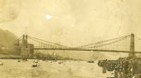
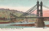
1876: Point
Pittsburgh, Pennsylvania, USA - Monongahela River
| Bridgemeister ID: | 84 (added before 2003) |
| Year Completed: | 1876 |
| Name: | Point |
| Location: | Pittsburgh, Pennsylvania, USA |
| Crossing: | Monongahela River |
| Principals: | Edward Hemberle |
| References: | AAJ, BOP, BPL, HBE, IEA, ONF, PBR, PTS2, SA19000106 |
| Use: | Vehicular and Rail (streetcar) |
| Status: | Demolished, 1927 |
| Main Cables: | Eyebar |
| Suspended Spans: | 1 |
| Main Span: | 1 x 243.8 meters (800 feet) |
| Deck width: | 34 feet |
Notes:
- Partial floor collapse requiring extensive repairs, December 24, 1903. Repaired, 1904. Demolished 1927.
External Links:
1877: Minneapolis
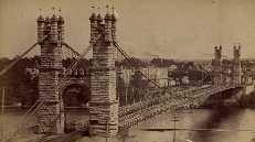
Minneapolis, Minnesota, USA - Mississippi River
| Bridgemeister ID: | 86 (added before 2003) |
| Year Completed: | 1877 |
| Name: | Minneapolis |
| Location: | Minneapolis, Minnesota, USA |
| Crossing: | Mississippi River |
| At or Near Feature: | Nicollet Island |
| Principals: | Thomas M. Griffith |
| References: | AAJ, BPL, HBE, PTS2 |
| Use: | Vehicular, with walkway |
| Status: | Replaced, 1890 |
| Main Cables: | Wire (iron) |
| Suspended Spans: | 1 |
| Main Span: | 1 x 205.8 meters (675.1 feet) |
| Deck width: | 32 feet |
Notes:
- Replaced 1855 Minneapolis (St. Anthony's Falls) - Minneapolis, Minnesota, USA.
- Later at same location 1990 Hennepin Avenue (Father Louis Hennepin) - Minneapolis, Minnesota, USA.
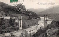
1879: Saint-Ilpize
Saint-Ilpize, Haute-Loire, France - Allier River
| Bridgemeister ID: | 1097 (added 2004-01-02) |
| Year Completed: | 1879 |
| Name: | Saint-Ilpize |
| Location: | Saint-Ilpize, Haute-Loire, France |
| Crossing: | Allier River |
| Coordinates: | 45.198556 N 3.386866 E |
| Maps: | Acme, GeoHack, Google, OpenStreetMap |
| Principals: | Ferdinand Arnodin |
| References: | AAJ, BPF, HBE, PTS2 |
| Use: | Vehicular (one-lane) |
| Status: | In use (last checked: 2020) |
| Main Cables: | Wire |
| Suspended Spans: | 3 |
| Main Span: | 1 x 70.35 meters (230.8 feet) |
| Side Spans: | 2 |
| Deck width: | 18 feet |
Notes:
- The side spans are supported solely by inclined stays, not suspenders from the main cables.
- Closed to all traffic on July 15, 2004 due to damage to the deck, possibly caused by an overloaded truck. Repaired and reopened.
External Links:
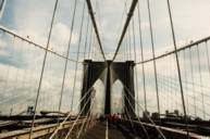
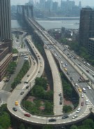
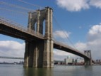
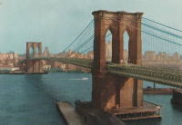
1883: Brooklyn
New York and Brooklyn, New York, USA - East River
| Bridgemeister ID: | 89 (added before 2003) |
| Year Completed: | 1883 |
| Name: | Brooklyn |
| Also Known As: | Great East River |
| Location: | New York and Brooklyn, New York, USA |
| Crossing: | East River |
| Coordinates: | 40.706 N 73.99667 W |
| Maps: | Acme, GeoHack, Google, OpenStreetMap |
| Principals: | John A. Roebling, Washington A. Roebling |
| References: | AAJ, BAAW, BBR, BBTS, BC3, BFL, BLD, BMA, BOB, BOU, BPL, COB, CTW, GB, GBD, HBE, LAB, LACE, NG198305, ONF, PTS2, SJR |
| Use: | Rail (light rail) and Vehicular (major highway), with walkway |
| Status: | In use (last checked: 2022) |
| Main Cables: | Wire (steel) |
| Suspended Spans: | 3 |
| Main Span: | 1 x 486.3 meters (1,595.5 feet) |
| Side Spans: | 2 x 283.5 meters (930 feet) |
| Deck width: | 85 feet |
Notes:
- Became longest suspension bridge by eclipsing 1869 Clifton (Niagara-Clifton, Falls View, First Falls View) - Niagara Falls, New York, USA and Niagara Falls, Ontario, Canada.
- Eclipsed by new longest suspension bridge 1903 Williamsburg - New York and Brooklyn, New York, USA.
- Next to 1909 Manhattan - New York and Brooklyn, New York, USA.
- Near 1903 Williamsburg - New York and Brooklyn, New York, USA.
External Links:
1884: (suspension bridge)
Charleston, West Virginia, USA - Elk River
| Bridgemeister ID: | 1427 (added 2004-07-24) |
| Year Completed: | 1884 |
| Name: | (suspension bridge) |
| Location: | Charleston, West Virginia, USA |
| Crossing: | Elk River |
| References: | AAJ, HBE, PTS2 |
| Use: | Vehicular and Rail (streetcar) |
| Status: | Removed |
| Main Cables: | Wire |
| Main Span: | 1 x 83.2 meters (273 feet) |
Notes:
- AAJ: Repaired by William Hildenbrand a few years after completion.
- Near 1852 Charleston (Lovell Street) - Charleston, West Virginia, USA.
1884: North Side
Pittsburgh, Pennsylvania, USA - Allegheny River
| Bridgemeister ID: | 91 (added before 2003) |
| Year Completed: | 1884 |
| Name: | North Side |
| Also Known As: | Seventh Street |
| Location: | Pittsburgh, Pennsylvania, USA |
| Crossing: | Allegheny River |
| Principals: | Gustav Lindenthal |
| References: | AAJ, BPL, HBE, PBR, PTS2 |
| Use: | Vehicular |
| Status: | Removed, 1924 |
| Main Cables: | Eyebar |
| Suspended Spans: | 4 |
| Main Spans: | 2 x 97.5 meters (320 feet) |
| Side Spans: | 2 x 50.3 meters (165 feet) |
| Deck width: | 42 feet |
Notes:
- Next to 1860 Allegheny River (Sixth Street, St. Clair) - Pittsburgh, Pennsylvania, USA.
- Replaced by 1926 Andy Warhol (Seventh Street) - Pittsburgh, Pennsylvania, USA.
External Links:
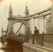
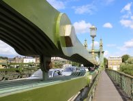
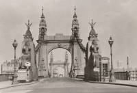
1887: Hammersmith
London, England, United Kingdom - River Thames
| Bridgemeister ID: | 419 (added before 2003) |
| Year Completed: | 1887 |
| Name: | Hammersmith |
| Location: | London, England, United Kingdom |
| Crossing: | River Thames |
| Coordinates: | 51.48845 N 0.23019 W |
| Maps: | Acme, GeoHack, Google, OpenStreetMap |
| Principals: | Sir Joseph Bazalgette |
| References: | BEM, BPL, HBE, NTB, PTS2 |
| Use: | Vehicular (two-lane), with walkway |
| Status: | Restricted to foot traffic, since 2021 (last checked: 2021) |
| Main Cables: | Eyebar |
| Suspended Spans: | 3 |
| Main Span: | 1 |
| Side Spans: | 2 |
Notes:
- 2019, April: Closed to vehicular traffic due to safety concerns after an inspection found fractures in the cast iron casings around the bridge pedestals. Some repair work followed, but was not fully funded or finished (as of mid-2020)
- 2020, August: Fractures found to have worsened during recent heatwave. Bridge is completely closed to all pedestrian and bicycle traffic. Pedestrian walkways under the bridge and all river traffic under the bridge are also prohibited (implying risk of collapse).
- 2020, December: Bridge may reopen to pedestrians and cyclists if deemed safe by maintenance contractor, Mott MacDonald.
- 2021, January: Plan discussed to "thread" a temporary truss along the length of the deck to permit traffic while the suspension bridge undergoes repairs.
- 2021, March: Feasibility study on "double-decker" temporary truss plan determines it is feasible, possibly opening to pedestrian and vehicular traffic by mid-2022.
- 2021, July: Reopened for pedestrian and bicycle use.
- Replaced 1827 Hammersmith - London, England, United Kingdom.
External Links:
- ENR - Engineers Ponder Solutions for Damaged London Bridge. February 22, 2021 Engineering News-Record article discusses proposal to thread a temporary truss between the towers to allow traffic while the larger suspension bridge repairs are completed. Recaps the issue: "Cracks have been found in the cast-iron pedestals that support suspension cable saddles at the abutments. Engineers suspect that roller bearings between the saddles and pedestals seized up at least 30 years ago…"
- Hammersmith Bridge | Temporary ‘double-decker’ proposal deemed technically feasible - New Civil Engineer. March 22, 2021
- The Happy Pontist: London Bridges: 33. Hammersmith Bridge
- Structurae - Structure ID 20008013
1888: Tidewater Pipeline
Jim Thorpe, Pennsylvania, USA - Lehigh River
| Bridgemeister ID: | 1527 (added 2004-10-24) |
| Year Completed: | 1888 |
| Name: | Tidewater Pipeline |
| Location: | Jim Thorpe, Pennsylvania, USA |
| Crossing: | Lehigh River |
| Coordinates: | 40.90714 N 75.748544 W |
| Maps: | Acme, GeoHack, Google, OpenStreetMap |
| Principals: | William Hildenbrand |
| References: | AAJ, HBE |
| Use: | Pipeline |
| Status: | Extant (last checked: 2020) |
| Main Cables: | Wire |
| Main Span: | 1 x 109.7 meters (360 feet) |
Notes:
- The town was named "Mauch Chunk" at the time the pipeline was built.
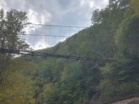
1890: Grand Avenue
St. Louis, Missouri, USA - Mill Creek Valley
| Bridgemeister ID: | 96 (added before 2003) |
| Year Completed: | 1890 |
| Name: | Grand Avenue |
| Also Known As: | Jefferson Avenue |
| Location: | St. Louis, Missouri, USA |
| Crossing: | Mill Creek Valley |
| Principals: | Carl Gayler |
| References: | AAJ, HBE, IEA, ONF, PTS2, SSB |
| Use: | Vehicular, with walkway |
| Status: | Demolished, 1960 |
| Main Cables: | Eyebar |
| Suspended Spans: | 3 |
| Main Span: | 1 x 121.9 meters (400 feet) |
| Side Spans: | 2 x 45.7 meters (150 feet) |
| Deck width: | 60 feet |
| Characteristics: | Braced (trussed) chain/cable |
Notes:
- Braced chain (stiffened-eyebar) design often espoused by Gustav Lindenthal. ONF (an article by Lindenthal) refers to this as the Jefferson Ave. bridge while Fowler's book (IEA) calls it "Grand Avenue". AAJ describes it as "a three-hinged inverted arch with two stiffened chains, one on each side."
External Links:
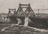
1893: Cable
Chicago, Illinois, USA - Garfield Park Lagoon
| Bridgemeister ID: | 320 (added before 2003) |
| Year Completed: | 1893 |
| Name: | Cable |
| Location: | Chicago, Illinois, USA |
| Crossing: | Garfield Park Lagoon |
| At or Near Feature: | Garfield Park |
| Coordinates: | 41.883548 N 87.714527 W |
| Maps: | Acme, GeoHack, Google, OpenStreetMap |
| References: | HBE |
| Use: | Footbridge |
| Status: | In use (last checked: 2021) |
| Main Cables: | Wire |
| Suspended Spans: | 1 |
Notes:
- 1870 and 1874 are also sometimes cited as year of completion.

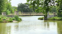
1894: Occidente
Santa Fé de Antioquia, Colombia - Cauca River
| Bridgemeister ID: | 934 (added 2003-10-25) |
| Year Completed: | 1894 |
| Name: | Occidente |
| Also Known As: | Western |
| Location: | Santa Fé de Antioquia, Colombia |
| Crossing: | Cauca River |
| Coordinates: | 6.577965 N 75.798177 W |
| Maps: | Acme, GeoHack, Google, OpenStreetMap |
| Principals: | José María Villa |
| References: | AAJ, HBE, PTS2 |
| Use: | Vehicular (one-lane), with walkway |
| Status: | In use (last checked: 2019) |
| Main Cables: | Wire |
| Main Span: | 1 x 286.5 meters (940 feet) |
External Links:
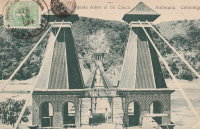
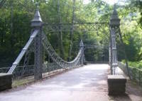
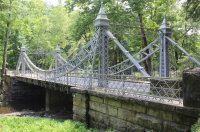
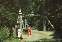
| Bridgemeister ID: | 343 (added before 2003) |
| Year Completed: | 1895 |
| Name: | Mill Creek Park |
| Also Known As: | White, Silver, Old Steel, Cinderella, Fairy Tale |
| Location: | Youngstown vicinity, Ohio, USA |
| At or Near Feature: | Mill Creek Park |
| Coordinates: | 41.07325 N 80.68886 W |
| Maps: | Acme, GeoHack, Google, OpenStreetMap |
| Principals: | Charles Evan Fowler |
| References: | AAJ, HBE, IEA, PTS2 |
| Use: | Vehicular (two-lane) |
| Status: | In use (last checked: 2021) |
| Main Cables: | Eyebar |
| Suspended Spans: | 1 |
| Main Span: | 1 x 27.4 meters (90 feet) |
| Characteristics: | Braced (trussed) chain/cable |
Notes:
- Short stiffened eyebar ("braced chain") of the style that Lindenthal often proposed. A mid-span support was added many years ago.
- Major rehabilitation started, June 2007. Reopened November, 2007.
External Links:
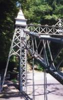
1897: Lincoln Highway
East Liverpool, Ohio and Chester, West Virginia, USA - Ohio River
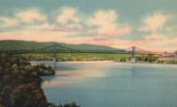
| Bridgemeister ID: | 105 (added before 2003) |
| Year Completed: | 1897 |
| Name: | Lincoln Highway |
| Also Known As: | Chester |
| Location: | East Liverpool, Ohio and Chester, West Virginia, USA |
| Crossing: | Ohio River |
| Principals: | Hermann Laub, E.S. Fickes |
| References: | AAJ, BPL, HBE, PTS2 |
| Use: | Vehicular, with walkway |
| Status: | Removed, 1970 |
| Main Cables: | Wire (steel) |
| Suspended Spans: | 3 |
| Main Span: | 1 x 214.9 meters (705 feet) |
| Side Spans: | 1 x 109.7 meters (360 feet), 1 x 128 meters (420 feet) |
| Deck width: | 27 feet |
Notes:
- Rebuilt 1939 by David Steinman. Closed and demolished, 1970.
External Links:
1897: Rochester
Rochester and Monaca, Pennsylvania, USA - Ohio River
| Bridgemeister ID: | 104 (added before 2003) |
| Year Completed: | 1897 |
| Name: | Rochester |
| Location: | Rochester and Monaca, Pennsylvania, USA |
| Crossing: | Ohio River |
| Principals: | Edwin Kirtland Morse |
| References: | AAJ, BPL, HBE, PTS2 |
| Use: | Vehicular, with walkway |
| Status: | Removed |
| Main Cables: | Wire (steel) |
| Suspended Spans: | 3 |
| Main Span: | 1 x 243.8 meters (800 feet) |
| Side Spans: | 1 x 121.9 meters (400 feet), 1 x 126.8 meters (416 feet) |
| Deck width: | 28 feet |
External Links:

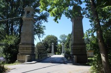
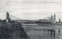
1898: Langenargen
Langenargen and Gohren, Kressbronn am Bodensee, Baden-Württemberg, Germany - Argen River
| Bridgemeister ID: | 929 (added 2003-10-24) |
| Year Completed: | 1898 |
| Name: | Langenargen |
| Location: | Langenargen and Gohren, Kressbronn am Bodensee, Baden-Württemberg, Germany |
| Crossing: | Argen River |
| Coordinates: | 47.59622 N 9.56208 E |
| Maps: | Acme, GeoHack, Google, OpenStreetMap |
| Principals: | Kubler, Leibbrand |
| References: | AAJ, HBE, PTS2 |
| Use: | Vehicular, with walkway |
| Status: | Restricted to foot traffic (last checked: 2022) |
| Main Cables: | Wire |
| Suspended Spans: | 1 |
| Main Span: | 1 x 71.9 meters (236 feet) |
Notes:
- Othmar Ammann worked as an intern on this bridge.
External Links:
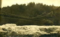
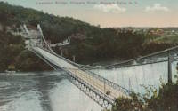
1899: Lewiston-Queenston
Lewiston, New York, USA and Queenston, Ontario, Canada - Niagara River
| Bridgemeister ID: | 108 (added before 2003) |
| Year Completed: | 1899 |
| Name: | Lewiston-Queenston |
| Location: | Lewiston, New York, USA and Queenston, Ontario, Canada |
| Crossing: | Niagara River |
| Principals: | L.L. Buck, R.S. Buck |
| References: | AAJ, BPL, HBE, PTS2 |
| Use: | Vehicular and Rail (streetcar) |
| Status: | Replaced, 1962 |
| Main Cables: | Wire (steel) |
| Suspended Spans: | 1 |
| Main Span: | 1 x 317 meters (1,040 feet) |
| Deck width: | 17 feet |
Notes:
- Reused parts from the recently dismantled Second Falls View Bridge.
- At former location of 1851 Lewiston-Queenston - Lewiston, New York, USA and Queenston, Ontario, Canada.
- See 1889 Second Falls View - Niagara Falls, New York, USA and Niagara Falls, Ontario, Canada.
1900: New River
Nuttallburg and South Nuttall, West Virginia, USA - New River
| Bridgemeister ID: | 347 (added before 2003) |
| Year Completed: | 1900 |
| Name: | New River |
| Also Known As: | Swinging |
| Location: | Nuttallburg and South Nuttall, West Virginia, USA |
| Crossing: | New River |
| Coordinates: | 38.047482 N 81.035972 W |
| Maps: | Acme, GeoHack, Google, OpenStreetMap |
| References: | AAJ, HBE |
| Use: | Footbridge |
| Status: | Only towers remain (last checked: 2006) |
| Main Cables: | Wire |
| Suspended Spans: | 1 |
| Main Span: | 1 x 103.6 meters (340 feet) |
| Deck width: | 6 feet |
Notes:
- At least one of the towers is still standing, as of 2006.
- Coordinates are for likely location of the bridge, based on historical maps.
1900: Ojuela
Mapimí, Torreon vicinity, Durango, Mexico
| Bridgemeister ID: | 1043 (added 2003-12-06) |
| Year Completed: | 1900 |
| Name: | Ojuela |
| Also Known As: | Mapimi, Mampimi, Miampimi |
| Location: | Mapimí, Torreon vicinity, Durango, Mexico |
| Coordinates: | 25.791768 N 103.790706 W |
| Maps: | Acme, GeoHack, Google, OpenStreetMap |
| Principals: | Santiago Minguín, William Hildenbrand?, Henry G. Tyrell |
| References: | AAJ, HBE, PTS2 |
| Use: | Vehicular |
| Status: | Restricted to foot traffic (last checked: 2019) |
| Main Cables: | Wire (steel) |
| Suspended Spans: | 1 |
| Main Span: | 1 x 271.5 meters (890.7 feet) estimated |
Notes:
- Misspelled on every long span bridge list I've ever seen, this long narrow footbridge is located at Mapimí, Mexico.
- AAJ notes this bridge as having a 10-foot wide roadway and having been built by William Hildenbrand. The present-day bridge's deck measures only 1.8 meters and is restricted to foot traffic. In HBE, Tyrell takes credit for the design of the bridge and also notes the 10-foot roadway (though, HBE was probably a source for AAJ).
External Links:
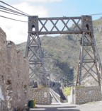
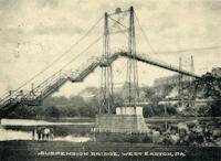
1900: Upper
Easton, Pennsylvania, USA - Lehigh River
| Bridgemeister ID: | 366 (added before 2003) |
| Year Completed: | 1900 |
| Name: | Upper |
| Location: | Easton, Pennsylvania, USA |
| Crossing: | Lehigh River |
| Principals: | Henry G. Tyrell, John McNeal |
| References: | AAJ, DSL20030414, EN19001122, HBE, PTS2, WGE20030513 |
| Use: | Footbridge |
| Status: | Demolished, 1955 |
| Main Cables: | Wire (steel) |
| Suspended Spans: | 3 |
| Main Spans: | 2 x 85 meters (279 feet) |
| Side Span: | 1 x 33.5 meters (110 feet) |
Notes:
- According to Tyrell, "[It] joins Dock Street on the lower side of the river with Glendon Avenue on the upper side, 90 feet above it. To overcome this difference in elevation of the two ends without incurring excessive expense for approach, the bridge floor was made to descend on a grade of 7.2 per cent from the upper bank to meet stairs rising from Dock Street..."
1903: Caperton
Caperton vicinity, West Virginia, USA - New River
| Bridgemeister ID: | 1422 (added 2004-07-17) |
| Year Completed: | 1903 |
| Name: | Caperton |
| Location: | Caperton vicinity, West Virginia, USA |
| Crossing: | New River |
| Coordinates: | 38.021856 N 81.028479 W |
| Maps: | Acme, GeoHack, Google, OpenStreetMap |
| References: | AAJ, HBE, PTS2 |
| Use: | Footbridge |
| Status: | Removed |
| Main Cables: | Wire |
| Suspended Spans: | 1 |
| Main Span: | 1 x 155.4 meters (510 feet) |
Notes:
- Removed by the 1960s, probably earlier.
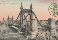
1903: Elisabeth
Budapest, Hungary - Danube River
| Bridgemeister ID: | 426 (added before 2003) |
| Year Completed: | 1903 |
| Name: | Elisabeth |
| Also Known As: | Elizabeth, Erzsébet |
| Location: | Budapest, Hungary |
| Crossing: | Danube River |
| Principals: | Aurel Czekelius, M. Nagy |
| References: | AAJ, BMA, HBE, PTS2, SA19050909 |
| Use: | Vehicular, with walkway |
| Status: | Destroyed, 1945 |
| Main Cables: | Eyebar |
| Suspended Spans: | 3 |
| Main Span: | 1 x 289.9 meters (951 feet) |
| Side Spans: | 2 x 44.2 meters (145 feet) |
Notes:
- Replaced by 1964 Elisabeth (Erzsébet) - Budapest, Hungary.
External Links:
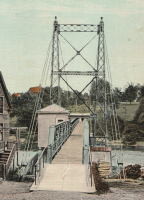
1903: Ticonic
Waterville, Maine, USA - Kennebec River
| Bridgemeister ID: | 110 (added before 2003) |
| Year Completed: | 1903 |
| Name: | Ticonic |
| Also Known As: | Tupenny, Two Cent |
| Location: | Waterville, Maine, USA |
| Crossing: | Kennebec River |
| Coordinates: | 44.55073 N 69.62728 W |
| Maps: | Acme, GeoHack, Google, OpenStreetMap |
| Principals: | Edwin D. Graves |
| References: | AAJ, HBE, PTS2 |
| Use: | Footbridge |
| Status: | In use (last checked: 2009) |
| Main Cables: | Wire |
| Suspended Spans: | 1 |
| Main Span: | 1 x 121.9 meters (400 feet) |
| Deck width: | 6 feet |
External Links:
1903: Williamsburg
New York and Brooklyn, New York, USA - East River
| Bridgemeister ID: | 111 (added before 2003) |
| Year Completed: | 1903 |
| Name: | Williamsburg |
| Location: | New York and Brooklyn, New York, USA |
| Crossing: | East River |
| Coordinates: | 40.71355 N 73.97226 W |
| Maps: | Acme, GeoHack, Google, OpenStreetMap |
| Principals: | L.L. Buck |
| References: | AAJ, BAAW, BAR, BBR, BPL, GBD, HBE, PTS2, SJR |
| Use: | Rail (light rail) and Vehicular (major highway), with walkway |
| Status: | In use (last checked: 2022) |
| Main Cables: | Wire (steel) |
| Suspended Spans: | 1 |
| Main Span: | 1 x 487.7 meters (1,600 feet) |
Notes:
- Became longest suspension bridge by eclipsing 1883 Brooklyn (Great East River) - New York and Brooklyn, New York, USA.
- Eclipsed by new longest suspension bridge 1924 Bear Mountain - Anthony's Nose and Bear Mountain, New York, USA.
- Near 1883 Brooklyn (Great East River) - New York and Brooklyn, New York, USA.
- Near 1909 Manhattan - New York and Brooklyn, New York, USA.
External Links:
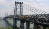
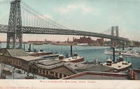
1905: Widnes-Runcorn Transporter
Runcorn, England, United Kingdom - River Mersey, Manchester Ship Canal
| Bridgemeister ID: | 954 (added 2003-10-31) |
| Year Completed: | 1905 |
| Name: | Widnes-Runcorn Transporter |
| Location: | Runcorn, England, United Kingdom |
| Crossing: | River Mersey, Manchester Ship Canal |
| Principals: | J.J. Webster, J.T. Wood, Charles Smith |
| References: | AAJ, BRB, HBE |
| Use: | Transporter |
| Status: | Removed |
| Main Cables: | Wire (steel) |
| Suspended Spans: | 1 |
| Main Span: | 1 x 304.8 meters (1,000 feet) |
External Links:
1908: Tyngs Island
Lowell vicinity, Massachusetts, USA - Merrimack River
| Bridgemeister ID: | 844 (added 2003-06-28) |
| Year Completed: | 1908 |
| Name: | Tyngs Island |
| Location: | Lowell vicinity, Massachusetts, USA |
| Crossing: | Merrimack River |
| At or Near Feature: | Vesper Country Club |
| Coordinates: | 42.65574 N 71.39971 W |
| Maps: | Acme, GeoHack, Google, OpenStreetMap |
| Principals: | Westinghouse, Church, Kerr, and Co., J.R. Worcester |
| References: | AAJ, HBE |
| Use: | Footbridge |
| Status: | Destroyed, 1936 |
| Main Cables: | Wire (steel) |
| Suspended Spans: | 1 |
| Main Span: | 1 x 167.6 meters (550 feet) |
| Deck width: | 4.5 feet |
Notes:
- Destroyed by flood, 1936.
1909: Manhattan
New York and Brooklyn, New York, USA - East River
| Bridgemeister ID: | 123 (added before 2003) |
| Year Completed: | 1909 |
| Name: | Manhattan |
| Location: | New York and Brooklyn, New York, USA |
| Crossing: | East River |
| Coordinates: | 40.70667 N 73.99167 W |
| Maps: | Acme, GeoHack, Google, OpenStreetMap |
| Principals: | O.F. Nichols, Leon Moisseiff |
| References: | AAJ, BAAW, BBR, BC3, BPL, GBD, HBE, LAB, PTS2, SA19050909, SJR |
| Use: | Vehicular (double-deck) |
| Status: | In use (last checked: 2022) |
| Main Cables: | Wire (steel) |
| Suspended Spans: | 3 |
| Main Span: | 1 x 448.1 meters (1,470 feet) |
| Side Spans: | 2 x 221 meters (725 feet) |
Notes:
- Opened December 31, 1909, but not fully completed yet.
- Next to 1883 Brooklyn (Great East River) - New York and Brooklyn, New York, USA.
- Near 1903 Williamsburg - New York and Brooklyn, New York, USA.
External Links:
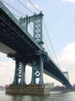

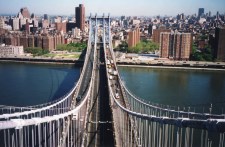
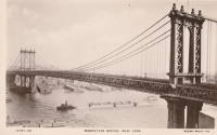
Montmorency Falls
Quebec City vicinity, Quebec, Canada - Montmorency Falls
| Bridgemeister ID: | 1526 (added 2004-10-24) |
| Name: | Montmorency Falls |
| Location: | Quebec City vicinity, Quebec, Canada |
| Crossing: | Montmorency Falls |
| Coordinates: | 46.890706 N 71.147952 W |
| Maps: | Acme, GeoHack, Google, OpenStreetMap |
| References: | AAJ, HBE |
| Use: | Vehicular |
| Status: | Failed, April 30, 1856 |
| Main Cables: | Wire (iron) |
| Suspended Spans: | 1 |
Notes:
- Towers from this bridge are still visible next to the towers of the current suspension footbridge. HBE, in 1911, notes that it "collapsed some years ago carrying a wagon and its driver into the cataract."
- Jakkula (AAJ) cites an article tracing back to the Quebec Gazette stating the bridge failed on April 30, 1856 resulting in the loss of "several" lives and recounting the troubled history of the bridge: "There had been statements made before to the effect that the bridge was not to be trusted. People crossed it with terror. On the northern bank, 5 of the 7 strands of one of the wire cables had previously given way, and the cable had been repaired."
- Later at same location Montmorency Falls - Quebec City vicinity, Quebec, Canada.
Sister Island
Niagara Falls, New York, USA - Niagara River
| Bridgemeister ID: | 649 (added 2003-02-17) |
| Name: | Sister Island |
| Location: | Niagara Falls, New York, USA |
| Crossing: | Niagara River |
| At or Near Feature: | Three Sister Islands |
| References: | HBE |
| Use: | Footbridge |
| Status: | Removed |
| Main Cables: | Wire |
| Suspended Spans: | 1 |
