Inventory Search Results
20 suspension bridges were found for search criteria: HBR. All 20 bridges from the search results appear below. Click the Bridgemeister ID number to isolate the bridge on its own page. If you don't see what you were looking for, try an image search with the same criteria: HBR. This will find the bridge if it is pictured on the site, but is not a catenary suspension bridge.
Related:
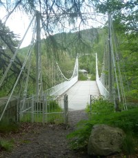
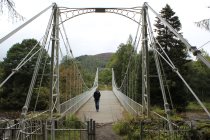
1834: Crathie
Crathie vicinity, Scotland, United Kingdom - River Dee
| Bridgemeister ID: | 1084 (added 2004-01-01) |
| Year Completed: | 1834 |
| Name: | Crathie |
| Location: | Crathie vicinity, Scotland, United Kingdom |
| Crossing: | River Dee |
| Coordinates: | 57.0335 N 3.211 W |
| Maps: | Acme, GeoHack, Google, OpenStreetMap |
| Principals: | Justice Junior and Co. |
| References: | AAJ, BSI, HBR |
| Use: | Vehicular (one-lane) |
| Status: | Closed, December 2015 (last checked: 2015) |
| Main Cables: | Eyebar (iron) |
| Suspended Spans: | 1 |
| Main Span: | 1 x 42.1 meters (138 feet) |
| Deck width: | 14 feet |
Notes:
- Small iron chain suspension bridge.
- BSI: Reported to have been "almost entirely renewed", 1885. Ruddock also suggests the bridge was originally constructed with just diagonal stays (as other Justice bridges) and the catenary chains were added during the renewal.
External Links:
- The Happy Pontist: Scottish Bridges: 56. Crathie Suspension Bridge (after the flood)
- Structurae - Structure ID 20070665
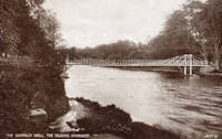
1853: General's Well
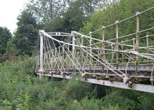
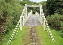
Inverness, Scotland, United Kingdom - River Ness
| Bridgemeister ID: | 406 (added before 2003) |
| Year Completed: | 1853 |
| Name: | General's Well |
| Location: | Inverness, Scotland, United Kingdom |
| Crossing: | River Ness |
| At or Near Feature: | Ness Islands |
| Coordinates: | 57.460944 N 4.237166 W |
| Maps: | Acme, GeoHack, Google, OpenStreetMap |
| Principals: | James Dredge |
| References: | HBR |
| Use: | Footbridge |
| Status: | In use (last checked: 2014) |
| Main Cables: | Rod (iron) |
| Suspended Spans: | 3 |
| Main Span: | 1 |
| Side Spans: | 2 |
Notes:
- Relocated to a nearby park (Whin Park) where it carries a miniature railway, 1988. The coordinates listed here are for that later (miniature railway park) location.
- Companion to 1853 Island Bank Road - Inverness, Scotland, United Kingdom.
- See 1988 (footbridge) - Inverness, Scotland, United Kingdom.
- See 1988 (footbridge) - Inverness, Scotland, United Kingdom.
External Links:

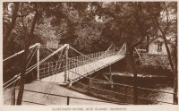
1853: Island Bank Road
Inverness, Scotland, United Kingdom - River Ness
| Bridgemeister ID: | 904 (added 2003-10-11) |
| Year Completed: | 1853 |
| Name: | Island Bank Road |
| Location: | Inverness, Scotland, United Kingdom |
| Crossing: | River Ness |
| At or Near Feature: | Ness Islands |
| Principals: | James Dredge |
| References: | HBR |
| Use: | Footbridge |
| Status: | Removed |
Notes:
- Companion to 1853 General's Well - Inverness, Scotland, United Kingdom.
- See 1988 (footbridge) - Inverness, Scotland, United Kingdom.
- See 1988 (footbridge) - Inverness, Scotland, United Kingdom.
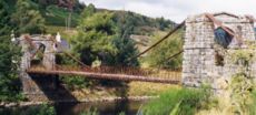
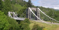
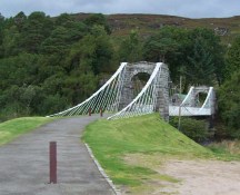
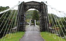
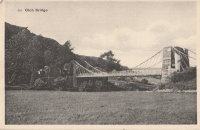
1854: Oich
Invergarry vicinity, Scotland, United Kingdom - River Oich
| Bridgemeister ID: | 403 (added before 2003) |
| Year Completed: | 1854 |
| Name: | Oich |
| Also Known As: | Aberchalder |
| Location: | Invergarry vicinity, Scotland, United Kingdom |
| Crossing: | River Oich |
| Coordinates: | 57.093377 N 4.745271 W |
| Maps: | Acme, GeoHack, Google, OpenStreetMap |
| Principals: | James Dredge |
| References: | BC3, HBR |
| Use: | Vehicular (one-lane) |
| Status: | Restricted to foot traffic (last checked: 2014) |
| Main Cables: | Rod (iron) |
| Suspended Spans: | 1 |
Notes:
- Restored and re-opened, late 1990's.
External Links:
1867: Corrieshalloch
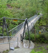
Braemore, Scotland, United Kingdom - Corrieshalloch Gorge
| Bridgemeister ID: | 1308 (added 2004-04-10) |
| Year Completed: | 1867 |
| Name: | Corrieshalloch |
| Location: | Braemore, Scotland, United Kingdom |
| Crossing: | Corrieshalloch Gorge |
| At or Near Feature: | Falls of Measach |
| Coordinates: | 57.755753 N 5.021048 W |
| Maps: | Acme, GeoHack, Google, OpenStreetMap |
| Principals: | John Fowler |
| References: | AAJ, HBR |
| Use: | Footbridge |
| Status: | In use (last checked: 2022) |
| Main Cables: | Wire |
| Suspended Spans: | 1 |
| Main Span: | 1 x 25.1 meters (82.5 feet) |
Notes:
- 2022, May: Closed again for maintenance and inspection, reopened by month's end.
- AAJ lists the bridge at "Corry Halloch" bridge completed in 1875. Other sources mention 1867, and 1874.
- 1977: Anchorages replaced (HBR).
- 2021: Closed September 10 due to safety concerns. Repaired and re-opened in October.
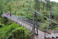
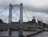
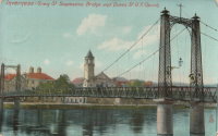
1879: Infirmary
Inverness, Scotland, United Kingdom - River Ness
| Bridgemeister ID: | 539 (added before 2003) |
| Year Completed: | 1879 |
| Name: | Infirmary |
| Location: | Inverness, Scotland, United Kingdom |
| Crossing: | River Ness |
| Coordinates: | 57.471653 N 4.228844 W |
| Maps: | Acme, GeoHack, Google, OpenStreetMap |
| Principals: | C. R. Manners |
| References: | HBR |
| Use: | Footbridge |
| Status: | In use (last checked: 2021) |
| Main Cables: | Wire |
| Suspended Spans: | 3 |
| Main Span: | 1 x 61 meters (200 feet) |
| Side Spans: | 2 x 12.8 meters (42 feet) |
Notes:
- 2020, November: Highland Council likely to close bridge if funding for urgent repairs cannot be raised.
- 2021, July: Reopened after interim repairs completed. Future major refurbishment expected.
- Companion to 1881 Greig Street (Wobbly) - Inverness, Scotland, United Kingdom.
Annotated Citations:
- Glen, Louise. “Closure Fears for Iconic Inverness Bridge Facing Huge Repair Bill.” Inverness Courier, 21 Apr. 2021, www.inverness-courier.co.uk/news/closure-fears-for-iconic-inverness-bridge-facing-huge-repair-235713/.
"Fears have been raised that decades of under investment in an iconic city bridge could see it closed permanently. Members of Ballifeary Community Council believe the cost of fixing and upgrading the Infirmary Bridge to bring it up to modern standards may be more than £1 million..."
- Duncan, Ian. "The future of Infirmary Bridge secured into the 2040s as Highland Council's Economy and Infrastructure Committee today agrees up to £550,000 in funding for repairs." Inverness Courier, 05 May 2021, www.inverness-courier.co.uk/news/the-future-of-infirmary-bridge-secured-into-the-2040s-237340/.
"Highland Council's Economy and Infrastructure Committee agreed today to include up to £550,000 for repairs for Infirmary Bridge… 'It will be 2022 before the repairs are completed, but once done the bridge's life will be extended for a further 20 to 25 years.'"
External Links:

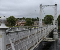
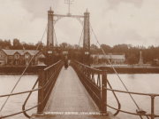
1881: Greig Street
Inverness, Scotland, United Kingdom - River Ness
| Bridgemeister ID: | 538 (added before 2003) |
| Year Completed: | 1881 |
| Name: | Greig Street |
| Also Known As: | Wobbly |
| Location: | Inverness, Scotland, United Kingdom |
| Crossing: | River Ness |
| Coordinates: | 57.479111 N 4.229796 W |
| Maps: | Acme, GeoHack, Google, OpenStreetMap |
| References: | HBR |
| Use: | Footbridge |
| Status: | In use (last checked: 2021) |
| Main Cables: | Wire |
| Suspended Spans: | 3 |
| Main Span: | 1 |
| Side Spans: | 2 |
Notes:
- Companion to 1879 Infirmary - Inverness, Scotland, United Kingdom.
- Near 1855 Ness - Inverness, Scotland, United Kingdom. In some photos, the two bridges are visible within a few hundred yards of each other.
External Links:
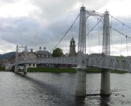
1885: Abergeldie Castle
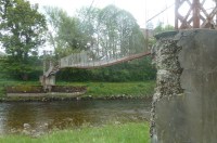
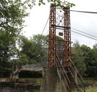
Balmoral vicinity, Scotland, United Kingdom - River Dee
| Bridgemeister ID: | 1705 (added 2005-03-29) |
| Year Completed: | 1885 |
| Name: | Abergeldie Castle |
| Location: | Balmoral vicinity, Scotland, United Kingdom |
| Crossing: | River Dee |
| Coordinates: | 57.043806 N 3.176197 W |
| Maps: | Acme, GeoHack, Google, OpenStreetMap |
| Principals: | Blaikie Brothers |
| References: | AAJ, HBR |
| Use: | Footbridge |
| Status: | Derelict (last checked: 2016) |
| Main Cables: | Wire |
| Suspended Spans: | 1 |
Notes:
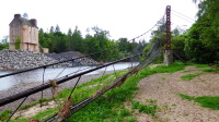
- William Craig describes the bridge, "A wood and angle iron deck supported from two pairs of wire cables and rod suspenders. The railings are of light woven wire. Pylons with ornamental heads are of lattice gider construction on concrete bases five miles west of Ballater, Scotland."
- Was already derelict before December 2015 flooding (Storm Frank) that severely damaged several River Dee bridges. Dave Cooper writes in early 2016: "The bridge's southern tower and its base are gone. The river bank has eroded back to within feet of the grade one listed Abergeldie Castle. Seat of Baron Abergeldie."
External Links:


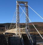
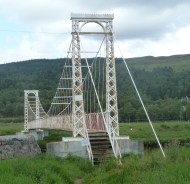
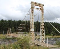
1892: Polhollick
Ballater vicinity, Aberdeenshire, Scotland, United Kingdom - River Dee
| Bridgemeister ID: | 1905 (added 2005-10-08) |
| Year Completed: | 1892 |
| Name: | Polhollick |
| Location: | Ballater vicinity, Aberdeenshire, Scotland, United Kingdom |
| Crossing: | River Dee |
| Coordinates: | 57.055048 N 3.083452 W |
| Maps: | Acme, GeoHack, Google, OpenStreetMap |
| Principals: | James Abernethy & Co. |
| References: | HARPER, HBR |
| Use: | Footbridge |
| Status: | In use (last checked: 2014) |
| Main Cables: | Wire (steel) |
| Suspended Spans: | 1 |
| Main Span: | 1 x 54.4 meters (178.5 feet) |
Notes:
- Closed May 2015 for repairs. Reopened October, 2015.
External Links:
- The Happy Pontist: Scottish Bridges: 19. Polhollick Suspension Bridge
- The Happy Pontist: Scottish Bridges: 44. Polhollick Bridge (revisited)
- Structurae - Structure ID 20021613
1900: Dunes
Bighouse, Melvich Bay vicinity, Scotland, United Kingdom - Halladale River
| Bridgemeister ID: | 2567 (added 2012-02-05) |
| Year Completed: | 1900 |
| Name: | Dunes |
| Location: | Bighouse, Melvich Bay vicinity, Scotland, United Kingdom |
| Crossing: | Halladale River |
| Coordinates: | 58.55716 N 3.91118 W |
| Maps: | Acme, GeoHack, Google, OpenStreetMap |
| References: | HBR |
| Use: | Footbridge |
| Status: | Removed |
| Main Cables: | Wire |
1905: Cambus O'May
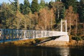
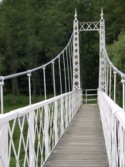
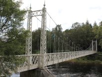
Ballater, Scotland, United Kingdom - River Dee
| Bridgemeister ID: | 429 (added before 2003) |
| Year Completed: | 1905 |
| Name: | Cambus O'May |
| Also Known As: | Gordon |
| Location: | Ballater, Scotland, United Kingdom |
| Crossing: | River Dee |
| Coordinates: | 57.065803 N 2.956825 W |
| Maps: | Acme, GeoHack, Google, OpenStreetMap |
| Principals: | James Abernethy & Co. |
| References: | BC2, BC3, BEM, HARPER, HBR, NTB |
| Use: | Footbridge |
| Status: | In use (last checked: April, 2021) |
| Main Cables: | Wire (steel) |
| Suspended Spans: | 1 |
| Main Span: | 1 x 51.8 meters (170 feet) |
Notes:
- 1988: Refurbished (HBR)
- 2015, December: Damaged by the River Dee flood caused by Storm Frank. Closed indefinitely. Repairs expected to start in 2020.
- 2020, August 31: Repairs underway, expected to be completed in approximately 16 weeks.
- 2020, December: Storm Frank repairs now expected to be completed in January 2021.
- 2021, January: Completion of repairs delayed due to COVID-19 pandemic "stay at home" recommendations.
- 2021, April 1: Repairs completed, bridge reopened.
External Links:
- Cambus O' May | Harper Bridges
- The Happy Pontist: Scottish Bridges: 20. Cambus O'May Footbridge
- The Happy Pontist: Scottish Bridges: 43. Cambus O' May Bridge (revisited)
- The Happy Pontist: Scottish Bridges: 55. Cambus O'May Bridge (after the flood)
- Structurae - Structure ID 20019638

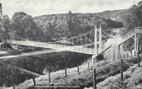
1924: Invercauld
Braemar vicinity, Scotland, United Kingdom - River Dee
| Bridgemeister ID: | 1906 (added 2005-10-08) |
| Year Completed: | 1924 |
| Name: | Invercauld |
| Also Known As: | Ballochbuie, Garbh Allt Shiel |
| Location: | Braemar vicinity, Scotland, United Kingdom |
| Crossing: | River Dee |
| Coordinates: | 57.001768 N 3.322743 W |
| Maps: | Acme, GeoHack, Google, OpenStreetMap |
| Principals: | James Abernethy & Co. |
| References: | HARPER, HBR |
| Use: | Footbridge |
| Status: | In use (last checked: 2014) |
| Main Cables: | Wire (steel) |
| Suspended Spans: | 1 |
External Links:
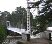
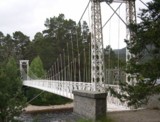
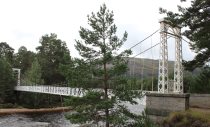
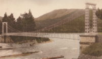
1988: (footbridge)
Inverness, Scotland, United Kingdom - River Ness
| Bridgemeister ID: | 905 (added 2003-10-11) |
| Year Completed: | 1988 |
| Name: | (footbridge) |
| Location: | Inverness, Scotland, United Kingdom |
| Crossing: | River Ness |
| At or Near Feature: | Ness Islands |
| Coordinates: | 57.462946 N 4.233579 W |
| Maps: | Acme, GeoHack, Google, OpenStreetMap |
| Principals: | Cruden and Tough |
| References: | HBR |
| Use: | Footbridge |
| Status: | In use (last checked: 2019) |
| Main Cables: | Wire (steel) |
| Suspended Spans: | 3 |
| Main Span: | 1 |
| Side Spans: | 2 |
Notes:
- One of two footbridges in the Ness Islands near the locations of the two 1853 Ness Islands bridges. This one has towers that are more in the river than the other 1988 bridge.
- Near 1988 (footbridge) - Inverness, Scotland, United Kingdom.
- See 1853 General's Well - Inverness, Scotland, United Kingdom.
- See 1853 Island Bank Road - Inverness, Scotland, United Kingdom.
External Links:
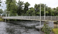
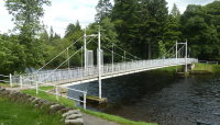
1988: (footbridge)
Inverness, Scotland, United Kingdom - River Ness
| Bridgemeister ID: | 906 (added 2003-10-11) |
| Year Completed: | 1988 |
| Name: | (footbridge) |
| Location: | Inverness, Scotland, United Kingdom |
| Crossing: | River Ness |
| At or Near Feature: | Ness Islands |
| Coordinates: | 57.465699 N 4.228247 W |
| Maps: | Acme, GeoHack, Google, OpenStreetMap |
| References: | HBR |
| Use: | Footbridge |
| Status: | In use (last checked: 2019) |
| Main Cables: | Wire (steel) |
| Suspended Spans: | 1 |
Notes:
- One of two footbridges in the Ness Islands near the locations of the two 1853 Ness Islands bridges. This one has towers set back from the river.
- Near 1988 (footbridge) - Inverness, Scotland, United Kingdom.
- See 1853 General's Well - Inverness, Scotland, United Kingdom.
- See 1853 Island Bank Road - Inverness, Scotland, United Kingdom.
External Links:
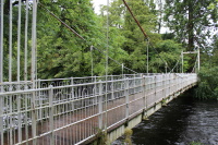
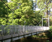
(suspension bridge)
Tomintoul, Scotland, United Kingdom - River Avon
| Bridgemeister ID: | 1904 (added 2005-10-08) |
| Name: | (suspension bridge) |
| Location: | Tomintoul, Scotland, United Kingdom |
| Crossing: | River Avon |
| References: | HBR |
Notes:
- HBR notes this bridge as 'remains of a former suspension bridge' located 'in the next field' from the Tomintoul footbridge.
- Near Tomintoul - Tomintoul, Scotland, United Kingdom.
Athnamulloch
Loch Affric, Scotland, United Kingdom - River Affric
| Bridgemeister ID: | 1907 (added 2005-10-08) |
| Name: | Athnamulloch |
| Location: | Loch Affric, Scotland, United Kingdom |
| Crossing: | River Affric |
| References: | HBR |
| Use: | Footbridge |
| Main Cables: | Wire |
| Suspended Spans: | 1 |
| Main Span: | 1 x 27.4 meters (90 feet) |
Bonawe
Bonawe, Scotland, United Kingdom - River Awe
| Bridgemeister ID: | 1909 (added 2005-10-08) |
| Name: | Bonawe |
| Location: | Bonawe, Scotland, United Kingdom |
| Crossing: | River Awe |
| Coordinates: | 56.434000 N 5.215000 W |
| Maps: | Acme, GeoHack, Google, OpenStreetMap |
| References: | HBR |
| Use: | Footbridge |
| Status: | In use (last checked: 2012) |
| Main Cables: | Wire (steel) |
| Suspended Spans: | 1 |
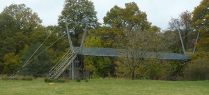
Loch Achnamoine
Loch Achnamoine, Scotland, United Kingdom - River Helmsdale
| Bridgemeister ID: | 1908 (added 2005-10-08) |
| Name: | Loch Achnamoine |
| Location: | Loch Achnamoine, Scotland, United Kingdom |
| Crossing: | River Helmsdale |
| Coordinates: | 58.263535 N 4.032381 W |
| Maps: | Acme, GeoHack, Google, OpenStreetMap |
| References: | HBR |
| Use: | Footbridge |
| Status: | Extant (last checked: 2011) |
| Main Cables: | Wire |
Notes:
- HBR notes several other light footbridges in this area. Dave Cooper noted there are likely five River Helmsdale suspension bridges (including this one) in this area.
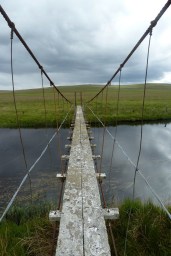
Tomintoul
Tomintoul, Scotland, United Kingdom - River Avon
| Bridgemeister ID: | 1903 (added 2005-10-08) |
| Name: | Tomintoul |
| Location: | Tomintoul, Scotland, United Kingdom |
| Crossing: | River Avon |
| Coordinates: | 57.290323 N 3.418058 W |
| Maps: | Acme, GeoHack, Google, OpenStreetMap |
| References: | HBR |
| Use: | Footbridge |
| Status: | In use (last checked: 2019) |
| Main Cables: | Wire (steel) |
| Suspended Spans: | 1 |
Notes:
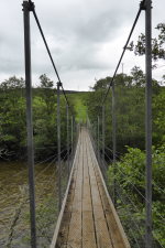
Victoria
Charlestown of Aberlour and Wester Elchies, Scotland, United Kingdom - River Spey
| Bridgemeister ID: | 781 (added 2003-03-16) |
| Name: | Victoria |
| Also Known As: | Penny, Aberlour |
| Location: | Charlestown of Aberlour and Wester Elchies, Scotland, United Kingdom |
| Crossing: | River Spey |
| Coordinates: | 57.47044 N 3.23173 W |
| Maps: | Acme, GeoHack, Google, OpenStreetMap |
| Principals: | James Abernethy & Co. "Abernethy Foundry" |
| References: | HARPER, HBR |
| Use: | Footbridge |
| Status: | In use (last checked: 2014) |
| Main Cables: | Wire (steel) |
| Suspended Spans: | 1 |
Notes:
- William Craig describes the bridge, "Built about 1900 by James Abernethy & Co. The pylons are tapered lattice girders with ball and spike finials and cross braced. Walkway is lattice girder hung from suspension cables."
- Near (footbridge) - Aberlour, Scotland, United Kingdom.
External Links:
