Inventory Search Results
20 suspension bridges were found for search criteria: LAB. All 20 bridges from the search results appear below. Click the Bridgemeister ID number to isolate the bridge on its own page. If you don't see what you were looking for, try an image search with the same criteria: LAB. This will find the bridge if it is pictured on the site, but is not a catenary suspension bridge.
Related:
1801: Jacob's Creek
Iron Bridge, Mount Pleasant vicinity, Pennsylvania, USA - Jacob's Creek
| Bridgemeister ID: | 3 (added before 2003) |
| Year Completed: | 1801 |
| Name: | Jacob's Creek |
| Also Known As: | Iron Bridge, Chain Bridge |
| Location: | Iron Bridge, Mount Pleasant vicinity, Pennsylvania, USA |
| Crossing: | Jacob's Creek |
| Coordinates: | 40.112598 N 79.553186 W |
| Maps: | Acme, GeoHack, Google, OpenStreetMap |
| Principals: | Judge James Finley |
| References: | AAJ, ASB, BBR, BOB, BPL, CAB, DSE20000116, HBE, LAB, PTS2 |
| Use: | Vehicular |
| Status: | Removed, 1833 |
| Main Cables: | Chain (iron) |
| Suspended Spans: | 3 |
| Main Span: | 1 x 21.3 meters (70 feet) |
| Deck width: | 12.5 feet |
Notes:
- In an email dated January 16, 2000, Don Sayenga provided information about the location of this bridge. Generally attributed to Uniontown (the seat of Fayette County, PA), Mr. Sayenga offers some clues about the bridge's true location. "[James Finley] stated that he built it near the home of his friend Meason which implies a connection for the iron as Meason was making iron. Meason's home has survived by the way, a beautiful place. Finley stated it was a combination contract with the cost split between two counties, and he stated it was built over Jacob's Creek which is the county boundary. He also makes it clear it was on the road to Greensburg. The only place the old road crossed Jacob's Creek is just south of Mount Pleasant, Pennsylvania. On the geodetic survey maps this spot is marked "Iron Bridge" but there is no town there. The last time I was there I saw a sign that said 'Iron Bridge' on an automobile scrap yard. I found absolutely no trace of the bridge, but it was not very big, so there was no need for a huge abutment."
- First suspension bridge with a rigid level deck, often considered the world's first modern suspension bridge.
- Coordinates are for the likely location of the bridge, where present-day (2020) Pennsylvania route 3105 crosses Jacob's Creek.
External Links:
1816: Spider
Philadelphia, Pennsylvania, USA - Schuylkill River
| Bridgemeister ID: | 20 (added before 2003) |
| Year Completed: | 1816 |
| Name: | Spider |
| Location: | Philadelphia, Pennsylvania, USA |
| Crossing: | Schuylkill River |
| Principals: | Josiah White, Erskine Hazard |
| References: | AAJ, BOB, BPL, GHD, HBE, LAB, PTS2 |
| Use: | Footbridge |
| Status: | Removed |
| Main Cables: | Wire (iron) |
| Main Span: | 1 x 120 meters (393.75 feet) |
Notes:
- Narrow footbridge. First wire bridge in North America. HBE notes "first wire suspension bridge in any country."
- Often described as having collapsed under the weight of ice and snow, Don Sayenga notes that no contemporary sources confirm this demise. Since the nearby chain bridge did fail under weight of ice and snow, he believes this fate has been misattributed to the White and Hazard footbridge. Don believes the bridge was just dismantled at some point after June, 1816.
- Al Zagofsky also wrote to explain there was no evidence of this bridge collapsing under weight of ice and snow. Al writes: "According to an original source Captain Joshua Rowley Watson, who inspected the bridge on June 15, 1816: '...There was a bridge, but which by the weight of ice and snow, has been carried away.' This refers to the previous bridge that the cable bridge was temporarily replacing. I did not see any cause for failure of the wire rope bridge. My guess is that it was removed when the regular bridge was repaired. The same article shows a sketch that he made, showing the main span to be 407 feet. I am looking at the Canal History and Technology Proceedings Vol 5, March 22, 1986."
1822: (footbridge)
Annonay, Ardèche, France - Cance River
| Bridgemeister ID: | 375 (added before 2003) |
| Year Completed: | 1822 |
| Name: | (footbridge) |
| Location: | Annonay, Ardèche, France |
| Crossing: | Cance River |
| Principals: | Marc Seguin, Camille Seguin, Jules Seguin, Paul Seguin, Charles Seguin |
| References: | AAJ, BBR, GHD, LAB, TTSB |
| Use: | Footbridge |
| Status: | Removed |
| Main Cables: | Wire (iron) |
| Suspended Spans: | 1 |
| Main Span: | 1 x 18 meters (59.1 feet) |
Notes:
- Test structure, but recognized as first wire bridge in France.
- See 1865 Moulin - Vernosc-lès-Annonay, Ardèche, France.
External Links:
1823: Saint Antoine
Geneva, Switzerland
| Bridgemeister ID: | 377 (added before 2003) |
| Year Completed: | 1823 |
| Name: | Saint Antoine |
| Location: | Geneva, Switzerland |
| Principals: | Guillame Henri Dufour, Marc Seguin, Marc-Auguste Pictet |
| References: | AAJ, GHD, HBE, LAB, MOS, PTS2 |
| Status: | Removed, c.1864 |
| Main Cables: | Wire (iron) |
| Suspended Spans: | 2 |
| Main Spans: | 2 x 40 meters (131.2 feet) |
| Deck width: | 7.5 feet |
External Links:
1825: Tain-Tournon
Tournon-sur-Rhône, Ardèche and Tain, Drôme, France - Rhône River
| Bridgemeister ID: | 378 (added before 2003) |
| Year Completed: | 1825 |
| Name: | Tain-Tournon |
| Location: | Tournon-sur-Rhône, Ardèche and Tain, Drôme, France |
| Crossing: | Rhône River |
| Principals: | Marc Seguin |
| References: | AAJ, ASB, BBR, BPF, GHD, LAB, MOS, PTS2, TTSB |
| Use: | Vehicular |
| Status: | Removed, 1965 |
| Main Cables: | Wire (iron) |
| Suspended Spans: | 2 |
| Main Spans: | 2 x 85 meters (278.88 feet) |
| Deck width: | 13.75 feet |
Notes:
- Often credited as being the first large wire suspension bridge in France (and elsewhere). Rebuilt 1847 as a footbridge. Removed 1965.
- Near 1849 Marc Seguin - Tournon-sur-Rhône, Ardèche and Tain-L'Hermitage, Drôme, France.
- Near 1958 Gustave Toursier - Tournon-sur-Rhône, Ardèche and Tain-L'Hermitage, Drôme, France.
External Links:
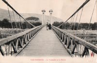
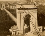
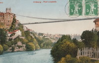
1834: Zaehringen
Fribourg, Switzerland - Sarine River
| Bridgemeister ID: | 395 (added before 2003) |
| Year Completed: | 1834 |
| Name: | Zaehringen |
| Also Known As: | Grand Pont Suspendu |
| Location: | Fribourg, Switzerland |
| Crossing: | Sarine River |
| Principals: | Joseph Chaley |
| References: | AAJ, BBR, BFL, HBE, LAB |
| Use: | Vehicular |
| Status: | Removed, 1920's |
| Main Cables: | Wire (iron) |
| Suspended Spans: | 1 |
| Main Span: | 1 x 273.1 meters (896 feet) |
Notes:
- Became longest suspension bridge by eclipsing 1826 Menai Strait - Menai Bridge and Bangor vicinity, Wales, United Kingdom.
- Eclipsed by new longest suspension bridge 1849 Wheeling (Wheeling and Belmont) - Wheeling, West Virginia, USA.
- Near 1840 Gotteron - Fribourg, Switzerland.
External Links:
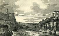
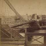
1842: Fairmount
Philadelphia, Pennsylvania, USA - Schuylkill River
| Bridgemeister ID: | 24 (added before 2003) |
| Year Completed: | 1842 |
| Name: | Fairmount |
| Also Known As: | Callowhill Street, Upper Ferry |
| Location: | Philadelphia, Pennsylvania, USA |
| Crossing: | Schuylkill River |
| Principals: | Charles Ellet |
| References: | BBR, BOB, BPL, HBE, LAB, PTS2, WHSB |
| Use: | Vehicular |
| Status: | Replaced, 1875 |
| Main Cables: | Wire (iron) |
| Suspended Spans: | 1 |
| Main Span: | 1 x 104.2 meters (342 feet) |
Notes:
- BBR and BOB say 1841.
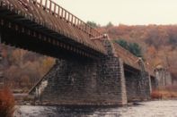
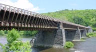
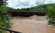
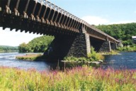
1848: Delaware Aqueduct
Lackawaxen, Pennsylvania and Minisink Ford, New York, USA - Delaware River
| Bridgemeister ID: | 30 (added before 2003) |
| Year Completed: | 1848 |
| Name: | Delaware Aqueduct |
| Also Known As: | Roebling Aqueduct |
| Location: | Lackawaxen, Pennsylvania and Minisink Ford, New York, USA |
| Crossing: | Delaware River |
| Coordinates: | 41.48262 N 74.98461 W |
| Maps: | Acme, GeoHack, Google, OpenStreetMap |
| Principals: | John A. Roebling |
| References: | AAJ, BDR, BOB, BPL, GBD, LAB, LACE, RDH, SJR |
| Use: | Aqueduct and Vehicular (one-lane), with walkway |
| Status: | In use (last checked: 2006) |
| Main Cables: | Wire (iron) |
| Suspended Spans: | 4 |
| Main Spans: | 1 x 43.3 meters (142 feet), 3 x 39.9 meters (131 feet) |
Notes:
- BPL: Completed 1848. RDH/BDR: Completed 1848, not used until 1849.
- Originally constructed to carry the Delaware and Hudson Canal. Converted to a one-lane vehicular bridge soon after the canal closed in 1898. Substantially restored in 1980's and 1990's, but retains original cables.
- Built as part of same project as 1849 Lackawaxen Aqueduct - Lackawaxen, Pennsylvania, USA.
- Built as part of same project as 1851 High Falls Aqueduct - High Falls, New York, USA.
- Built as part of same project as 1851 Neversink Aqueduct - Cuddebackville, New York, USA.
- Near 1849 Lackawaxen Aqueduct - Lackawaxen, Pennsylvania, USA.
External Links:
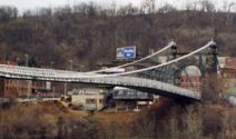
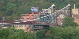
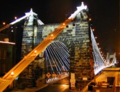
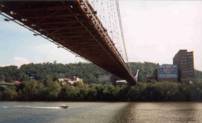
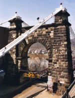
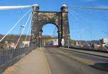
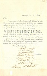
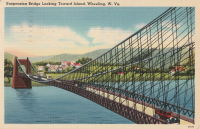
1849: Wheeling
Wheeling, West Virginia, USA - Ohio River
| Bridgemeister ID: | 32 (added before 2003) |
| Year Completed: | 1849 |
| Name: | Wheeling |
| Also Known As: | Wheeling and Belmont |
| Location: | Wheeling, West Virginia, USA |
| Crossing: | Ohio River |
| Coordinates: | 40.07167 N 80.72667 W |
| Maps: | Acme, GeoHack, Google, OpenStreetMap |
| Principals: | Charles Ellet |
| References: | AAJ, BBR, BC3, BOB, BPL, CEJ, COB, GBD, HBE, LAB, LACE, ONF, PTS2, RWS, WCC, WHSB |
| Use: | Vehicular (two-lane, light vehicles only) |
| Status: | Restricted to foot traffic, since September 2019 (last checked: 2020) |
| Main Cables: | Wire (iron) |
| Suspended Spans: | 1 |
| Main Span: | 1 x 307.8 meters (1,010 feet) |
Notes:
- Was still part of Virginia at time of completion.
- 1854: Rebuilt after it was wrecked by a windstorm. Contrary to popular myth, the rebuilding was undertaken by Ellet and his assistant William K. McComas, not by John A. Roebling.
- 1860: Overhauled. Popular myth often attributes this work to the Roeblings. WHSB attributes this work to William K. McComas. After this overhaul, the bridge still does not have the distinctive diagonal cable stays that give it the appearance of a Roebling bridge.
- 1872: Overhauled according to a design by Washington Roebling. John A. Roebling had died in 1869 and was not involved with this work. WHSB notes, "The design essentially Roeblingized the bridge with the diagonal cable stays that are such a prominent feature of the bridge."
- 2019, September: Closed to vehicular traffic indefinitely due to safety concerns after repeated overweight vehicle violations.
- 2020, November: Bids being evaluated for renovation project. Bridge remains closed to vehicular traffic.
- 2021, April: Single bid received was rejected. Bids expected to be resolicited in June. The bridge remains closed to all vehicular traffic.
- 2022, February: $17.9 million renovation project expected to start soon.
- Became longest suspension bridge by eclipsing 1834 Zaehringen (Grand Pont Suspendu) - Fribourg, Switzerland.
- Eclipsed by new longest suspension bridge 1867 John A. Roebling (Cincinnati, Cincinnati and Covington) - Cincinnati, Ohio and Covington, Kentucky, USA.
External Links:
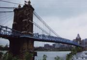
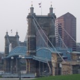
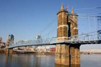
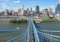
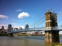
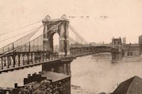
1867: John A. Roebling
Cincinnati, Ohio and Covington, Kentucky, USA - Ohio River
| Bridgemeister ID: | 65 (added before 2003) |
| Year Completed: | 1867 |
| Name: | John A. Roebling |
| Also Known As: | Cincinnati, Cincinnati and Covington |
| Location: | Cincinnati, Ohio and Covington, Kentucky, USA |
| Crossing: | Ohio River |
| Coordinates: | 39.09167 N 84.50833 W |
| Maps: | Acme, GeoHack, Google, OpenStreetMap |
| Principals: | John A. Roebling |
| References: | BAAW, BC3, BOB, BPL, COB, EOV, HBE, LAB, LACE, ONF, PTS2, SJR, TOB |
| Use: | Vehicular (two-lane), with walkway |
| Status: | Closed, February, 2021 (last checked: 2021) |
| Main Cables: | Wire (iron) |
| Suspended Spans: | 3 |
| Main Span: | 1 x 322.2 meters (1,057 feet) |
| Side Spans: | 2 |
Notes:
- 1892: Cable ends restored.
- 1899: Steel cables added to assist original cables.
- 2021, February: Closed to all vehicular traffic for a nine-month restoration project.
- Became longest suspension bridge by eclipsing 1849 Wheeling (Wheeling and Belmont) - Wheeling, West Virginia, USA.
- Eclipsed by new longest suspension bridge 1869 Clifton (Niagara-Clifton, Falls View, First Falls View) - Niagara Falls, New York, USA and Niagara Falls, Ontario, Canada.
External Links:
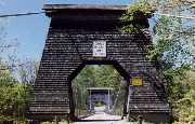
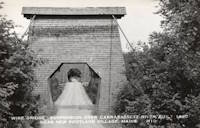
1868: Wire
New Portland, Maine, USA - Carrabasset River
| Bridgemeister ID: | 69 (added before 2003) |
| Year Completed: | 1868 |
| Name: | Wire |
| Location: | New Portland, Maine, USA |
| Crossing: | Carrabasset River |
| Coordinates: | 44.890783 N 70.0925 W |
| Maps: | Acme, GeoHack, Google, OpenStreetMap |
| References: | BC3, BPL, GBD, LAB, RDH |
| Use: | Vehicular (one-lane) |
| Status: | In use (last checked: 2023) |
| Main Cables: | Wire (iron) |
| Suspended Spans: | 1 |
| Main Span: | 1 x 60.5 meters (198.4 feet) |
Notes:
- BPL says c. 1866. Historic landmark plaque at bridge also says 1866.
- Extensive repairs, 1960.
External Links:
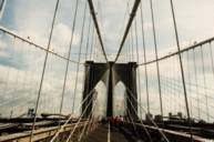
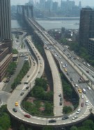
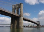
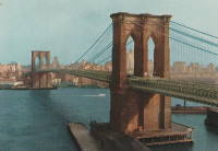
1883: Brooklyn
New York and Brooklyn, New York, USA - East River
| Bridgemeister ID: | 89 (added before 2003) |
| Year Completed: | 1883 |
| Name: | Brooklyn |
| Also Known As: | Great East River |
| Location: | New York and Brooklyn, New York, USA |
| Crossing: | East River |
| Coordinates: | 40.706 N 73.99667 W |
| Maps: | Acme, GeoHack, Google, OpenStreetMap |
| Principals: | John A. Roebling, Washington A. Roebling |
| References: | AAJ, BAAW, BBR, BBTS, BC3, BFL, BLD, BMA, BOB, BOU, BPL, COB, CTW, GB, GBD, HBE, LAB, LACE, NG198305, ONF, PTS2, SJR |
| Use: | Rail (light rail) and Vehicular (major highway), with walkway |
| Status: | In use (last checked: 2022) |
| Main Cables: | Wire (steel) |
| Suspended Spans: | 3 |
| Main Span: | 1 x 486.3 meters (1,595.5 feet) |
| Side Spans: | 2 x 283.5 meters (930 feet) |
| Deck width: | 85 feet |
Notes:
- Became longest suspension bridge by eclipsing 1869 Clifton (Niagara-Clifton, Falls View, First Falls View) - Niagara Falls, New York, USA and Niagara Falls, Ontario, Canada.
- Eclipsed by new longest suspension bridge 1903 Williamsburg - New York and Brooklyn, New York, USA.
- Next to 1909 Manhattan - New York and Brooklyn, New York, USA.
- Near 1903 Williamsburg - New York and Brooklyn, New York, USA.
External Links:
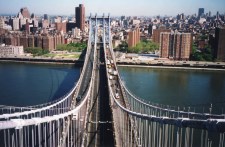
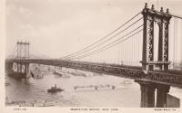
1909: Manhattan
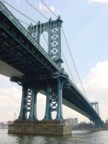
New York and Brooklyn, New York, USA - East River
| Bridgemeister ID: | 123 (added before 2003) |
| Year Completed: | 1909 |
| Name: | Manhattan |
| Location: | New York and Brooklyn, New York, USA |
| Crossing: | East River |
| Coordinates: | 40.70667 N 73.99167 W |
| Maps: | Acme, GeoHack, Google, OpenStreetMap |
| Principals: | O.F. Nichols, Leon Moisseiff |
| References: | AAJ, BAAW, BBR, BC3, BPL, GBD, HBE, LAB, PTS2, SA19050909, SJR |
| Use: | Vehicular (double-deck) |
| Status: | In use (last checked: 2022) |
| Main Cables: | Wire (steel) |
| Suspended Spans: | 3 |
| Main Span: | 1 x 448.1 meters (1,470 feet) |
| Side Spans: | 2 x 221 meters (725 feet) |
Notes:
- Opened December 31, 1909, but not fully completed yet.
- Next to 1883 Brooklyn (Great East River) - New York and Brooklyn, New York, USA.
- Near 1903 Williamsburg - New York and Brooklyn, New York, USA.
External Links:

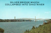
1928: Point Pleasant
Point Pleasant, West Virginia and Kanauga, Gallipolis vicinity, Ohio, USA - Ohio River
| Bridgemeister ID: | 156 (added before 2003) |
| Year Completed: | 1928 |
| Name: | Point Pleasant |
| Also Known As: | Silver |
| Location: | Point Pleasant, West Virginia and Kanauga, Gallipolis vicinity, Ohio, USA |
| Crossing: | Ohio River |
| Coordinates: | 38.845 N 82.141111 W |
| Maps: | Acme, GeoHack, Google, OpenStreetMap |
| Principals: | J.E. Greiner Co. |
| References: | AAJ, BDO, ENR19290620a, ENR19290620b, GBD, LAB, PTS2, SSS |
| Use: | Vehicular, with walkway |
| Status: | Collapsed, 1967 |
| Main Cables: | Eyebar (steel) |
| Suspended Spans: | 3 |
| Main Span: | 1 x 213.4 meters (700 feet) |
| Side Spans: | 2 x 115.8 meters (380 feet) |
| Deck width: | 27 feet |
Notes:
- Hybrid truss, suspension bridge. Collapsed December 15, 1967 while full with traffic. 46 people died.
- Companion to 1928 Saint Marys (Hi Carpenter, Short Route) - Saint Marys, West Virginia and Newport, Ohio, USA.
External Links:

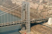
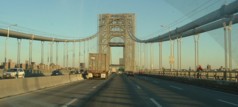
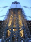
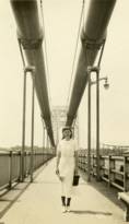
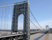
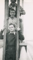
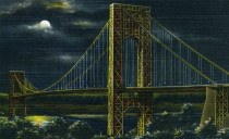
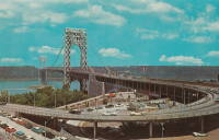
1931: George Washington
New York, New York and Fort Lee, New Jersey, USA - Hudson River
| Bridgemeister ID: | 169 (added before 2003) |
| Year Completed: | 1931 |
| Name: | George Washington |
| Also Known As: | GWB |
| Location: | New York, New York and Fort Lee, New Jersey, USA |
| Crossing: | Hudson River |
| Coordinates: | 40.85333 N 73.955 W |
| Maps: | Acme, GeoHack, Google, OpenStreetMap |
| Principals: | O.H. Ammann, Leon Moisseiff, Dana, Gilbert |
| References: | AAJ, AOB, ARF, BBR, BC3, BFL, BMA, BONJ, BOU, BPL, BRU, COB, CTW, ENR19270811a, ENR19270811b, ENR19290411c, GBD, LAB, LACE, PTS2, SIX, SJR |
| Use: | Vehicular (double-deck), with walkway |
| Status: | In use (last checked: 2022) |
| Main Cables: | Wire (steel) |
| Suspended Spans: | 3 |
| Main Span: | 1 x 1,066.8 meters (3,500 feet) |
| Side Spans: | 2 x 198.1 meters (650 feet) |
| Deck width: | 120 feet |
Notes:
- Became longest suspension bridge by eclipsing 1929 Ambassador - Detroit, Michigan, USA and Windsor, Ontario, Canada.
- Eclipsed by new longest suspension bridge 1937 Golden Gate - San Francisco and Marin County, California, USA.
External Links:
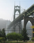
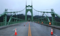
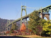
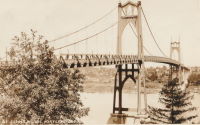
1931: St. Johns
Portland, Oregon, USA - Willamette River
| Bridgemeister ID: | 174 (added before 2003) |
| Year Completed: | 1931 |
| Name: | St. Johns |
| Location: | Portland, Oregon, USA |
| Crossing: | Willamette River |
| Coordinates: | 45.585 N 122.76333 W |
| Maps: | Acme, GeoHack, Google, OpenStreetMap |
| Principals: | Robinson and Steinman |
| References: | AAJ, ADDS, BC3, BCO, BFL, BPL, GBD, LAB, SJR |
| Use: | Vehicular (four-lane), with walkway |
| Status: | In use (last checked: 2022) |
| Main Cables: | Wire (steel) |
| Suspended Spans: | 3 |
| Main Span: | 1 x 367.9 meters (1,207 feet) |
| Side Spans: | 2 x 131.1 meters (430.25 feet) |
| Deck width: | 52 feet |
Notes:
- Substantially rehabilitated, 2003-2005.
External Links:
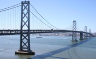
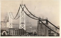
1936: San Francisco-Oakland Bay
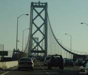
Oakland and San Francisco, California, USA - San Francisco Bay
| Bridgemeister ID: | 184 (added before 2003) |
| Year Completed: | 1936 |
| Name: | San Francisco-Oakland Bay |
| Location: | Oakland and San Francisco, California, USA |
| Crossing: | San Francisco Bay |
| Coordinates: | 37.78667 N 122.39 W |
| Maps: | Acme, GeoHack, Google, OpenStreetMap |
| Principals: | C.H. Purcell, Glenn B. Woodruff |
| References: | AAJ, AZB, BAAW, BC3, BPL, GBD, LAB, OBB1, SFOM, USS |
| Use: | Vehicular (double-deck) |
| Status: | In use (last checked: 2022) |
| Main Cables: | Wire (steel) |
| Suspended Spans: | 6 |
| Main Spans: | 1 x 678 meters (2,224.4 feet), 1 x 673.6 meters (2,210 feet) |
| Side Spans: | 4 |
| Deck width: | 66 feet (58 feet roadway) |
Notes:
External Links:

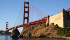
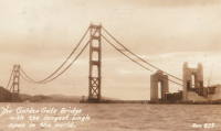
1937: Golden Gate
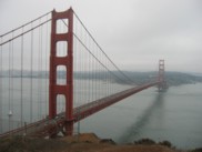
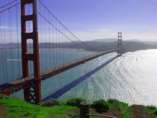
San Francisco and Marin County, California, USA - San Francisco Bay
| Bridgemeister ID: | 188 (added before 2003) |
| Year Completed: | 1937 |
| Name: | Golden Gate |
| Location: | San Francisco and Marin County, California, USA |
| Crossing: | San Francisco Bay |
| Coordinates: | 37.82 N 122.47667 W |
| Maps: | Acme, GeoHack, Google, OpenStreetMap |
| Principals: | Joseph B. Strauss, Leon Moisseiff, Charles A. Ellis, Irving F. Morrow |
| References: | AAJ, AZB, BAAW, BBR, BC3, BFL, BLD, BMA, BOU, BPL, BRU, COB, CTW, GAT, GBD, GGB, LAB, SPG |
| Use: | Vehicular (major highway), with walkway |
| Status: | In use (last checked: 2022) |
| Main Cables: | Wire (steel) |
| Suspended Spans: | 3 |
| Main Span: | 1 x 1,280.2 meters (4,200 feet) |
| Side Spans: | 2 x 343 meters (1,125.41 feet) |
| Deck width: | 80 feet |
Notes:
- Became longest suspension bridge by eclipsing 1931 George Washington (GWB) - New York, New York and Fort Lee, New Jersey, USA.
- Eclipsed by new longest suspension bridge 1964 Verrazzano Narrows (Verrazano Narrows) - Brooklyn and Staten Island, New York, USA.
External Links:

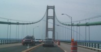
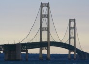
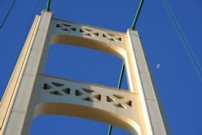
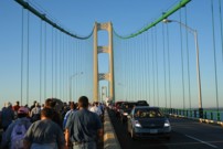
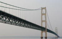
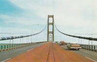
1957: Mackinac
St. Ignace and Mackinaw City, Michigan, USA - Straits of Mackinac
| Bridgemeister ID: | 210 (added before 2003) |
| Year Completed: | 1957 |
| Name: | Mackinac |
| Also Known As: | Mighty Mac |
| Location: | St. Ignace and Mackinaw City, Michigan, USA |
| Crossing: | Straits of Mackinac |
| Coordinates: | 45.820533 N 84.727667 W |
| Maps: | Acme, GeoHack, Google, OpenStreetMap |
| Principals: | David B. Steinman |
| References: | ADDS, BBR, BC3, BFL, BLD, BMA, COB, GBD, LAB, MACB, MM, WOT |
| Use: | Vehicular (four-lane) |
| Status: | In use (last checked: 2022) |
| Main Cables: | Wire (steel) |
| Suspended Spans: | 3 |
| Main Span: | 1 x 1,158.2 meters (3,800 feet) |
| Side Spans: | 2 x 548.6 meters (1,800 feet) |
External Links:

1964: Verrazzano Narrows
Brooklyn and Staten Island, New York, USA - Verrazano Narrows
| Bridgemeister ID: | 219 (added before 2003) |
| Year Completed: | 1964 |
| Name: | Verrazzano Narrows |
| Also Known As: | Verrazano Narrows |
| Location: | Brooklyn and Staten Island, New York, USA |
| Crossing: | Verrazano Narrows |
| Coordinates: | 40.60667 N 74.045 W |
| Maps: | Acme, GeoHack, Google, OpenStreetMap |
| Principals: | Othmar H. Ammann, Whitney |
| References: | BBR, BC3, BFL, BOU, COB, CTW, GBD, LAB, SIX, VNB |
| Use: | Vehicular (double-deck) |
| Status: | In use (last checked: 2022) |
| Main Cables: | Wire (steel) |
| Suspended Spans: | 3 |
| Main Span: | 1 x 1,298.4 meters (4,260 feet) |
| Side Spans: | 2 |
Notes:
- 2017: Long known as the "Verrazano" bridge, efforts to fix the spelling of the bridge's name to "Verrazzano" (such as Giovanni da Verrazzano) pick up momentum with New York state legislature and senate.
- Became longest suspension bridge by eclipsing 1937 Golden Gate - San Francisco and Marin County, California, USA.
- Eclipsed by new longest suspension bridge 1981 Humber - Hull, Humberside, England, United Kingdom.
External Links:

