Inventory Search Results
23 suspension bridges were found for search criteria: NTB. All 23 bridges from the search results appear below. Click the Bridgemeister ID number to isolate the bridge on its own page. If you don't see what you were looking for, try an image search with the same criteria: NTB. This will find the bridge if it is pictured on the site, but is not a catenary suspension bridge.
Related:
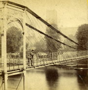
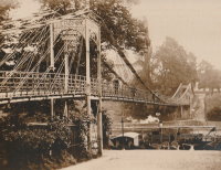
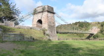
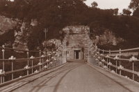
1820: Union
Horncliffe, Berwick-upon-Tweed vicinity, England and Fishwick, Scotland, United Kingdom - River Tweed
| Bridgemeister ID: | 373 (added before 2003) |
| Year Completed: | 1820 |
| Name: | Union |
| Location: | Horncliffe, Berwick-upon-Tweed vicinity, England and Fishwick, Scotland, United Kingdom |
| Crossing: | River Tweed |
| Coordinates: | 55.75256 N 2.10677 W |
| Maps: | Acme, GeoHack, Google, OpenStreetMap |
| Principals: | Sir Samuel Brown |
| References: | AAJ, BBR, BC3, BEM, BOB, HBE, MOS, NTB, PTS2, SBR |
| Use: | Vehicular (one-lane) |
| Status: | In use (last checked: 2023) |
| Main Cables: | Chain (iron) |
| Suspended Spans: | 1 |
| Main Span: | 1 x 136.9 meters (449 feet) |
| Deck width: | 18 feet |
Notes:
- 2007, March: Closed after a hanger snapped in high winds. Repaired and reopened August, 2007.
- 2020, October: Closed for major renovation and conservation project.
- 2023, April: The bridge is reopened.
- Eclipsed by new longest suspension bridge 1826 Menai Strait - Menai Bridge and Bangor vicinity, Wales, United Kingdom.
External Links:
- Conservation - Union Chain Bridge - unionchainbridge.org. Site devoted to the 2020-2023 renovation project. This page lists the highlights of the project.
- Structurae - Structure ID 20000162

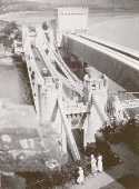
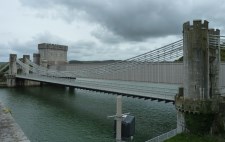
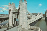
1826: Conwy
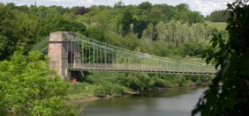
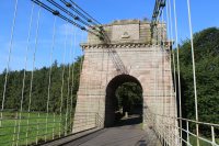
Conwy, Wales, United Kingdom - River Conwy
| Bridgemeister ID: | 380 (added before 2003) |
| Year Completed: | 1826 |
| Name: | Conwy |
| Also Known As: | Conway |
| Location: | Conwy, Wales, United Kingdom |
| Crossing: | River Conwy |
| Coordinates: | 53.280476 N 3.823742 W |
| Maps: | Acme, GeoHack, Google, OpenStreetMap |
| Principals: | Thomas Telford |
| References: | AAJ, BBR, BC3, BCO, BEM, HBE, MOS, NTB, PTS2 |
| Use: | Vehicular |
| Status: | Restricted to foot traffic (last checked: 2021) |
| Main Cables: | Chain (iron) |
| Suspended Spans: | 1 |
| Main Span: | 1 x 99.7 meters (327 feet) |
Notes:
- 1904: Major reinforcement and strengthening project.
- 2008, February: Major refurbishment project completed.
- Next to 1904 (footbridge) - Conwy, Wales, United Kingdom.
Annotated Citations:
- "Conway Suspension Bridge." The Engineer, 20 May 1904.
Details regarding the 1904 reinforcement project: "...It was therefore decided to renew all the suspension rods, and pins, and to fix steel cables above the suspension links, to supplement them so that the maximum stress in the links due to any possible travelling load should not exceed 5 tons per square inch. It was also decided to build a stiffening girder coupled to the suspension rod on each side of the bridge, and at the same time to widen the bridge by building a footway 6ft. wide outside the suspenders on the north side of the bridge."
External Links:
1826: Gattonside
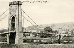
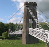
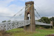
Melrose, Scotland, United Kingdom - River Tweed
| Bridgemeister ID: | 381 (added before 2003) |
| Year Completed: | 1826 |
| Name: | Gattonside |
| Also Known As: | Melrose |
| Location: | Melrose, Scotland, United Kingdom |
| Crossing: | River Tweed |
| Coordinates: | 55.602830 N 2.723349 W |
| Maps: | Acme, GeoHack, Google, OpenStreetMap |
| Principals: | Redpath and Brown |
| References: | BC2, BSI, NTB |
| Use: | Footbridge |
| Status: | In use (last checked: 2014) |
| Main Cables: | Chain (iron) |
| Suspended Spans: | 3 |
| Main Span: | 1 x 91.4 meters (300 feet) |
| Side Spans: | 2 |
| Deck width: | 4 feet 4 inches |
Notes:
- Steel cables added, 1992.
External Links:
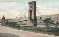
1826: Menai Strait
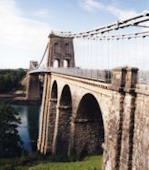
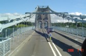
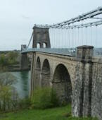
Menai Bridge and Bangor vicinity, Wales, United Kingdom - Menai Strait
| Bridgemeister ID: | 382 (added before 2003) |
| Year Completed: | 1826 |
| Name: | Menai Strait |
| Location: | Menai Bridge and Bangor vicinity, Wales, United Kingdom |
| Crossing: | Menai Strait |
| Coordinates: | 53.221367 N 4.1646 W |
| Maps: | Acme, GeoHack, Google, OpenStreetMap |
| Principals: | Thomas Telford |
| References: | AAJ, BBR, BC3, BCO, BDU, BEM, BOU, HBE, MOS, NTB, PTS2 |
| Use: | Vehicular (two-lane), with walkway |
| Status: | In use (last checked: 2022) |
| Main Cables: | Chain (iron) |
| Suspended Spans: | 1 |
| Main Span: | 1 x 176.5 meters (579 feet) |
Notes:
- 1839 (or 1840): Restored. Deck strengthened.
- 1893: Original wood deck replaced with a steel deck.
- 1938-1940: Original wrought-iron chains replaced with steel eyebars, deck strengthened.
- 1999: Deck resurfaced and other improvements to strengthen bridge.
- 2020: Major maintenance project planned to start January, 2021.
- 2022, October: Closed due to serious structural concerns. Expected to reopen January 2023 with a weight restriction.
- Became longest suspension bridge by eclipsing 1820 Union - Horncliffe, Berwick-upon-Tweed vicinity, England and Fishwick, Scotland, United Kingdom.
- Eclipsed by new longest suspension bridge 1834 Zaehringen (Grand Pont Suspendu) - Fribourg, Switzerland.
External Links:

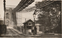
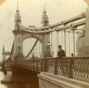
1827: Hammersmith
London, England, United Kingdom - River Thames
| Bridgemeister ID: | 386 (added before 2003) |
| Year Completed: | 1827 |
| Name: | Hammersmith |
| Location: | London, England, United Kingdom |
| Crossing: | River Thames |
| Principals: | William Tierney Clark |
| References: | AAJ, BEM, BTH, HBE, MOS, NTB, ONF, PTS2 |
| Use: | Vehicular, with walkway |
| Status: | Replaced |
| Main Cables: | Chain |
| Suspended Spans: | 3 |
| Main Span: | 1 x 121.9 meters (400 feet) |
| Side Spans: | 2 x 44.8 meters (147 feet) |
Notes:
- Replaced by 1887 Hammersmith - London, England, United Kingdom.
External Links:
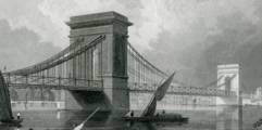
1829: Middleham
Middleham and Leyburn, England, United Kingdom - River Ure
| Bridgemeister ID: | 387 (added before 2003) |
| Year Completed: | 1829 |
| Name: | Middleham |
| Location: | Middleham and Leyburn, England, United Kingdom |
| Crossing: | River Ure |
| Coordinates: | 54.294316 N 1.818643 W |
| Maps: | Acme, GeoHack, Google, OpenStreetMap |
| Principals: | Edward Welch, Joseph Hansom |
| References: | NTB |
| Use: | Vehicular |
| Status: | Only towers remain (last checked: 2023) |
| Suspended Spans: | 1 |
Notes:
- 1830: Said to have collapsed under weight of cattle in 1830. At some point it was rebuilt as a non-suspension bridge with the original suspension bridge towers intact. The current (in the 2020s and for many years before) main span is steel plate girder.
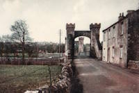
1831: Scotswood
Newcastle-upon-Tyne, England, United Kingdom - River Tyne
| Bridgemeister ID: | 392 (added before 2003) |
| Year Completed: | 1831 |
| Name: | Scotswood |
| Also Known As: | Chine |
| Location: | Newcastle-upon-Tyne, England, United Kingdom |
| Crossing: | River Tyne |
| Principals: | John Green |
| References: | AAJ, BRB, NTB |
| Use: | Vehicular (two-lane), with walkway |
| Status: | Demolished, 1967 |
| Main Cables: | Chain (iron) |
| Suspended Spans: | 3 |
| Main Span: | 1 x 112.2 meters (368 feet) |
| Side Spans: | 2 x 39.9 meters (131 feet) |
| Deck width: | 16 feet 10 inch roadway, 3 feet 3 inch footway |
Notes:
- "Chine" is the spelling/pronounciation of "Chain" in Geordie a dialect spoken in Tyneside.
- Widened (19ft 6in roadway, two 6ft walkways), iron chains replaced with steel cables 1931. Bypassed, 1967. Since demolished.
External Links:
- Scotswood Suspension Bridge (1831 - 1967) | Co-Curate. Several images of the bridge.
- Structurae - Structure ID 20013208

1832: Marlow
Marlow, England, United Kingdom - River Thames
| Bridgemeister ID: | 394 (added before 2003) |
| Year Completed: | 1832 |
| Name: | Marlow |
| Location: | Marlow, England, United Kingdom |
| Crossing: | River Thames |
| Coordinates: | 51.56735 N 0.773567 W |
| Maps: | Acme, GeoHack, Google, OpenStreetMap |
| Principals: | William Tierney Clark |
| References: | AAJ, BEM, BRB, BTH, MOS, NTB |
| Use: | Vehicular, with walkway |
| Status: | In use (last checked: 2019) |
| Main Cables: | Chain (iron) |
| Suspended Spans: | 3 |
| Main Span: | 1 |
| Side Spans: | 2 |
| Deck width: | 30 feet |
Annotated Citations:
- Butler, Rory. "Marlow Bridge repairs will take almost a year." BuckinghamshireLive, 1 October 2021, https://www.buckinghamshirelive.com/news/buckinghamshire-news/repairs-mould-covered-marlow-bridge-5994064
"A complete renovation of the road and foot bridge, currently covered in mould and rust, could take up to 40 weeks… The plans outline ‘refurbishment to the bridge, including works to the carriageway, footway, towers, lighting, drainage, parapet posts and timber rails’."
External Links:
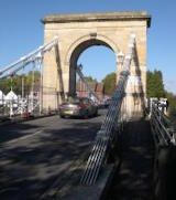
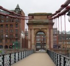
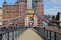
1851: South Portland
Glasgow, Scotland, United Kingdom - River Clyde
| Bridgemeister ID: | 404 (added before 2003) |
| Year Completed: | 1851 |
| Name: | South Portland |
| Also Known As: | Carlton |
| Location: | Glasgow, Scotland, United Kingdom |
| Crossing: | River Clyde |
| Coordinates: | 55.85433 N 4.25618 W |
| Maps: | Acme, GeoHack, Google, OpenStreetMap |
| Principals: | Alexander Kirkland, George Martin |
| References: | BEM, NTB |
| Use: | Footbridge |
| Status: | In use (last checked: 2019) |
| Main Cables: | Eyebar (iron) |
| Suspended Spans: | 1 |
Notes:
- 1853 sometimes cited as the year it opened.
External Links:
1852: Queens Park
Chester and Handbridge, England, United Kingdom - River Dee
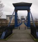
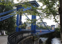
1854: Saint Andrew's
Glasgow, Scotland, United Kingdom - River Clyde
| Bridgemeister ID: | 408 (added before 2003) |
| Year Completed: | 1854 |
| Name: | Saint Andrew's |
| Location: | Glasgow, Scotland, United Kingdom |
| Crossing: | River Clyde |
| Coordinates: | 55.84883 N 4.23835 W |
| Maps: | Acme, GeoHack, Google, OpenStreetMap |
| Principals: | Neil Robson |
| References: | NTB |
| Use: | Footbridge |
| Status: | In use (last checked: 2019) |
| Main Cables: | Eyebar |
| Suspended Spans: | 1 |
| Main Span: | 1 x 67.1 meters (220 feet) |
| Deck width: | 13 feet |
Notes:
- Also sometimes attributed to Neil "Robinson" and completed 1853. May have originally been a narrow vehicular bridge.
External Links:
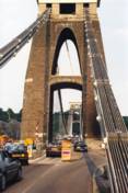
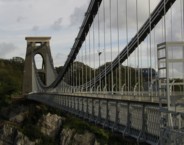
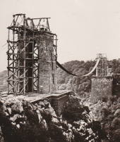
1864: Clifton
Bristol, England, United Kingdom - River Avon
| Bridgemeister ID: | 413 (added before 2003) |
| Year Completed: | 1864 |
| Name: | Clifton |
| Location: | Bristol, England, United Kingdom |
| Crossing: | River Avon |
| Coordinates: | 51.45496 N 2.62781 W |
| Maps: | Acme, GeoHack, Google, OpenStreetMap |
| Principals: | Isambard K. Brunel, P.W. Barlow, Hawkshaw |
| References: | AOB, BBR, BC3, BEM, BMA, BOU, BRB, CTW, HBE, NTB, ONF, PTS2 |
| Use: | Vehicular, with walkway |
| Status: | In use (last checked: 2021) |
| Main Cables: | Eyebar (iron) |
| Suspended Spans: | 1 |
| Main Span: | 1 x 214 meters (702 feet) |
Notes:
- Built with chain cables reused from the Hungerford bridge.
- See 1845 Hungerford - London, England, United Kingdom.
External Links:

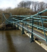
1886: (footbridge)
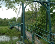
Huttons Ambo, North Yorkshire, England, United Kingdom - River Derwent
| Bridgemeister ID: | 417 (added before 2003) |
| Year Completed: | 1886 |
| Name: | (footbridge) |
| Location: | Huttons Ambo, North Yorkshire, England, United Kingdom |
| Crossing: | River Derwent |
| Coordinates: | 54.09975 N 0.8311 W |
| Maps: | Acme, GeoHack, Google, OpenStreetMap |
| References: | NTB |
| Use: | Footbridge |
| Status: | In use (last checked: 2014) |
| Main Cables: | Wire |
| Suspended Spans: | 1 |
| Main Span: | 1 x 29 meters (95 feet) |
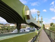
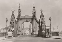
1887: Hammersmith
London, England, United Kingdom - River Thames
| Bridgemeister ID: | 419 (added before 2003) |
| Year Completed: | 1887 |
| Name: | Hammersmith |
| Location: | London, England, United Kingdom |
| Crossing: | River Thames |
| Coordinates: | 51.48845 N 0.23019 W |
| Maps: | Acme, GeoHack, Google, OpenStreetMap |
| Principals: | Sir Joseph Bazalgette |
| References: | BEM, BPL, HBE, NTB, PTS2 |
| Use: | Vehicular (two-lane), with walkway |
| Status: | Restricted to foot traffic, since 2021 (last checked: 2021) |
| Main Cables: | Eyebar |
| Suspended Spans: | 3 |
| Main Span: | 1 |
| Side Spans: | 2 |
Notes:
- 2019, April: Closed to vehicular traffic due to safety concerns after an inspection found fractures in the cast iron casings around the bridge pedestals. Some repair work followed, but was not fully funded or finished (as of mid-2020)
- 2020, August: Fractures found to have worsened during recent heatwave. Bridge is completely closed to all pedestrian and bicycle traffic. Pedestrian walkways under the bridge and all river traffic under the bridge are also prohibited (implying risk of collapse).
- 2020, December: Bridge may reopen to pedestrians and cyclists if deemed safe by maintenance contractor, Mott MacDonald.
- 2021, January: Plan discussed to "thread" a temporary truss along the length of the deck to permit traffic while the suspension bridge undergoes repairs.
- 2021, March: Feasibility study on "double-decker" temporary truss plan determines it is feasible, possibly opening to pedestrian and vehicular traffic by mid-2022.
- 2021, July: Reopened for pedestrian and bicycle use.
- Replaced 1827 Hammersmith - London, England, United Kingdom.
External Links:
- ENR - Engineers Ponder Solutions for Damaged London Bridge. February 22, 2021 Engineering News-Record article discusses proposal to thread a temporary truss between the towers to allow traffic while the larger suspension bridge repairs are completed. Recaps the issue: "Cracks have been found in the cast-iron pedestals that support suspension cable saddles at the abutments. Engineers suspect that roller bearings between the saddles and pedestals seized up at least 30 years ago…"
- Hammersmith Bridge | Temporary ‘double-decker’ proposal deemed technically feasible - New Civil Engineer. March 22, 2021
- The Happy Pontist: London Bridges: 33. Hammersmith Bridge
- Structurae - Structure ID 20008013
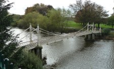
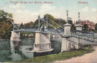
1898: Victoria
Hereford, England, United Kingdom - River Wye
| Bridgemeister ID: | 424 (added before 2003) |
| Year Completed: | 1898 |
| Name: | Victoria |
| Location: | Hereford, England, United Kingdom |
| Crossing: | River Wye |
| Coordinates: | 52.051075 N 2.712197 W |
| Maps: | Acme, GeoHack, Google, OpenStreetMap |
| Principals: | Alexander Findlay and Co. |
| References: | NTB |
| Use: | Footbridge |
| Status: | In use (last checked: 2018) |
| Main Cables: | Eyebar |
| Suspended Spans: | 3 |
| Main Span: | 1 x 24.4 meters (80 feet) |
| Side Spans: | 2 |

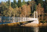
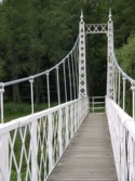
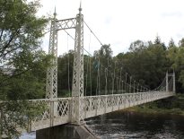
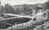
1905: Cambus O'May
Ballater, Scotland, United Kingdom - River Dee
| Bridgemeister ID: | 429 (added before 2003) |
| Year Completed: | 1905 |
| Name: | Cambus O'May |
| Also Known As: | Gordon |
| Location: | Ballater, Scotland, United Kingdom |
| Crossing: | River Dee |
| Coordinates: | 57.065803 N 2.956825 W |
| Maps: | Acme, GeoHack, Google, OpenStreetMap |
| Principals: | James Abernethy & Co. |
| References: | BC2, BC3, BEM, HARPER, HBR, NTB |
| Use: | Footbridge |
| Status: | In use (last checked: April, 2021) |
| Main Cables: | Wire (steel) |
| Suspended Spans: | 1 |
| Main Span: | 1 x 51.8 meters (170 feet) |
Notes:
- 1988: Refurbished (HBR)
- 2015, December: Damaged by the River Dee flood caused by Storm Frank. Closed indefinitely. Repairs expected to start in 2020.
- 2020, August 31: Repairs underway, expected to be completed in approximately 16 weeks.
- 2020, December: Storm Frank repairs now expected to be completed in January 2021.
- 2021, January: Completion of repairs delayed due to COVID-19 pandemic "stay at home" recommendations.
- 2021, April 1: Repairs completed, bridge reopened.
External Links:
- Cambus O' May | Harper Bridges
- The Happy Pontist: Scottish Bridges: 20. Cambus O'May Footbridge
- The Happy Pontist: Scottish Bridges: 43. Cambus O' May Bridge (revisited)
- The Happy Pontist: Scottish Bridges: 55. Cambus O'May Bridge (after the flood)
- Structurae - Structure ID 20019638

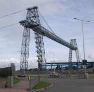
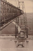
1906: Newport Transporter
Newport, Wales, United Kingdom - River Usk
| Bridgemeister ID: | 939 (added 2003-10-25) |
| Year Completed: | 1906 |
| Name: | Newport Transporter |
| Location: | Newport, Wales, United Kingdom |
| Crossing: | River Usk |
| Coordinates: | 51.570642 N 2.985246 W |
| Maps: | Acme, GeoHack, Google, OpenStreetMap |
| Principals: | Ferdinand Arnodin |
| References: | AAJ, NTB |
| Use: | Transporter |
| Status: | In use (last checked: 2011) |
| Main Cables: | Wire (steel) |
| Suspended Spans: | 1 |
| Main Span: | 1 x 196.6 meters (645 feet) |
External Links:
1922: Porthill
Shrewsbury, England, United Kingdom - River Severn
| Bridgemeister ID: | 434 (added before 2003) |
| Year Completed: | 1922 |
| Name: | Porthill |
| Location: | Shrewsbury, England, United Kingdom |
| Crossing: | River Severn |
| Coordinates: | 52.708233 N 2.763083 W |
| Maps: | Acme, GeoHack, Google, OpenStreetMap |
| Principals: | David Rowell & Co. |
| References: | NTB |
| Use: | Footbridge |
| Status: | In use (last checked: 2010) |
| Suspended Spans: | 1 |
External Links:
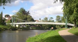
1923: Queens Park
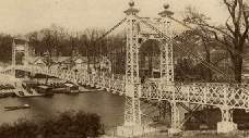
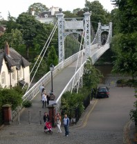
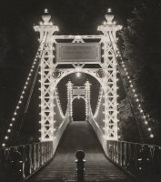
Chester and Handbridge, England, United Kingdom - River Dee
| Bridgemeister ID: | 435 (added before 2003) |
| Year Completed: | 1923 |
| Name: | Queens Park |
| Location: | Chester and Handbridge, England, United Kingdom |
| Crossing: | River Dee |
| Coordinates: | 53.18796 N 2.88421 W |
| Maps: | Acme, GeoHack, Google, OpenStreetMap |
| Principals: | Charles Greenwood, David Rowell & Co., William E. Barker |
| References: | BRB, NTB |
| Use: | Footbridge |
| Status: | In use (last checked: 2019) |
| Main Cables: | Wire (steel) |
| Suspended Spans: | 1 |
| Main Span: | 1 x 83.8 meters (275 feet) |
Notes:
External Links:
- Chesterwiki - Suspension Bridge. Interesting details about the bridge.
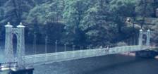
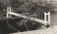
1935: Goyt Valley
Buxton, England, United Kingdom - River Goyt
| Bridgemeister ID: | 520 (added before 2003) |
| Year Completed: | 1935 |
| Name: | Goyt Valley |
| Also Known As: | Buxton |
| Location: | Buxton, England, United Kingdom |
| Crossing: | River Goyt |
| References: | NTB |
| Use: | Footbridge |
| Status: | Removed, 1960s |
| Main Cables: | Wire |
| Suspended Spans: | 1 |
Notes:
- Dismantled during construction of the Errwood Reservoir.
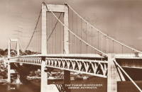
1962: Tamar
Devon and Cornwall, England, United Kingdom - Tamar River estuary
| Bridgemeister ID: | 461 (added before 2003) |
| Year Completed: | 1962 |
| Name: | Tamar |
| Location: | Devon and Cornwall, England, United Kingdom |
| Crossing: | Tamar River estuary |
| Coordinates: | 50.40917 N 4.2033 W |
| Maps: | Acme, GeoHack, Google, OpenStreetMap |
| Principals: | Mott, Hay and Anderson |
| References: | AOB, BBR, NTB, WOT |
| Use: | Vehicular (major highway) |
| Status: | In use (last checked: 2021) |
| Main Cables: | Wire (steel) |
| Suspended Spans: | 3 |
| Main Span: | 1 x 336.4 meters (1,103.7 feet) |
| Side Spans: | 2 |
Notes:
- 2001: Major strengthening and widening project completed.
- 2021: Deck resurfacing project underway including replacement of expansion joints.
External Links:
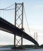
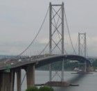
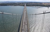
1964: Forth Road
Queensferry, Scotland, United Kingdom - Firth of Forth
| Bridgemeister ID: | 463 (added before 2003) |
| Year Completed: | 1964 |
| Name: | Forth Road |
| Location: | Queensferry, Scotland, United Kingdom |
| Crossing: | Firth of Forth |
| Coordinates: | 56.004020 N 3.404095 W |
| Maps: | Acme, GeoHack, Google, OpenStreetMap |
| References: | BBR, BC3, BDU, BFL, FRB, NTB, WOT |
| Use: | Vehicular (major highway), with walkway |
| Status: | In use (last checked: 2021) |
| Main Cables: | Wire (steel) |
| Suspended Spans: | 3 |
| Main Span: | 1 x 1,006 meters (3,300.5 feet) |
| Side Spans: | 2 x 408 meters (1,338.6 feet) |
Notes:
- December 4, 2015: Closed to all traffic because of structural issues. Reopened for lighter traffic, December 23, 2015. Fully reopened February 20, 2016.
- September 5, 2017: All traffic diverted to newly-opened nearby Queensferry Crossing. Closed completely for repairs. Reopened February 1, 2018 but restricted to public transportation (buses and taxis), pedestrians, and cyclists.
External Links:


1966: Severn
Aust and Beachley, England, United Kingdom - River Severn
| Bridgemeister ID: | 465 (added before 2003) |
| Year Completed: | 1966 |
| Name: | Severn |
| Also Known As: | First Severn Crossing |
| Location: | Aust and Beachley, England, United Kingdom |
| Crossing: | River Severn |
| Coordinates: | 51.610422 N 2.641658 W |
| Maps: | Acme, GeoHack, Google, OpenStreetMap |
| References: | AOB, BAAW, BBR, BDU, BFL, COB, NTB, SEV |
| Use: | Vehicular (major highway) |
| Status: | In use (last checked: 2021) |
| Main Cables: | Wire (steel) |
| Suspended Spans: | 3 |
| Main Span: | 1 x 987.6 meters (3,240 feet) |
| Side Spans: | 2 x 304.8 meters (1,000 feet) |
External Links:
