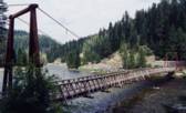
Inventory Search Results
12 suspension bridges were found for search criteria: PQU. All 12 bridges from the search results appear below. Click the Bridgemeister ID number to isolate the bridge on its own page. If you don't see what you were looking for, try an image search with the same criteria: PQU. This will find the bridge if it is pictured on the site, but is not a catenary suspension bridge.
Related:
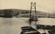
1930: Cranberry Lake
Cranberry Lake, Byram, New Jersey, USA - Cranberry Lake
| Bridgemeister ID: | 153 (added before 2003) |
| Year Completed: | 1930 |
| Name: | Cranberry Lake |
| Location: | Cranberry Lake, Byram, New Jersey, USA |
| Crossing: | Cranberry Lake |
| Coordinates: | 40.95401 N 74.73714 W |
| Maps: | Acme, GeoHack, Google, OpenStreetMap |
| References: | BONJ, PQU |
| Use: | Footbridge |
| Status: | Closed, 2019 (last checked: 2020) |
| Main Cables: | Wire (steel) |
| Suspended Spans: | 3 |
| Main Span: | 1 x 61.5 meters (201.7 feet) estimated |
| Side Spans: | 2 x 21.8 meters (71.5 feet) estimated |
Notes:
- 1928 and 1931 also sometimes cited as years of completion. Construction appears to have completed in December 1930, possibly opening in early 1931.
- 2019: Closed pending repairs and rehabilitation.
External Links:
- Save Our Bridge. "Dedicated to restoring and preserving the historic Cranberry Lake footbridge - one of the oldest pedestrian footbridges in the state of New Jersey."
1931: Bemis
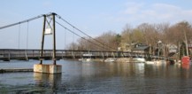
Notchland, Hart's Location vicinity, New Hampshire, USA - Saco River
| Bridgemeister ID: | 316 (added before 2003) |
| Year Completed: | 1931 |
| Name: | Bemis |
| Location: | Notchland, Hart's Location vicinity, New Hampshire, USA |
| Crossing: | Saco River |
| At or Near Feature: | Davis Path trail, White Mountain National Park |
| Coordinates: | 44.12047 N 71.35367 W |
| Maps: | Acme, GeoHack, Google, OpenStreetMap |
| References: | PQU |
| Use: | Footbridge |
| Status: | Replaced, c. 2001 |
| Suspended Spans: | 2 |
| Main Span: | 1 x 32.9 meters (108 feet) |
| Side Span: | 1 x 15.2 meters (50 feet) |
Notes:
- Replaced by a small single-towered cable-stayed bridge, circa 2001.
External Links:
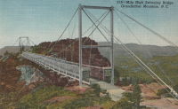
1952: Mile High Swinging
Grandfather Mountain, Linville, North Carolina, USA
| Bridgemeister ID: | 341 (added before 2003) |
| Year Completed: | 1952 |
| Name: | Mile High Swinging |
| Location: | Grandfather Mountain, Linville, North Carolina, USA |
| Coordinates: | 36.095054 N 81.832238 W |
| Maps: | Acme, GeoHack, Google, OpenStreetMap |
| Principals: | Charles Hartman, Jr. |
| References: | PQU, WSJ20060128 |
| Use: | Footbridge |
| Status: | In use (last checked: 2022) |
| Main Cables: | Wire (steel) |
| Suspended Spans: | 1 |
| Main Span: | 1 x 69.5 meters (228 feet) |
Notes:
- Major refurbishing, 1999, but soon after was wrecked by winds. WSJ20060128: "...winds blew it off its moorings. It might have been blown down the mountain if it hadn't wedged against the steel-frame supports." Reopened April 2000 with 21 new stabilizer cables on each side. Survived 200+ mph wind gust, January 2006.
External Links:
1992: Kimberling Creek
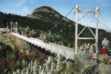
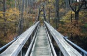
Mechanicsburg vicinity, Virginia, USA - Kimberling Creek
| Bridgemeister ID: | 237 (added before 2003) |
| Year Completed: | 1992 |
| Name: | Kimberling Creek |
| Location: | Mechanicsburg vicinity, Virginia, USA |
| Crossing: | Kimberling Creek |
| At or Near Feature: | Appalachian Trail |
| Coordinates: | 37.1708 N 80.9032 W |
| Maps: | Acme, GeoHack, Google, OpenStreetMap |
| Principals: | Sahale, LLC |
| References: | PQU |
| Use: | Footbridge |
| Status: | In use (last checked: 2020) |
| Main Cables: | Wire (steel) |
| Suspended Spans: | 1 |
| Main Span: | 1 x 45.7 meters (150 feet) |
| Deck width: | 3 feet |
Notes:
- Similar to (footbridge) - Tyro vicinity, Virginia, USA.
External Links:
1993: Smokey's Dream
Hartland, Maine, USA - Sebasticook River
| Bridgemeister ID: | 352 (added before 2003) |
| Year Completed: | 1993 |
| Name: | Smokey's Dream |
| Location: | Hartland, Maine, USA |
| Crossing: | Sebasticook River |
| Coordinates: | 44.88943 N 69.46198 W |
| Maps: | Acme, GeoHack, Google, OpenStreetMap |
| References: | PQU |
| Use: | Snowmobile |
| Status: | In use (last checked: 2003) |
| Main Cables: | Wire (steel) |
| Suspended Spans: | 1 |
| Main Span: | 1 x 57.9 meters (190 feet) |
1996: Pochuck Quagmire
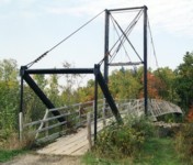
Vernon Valley, New Jersey, USA - Pochuck Creek
| Bridgemeister ID: | 239 (added before 2003) |
| Year Completed: | 1996 |
| Name: | Pochuck Quagmire |
| Location: | Vernon Valley, New Jersey, USA |
| Crossing: | Pochuck Creek |
| At or Near Feature: | Appalachian Trail |
| Coordinates: | 41.2353 N 74.472083 W |
| Maps: | Acme, GeoHack, Google, OpenStreetMap |
| Principals: | Tibor Latincsics |
| References: | BONJ, PQU |
| Use: | Footbridge |
| Status: | In use (last checked: 2008) |
| Main Cables: | Wire (steel) |
| Main Span: | 1 x 33.5 meters (110 feet) |
1997: Hastings Trail
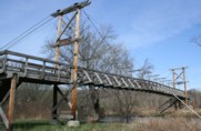
Hastings, Maine, USA - Wild River
| Bridgemeister ID: | 335 (added before 2003) |
| Year Completed: | 1997 |
| Name: | Hastings Trail |
| Location: | Hastings, Maine, USA |
| Crossing: | Wild River |
| Coordinates: | 44.35558 N 70.9923 W |
| Maps: | Acme, GeoHack, Google, OpenStreetMap |
| References: | PQU |
| Use: | Footbridge |
| Status: | Removed |
| Main Span: | 1 x 54.9 meters (180 feet) |
Notes:
- Replaced Hastings Trail - Hastings, Maine, USA.
Clarendon Gorge
Rutland vicinity, Vermont, USA - Mill River
| Bridgemeister ID: | 323 (added before 2003) |
| Name: | Clarendon Gorge |
| Also Known As: | Robert Brugmann Memorial |
| Location: | Rutland vicinity, Vermont, USA |
| Crossing: | Mill River |
| At or Near Feature: | Appalachian Trail |
| Coordinates: | 43.520240 N 72.925480 W |
| Maps: | Acme, GeoHack, Google, OpenStreetMap |
| References: | PQU |
| Use: | Footbridge |
| Status: | In use (last checked: 2021) |
| Main Cables: | Wire (steel) |
| Main Span: | 1 |
Notes:
- Destroyed by flood 1973, rebuilt.
- Welles Lobb writes: "Bob Brugmann, my best friend from high school, was attempting to cross an older damaged version of the bridge on July 4, 1973 during a flood when he was swept to death in the raging waters. Bob was 17, a brilliant budding environmentalist, and was attempting a southbound thru-hike of the Appalachian Trail the time of his accident. Later, the Green Mountain Club (a hiking organization) rebuilt the bridge and dedicated it to my late friend."
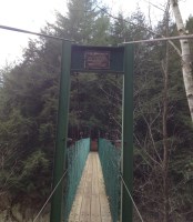
Great Gulf Wilderness
Dolly Copp Campground vicinity, New Hampshire, USA - Peabody River
| Bridgemeister ID: | 333 (added before 2003) |
| Name: | Great Gulf Wilderness |
| Location: | Dolly Copp Campground vicinity, New Hampshire, USA |
| Crossing: | Peabody River |
| At or Near Feature: | Appalachian Trail |
| Coordinates: | 44.31248 N 71.22038 W |
| Maps: | Acme, GeoHack, Google, OpenStreetMap |
| References: | PQU |
| Use: | Footbridge |
Hastings Trail
Hastings, Maine, USA - Wild River
| Bridgemeister ID: | 3222 (added 2019-11-11) |
| Name: | Hastings Trail |
| Location: | Hastings, Maine, USA |
| Crossing: | Wild River |
| References: | PQU |
| Use: | Footbridge |
| Status: | Destroyed, October 22, 1995 |
| Main Cables: | Wire (steel) |
Notes:
- Destroyed by flood caused by Hurricane Opal, October 22, 1995.
- Replaced by 1997 Hastings Trail - Hastings, Maine, USA.
Mocus Point Pack
Clearwater National Forest, Idaho, USA - Lochsa River
| Bridgemeister ID: | 344 (added before 2003) |
| Name: | Mocus Point Pack |
| Location: | Clearwater National Forest, Idaho, USA |
| Crossing: | Lochsa River |
| Coordinates: | 46.46130 N 115.01868 W |
| Maps: | Acme, GeoHack, Google, OpenStreetMap |
| References: | PQU |
| Use: | Pack |
| Status: | In use (last checked: 2003) |
| Main Cables: | Wire (steel) |
| Suspended Spans: | 1 |
| Main Span: | 1 x 61 meters (200 feet) estimated |
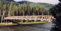
Warm Springs Creek Pack
Clearwater National Forest, Idaho, USA - Lochsa River
| Bridgemeister ID: | 367 (added before 2003) |
| Name: | Warm Springs Creek Pack |
| Also Known As: | Jerry Johnson Hot Springs Pack |
| Location: | Clearwater National Forest, Idaho, USA |
| Crossing: | Lochsa River |
| Coordinates: | 46.474333 N 114.885067 W |
| Maps: | Acme, GeoHack, Google, OpenStreetMap |
| References: | PQU |
| Use: | Pack |
| Status: | In use (last checked: 2005) |
| Main Cables: | Wire (steel) |
| Suspended Spans: | 1 |
| Main Span: | 1 x 67.7 meters (222 feet) estimated |
