Inventory Search Results
34 suspension bridges were found for search criteria: SIX. All 34 bridges from the search results appear below. Click the Bridgemeister ID number to isolate the bridge on its own page. If you don't see what you were looking for, try an image search with the same criteria: SIX. This will find the bridge if it is pictured on the site, but is not a catenary suspension bridge.
Related:
1810: Chain
Newburyport, Massachusetts, USA - Merrimack River
| Bridgemeister ID: | 14 (added before 2003) |
| Year Completed: | 1810 |
| Name: | Chain |
| Also Known As: | Essex-Merrimack |
| Location: | Newburyport, Massachusetts, USA |
| Crossing: | Merrimack River |
| At or Near Feature: | Deer Island |
| Coordinates: | 42.833947 N 70.906811 W |
| Maps: | Acme, GeoHack, Google, OpenStreetMap |
| Principals: | John Templeman |
| References: | AAJ, BBR, CAB, GBD, HBE, POPE, PTS2, RDH |
| Use: | Vehicular (two-lane, light vehicles only) |
| Status: | Replaced, 1909 |
| Main Cables: | Chain (iron) |
| Suspended Spans: | 1 |
| Main Span: | 1 x 74.1 meters (243 feet) |
| Deck width: | 30 feet (2 roadways of 15 feet) |
Notes:
- John Templeman built several bridges (like this one) using James Finley's design.
- Repaired in 1827 after 5 of 10 chains snapped under weight of a team of oxen.
- The complete description from Thomas Pope's 1811 Treatise (POPE):
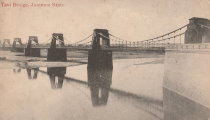
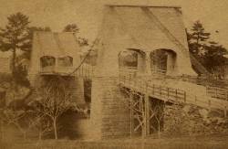
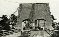
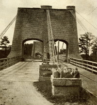
"The chain Bridge lately thrown over the Merrimack, three miles above Newburyport, in the state of Massachusetts, is now in constant use. This Bridge consists of a single arc, two hundred and forty-four feet span. The abutments are of stone, forty-seven feet long, and thirty-seven high; the uprights, or framed work, which stand on the abutments, are thirty-five feet high, over which are suspended ten distinct chains, the ends of which on both sides of the river are buried deep in pits and secured by large stones: each chain is five hundred and sixteen feet long; and, where they pass over the uprights, they are treble, and made in short links, which is said to be more secure than saddles made of plates of iron. The four middle joists rest on the chains; all the rest are suspended to the main chains to equalize the floor. This Bridge has two passage-ways of fifteen feet in width each, and the floor is so solid as to admit of horses, carriages, etc. to travel at any speed, with very little perceptible motion of the floors. The railing is stout and strong, which adds much firmness to the floor. There are three chains in each range on each side, and four in the middle range: they are calculated to support nearly five hundred tons. From the surface of the water to the middle of the floor is forty feet; and from the top of the abutments to the top of the uprights is thirty-five feet high, making seventy-two feet. The magnitude and power of the abutments, the width and length of the floors, the elevation of the work, the evident powers of the chains, etc. all conspire to make it a wonderful work. Every expense attending it did not amount to twenty-five thousand dollars. The abutment being of stone, the uprights covered, and the chains painted to prevent rust, leaves nothing but the flooring to decay. This Bridge was constructed by John Templeman, Esq. of the district of Columbia, whose talents for the productions of such work, and the various improvements suggested and used by him, have been highly beneficial, and do him great credit."
- Gregory W. Buff sent a transcription of an article describing the 1827 failure. The article was in the Saturday, February 24, 1827 issue (Volume IV, Number 31) of the Canadian Spectator (Montreal, Quebec) newspaper:
"Newburyport, Feb 9. Disastrious [sic] Accident. - On Tuesday morning last, the Essex Merrimack Bridge gave way in the centre, from the parting of the chains that support it. On the Bridge, at the moment, was a loaded team, drawn by six oxen and two horses, driven by two men, Messrs. Garlton [sic] and Jackman, all of whom were precipitated, forty feet, into the river beneath. The teamsters preserved themselves by means of swimming, and the support of fragments of the bridge; the team were all of them except one of the horses, swept beneath the ice a few rods below, and drowned. Five of the ten chains which supported the Bridge, were snapped in different places, and now remain upholding the broken and shattered timber altogether as sad a wreck as we ever witnessed. At the moment of the crash, the light evolved from the friction of the chains resembled the the vivid streaming of a meteor. Various excuses are assigned for the accident, and none, with more probability, than the united effect of the incumbent pressure of the immense body of snow lying upon the bridge, and the frost which had contracted the particles of iron. These produced a tenseness in the chains, which was incapable of resisting the additional pressure of the loaded team, and the whole gave way. The estimated expense of repairing the breach is about 4000 dollars; and the Directors, as we understand, plan to set about it immediately. It will be built up as before. To those who have been losers by this accident the corporation intend to make generous inumeration. The traveling will be uninterrupted, as the solidity of the ice above the bridge forms a safe passage way - and for the conveyance of carriages and heavy baggage the proprietors have promptly provided suitable boats. If any aversion to chain bridges has been produced by this accident, we should be sorry, for ourselves we feel yet unshaken faith in their superior security. The misfortune in this case was no doubt owing to the causes above stated, and not to any defect in the construction of the bridge. Probably hundreds of individuals, including each sex and all ages, have visited the ruins of the bridge. They present a sad and melancholy appearance - crushed and broken timbers suspended by the massy chains, which hang lazily from the pyramidical abutments, while the beholder instinctly shrinks back in terror at the reflection of the situation of the two human beings who were precipitated into the abyss beneath. The preservation of these two men is almost miraculous. Although hurled down 40 feet amid crashing and falling timber, entangled with their cattle, they fell without receiving the least injury, and attained the shore, after being for nearly half an hour, immerse in water chilled to the freezing point. Mr. Jackman is far advanced in years - and suffered somewhat from the exposure to the cold. Mr. Carlton [sic], escaped unhurt. The Chain Bridge has been built for about fifteen years, the span is 220 feet. We believe this was the second or third Chain Bridge built in the United States; and this is probably the first that has met with a similar accident. We understand the proprieters of the Rooks Bridge intend to rebuild theirs as a Chain Bridge."
- Replaced by 1909 Chain - Newburyport, Massachusetts, USA. The 1909 structure was almost entirely new (except for portions of the piers and abutments).
External Links:
1835: Chasse
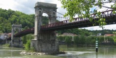
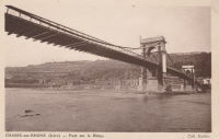
Chasse-sur-Rhône, Isère and Givors, Métropole De Lyon, France - Rhône River
| Bridgemeister ID: | 980 (added 2003-11-15) |
| Year Completed: | 1835 |
| Name: | Chasse |
| Also Known As: | Givors |
| Location: | Chasse-sur-Rhône, Isère and Givors, Métropole De Lyon, France |
| Crossing: | Rhône River |
| Coordinates: | 45.581666 N 4.780083 E |
| Maps: | Acme, GeoHack, Google, OpenStreetMap |
| References: | AAJ |
| Use: | Vehicular (one-lane) |
| Status: | In use (last checked: 2005) |
| Main Cables: | Wire (iron) |
| Suspended Spans: | 3 |
| Main Span: | 1 |
| Side Spans: | 2 |
Notes:
- Cables and deck appear to have been replaced (at least once).
- AAJ describes an accident in 1836: "...some of the iron-work, which was faulty, gave way and the platform fell into the river. Six persons were drowned."
External Links:
1846: Saint Clair
Lyon, Métropole de Lyon, France - Rhône River
| Bridgemeister ID: | 551 (added before 2003) |
| Year Completed: | 1846 |
| Name: | Saint Clair |
| Also Known As: | Louis Philippe, Vaïsse |
| Location: | Lyon, Métropole de Lyon, France |
| Crossing: | Rhône River |
| References: | AAJ, PQL |
| Use: | Vehicular |
| Status: | Demolished, 1953 |
| Main Cables: | Wire (iron) |
| Suspended Spans: | 2 |
| Deck width: | 7 meters |
Notes:
- Damaged by drifting boat, 1854. Rebuilt, 1856. Bombed, 1944. Rebuilt, 1946. Demolished, 1953.
- Crossed at present-day location of Pont Maréchal de Lattre de Tassigny.
- Originally constructed with two suspended spans. When it was rebuilt in 1856, towers were added increasing the number of suspended spans to six.
- Near 1845 College (Collège) - Lyon, Métropole de Lyon, France.
External Links:

1852: Wilson's
Cosumne, California, USA - Cosumnes River
| Bridgemeister ID: | 2116 (added 2006-09-10) |
| Year Completed: | 1852 |
| Name: | Wilson's |
| Location: | Cosumne, California, USA |
| Crossing: | Cosumnes River |
| Coordinates: | 38.49229 N 121.17183 W |
| Maps: | Acme, GeoHack, Google, OpenStreetMap |
| Principals: | W. D. Wilson |
| References: | DSL200106 |
| Use: | Vehicular |
| Status: | Removed |
| Main Cables: | Wire |
| Main Span: | 1 x 45.7 meters (150 feet) |
| Deck width: | 12 feet |
Notes:
- The location of this bridge was near the present day location of Cosumne in Sacramento County, just east of Sloughhouse. The location coordinates provided here are only to show the approximate location of present-day Cosumne and should not be considered the exact location of the bridge. Don Sayenga writes: "The exact location was at the intersection of [present-day] Dillard Road and State Route 16 a very short distance east of Sloughhouse, Sacramento County, California... The whole area at that time was known as Daylor's Ranch."
- Don Sayenga notes an F.W. Panhorst (of the California Highway Department) citation:
"Alta California July 27, 1852 reprinting an article from Sacramento Union mentions a wire suspension bridge built in Sacramento County across the Cosumnes. The span is described as 150 feet with a roadway width of 12 feet. One W.D. Wilson is mentioned as owner and designer. This structure, according to our best information, was the first suspension bridge in California."
- A January 14, 1862 Sacramento Bee article notes:
"The quartz mill and house of the brothers Wiley, just beyond Butte City, were carried away by the torrent. At Ione City, William's brick stable had fallen, and several other houses had met with a like fate. On Sutter creek, the loss and damage had been terrific - bridges and houses being carried off like chaff. Mr. Haywood, proprietor of a quartz mill on Sutter creek, had been a loser to the amount of at least $75,000. We have it from good authority that in the counties of Calaveras and Amador not a bridge is left standing. Below Ione City, it is thought that there has been loss of life."
which seems to imply a relationship between the Ione Valley, the Cosumnes River, and the bridge at Wilson's Exchange, but this may have just been coincidental that both "Ione Valley" and Wilson's Exchange were mentioned in the same paragraph; they are nearby. Present-day Ione is in Amador County a few miles east of Sacramento County. The Cosumnes River forms the northern border of Amador County several miles to the north of present-day Ione. Barry Parr notes that the Cosumnes River does not flow through the "Ione Valley," but Barry writes: "Recalling Daylor’s name in Historic Spots of California: 'Daylor established himself as a trader and hotel-keeper on the Cosumnes River about a mile east of Slough House. This place, which was at first known as Daylor’s Ranch, later became the Cosumnes post office.' (p. 290) The site of Cosumnes post office is about five miles downstream from Bridge House, and both are on the Sacramento-Ione Road.
"Last Saturday night, the reports of minute guns were heard, as if signals of distress, coming from the direction of a house where lived Mr. Martin and his family. The whole of Ione Valley was many feet under water. No boats were to be had, so that assistance might be rendered those in danger and distress. In a short time a heavy crash was heard, the signals of distress ceased, and our informant tells us that when he left the general impression was that Martin and his family had lost their lives. The wire suspension bridge over the Cosumnes river had disappeared - the house known as Wilson’s Exchange has also been washed away, and Daylor’s adobe house is flat with the ground. These facts go to show that throughout the mountain districts, as well as in the valleys, the destruction of property and loss of human life exceed the worst that was anticipated, and we shall hear repetitions of such tales of distress as the avenues for communication are gradually opened to us." - See 1852 Huse - Yeomet, California, USA.
- See 1863 Lamb's - Latrobe vicinity and Plymouth vicinity, California, USA.
External Links:
- Oliver Plummer. Transcription by Debbie Walke Gramlick of passage from An Illustrated History of Sacramento County, California. (by Hon. Win. J. Davis, Lewis Publishing Company, 1890, Pages 435-436) which sheds more light on W.D. Wilson.
"Mr. Wilson and part of the company concluded to seek the land of gold, while others kept to the original design of going to Oregon. On his arrival Mr. Wilson mined for a short time on Mormon Island and then moved to Hangtown, now Placerville, where in the winter of 1848-49 he built the first house erected in that place. The family then comprised six children; five more were born in California; nine grew to maturity and seven are living in 1889. In the spring of 1850 he moved down on the Cosumnes and purchased 6,000 acres of the Hartnell Grant, and built a tavern, long known as Wilson’s Exchange, across the river from what is now the Cosumnes post office. He was postmaster from the establishment of that office until 1868. He was by trade a millwright and built the first suspension bridge on the Cosumnes."
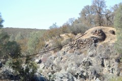
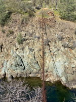
1863: Lamb's
Latrobe vicinity and Plymouth vicinity, California, USA - Cosumnes River
| Bridgemeister ID: | 2117 (added 2006-09-10) |
| Year Completed: | 1863 |
| Name: | Lamb's |
| Location: | Latrobe vicinity and Plymouth vicinity, California, USA |
| Crossing: | Cosumnes River |
| Coordinates: | 38.52222 N 120.95587 W |
| Maps: | Acme, GeoHack, Google, OpenStreetMap |
| Use: | Vehicular (one-lane) |
| Status: | Derelict (last checked: 2020) |
| Main Cables: | Wire (iron) |
| Suspended Spans: | 1 |
Notes:
- The location coordinates provided here are the approximate location of this bridge, crossing the Cosumnes between present day El Dorado and Amador counties at Michigan Bar (as named on USGS topographical maps) on current Latrobe Road where Clark Creek meets the Cosumnes River. Note that USGS topographical maps show another, more prominently marked, "Michigan Bar" a few miles west in Sacramento County.
- A California Highways and Public Works article (unsure of exact citation but it may be the article on the history of California bridges that appeared in the 1941 June issue and was reprinted in the 1950 September/October issue) says "there were four [suspension bridges] on the Cosumnes River, one of which (Lamb's Bridge on the Latrobe-Plymouth Road) killed one man and seven horses when it fell in 1869."
- The October 14, 1976 edition of The Mountain Democrat Times (Placerville, California) has an article about the nearby Huse Bridge (from the Heritage Association of El Dorado) which mentions Lamb's Bridge: "...Lamb's Bridge, several miles downriver, was reconstructed in 1872 and was also a wire bridge of the same type [as Huse's]."
- The Statutes of California passed at the Fourteenth Session of the Legislature, 1863 records: "Chapter XLI. An Act to grant to Larkin Lamb and his Associates the right to construct and maintain a Toll Bridge across the Cosumnes River, in the Counties of Amador and El Dorado. Approved March 6, 1863. The People of the State of California, represented in Senate and Assembly, do enact as follows: Section 1. Larkin Lamb, and those he may associate with him, their heirs and assigns, shall have full power to build, erect, construct, and maintain a public toll bridge across the Cosumnes River, at a point about eighty (80) rods below Dutch Hill;..."
- A November 12, 2017 article in Ledger Dispatch (of Amador and Calaveras counties) titled "Vestiges of Amador-Communities Along the Cosumnes, Part VI: The Lower Reaches - Michigan Bar to Wisconsin Bar" by Deborah Coleen Cook gives a more complete history of Lamb's bridge citing the enactment (February 9, 1863) of the bill to permit construction, construction completing six months later, failure of one of the cables in 1869 under the weight of a large freight wagon, and another cable/anchorage failure in 1872 while the bridge was undergoing major repairs.
- See 1852 Huse - Yeomet, California, USA.
- See 1852 Wilson's - Cosumne, California, USA.
1871: Ferry Street
Binghamton, New York, USA - Chenango River
| Bridgemeister ID: | 276 (added before 2003) |
| Year Completed: | 1871 |
| Name: | Ferry Street |
| Location: | Binghamton, New York, USA |
| Crossing: | Chenango River |
| Principals: | John A. Roebling's Sons, Co. |
| Use: | Vehicular (one-lane) |
| Status: | Removed, 1897 |
| Main Cables: | Wire |
| Suspended Spans: | 1 |
| Main Span: | 1 x 109.7 meters (360 feet) |
Notes:
- This bridge was close to the alignment of Binghamton's present Clinton Street bridge. It replaced a bridge that was destroyed by flood in 1865. It was condemned in 1896 and removed in 1897. History Of Broome County indicates an act was passed March 13th, 1871 authorizing the bridge with the contract let to "W.A. Roebling & Son" each cable consisting of seven steel wire ropes, each two inches in diameter.
- An article from the Binghamton Democrat, July 20, 1871: "The Suspension Bridge -- The work on the west abutment of the suspension bridge has been commenced and will be rapidly as advisable pushed forward to completion, and soon thereafter the wire cables will be placed in position, the stays, supports and girders made fast, and ready for the flooring. In the course of six or eight weeks it is hoped that the bridge will be completed, and our people given another way of passing from the 1st to the 2nd wards, and the old-pleasant driveway re-opened, of which we have been debarred since the flood of St-Patrick's Day in the morning in [1865]. Upon the completion of this enterprise, surely no one will ever regret having voted in favor of the free suspension bridge."
- An article from the Binghamton Democrat, Nov. 30, 1871: "The New Bridge -- Its Cost -- For the suspenssion [sic] bridge, the tax-payers voted $28,000. It is finished, and in the Common Council last evening it was asserted that it cost over $30,000 and still all the claims are not satisfied. Mr. Jas. Fanning, contractor for building abutments, seeks relief for $1,000 or upwards which he is out no account of his contract. His petition was after considerable skirmishing finally referred to a committee. We hold that this is wrong, the Common Council has nothing to do with this matter. Mayor Dwight published a card binding himself to pay all over $28,000 that the bridge would cost. The people voted that amount and their representatives have nothing to do with any further cost or expense arrising [sic] from that source."
- Internet searches for this bridge often lead to an image on page 32 of the book "Binghamton", from the "Images of America" series, by Ed Aswad and Suzanne M. Meredith. However, that image is of the Warren Pensylvania suspension bridge and is erroneously captioned as the Binghamton Ferry Street bridge. The bridges may be sometimes confused because of similar surroundings and similar towers. Both are often depicted with a large warehouse building on the far side of the bridge, to the right. Both had "walk-through" towers where the pedestrian walkway passed through portals in the towers. Closer comparisons reveal the Warren towers are substantially larger than the Ferry Street towers. This is not surprising given the Warren bridge was substantially longer than the Ferry Street bridge. All this being said, there are different images purporting to be the Ferry Street bridge that show different towers. The stereoview image linked here appears to show the original towers. Later photos appear to show either replaced towers or, perhaps, the original towers clad in protective housing.
- See 1871 Warren (Hickory Street) - Warren, Pennsylvania, USA. The two bridges are sometimes confused despite the significant size difference.
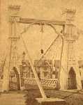
1877: Cottaneva
Cottaneva Creek, Rockport, California, USA - Rockport Bay, Pacific Ocean
| Bridgemeister ID: | 1152 (added 2004-01-18) |
| Year Completed: | 1877 |
| Name: | Cottaneva |
| Location: | Cottaneva Creek, Rockport, California, USA |
| Crossing: | Rockport Bay, Pacific Ocean |
| Coordinates: | 39.736703 N 123.832585 W |
| Maps: | Acme, GeoHack, Google, OpenStreetMap |
| Principals: | Pacific Bridge Co. |
| References: | AAJ |
| Use: | Vehicular (one-lane) |
| Status: | Removed |
| Main Cables: | Wire (iron) |
| Suspended Spans: | 1 |
| Main Span: | 1 x 82.3 meters (270 feet) |
Notes:
- This bridge was part of the Rockport lumber mill (Mendocino County). The bridge stretched over ocean to a large rock in the bay.
- Jakkula cites two sources describing the cables as steel.
- Don Sayenga transcribed one of Jakkula's references, The Iron Age Volume XX , No. 3 (August 2, 1877) Page 1: "A Steel Wire Suspension Bridge In California"
The Pacific Bridge Company are building in Mendocino county, California at Cottoneva, a suspension bridge which is described as follows "The distance from center to center of the saddles on the towers is 270 feet. The deflection or fall of the cable is 23 feet 6 inches. The cables are built in the same manner as those of the Clifton bridge at Niagara. The steel wire is about No. 11 Birmingham gauge, and is protected against rust by immersing in a bath which it a fine coat of zinc. There are eleven wires in each strand, seven strands in each rope, and seven ropes in each cable. The ropes are not twisted together to form the cable but gathered up every six feet by the suspender bands. Each rope is warranted to bear a strain of 60 tons. It is made fast to an independent anchor bar, 1 by 3 inches in diameter, and forming links 18 feet long, until connection is made with the anchors. The anchors are of cast iron, 3-1/2 by 3 feet in surface, weigh 1000 pounds each, and are placed 14 feet below the surface of the rock. Great care was taken in securing the anchors in place by means of cross I beams which run under the rock on either side. The lower part of each pit was enlarged to so as to form a hemispherical chamber, and the rock work, set in Portland cement, which is built upon the anchor, is so constructed that the upward strain is transmitted to the sides. The towers are of red wood. There are four posts 10 x 10 inches and two 10 x 12 inches, giving an effective area of 640 inches to withstand the strain of the cables on the tower. The wooden truss to prevent vertical vibration is 8 feet high and of the Howe truss pattern. The 270 feet of the bridge is divided into 45 pannels. The longest suspenders, 44 in number are of 7/8 inch steel wire, the 42 shorter ones are of 1-1/8 inch solid iron. The estimated dead load of the bridge is 1000 pounds per linear foot; live load, one ton per linear foot; in all, one and one half tons, or one fifth of actual breaking load. The bridge will be completed in about 30 days and promises to be a structure which the builders may well be proud of."
Don writes: "[In] Jakkula's last citation, he is saying that this is factory-made wire rope... The construction of the wire rope (7 by 11) used in the main cables is not common for the USA as of 1877; in fact it is extremely uncommon. The wire ropes used at Clifton/Niagara were made in England -- it wouldn't surprise me if these were made in England too."
1882: Long Creek
Melvern vicinity, Kansas, USA - Long Creek
| Bridgemeister ID: | 2062 (added 2006-06-03) |
| Year Completed: | 1882 |
| Name: | Long Creek |
| Location: | Melvern vicinity, Kansas, USA |
| Crossing: | Long Creek |
| At or Near Feature: | Francis Crossing |
| Principals: | Wilden Bridge Company |
| Use: | Vehicular (one-lane) |
| Status: | Removed, c. 1970 |
Notes:
- In the June 18, 1970 edition of the Daily Tribune newspaper (Great Bend, Kansas) an article titled "Last Suspension Bridge to Fall" describes this bridge: "The suspension bridge appears to be going the way of the old covered bridge in Kansas. At least, the particular type of suspension span represented by Osage County Bridge No. 18 may be gone when this structure is replaced within two years. L.D. Pierce, Osage County engineer, said he believes this 'homemade' suspension bridge probably is the last of its kind in this state. He said it was built in 1882 from a pencil-drawn plan that probably was prepared by asurveyor or a millwright. He said it was constructed with materials that could be found in any hardware store and lumber yard. For example, cables are No. 9 gauge wire, bound together. Pierce said at one time there were five or six of these bridges in Osage County. The 100-foot span over Long Creek has been closed to traffic since 1967."
- See Long Creek - Melvern, Kansas, USA.
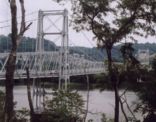
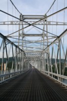
1905: Newell
East Liverpool, Ohio and Newell, West Virginia, USA - Ohio River
| Bridgemeister ID: | 117 (added before 2003) |
| Year Completed: | 1905 |
| Name: | Newell |
| Location: | East Liverpool, Ohio and Newell, West Virginia, USA |
| Crossing: | Ohio River |
| Coordinates: | 40.62167 N 80.595 W |
| Maps: | Acme, GeoHack, Google, OpenStreetMap |
| Principals: | Edwin Kirtland Morse, Dravo Company |
| References: | AAJ, BPL, PTS2 |
| Use: | Vehicular (two-lane), with walkway |
| Status: | In use (last checked: 2022) |
| Main Cables: | Wire (steel) |
| Suspended Spans: | 3 |
| Main Span: | 1 x 228.6 meters (750 feet) |
| Side Spans: | 2 |
Annotated Citations:
- Huba, Stephen. "There’s a new owner for the Newell Bridge." The Weirton Daily Times, 6 May 2022, www.weirtondailytimes.com/news/local-news/2022/05/theres-a-new-owner-for-the-newell-bridge/.
"Frank Six of Six Enterprises in Newell, assumed ownership Wednesday of one of the oldest suspension bridges on the Ohio River for an undisclosed sum from HLC Holdings Inc., parent company of the Fiesta Tableware Co., formerly known as the Homer Laughlin China Co."
- Bobby-Gilbert, Jo-Ann., "Fiesta Tableware Parent Sells Iconic Newell Bridge." The Business Journal, 5 May 2022, businessjournaldaily.com/fiesta-tableware-parent-sells-iconic-newell-bridge/.
"After 116 years of ownership by HLC Holdings Inc., parent company of The Fiesta Tableware Co., the Newell Bridge and Railway Co. changed hands at midnight Wednesday. Officials of Fiesta Tableware, formerly known as Homer Laughlin China Co., announced that the bridge has been purchased by Frank Six, owner of Six Enterprises in Newell."
External Links:

1913: South Fork Mule
Hyampom vicinity, California, USA - South Fork Trinity River
| Bridgemeister ID: | 1993 (added 2005-12-10) |
| Year Completed: | 1913 |
| Name: | South Fork Mule |
| Also Known As: | Limestairs |
| Location: | Hyampom vicinity, California, USA |
| Crossing: | South Fork Trinity River |
| At or Near Feature: | Six Rivers National Forest |
| Coordinates: | 40.719083 N 123.523217 W |
| Maps: | Acme, GeoHack, Google, OpenStreetMap |
| Use: | Footbridge |
| Status: | In use (last checked: 2013) |
| Main Cables: | Wire (steel) |
| Suspended Spans: | 1 |
Notes:
- 2006: The bridge is closed. Marilyn Renaker of the "Committee to Save the Mule Bridge" writes in late August, 2006: "Trinity County and the Forest Service would like to abandon the Mule Bridge. Hyampom had a town meeting about this and everyone was opposed to the removal of the bridge which has been a part of our community since 1913."
- 2010: Multi-year repair and reconstruction project started.
- 2013: Bridge is reopened.
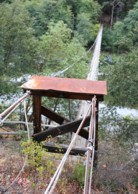
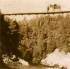
1915: Brown's Ford
Brown's Ford and Lowry City vicinity, Missouri, USA - Osage River
| Bridgemeister ID: | 2325 (added 2007-05-06) |
| Year Completed: | 1915 |
| Name: | Brown's Ford |
| Location: | Brown's Ford and Lowry City vicinity, Missouri, USA |
| Crossing: | Osage River |
| References: | AAJ |
| Status: | Removed |
| Main Cables: | Wire |
Notes:
- The June 22, 1940 edition of The Chillicothe Constitution-Tribune (Chillicothe, Missouri) has an article titled "Three Killed in Bridge Collapse, Workmen were repairing the structure near Lowry City, Mo." describing a fatal collapse of the bridge: "Three men were killed, three injured critically and an 8-year old boy believed drowned when cribbing on a wooden suspension bridge across the Osage River six miles east of Lowry City collapsed about 4 o'clock yesterday afternoon. The bridge, on a farm-to-market road in St. Clair County, was being remodeled. Of the ten men working and bystanders on and near the structure when it fell, only one escaped without injury. All those killed or injured lived in St. Clair County. On the west side of the bridge a framework of heavy timbers had been inserted between one of the suspension cables and an old wooden pier, which originally had supported the cable. The workmen were attempting to slide a steel pier under the cable, to replace the wooden pier. The cribbing suddenly gave way, and the pressure from the cable hurled the wood supports in all directions. The bridge floor dropped into the river, except for a small section near the east end."
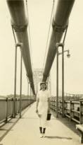
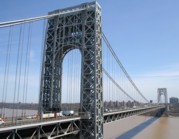
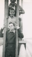
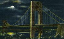
1931: George Washington
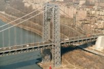
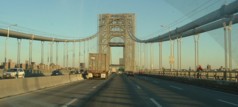
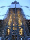
New York, New York and Fort Lee, New Jersey, USA - Hudson River
| Bridgemeister ID: | 169 (added before 2003) |
| Year Completed: | 1931 |
| Name: | George Washington |
| Also Known As: | GWB |
| Location: | New York, New York and Fort Lee, New Jersey, USA |
| Crossing: | Hudson River |
| Coordinates: | 40.85333 N 73.955 W |
| Maps: | Acme, GeoHack, Google, OpenStreetMap |
| Principals: | O.H. Ammann, Leon Moisseiff, Dana, Gilbert |
| References: | AAJ, AOB, ARF, BBR, BC3, BFL, BMA, BONJ, BOU, BPL, BRU, COB, CTW, ENR19270811a, ENR19270811b, ENR19290411c, GBD, LAB, LACE, PTS2, SIX, SJR |
| Use: | Vehicular (double-deck), with walkway |
| Status: | In use (last checked: 2022) |
| Main Cables: | Wire (steel) |
| Suspended Spans: | 3 |
| Main Span: | 1 x 1,066.8 meters (3,500 feet) |
| Side Spans: | 2 x 198.1 meters (650 feet) |
| Deck width: | 120 feet |
Notes:
- Became longest suspension bridge by eclipsing 1929 Ambassador - Detroit, Michigan, USA and Windsor, Ontario, Canada.
- Eclipsed by new longest suspension bridge 1937 Golden Gate - San Francisco and Marin County, California, USA.
External Links:
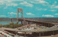
1936: Triborough
New York and Queens, New York, USA - East River
| Bridgemeister ID: | 186 (added before 2003) |
| Year Completed: | 1936 |
| Name: | Triborough |
| Also Known As: | Robert F. Kennedy |
| Location: | New York and Queens, New York, USA |
| Crossing: | East River |
| At or Near Feature: | Randalls-Wards Island |
| Coordinates: | 40.781283 N 73.9273 W |
| Maps: | Acme, GeoHack, Google, OpenStreetMap |
| Principals: | O.H. Ammann, Allston Dana |
| References: | AAJ, GBD, SIX |
| Use: | Vehicular (major highway), with walkway |
| Status: | In use (last checked: 2022) |
| Main Cables: | Wire (steel) |
| Suspended Spans: | 3 |
| Main Span: | 1 x 420.6 meters (1,380 feet) |
| Side Spans: | 2 x 214.8 meters (704.75 feet) |
| Deck width: | 96 feet |
External Links:
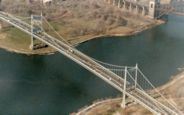
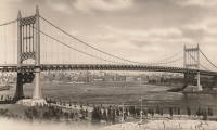
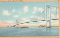
1939: Bronx-Whitestone
The Bronx and Queens, New York, USA - East River
| Bridgemeister ID: | 191 (added before 2003) |
| Year Completed: | 1939 |
| Name: | Bronx-Whitestone |
| Location: | The Bronx and Queens, New York, USA |
| Crossing: | East River |
| Coordinates: | 40.80167 N 73.83 W |
| Maps: | Acme, GeoHack, Google, OpenStreetMap |
| Principals: | O. H. Ammann, Allston Dana |
| References: | AAJ, ARF, BAAW, BBR, BFL, BPL, GBD, SIX |
| Use: | Vehicular (major highway) |
| Status: | In use (last checked: 2022) |
| Main Cables: | Wire (steel) |
| Suspended Spans: | 3 |
| Main Span: | 1 x 701 meters (2,300 feet) |
| Side Spans: | 2 x 224 meters (735 feet) |
Notes:
External Links:

1957: Glen Canyon
Glen Canyon Dam, Arizona, USA - Colorado River
| Bridgemeister ID: | 1191 (added 2004-01-25) |
| Year Completed: | 1957 |
| Name: | Glen Canyon |
| Location: | Glen Canyon Dam, Arizona, USA |
| Crossing: | Colorado River |
| Principals: | Kiewit-Judson Pacific Murphy Co. |
| Use: | Footbridge |
| Status: | Removed |
| Main Cables: | Wire (steel) |
| Suspended Spans: | 1 |
| Main Span: | 1 x 390.1 meters (1,280 feet) |
Notes:
- Very long, very high footbridge spanning the canyon. Originally built for bridge workers building the Glen Canyon Bridge (the large deck arch next to the dam). Survived at least until 1959.
- From a Roebling ad in the July 1958 issue of Civil Engineering: "The bridge was completed in sixty days and features a steel mesh deck, to reduce wind resistance. Construction was started by lowering two 5/8 in. cables to the bottom of the west side of the gorge, transporting them across the river by boat and raising them on the east side by block and tackle. The six main suspension cables are 1 3/4 in. diameter prestretched galvanized bridge strands. From them are hung sixty-four 5/8 in. suspenders, attached to 7 ft-wide floor beams. The wire mesh floor is laid on eight 1 in. diameter deck cables. These in turn are supported every twenty feet by the floor beams. For safety, four handrail cables are attached to the suspenders. To add stability in strong winds, two 1 3/4 in. bridge strand wind brace cables run below the deck on either side for its length."
External Links:
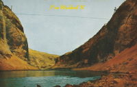
1961: Throgs Neck
The Bronx and Queens, New York, USA - East River
| Bridgemeister ID: | 215 (added before 2003) |
| Year Completed: | 1961 |
| Name: | Throgs Neck |
| Location: | The Bronx and Queens, New York, USA |
| Crossing: | East River |
| Coordinates: | 40.8 N 73.795 W |
| Maps: | Acme, GeoHack, Google, OpenStreetMap |
| Principals: | O. H. Ammann |
| References: | ARF, BCO, SIX, VNB |
| Use: | Vehicular (major highway) |
| Status: | In use (last checked: 2022) |
| Main Cables: | Wire (steel) |
| Suspended Spans: | 3 |
| Main Span: | 1 x 548.6 meters (1,800 feet) |
| Side Spans: | 2 |
Notes:
External Links:
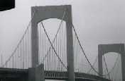
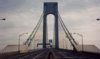
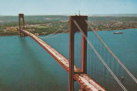
1964: Verrazzano Narrows
Brooklyn and Staten Island, New York, USA - Verrazano Narrows
| Bridgemeister ID: | 219 (added before 2003) |
| Year Completed: | 1964 |
| Name: | Verrazzano Narrows |
| Also Known As: | Verrazano Narrows |
| Location: | Brooklyn and Staten Island, New York, USA |
| Crossing: | Verrazano Narrows |
| Coordinates: | 40.60667 N 74.045 W |
| Maps: | Acme, GeoHack, Google, OpenStreetMap |
| Principals: | Othmar H. Ammann, Whitney |
| References: | BBR, BC3, BFL, BOU, COB, CTW, GBD, LAB, SIX, VNB |
| Use: | Vehicular (double-deck) |
| Status: | In use (last checked: 2022) |
| Main Cables: | Wire (steel) |
| Suspended Spans: | 3 |
| Main Span: | 1 x 1,298.4 meters (4,260 feet) |
| Side Spans: | 2 |
Notes:
- 2017: Long known as the "Verrazano" bridge, efforts to fix the spelling of the bridge's name to "Verrazzano" (such as Giovanni da Verrazzano) pick up momentum with New York state legislature and senate.
- Became longest suspension bridge by eclipsing 1937 Golden Gate - San Francisco and Marin County, California, USA.
- Eclipsed by new longest suspension bridge 1981 Humber - Hull, Humberside, England, United Kingdom.
External Links:

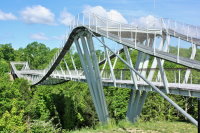
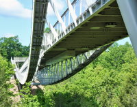
2013: CONSOL Energy Wing Tip
Glen Jean, Oak Hill vicinity, West Virginia, USA - Turley Branch
| Bridgemeister ID: | 6139 (added 2021-07-06) |
| Year Completed: | 2013 |
| Name: | CONSOL Energy Wing Tip |
| Also Known As: | Wingtip |
| Location: | Glen Jean, Oak Hill vicinity, West Virginia, USA |
| Crossing: | Turley Branch |
| At or Near Feature: | Summit Bechtel National Scout Reserve |
| Coordinates: | 37.917343 N 81.119230 W |
| Maps: | Acme, GeoHack, Google, OpenStreetMap |
| Principals: | Hatch Mott MacDonald, Schlaich Bergermann Partner, Freyssinet |
| Use: | Footbridge |
| Status: | In use (last checked: 2021) |
| Main Cables: | Wire (steel) |
| Suspended Spans: | 3 |
| Main Span: | 1 x 177.4 meters (582 feet) |
| Side Spans: | 2 x 31.1 meters (102 feet) estimated |
Notes:
- Large, unconventional suspension bridge with a large underspanned section, walkways running along the tops of the main cables, and rigid suspenders.
External Links:
- CONSOL Energy Wing Tip Bridge - Mott MacDonald. "Each end of the bridge passes through a V-shaped structure made of six steel masts, raked outward at the top. Between the masts and abutments, the cables are splayed to provide extra stability against lateral motion. The resemblance of the slanting masts to the wing tip feathers of a flying eagle inspired the name Wing Tip Bridge… A unique feature of the bridge is that pedestrians can cross in one of two ways: on a traditional level deck or on secondary walkways that follow the cables and pass above and then below the deck, sometimes at an angle of up to 10 degrees."
- Consol Energy Wingtip Bridge (Boy Scouts Bridge) - schlaich bergermann partner. "The design of the bridge was to be adventurous and the crossing of the bridge was to be an experience in itself. To that end, the scouts are able to walk not only on the bridge deck but also along the cables of the bridge on a steel walkway. The cables pass over the tops of the masts and below the main deck of the bridge allowing the scouts to see the bridge from multiple perspectives. The masts are spread to form a V in section which evokes the tips of eagle’s wings, the symbol of the Boy Scouts."
- Structurae - Structure ID 20066259
(footbridge)
Burnt Ranch vicinity, California, USA - Trinity River
| Bridgemeister ID: | 2408 (added 2007-12-24) |
| Name: | (footbridge) |
| Location: | Burnt Ranch vicinity, California, USA |
| Crossing: | Trinity River |
| At or Near Feature: | Six Rivers National Forest |
| Use: | Footbridge |
| Status: | Removed |
| Main Cables: | Wire |
| Suspended Spans: | 1 |
Notes:
- Completed 1915-1917, likely removed, 1970s.
- An article in the October 29, 1971 edition of The Times-Standard (Eureka, California) describes this bridge as being located over the Trinity River at New River. USGS topographical maps show a footbridge a few hundred yards north of the intersection of the two rivers at Gray Falls. The article has a photograph of the bridge and describes its possible replacement. The bridge was already closed at the time of the article: "A 50 year-old picturesque footbridge across the Trinity River at New River will be replaced if special funds can be obtained by the Six Rivers Nalional Forest, the federal agency has decided. 'Strong supportive response from people throughout the area to the continued need for a bridge' was reported by Forest Supervisor Bob Allison. The responses came after the Forest Service solicited comments in August on the replacement need for the span. The new bridge would be nearly as possible a replica of the present bridge constructed sometime between 1915 - 1917 by Jim and John Larson. It served as the main link between Denny and the outside world."
(footbridge)
Pryvillya, Luhansk Oblast, Ukraine - Siverskyi Donets River
| Bridgemeister ID: | 6940 (added 2022-01-23) |
| Name: | (footbridge) |
| Location: | Pryvillya, Luhansk Oblast, Ukraine |
| Crossing: | Siverskyi Donets River |
| Coordinates: | 49.025677 N 38.284821 E |
| Maps: | Acme, GeoHack, Google, OpenStreetMap |
| Use: | Footbridge |
| Status: | In use (last checked: 2022) |
| Main Span: | 1 x 98 meters (321.5 feet) estimated |
Notes:
- Very unconventional suspension system. Main cables are strapped to the top chord of the deck truss for six panels. Suspender cables are inclined and very sparse.
(pipeline bridge)
Eagle Creek Township and Keener Township, Indiana, USA - Kankakee River
| Bridgemeister ID: | 8412 (added 2024-03-03) |
| Name: | (pipeline bridge) |
| Location: | Eagle Creek Township and Keener Township, Indiana, USA |
| Crossing: | Kankakee River |
| Coordinates: | 41.220361 N 87.270806 W |
| Maps: | Acme, GeoHack, Google, OpenStreetMap |
| Use: | Pipeline |
| Status: | Extant (last checked: 2023) |
| Main Spans: | 1 x 72 meters (236.2 feet) estimated, 1 x 25 meters (82 feet) estimated |
Notes:
- One of six short suspended pipelines along a five mile stretch of, what appears to be, the same pipeline. This one, crossing the Kankakee River is the longest of the group by far.
- Connects to (pipeline bridge) - Eagle Creek Township, Indiana, USA.
- Connects to (pipeline bridge) - Eagle Creek Township, Indiana, USA.
- Connects to (pipeline bridge) - Eagle Creek Township, Indiana, USA.
- Connects to (pipeline bridge) - Keener Township, Indiana, USA.
- Connects to (pipeline bridge) - Keener Township, Indiana, USA.
(pipeline bridge)
Eagle Creek Township, Indiana, USA - Singleton Ditch
| Bridgemeister ID: | 8409 (added 2024-03-03) |
| Name: | (pipeline bridge) |
| Location: | Eagle Creek Township, Indiana, USA |
| Crossing: | Singleton Ditch |
| Coordinates: | 41.260667 N 87.300861 W |
| Maps: | Acme, GeoHack, Google, OpenStreetMap |
| Use: | Pipeline |
| Status: | Extant (last checked: 2023) |
| Suspended Spans: | 1 |
| Main Span: | 1 x 20 meters (65.6 feet) estimated |
Notes:
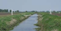
- One of six short suspended pipelines along a five mile stretch of, what appears to be, the same pipeline.
- Connects to (pipeline bridge) - Eagle Creek Township and Keener Township, Indiana, USA.
- Connects to (pipeline bridge) - Eagle Creek Township, Indiana, USA.
- Connects to (pipeline bridge) - Eagle Creek Township, Indiana, USA.
- Connects to (pipeline bridge) - Keener Township, Indiana, USA.
- Connects to (pipeline bridge) - Keener Township, Indiana, USA.
(pipeline bridge)
Eagle Creek Township, Indiana, USA - Little Ditch
| Bridgemeister ID: | 8410 (added 2024-03-03) |
| Name: | (pipeline bridge) |
| Location: | Eagle Creek Township, Indiana, USA |
| Crossing: | Little Ditch |
| Coordinates: | 41.257639 N 87.298583 W |
| Maps: | Acme, GeoHack, Google, OpenStreetMap |
| Use: | Pipeline |
| Status: | Extant (last checked: 2023) |
| Suspended Spans: | 1 |
| Main Span: | 1 x 21 meters (68.9 feet) estimated |
Notes:
- One of six short suspended pipelines along a five mile stretch of, what appears to be, the same pipeline.
- Connects to (pipeline bridge) - Eagle Creek Township and Keener Township, Indiana, USA.
- Connects to (pipeline bridge) - Eagle Creek Township, Indiana, USA.
- Connects to (pipeline bridge) - Eagle Creek Township, Indiana, USA.
- Connects to (pipeline bridge) - Keener Township, Indiana, USA.
- Connects to (pipeline bridge) - Keener Township, Indiana, USA.

(pipeline bridge)
Eagle Creek Township, Indiana, USA - Brown Ditch
| Bridgemeister ID: | 8411 (added 2024-03-03) |
| Name: | (pipeline bridge) |
| Location: | Eagle Creek Township, Indiana, USA |
| Crossing: | Brown Ditch |
| Coordinates: | 41.239583 N 87.285444 W |
| Maps: | Acme, GeoHack, Google, OpenStreetMap |
| Use: | Pipeline |
| Status: | Extant (last checked: 2023) |
| Suspended Spans: | 1 |
| Main Span: | 1 x 16 meters (52.5 feet) estimated |
Notes:
- One of six short suspended pipelines along a five mile stretch of, what appears to be, the same pipeline.
- Connects to (pipeline bridge) - Eagle Creek Township and Keener Township, Indiana, USA.
- Connects to (pipeline bridge) - Eagle Creek Township, Indiana, USA.
- Connects to (pipeline bridge) - Eagle Creek Township, Indiana, USA.
- Connects to (pipeline bridge) - Keener Township, Indiana, USA.
- Connects to (pipeline bridge) - Keener Township, Indiana, USA.
(pipeline bridge)
Keener Township, Indiana, USA - Brent Ditch
| Bridgemeister ID: | 8413 (added 2024-03-03) |
| Name: | (pipeline bridge) |
| Location: | Keener Township, Indiana, USA |
| Crossing: | Brent Ditch |
| Coordinates: | 41.206889 N 87.261222 W |
| Maps: | Acme, GeoHack, Google, OpenStreetMap |
| Use: | Pipeline |
| Status: | Extant (last checked: 2023) |
| Suspended Spans: | 1 |
| Main Span: | 1 x 14 meters (45.9 feet) estimated |
Notes:
- One of six short suspended pipelines along a five mile stretch of, what appears to be, the same pipeline.
- Connects to (pipeline bridge) - Eagle Creek Township and Keener Township, Indiana, USA.
- Connects to (pipeline bridge) - Eagle Creek Township, Indiana, USA.
- Connects to (pipeline bridge) - Eagle Creek Township, Indiana, USA.
- Connects to (pipeline bridge) - Eagle Creek Township, Indiana, USA.
- Connects to (pipeline bridge) - Keener Township, Indiana, USA.
(pipeline bridge)
Keener Township, Indiana, USA - Dehaan Ditch
| Bridgemeister ID: | 8414 (added 2024-03-03) |
| Name: | (pipeline bridge) |
| Location: | Keener Township, Indiana, USA |
| Crossing: | Dehaan Ditch |
| Coordinates: | 41.202500 N 87.258056 W |
| Maps: | Acme, GeoHack, Google, OpenStreetMap |
| Use: | Pipeline |
| Status: | Extant (last checked: 2023) |
| Suspended Spans: | 1 |
| Main Span: | 1 x 14.5 meters (47.6 feet) estimated |
Notes:
- One of six short suspended pipelines along a five mile stretch of, what appears to be, the same pipeline.
- Connects to (pipeline bridge) - Eagle Creek Township and Keener Township, Indiana, USA.
- Connects to (pipeline bridge) - Eagle Creek Township, Indiana, USA.
- Connects to (pipeline bridge) - Eagle Creek Township, Indiana, USA.
- Connects to (pipeline bridge) - Eagle Creek Township, Indiana, USA.
- Connects to (pipeline bridge) - Keener Township, Indiana, USA.
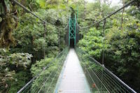
Sky Walk 1
Monteverde, Santa Elena vicinity, Costa Rica - Monteverde Cloud Forest
| Bridgemeister ID: | 1118 (added 2004-01-06) |
| Name: | Sky Walk 1 |
| Location: | Monteverde, Santa Elena vicinity, Costa Rica |
| Crossing: | Monteverde Cloud Forest |
| At or Near Feature: | Sky Adventures Monteverde Park |
| Coordinates: | 10.336227 N 84.808606 W |
| Maps: | Acme, GeoHack, Google, OpenStreetMap |
| Use: | Footbridge |
| Status: | In use (last checked: 2023) |
| Main Cables: | Wire (steel) |
| Suspended Spans: | 1 |
Notes:
- One of six suspension bridges on the treetop Sky Walk.
- Near (footbridge) - Monteverde, Santa Elena vicinity, Costa Rica.
- Near (footbridge) - Monteverde, Santa Elena vicinity, Costa Rica.
- Near Sky Walk 2 - Monteverde, Santa Elena vicinity, Costa Rica.
- Near Sky Walk 3 - Monteverde, Santa Elena vicinity, Costa Rica.
- Near Sky Walk 4 - Monteverde, Santa Elena vicinity, Costa Rica.
- Near Sky Walk 5 - Monteverde, Santa Elena vicinity, Costa Rica.
- Near Sky Walk 6 - Monteverde, Santa Elena vicinity, Costa Rica.
Sky Walk 2
Monteverde, Santa Elena vicinity, Costa Rica - Monteverde Cloud Forest
| Bridgemeister ID: | 7786 (added 2023-08-21) |
| Name: | Sky Walk 2 |
| Location: | Monteverde, Santa Elena vicinity, Costa Rica |
| Crossing: | Monteverde Cloud Forest |
| At or Near Feature: | Sky Adventures Monteverde Park |
| Coordinates: | 10.336986 N 84.805990 W |
| Maps: | Acme, GeoHack, Google, OpenStreetMap |
| Use: | Footbridge |
| Status: | In use (last checked: 2023) |
| Main Cables: | Wire (steel) |
| Suspended Spans: | 1 |
Notes:
- One of six suspension bridges along the treetop Sky Walk.
- Near (footbridge) - Monteverde, Santa Elena vicinity, Costa Rica.
- Near (footbridge) - Monteverde, Santa Elena vicinity, Costa Rica.
- Near Sky Walk 1 - Monteverde, Santa Elena vicinity, Costa Rica.
- Near Sky Walk 3 - Monteverde, Santa Elena vicinity, Costa Rica.
- Near Sky Walk 4 - Monteverde, Santa Elena vicinity, Costa Rica.
- Near Sky Walk 5 - Monteverde, Santa Elena vicinity, Costa Rica.
- Near Sky Walk 6 - Monteverde, Santa Elena vicinity, Costa Rica.
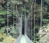
Sky Walk 3
Monteverde, Santa Elena vicinity, Costa Rica - Monteverde Cloud Forest
| Bridgemeister ID: | 7787 (added 2023-08-21) |
| Name: | Sky Walk 3 |
| Location: | Monteverde, Santa Elena vicinity, Costa Rica |
| Crossing: | Monteverde Cloud Forest |
| At or Near Feature: | Sky Adventures Monteverde Park |
| Coordinates: | 10.339592 N 84.807801 W |
| Maps: | Acme, GeoHack, Google, OpenStreetMap |
| Use: | Footbridge |
| Status: | In use (last checked: 2023) |
| Main Cables: | Wire (steel) |
| Suspended Spans: | 1 |
Notes:
- One of six suspension bridges along the treetop Sky Walk.
- Near (footbridge) - Monteverde, Santa Elena vicinity, Costa Rica.
- Near (footbridge) - Monteverde, Santa Elena vicinity, Costa Rica.
- Near Sky Walk 1 - Monteverde, Santa Elena vicinity, Costa Rica.
- Near Sky Walk 2 - Monteverde, Santa Elena vicinity, Costa Rica.
- Near Sky Walk 4 - Monteverde, Santa Elena vicinity, Costa Rica.
- Near Sky Walk 5 - Monteverde, Santa Elena vicinity, Costa Rica.
- Near Sky Walk 6 - Monteverde, Santa Elena vicinity, Costa Rica.
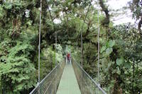
Sky Walk 4
Monteverde, Santa Elena vicinity, Costa Rica - Monteverde Cloud Forest
| Bridgemeister ID: | 7788 (added 2023-08-21) |
| Name: | Sky Walk 4 |
| Location: | Monteverde, Santa Elena vicinity, Costa Rica |
| Crossing: | Monteverde Cloud Forest |
| At or Near Feature: | Sky Adventures Monteverde Park |
| Coordinates: | 10.339206 N 84.808631 W |
| Maps: | Acme, GeoHack, Google, OpenStreetMap |
| Use: | Footbridge |
| Status: | In use (last checked: 2023) |
| Main Cables: | Wire (steel) |
| Suspended Spans: | 1 |
Notes:
- One of six suspension bridges along the treetop Sky Walk.
- Near (footbridge) - Monteverde, Santa Elena vicinity, Costa Rica.
- Near (footbridge) - Monteverde, Santa Elena vicinity, Costa Rica.
- Near Sky Walk 1 - Monteverde, Santa Elena vicinity, Costa Rica.
- Near Sky Walk 2 - Monteverde, Santa Elena vicinity, Costa Rica.
- Near Sky Walk 3 - Monteverde, Santa Elena vicinity, Costa Rica.
- Near Sky Walk 5 - Monteverde, Santa Elena vicinity, Costa Rica.
- Near Sky Walk 6 - Monteverde, Santa Elena vicinity, Costa Rica.
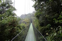
Sky Walk 5
Monteverde, Santa Elena vicinity, Costa Rica - Monteverde Cloud Forest
| Bridgemeister ID: | 7789 (added 2023-08-21) |
| Name: | Sky Walk 5 |
| Location: | Monteverde, Santa Elena vicinity, Costa Rica |
| Crossing: | Monteverde Cloud Forest |
| At or Near Feature: | Sky Adventures Monteverde Park |
| Coordinates: | 10.338204 N 84.808238 W |
| Maps: | Acme, GeoHack, Google, OpenStreetMap |
| Use: | Footbridge |
| Status: | In use (last checked: 2023) |
| Main Cables: | Wire (steel) |
| Suspended Spans: | 3 |
| Main Spans: | 3 |
Notes:
- One of six suspension bridges on the treetop Sky Walk. This is the largest of the group and the only multi-span bridge.
- Near (footbridge) - Monteverde, Santa Elena vicinity, Costa Rica.
- Near (footbridge) - Monteverde, Santa Elena vicinity, Costa Rica.
- Near Sky Walk 1 - Monteverde, Santa Elena vicinity, Costa Rica.
- Near Sky Walk 2 - Monteverde, Santa Elena vicinity, Costa Rica.
- Near Sky Walk 3 - Monteverde, Santa Elena vicinity, Costa Rica.
- Near Sky Walk 4 - Monteverde, Santa Elena vicinity, Costa Rica.
- Near Sky Walk 6 - Monteverde, Santa Elena vicinity, Costa Rica.
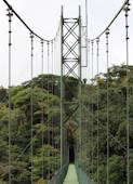
Sky Walk 6
Monteverde, Santa Elena vicinity, Costa Rica - Monteverde Cloud Forest
| Bridgemeister ID: | 7790 (added 2023-08-21) |
| Name: | Sky Walk 6 |
| Location: | Monteverde, Santa Elena vicinity, Costa Rica |
| Crossing: | Monteverde Cloud Forest |
| At or Near Feature: | Sky Adventures Monteverde Park |
| Coordinates: | 10.338119 N 84.808717 W |
| Maps: | Acme, GeoHack, Google, OpenStreetMap |
| Use: | Footbridge |
| Status: | In use (last checked: 2023) |
| Main Cables: | Wire (steel) |
| Suspended Spans: | 1 |
Notes:
- One of six suspension bridges on the treetop Sky Walk.
- Near (footbridge) - Monteverde, Santa Elena vicinity, Costa Rica.
- Near (footbridge) - Monteverde, Santa Elena vicinity, Costa Rica.
- Near Sky Walk 1 - Monteverde, Santa Elena vicinity, Costa Rica.
- Near Sky Walk 2 - Monteverde, Santa Elena vicinity, Costa Rica.
- Near Sky Walk 3 - Monteverde, Santa Elena vicinity, Costa Rica.
- Near Sky Walk 4 - Monteverde, Santa Elena vicinity, Costa Rica.
- Near Sky Walk 5 - Monteverde, Santa Elena vicinity, Costa Rica.
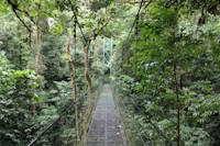
Swinging
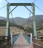
Browns Park National Wildlife Refuge vicinity, Colorado, USA - Green River
| Bridgemeister ID: | 1442 (added 2004-07-31) |
| Name: | Swinging |
| Location: | Browns Park National Wildlife Refuge vicinity, Colorado, USA |
| Crossing: | Green River |
| Coordinates: | 40.827833 N 109.030444 W |
| Maps: | Acme, GeoHack, Google, OpenStreetMap |
| Use: | Vehicular (one-lane) |
| Status: | In use (last checked: 2019) |
| Main Cables: | Wire (steel) |
| Suspended Spans: | 1 |
| Main Span: | 1 x 96.3 meters (316 feet) estimated |
Notes:
- June 2014: Damaged when a tractor, well over the posted weight limit, tried to cross and broke through the bridge deck. Reopened August 23, 2018 after an "extensive reconstruction" that completely replaced the deck and possibly cables. After reconstruction, the weight limit was increased from 3 tons to 20 tons.
- November 2009: Closed due to safety concerns after six cable strrands were found to be broken. Repaired June-August 2010 and reopened.

Tawi
Jammu, Jammu and Kashmir, India - Tawi River
| Bridgemeister ID: | 5914 (added 2021-05-23) |
| Name: | Tawi |
| Location: | Jammu, Jammu and Kashmir, India |
| Crossing: | Tawi River |
| Coordinates: | 32.720315 N 74.858353 E |
| Maps: | Acme, GeoHack, Google, OpenStreetMap |
| Use: | Vehicular |
| Status: | Removed |
| Suspended Spans: | 6 |
Notes:
- Coordinates are for present-day (2021) "Tawi Bridge" which is believed to be the approximate location of this multi-span suspension bridge. It had at least six suspended main spans, possibly more.
