Inventory Search Results (8,101-8,200 of 8,477)
Results : << < ... 7701-7800 7801-7900 7901-8000 8001-8100 8101-8200 8201-8300 8301-8400 8401-8477 > >> All
8,477 suspension bridges were found for search criteria: suspension .
Bridges 8,101 through 8,200 (of 8,477 total) appear below. Click the Bridgemeister ID number to isolate the bridge on its own page.
If you don't see what you were looking for, try an image search with the same criteria: suspension
Related:
Bridgemeister ID: 6306 (added 2021-07-23)Name: Shalfalam Location: Shalfalam (شلفلام), Khyber Pakhtunkhwa, Pakistan Crossing: Panjkora River Coordinates: 34.912479 N 71.997668 E Maps: Acme , GeoHack , Google , OpenStreetMap Use: Vehicular (one-lane) Status: In use (last checked: 2021) Main Cables: Wire (steel) Main Span: 1
Bridgemeister ID: 5316 (added 2020-11-11)Name: Shanag Also Known As: शनाग ब्रिज, Nehru Kund Location: Manali vicinity and Bashisht, Himachal Pradesh , India Crossing: Beas River Coordinates: 32.286250 N 77.178716 E Maps: Acme , GeoHack , Google , OpenStreetMap Use: Vehicular (one-lane) Status: In use (last checked: 2022) Main Cables: Wire Suspended Spans: 1
Bridgemeister ID: 5319 (added 2020-11-11)Name: Shangribagh Ramshilla Also Known As: शांगरीबाग रामशिला ब्रिज Location: Kais and Kullu, Himachal Pradesh , India Crossing: Beas River Coordinates: 31.970943 N 77.122063 E Maps: Acme , GeoHack , Google , OpenStreetMap Use: Vehicular (one-lane) Status: Restricted to foot traffic (last checked: 2020) Main Cables: Wire (steel) Suspended Spans: 1
Bridgemeister ID: 2774 (added 2019-06-30)Name: Shaolai Location: Guguan, Heping District, Taichung City, Taiwan Coordinates: 24.204339 N 121.006102 E Maps: Acme , GeoHack , Google , OpenStreetMap Use: Footbridge Status: In use (last checked: 2019) Main Cables: Wire (steel) Suspended Spans: 1
Bridgemeister ID: 8023 (added 2023-12-17)Name: Shapotou Location: Shapotou Village (沙坡头村), Zhongwei, Ningxia , China Crossing: Yellow River Coordinates: 37.458861 N 105.000194 E Maps: Acme , GeoHack , Google , OpenStreetMap Use: Footbridge Status: In use (last checked: 2022) Main Cables: Wire (steel) Suspended Spans: 3 Main Span: 1 x 206 meters (675.9 feet) estimated Side Spans: 2
Bridgemeister ID: 4544 (added 2020-05-23)Name: Sheep Location: Stanton Crossing vicinity, Idaho , USA Crossing: Big Wood River Coordinates: 43.329264 N 114.359692 W Maps: Acme , GeoHack , Google , OpenStreetMap Use: Stock and Footbridge Status: In use (last checked: 2019) Main Cables: Wire Suspended Spans: 1
Bridgemeister ID: 5272 (added 2020-11-07)Name: Sheetla Also Known As: Old Sheetla, Old Shitla, Sheetala, ओल्ड शीतला ब्रिज Location: Chamba, Himachal Pradesh , India Crossing: Ravi River Coordinates: 32.555161 N 76.120657 E Maps: Acme , GeoHack , Google , OpenStreetMap Use: Vehicular (one-lane) Status: Restricted to foot traffic (last checked: 2018) Main Cables: Wire Suspended Spans: 1
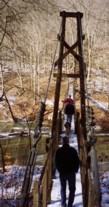
Bridgemeister ID: 1182 (added 2004-01-24)Name: Sheltowee Also Known As: Swinging Location: Red River Gorge Geologic Area, Kentucky , USA Crossing: Red River At or Near Feature: Sheltowee Trace Trail Coordinates: 37.82781 N 83.62427 W Maps: Acme , GeoHack , Google , OpenStreetMap Use: Footbridge Status: Destroyed, 2023 Main Cables: Wire (steel) Suspended Spans: 1
2023, March: Destroyed when a tree fell on it. May be rebuilt by mid-2023. Bridgemeister ID: 6785 (added 2021-10-29)Name: Sherqilla Location: Sherqilla, Gilgit-Baltistan, Pakistan Crossing: Gilgit River Coordinates: 36.089358 N 74.033298 E Maps: Acme , GeoHack , Google , OpenStreetMap Use: Vehicular (one-lane) Status: In use (last checked: 2018) Main Cables: Wire (steel) Suspended Spans: 1 Main Span: 1 x 118.9 meters (390 feet) estimated
Bridgemeister ID: 4870 (added 2020-07-12)Name: Shian Also Known As: しあん橋 Location: Iga, Mie , Japan Crossing: Kizu River Coordinates: 34.778750 N 136.086453 E Maps: Acme , GeoHack , Google , OpenStreetMap Use: Footbridge Status: In use (last checked: 2019) Main Cables: Wire (steel) Main Span: 1 x 118 meters (387.1 feet) estimated
Bridgemeister ID: 5163 (added 2020-09-07)Name: Shidakura Also Known As: しだくら橋 Location: Okutama, Tokyo , Japan Crossing: Tama River Coordinates: 35.792555 N 139.066852 E Maps: Acme , GeoHack , Google , OpenStreetMap Use: Footbridge Status: In use (last checked: 2019) Main Cables: Wire (steel) Suspended Spans: 1
Bridgemeister ID: 7510 (added 2023-01-08)Name: Shimizu Also Known As: 清水橋 Location: Hiraoka, Tenryu, Nagano , Japan Crossing: Toyama River Coordinates: 35.288629 N 137.861652 E Maps: Acme , GeoHack , Google , OpenStreetMap Use: Footbridge Status: In use (last checked: 2022) Main Cables: Wire (steel) Suspended Spans: 1 Main Span: 1
Bridgemeister ID: 6034 (added 2021-07-03)Name: Shimizu Also Known As: 清水橋 Location: Kimitsu, Chiba , Japan Coordinates: 35.207648 N 140.039139 E Maps: Acme , GeoHack , Google , OpenStreetMap Use: Footbridge Status: Closed (last checked: 2019) Main Cables: Wire (steel) Suspended Spans: 1
Bridgemeister ID: 6082 (added 2021-07-04)Name: Shindoji Also Known As: 新童子橋 Location: Fukuchiyama, Kyoto , Japan Crossing: Miyagawa River Coordinates: 35.452474 N 135.147998 E Maps: Acme , GeoHack , Google , OpenStreetMap Use: Footbridge Status: In use (last checked: 2021) Main Cables: Wire (steel) Suspended Spans: 1 Main Span: 1
Bridgemeister ID: 6956 (added 2022-02-19)Name: Shinodomari Also Known As: 新王泊橋 Location: Kitahiroshima, Hiroshima , Japan Crossing: Sensui Lake At or Near Feature: Odomari Dam (王泊ダム) Coordinates: 34.699721 N 132.312055 E Maps: Acme , GeoHack , Google , OpenStreetMap Use: Vehicular (one-lane) Status: In use (last checked: 2022) Main Cables: Wire (steel) Suspended Spans: 1 Main Span: 1 x 151 meters (495.4 feet) estimated
Bridgemeister ID: 5113 (added 2020-09-05)Name: Shiokaratanitsuri Also Known As: シオカラ谷吊り橋 Location: Kamikitayama, Nara , Japan Coordinates: 34.177976 N 136.090498 E Maps: Acme , GeoHack , Google , OpenStreetMap Use: Footbridge Status: In use (last checked: 2020) Main Cables: Wire (steel) Suspended Spans: 1
Bridgemeister ID: 2984 (added 2019-10-12)Name: Shiomi Location: Narada, Hayakawa, Minamikoma District, Yamanashi , Japan Crossing: Narada Lake Coordinates: 35.573039 N 138.300307 E Maps: Acme , GeoHack , Google , OpenStreetMap Use: Footbridge Status: In use (last checked: 2019) Main Cables: Wire (steel) Suspended Spans: 1
Bridgemeister ID: 5949 (added 2021-06-29)Name: Shirany Also Known As: Chirani Location: Bajo Aldea, Peru Crossing: Río Perené Coordinates: 10.861878 S 75.006248 W Maps: Acme , GeoHack , Google , OpenStreetMap Use: Vehicular (one-lane) Status: In use (last checked: 2014) Main Cables: Wire (steel) Suspended Spans: 1
Bridgemeister ID: 7927 (added 2023-10-22)Name: Shivapura Location: Kattige (ಕತ್ತಿಗೆ), Karnataka , India Crossing: Kali River At or Near Feature: Kodasalli Reservoir Coordinates: 14.983750 N 74.571250 E Maps: Acme , GeoHack , Google , OpenStreetMap Use: Footbridge Status: In use (last checked: 2023) Main Cables: Wire (steel) Main Span: 1 x 237 meters (777.6 feet) estimated
Bridgemeister ID: 1202 (added 2004-02-01)Name: Short Creek Location: Guntersville, Alabama , USA Crossing: Short Creek Use: Vehicular (one-lane) Status: Removed
Early 20th-century one-lane vehicular bridge, no longer in existence Bridgemeister ID: 2807 (added 2019-07-04)Name: Shuilian Location: Xinyi Township, Nantou County, Taiwan Coordinates: 23.657696 N 120.828568 E Maps: Acme , GeoHack , Google , OpenStreetMap Use: Footbridge Status: In use (last checked: 2017) Main Cables: Wire (steel) Suspended Spans: 1 Main Span: 1 x 100 meters (328.1 feet)
Bridgemeister ID: 3415 (added 2019-12-21)Name: Shuiyun Also Known As: 水雲吊橋 Location: Tai'an Township, Miaoli County, Taiwan Coordinates: 24.471388 N 120.986844 E Maps: Acme , GeoHack , Google , OpenStreetMap Use: Footbridge Status: In use (last checked: 2017) Main Cables: Wire (steel)
The newer of the two side-by-side suspension bridges at Sibilong. Built at some point in the 2013-2016 time frame. 2021: Replacement under construction. Next to Sibilong - Sibilong, Manipur, India . Bridgemeister ID: 5350 (added 2020-11-15)Name: Siegue Location: Corçà, Lleida, Catalonia, Spain Crossing: Canelles Reservoir At or Near Feature: Pasarelas de Montfalcó Coordinates: 42.068133 N 0.673781 E Maps: Acme , GeoHack , Google , OpenStreetMap Use: Footbridge Status: In use (last checked: 2020) Main Cables: Wire (steel) Suspended Spans: 1
Bridgemeister ID: 2789 (added 2019-06-30)Name: Siguangtan Also Known As: 四廣潭吊橋 Location: Pingxi District, New Taipei City, Taiwan Crossing: Keelung River At or Near Feature: Shifen Falls Walk Coordinates: 25.047497 N 121.783502 E Maps: Acme , GeoHack , Google , OpenStreetMap Use: Footbridge Status: In use (last checked: 2019) Main Cables: Wire (steel) Suspended Spans: 1
Still in use (2020), but bypassed by a large box girder bridge. Bridgemeister ID: 7036 (added 2022-05-21)Name: Siju Location: Siju Rongkenggittim, South Garo Hills and Siju Dobakolgittim, Meghalaya , India Crossing: Simsang River At or Near Feature: Siju Caves Coordinates: 25.353555 N 90.687983 E Maps: Acme , GeoHack , Google , OpenStreetMap Use: Footbridge Status: In use (last checked: 2022) Main Cables: Wire (steel) Main Span: 1
Bridgemeister ID: 6315 (added 2021-07-24)Name: Silbu Location: Silbu, Gilgit-Baltistan, Pakistan Crossing: Indus River Coordinates: 35.633565 N 74.957119 E Maps: Acme , GeoHack , Google , OpenStreetMap Use: Vehicular (one-lane) Status: Extant (last checked: 2021) Main Cables: Wire Suspended Spans: 1
Bridgemeister ID: 6316 (added 2021-07-24)Name: Silbu Location: Silbu, Gilgit-Baltistan, Pakistan Crossing: Indus River Coordinates: 35.632783 N 74.962705 E Maps: Acme , GeoHack , Google , OpenStreetMap Use: Vehicular (one-lane) Status: Extant (last checked: 2021) Main Cables: Wire (steel) Suspended Spans: 1
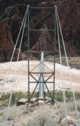
Bridgemeister ID: 351 (added before 2003)Name: Silver Location: Bright Angel Campground vicinity, Arizona , USA Crossing: Colorado River At or Near Feature: Grand Canyon National Park Coordinates: 36.09745 N 112.09550 W Maps: Acme , GeoHack , Google , OpenStreetMap Use: Footbridge and Pipeline Status: In use (last checked: 2020) Main Cables: Wire (steel) Suspended Spans: 1 Main Span: 1 x 149.4 meters (490 feet)
Bridgemeister ID: 6784 (added 2021-10-29)Name: Singal Nala Location: Singal, Gilgit-Baltistan, Pakistan Crossing: Singal Gah Coordinates: 36.111192 N 73.885661 E Maps: Acme , GeoHack , Google , OpenStreetMap Use: Vehicular (one-lane) Status: In use (last checked: 2021) Main Cables: Wire Suspended Spans: 1 Main Span: 1 x 96.6 meters (317 feet) estimated
Bridgemeister ID: 3861 (added 2020-03-07)Name: Singsås Location: Singsås, Midtre Gauldal, Trøndelag, Norway Crossing: Gaula Coordinates: 62.954830 N 10.730960 E Maps: Acme , GeoHack , Google , kart.1881.no , OpenStreetMap Use: Vehicular (one-lane) Status: Removed Main Cables: Wire Suspended Spans: 1 Main Span: 1 x 63 meters (206.7 feet) estimated
Bridgemeister ID: 3862 (added 2020-03-07)Name: Singsås Location: Singsås, Midtre Gauldal, Trøndelag, Norway Crossing: Gaula Coordinates: 62.95499 N 10.72968 E Maps: Acme , GeoHack , Google , kart.1881.no , OpenStreetMap Use: Vehicular (one-lane) Status: Removed Suspended Spans: 1 Main Span: 1 x 75 meters (246.1 feet) estimated
Bridgemeister ID: 2720 (added 2019-06-22)Name: Singshore Location: Uttarey, Sikkim , India Coordinates: 27.260882 N 88.112271 E Maps: Acme , GeoHack , Google , OpenStreetMap Use: Vehicular (one-lane) Status: In use (last checked: 2019) Main Cables: Wire (steel) Suspended Spans: 1 Main Span: 1 x 240 meters (787.4 feet)
Bridgemeister ID: 8156 (added 2024-02-03)Name: Sinwa Location: Sinwa, Limkhim (लिमखिम) and Sawadin (सवादिन), Nepal Crossing: Tamor River Coordinates: 27.441229 N 87.700855 E Maps: Acme , GeoHack , Google , OpenStreetMap Use: Footbridge Status: Extant Main Span: 1 x 10⁸ meters (354.3 feet)
Bridgemeister ID: 8157 (added 2024-02-03)Name: Sinwa Location: Sinwa, Limkhim (लिमखिम) and Sawadin (सवादिन), Nepal Crossing: Tamor River Use: Footbridge Status: Removed Main Span: 1 x 83 meters (272.3 feet)
Scribd - Standard Trail Suspended and Suspension Bridges . Maintenance report dated February 27, 1977 mentioning a suspension bridge over the Tamor River near Sinwa: "Actual condition of the bridge: This bridge is in a very dangerous condition. The tower (masonry tower) is partly broken. Also the planking is in a very bad condition. The best way to maintain this bridge is to build a new bridge."Bridgemeister ID: 649 (added 2003-02-17)Name: Sister Island Location: Niagara Falls, New York , USA Crossing: Niagara River At or Near Feature: Three Sister Islands References: HBE Use: Footbridge Status: Removed Main Cables: Wire Suspended Spans: 1
Bridgemeister ID: 2822 (added 2019-07-04)Name: Siyuan Also Known As: 思源吊橋, Siyuandiao Location: Ren'ai Township, Nantou County, Taiwan Coordinates: 23.916838 N 121.055186 E Maps: Acme , GeoHack , Google , OpenStreetMap Use: Footbridge Status: In use (last checked: 2016) Main Cables: Wire (steel) Suspended Spans: 1
Bridgemeister ID: 3755 (added 2020-02-29)Name: Sjønstå Gård Location: Sjønstå, Fauske, Nordland, Norway Crossing: Sjønståelva Coordinates: 67.20575 N 15.71460 E Maps: Acme , GeoHack , Google , kart.1881.no , OpenStreetMap Use: Footbridge Status: In use (last checked: 2019) Main Cables: Wire (steel) Suspended Spans: 1 Main Span: 1 x 53 meters (173.9 feet) estimated
Bridgemeister ID: 3918 (added 2020-03-20)Name: Sjulhusbrua Location: Alvdal, Innlandet, Norway Crossing: Glomma Coordinates: 62.09653 N 10.64445 E Maps: Acme , GeoHack , Google , kart.1881.no , OpenStreetMap Use: Vehicular (one-lane) Status: Removed Main Cables: Wire (steel) Suspended Spans: 1 Main Span: 1 x 82.5 meters (270.7 feet) estimated
Based on historic aerial images, removed after 1969 and before 1980. Bridgemeister ID: 4484 (added 2020-04-26)Name: Skårabrui Location: Teigen vicinity, Årdal, Vestland, Norway Crossing: Utla Coordinates: 61.347986 N 7.879549 E Maps: Acme , GeoHack , Google , kart.1881.no , OpenStreetMap Use: Vehicular (one-lane) Status: Closed (last checked: 2019) Main Cables: Wire Suspended Spans: 1 Main Span: 1 x 21.5 meters (70.5 feet) estimated
Based on historical aerial imagery, removed at some point 1961-2004. Bridgemeister ID: 8544 (added 2024-03-31)Name: Sky Walk Location: Scheidegg, Germany Coordinates: 47.564500 N 9.826806 E Maps: Acme , GeoHack , Google , OpenStreetMap Use: Footbridge Status: In use (last checked: 2023) Main Cables: Wire (steel) Suspended Spans: 13 Main Spans: 13
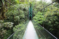
Treetop walkway attraction with thirteen connected suspension spans and two cable-stayed spans. Completed at some point in the 2010-2012 time frame. Bridgemeister ID: 1118 (added 2004-01-06)Name: Sky Walk 1 Location: Monteverde, Santa Elena vicinity, Costa Rica Crossing: Monteverde Cloud Forest At or Near Feature: Sky Adventures Monteverde Park Coordinates: 10.336227 N 84.808606 W Maps: Acme , GeoHack , Google , OpenStreetMap Use: Footbridge Status: In use (last checked: 2023) Main Cables: Wire (steel) Suspended Spans: 1
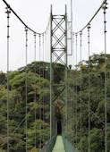
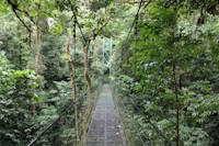
One of six suspension bridges on the treetop Sky Walk. Near (footbridge) - Monteverde, Santa Elena vicinity, Costa Rica . Near (footbridge) - Monteverde, Santa Elena vicinity, Costa Rica . Near Sky Walk 2 - Monteverde, Santa Elena vicinity, Costa Rica . Near Sky Walk 3 - Monteverde, Santa Elena vicinity, Costa Rica . Near Sky Walk 4 - Monteverde, Santa Elena vicinity, Costa Rica . Near Sky Walk 5 - Monteverde, Santa Elena vicinity, Costa Rica . Near Sky Walk 6 - Monteverde, Santa Elena vicinity, Costa Rica . Bridgemeister ID: 7786 (added 2023-08-21)Name: Sky Walk 2 Location: Monteverde, Santa Elena vicinity, Costa Rica Crossing: Monteverde Cloud Forest At or Near Feature: Sky Adventures Monteverde Park Coordinates: 10.336986 N 84.805990 W Maps: Acme , GeoHack , Google , OpenStreetMap Use: Footbridge Status: In use (last checked: 2023) Main Cables: Wire (steel) Suspended Spans: 1
One of six suspension bridges along the treetop Sky Walk. Near (footbridge) - Monteverde, Santa Elena vicinity, Costa Rica . Near (footbridge) - Monteverde, Santa Elena vicinity, Costa Rica . Near Sky Walk 1 - Monteverde, Santa Elena vicinity, Costa Rica . Near Sky Walk 3 - Monteverde, Santa Elena vicinity, Costa Rica . Near Sky Walk 4 - Monteverde, Santa Elena vicinity, Costa Rica . Near Sky Walk 5 - Monteverde, Santa Elena vicinity, Costa Rica . Near Sky Walk 6 - Monteverde, Santa Elena vicinity, Costa Rica . Bridgemeister ID: 7787 (added 2023-08-21)Name: Sky Walk 3 Location: Monteverde, Santa Elena vicinity, Costa Rica Crossing: Monteverde Cloud Forest At or Near Feature: Sky Adventures Monteverde Park Coordinates: 10.339592 N 84.807801 W Maps: Acme , GeoHack , Google , OpenStreetMap Use: Footbridge Status: In use (last checked: 2023) Main Cables: Wire (steel) Suspended Spans: 1
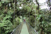
One of six suspension bridges along the treetop Sky Walk. Near (footbridge) - Monteverde, Santa Elena vicinity, Costa Rica . Near (footbridge) - Monteverde, Santa Elena vicinity, Costa Rica . Near Sky Walk 1 - Monteverde, Santa Elena vicinity, Costa Rica . Near Sky Walk 2 - Monteverde, Santa Elena vicinity, Costa Rica . Near Sky Walk 4 - Monteverde, Santa Elena vicinity, Costa Rica . Near Sky Walk 5 - Monteverde, Santa Elena vicinity, Costa Rica . Near Sky Walk 6 - Monteverde, Santa Elena vicinity, Costa Rica . Bridgemeister ID: 7788 (added 2023-08-21)Name: Sky Walk 4 Location: Monteverde, Santa Elena vicinity, Costa Rica Crossing: Monteverde Cloud Forest At or Near Feature: Sky Adventures Monteverde Park Coordinates: 10.339206 N 84.808631 W Maps: Acme , GeoHack , Google , OpenStreetMap Use: Footbridge Status: In use (last checked: 2023) Main Cables: Wire (steel) Suspended Spans: 1
One of six suspension bridges along the treetop Sky Walk. Near (footbridge) - Monteverde, Santa Elena vicinity, Costa Rica . Near (footbridge) - Monteverde, Santa Elena vicinity, Costa Rica . Near Sky Walk 1 - Monteverde, Santa Elena vicinity, Costa Rica . Near Sky Walk 2 - Monteverde, Santa Elena vicinity, Costa Rica . Near Sky Walk 3 - Monteverde, Santa Elena vicinity, Costa Rica . Near Sky Walk 5 - Monteverde, Santa Elena vicinity, Costa Rica . Near Sky Walk 6 - Monteverde, Santa Elena vicinity, Costa Rica . Bridgemeister ID: 7789 (added 2023-08-21)Name: Sky Walk 5 Location: Monteverde, Santa Elena vicinity, Costa Rica Crossing: Monteverde Cloud Forest At or Near Feature: Sky Adventures Monteverde Park Coordinates: 10.338204 N 84.808238 W Maps: Acme , GeoHack , Google , OpenStreetMap Use: Footbridge Status: In use (last checked: 2023) Main Cables: Wire (steel) Suspended Spans: 3 Main Spans: 3
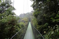
One of six suspension bridges on the treetop Sky Walk. This is the largest of the group and the only multi-span bridge. Near (footbridge) - Monteverde, Santa Elena vicinity, Costa Rica . Near (footbridge) - Monteverde, Santa Elena vicinity, Costa Rica . Near Sky Walk 1 - Monteverde, Santa Elena vicinity, Costa Rica . Near Sky Walk 2 - Monteverde, Santa Elena vicinity, Costa Rica . Near Sky Walk 3 - Monteverde, Santa Elena vicinity, Costa Rica . Near Sky Walk 4 - Monteverde, Santa Elena vicinity, Costa Rica . Near Sky Walk 6 - Monteverde, Santa Elena vicinity, Costa Rica . Bridgemeister ID: 7790 (added 2023-08-21)Name: Sky Walk 6 Location: Monteverde, Santa Elena vicinity, Costa Rica Crossing: Monteverde Cloud Forest At or Near Feature: Sky Adventures Monteverde Park Coordinates: 10.338119 N 84.808717 W Maps: Acme , GeoHack , Google , OpenStreetMap Use: Footbridge Status: In use (last checked: 2023) Main Cables: Wire (steel) Suspended Spans: 1
One of six suspension bridges on the treetop Sky Walk. Near (footbridge) - Monteverde, Santa Elena vicinity, Costa Rica . Near (footbridge) - Monteverde, Santa Elena vicinity, Costa Rica . Near Sky Walk 1 - Monteverde, Santa Elena vicinity, Costa Rica . Near Sky Walk 2 - Monteverde, Santa Elena vicinity, Costa Rica . Near Sky Walk 3 - Monteverde, Santa Elena vicinity, Costa Rica . Near Sky Walk 4 - Monteverde, Santa Elena vicinity, Costa Rica . Near Sky Walk 5 - Monteverde, Santa Elena vicinity, Costa Rica . Bridgemeister ID: 4022 (added 2020-03-28)Name: Slawe Location: Slawe, Gondang District, Mojokerto Regency, East Java , Indonesia Coordinates: 7.636569 S 112.510955 E Maps: Acme , GeoHack , Google , OpenStreetMap Use: Footbridge Status: In use (last checked: 2020) Main Cables: Wire (steel)
Bridgemeister ID: 4318 (added 2020-04-10)Name: Slogedalsbrua Location: Håbbesland, Birkenes, Agder, Norway Crossing: Tovdalselva Coordinates: 58.349402 N 8.241430 E Maps: Acme , GeoHack , Google , kart.1881.no , OpenStreetMap Use: Footbridge Status: Closed, 2017 Main Cables: Wire (steel) Suspended Spans: 1 Main Span: 1 x 69 meters (226.4 feet) estimated
Restored 2005. Damaged by flood 2017. Plans underway to restore Spring 2020. Bridgemeister ID: 3985 (added 2020-03-22)Name: Sofutanitsuri Location: Shokawacho Ushimaru, Takayama, Gifu , Japan Crossing: Shō River Coordinates: 36.052426 N 136.943336 E Maps: Acme , GeoHack , Google , OpenStreetMap Status: Closed (last checked: 2019) Main Cables: Wire (steel) Suspended Spans: 1
Bridgemeister ID: 7236 (added 2022-07-16)Name: Sogamoso Location: Girón and Betulia, Santander, Colombia Crossing: Rio Sogamoo Coordinates: 7.105687 N 73.416158 W Maps: Acme , GeoHack , Google , OpenStreetMap Use: Vehicular Status: Extant (last checked: 2021) Main Cables: Wire (steel) Main Span: 1 x 120 meters (393.7 feet) estimated
Bridgemeister ID: 5154 (added 2020-09-07)Name: Somanoko Also Known As: 杣の小橋 Location: Ome, Tokyo , Japan Crossing: Tama River Coordinates: 35.799926 N 139.178124 E Maps: Acme , GeoHack , Google , OpenStreetMap Use: Footbridge Status: In use (last checked: 2020) Main Cables: Wire (steel) Suspended Spans: 1
Bridgemeister ID: 5706 (added 2021-04-02)Name: Songdo Yonggung Also Known As: 송도 용궁구름다리 Location: Amnam-dong, Seo-gu, Busan, South Korea Coordinates: 35.061998 N 129.022241 E Maps: Acme , GeoHack , Google , OpenStreetMap Use: Footbridge Status: In use (last checked: 2021) Main Cables: Wire (steel) Main Span: 1
Bridgemeister ID: 1346 (added 2004-05-08)Name: Sorthfork River Ranch Location: Southfork River Ranch, Idaho , USA Crossing: South Fork Clearwater River Coordinates: 46.01567 N 115.96030 W Maps: Acme , GeoHack , Google , OpenStreetMap Use: Vehicular (one-lane) Status: In use (last checked: 2003) Main Cables: Wire (steel) Suspended Spans: 1 Main Span: 1 x 45.7 meters (150 feet) estimated
Bridgemeister ID: 1997 (added 2005-12-25)Name: South Fork Trinity River Trail Location: Forest Glen vicinity, California , USA Crossing: South Fork Trinity River At or Near Feature: Trinity National Forest Coordinates: 40.361383 N 123.306617 W Maps: Acme , GeoHack , Google , OpenStreetMap Use: Footbridge Status: In use (last checked: 2005) Main Cables: Wire (steel) Suspended Spans: 1 Main Span: 1 x 39.6 meters (130 feet) estimated
Bridgemeister ID: 3072 (added 2019-10-26)Name: Southern Discoveries Location: Arrowtown, New Zealand Crossing: Arrow River At or Near Feature: Queenstown Trail - Arrow River Bridges Ride Coordinates: 44.968425 S 168.855546 E Maps: Acme , GeoHack , Google , OpenStreetMap Use: Footbridge Status: In use (last checked: 2019) Main Cables: Wire (steel) Suspended Spans: 1
Located off of Front Street. Heavily damaged by November, 2003 floods. Bridgemeister ID: 7524 (added 2023-01-14)Name: Sozukyoonsennotsuri Also Known As: 雙津峡温泉の吊橋 Location: Iwakuni, Yamaguchi , Japan Crossing: Usa River Coordinates: 34.313748 N 131.987646 E Maps: Acme , GeoHack , Google , OpenStreetMap Use: Vehicular (one-lane) Status: In use (last checked: 2021) Main Cables: Wire (steel) Suspended Spans: 1 Main Span: 1 x 39 meters (128 feet) estimated
Bridgemeister ID: 4569 (added 2020-06-02)Name: Speybrug Location: Lievegem, Gent vicinity, East Flanders, Belgium Crossing: Ringvaart Coordinates: 51.085412 N 3.658703 E Maps: Acme , GeoHack , Google , OpenStreetMap Use: Vehicular (two-lane) Status: In use (last checked: 2019) Main Cables: Wire (steel) Suspended Spans: 1 Main Span: 1 x 54.5 meters (178.8 feet) estimated
Bridgemeister ID: 1410 (added 2004-07-04)Name: Split Creek Pack Location: Lowell vicinity, Idaho , USA Crossing: Lochsa River Coordinates: 46.2307 N 115.416733 W Maps: Acme , GeoHack , Google , OpenStreetMap Use: Pack Status: In use (last checked: 2007) Main Cables: Wire (steel) Suspended Spans: 1 Main Span: 1 x 45.7 meters (150 feet) estimated
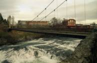
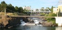
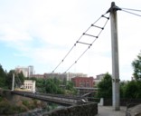
Bridgemeister ID: 354 (added before 2003)Name: Spokane Falls I Location: Spokane, Washington , USA Crossing: Spokane River Coordinates: 47.66276 N 117.42269 W Maps: Acme , GeoHack , Google , OpenStreetMap Use: Footbridge Status: In use (last checked: 2024) Main Cables: Wire (steel) Suspended Spans: 1 Main Span: 1 x 68.9 meters (226 feet) estimated
This entry refers to the southernmost of the two footbridges at this location. 2022, March 30: Reopened, but in need of further repairs. Unclear if it was closed because its companion bridge was also closed for repairs or for other safety reasons. 2023, May: Closed for extensive repairs. 2024, March: Reopened upon complation of repairs. Connects to Spokane Falls II - Spokane, Washington, USA . Bridgemeister ID: 355 (added before 2003)Name: Spokane Falls II Location: Spokane, Washington , USA Crossing: Spokane River Coordinates: 47.66374 N 117.42298 W Maps: Acme , GeoHack , Google , OpenStreetMap Use: Footbridge Status: In use (last checked: 2022) Main Cables: Wire (steel) Suspended Spans: 1 Main Span: 1 x 90.2 meters (296 feet) estimated
This entry refers to the northernmost of the two footbridges at this location. 2019, April: Closed awaiting deck repairs. 2022, March 30: Reopened following completion of repairs including deck replacement. Connects to Spokane Falls I - Spokane, Washington, USA . Bridgemeister ID: 2353 (added 2007-08-19)Name: Spring Also Known As: Hanging Location: Blanchisseuse, Trinidad and Tobago Crossing: Marianne River Use: Vehicular (one-lane) Status: In use (last checked: 2007) Main Cables: Wire Suspended Spans: 1
Bridgemeister ID: 3760 (added 2020-02-29)Name: Stabbursdalen Location: Bævkopp, Porsanger, Lakselv vicinity, Troms og Finnmark, Norway Crossing: Stabburselva Coordinates: 70.17401 N 24.86980 E Maps: Acme , GeoHack , Google , kart.1881.no , OpenStreetMap Use: Footbridge Status: In use (last checked: 2019) Main Cables: Wire (steel) Suspended Spans: 1 Main Span: 1 x 70 meters (229.7 feet) estimated
Temporary suspension bridge erected some time after the destruction of the historic Stari Most arch in November 1993. Was in existence in 1997. Removed late 1990s or early 2000s. A different cable-stayed replacement was erected at some point during (or prior to) the arch reconstruction started in 2001. That temporary cable-stayed structure was different than this true suspension bridge. Bridgemeister ID: 4490 (added 2020-04-30)Name: Storablåfjell Location: Hjelmeland, Rogaland, Norway Coordinates: 59.351075 N 6.753190 E Maps: Acme , GeoHack , Google , kart.1881.no , OpenStreetMap Use: Footbridge Status: In use (last checked: 2019) Main Cables: Wire (steel) Suspended Spans: 1 Main Span: 1 x 20.5 meters (67.3 feet) estimated
Bridgemeister ID: 3849 (added 2020-03-07)Name: Storeng Location: Kvikne, Innlandet, Norway Crossing: Orkla Coordinates: 62.622040 N 10.248190 E Maps: Acme , GeoHack , Google , kart.1881.no , OpenStreetMap Use: Vehicular (one-lane) Status: Removed Main Cables: Wire Suspended Spans: 1 Main Span: 1 x 46.5 meters (152.6 feet) estimated
Bridgemeister ID: 3455 (added 2019-12-22)Name: Storms River Location: Tsitsikamma National Park, Pretoria, South Africa Crossing: Storms River Coordinates: 34.019532 S 23.903529 E Maps: Acme , GeoHack , Google , OpenStreetMap Use: Footbridge Status: In use (last checked: 2019) Main Cables: Wire (steel) Suspended Spans: 1
Bridgemeister ID: 3456 (added 2019-12-22)Name: Storms River Location: Tsitsikamma National Park, Pretoria, South Africa Crossing: Storms River Coordinates: 34.019545 S 23.902928 E Maps: Acme , GeoHack , Google , OpenStreetMap Use: Footbridge Status: In use (last checked: 2019) Main Cables: Wire (steel) Suspended Spans: 1
Bridgemeister ID: 3457 (added 2019-12-22)Name: Storms River Location: Tsitsikamma National Park, Pretoria, South Africa Crossing: Storms River Coordinates: 34.019803 S 23.902611 E Maps: Acme , GeoHack , Google , OpenStreetMap Use: Footbridge Status: In use (last checked: 2019) Main Cables: Wire (steel) Suspended Spans: 1
Bridgemeister ID: 3948 (added 2020-03-21)Name: Strømbu Rasteplass Location: Folldal, Innlandet, Norway Crossing: Atna Coordinates: 61.92238 N 10.05187 E Maps: Acme , GeoHack , Google , kart.1881.no , OpenStreetMap Use: Footbridge Status: In use (last checked: 2019) Main Cables: Wire (steel) Suspended Spans: 1 Main Span: 1 x 26 meters (85.3 feet) estimated
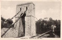
Based on historic aerial images, completed between 1978 and 2004. Bridgemeister ID: 7566 (added 2023-04-08)Name: Streghe Also Known As: Witches Location: Marzabotto, Bologna, Italy Crossing: Reno River Coordinates: 44.344316 N 11.208215 E Maps: Acme , GeoHack , Google , OpenStreetMap Use: Footbridge Status: In use (last checked: 2022) Main Cables: Wire (steel) Main Span: 1 x 94 meters (308.4 feet) estimated
Coordinates provided reflect the approximate location of the bridge. A detailed interpretive sign located 40 meters south of the coordinates appears to explain the location of the former suspension bridge in detail but I haven't been able to find a clear image of the text. Bridgemeister ID: 8111 (added 2024-01-06)Name: Suhovo Rope Location: Suhovo (Сухово) and Snezhinka (Снежинка), Kardzhali, Bulgaria Crossing: Kardzhali Reservoir Coordinates: 41.661938 N 25.265297 E Maps: Acme , GeoHack , Google , OpenStreetMap Use: Footbridge Status: In use Main Cables: Wire (steel) Suspended Spans: 1 Main Span: 1 x 184.7 meters (606 feet) estimated
Bridgemeister ID: 6046 (added 2021-07-03)Name: Suiha Also Known As: 翠波橋 Location: Shikokuchuo, Ehime , Japan Crossing: Dōzan River Coordinates: 33.935751 N 133.550722 E Maps: Acme , GeoHack , Google , OpenStreetMap Status: In use (last checked: 2020) Main Cables: Wire (steel) Suspended Spans: 1 Main Span: 1 x 130.5 meters (428.1 feet) estimated
Bridgemeister ID: 7434 (added 2022-12-10)Name: Sujupalbong Also Known As: 수주팔봉 구름다리 Location: Chungju-si, Chungcheongbuk-do, South Korea At or Near Feature: Sujupalbong Peaks 수주팔봉(水周八峰) Coordinates: 36.898282 N 127.924571 E Maps: Acme , GeoHack , Google , OpenStreetMap Use: Footbridge Status: In use (last checked: 2022) Main Cables: Wire (iron) Suspended Spans: 1
Bridgemeister ID: 8456 (added 2024-03-16)Name: Sundar Nagar Location: Mahakali (Dodhara Chandani, दोधारा-चाँदनी नगरपालिका), Kanchanpur, Nepal Crossing: Jogbuda River Coordinates: 28.841737 N 80.069208 E Maps: Acme , GeoHack , Google , OpenStreetMap Use: Footbridge Status: Extant (last checked: 2024) Main Span: 1 x 168.8 meters (553.8 feet)
Completed at some point in 2016 or early 2017. Mail | Facebook | Twitter
