Suspension Bridges of Iowa
This is a list of all 28 bridges from the suspension bridge inventory for Iowa in USA. Wherever you see a Bridgemeister ID number click it to isolate the bridge on its own page.
Related Lists:
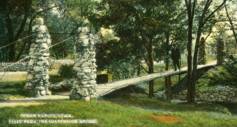
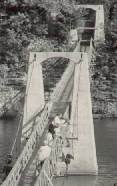
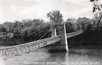
1897: Swinging
Iowa Falls, Iowa, USA - Iowa River
| Bridgemeister ID: | 106 (added before 2003) |
| Year Completed: | 1897 |
| Name: | Swinging |
| Location: | Iowa Falls, Iowa, USA |
| Crossing: | Iowa River |
| At or Near Feature: | Assembly Park |
| Coordinates: | 42.5215 N 93.2708 W |
| Maps: | Acme, GeoHack, Google, OpenStreetMap |
| Principals: | Commodore C.C. Bartlett, J.M. Eddy |
| Use: | Footbridge |
| Status: | In use (last checked: 2006) |
| Main Cables: | Wire |
| Suspended Spans: | 2 |
| Main Span: | 1 x 39 meters (128 feet) estimated |
| Side Span: | 1 x 20.7 meters (68 feet) estimated |
Notes:
- According to plaque at bridge, rebuilt 1909, 1925, 1956, 1989.
External Links:
Image Sets:
1906: Swinging
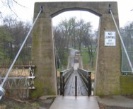
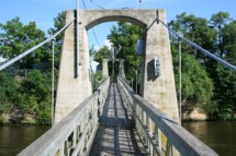
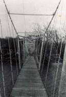
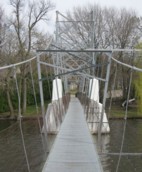
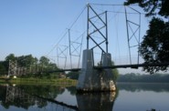
Charles City, Iowa, USA - Cedar River
| Bridgemeister ID: | 118 (added before 2003) |
| Year Completed: | 1906 |
| Name: | Swinging |
| Also Known As: | Charles City, Clark Street |
| Location: | Charles City, Iowa, USA |
| Crossing: | Cedar River |
| Coordinates: | 43.070433 N 92.685517 W |
| Maps: | Acme, GeoHack, Google, OpenStreetMap |
| Principals: | Charles Hart, O.B. Zimmerman |
| Use: | Footbridge |
| Status: | Destroyed, June 8, 2008 |
| Main Cables: | Wire |
| Suspended Spans: | 3 |
| Main Span: | 1 x 90.8 meters (298 feet) estimated |
| Side Spans: | 1 x 41.5 meters (136 feet) estimated, 1 x 9.1 meters (30 feet) estimated |
Notes:
- Bids accepted for refurbishment, expected to be completed October, 2007.
- Destroyed by floodwaters June 8, 2008.
External Links:
Image Sets:
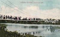
1932: Prairie du Chien
Praire du Chien, Wisconsin and Marquette, Iowa, USA - Mississippi River
| Bridgemeister ID: | 177 (added before 2003) |
| Year Completed: | 1932 |
| Name: | Prairie du Chien |
| Location: | Praire du Chien, Wisconsin and Marquette, Iowa, USA |
| Crossing: | Mississippi River |
| Coordinates: | 43.046 N 91.17 W |
| Maps: | Acme, GeoHack, Google, OpenStreetMap |
| Principals: | Austin Bridge Co. |
| References: | AAJ, AUB, BPL |
| Use: | Vehicular (two-lane) |
| Status: | Removed, 1974 |
| Main Cables: | Wire (steel) |
| Main Span: | 1 x 144.2 meters (473 feet) |
Notes:
- There were two back-to-back suspension bridges at this location.
- Connects to 1932 Prairie du Chien - Praire du Chien, Wisconsin and Marquette, Iowa, USA.
- All past and present bridges at this location.
External Links:
Image Sets:
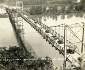
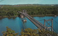
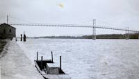
1932: Prairie du Chien
Praire du Chien, Wisconsin and Marquette, Iowa, USA - Mississippi River
| Bridgemeister ID: | 1256 (added before 2003) |
| Year Completed: | 1932 |
| Name: | Prairie du Chien |
| Location: | Praire du Chien, Wisconsin and Marquette, Iowa, USA |
| Crossing: | Mississippi River |
| Coordinates: | 43.05 N 91.162 W |
| Maps: | Acme, GeoHack, Google, OpenStreetMap |
| Principals: | Austin Bridge Co. |
| References: | AAJ, AUB, BPL |
| Use: | Vehicular (two-lane) |
| Status: | Removed, 1974 |
| Main Cables: | Wire (steel) |
| Main Span: | 1 x 144.2 meters (473 feet) |
Notes:
- There were two back-to-back suspension bridges at this location.
- Connects to 1932 Prairie du Chien - Praire du Chien, Wisconsin and Marquette, Iowa, USA.
- All past and present bridges at this location.
External Links:
Image Sets:


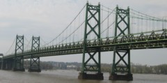
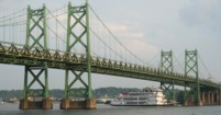
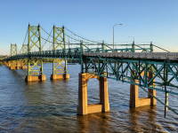
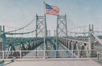
1935: Iowa-Illinois Memorial
Bettendorf, Iowa and Moline, Illinois, USA - Mississippi River
| Bridgemeister ID: | 180 (added before 2003) |
| Year Completed: | 1935 |
| Name: | Iowa-Illinois Memorial |
| Also Known As: | Interstate 74 Bridge, I-74 Bridge |
| Location: | Bettendorf, Iowa and Moline, Illinois, USA |
| Crossing: | Mississippi River |
| Coordinates: | 41.520264 N 90.513034 W |
| Maps: | Acme, GeoHack, Google, OpenStreetMap |
| Principals: | Modjeski, Masters, and Chase |
| References: | AAJ, CMR |
| Use: | Vehicular, with walkway |
| Status: | Demolished, 2024 |
| Main Cables: | Wire (steel) |
| Suspended Spans: | 3 |
| Main Span: | 1 x 225.6 meters (740 feet) |
| Side Spans: | 2 x 112.8 meters (370 feet) |
| Deck width: | 24.2 feet |
Notes:
- 2017, June 26: Groundbreaking ceremony for a replacement bridge for the twin Iowa-Illinois Memorial bridges. The new bridge is expected to be completed in 2020.
- 2020, November: Replacement span opens (for Iowa-bound traffic previously carried across the older of the two suspension bridges). Suspension bridge expected to be demolished in 2022.
- 2023: Demolition expected to be completed in 2024.
- 2024: Demolition of both bridges is complete.
- Next to 1960 Iowa-Illinois Memorial (Interstate 74 Bridge, I-74 Bridge) - Bettendorf, Iowa and Moline, Illinois, USA.
- All past and present bridges at this location.
External Links:
Image Sets:
1936: Swinging
Story City, Iowa, USA - Skunk River
| Bridgemeister ID: | 1181 (added 2004-01-24) |
| Year Completed: | 1936 |
| Name: | Swinging |
| Location: | Story City, Iowa, USA |
| Crossing: | Skunk River |
| At or Near Feature: | South Park |
| Coordinates: | 42.186517 N 93.586683 W |
| Maps: | Acme, GeoHack, Google, OpenStreetMap |
| Principals: | WPA |
| Use: | Footbridge |
| Status: | Closed, 2019 (last checked: 2019) |
| Main Cables: | Wire (steel) |
| Suspended Spans: | 1 |
| Main Span: | 1 x 21.6 meters (71 feet) estimated |
Notes:
- Damaged by flood, early 2019. Repairs underway October, 2019, expected to reopen soon.
External Links:
Image Sets:

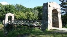
1938: Veenker Golf Course
Ames, Iowa, USA - Ioway Creek
| Bridgemeister ID: | 2690 (added 2019-05-27) |
| Year Completed: | 1938 |
| Name: | Veenker Golf Course |
| Location: | Ames, Iowa, USA |
| Crossing: | Ioway Creek |
| Coordinates: | 42.037583 N 93.651639 W |
| Maps: | Acme, GeoHack, Google, OpenStreetMap |
| Use: | Golf cart |
| Status: | Failed, November 2014 |
| Main Cables: | Wire (steel) |
| Suspended Spans: | 1 |
Notes:
- Ioway Creek, previously known as "Squaw Creek," was officially renamed in 2021.
External Links:
1940: (pipeline bridge)
Sioux City, Iowa and Dakota City vicinity, Nebraska, USA - Missouri River
| Bridgemeister ID: | 2252 (added 2007-03-31) |
| Year Completed: | 1940 |
| Name: | (pipeline bridge) |
| Location: | Sioux City, Iowa and Dakota City vicinity, Nebraska, USA |
| Crossing: | Missouri River |
| Coordinates: | 42.43842 N 96.38387 W |
| Maps: | Acme, GeoHack, Google, OpenStreetMap |
| References: | AAJ |
| Use: | Pipeline |
| Status: | Removed, 2005 |
| Main Cables: | Wire (steel) |
| Main Span: | 1 x 404 meters (1,325.5 feet) estimated |
Notes:
- Large pipeline suspension bridge located near the Big Soo terminal.
External Links:
1955: Gateway
Clinton, Iowa and East Clinton, Illinois, USA - Mississippi River
| Bridgemeister ID: | 331 (added before 2003) |
| Year Completed: | 1955 |
| Name: | Gateway |
| Location: | Clinton, Iowa and East Clinton, Illinois, USA |
| Crossing: | Mississippi River |
| Coordinates: | 41.83785 N 90.18455 W |
| Maps: | Acme, GeoHack, Google, OpenStreetMap |
| References: | CMR |
| Use: | Vehicular (two-lane, heavy vehicles) |
| Status: | In use (last checked: 2019) |
| Main Cables: | Wire (steel) |
| Suspended Spans: | 1 |
| Main Span: | 1 x 196.3 meters (644 feet) |
External Links:
Image Sets:
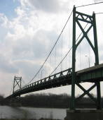
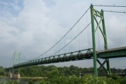
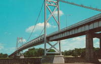
1960: Iowa-Illinois Memorial
Bettendorf, Iowa and Moline, Illinois, USA - Mississippi River
| Bridgemeister ID: | 213 (added before 2003) |
| Year Completed: | 1960 |
| Name: | Iowa-Illinois Memorial |
| Also Known As: | Interstate 74 Bridge, I-74 Bridge |
| Location: | Bettendorf, Iowa and Moline, Illinois, USA |
| Crossing: | Mississippi River |
| Coordinates: | 41.519372 N 90.513259 W |
| Maps: | Acme, GeoHack, Google, OpenStreetMap |
| References: | CMR |
| Use: | Vehicular |
| Status: | Demolished, 2024 |
| Main Cables: | Wire (steel) |
| Suspended Spans: | 3 |
| Main Span: | 1 |
| Side Spans: | 2 |
Notes:
- 2017, June 26: Groundbreaking ceremony for a replacement bridge for the twin Iowa-Illinois Memorial bridges. The new bridge is expected to be completed in 2020.
- 2021, December: Replacement span opens. Suspension bridge expected to be demolished in 2022.
- 2023: Demolition expected to be completed in 2024.
- 2024: Demolition of both bridges is complete.
- Next to 1935 Iowa-Illinois Memorial (Interstate 74 Bridge, I-74 Bridge) - Bettendorf, Iowa and Moline, Illinois, USA.
- All past and present bridges at this location.
External Links:
Image Sets:


| Bridgemeister ID: | 2626 (added 2018-12-31) |
| Year Completed: | 1962 |
| Name: | Elk Run Heights |
| Location: | Elk Run Heights and Evansdale, Iowa, USA |
| Crossing: | Elk Run |
| Coordinates: | 42.46863 N 92.264234 W |
| Maps: | Acme, GeoHack, Google, OpenStreetMap |
| Use: | Footbridge |
| Status: | In use (last checked: 2018) |
| Main Cables: | Wire (steel) |
| Suspended Spans: | 1 |
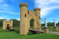
1971: Castle
Ida Grove, Iowa, USA - Odebolt Creek
| Bridgemeister ID: | 2982 (added 2019-10-12) |
| Year Completed: | 1971 |
| Name: | Castle |
| Location: | Ida Grove, Iowa, USA |
| Crossing: | Odebolt Creek |
| At or Near Feature: | Ida Grove Golf and Country Club |
| Coordinates: | 42.343539 N 95.458580 W |
| Maps: | Acme, GeoHack, Google, OpenStreetMap |
| Use: | Golf cart and Footbridge |
| Status: | In use (last checked: 2022) |
| Suspended Spans: | 1 |
External Links:
Image Sets:
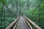
| Bridgemeister ID: | 1866 (added 2005-08-02) |
| Year Completed: | 1984 |
| Name: | (footbridge) |
| Location: | Martensdale vicinity, Iowa, USA |
| At or Near Feature: | Zo-El Annett Woods |
| Coordinates: | 41.395367 N 93.698733 W |
| Maps: | Acme, GeoHack, Google, OpenStreetMap |
| Principals: | Iowa Youth Conservation Corp |
| Use: | Footbridge |
| Status: | In use (last checked: 2007) |
| Main Cables: | Wire (steel) |
| Suspended Spans: | 1 |
| Main Span: | 1 x 36.6 meters (120 feet) estimated |
Notes:
- Lisa Youngblut writes: "My husband and his summer crew, the Iowa Youth Conservation Corp, built this bridge in the summer 1984. They used spades, shovels, hammers and nails, a handsaw and a brace and bit. Half of the materials, including 4 yards of concrete, were shipped to the other side of the ravine on a zip line. The cement was bucket brigaded from the zip line to the piling and the anchors."
External Links:
Image Sets:
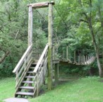
(footbridge)
Baldwin vicinity, Iowa, USA - Bear Creek
| Bridgemeister ID: | 1875 (added 2005-09-22) |
| Name: | (footbridge) |
| Location: | Baldwin vicinity, Iowa, USA |
| Crossing: | Bear Creek |
| At or Near Feature: | Eden Valley County Refuge |
| Coordinates: | 42.04455 N 90.86093 W |
| Maps: | Acme, GeoHack, Google, OpenStreetMap |
| Use: | Footbridge |
| Status: | In use (last checked: 2007) |
| Suspended Spans: | 1 |
| Main Span: | 1 x 27.4 meters (90 feet) |
External Links:
Image Sets:
| Bridgemeister ID: | 8866 (added 2024-10-01) |
| Name: | (footbridge) |
| Location: | Boone, Iowa, USA |
| At or Near Feature: | Camp Hantesa |
| Coordinates: | 41.999361 N 93.894444 W |
| Maps: | Acme, GeoHack, Google, OpenStreetMap |
| Use: | Footbridge |
| Status: | In use (last checked: 2022) |
| Main Cables: | Wire (steel) |
External Links:
- Google Maps - Camp Hantesa. Image of the bridge. Dated June 2022.
- Bridgehunter.com - BH61615
(footbridge)
Dubuque vicinity, Iowa, USA - Catfish Creek
| Bridgemeister ID: | 3095 (added 2019-10-27) |
| Name: | (footbridge) |
| Location: | Dubuque vicinity, Iowa, USA |
| Crossing: | Catfish Creek |
| At or Near Feature: | Swiss Valley Nature Preserve |
| Coordinates: | 42.414786 N 90.766344 W |
| Maps: | Acme, GeoHack, Google, OpenStreetMap |
| Use: | Footbridge |
| Status: | In use (last checked: 2021) |
| Main Cables: | Wire (steel) |
| Suspended Spans: | 1 |
Notes:
(footbridge)
Dubuque vicinity, Iowa, USA - Catfish Creek
| Bridgemeister ID: | 5727 (added 2021-04-03) |
| Name: | (footbridge) |
| Location: | Dubuque vicinity, Iowa, USA |
| Crossing: | Catfish Creek |
| At or Near Feature: | Swiss Valley Nature Preserve |
| Coordinates: | 42.420553 N 90.764417 W |
| Maps: | Acme, GeoHack, Google, OpenStreetMap |
| Use: | Footbridge |
| Status: | In use (last checked: 2018) |
| Main Cables: | Wire (steel) |
| Suspended Spans: | 1 |
| Main Span: | 1 x 18.3 meters (60 feet) estimated |
Notes:
(footbridge)
Dubuque vicinity, Iowa, USA - Catfish Creek
| Bridgemeister ID: | 5728 (added 2021-04-03) |
| Name: | (footbridge) |
| Location: | Dubuque vicinity, Iowa, USA |
| Crossing: | Catfish Creek |
| At or Near Feature: | Swiss Valley Nature Preserve |
| Coordinates: | 42.422724 N 90.757699 W |
| Maps: | Acme, GeoHack, Google, OpenStreetMap |
| Use: | Footbridge |
| Status: | In use (last checked: 2018) |
| Main Cables: | Wire (steel) |
| Suspended Spans: | 1 |
| Main Span: | 1 x 20.4 meters (67 feet) estimated |
Notes:
(footbridge)
Estherville, Iowa, USA - West Fork Des Moines River
| Bridgemeister ID: | 2041 (added 2006-05-07) |
| Name: | (footbridge) |
| Location: | Estherville, Iowa, USA |
| Crossing: | West Fork Des Moines River |
| Coordinates: | 43.403883 N 94.844167 W |
| Maps: | Acme, GeoHack, Google, OpenStreetMap |
| Use: | Footbridge |
| Status: | In use (last checked: 2006) |
| Main Cables: | Wire |
| Suspended Spans: | 1 |
| Main Span: | 1 x 46.3 meters (152 feet) estimated |
External Links:
Image Sets:
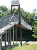
(footbridge)
Manchester vicinity, Iowa, USA - Spring Branch
| Bridgemeister ID: | 5726 (added 2021-04-03) |
| Name: | (footbridge) |
| Location: | Manchester vicinity, Iowa, USA |
| Crossing: | Spring Branch |
| At or Near Feature: | Manchester Trout Hatchery |
| Coordinates: | 42.460648 N 91.397808 W |
| Maps: | Acme, GeoHack, Google, OpenStreetMap |
| Use: | Footbridge |
| Status: | In use (last checked: 2019) |
| Main Cables: | Wire (steel) |
| Main Span: | 1 |
(footbridge)
Winterset, Iowa, USA - North River
| Bridgemeister ID: | 2746 (added 2019-06-23) |
| Name: | (footbridge) |
| Location: | Winterset, Iowa, USA |
| Crossing: | North River |
| At or Near Feature: | Guye Woods County Park |
| Coordinates: | 41.416563 N 93.957499 W |
| Maps: | Acme, GeoHack, Google, OpenStreetMap |
| Use: | Footbridge |
| Status: | In use (last checked: 2015) |
| Main Cables: | Wire (steel) |
(pipeline bridge)
Council Bluffs, Iowa, USA - Mosquito Creek
| Bridgemeister ID: | 2268 (added 2007-04-21) |
| Name: | (pipeline bridge) |
| Location: | Council Bluffs, Iowa, USA |
| Crossing: | Mosquito Creek |
| Coordinates: | 41.20985 N 95.82730 W |
| Maps: | Acme, GeoHack, Google, OpenStreetMap |
| Use: | Pipeline |
| Status: | Extant (last checked: 2010) |
| Main Cables: | Wire (steel) |
Notes:
- Patrick S. O'Donnell estimated the main span of this bridge at roughly 550 feet.
(pipeline bridge)
Plattsmouth, Nebraska and Pacific Junction vicinity, Iowa, USA - Missouri River
| Bridgemeister ID: | 2038 (added 2006-05-07) |
| Name: | (pipeline bridge) |
| Location: | Plattsmouth, Nebraska and Pacific Junction vicinity, Iowa, USA |
| Crossing: | Missouri River |
| Coordinates: | 41.0028 N 95.8679 W |
| Maps: | Acme, GeoHack, Google, OpenStreetMap |
| Use: | Pipeline |
| Status: | Extant (last checked: 2023) |
| Main Cables: | Wire (steel) |
| Suspended Spans: | 2 |
| Main Span: | 1 x 457.2 meters (1,500 feet) estimated |
| Side Span: | 1 x 228.6 meters (750 feet) estimated |
External Links:
Image Sets:
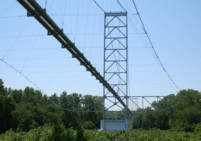
(suspension bridge)
Mona and Otranto, Iowa, USA - Otter Creek
| Bridgemeister ID: | 7026 (added 2022-05-15) |
| Name: | (suspension bridge) |
| Location: | Mona and Otranto, Iowa, USA |
| Crossing: | Otter Creek |
| Coordinates: | 43.469410 N 92.960649 W |
| Maps: | Acme, GeoHack, Google, OpenStreetMap |
| Use: | Vehicular (one-lane) |
| Main Cables: | Wire |
| Suspended Spans: | 1 |
| Main Span: | 1 |
Notes:
- Removed in 1920s. Coordinates are for the present day (2022) crossing at this location. The suspension bridge was located slightly east.
External Links:
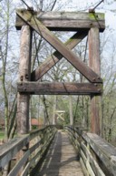
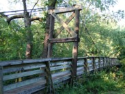
Brookside Park
Ames, Iowa, USA - Ioway Creek
| Bridgemeister ID: | 1644 (added 2005-03-18) |
| Name: | Brookside Park |
| Location: | Ames, Iowa, USA |
| Crossing: | Ioway Creek |
| At or Near Feature: | Brookside Park |
| Coordinates: | 42.02895 N 93.62915 W |
| Maps: | Acme, GeoHack, Google, OpenStreetMap |
| Use: | Footbridge |
| Status: | Replaced, 2009 |
| Main Cables: | Wire (steel) |
| Suspended Spans: | 1 |
| Main Span: | 1 x 39 meters (128 feet) estimated |
Notes:
- Ioway Creek, previously known as "Squaw Creek," was officially renamed in 2021.
- Wrecked by flood May, 2008. Permanently replaced by a non-suspension bridge February, 2009.
External Links:
Image Sets:
Cedar Rapids Country Club
Cedar Rapids, Iowa, USA - Indian Creek
| Bridgemeister ID: | 3275 (added 2019-11-17) |
| Name: | Cedar Rapids Country Club |
| Location: | Cedar Rapids, Iowa, USA |
| Crossing: | Indian Creek |
| Coordinates: | 42.004703 N 91.624127 W |
| Maps: | Acme, GeoHack, Google, OpenStreetMap |
| Use: | Golf cart |
| Status: | In use (last checked: 2019) |
| Main Cables: | Wire (steel) |
Notes:
External Links:
Cedar Rapids Country Club
Cedar Rapids, Iowa, USA - Indian Creek
| Bridgemeister ID: | 3350 (added 2019-12-14) |
| Name: | Cedar Rapids Country Club |
| Location: | Cedar Rapids, Iowa, USA |
| Crossing: | Indian Creek |
| Coordinates: | 41.999404 N 91.620777 W |
| Maps: | Acme, GeoHack, Google, OpenStreetMap |
| Use: | Golf cart |
| Status: | In use (last checked: 2019) |
| Main Cables: | Wire (steel) |
Notes:
Do you have any information or photos for these bridges that you would like to share? Please email david.denenberg@bridgemeister.com.
Mail | Facebook | X (Twitter) | Bluesky
